How Where I Live Now Looked In 1949
This is an image of Dalston from Britain from Above taken in 1949.

Dalston In 1949
This is the same area today from Google Earth.
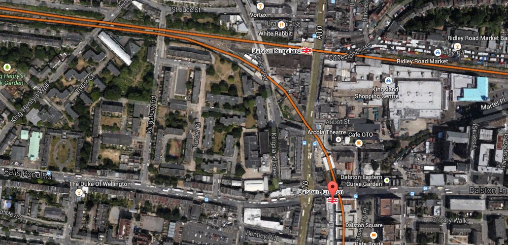
Dalston In 2014
In the Google Earth image, the Overground lines are marked in orange and Dalston Junction station is marked by a red arrow.
In the aerial image the following can be clearly seen.
1. The platforms at the old Dalston Junction station in the bottom right hand corner.
2. The A10 road stretching away to the North.
3. The Balls Pond Road stretching towards Highbury Corner.
I can pick out more, but then I live in a house that was built ten years ago and is or would be in the bottom left hand corners of both images.

[…] picture of Dalston, focuses on Kerridge Court, which was being built in 1949 by the London County Council, when the […]
Pingback by Kerridge Court « The Anonymous Widower | February 5, 2015 |