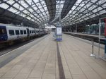
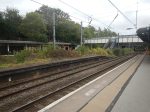
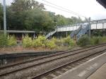
North-East-Based Turntide Receives Initial Battery Production Order From Hitachi Rail For Arriva’s Grand Central Intercity UK Battery Trains
The title of this post, is the same as that of this news item from Turntide Technologies.
This is the sub-heading.
New batteries to enable greener train operations to remove over 600 engines on existing trains, offering lower cost of operations, more range, and path to zero-emissions travel.
These are the initial three paragraphs, that add more detail.
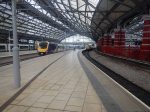
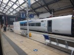
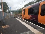
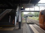
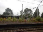
Turntide Technologies (Turntide), a global leader in electrification and hybridisation solutions and a long-standing North East manufacturer, received its first order from Hitachi Rail to begin production of its next-generation modular battery system for the first U.K.-manufactured battery trains for Arriva’s Grand Central.
First announced on July 2, 2025, this partnership involved an R&D component and has officially moved into production with the potential to support either new battery trains or retrofitting over 600 engines on existing Hitachi Rail U.K. fleets.
This new battery system will allow for lower cost of operations, extended range, and a path to zero-emission travel, while reducing reliance on fossil fuels and improving air quality and noise pollution. Turntide’s bespoke batteries are designed to deliver even greater power density in the same footprint of a diesel engine. This battery production is an advanced manufacturing milestone for Arriva’s Grand Central new fleet, which is being built in Newton Aycliffe, County Durham by Hitachi Rail.
In Are Hitachi’s Tri-Mode Trains Exceeding Expectations?, I said this.
I asked Google AI, the question in the title of this post and received this answer.
Yes, Hitachi’s tri-mode (battery-hybrid) trains are exceeding expectations, particularly following successful trials in the UK in late 2024. Trials of the battery-equipped Class 802/2 demonstrated superior performance to initial forecasts, leading to a £300 million order for a new fleet to be delivered in 2028.
Key findings from trials and operational expectations:
Performance Exceeded: The trial, conducted with TransPennine Express and Angel Trains, showed fuel cost savings of 35%–50%, surpassing initial predictions of up to 30%.
Operational Capability: The battery technology enabled trains to reach speeds greater than 75 mph and provided enough range for zero-emission, silent running in and out of stations, significantly reducing noise and improving air quality.
Energy Efficiency: The battery matched the weight of a diesel engine, meaning no extra track degradation.
Future Impact: The success of the trial led to an order from Arriva Group for a new fleet for Grand Central services, which will increase seating capacity by 20% and are expected to significantly reduce carbon emissions.
These trains, designed to run on electric, battery, or diesel power, are part of a push to modernize rail services, with the technology allowing for the gradual elimination of diesel-only operation on certain routes.
In The Data Sheet For Hitachi Battery Electric Trains, I came to these conclusions.
- The battery pack has a capacity of 750 kWh.
- A five-car train needs three battery-packs to travel 100 miles.
- A nine-car train needs five battery-packs to travel 100 miles.
- The maximum range of a five-car train with three batteries is 117 miles.
- The maximum range of a nine-car train with five batteries is 121 miles.
Hitachi have seen my figures and told me they’re not far out.
As battery technology gets better, these distances will increase
What Battery Range Do Arriva Grand Central Trains Need?
Arriva Grand Central Trains currently run services to Bradford Interchange and Sunderland and hope of adding services to Cleethorpes.
All services would go between Doncaster and Kings Cross, with some stopping additionally at Peterborough.
The lengths of unelectrified track on each route is as follows.
- Bradford Interchange – Shaftholme junction and Bradford Interchange is not electrified – 47.8 miles
- Cleethorpes – Doncaster and Cleethorpes is not electrified – 52.1 miles
- Sunderland – Northallerton and Sunderland is not electrified – 47.4 miles
Note.
- Bradford Interchange station is on a tightly hemmed-in site and putting charging infrastructure in the station might be difficult.
- All Bradford Interchange services will soon be passing electrification at Mirfield station, so there may be scope for a quick charge and continue.
- Cleethorpes station is an open-air station with four platforms.
- I believe it is likely, that Cleethorpes station will also be a destination station for other battery-electric trains from LNER, Northern Trains and TransPennine, so I would suspect that charging facilities will be installed.
- Cleethorpes station could be an ideal location for one of Siemens’ Rail Charging Converters.
- Sunderland station is underground and has a unique layout where both platforms are electrified for the Metro. It is all explained in the Wikipedia entry for the station.
- The Wikipedia entry shows an open-air siding without electrification. One possibility would be for the Class 820 trains to park there and use their on-board diesel to top-up the batteries, so they could reach Northallerton.
- It appears that Grand Central visit Ryhope Grange Sidings between arriving and leaving for King’s Cross. The trains could have their batteries topped up there if needed.
It does look like a five-car train with a battery range of at least 105 miles would be able to handle these three routes.
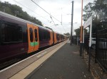
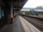
The Arriva Grand Central Trains Fleet Are Now Class 820 trains
They have a Wikipedia entry.
The order was for nine trains of five cars.
- Wikipedia describes them as tri-mode trains.
- I believe they will have three battery packs and one diesel generator.
- Three battery packs should give a range of 117 miles.
- Google AI says that on one diesel generator, these trains can limp home at 60 miles per hour.
- Google AI says that the diesel generator will be able to charge the batteries at the destination station?
- From comments on the Internet, it appears that Hitachi have a very clever train control system, that ekes out the available power.
It looks to me that Hitachi have designed a train that can handle an unelectrified branch line of up to 60 miles or 120 miles if there are charging facilities at the destination station.
Did LNER And TransPennine Express Not Want To Be First With Battery-Electric Intercity Trains?
Consider.
- TransPennine and LNER are under government control.
- TransPennine provided the train for the testing, so they must know all the results and their drivers, who were probably involved certainly do.
- LNER must have the best initial route in King’s Cross and Lincoln, where only the last 16.6 miles, between Newark and Lincoln is not electrified.
- Surely, both companies should have been given at least one of the first batteries, so they could start training staff in how to use and service the batteries.
I have also totalled how many existing diesel power-packs are in existing Hitachi trains and it is 759.
This figure surprised me, as the sub-heading in the Turntide news item said the number of engines in existing trains was over 600. But then East Midlands Railway are still introducing their fleet of 33 x Class 810 trains, which have a total of 132 engines, and 627 could be described as over 600 engines.
How Much Would A Turntide Battery-Pack Cost?
Consider.
- This is a bespoke product for Hitachi.
- Hitachi have stated that the weight is the same as a diesel-pack, so that track-access rules and charges won’t change.
- As a Control Engineer, I wouldn’t be surprised, that the battery-pack is designed to tell the train control system, that it is a diesel power pack. So it acts just like one!
- In the 1960s, I was designing, building and installing transisterised control systems to replace electronic valve and relay equipment in a rolling mills. The two generations of control systems were interchangeable. Are diesel-packs and battery-packs the same?
- Why did Hitachi choose a small supplier in Gateshead, rather than one of a number of capable companies in Japan? You don’t go halfway around the world, if the quality is available locally.
- Deployment of these trains, will avoid the cost of scores of miles of overhead electrification.
- A lot of routes won’t even need chargers at the remote destination, as the range will be sufficient for an out and back journey from the current electrification.
- Fuel cost savings of 35%–50% were achieved in development testing.
- I have ridden in three battery-electric trains. All were mouse quiet. Will that increase ridership?
I believe these batteries are no ordinary batteries. So they won’t come cheap!
I wouldn’t be surprised that the cost of each battery-pack between a half-a-million pounds and a million pounds, with support.
Will These Trains Create Growth In The Economy?
I have ridden in all current variants of the Hitachi Intercity Express Trains, with the possible exception of the Class 805 train and as each version has been introduced, they are no worse, but often better than previous versions.
I have had two or maybe three return trips to Nottingham and Sheffield in the latest variant, which is East Midlands Railway’s Class 810 train.
This is without doubt the pick of the bunch.
I therefor believe that if this continuous improvement carries on, that the new Class 820 train, that has been ordered by Grand Central will be even better.
- My experience of battery-electric trains, says it will be quieter.
- The environment of stations will be improved.
- Train fuel costs will be reduced.
- I believe that ridership will be increased, as people will be intrigued by a 125 mph train running on batteries.
- The trains will have the ability to divert via Lincoln using the GNGE Diversion on the East Coast Main Line during engineering works.
- Because of their regenerative braking, the trains should be able to do very quick extra stops at intermediate stations.
- New routes will be developed.
- Less ugly electrification will be erected on scenic routes like Settle and Carlisle, and across the Highlands of Scotland.
I believe strongly, that at the end of the day, that battery-electric trains will increase the profits of operators and Network Rail, and reduce the cost to the taxpayers of the railways.
Grand Central’s New Trains Will Improve Services
All these stations will be served by the new Class 820 trains.
- Barnetby
- Bradford Interchange
- Brighouse
- Cleethorpes
- Doncaster
- Eaglescliffe
- Grimsby
- Habrough
- Halifax
- Hartlepool
- Low Moor
- Mirfield
- Northallerton
- Peterborough
- Pontefract Monkhill
- Scunthorpe
- Seaham
- Sunderland
- Thirsk
- Wakefield Kirkgate
- York
Passengers should notice the following from the new Grand Central trains.
- A quieter ride.
- Less vibration.
- Slightly faster services due to faster stops at stations.
- No diesel smoke and much less noise from trains in stations.
Note.
- Cross Country, Hull Trains, LNER, Lumo, TransPennine Express and other operators will come under pressure to follow suit.
- Batteries, will not have the power for freight trains, so will we see a new generation of hydrogen freight locomotives?
But will the improved services bring that exclusive growth to the economy?
Only time will tell!
Private And Public Operators
In the UK, we have.
- Private open access operators like Grand Central, Hull Trains and Lumo, who can buy trains on a loan from a leasing company.
- Public operators like LNER and TransPennine Express, who probably have to get sign off from the Treasury.
- Several companies like Great Western Railways and East Midlands Railway, who are soon to be taken over by Great British Railways, who are stuck in a sort of limbo.
My late friend ; David, who rose to the highest level in banking in the UK, would have come up with a solution.
He would probably have said, that there’s is very little difference between the groups of operators.
- The train services they offer vary only on destinations and prices.
- The ticketing system is now unified, so if you turn up at the last minute and want to go to Newcastle and Lumo and LNER both have tickets, you are offered a choice and you can pick the one that’s best for you.
- All services will soon be running similar battery-electric trains, fprobably from the same Hitachi factory in Newton Aycliffe.
- Food and beverage service is not competitive and could be improved.
- Staff are probably on similar employment agreements.
So why shouldn’t Great British Railways be able to lease trains and even battery packs from companies like Angel Trains, who are funding the trains for Grand Central?
It might get more battery trains running on tracks all over Great Britain sooner than it appears they will now!
‘I Get To Work On The Most Scenic Railway Line In The World’
The title of this post, is the same as that of this article on the BBC. It is a quote from someone in the BBC article.
This is the sub-heading.
Have you heard the one about the railway line that was threatened with closure, so lots of people started using it and it was saved?
These three opening paragraphs add some detail to the story.
Welcome to the Settle to Carlisle line, the quirky steel road through some of Britain’s most magnificent countryside.
The line starts in Leeds and passes through Shipley and Skipton, but it is the section between North Yorkshire and Cumbria that is world-famous for its views.
Heading north from Settle, the peak of Pen-y-Ghent soon looms large, with Whernside and Ingleborough following a few miles later.
The saving of the line in the 1980s, is one of those classic British tales of a fight against bureaucracy, which like all these tales involved a dog, who gets a heroic mention in the BBC article.
In the next few sections, I will detail how improvements to the rail infrastructure between Bradford, Carlisle, Lancaster, Leeds have gradually developed the rail infrastructure, so that the Settle and Carlisle Line can play an increasing part in improving the economic outlook for a large area of England.
Is The Settle And Carlisle Line In Good Condition?
Google AI gives this answer to the question in the title of this section.
Yes, the Settle-Carlisle line is in good, operational condition and is considered a vital, well-maintained part of the National Rail network.
Despite a history of threatened closures and past structural issues, major investments have secured its future, and it currently carries over 1.2 million passengers a year.
Here is the current status of the line as of early 2026:
Infrastructure Condition: Following significant repairs, including a major £2.1 million project on the Ribblehead Viaduct completed in 2021 and extensive work at Eden Brows (2017), the line’s 14 tunnels and 22 viaducts are in good condition.
Active Usage: It is regularly used by Northern passenger services and is a designated diversionary route for mainline express trains when the West Coast Main Line is closed.
Operational Status: The line is fully operational, featuring regular commuter services, tourist trains, and steam heritage charter trains.
Safety & Upgrades: While it is a historic line, the infrastructure is deemed safe.
Occasional, isolated issues (like the 2022 freight derailment near Carlisle) have been managed with swift repairs.As of early 2026, the line is heavily used, with special passenger services and 150th-anniversary celebrations planned.
It’s probably in better condition, than many houses in the UK.
What Is The Operating Speed Of The Settle And Carlisle Line?
Google AI gives this answer to the question in the title of this section.
The Settle and Carlisle Line generally operates at a maximum speed of 60 mph/97 km/h.
While historically faster, this 60 mph limit is standard for modern passenger and freight services on the route.
Usage Examples and ContextPassenger Services: Northern Rail and various chartered services, including the scenic “Staycation Express” HST 125, operate along the route.
Freight: The line is used for heavy freight, including oil, timber, and cement trains.
Diversions: The line is frequently used as a, albeit slower, alternative route (approx. 2.5 hours for Leeds-Carlisle) during major West Coast Main Line (WCML) closures.
Scenic Tourism: The line is renowned as one of England’s most scenic, carrying over a million travelers annually, with notable sights like the Ribblehead Viaduct.
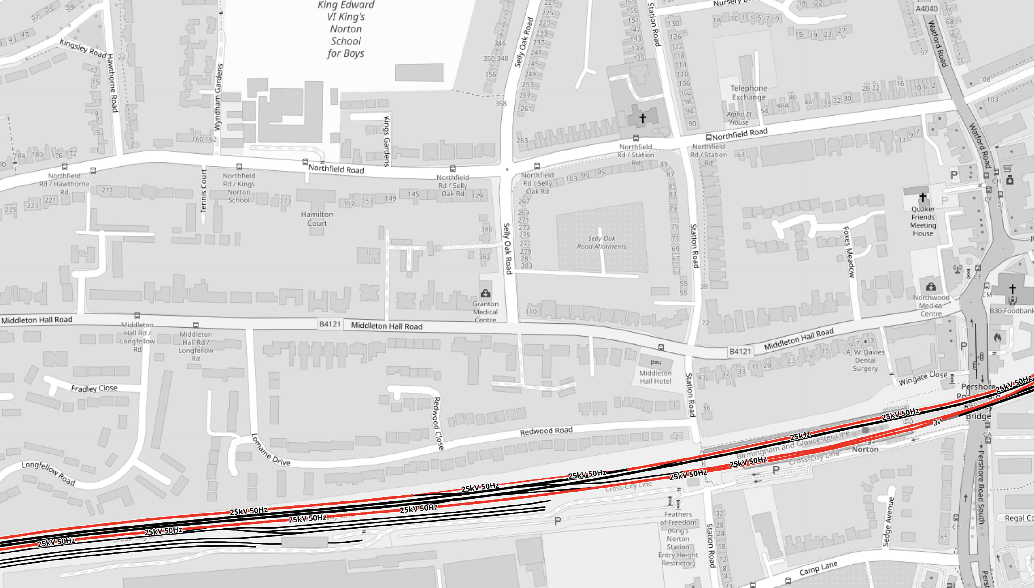
The Settle And Carlisle Line Is Well Connected To The Rail Network At The Northern End
This OpenRailwayMap shows how the line connects to the West Coast Main Line and the Tyne Valley Line, to the South of Carlisle.
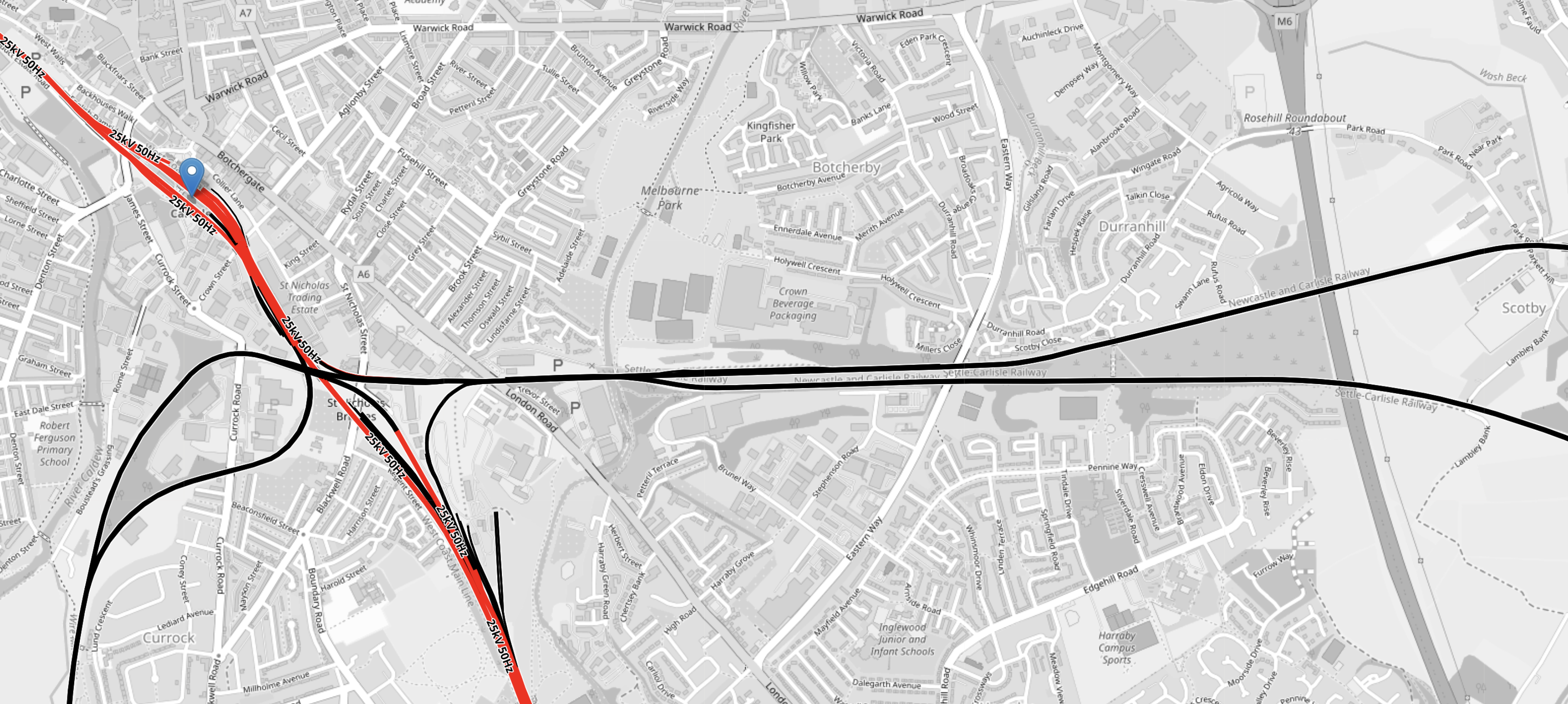
Note.
- Electrified lines are shown in red and lines shown in black are not electrified.
- The electrified West Coast Main Line runs diagonally across the South-West corner of the map.
- The blue arrow on this line, indicates Carlisle station.
- The Northernmost of the two black cross lines is the Tyne Valley Line between Carlisle and Newcastle.
- The Southernmost of the two black cross lines is the Settle And Carlisle Line, which goes South to Settle, Bradford Forster Square, Leeds and Settle stations.
- The line going South-West joins the Cumbrian Coast Line, which joins the West Coast Main Line at Carnforth.
It does appear that the junction South of Carlisle is very comprehensive and allows very flexible routing.
The Settle And Carlisle Line Is Well Connected To The Rail Network At The Southern End
This OpenRailwayMap shows how the line connects to the West Coast Main Line and the Tyne Valley Line, to the North of Skipton.
Note.
- Electrified lines are shown in red and lines shown in black are not electrified.
- The blue arrow on this line, indicates Bradford Forster Square station.
- The fully-electrified Leeds station is in the South-East corner of the map. You can just pick out the ee of the name.
- The electrified Leeds-Bradford Line connects Bradford Forster Square and Leeds station via Shipley station and its triangular junction.
- The electrification continues in a North-Westerly direction as far as Skipton, where the red track stops.
- Electric intercity trains can run from London to Leeds, Bradford Forster Square and Skipton.
- Self-powered intercity trains can also run from London to Harrogate, which is on the line without electrification, that runs North from Leeds.
- Leeds receives a London service of two trains per hour (tph).
- Bradford Forster Square station receives a London service of one train per two hours (tp2h) via Leeds.
- Harrogate station receives a London service of 1 tp2h via Leeds.
- Skipton station receives a London service of one train per day (tpd) via Leeds.
The Leeds-Bradford area gets a frequent service to London and the South.
This OpenRailwayMap shows how the Settle and Carlisle Line connects to the electrification at Skipton.

Note.
- Electrified lines are shown in red and lines shown in black are not electrified.
- The only electrified lines on the map are at Skipton station in the South-East corner of the map.
- The blue arrow on this line, indicates Settle station.
- Skipton and Settle stations are 15.2 miles apart.
- Settle and Carlisle are 71.5 miles apart.
To bridge the gap in the electrification between Carlisle and Skipton, trains will need to be able to run 86.7 miles on their own power.
Bridging The Carlisle And Skipton Gap
But once the train gets to Carlisle or Skipton, the train will have the luxury of 25 KVAC overhead electrification to both power the train and charge any batteries.
In my opinion, there are three intercity trains coming into service, that could handle an 86.7 mile gap in electrification.
- East Midland Railways’s Class 810 train, which is a diesel bi-mode with lots of power, which is described in this Wikipedia entry.
- LNER’s Class 802 trains, which currently is a diesel bi-mode, that Hitachi could convert into a Hitachi Intercity Battery Train, which is described on this Hitachi web site.
- LNER’s Class 897 trains, which is a diesel tri-mode, that CAF are building in Spain and Wales, which is described in this Wikipedia entry.
In How Far Will A Hitachi Intercity Battery Train Travel Without Using The Electrification?, I answer the question for both Hitachi and CAF trains.
Surprisingly, I got the answer of a range of 120 miles for both the Hitachi and CAF trains. But could it be that Network Rail and the train companies wanted a range of 120 miles to electrify the UK rail network and so a 120 mile battery range was in the specification.
My estimate of 120 miles for Hitachi’s trains, was also confirmed by the company.
Bridging The Gaps
Some other distances, where gaps must be bridged include.
- Sheffield and South Wigston – 69.4 miles
- Holyhead and Chester – 84.4 miles
- Exeter and Basingstoke – 124,3 miles
- Fishguard Harbour and Cardiff Central – 119.1 miles
- Aberystwyth and Shrewsbury – 81.5 miles
- Bristol Temple Meads and Newbury – 70.8 miles
- Inverness and Aberdeen – 108.3 miles
- Carlisle and Glasgow Central via Dumfries – 115.9 miles
- Hereford to Didcot Junction – 96.9 miles
120 miles could be a good fit.
Could it be that that distance was the range of a steam locomotive on a full load of water?
The Updating Of Bradford Forster Square Station
This is now a four-platform station, with two platforms able to take a pair of 5-car Hitachi or the new CAF 10-car Class 397 trains.
In Bradford Forster Square Station – 20th May 2025, I describe and show pictures of the updated station.
Bradford Forster Square station now gets seven trains per day to and from London King’s Cross via Leeds.
This article on the BBC, which is entitled New Platform’s Opening Gives Bradford More Trains has this sub-heading.
A new £35m platform at Bradford’s Forster Square Station has opened – boosting rail services in the city
£35million seems a lot of money to spend to just increase the number of services between King’s Cross and Bradford, even though 2025 was the year that Bradford was UK City of Culture, but there may be valid reasons to create a new route between London and Scotland, using the Settle and Carlisle Line.
- The Settle and Carlisle Line is one of the UK’s most famous scenic routes with 20 viaducts, 14 tunnels and countless beautiful vistas along its 72 mile track.
- You put the Mona Lisa on display, not in a store.
- LNER now has battery-electric bi-mode trains, with CAF tri-mode trains due to enter service in 2028, that can both handle the 86.7 mile gap in the electrification in silence.
- The CAF trains have extra diesel power, about which CAF is not disclosing much. This to me, suggests some innovative use.
- There appear to be no flights between Leeds/Bradford Airport and Scotland.
- There appear to be no direct trains between Glasgow and West Yorkshire.
- A direct train between Glasgow and Leeds and Bradford Forster Square would add additional connectivity between Scotland and Yorkshire.
- With the cancellation of High Speed Two, we need more train paths between London and Scotland.
- Decarbonisation of aviation is difficult, but replacing fossil-fueled planes with zero-carbon trains is easier.
- A single Class 897 train can carry 569 seated passengers, which is about 3.5 times the capacity of a single Airbus A320.
- The proposed Leeds Metro would bring passengers to the new service.
- Leeds and Bradford could see an upturn in tourism.
I also think the line will not be lightly used due to its iconic status.
How Would A Leeds/Bradford And Scotland Service Call At Bradford Forster Square Station?
- Bradford Forster Square station now gets seven trains per day to and from London King’s Cross via Stevenage, Newark Northgate, Doncaster, Wakefield Westgate, Leeds and Shipley.
- There is one fewer train on Sunday.
- There is a triangular junction at Shipley station, which connects the three electrified lines to Leeds, Bradford Forster Square and Skipton.
This OpenRailwayMap shows Shipley station and the triangular junction.
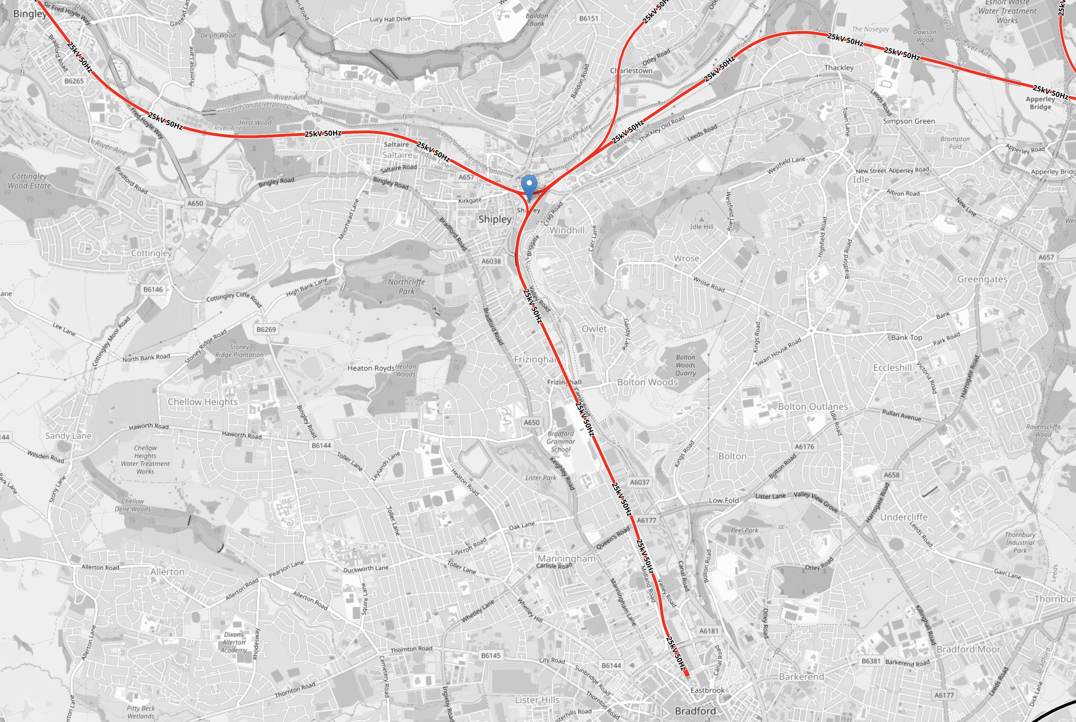
Note.
- All rail lines are electrified and shown in red.
- The blue arrow on this line, indicates Shipley station.
- Shipley station appears to be in the middle of the junction.
- The line going East connects to Leeds station.
- The line going South connects to Bradford Forster Square station, which is at the end of the line.
- The line going West connects to Skipton station and the Settle and Carlisle Line.
Trains returning to London would reverse out of Bradford Forster Square station and take the Eastern route through Shipley and Leeds back to London.
- An appropriate number of trains for Carlisle and Scotland, could surely just reverse out of the station and take the Western route through Skipton station and go on to the Settle and Carlisle Line.
- The trains would call at Wakefield Westgate, Leeds, Shipley, Bradford Forster Square and Skipton stations in the Leeds/Bradford conurbation.
- Other stations could be added to the route if required.
- The trains would effectively reverse direction in their call at Bradford Forster Square station.
- Going North the trains might check their battery levels in Bradford Forster Square station and use a fast-charger if necessary.
- Going South, there would be no need for charging, as the route South from Bradford Forster Square station, is already fully-electrified.
- Would the operator, use this longer stop to replace the crew with a fresh one?
It could be a simple and efficient way to run a London and Scotland service via the Settle and Carlisle Line.
What About Hull, Sheffield And York?
I’m asking this question, as Yorkshire is a large county and this article has only mentioned a few places, where people live and might need to go to London or Scotland.
In February, I wrote Northern Launches New Yorkshire Flyer Fast Service Between Leeds And Sheffield.
I’m fairly sure that Hull, York and other cities and large towns in Yorkshire already have a good regional service to Bradford Forster Square or Leeds station, which will give a good connection to the new service.
Could Dumfries Be Served By Using The Glasgow South Western Line?
This OpenRailwayMap shows the Southern part of the Glasgow South Western Line.
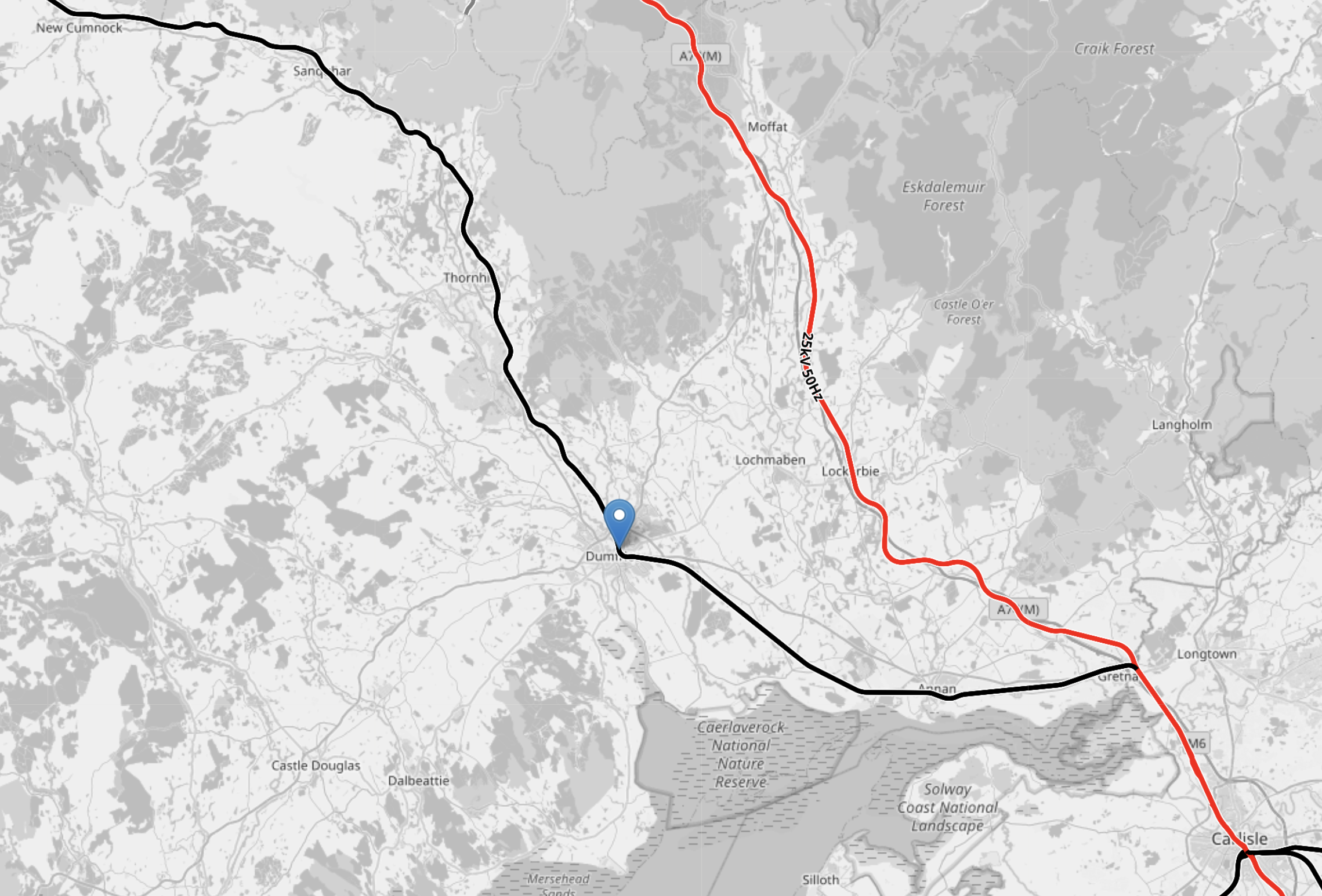
Note.
- Electrified lines are shown in red and lines shown in black are not electrified.
- The blue arrow on the black track, indicates Dumfries station on the Glasgow South Western Line.
- The red track is the West Coast Main Line.
- Carlisle is in the South-East corner of the map.
- Carlisle and Glasgow Central via Dumfries is 115.9 miles
- The Thames-Clyde Express, ran on this route until 1974.
- According to the Wikipedia entry for the Thames-Clyde Express, the train called at Dumfries and Kilmarnock stations.
From this brief look it appears that the new service could include Dumfries and should be able to serve the town on battery power.
Is More Capacity Needed On The West Coast Main Line Between Carlisle And Glasgow?
I asked Google AI, this question, to see if there is capacity.
This was the answer I received.
Yes, increased capacity and infrastructure enhancements are required on the West Coast Main Line (WCML) between Carlisle and Glasgow, as the line is currently full and unable to meet modern, growing passenger and freight demands.
Upgrades are necessary to tackle aging infrastructure, bottlenecks, and the need for more frequent services.
Key Aspects of the Need for Capacity:Full Capacity: The WCML is essentially full, with little space left for growth, despite 75 million passengers using it annually.
Freight and Passenger Growth: Passenger numbers are expected to double by 2050, and the line is a crucial artery for Anglo-Scottish freight.
Infrastructure Age: The northern section is undergoing its largest upgrade in half a century to address reliability issues.
Performance Bottlenecks: Specific locations, such as those north of Carlisle, require signaling and track improvements to prevent delays.
Proposed Upgrades: Current initiatives include a £400m investment until March 2029 for upgrades, including signalling and track renewals, though these are largely to boost reliability rather than provide a massive increase in capacity.
It looks to me, that a bit of a redesign and some use of battery trains on the Glasgow South Western Line, might squeeze a few more trains into the route.
Liverpool Lime Street Station After the Transformation of 2017-18
This document from Network Rail is entitled £140m Transformation Of Liverpool Lime Street Completed On Time.
These bullet points serve as sub-headings.
- Track, platform and signalling improvements
- Paving the way for bigger, better trains with more seats for more customers in future
- Part of the wider Great North Rail Project
- Part of #StationsDay – celebrating the £5.2billion investment to regenerate Britain’s rail stations
But I also believe two other important sub-projects were carried out during the work.
The Station Has Been Substantially Prepared For High Speed Two
Consider.
- Platforms were lengthened so they can accept 265.3-metre long eleven-car Class 390 trains.
- Platforms were widened, so they could handle the 607 passengers, that can be carried in an eleven-car train.
- There appears to be five full-size platforms numbered 6-10.
- Is there the possibility of a sixth platform, which is currently numbered E (for Emergency (?))?
- The approaches to the station have been remodeled, so trains can enter the station very efficiently.
- The Class 390 trains are going between Crewe and Liverpool Lime Street stations, in times that are not far off those expected from High Speed Two trains.
As Liverpool Lime Street will only need to handle half-length 200-metre long classic compatible High Speed Two trains, Liverpool Lime Street station is now ready for High Speed Two.
Liverpool Lime Street Station Is Now Effectively Two Five Platform Stations
This OpenRailwayMap shows the platform layout at Liverpool Lime Street station.
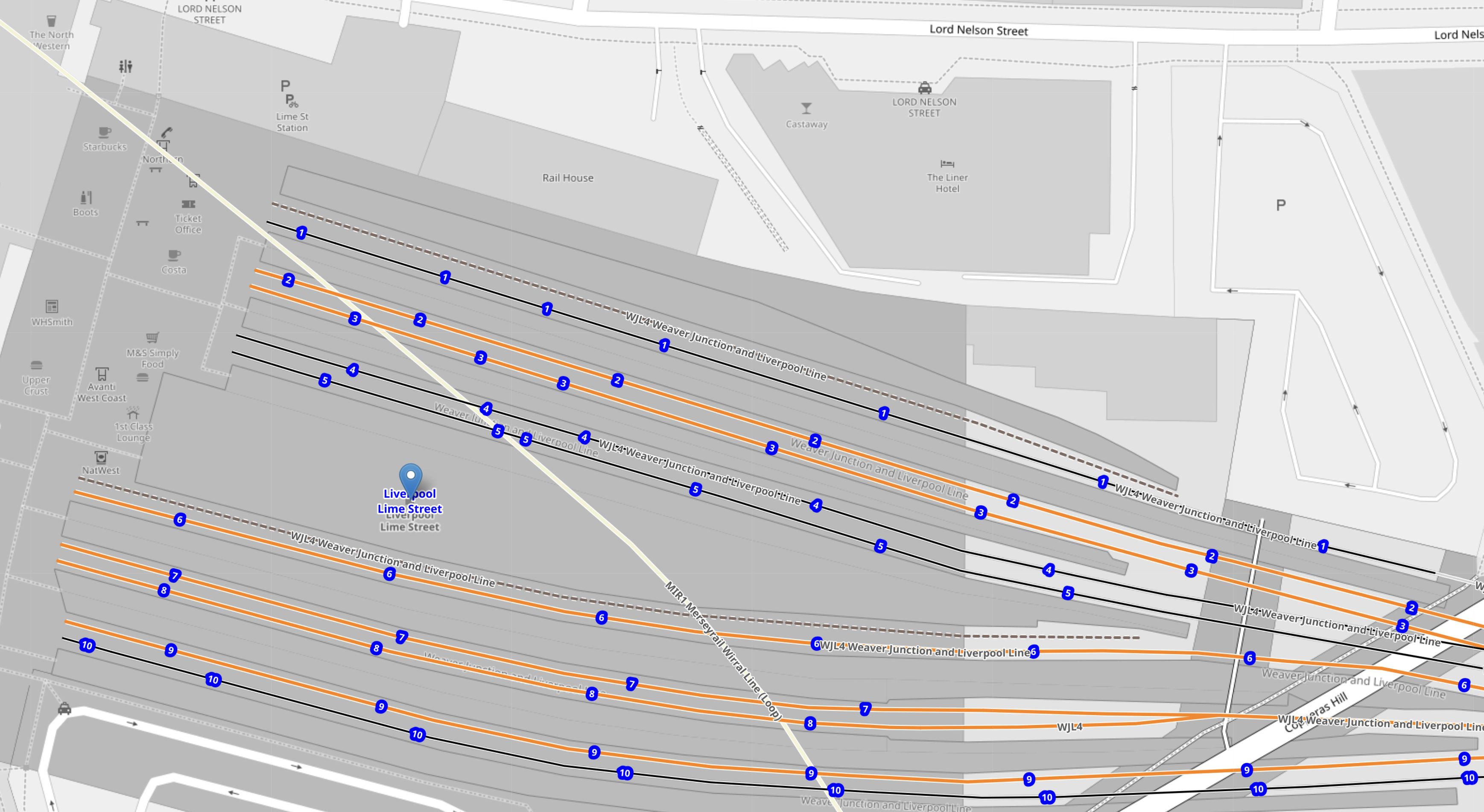
Note.
- The platforms indicated by blue dots with numbers are the ten platforms of the station.
- The platforms in the Northern-half of the station are numbered 1-5.
- The platforms in the Southern-half of the station are numbered 6-10.
- All platforms; 1-10 are electrified.
- The white line running diagonally across the map, shows the route of the loop of the Wirral Line.
Click the map to show it to a larger scale.
These are some of my pictures of the station.

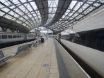


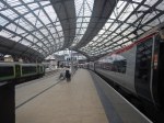
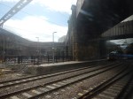
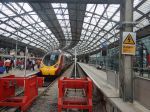
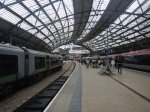
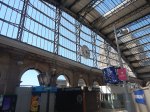
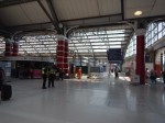

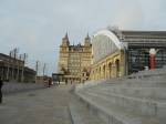

It is without doubt, one of the best stations aesthetically and operationally in the world.
Network Rail’s Test Track Take Centre Stage As Hydrogen Is Delivered By Rail For The First Time
The title of this post, is the same as that of this press release from GeoPura.
These three paragraphs introduce the story.
Network Rail, working with rail and energy partners Freightliner and GeoPura, has transported hydrogen for the first time on Britain’s rail network, marking a major step forward for both the rail and energy sectors.
The milestone was achieved yesterday (Wednesday 3 December) at Network Rail’s Test Tracks* site in Tuxford, where freight operator Freightliner hauled a train of gas containers from Doncaster to High Marnham – marking Britain’s first shipment of hydrogen by rail.
It was part of a rail and energy industry innovation event showcasing several hydrogen initiatives. This included the first re-engineered hydrogen-powered shunting locomotive – seen as a step towards replacing diesel – another milestone towards the rail industry’s goal of becoming net zero. The event also demonstrated HPU hydrogen-powered generators, lighting towers and support vehicles.
These two paragraphs describe Network Rail’s test track at Tuxford and GeoPura’s hydrogen production facility at High Marnham.
Network Rail’s site at Tuxford runs all the way to High Marnham, where it sits adjacent to HyMarnham Power, the UK’s largest green hydrogen production facility operated by GeoPura and JG Pears. Built on the site of a former coal-fired power station, HyMarnham Power is one of the world’s first rail-connected hydrogen production facilities, and Network Rail’s Tuxford site will be the world’s first net-zero railway testing facility.
Currently, hydrogen is transported by road. This breakthrough marks a major step towards the rail network becoming a ready-made hydrogen distribution system, a rolling pipeline, with connections to all major industrial and urban centres across Britain – proving the practical capability of rail to transport hydrogen at scale. Hydrogen will also be utilised to decarbonise wider rail operations, from construction to ongoing maintenance and off-grid operations.
This OpenRailwayMap shows Tuxford and High Marnham.
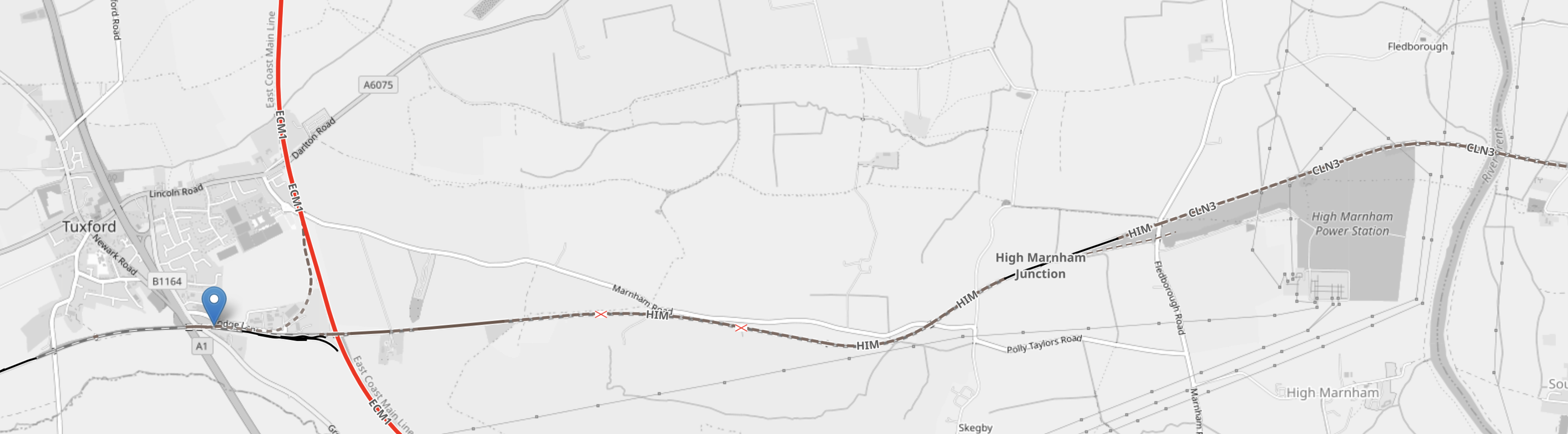
Note.
- The blue arrow is Tuxford West junction.
- The North-South red track is the East Coast Main Line. East-West track indicated by the blue arrow is Network Rail’s Test Track
- The grey area, to the South of the Test Track in the East is the former site of High Marnham power station, where GeoPura have their hydrogen facility.
- If you continue East on the Test Track it connects to the Sheffield and Lincoln Line at Pye Wipe junction.
Sheffield could be the sort of city, that would need a lot of hydrogen to decarbonise.
Has Hydrogen Been Transported From ICI’s Former Site At Runcorn By Rail
I ask this question, as I used to work at Runcorn in the 1960s, and I don’t remember seeing any hydrogen railway wagons.
I asked Google AI, the question in the title of this section and received this answer.
Hydrogen is typically transported from the INEOS (formerly ICI) site in Runcorn via pipeline or by road in cryogenic liquid tanker trucks or gaseous tube trailers, but it has not been historically transported by rail from that specific site.
The first ever trial shipment of hydrogen by rail on Britain’s network took place only very recently, in December 2025, as part of an industry innovation event. This trial involved transporting hydrogen containers from Doncaster to High Marnham, adjacent to the HyMarnham Power green hydrogen production facility.
It looks like my memory and Google AI agree.
Manchester To London Train To Run Without Passengers
The title of this post, is the same as that of this article on the BBC.
This is the sub-heading.
A train service taking commuters from Manchester to London is to run empty for around five months following a decision by the rail regulator.
These three paragraphs add more detail.
A decision by the Office of Rail and Road (ORR), means the 07:00 GMT service operated by Avanti West Coast from Manchester Piccadilly to London will still run but will only be used to carry staff from mid-December.
An Avanti West Coast spokesperson said they were “disappointed” with the decision, which would “clearly impact those customers who already use these services”.
An ORR spokesperson said the decision was made on “robust evidence” from Network Rail to guard against possible service disruption on the West Coast Main Line.
It is a long article on the BBC and I suspect, it is one of those, that should be fully-read before commenting.
I looked up last Friday’s service and found this.
- It was an eleven-coach Class 390 train.
- The train goes via Macclesfield, Stoke-on-Trent and Stafford, but only stops to pick up passengers at Stockport.
- It left on time at 07:00.
- It arrived in London at 09:20, which was twenty-one minutes late.
I think, I’ll see this train arrive on Monday.
Could Avanti West Coast Be Planning A Fast Service From Both Liverpool and Manchester?
Consider.
- Manchester Piccadilly has a 07:00 train to Euston, that takes two hours via Stoke-on-Trent.
- The train also stops at Stockport.
- The Manchester Piccadilly train is an eleven-car Class 390 train, that is 265.3 metres long.
- Liverpool Lime Street has a 06:43 train to Euston, that takes two hours and 11 minutes via Crewe, that stops at Runcorn.
- The Liverpool Lime Street train is a seven-car Class 807 train, that is 182 metres long.
Note.
- I wonder, if at some time in the future, these two services could both be run by seven-car Class 807 trains, that joined at Crewe.
- This might not have been possible with Class 390 trains, as the pair of trains would have been very long.
- Class 390 trains may not be able to split and join.
- I don’t think any extra paths would be needed.
This would give Crewe, Liverpool, Manchester, Runcorn and Stockport, a fast early train to Euston.
Managing Earthworks In A Changing Environment
This image shows the train derailment at Shap at 06:10 on Monday.
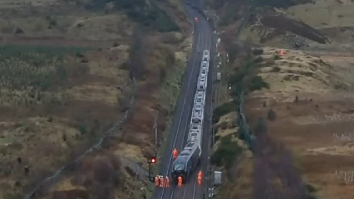
The BBC and others were talking about the cause of the derailment being a landslide.
So it was perhaps appropriate that the latest edition of Rail Engineer had a sponsorsed feature with a title of Managing Earthworks In A Changing Environment.
It is well-worth a full read.
The New Clock At London Bridge Station
These pictures show the new clock at London Bridge station.

This story on the Network Rail web site, which is entitled A New Timepiece For The Railway, gives more details.
Midlands Rail Hub Looks To The Future With Preferred Alliance Partners
The title of this post, is the same as that of this press release from Network Rail.
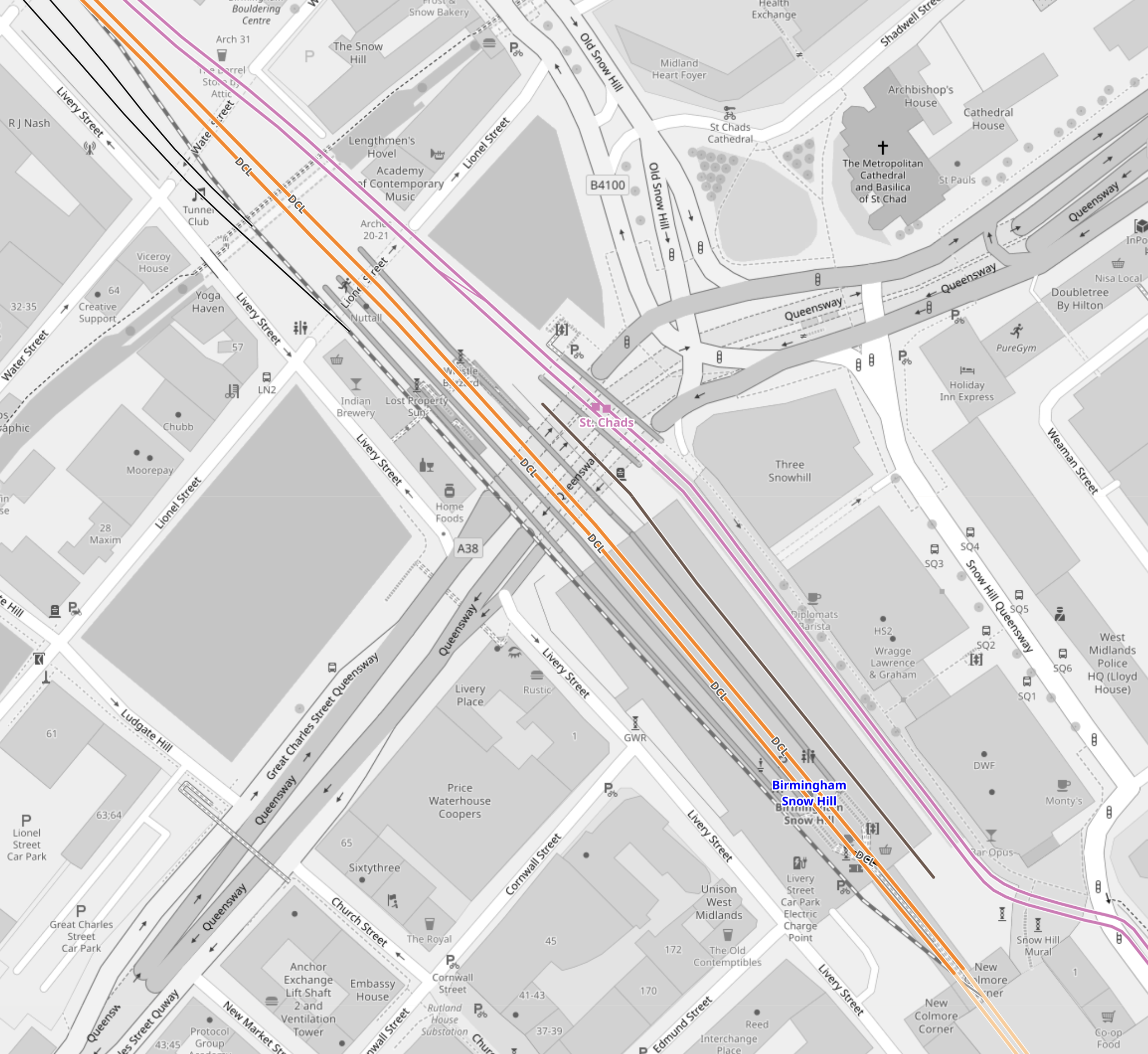
The press release has a spectacular picture, which I’m showing here.
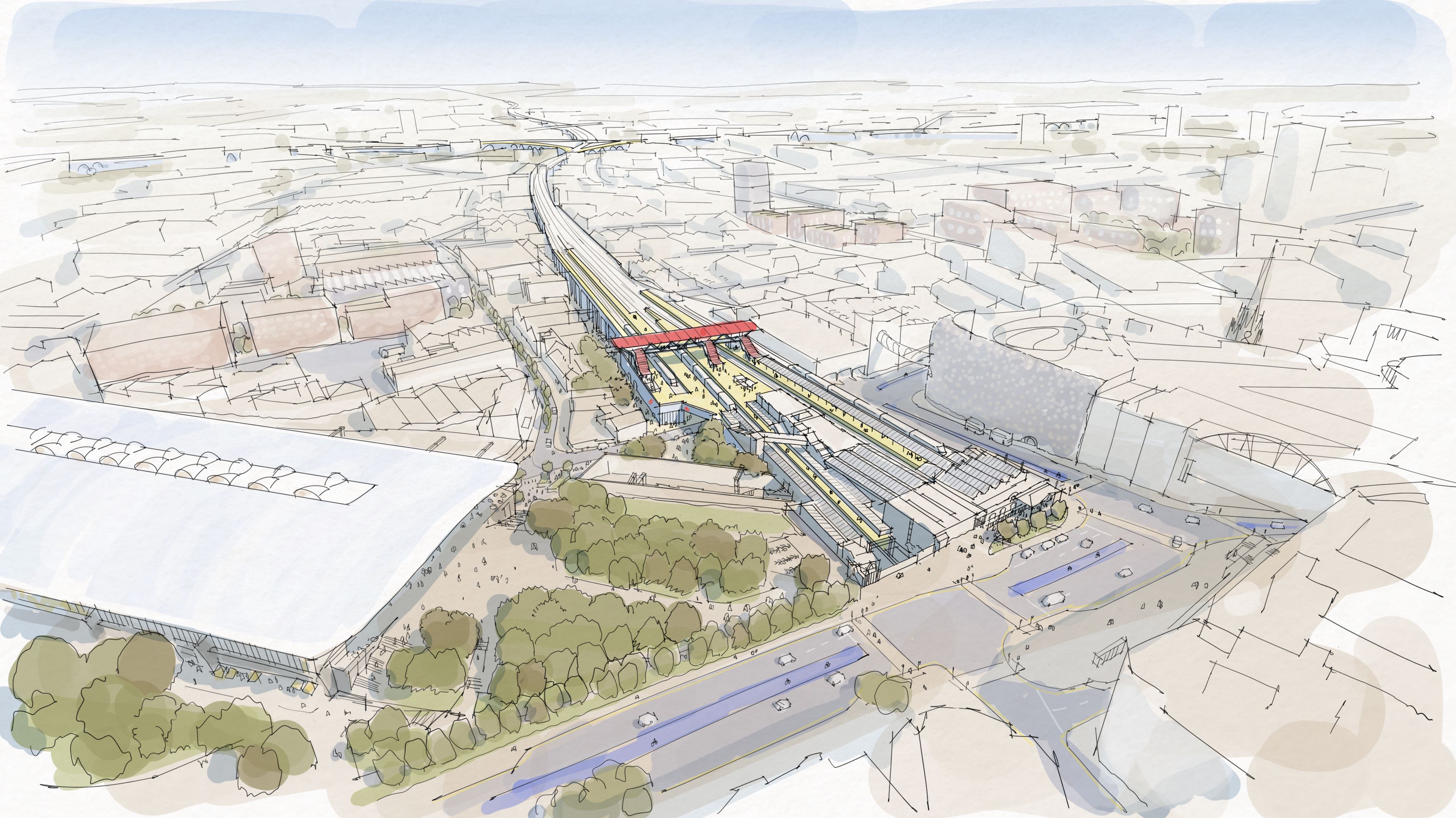
Note.
- High Speed Two’s Curzon Street station is on the left.
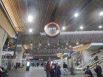
- Birmingham Moor Street station is in the centre.
- There appears to be parkland between the two stations.
- Is that the West Midlands Metro running across in front of Moor Street station?
This OpenRailwayMap shows the railway lines in the area.
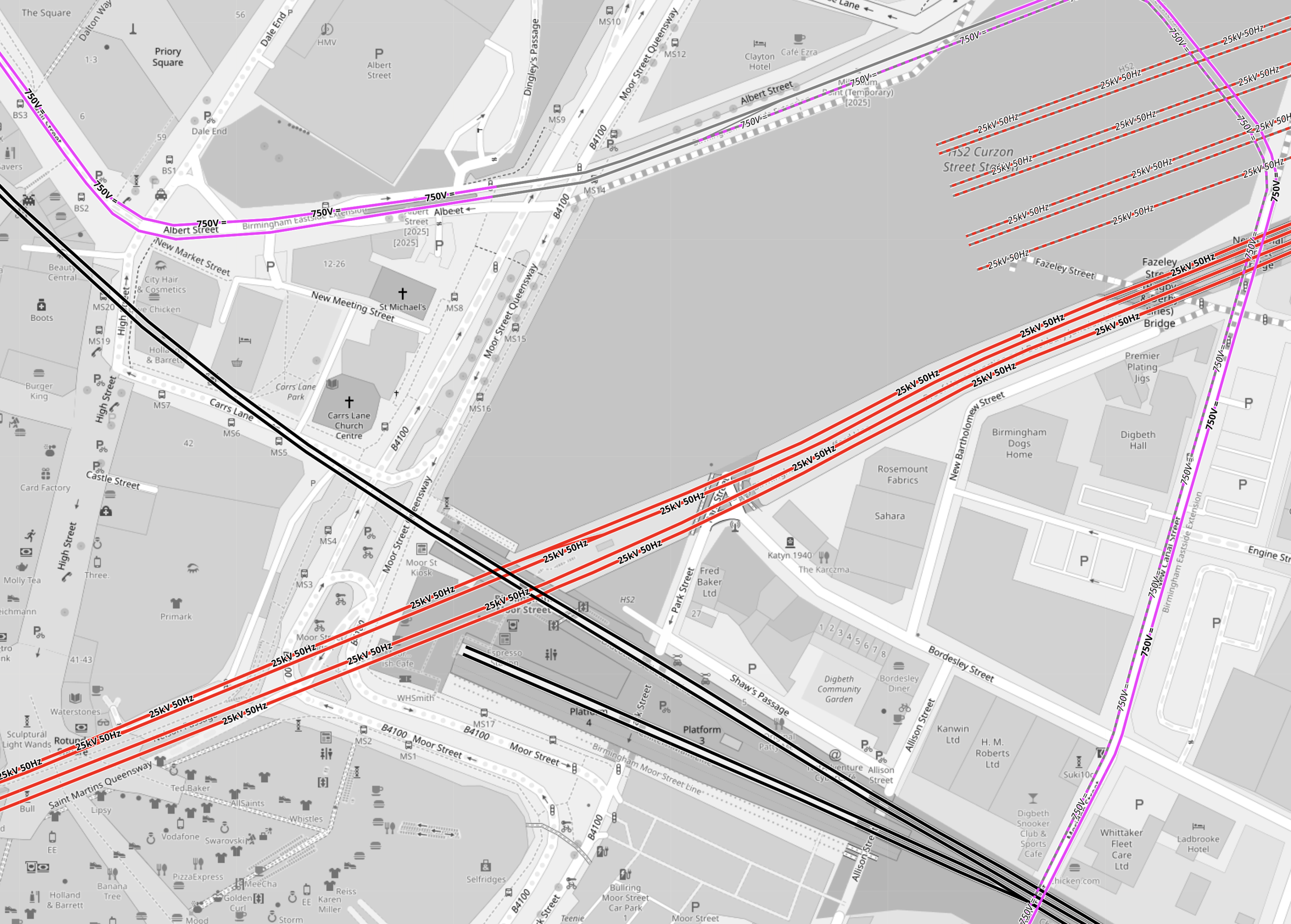
Note.
- Electrified tracks are shown in red.
- Tracks without electrification are shown in black.
- West Midlands Metro tracks are shown in mauve.
- The red tracks going diagonally across the map are the four electrified tracks going into Birmingham New Street station.
- Birmingham New Street station is off the map to the West.
- To the North of the tracks going into Birmingham New Street station, there are the seven platforms of High Speed Two’s Curzon Street station.
- The four platforms without electrification are shown South of the tracks into Birmingham New Street station.
- Two platforms at Birmingham Moor Street station are through platforms, that pass under Birmingham City Centre to Birmingham Snow Hill station.
- The other two platforms at Birmingham Moor Street station are bay platforms.
- The West Midlands Metro appears to take a loop around the stations.
But when you get into the words of the press release, there are a lot of vegetables and very little meat.
- The Midlands Rail Hub could cost around £1.75bn if delivered in full.
- The government’s recent spending review committed to progress the next stage of Midlands Rail Hub.
- Alongside this, planning is underway to begin to deliver two smaller but significant upgrades to benefit passengers as quickly as possible.
- The Alliance partners will be VolkerRail, Laing O’Rourke, AtkinsRéalis, Siemens Mobility, and Network Rail.
These four paragraphs indicate the work, that could be done.
The biggest change will be connecting the Chiltern main line, which runs into Moor Street, with the Camp Hill lines which run towards the South West and East Midlands via two new chords in Bordesley, near Birmingham city centre.
The transformation of the network will include running more train services on key routes through Birmingham and significantly improving connections for the millions of people who use the railway every day.
Work will be prioritised to explore how smaller, but vital, pieces of work which will provide passengers and communities with quicker benefits, including new journey options and more trains can be delivered as soon as possible.
They include reopening platform 4 at Snow Hill station so additional Chiltern Railways services can run directly between Birmingham’s business district and London Marylebone, and redeveloping Kings Norton station and the lines through it so extra Cross City trains can be added and new Midlands Rail Hub-enabled services can call there.
Three projects are specifically mentioned.
- The new chords in Bordesley.
- The reopening of platform 4 at Snow Hill station.
- The redeveloping of Kings Norton station.
I shall now look at each in detail.
The New Chords At Bordesley
This OpenRailwayMap shows the tracks going into and around Birmingham Moor Street station.
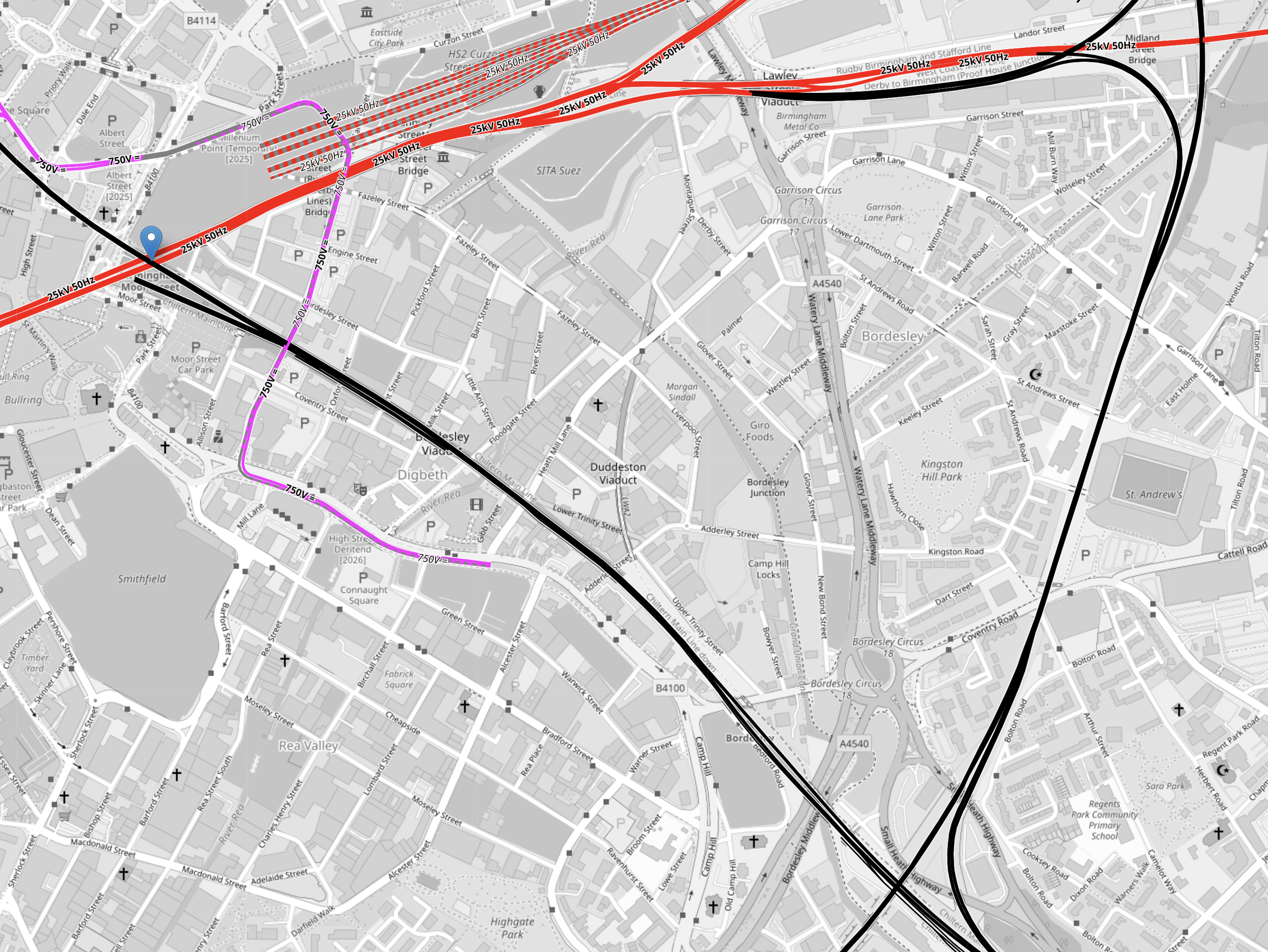
Note.
- Electrified tracks are shown in red.
- Tracks without electrification are shown in black.
- West Midlands Metro tracks are shown in mauve.
- The red tracks going diagonally across the map are the four electrified tracks going into Birmingham New Street station.
- Birmingham New Street station is off the map to the West.
- To the North of the tracks going into Birmingham New Street station, there are the seven platforms of High Speed Two’s Curzon Street station.
- The black track running NW-SE is the Chiltern Main Line between London Marylebone and Birmingham Moor Street stations.
- Birmingham Moor Street station is indicated by the blue arrow in the North-West corner of the map.
- The black track running NE-SW is the Camp Hill Line, that allows services to cross Birmingham.
Two new chords will be built where the Chiltern Main and the Camp Hill Lines cross, to allow services on the Camp Hill Line to call at Birmingham Moor Street station.
Consider.
- The press release described these chords as the biggest change.
- The chords will probably not be fully used, until the new stations are built on the Camp Hill Line.
- There may be need for extra platforms at Birmingham Moor Street station to accommodate any new services.
For these reasons, I suspect that these chords could well be the project that is pushed back to a later date.
The Reopening Of Platform 4 At Snow Hill Station
This OpenRailwayMap shows the track layout at Birmingham Snow Hill station.
Note.
- The two lilac tracks are the West Midlands Metro.
- The two orange tracks are the two through tracks between Birmingham Moor Street and Stourbridge Junction stations.
- Platform 3 is the Southbound track to Birmingham Moor Street on the right.
- Platform 2 is the Northbound track to Stourbridge Junction on the left
- Platform 1 is a loop on left.
- Platforms 1, 2 and 3 are all bi-directional.
- The closed Platform 4 is on the right and is shown by the black track.
I would expect that this reopening could be fairly straightforward and may also have worthwhile benefits.
- Would an extra platform, allow all Chiltern services to serve both Birmingham Moor Street and Birmingham Show Hill stations?
- Chiltern would probably find it easy to extend services from Birmingham to the North-West of the city.
- In this century, services have run as far as Wrexham from Marylebone.
- If all Chiltern services terminated at Birmingham Show Hill station would this have operational and/or marketing advantages?
- If all Chiltern services terminated at Birmingham Show Hill station would this, make it easier for some passengers to get a train to London and the South?
- If all Chiltern services terminated at Birmingham Show Hill station would this release a platform at Birmingham Moor Street station for other services?
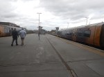
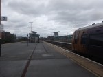
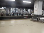
These are a few pictures of Birmingham Snow Hill station.


Platform 4 at Birmingham Snow Hill station could be a Build One Platform-Get One Free At Another Station situation!
The Redeveloping Of Kings Norton Station
This will probably be needed for running services on the Camp Hill Line, so why not get some of the work done early, so the rebuilding doesn’t effect existing services?
This OpenRailwayMap shows the Eastern end of Kings Norton station
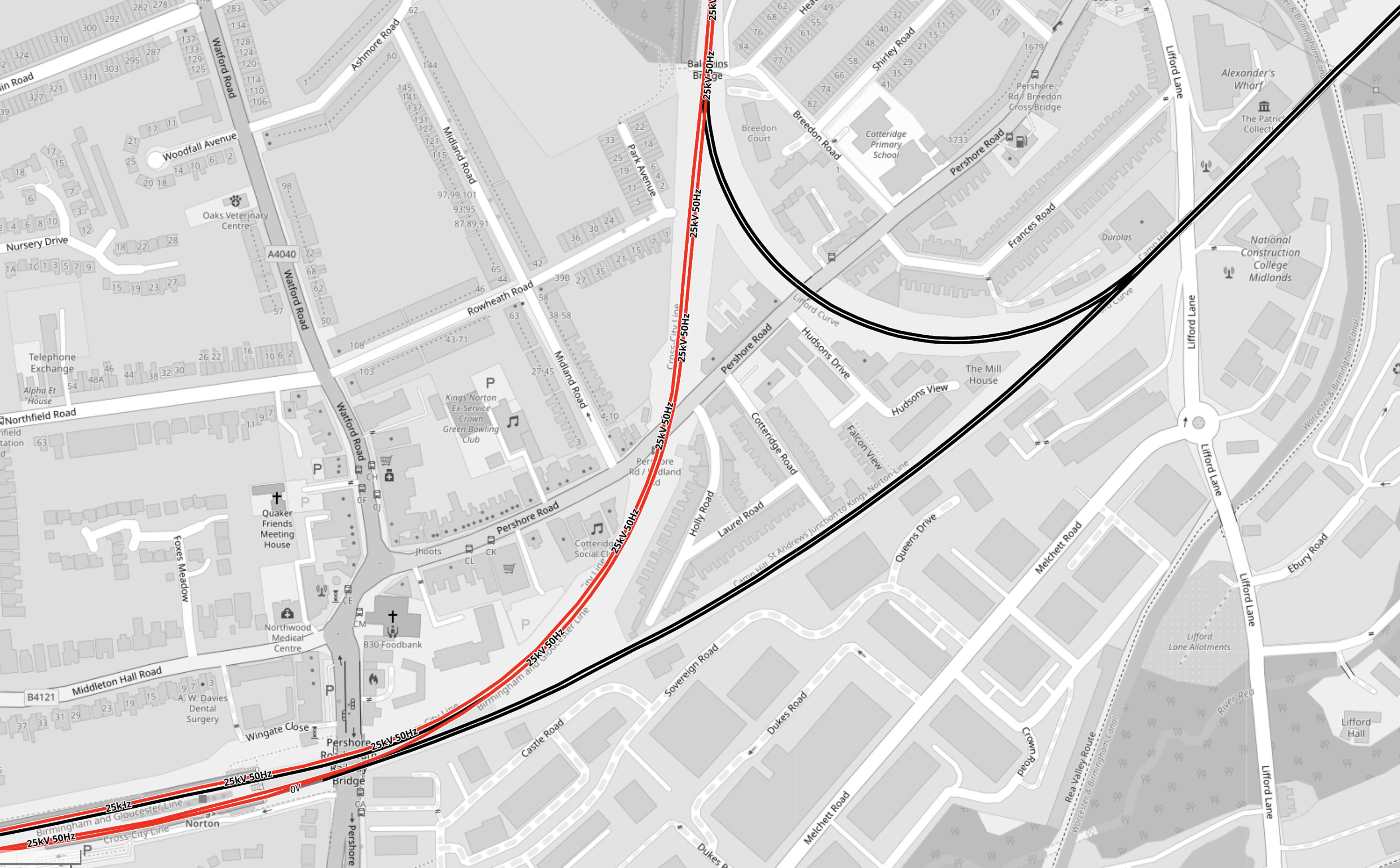
Note.
- Electrified tracks are shown in red.
- Tracks without electrification are shown in black.
- The station has four platforms, but some are unused.
- Two platforms are on an island, with a single platform on either side.
This OpenRailwayMap shows the Western end of Kings Norton station.
The notes to the previous map apply.
These two paragraphs from the Wikipedia entry for Kings Norton station, describe the station.
With the development of both bus and tram services, the need for such a large facility reduced from the 1930s onwards. The result is that today although all four platforms remain in place, only the outer two are in passenger use, with the middle island platforms now derelict.
Refurbished as part of the Cross-City line in 1978, it retained some of its original features following refurbishment, unlike the other ‘cross city line’ stations. The original station building survived, leased out for commercial purposes, until it was demolished in February 2006 for safety reasons. An extension car park provides a Park and Ride facility.
Disabled-access doesn’t seem to be the best either.
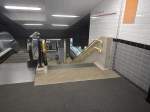
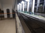
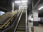
These pictures show the station.

Note.
- As I guessed, there is no disabled-access.
- But there are Braille markings on the handrails down to the platforms.
- Two CrossCountry trains are seen going through the station.
- The local Class 730 trains, lights and information screens appeared to be new.
- Three platforms are electrified, but the fourth is not.
- The electrification structure could probably be used to electrify the fourth platform.
- Only the two outside platforms ; 1 and 4 are in use, with the central island platforms ; 2 and 3 left derelict.
- There is car parking and possibly space for more.
- The two active platforms are 150 metres long and the six-car Class 730 trainstrains appear to be 144 metres long.
- The Class 220 trains, that are run by CrossCountry Trains appear to be 93 metres long.
It was one of the scruffiest stations, that I’ve ever seen.
These are my thoughts on the station.
Handling The Camp Hill Line
Refurbishing Kings Norton Station
I don’t feel, that this will be the most horrendous of jobs, as it is very much a job, where all the rubbish and wild forest is removed and new platforms and a bridge are built.
South Eastern Railway Deploys IsoMat Thermal Technology To Keep Trains On The Tonbridge To Hastings Line Running In Hot Weather
The title of this post, is the same as that of this news item on the Network Rail web site.
This is the sub-heading.
A new type of technology is being trialled on the Tonbridge to Hastings railway line to help keep trains running in hotter weather, and more reliable journeys for passengers and freight customers.
These two paragraphs add more details.
The South Eastern Railway has partnered with UK green tech start-up Flint Engineering to combat excessive heat in railway signalling cabinets that can exceed 70°C, with a new patented system that requires no power, maintenance, or internal cabinet modifications, and can be installed in under an hour.
Flint’s innovative IsoMat technology delivers peak temperature reductions of over 21%, on the hottest days, transferring thermal energy thousands of times more efficiently than copper or aluminium alone.
This is one of those ideas, that could be filed under Too Good To Be True.
This picture shows the device in operation.
I can see this device having many uses, in the most surprising places.
Agreement To Eliminate Mobile Blackspots On Britain’s Lines
The title of this post, is the same as that of this article on Railway/PRO.
This is the sub-heading.
Network Rail and telecoms companies, Neos Networks and Freshwave signed an agreement named Project Reach to boost connectivity and remove mobile signal blackspots on the Britain’s rail network.
These first three paragraphs add more detail.
The ground-breaking public-private partnership delivers on the government’s Plan for Change mission to kickstart economic growth with ultra fast fibre optic cable across country’s busiest rail lines.
This is a multi-year project with the first installation of mobile infrastructure expected to begin in 2026 and fully rolled out by 2028.
The new deal will eliminate mobile signal blackspots in tunnels on key rail routes up and down the country, transforming daily journeys for millions of passengers who currently face the frustration of dropped calls and interrupted streaming on key routes between London, Manchester, Newcastle and Cardiff.
Note.
- Finance appears to be coming from both the public and private sector. Is this setting a dangerous precedent for Starmer and Rachel from Accounts.
- It is a £300 million project.
- In addition, a second project will tackle black-spots in 57 tunnels.
- Would the technology allow or improve other services on trains, where they could use mobile phone technology?
It is an ambitious and much-needed project, that could encourage many people to increase their use of rail transport.
Years ago, I built a new office on the farm, where I lived. The mobile coverage was bad in the new office, which was annoying. Someone suggested a piece of kit, that pointed at the nearest mobile phone mast and rebroadcast mobile signals, which solved the problem.
I suspect that Neos Networks and Freshwave can do the connection at 125 mph, that the solution, that I used, did without moving.
Conclusion
Sounds to me, that every train and rail line should have this technology installed.
