It Looks Like The Hackney Downs/Central Link Is Ready To Open
I took these pictures at Hackney Downs and Hackney Central stations today,


I don’t think it will be long before when I come back from Walthamstow, I can arrive at Downs station, walk through the link to go out on the street at Central station station to get a 38 bus home. The advantage of this route, as opposed to getting a 56 bus by Downs station, will be that I can do some food shopping if necessary in the Hackney Marks and Spencer.
I can’t help feeling that passengers will press for links between the other platforms and lifts to the platforms from the subway at Hackney Downs station.
The reopening of Lea Bridge station and the possible reopening of the Hall Farm Curve are both developments that could affect any future work at Downs and Central stations. This Google Map shows the layout of the two stations.
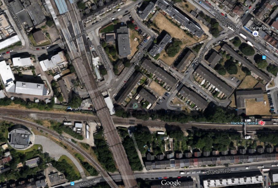
Hackney Downs/Central Link
Downs station is at the top and Central station is at the right.
You can actually see some sections of the new link in place, so the image must have been taken recently. The large oval object at the left (west) of the image is the ventilation and evacuation shaft for the Channel Tunnel Rail Link, which is easily seen from trains on the North London Line. It is connected by a concrete roadway to Graham Road.
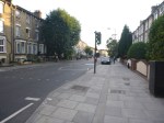
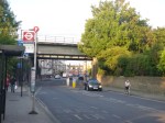
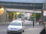
Note how it is possible to walk inside the railway land to Graham Road. I believe it would be possible to create a southern entrance for the two stations, by the two bridges, that would give access to the westbound platform at Central station and possibly perhaps using a lift to Platform 4 at Downs station. These pictures show the area of Graham Road, where the two bridges cross.


This is an enlarged Google Map of Graham Road, the two bridges and the two access roads.
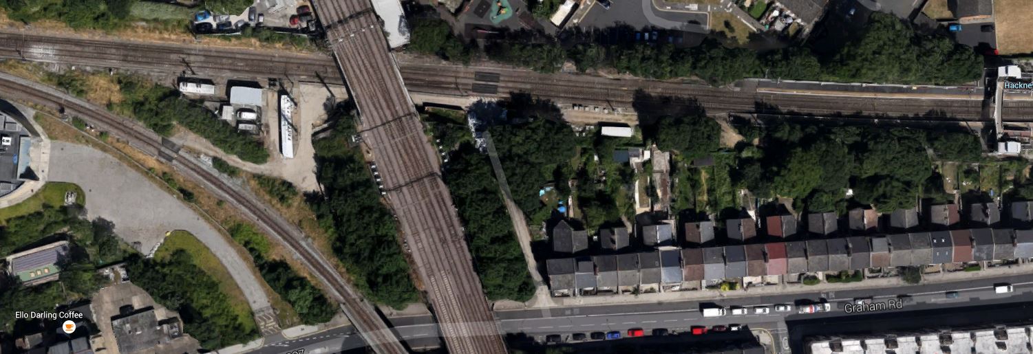
An Enlarged Map
In order from the west, the features are.
- The Ventilation and Evacuation Shaft for the CTRL
- The Access Road to the CTRL shaft
- The two-track Curve that connects the Lea Valley Line to the North London Line.
- The four-track Lea Valley Line
- The Network Rail Access Road
The footbridge at Central station is shown at the far right.
As the pictures and the map show there is an embankment, so to get to a possible southern entrance, there might need to be some serious engineering.
On the other hand their is already a light-controlled crossing on Graham Road by the bridges.
The only problem of putting a second link on the southern side of the tracks, is that signalling cables and equipment may get in the way. This necessitated a big redesign of the link, that is now being created. This page on the contractor’s web site, which describes the current link, says this.
An earlier proposal had to be abandoned because it would interfere with Network Rail signalling equipment. The latest plan avoids this problem by building the interchange on the northern side of the track.
So this probably partly explains, why the new walkway is not a small structure.
I also heard in the evening that the link will open next week, possibly on Tuesday.
In the nearly five years, I’ve lived in Hackney, the development of the area around the two Hackney stations has been extensive and it is showing no sign of slowing down.
The London Borough of Hackney is now one of the more desireble boroughs in which to live.

[…] I think we’ll be seeing more of these short-cut entrance/exits at several stations. I proposed this for Highbury & Islington in this article in March 2013 and personally, I’d like one at Hackney Central on the Westbound platform, to give access to the buses on Graham Road. […]
Pingback by Improving The East London Line « The Anonymous Widower | August 2, 2015 |