Crossrail Release Aerial Views Of Stations
This page on the Crossrail web site has several up-to-date aerial views of stations.
This image shows the Crossrail station at Paddington station.
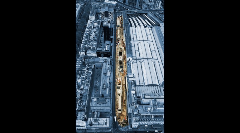
Crossrail have said this about the station.
The Elizabeth line station runs along the full length of the existing Paddington Main Line station. A 90 metre clear opening – a unique feature for an urban underground station design – will be covered by a dramatic steel and glass canopy eight metres above the ground that will allow natural light to flood down to the station platforms.
This Google Map shows Paddington station and where Crossrail comes to the surface to the West of Royal Oak station.
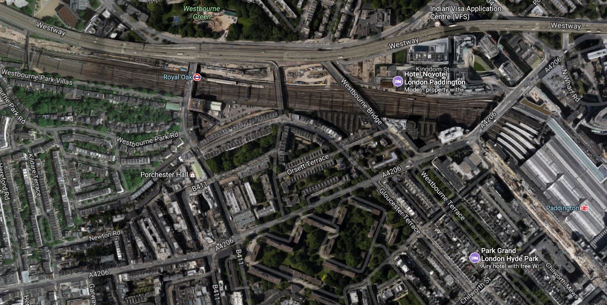
If you look in the top-left corner of the map, you can see a road named as Westbourne Park Villas. The foot-bridge across the railway from this road is the one in The Footbridge At Westbourne Park, from which I took pictures of the Crossrail tunnel portal at Royal Oak.
This map from carto.metro.free.fr shows the layout of Crossrail and the Underground Lines at Paddington station.
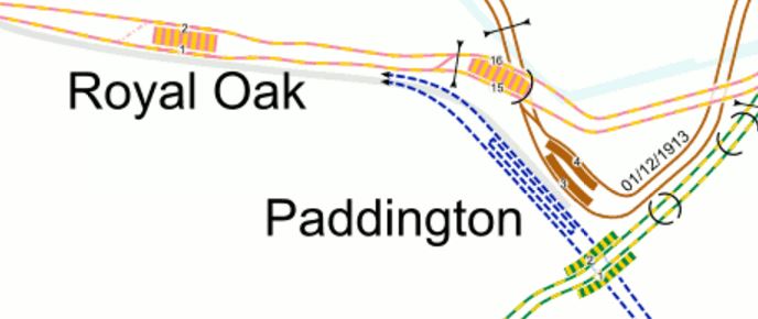
So it looks like the Crossrail lines go under all the lines into Paddington and then they surface by the Westway, before going under the footbridge and linking with the main line out of Paddington.
A link between the Bakerloo Line and Crossrail is being constructed, which I wrote about in Paddington Is Operational Again, but is there going to be a link between the Circle/District Lines and Crossrail?
No comments yet.

Leave a comment