Underground Maps By Lego
Five Underground maps have been made in Lego.


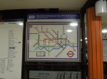

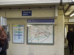
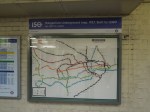
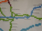

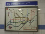


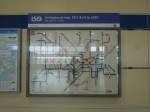

They are at South Kensington (1927), Green Park (1968), Piccadilly(1933), Kings Cross (Future) and Stratford 2013) stations.
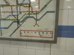
The only map, that was difficult to find was the one at Stratford, which was at the Eastfield entrance to the station. It was also the only one inside the ticket barriers.
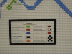
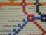
The map at Kings Cross is the first in an Underground station to show Crossrail integrated with the Underground.

[…] So I decided that I needed to explore some parts of the London Underground. I intended to have breakfast at Leon in Kings Cross station and then I intended to see if I could find the Underground maps in Lego. […]
Pingback by A Visit To The World’s Best Therapist « The Anonymous Widower | June 13, 2013 |
I LOVE Lego, I was taken to Hamleys by an aunt when it was first on display there, and she bought me some and I loved it so much that other people bought me Lego as well.
Comment by Liz P | June 13, 2013 |
The maps were certainly getting attention. The two Malaysian tourists I met at Green Park seemed to be fascinated.
Comment by AnonW | June 13, 2013 |