Wytch Farm And Horse Hill
I couldn’t resist looking at the Google Earth images of the two sites.
This is Wytch Farm
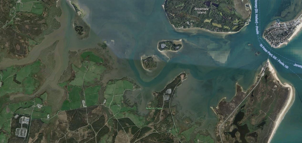
Wytch Farm
The processing plant for the field is the two squares in the bottom-left or south-west corner of the map and the wells fan out for upwards of 10 km. The field even goes under the upmarket area of Sandbanks, so if anybody would complain, the residents from there would.
And this is the area of Horse Hill
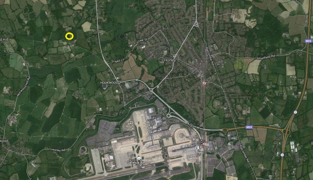
Horse Hill
It is marked by the yellow circle. Note the sprawl of Gatwick at the bottom.
Both sites are surrounded by a lot of green field and woods, so I feel that a similar camouflage job could be done in Surrey to that done in Dorset.
Although as Wytch Farm is now forty years old, I suspect we’ll do a better job today of hiding it. It might be that directional drilling is used from a site near the railway through Gatwick, so that the processing plant could be well hidden and oil could be removed by train.
No comments yet.

Leave a comment