The Northern End Of The Silvertown Tunnel
This map from OpenRailwayMap shows the Northern end of the Silvertown Tunnel.
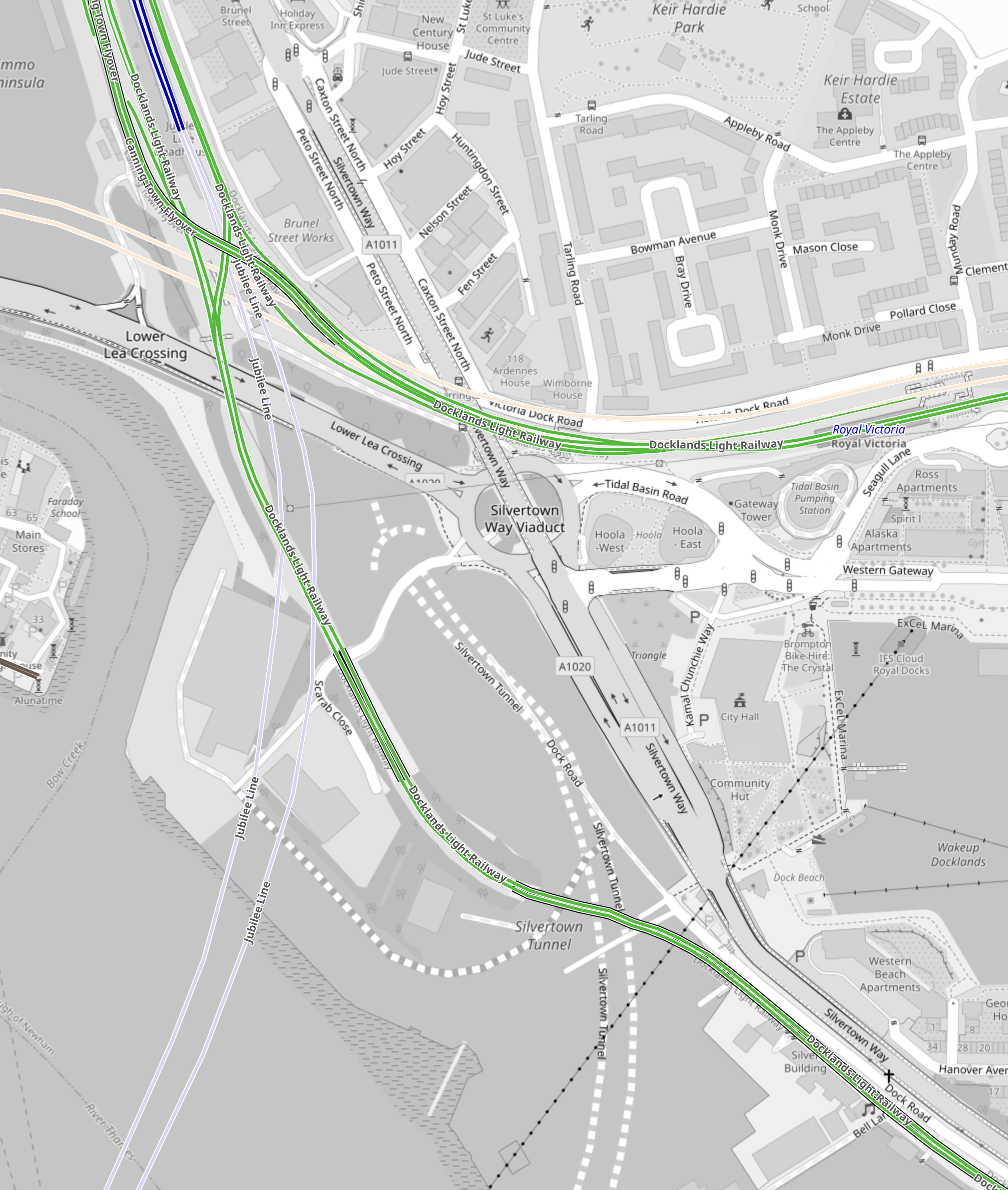
Note.
- The two dotted white lines show the route of the Silvertown Tunnel.
- The green lines are the Docklands Light Railway.
- The Northern green line is the Beckton branch.
- The Southern green line is the Woolwich Arsenal branch.
- The two silver-grey lines that loop across the top part of the map are the Jubilee Line.
- Canning Town Station is in the North-West corner of the map.
- The pair of cream lines across the map to the South of Canning Town station are the tunnels of the Elizabeth Line.
- The black dotted line going across the South-East corner of the map is the cable car.
This Google Map shows vaguely the same area.
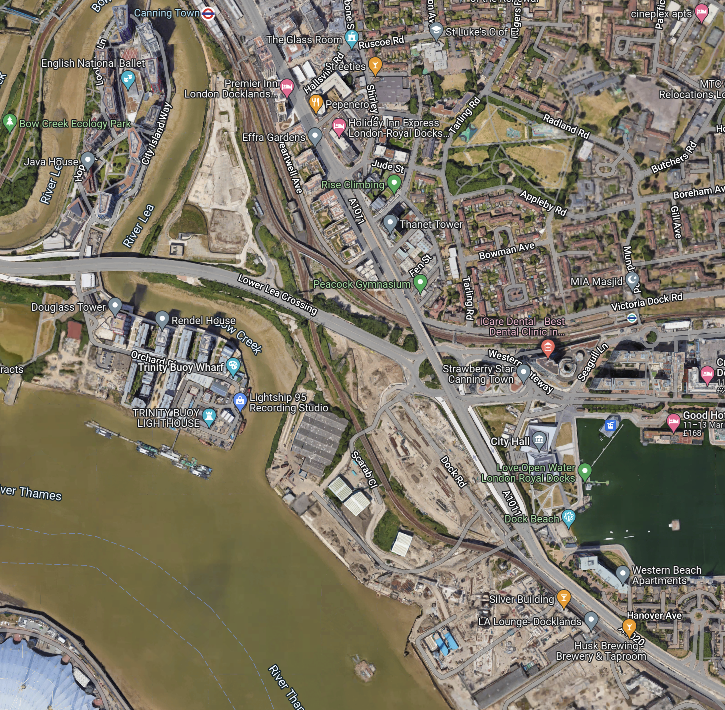
Note.
- Canning Town station at the North of the map in the middle.
- The dual carriage road running NW-SE past Canning Town station, is numbered A1011 in the North-West and A1020 in the South-East.
- The A1011 crosses over a roundabout and the Beckton branch of the DLR on a flyover.
- The roundabout is the Tidal Basin Roundabout, which will be the Northern connection of the Silvertown Tunnel.
- The road running West from the roundabout is the Lower Lea Crossing, which leads to Canary Wharf and the City.
- The water to the right, is the Royal Victoria Dock.
- The Royal Docks cable car station can be seen in the North-West corner of the dock.
- The new City Hall is between the cable car and the A1011.
Comparing the two maps, it appears that the Silvertown Tunnel will emerge somewhere in the cleared land to the West of the A1011.
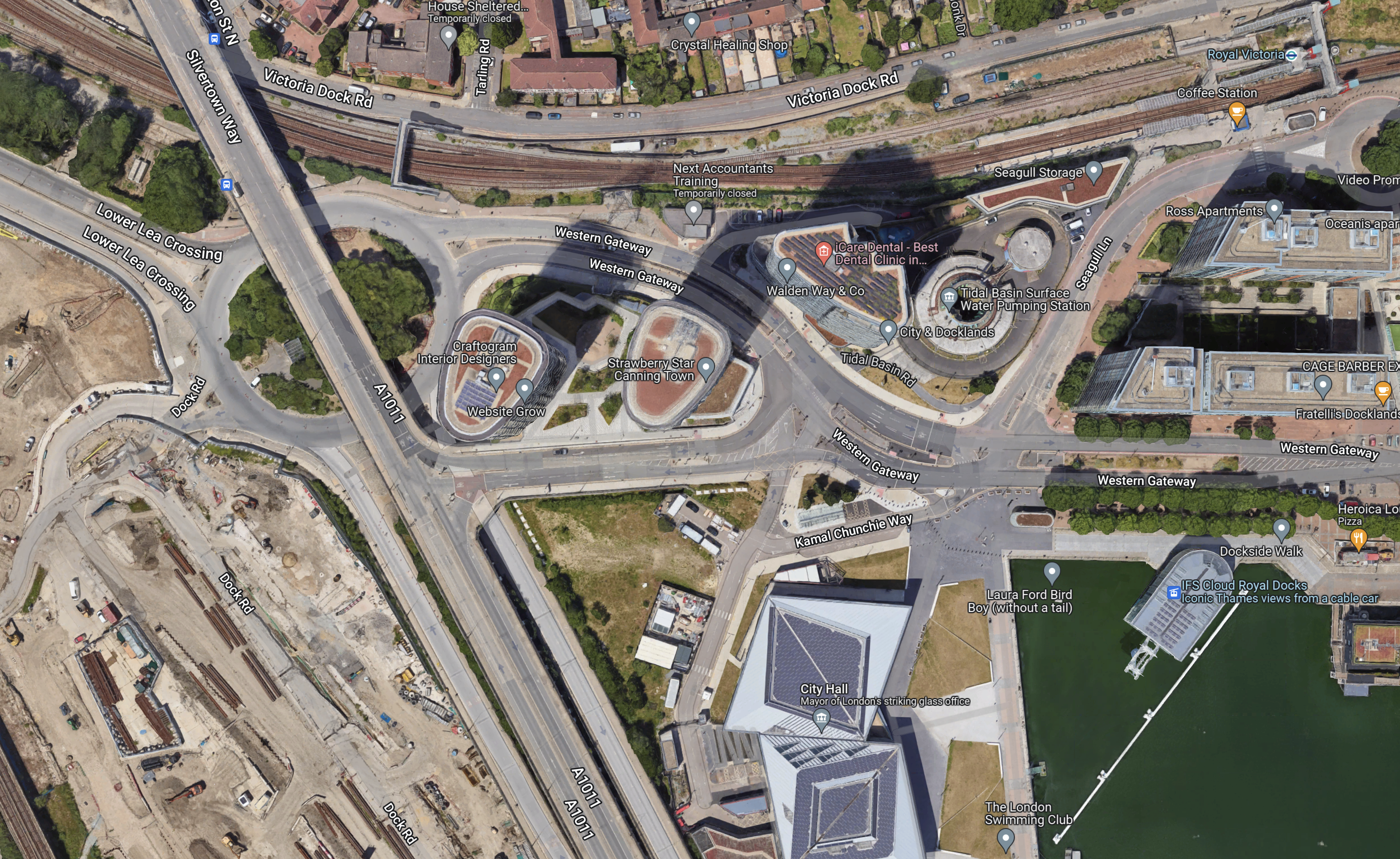
This second Google Map shows the Tidal Basin roundabout, City Hall and the Royal Docks cable car station.
I took these pictures of the area from the cable-car yesterday.

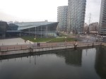
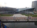
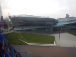
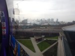
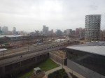
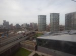
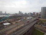
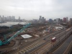
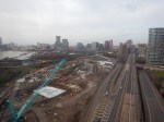
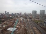
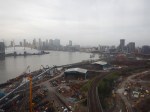
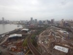
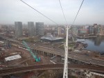
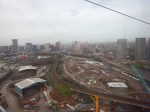
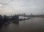
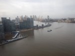
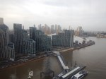
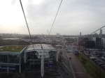
Note.
- The cable-car wasn’t busy.
- I was sitting alone on the Western side of the car.
I have some thoughts about the Silvertown Tunnel.
The Silvertown Tunnel Is Convenient For The New City Hall
From the Google Map, I included earlier, it looks like City Hall is on a loop from the Tidal Basin Roundabout.
it is also especially convenient for those members and officials who live in South London, who will just nip through the new tunnel.
I suspect that limousine access for the great and good to the old City Hall wasn’t as good.
The Obvious Truck Route To The City of London From the Channel Tunnel Will Be To Use The Silverton Tunnel
Recently. I have been watching the construction of 22 Ropemaker Street and I have surprised at how many large components for this building have come in by truck from Europe.
As they seem to arrive overnight, they are probably sneaked in by a secret route like the A13 to avoid a crossing of the River.
As Blackwall and Rotherhithe Tunnels don’t have a high clearance, could these components come into City through the Silvertown Tunnel.
I certainly feel that large truck access to Central London, is the major reason for building the Silvertown Tunnel.
But will large numbers of trucks using the Silverton Tunnel increase congestion on the roads in East London?
As Hackney and Newham are against the Silvertown Tunnel, I suspect they expect lots of traffic to be generated.
Will Satellite Navigation Systems Recommend Using The Silvertown Tunnel?
Of course they will and I suspect when the Northern section of the M25 is congested, vehicles will be sent through the Silvertown Tunnel and London to go North. I must admit, that my brain has sent me on that route to get through London, when the M25 is congested. But then I would generally have been driving a nippy Jaguar estate car, that could use Rotherhithe Tunnel or the bridges in Central London.
The Southern End Of The Silvertown Tunnel
This map from OpenRailwayMap shows the Southern end of the Silvertown Tunnel.
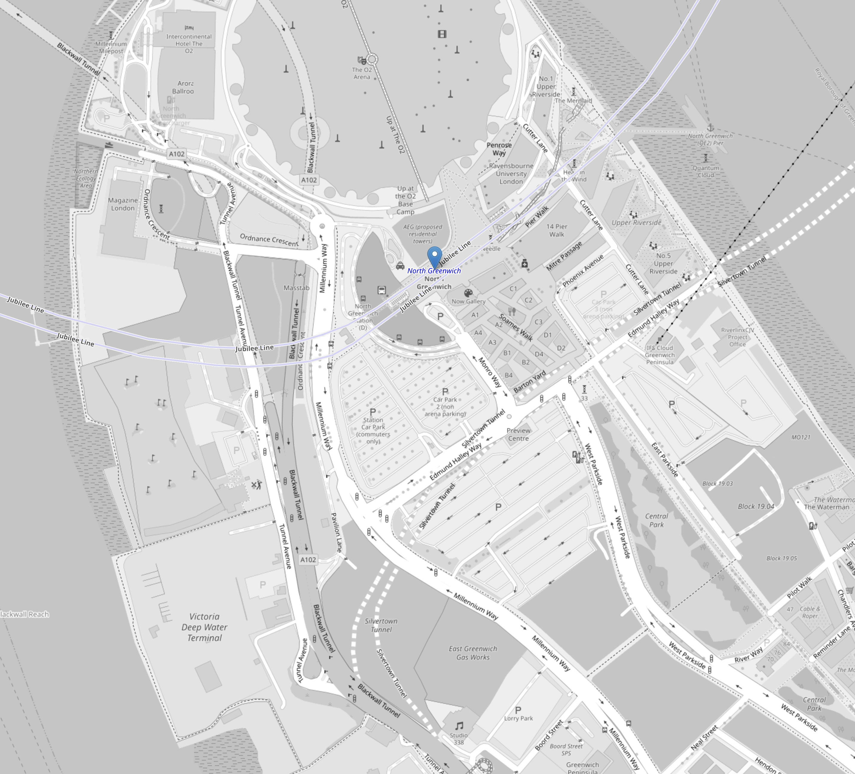
Note.
- The O2 Arena at the top of the map in the middle.
- The blue arrow below it, which indicates North Greenwich station.
- The two dotted white lines show the route of the Silvertown Tunnel.
- The two silver-grey lines that loop across the top part of the map are the Jubilee Line.
- The black dotted line between the Jubilee Line and the Silvertown Tunnel is the cable car.
This second OpenRailwayMap shows the Silvertown Tunnel’s junction with the approach to the Blackwall Tunnel.
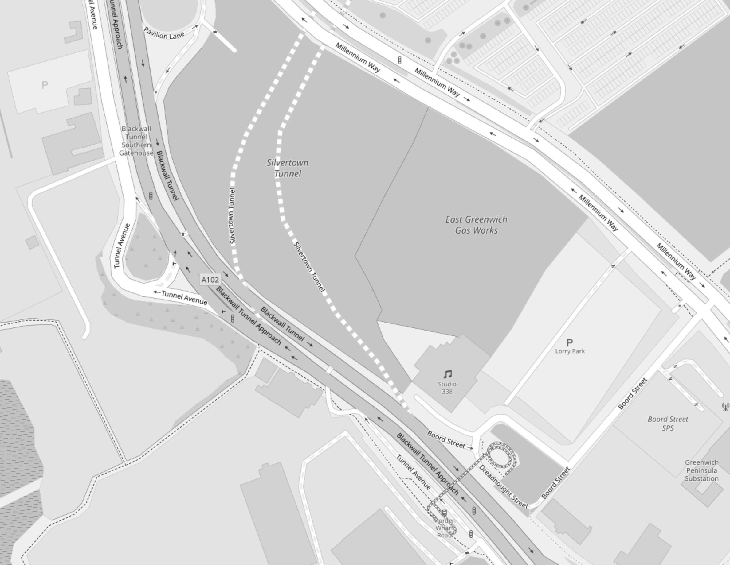
Note.
- The two dotted white lines show the route of the Silvertown Tunnel.
- Studio 338, which is a music and arts venue, is indicated by the double quaver.
- The site to the North of Studio 338 is labelled the East Greenwich Gas Works.
- The roads to the Northbound tunnel bores of both tunnels, split to the West of Studio 338.
- The roads from the Northbound tunnel bores of both tunnels, join to the West of Studio 338.
This Google Map shows the same area as the previous map.
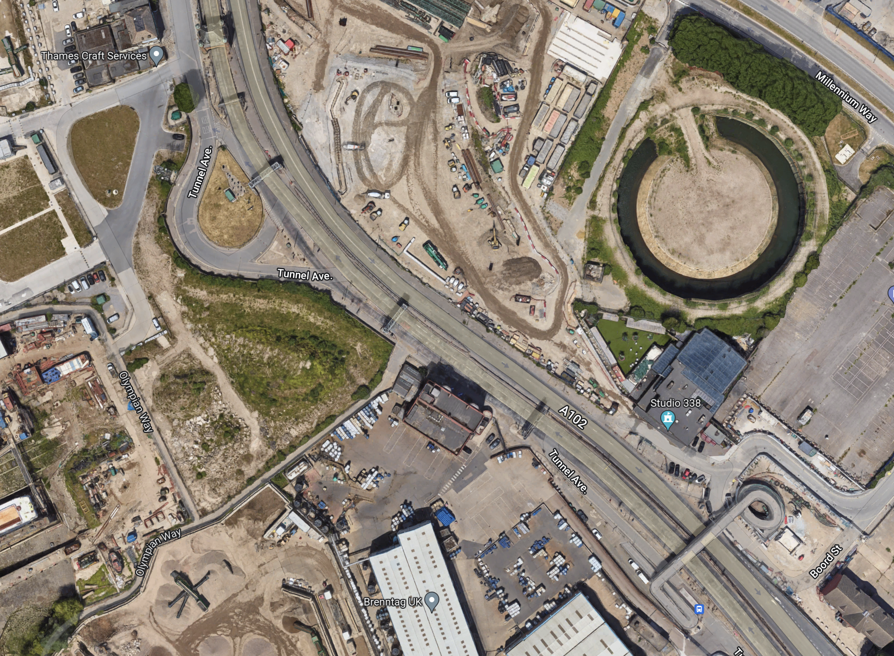
Note.
- Studio 338 is clearly marked.
- To its North is a circular structure on the site labelled as the East Greenwich Gas Works on the previous map.
- Could this be the remains of a gas holder?
Could it be that the works to the West of the circular structure are the start of tunneling?
Conclusion
It looks to me, that the designers of the Silvertown Tunnel have been able to squeeze in a junction between the approaches to the two tunnels, that should be fairly free-flowing.
