Crossrail 2 October 2015 – Tottenham Hale Tunnelling Site
This Crossrail document is entitled Tunnelling Worksite At Tottenham Hale.
This is said.
A new Crossrail 2 portal at Tottenham Hale would include the following:
A retained cutting approximately 300 metres long where the surface railway gradually descends to the tunnel entrance
The tunnel entrance, where the surface railway enters the tunnel and the tunnel boring machines would start from during construction
A worksite for building and equipping the tunnels
It’s all quite simple really and this Google Map shows the area.
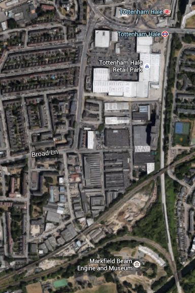
Tottenham Hale Tunnelling Worksite
The worksite is the triangular area, bounded by rail lines, north of the Markfield Beam Engine and Museum. The rail lines are.
- The North-South West Anglia Main Line.
- The East-West Gospel Oak to Barking Line.
- The curve that allows trains to pass between the two other lines.
You can get a good view of the site from both of the first two lines.
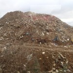

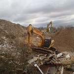
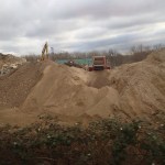
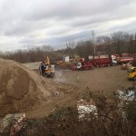
The site seems to be mainly a site that collects London’s demolition rubbish. Some of the pictures came from Could This Be Where Crossrail 2 Is Dug?
In addition to the tunnel portal here, it may also be the starting point of the four-tracking of the West Anglia Main Line to increase capacity.
I have always assumed that the two new slow lines that are being built alongside the West Anglia Main Line will be built on the Eastern side of the current two tracks. I could have made a wrong assumption, but if this is the case, there will need to be tunnels under the main lines so that Crossrail 2 can join up with the slow lines.
Working Around The Victoria Line Closure
Today, I wanted to go to IKEA and a decent B & Q, so as both are close to Tottenham Hale station, it required a trip to that station or thereabouts.
The problem is that the Victoria Line is closed past Seven Sisters in August, so they can remove the bottleneck at Walthamstow Central that was part of the cheapskate design of the 1960s. Click here for the full story.
So I couldn’t take my usual route of an Undrground train to Tottenham Hale and a 192 bus.
I decided to go to IKEA first, which is just an easy trip all the way on a 341 bus from perhaps a hundred metres from my house. But as I got to the stop, the 341 whizzed past. Luckily it was followed by a 476 bus, which joins up with the 341 at Northumberland Park and hopefully because of the route it takes will get there first.
So I got the 476 and sat upstairs. I was watching to see if the 341 was behind us as we turned off Tottenham High Road and saw the 341 appear behind.
At the next stop I got off the bus to get the 341, only to see that bus go straight past. Luckily, I was able to get back on the 476, so in the end, I went all the way to Northumberland Park, a couple of stops short of IKEA. The bus information saif I’d haveto wait twenty minutes for a 341, so I walked over the level crossing to the Marigold Road stop for the 192. Again my luck was in, as a 192 had just turned up and they were changing drivers.
Coming back, I was carrying a full IKEA bag, and wanted to get to B & Q at Tottenham Hale for a couple of small bits, so I needed a 192 bus. Unfortunately, there was a bit of a gap in the service, but after about twenty minutes, I’d done my hopping and needed to get home.
So I walked back to Tottenham Hale station, hoping that there was a Hackney Downs train due.
Remarkably there was one in a couple of minutes and I just had time to climb over the bridge to catch it.
At Hackney Downs, the train dropped me on Platform 1, so I could either go down into Hackney Downs station and get a 56 or 38 bus, or use the new walkway to Hackney Central, from where I could get a more numerous 38 bus.
As it was a warm day and there was a lift in the walkway, I decided to take the newly-opened route.
I’m glad I did, as it turned out that due to the wire mesh at the top of the sides of the walkway, it was remarkably cool.

I’d surmised it would have been good in wet weather, but I’d never thought I’d be pleased to use it because of the heat.
According to one of the staff to whom I spoke, the walkway is staring to be increasingly well-used as passengers discover it.
I think that we’ll see this type of walkway in other places on the UK rail network.
One thing that helped this morning to get around the Victoria Line closure, which removes a bit chunk of my usual routes to Tottenham and Walthamstow, was London’s superb text message-based bus information system, which like any good system is designed to work on any device that can send and receive text messages.
And it does it all without using any dreaded app.
Before Crossrail 2 – Tottenham Hale
In the near five years since, I moved back to London, Tottenham Hale station has changed for the better, with the addition of a lift to the Victoria Line platforms and the reorganisation of buses, taxis and other traffic around the station.


But over the next few years, we should be seeing a lot more changes as this Future section in the Wikipedia entry for the station. The significant section is about Crossrail 2.
In February 2013, the Crossrail task force of business group London First, chaired by former Secretary of State for Transport Andrew Adonis, published its recommendations on Crossrail 2, favouring a route almost identical to the regional option proposed by TfL in 2011. The report was endorsed by Network Rail.
This proposal will see four tracks restored through Tottenham Hale and direct links to South-West London.
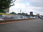
This Google Map shows the station and the surrounding area.
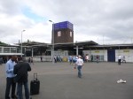
Tottenham Hale Station
This image appears to have been taken before the new Tottenham Hale Bus Station was created and the traffic system was changed.
With all the development going on, putting four tracks through the station will need a very narrow track and platform layout.
On this page of the Haringey web site are more details and an artist’s impression of the proposed station. This picture is shown in an article in the Tottenham Journal.

Proposed Tottenham Hale Station
I would suspect that a wide bridge would extend eastwards from this building over the tracks with lifts and escalators to the platforms. Looking at this image, it does strike me that the the architect has taken some of Charles Holden‘s stations as their inspiration.
Crossrail 2 At Tottenham Hale
As regards Tottenham Hale this has been said recently.
A new tunnel entrance south of Tottenham Hale station to take the line from above to below ground
This is Crossrail 2‘s map of the area, which I obtained from this page on the Crossrail 2 web site.
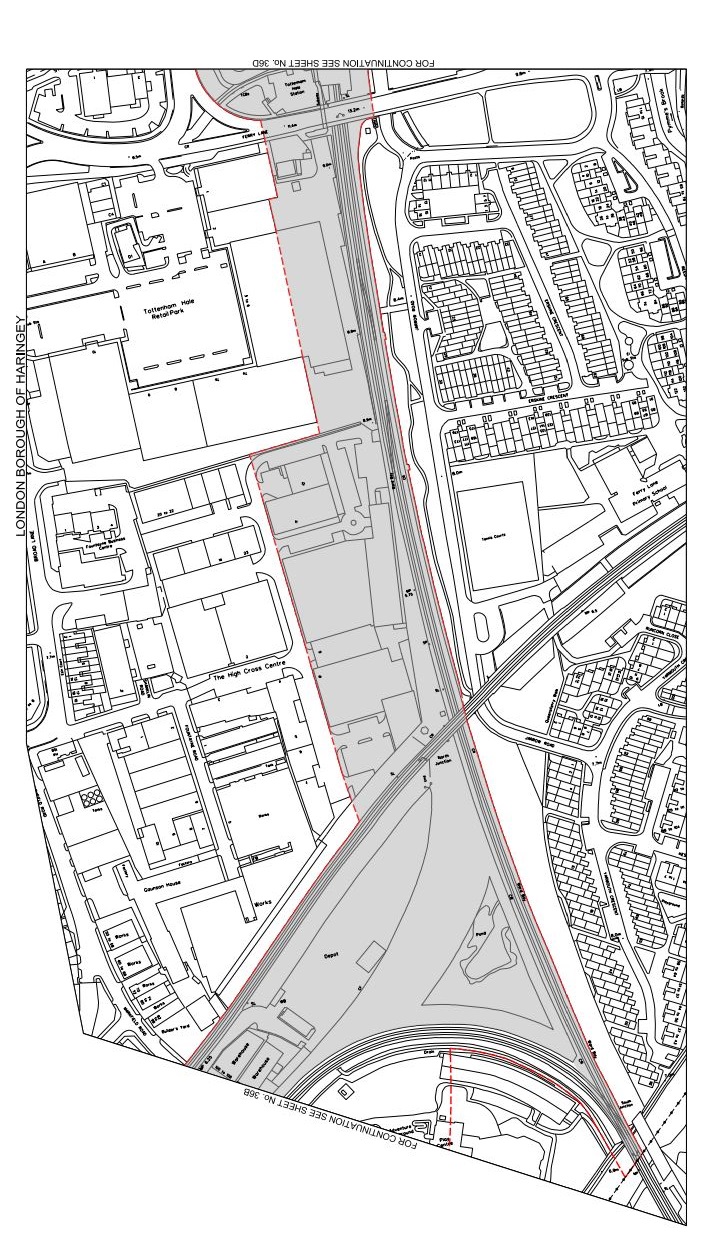
Crossrail 2 At Tottenham Hale
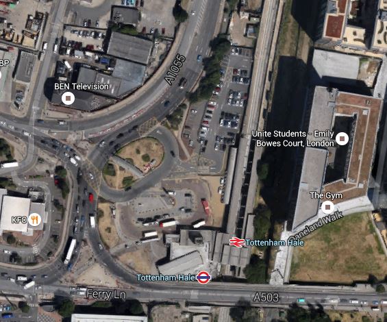
Tottenham Hale station is at the top of the map and the Lea Valley Line to Liverpool Street and Stratford goes down the map. The other railway going across the map is the Gospel Oak to Barking Line. Note the curve that makes a triangular junction that encloses a large amount of safeguarded land, which is shaded and bounded in red. This is a Google Earth image of the area south of Tottenham Hale station.
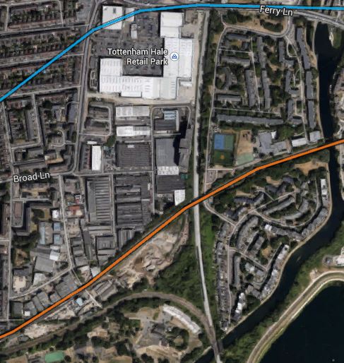
South Of Tottenham Hale
I’ve tried rather badly to match the two maps, but it does show that there would appear to be enough space to fit a tunnel portal into the area. This is a detailed look from Google Earth of the eastern end of the land enclosed by the triangle of lines.
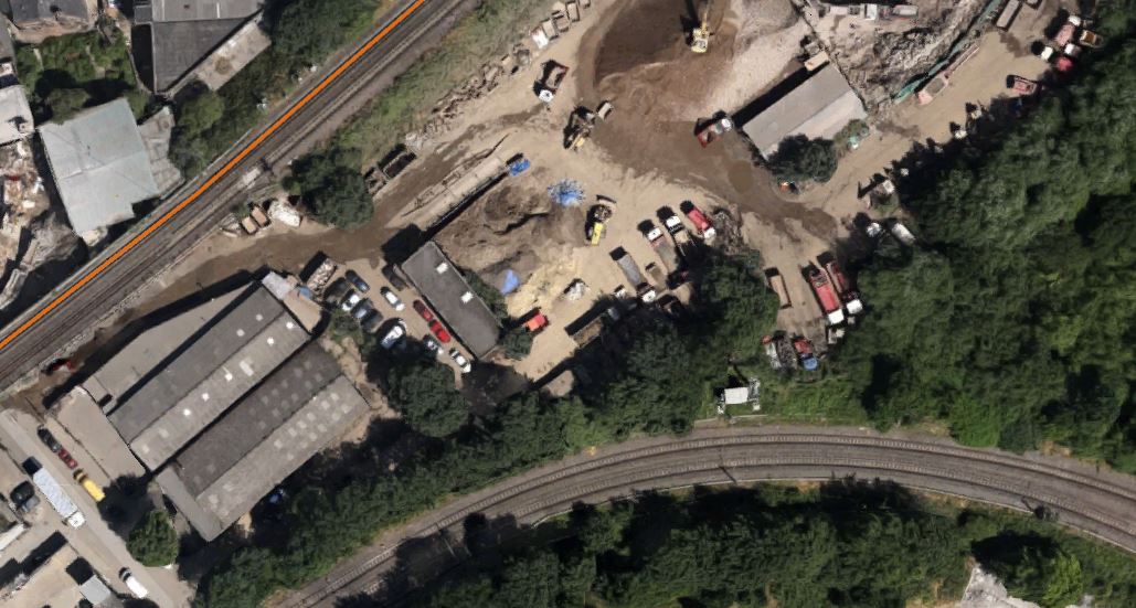
Industrial Land At Tottenham Hale
As the safeguarded route moves away to the west from here to join the New Southgate branch of the line, it is probably in this downmarket industrial area which appears to be a depot of some sort, that the Crossrail 2 tunnels will emerge. I actually put up a post entitled Could This Be Where Crossrail 2 Is Dug?, which shows this area.
As a site from where to build the tunnels, it has a lot to recommend it.
1. It is well served by railways and the River Lee and the related substantial canal, so it would be unlikely that there would be many heavy lorries associated with the construction.
2. There is little housing in the area and it would appear few or even none will be needed to be demolished for the construction. The only sensitive area would possibly be Markfield Park with the recreational developments and steam engine by the River.
3. There is plenty of space to create a surface junction with perhaps a flyover for operational reasons to connect to the Lea Valley Lines. On the other hand, the tunnels may turn north underground and just emerge alongside the Lea Valley Lines.
4. Perhaps crucially though, Tottenham Hale station, the Tottenham Hale Retail Park and the surrounding area are the subject of a big development to create almost a new town centre in South Tottenham, which I talked about in this post. I doubt this development will not be built to be totally Crossrail 2 ready.
Looking at these maps in detail, I can’t help feeling that in a few years time, there will be something special in this area, given that Thames Water and Waltham Forest Council are developing the reservoirs to the south-east of Tottenham Hale station into the Walthamstow Wetlands.
Some maps have shown Crossrail 2 surfacing north of Tottenham Hale station. This Google Earth image shows the area.
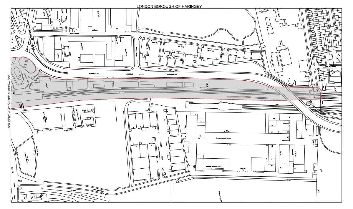
North Of Tottenham Hale Station
The strange structure underneath the lines through the station is the tunnel portal for the Victoria Line, where trains go to and from the Northumberland Park Depot.
I think the image shows why the Crossrail 2 tunnel portal can’t be north of the station.
