Crossrail And The Channel Tunnel Rail Link Compared
The differences between the ventilation and access shafts in Crossrail and the Channel Tunnel Rail Link seem to be more than you would think.
Those in the newer tunnel appear to be smaller and possibly lesser in number. Certainly after a redesigned Crossrail abandoned eight further shafts, which must have been a substantial saving.
Perhaps too, as Crossrail has stations in its tunnels under London, the number of shafts can be reduced.
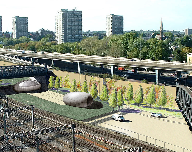
If you look at the pictures of the five Channel Tunnel ventilation shafts, you will see a series of brutal brick towers more equivalent to Napoleonic War defence installations, than anything built in this century. None of those for Crossrail have yet been built, but they seem to be innovative structures that enhance rather than confront their environment. This page on the Fereday-Pollard web site shows a few concepts. I particularly like this visualisation of the concept for the ventilation shaft in Mile End Park.

Mile End Park Ventilation Shaft
This is another almost cheeky concept from this page on the Acanthus Architects web site.
Crossrail Ventilation Shaft By Acanthus
This Google Earth image may show the location of this ventilation shaft.
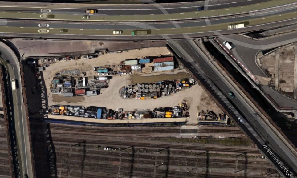
Ranelagh And Westbourne Bridges
The shaft is above the Royal Oak portal by the elevated A40 Westway between Ranelagh and Westbourne Bridges over the Great Western Main Line into Paddington station.
I think it all points to Crossrail 2 being simpler still! But then with my experience of watching projects for many years, as each version of a series of similar projects gets implemented, the engineers and managers ratchet up the design quality, speed of construction and efficiency.
The Ventilation Shafts For Crossrail
This post is being developed together with a related one of the ventilation shafts for the Channel Tunnel Rail Link, to show the sort of buildings we can expect to be created to provide access to new rail tunnels under London and other cities.
As I travel around the city, I will be adding more pictures and when I think the details are complete, I’ll add a summary.
Crossrail goes from Stratford and Abbey Wood to Royal Oak across the city in twin tunnels.
The tunnels have to have ventilation and emergency access shafts and there are six of them for the Crossrail. The original plan for the tunnels required another eight shafts, but after a redesign they were removed, as is detailed in this note on the Crossrail web site. This is an extract from the note.
The Mayor of London, Boris Johnson, today welcomed news that Crossrail has reached agreement with the London Fire Brigade (LFB) to remove eight of the proposed permanent access and ventilation shafts from the central tunnelled section of the new railway.
This decision will particularly benefit communities in east London where four of the permanent shafts were due to be located. The removal of the shafts means the elimination of construction works impacts, including lorry journeys, in these areas. In addition, a number of properties in Hanbury Street in east London will no longer need to be compulsorily purchased and demolished.
The eight shafts no longer required are located at: Westbourne Bridge W2, Hyde Park W2, Park Lane W1, Hanbury Street E1, Lowell Street E14, Hertsmere Road E14, Blackwall Way E14 and Warren Lane SE18.
These permanent access and ventilation shafts would typically be around 9 metres in diameter, with a structure on top the size of a one- or two-storey building.
Looking at that last statement, it would appear that the ventilation shafts for the Channel Tunnel were much larger. Is that progress or just that Channel Tunnel trains are lsrger and faster?
From East to West across London the ventilation shafts that are now being built are as follows.
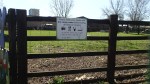
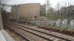
1. Eleanor Street Ventilation Shaft
This shaft is located in a triangle of rail lines between Bow Road and Bromley-by-Bow District Line stations.
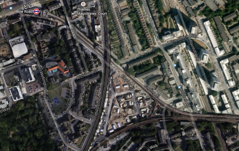
Eleanor Street Ventilation Shaft
The shaft is in the point of the triangle at the eastern end and it shares the triangle with the Eleanor Street Gypsy and Travellers Site. This is another image to a larger scale.
An Enlarged View
It clearly shows the round shaft.
After construction, this part of the site has been redesigned as detailed in this page on the architect’s web site.
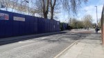
These are images I took of progress to date, some from a District Line train, passing by the site.

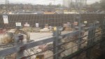

It is possibly the only Crossrail ventilation shaft that you can look into, when you see it from the train. Unfortunately, getting a clear image was diffucult, especially from a train with dirty windows.
2. Mile End Park Ventilation Shaft
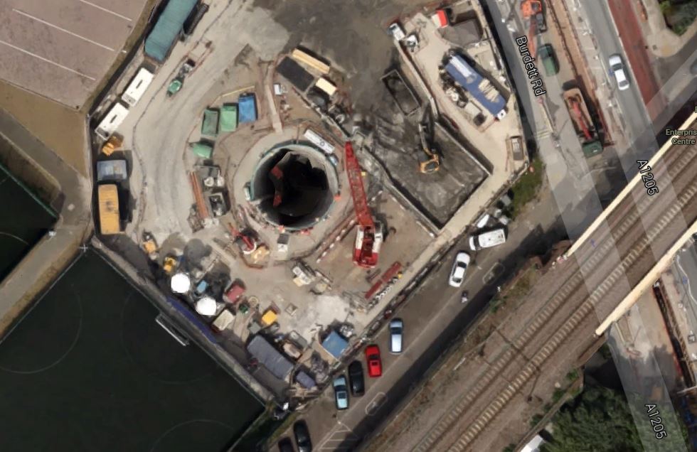
This shaft is located in Mile End Park, just north of where the rail lines into Fenchurch Street cross Burdett Road. This is a Google Earth image of the site.
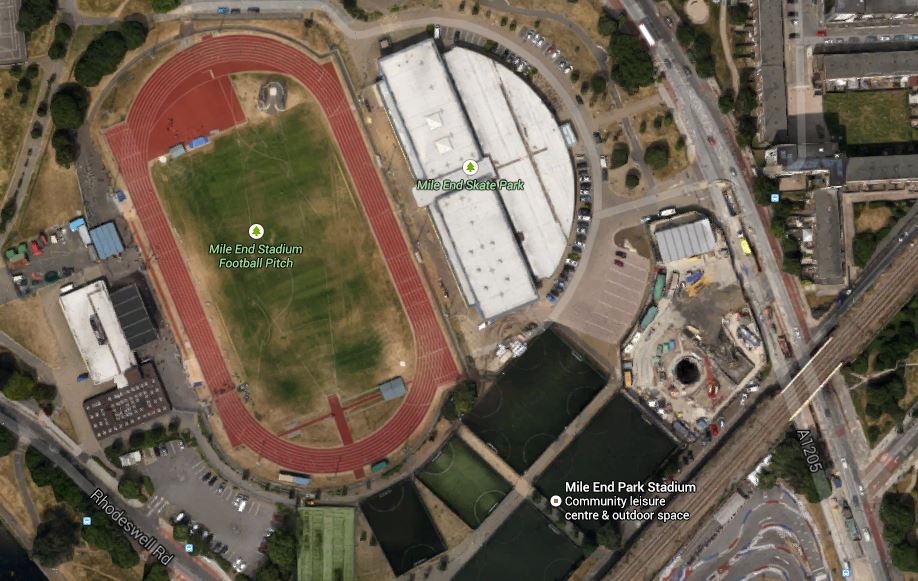
Mile End Park Ventilation Shaft
Note the shaft which is clearly visible in the middle of what looks to be a site fenced off from the rest of the park.
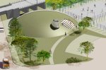
Google found this other image of a drawing of the layout at Mile End Park.
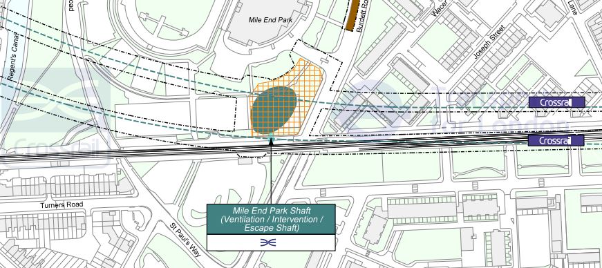
Mile End Park Ventilation Shaft
It is at a different angle, but I believe it confirms the black hole in the first image is the shaft.
This Google Earth image shows the shaft in more detail.
An Enlarged View
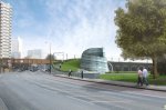
And this is a visualisation of what the shaft will look like when complete.
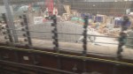
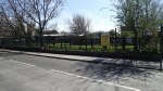
These are images I took of progress to date, together with several images of the park.

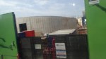


It looks like there will be a concrete retaining wall around the whole site. If you look at the map, visualisations and my actual pictures, I think it could be true to say, that when the ventilation shaft is complete, it will enhance rather than despoil the area. It is certainly orders of magnitude better than the Martello towers of the Channel Tunnel Rail Link
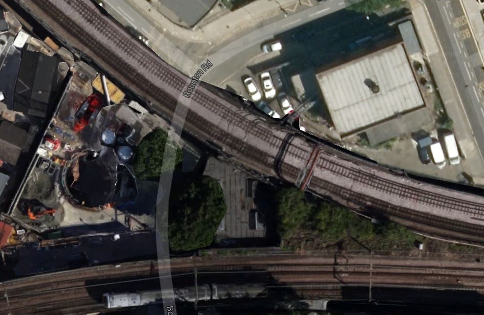
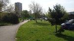
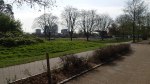
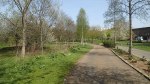
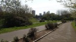
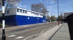
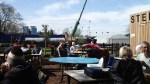
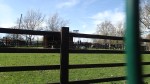
3. Stepney Green Ventilation Shaft
Stepney Green is much more than a ventilation and access shaft as thirty metres down is the junction, where the two eastern branches of Crossrail. join. This is a Google Earth image of the site and the Stepney City Farm, which shares the land.
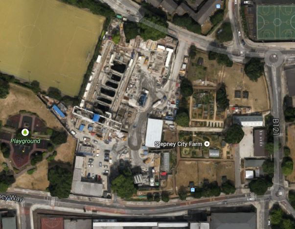
Stepney Green Ventilation Shaft
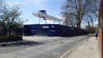
I went there today and took these pictures.


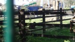

As you can see, I also had a cup of tea in a genuine willow pattern cup and saucer, that must have been fifty years old at least.
To me, this project, where one of the largest holes ever dug in Europe has been created shows how with good thinking and project management skills even the largest and most difficult projects can be carried out, without upsetting the neighbours.
Every project manager in charge of a project that is a bit sensitive, should go to Stepney City Farm to see how projects should be performed.
4. Durward Street Ventilation Shaft
Tucked away between the Blind Beggar public house and Whitechapel’s Sainsburys supermarket is the Durward Street Ventilation Shaft. This Google Earth image shows the shaft.
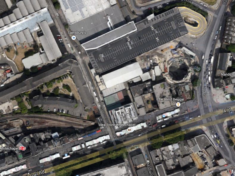
Durward Street Ventilation Shaft
Note how little space, there is in this area.
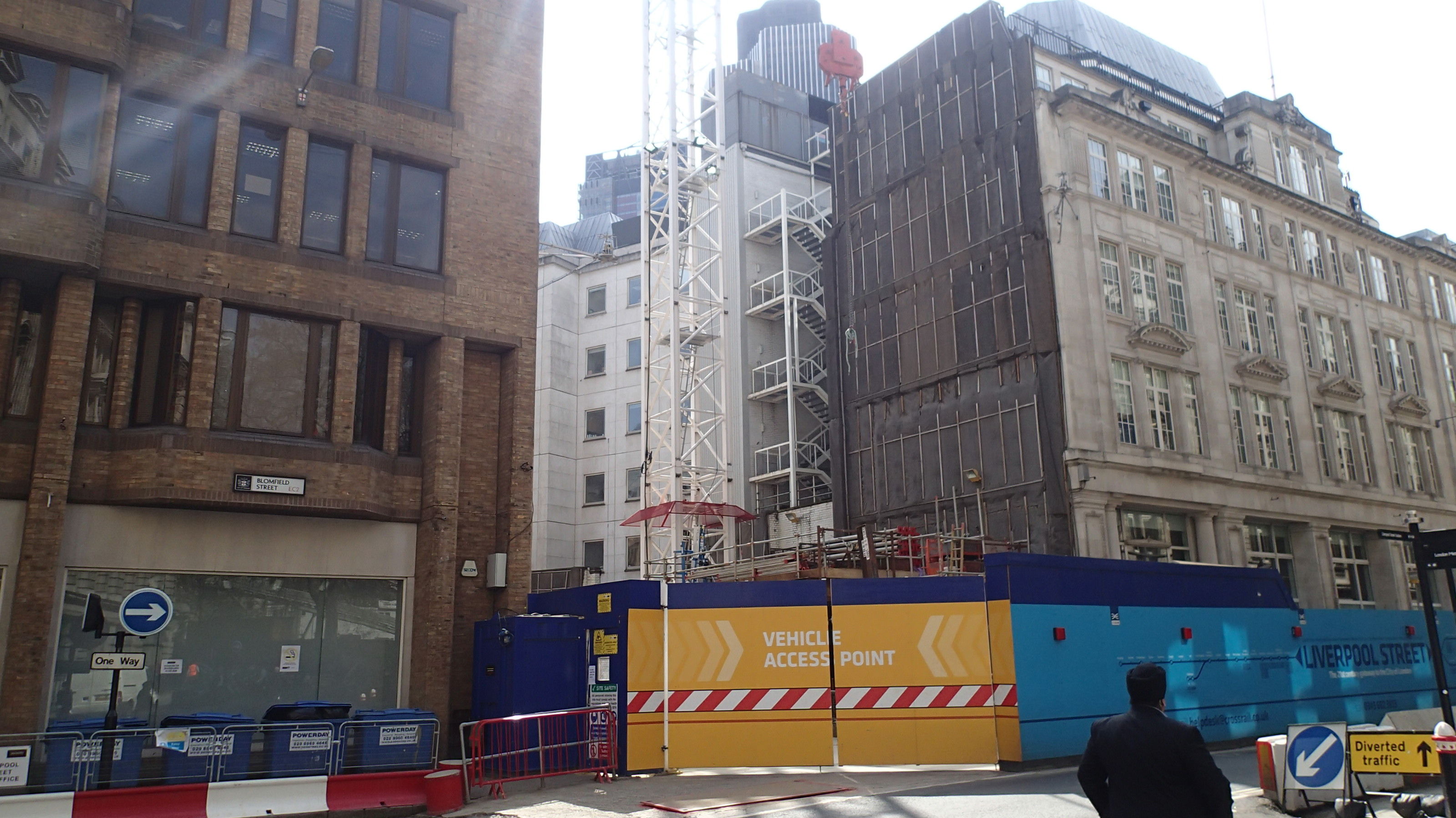
5. Blomfield Street Ventilation Shaft
This shaft is by Liverpool Street and is described on this page on the Crossrail web site. This lead paragraph describes its main functions.
At the Blomfield Street worksite we are constructing the Blomfield Box, a ventilation shaft for Liverpool Street Station; it is Crossrail’s deepest piled shaft. The shaft will house mechanical and electrical plant as well as service as an emergency escape route from the station.
The position of the shaft is shown in this Google Earth image.
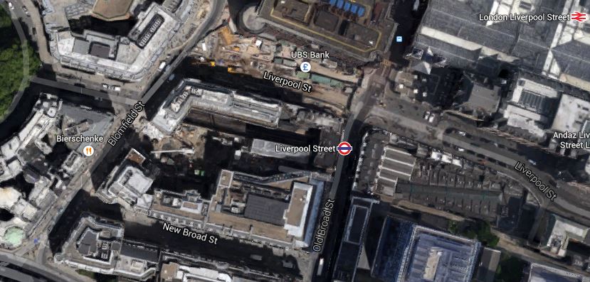
Blomfield Street Ventilation Shaft
The actual shaft is hidden by the buildings, but you should be able to read Blomfield Street. On the ground there is a gap in the buildings, where the shaft is being built.
Blomfield Street Vent Shaft Location
I suspect that the shaft will be topped by a useful building in an appropriate style, as any land within the actual City is so valuable.
6.Fisher Street Ventilation Shaft
This shaft is just north of Holborn station and is shown on this Google Earth image.
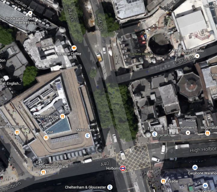
Fisher Street Ventilation Shaft
Note the shaft in the top right of the image. There is not much to see on the ground yet.
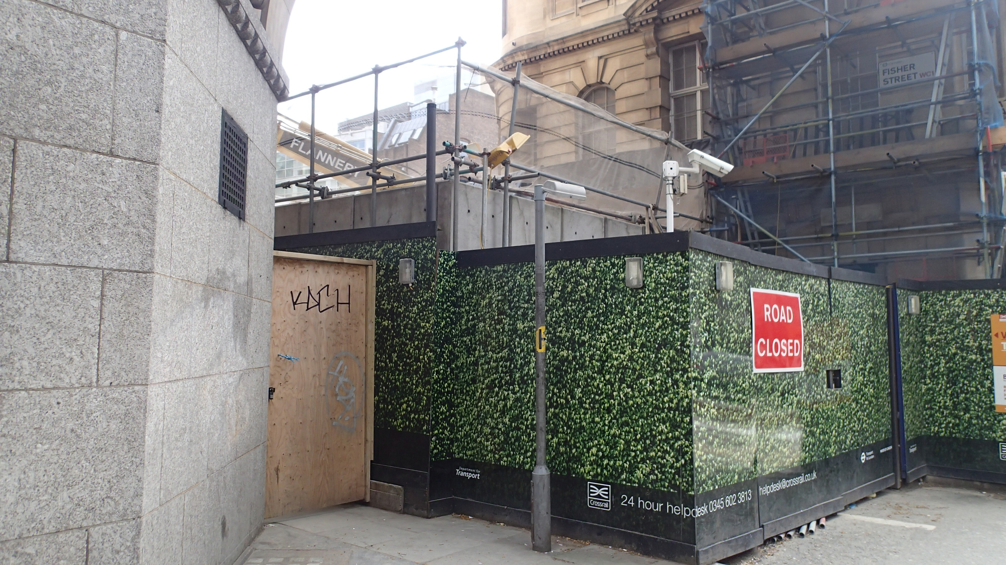
Fisher Street Ventilation Shaft
The picture shows the site from Southampton Row.
The Ventilation Shafts For The Channel Tunnel Rail Link
This post is being developed together with a related one of the ventilation shafts for Crossrail, to show the sort of buildings we can expect to be created to provide access to new rail tunnels under London and other cities.
As I travel around the city, I will be adding more pictures and when I think the details are complete, I’ll add a summary.
The Channel Tunnel Rail Link goes from Ebbsfleet to St. Pancras in two twin tunnels, which both surface on either side of Stratford International station.
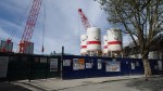
The twin tunnels have to have ventilation and emergency access shafts and there are five of them for the Channel Tunnel Rail Link. From East to West approaching London they are as follows.
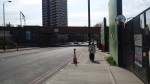
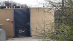
1. Wayside Ventilation Shaft
This shaft is in Barking and can be seen on this Google Earth image.
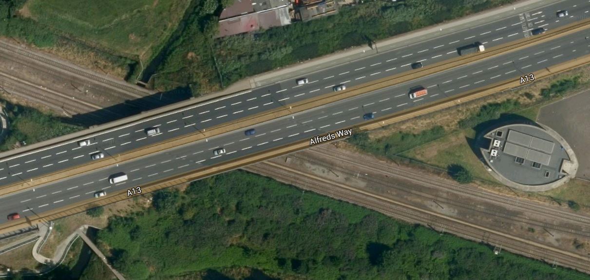
Wayside Ventilation Shaft
The shaft is nestled in the angle of where the A13 crosses the London Tilbury and Southend Line.
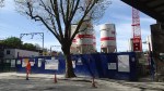
This page on the Bell Johnson web site, gives an interesting insight into the design of the shaft. There is also an image taken during construction.
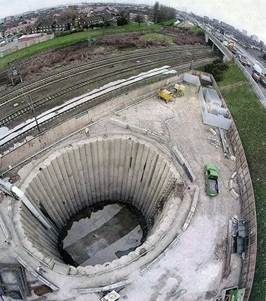
Waysite Ventilation Shaft Under Construction
The picture was taken from the east and clearly shows the road and the railway. These images were taken from a train.

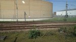

The ventilation shaft is to the west of Dagenham Dock station, which is where I turned round to come back into London. As the station is in Zone 5, it is Freedom Pass territory.
2. Barrington Road Ventilation Shaft
This shaft is to the west of Barking station and is shown in this Google Earth image.
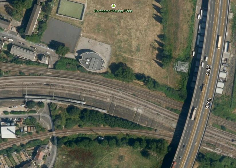
Barrington Road Ventilation Shaft
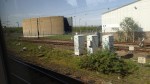
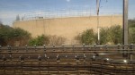
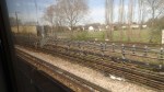
Note that the shaft is to the north of the train lines going into Barking station and to the west of the A406 road. I took these pictures from trains passing through the area.

I reckon that you possibly get the best view of the building on top of the ventilation shaft from a eastbound, District or Metropolitan Line train with clean windows. Unless of course, you walk to the Barrington Playing Field from East Ham station.
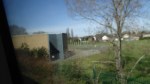
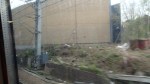
3. Woodgrange Road Ventilation Shaft
This shaft is located south of Forest Gate station and is shown on this Google Earth image.
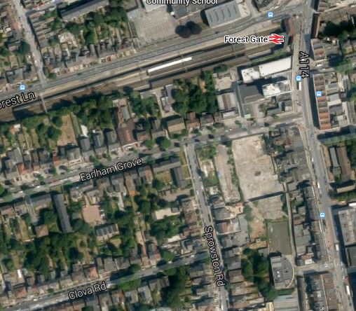
Woodgrange Road Ventilation Shaft
Forest Gate station is on the Great Eastern Main Line out of Liverpool Street and later next month, it will be taken over by Crossrail.
The shaft is directly underneath the station, but would appear to be more tucked away in buildings than the shafts at Wayside and Barrington Road.
It is also the only ventilation shaft for the tunnel, that doesn’t have a full elliptical building on top.
I tried to take a decent picture of the building, but you can only see one side between the houses.
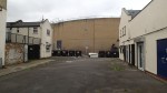
The only point to note, is that in a previous building on the site, Jimmi Hendrix wrote Purple Haze.
4. Graham Road Ventilation Shaft
This shaft is east of Dalston and just to the west of Hackney Central station, close to the North London Line, under which the Channel Tunnel Rail Link was bored.
It is shown on this Google Earth image.
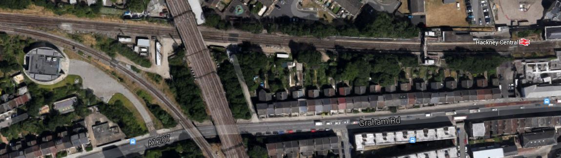
Graham Road Ventilation Shaft
Note how it lies close to the curve that links the North London and Lea Valley Lines, just to the south-west of where the two lines cross, which in turn is to the west of Hackney Central station.
I was able to take these pictures from a train on the North London Line.
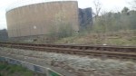
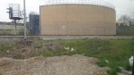
I shall attempt to take a few more.
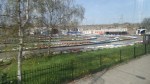
5. Corsica Street Ventilation Shaft
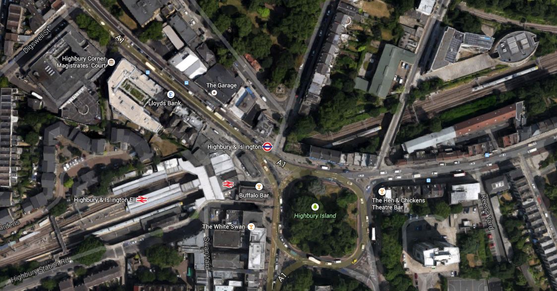
This shaft is just east of Highbury and Islington station and is shown on this Google Earth image.
Corsica Street Ventilation Shaft
It is another shaft with an elliptical building on top, which you can see in the top-right corner of the image.
I was able to take these pictures.
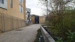
Some were taken from Corsica Street looking through the gate and the others from passing trains.
These structures have more than a touch of the Martello Tower about them! Ironic really, as these ventilation shafts are there to help encourage the French to visit, whereas the Towers were built to repel Napoleon.
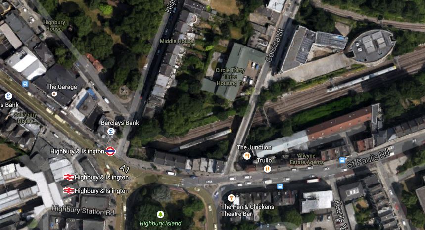
Sorting Out Highbury Corner And Highbury And Islington Station
Highbury Corner is an important transport hub in Islington, where traffic from the City starts to squeeze up the A1 to get North. It also contains the important but badly-designed rail station of Highbury and Islington. This Google Earth image shows the area.
Highbury Corner
Note the green space named as Highbury Island in the middle of the junction with traffic going all the way round in both directions.
The road leading off to the North West (top-left) is the A1, which goes up the Holloway Road to Archway, which is another major junction, that needs a good sorting. The road leading to the East is St. Paul’s Road, which leads to the Balls Pond Road and Dalston Junction. The roads leading to the south from the island are extremely congested at all times and all the way to the Angel and Old Street respectively. They are the sort of roads, that make me glad, I don’t drive any more.
The junction is a pedestrian’s nightmare, as you are constantly crossing busy roads on light-controlled crossings.
What I find particularly difficult is that to get from the stop where buses from my house arrive in St.Paul’s Road to Highbury and Islington station involves two road crossings. It’s so tiresome, that often if I need the Victoria or Northern City Line at the station, I’ll walk to Dalston Junction station and get the North London Line for two stops. Coming home, I’ll get the North London Line back to Dalston Junction and then get any of four buses back towards Highbury Corner to my house.
It’s not quicker, but it’s certainly easier and definitely more pleasant in bad weather.
This illustrates how bad Highbury Corner is for buses, which like the vehicle routes need a very good sorting.
Add to this that Highbury and Islington station is a dreadful 1960s station, that has inadequate access to the two deep lines. To be fair though, access to the four London Overground platforms is a lot better. I have written before that there could also be access to these platforms from the other end, but that may well happen, when a new station is developed.
At the present time, work is ongoing to clear the area in front of the station, by removing the old Post Office, before the main bridge that carries the A1 over the railway is replaced.
In July 2004, Islington Council produced a planning framework for the area. It is packed full of information and some worthwhile proposals.
It suggests the following.
1. Giving public access to Highbury Island and turning it into a green oasis with facilities.
2. Proposals to simplify the traffic flows, with a strong hint, that traffic on the Western side of the Highbury island be closed off.
3. In the rebuilding of the station, it says that building could incorporate extensive development over the North London Line tracks for residential or other purposes.
4. Using the old Highbury and Islington station on the North side of the junction to create a new access for escalators and lifts to the lines deep under the station.
The report also told me, the purpose of the strange elliptical building on the north side of the North London Line, which is at the top-right of the Google image. It’s the vent shaft for the Channel Tunnel Rail Link.
Hopefully, in the next few years, we’ll see the sorting out of the area.
1
