Uncovering The Past On Thameslink
The definition of archaeology according to the Oxford English Dictionary is.
The study of human history and prehistory through the excavation of sites and the analysis of artefacts and other physical remains.
So perhaps calling digging up an old nineteenth century station is stretching the definition a bit far.
But this report on the BBC web site about the uncovering of the disused Southwark Park station is fascinating none-the-less. This is an extract from the report.
The station was discovered as engineers constructed the Bermondsey Dive Under, which will see two Victorian viaducts partially-demolished and rebuilt to allow trains from south east London and Kent to dive down, under a new route carrying Thameslink services from Croydon.
There’s more here on the Ian Visits site and here on the Thameslink web site. This is a Google Earth image of the area.
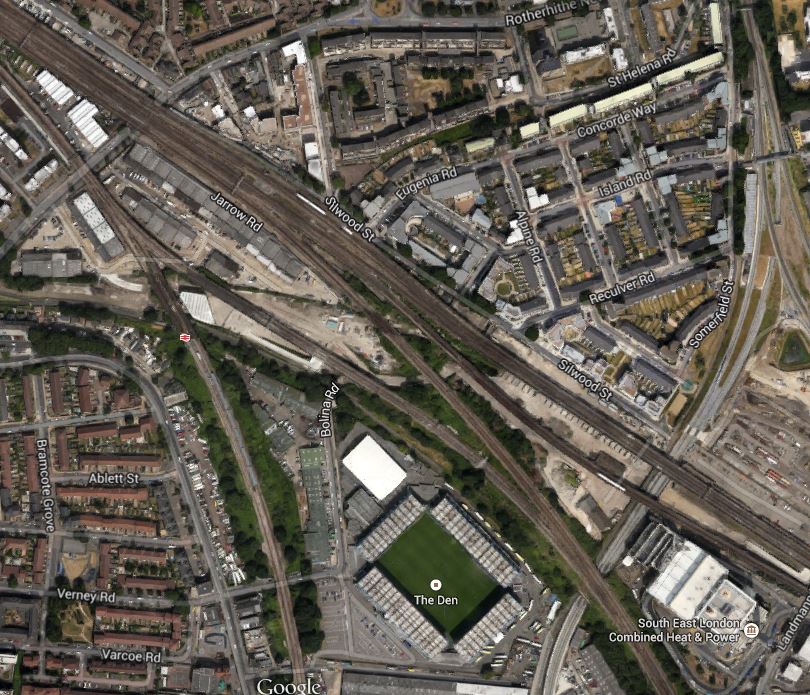
Bermondsey Dive-Under
Note The New Den, which is Millwall’s ground and SELCHP incinerator to its right. The image highlights the complicated nature of the lines into London Bridge station. The line that runs between the football ground and the incinerator in a south-easterly direction is the Thameslink line between London Bridge and New Cross Gate. The smaller line that crosses this line at right angles is the Overground line between Surrey Quays and Clapham Junction.
Where this Overground line crosses Surrey Canal Road just off the bottom of this image, construction should start on the new New Bermondsey station later this year.
Southwark Park station was under the tracks , where Rotherhithe New Road crosses underneath.

[…] the post entitled Uncovering The Past On Thameslink showed, the railway lines around South Bermondsey station are complicated to say the least and at […]
Pingback by Exploring Around The Bermondsey Dive-Under « The Anonymous Widower | April 22, 2015 |