Plans Progress To Build World’s Largest Tidal Scheme On The Banks Of The River Mersey
The title of this post, is the same as that of this press release from the Liverpool City Region.
These four bullet points, act as sub-headings.
- Mersey Tidal Power has the potential to become the world’s largest tidal scheme
- Formal planning process for UK’s “first of a kind” Mersey Tidal Power set to begin
- Potential to manage environmental issues associated with climate change
- Scheme would need government backing to complete development stage
These three paragraphs introduce the project.
Advanced proposals to build the world’s largest tidal scheme on the banks of the River Mersey have been unveiled by the Liverpool City Region’s Mayor Steve Rotheram.
Mayor Rotheram has revealed that the city region will pursue a barrage between the Wirral and Liverpool as the preferred option for the city region’s flagship Mersey Tidal Power project.
The barrage scheme – the “first of a kind” in the UK – could generate clean, predictable energy for 120 years and create thousands of jobs in its construction and operation.
Note.
- This page on the Liverpool City Region, has this explanatory video.
- This brochure can also be downloaded.
At a first glance all the documentation is very professional.
These are my thoughts.
How Much Power Will The Mersey Tidal Project Generate?
This graphic from the brochure shows electricity generation in Liverpool Bay.
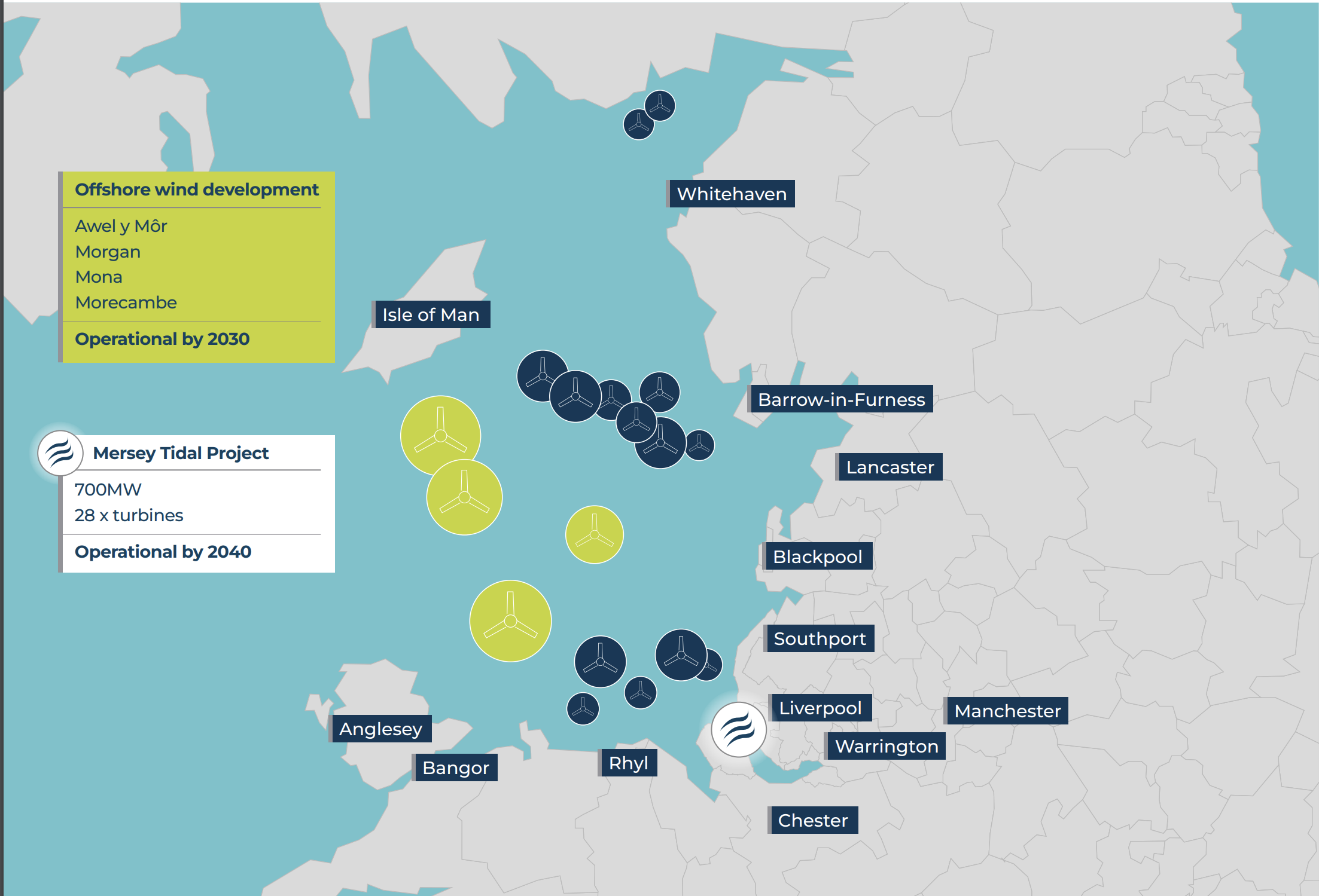
Note.
- The dark blue circles are the thirteen existing wind farms, that have a total capacity of 3 GW.
- The yellow circles are four new wind farms, that will be built by 2030 and will have a total capacity of 4 GW.
- The Mersey Tidal Project will have 28 x 25 MW turbines and generate 700 MW.
I also suspect that the power generation will be supplemented by a large battery, that will smooth out the electricity, when the wind isn’t blowing and the tides are at the wrong cycle.
Access For Ships To The Tranmere Oil Terminal And The Manchester Ship Canal
This article on the Liverpool Business News is entitled £6bn ‘Barrage Across The Mersey’ Takes Step Forward.
This is the introductory paragraph.
Steve Rotheram says his £6bn Mersey Tidal Power project will see a barrage across the river, with locks to allow ships through, but original 2030 switch-on now looks unlikely.
The article has a picture which could show locks on the Wirral side of the Mersey.
This Google Map shows the location of the Tranmere Oil Terminal and the Manchester Ship Canal.

Note.
- Birkenhead is in the North-West corner of the map.
- The line of white squares running parallel to the River Mersey, indicate the stations of the Wirral Line to Chester and Ellesmere Port.
- The Tranmere Oil Terminal is indicated by the red arrow at the top of the map.
This second Google Map expands the area on the West bank of the Mersey, at the bottom of the map.
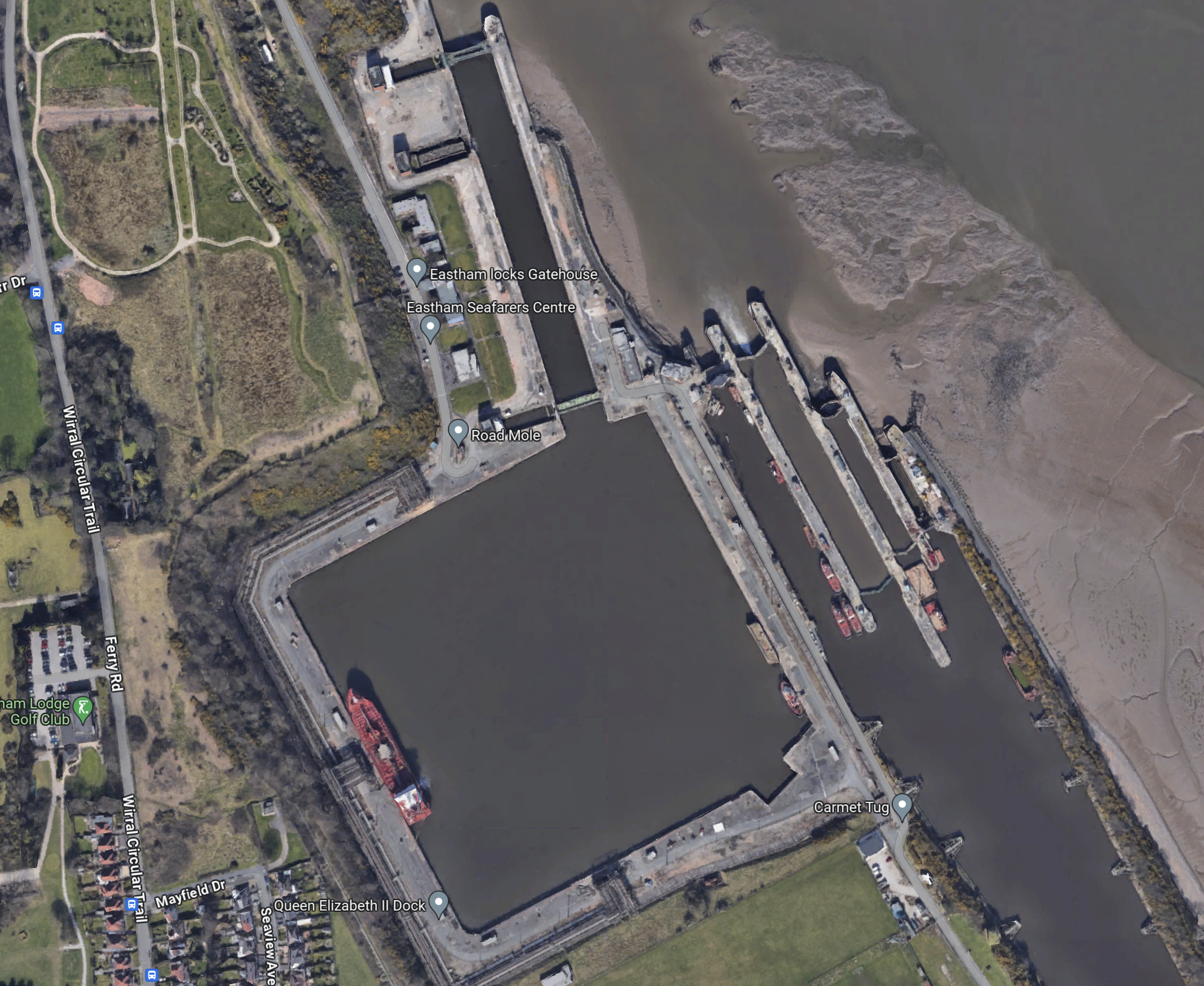
These are Eastham Locks, which allow ships to enter and leave the Manchester Ship Canal.
This third Google Map shows the area around the Tranmere Oil Terminal.
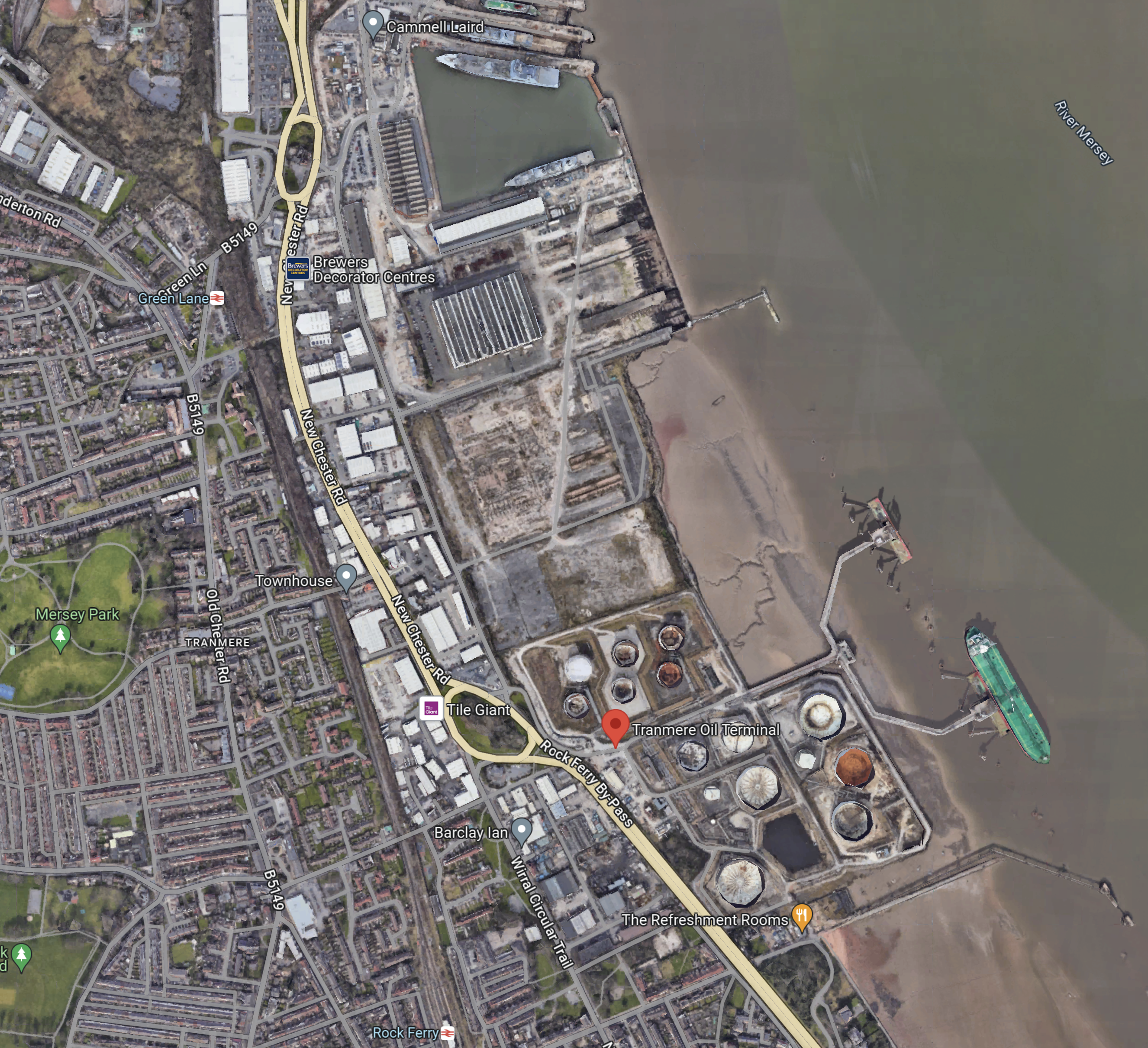
As before the Tranmere Oil Terminal is indicated by the red arrow, with Cammell Laird to the North.
The Liverpool Business News article says this about oil tankers, that use the Mersey.
In terms of oil tankers alone, there are more than 700 vessels coming in and out of the Mersey every year. Supertankers berth at the Tranmere Oil Terminal next to the Cammell Laird shipyard and around 500 smaller vessels berth at Stanlow at Ellesmere Port.
LBN understands that some form of lock system will be incorporated into the barrage to allow ships in and out. That might prove tricky for supertankers which suggests the barrage would be down river from the Tranmere terminal.
This Google Map shows the Manchester Ship Canal as it goes East from Eastham Locks.
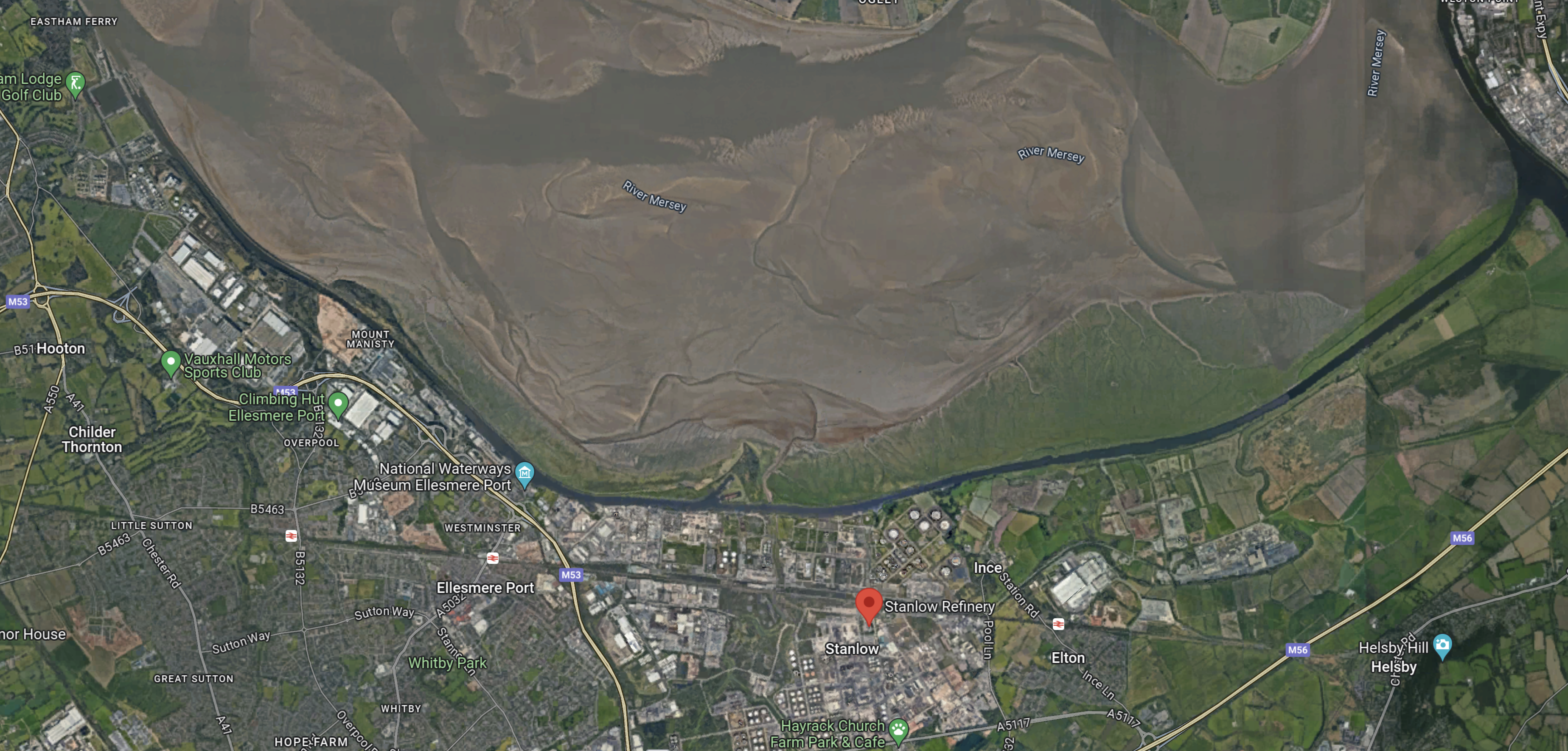
Note.
- The Manchester Ship Canal clings to the South Bank of the Mersey.
- The red arrow indicates Stanlow Refinery,
- There is a lot of industry on the South Bank of the Manchester Ship Canal.
It would appear that access to the Manchester Ship Canal gives access to several important places other than Manchester.
Access To Garston Docks
This Google Map shows the Liverpool Bank of the Mersey.
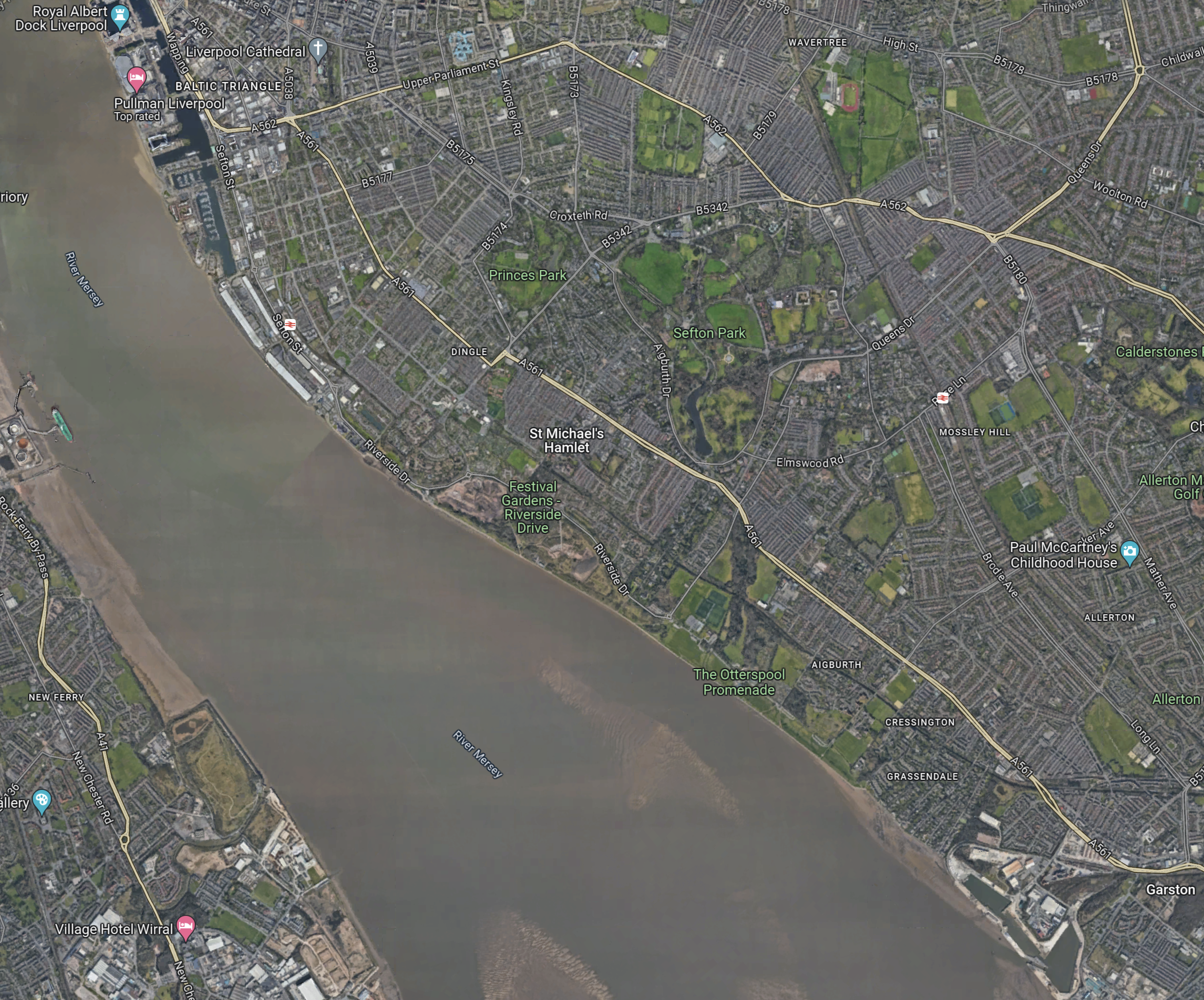
Note.
- The blue marker in the North-West corner of the map indicates the Royal Albert Dock.
- Garston Docks are in the South-East corner of the map
- There are no docks between Liverpool and Garston and much of the route can be walked along the Mersey.
- On the other bank of the Mersey, note the green ship at the Tranmere Oil Terminal, that can be seen in other maps.
This second Google Map shows Garston Docks.
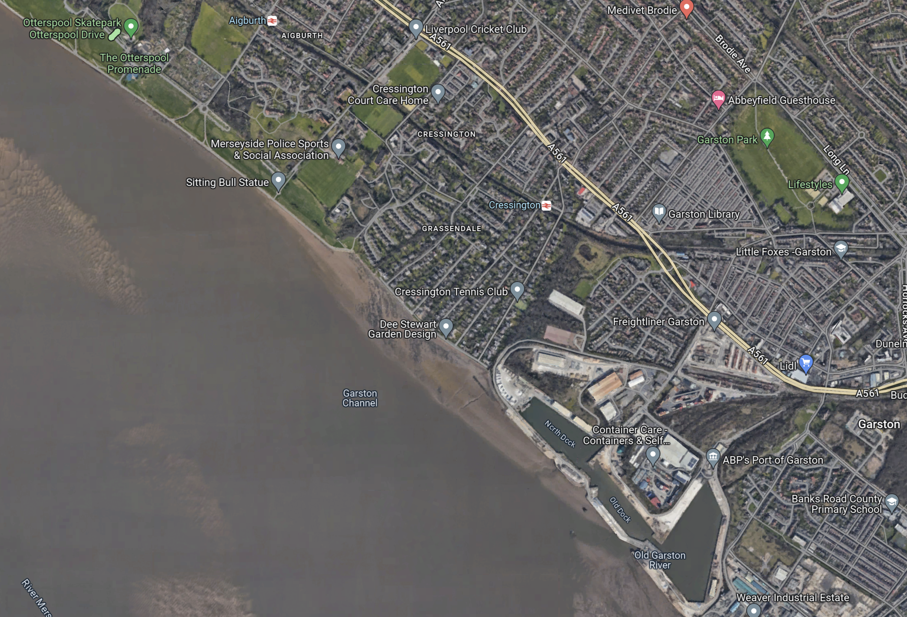
Note.
- There are three docks.
- The Garston Channel and the Old Garston River provide a route for ships to enter or leave the docks.
The Wikipedia entry for the Port of Garston, indicates that the port is rather run-down and a shadow of its former self.
It would appear that ships would have to pass through the locks in the barrier, which would likely be on the Wirral bank, to gain access to the Manchester Ship Canal and then cross the Mersey for Garston.
However, the barrier is built, it must have a route to both the Tranmere Oil Terminal and the Manchester Ship Canal at Eastham Locks.
The barrier could be built either North or South of the Tranmere Oil Terminal.
- If built North of the oil terminal, the locks in the barrier will have to accommodate the largest supertanker that calls at the terminal.
- If built South of the oil terminal, the locks in the barrier would only have to accommodate the largest ship that needed to use the Manchester Ship Canal or visit Garston.
One option would probably be more affordable.
Barrage Cross The Mersey
The very informative Liverpool Business News article, explains why a barrage was chosen, in this paragraph.
After pondering whether to build a barrage across the river from Liverpool to Wirral, or a floating lagoon, the Combined Authority has chosen the former as it would be cheaper and also creates a bridge that could have a pedestrian and cycle link.
The choice of a barrage sounds sensible on grounds of cost and accessibility.

More immediate is the water-sourced heat pump that’s being installed by the Leeds and Liverpool canal at the Princes Dock along with district heating pipes. https://environmentjournal.online/headlines/mersey-energy-centre-to-get-game-changing-water-sourced-heat-pump/ They’re initially planning on 24GWh of heat, and there’s planning permission to more that double that. As the article says, the plan is for this to be operational by the winter.
AFAIK, there’s very little district heating in GB atm.
Comment by Peter Robins | March 9, 2024 |
sorry, that should have read “24GWh of heat a year” …
Comment by Peter Robins | March 9, 2024 |
There’s one near me, which is unusual.
https://anonw.com/2020/03/06/world-first-as-bunhill-2-launches-using-tube-heat-to-warm-1350-homes/
In the next round of renewable energy projects, the government is calling for geothermal projects.
https://anonw.com/2024/03/07/uk-set-to-provide-record-gbp-800-million-support-for-offshore-wind-projects/
See Pot 2.
Comment by AnonW | March 9, 2024 |