A Video Description Of Princess Elisabeth Island
This web site is the web site of Belgium’s Princess Elisabeth energy island.
This YouTube video describes the Princess Elisabeth island.
From the video the following can be determined.
- The Princess Elisabeth island is 45 km. from the Belgian coast.
- An interconnector to the UK could come ashore at the site of the decommissioned Bradwell nuclear power station.
- An interconnector to Denmark could come ashore in Southern Jutland, just North of where the Viking Link connects to Denmark.
This map clipped from the video shows the location of Princess Elisabeth island.

Note.
- Belgium is shown in red.
- Istend is in the middle of the straight Belgian coast.
- The red dot between Belgium and the UK is Princess Elisabeth island.
- The interconnector to the UK could feasibly go to Bradwell.
- The interconnector to Denmark could go via a wind farm, which would explain the kink.
- Could the kink point be at the Dogger Bank, where there could be 20 GW of wind farms?
Has Belgium made a bid to dominate European energy distribution?
This Google Map shows the Belgian and English coast lines.
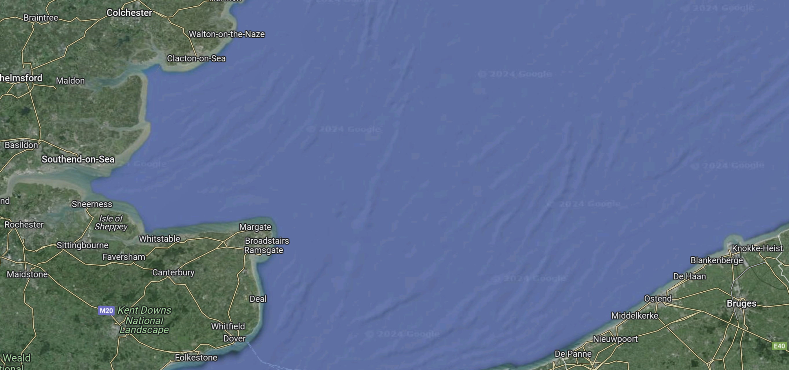
Note.
- Bradwell is on the coast to the North-East of Southend-on-Sea.
- As it used to be a nuclear power station site it still has an electricity connection to the grid.
- The Princess Elisabeth island is 45 km. from the Belgian coast at Ostend.
I estimate that a Bradwell and Princess Elisabeth island interconnector would be about 150 miles.

Well the Belgians are certainly aiming at routing the Nautilus and Triton interconnectors via the Elisabeth Energy Island, so I suppose they are aiming at being a focal point for distribution.
Incidentally the Nautilus Interconnector’s UK termination could either be in Friston, Suffolk or the Isle of Grain.
Comment by fammorris | April 25, 2024 |