The Ventilation Shafts For The Channel Tunnel Rail Link
This post is being developed together with a related one of the ventilation shafts for Crossrail, to show the sort of buildings we can expect to be created to provide access to new rail tunnels under London and other cities.
As I travel around the city, I will be adding more pictures and when I think the details are complete, I’ll add a summary.
The Channel Tunnel Rail Link goes from Ebbsfleet to St. Pancras in two twin tunnels, which both surface on either side of Stratford International station.
The twin tunnels have to have ventilation and emergency access shafts and there are five of them for the Channel Tunnel Rail Link. From East to West approaching London they are as follows.
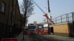
1. Wayside Ventilation Shaft
This shaft is in Barking and can be seen on this Google Earth image.
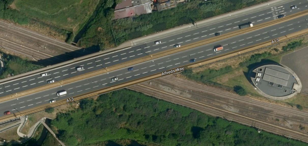
Wayside Ventilation Shaft
The shaft is nestled in the angle of where the A13 crosses the London Tilbury and Southend Line.
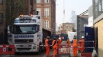
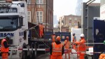
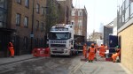
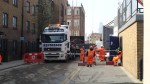
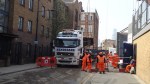
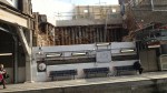
This page on the Bell Johnson web site, gives an interesting insight into the design of the shaft. There is also an image taken during construction.
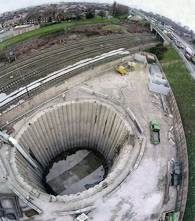
Waysite Ventilation Shaft Under Construction
The picture was taken from the east and clearly shows the road and the railway. These images were taken from a train.

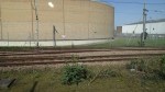
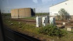

The ventilation shaft is to the west of Dagenham Dock station, which is where I turned round to come back into London. As the station is in Zone 5, it is Freedom Pass territory.
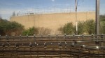
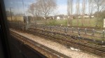
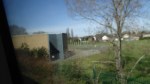
2. Barrington Road Ventilation Shaft
This shaft is to the west of Barking station and is shown in this Google Earth image.
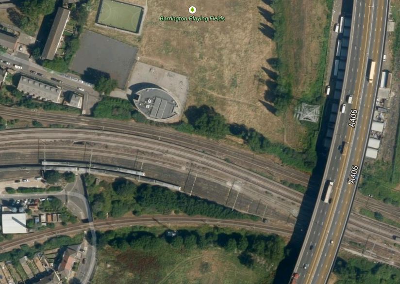
Barrington Road Ventilation Shaft
Note that the shaft is to the north of the train lines going into Barking station and to the west of the A406 road. I took these pictures from trains passing through the area.

I reckon that you possibly get the best view of the building on top of the ventilation shaft from a eastbound, District or Metropolitan Line train with clean windows. Unless of course, you walk to the Barrington Playing Field from East Ham station.
3. Woodgrange Road Ventilation Shaft
This shaft is located south of Forest Gate station and is shown on this Google Earth image.
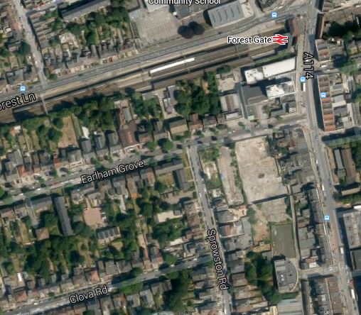
Woodgrange Road Ventilation Shaft
Forest Gate station is on the Great Eastern Main Line out of Liverpool Street and later next month, it will be taken over by Crossrail.
The shaft is directly underneath the station, but would appear to be more tucked away in buildings than the shafts at Wayside and Barrington Road.
It is also the only ventilation shaft for the tunnel, that doesn’t have a full elliptical building on top.
I tried to take a decent picture of the building, but you can only see one side between the houses.
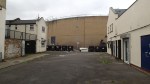
The only point to note, is that in a previous building on the site, Jimmi Hendrix wrote Purple Haze.
4. Graham Road Ventilation Shaft
This shaft is east of Dalston and just to the west of Hackney Central station, close to the North London Line, under which the Channel Tunnel Rail Link was bored.
It is shown on this Google Earth image.
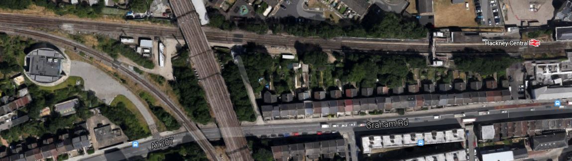
Graham Road Ventilation Shaft
Note how it lies close to the curve that links the North London and Lea Valley Lines, just to the south-west of where the two lines cross, which in turn is to the west of Hackney Central station.
I was able to take these pictures from a train on the North London Line.
I shall attempt to take a few more.
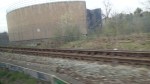
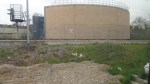
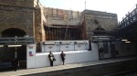
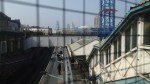
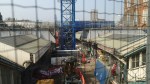
5. Corsica Street Ventilation Shaft
This shaft is just east of Highbury and Islington station and is shown on this Google Earth image.
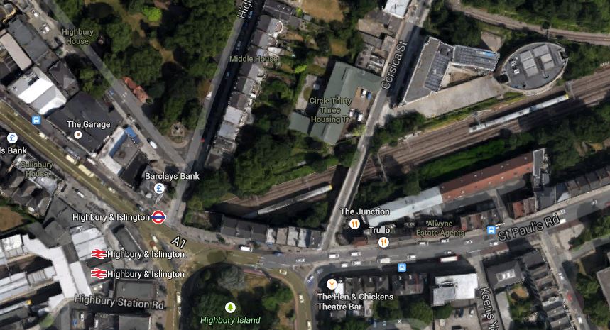
Corsica Street Ventilation Shaft
It is another shaft with an elliptical building on top, which you can see in the top-right corner of the image.
I was able to take these pictures.
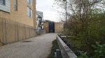
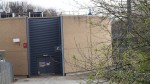
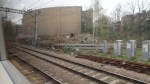
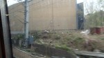
Some were taken from Corsica Street looking through the gate and the others from passing trains.
These structures have more than a touch of the Martello Tower about them! Ironic really, as these ventilation shafts are there to help encourage the French to visit, whereas the Towers were built to repel Napoleon.
Sorting Out Highbury Corner And Highbury And Islington Station
Highbury Corner is an important transport hub in Islington, where traffic from the City starts to squeeze up the A1 to get North. It also contains the important but badly-designed rail station of Highbury and Islington. This Google Earth image shows the area.
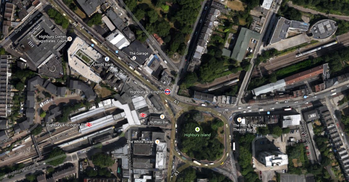
Highbury Corner
Note the green space named as Highbury Island in the middle of the junction with traffic going all the way round in both directions.
The road leading off to the North West (top-left) is the A1, which goes up the Holloway Road to Archway, which is another major junction, that needs a good sorting. The road leading to the East is St. Paul’s Road, which leads to the Balls Pond Road and Dalston Junction. The roads leading to the south from the island are extremely congested at all times and all the way to the Angel and Old Street respectively. They are the sort of roads, that make me glad, I don’t drive any more.
The junction is a pedestrian’s nightmare, as you are constantly crossing busy roads on light-controlled crossings.
What I find particularly difficult is that to get from the stop where buses from my house arrive in St.Paul’s Road to Highbury and Islington station involves two road crossings. It’s so tiresome, that often if I need the Victoria or Northern City Line at the station, I’ll walk to Dalston Junction station and get the North London Line for two stops. Coming home, I’ll get the North London Line back to Dalston Junction and then get any of four buses back towards Highbury Corner to my house.
It’s not quicker, but it’s certainly easier and definitely more pleasant in bad weather.
This illustrates how bad Highbury Corner is for buses, which like the vehicle routes need a very good sorting.
Add to this that Highbury and Islington station is a dreadful 1960s station, that has inadequate access to the two deep lines. To be fair though, access to the four London Overground platforms is a lot better. I have written before that there could also be access to these platforms from the other end, but that may well happen, when a new station is developed.
At the present time, work is ongoing to clear the area in front of the station, by removing the old Post Office, before the main bridge that carries the A1 over the railway is replaced.
In July 2004, Islington Council produced a planning framework for the area. It is packed full of information and some worthwhile proposals.
It suggests the following.
1. Giving public access to Highbury Island and turning it into a green oasis with facilities.
2. Proposals to simplify the traffic flows, with a strong hint, that traffic on the Western side of the Highbury island be closed off.
3. In the rebuilding of the station, it says that building could incorporate extensive development over the North London Line tracks for residential or other purposes.
4. Using the old Highbury and Islington station on the North side of the junction to create a new access for escalators and lifts to the lines deep under the station.
The report also told me, the purpose of the strange elliptical building on the north side of the North London Line, which is at the top-right of the Google image. It’s the vent shaft for the Channel Tunnel Rail Link.
Hopefully, in the next few years, we’ll see the sorting out of the area.
1
Crossrail In The New Yorker
According to Wikipedia, the New Yorker is an American magazine of reportage, commentary, criticism, essays, fiction, satire, cartoons, and poetry.
This serious article from the magazine, which discusses the archaeology around the new rail line, is well worth a read.
Disconnected Croydon
Connected Croydon is a programme of public works to improve Croydon’s streets, squares and open spaces.
On Tuesday, I had a simple need to go to IKEA Croydon, which is served by the Ampere Way tram stop, to meet an e-friend, who’d seen my musing about creating a new IKEA Kitchen. We’d agreed to meet at 13:00 and as I knew the journey well, I took a timely train from Whitechapel to get to Croydon about 12:30, which would have given me time to walk through Croydon to one of the tram stops like George Street that are served by trams going to Wimbledon.
But there had been no warning that the trams weren’t running through Croydon town centre and an Overground employee told me, I must walk to Reeve’s Corner tram stop.
But I don’t know Croydon at all, except from on a tram or train passing through, so I got lost and walked to East Croydon, where a sensible man told me that there were no trams and I would need a 410 bus to get to Reeve’s Corner. But the bus information system didn’t call out Reeve’s Corner, so I ended up two stops down the line at Wandle Park, where the information system said that I’d hjave to wait twenty-seven minutes for a tram to IKEA.
Luckily, the display was wrong and a geezer with a clipboard, said that was par for the course, so I eventually got to IKEA at 13:30 or so, after my friend had had to give up.
I didn’t muck about coming home and avoided Croydon by going the long way round via Wimbledon.
Connected Croydon? Pull the other one!
Or at least put up some signs that can be understood by visitors! And a Tram Replacement Bus would have helped this simple soul!
On the other hand, perhaps, they don’t want visitors!
My mother was right, when she told me not to go south of the Thames, as you get lost!
Alliance Rail Are Thinking Big
In the UK, there is provision for allowing what are called open access operators on UK railways. This is Wikipedia’s definition.
An open access operator is a train operating company that is not subject to franchising, instead purchasing individual slots on the mainline from a railway infrastructure company.
The three most well-known open access operators in the UK are Eurostar, First Hull Trains and Grand Central Railway.
A new company called Alliance Rail, who incidentally are the parent company of Grand Central is trying to join them.
They are proposing to have two train companies Great North Western Railway and Great North Eastern Railway running on the West and East Coast Main Lines respectively.
Services which would be run using six-car Class 390 Pendolinos are proposed as follows.
GNWR
London Euston – Blackpool North (six daily)
London Euston – Leeds (six daily)
GNER
London King’s Cross – Edinburgh – (hourly)
London King’s Cross – Bradford/Ilkley – (two hourly)
London – Cleethorpes – (up to four daily)
In addition towns and cities like Dewsbury, Eccles, Grimsby, Huddersfield, Newton-le-Willows, Scunthorpe and Stalybridge will get direct services to London.
It is an ambitious plan and I suspect that Virgin and Stagecoach will use everything in their power to strangle this upstart before it starts.
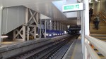
The New Stairs at Whitechapel Station
In a few weeks time, the main entrance at Whitechapel station will be closed and all entry will be from Durward Street at the other end of the East London Line platforms. At present there is just an Emergency Exit there. These pictures show the current stairs and the half-assembled new ones.
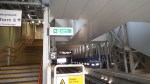
It looks like the stairs will lead up to the walkway, which goes across the line.
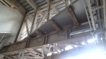
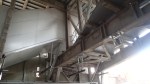
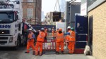
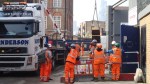
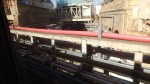
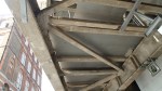
A Heavy Delivery
I was behind Whitechapel station this morning and this steel beam was delivered.
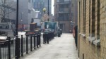
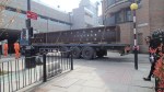
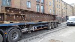
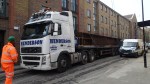
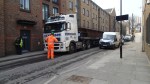
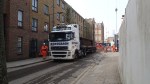
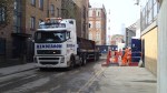
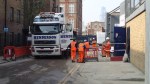
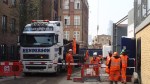
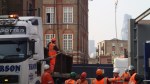
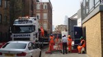
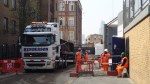
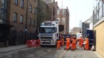

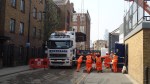
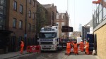
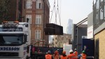
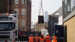
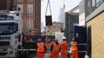
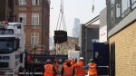
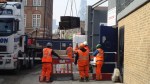

This Google Earth image shows the small area in which the builders have to work.
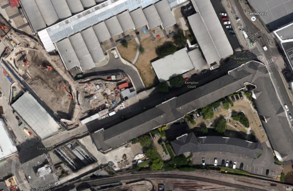
Whitechapel Crossrail Site
The site is accessed down Durward Street, which is in shadow above the buildings.
To actually get the large artic down Durward Street, necessitated poking under the entrance to Sainsburys, which is to the right. I assume the truck was parked for the lift over the Overground line.
It was all a very professional delivery and unloading.
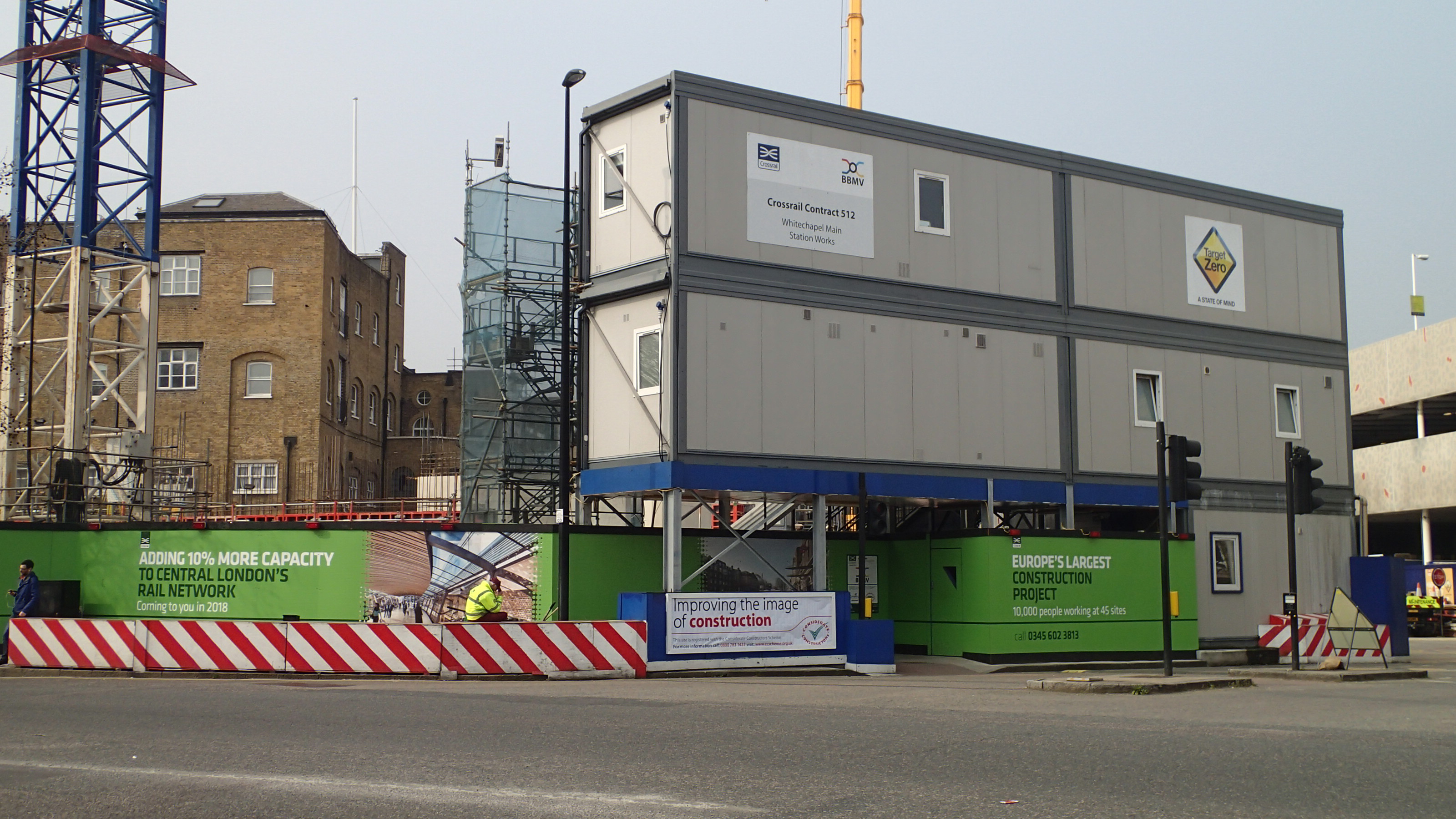
The Crossrail Cambridge Heath Site At Whitechapel
As the pictures of the delivery showed, the Whitechapel station site is extremely crowded. Luckily, the major occupier of the area, is a large Sainsburys supermarket, which seems to have been rebuilt, as I remember using it around the turn of the millennium and it was all massive surface car parks, which have now seemed to have gone. This Google Earth image shows the area from the supermarket to the Whitechapel Road.
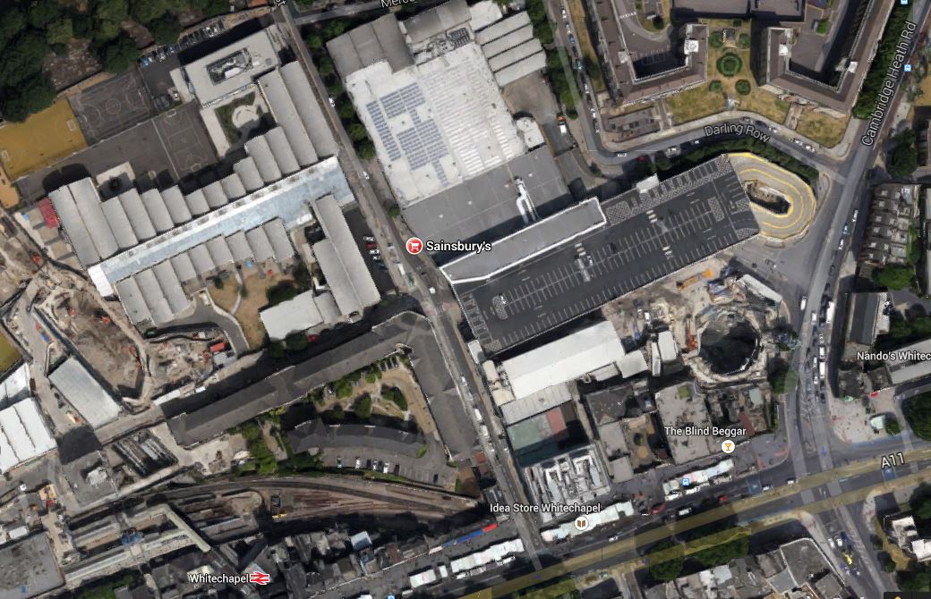
Whitechapel Station, Crossrail And Sainsburys
The Sainsburys is large and it has a multi-story car park, which stretches across the picture.
Note the big hole to the South of the supermarket, which is thirty-two metres deep and is Crossrail’s Cambridge Heath shaft to provide emergency access and ventilation to the Crossrail tunnels. Read more about the shaft and the other works at Whitechapel station in this page on Crossrail’s web site. This is all you can see from outside the site.
The Crossrail Cambridge Heath Site At Whitechapel
I was standing in Cambridge Heath Road, which is the road on the right of the image, which goes past the site and Sainsburys.
All this site used to be the Mann, Crossman and Paulin brewery,of which the only remains are the ornamental gates and the Blind Beggar public house. The latter is marked on the map and is notorious for its association with gang violence of the 1960s.
I wonder what the customers of those days, would make of the area now!
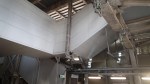
Structures At Whitechapel Station
I believe that Whitechapel station, will be Crossrail’s Jewel In The East and over the Easter weekend the East London Line was closed to allow Crossrail work. These pictures show the station after the weekend.
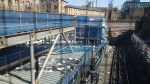
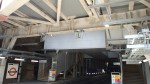

It does seem that more big structures are going up.
This Google Earth image shows the station.
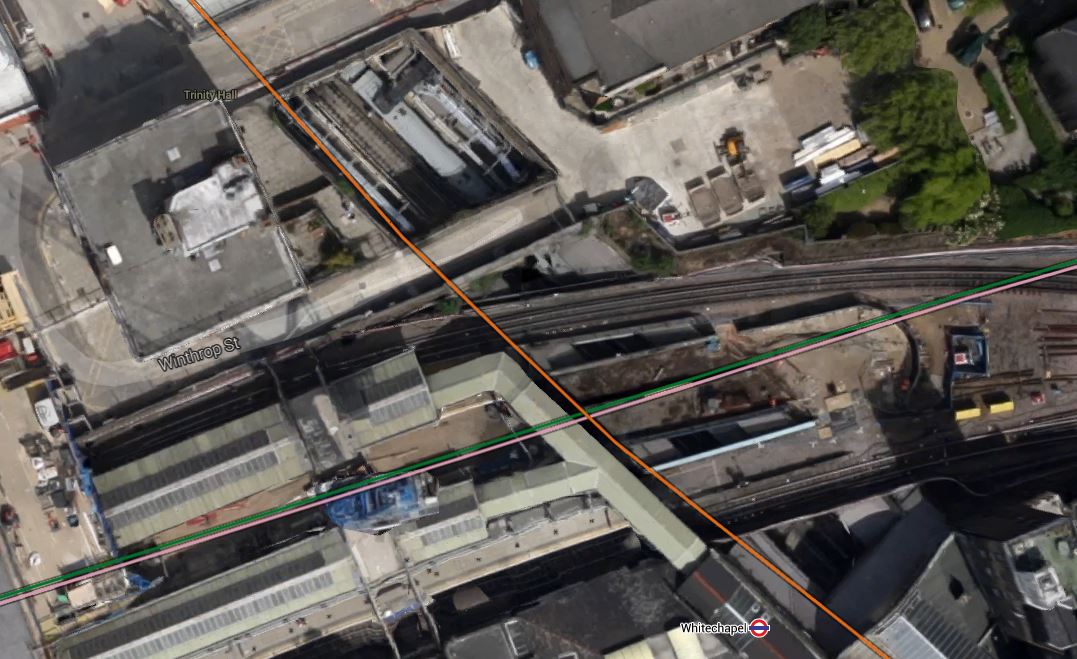
Whitechapel Station
The image was taken some time ago, but it does show the layout of the station.
Note the orange line determining how the East London Line passes through and how the Metropolitan and District Lines go either side of the works. When the station is completed, there will be one large platform between these lines, from which escalators will descend to the Crossrail platforms about thirty metres beneath.
Know Your Ticketing
My trip yesterday illustrated one thing, in that you can save pounds and pence by being smart with ticketing. This picture shows my six tickets from yesterday.
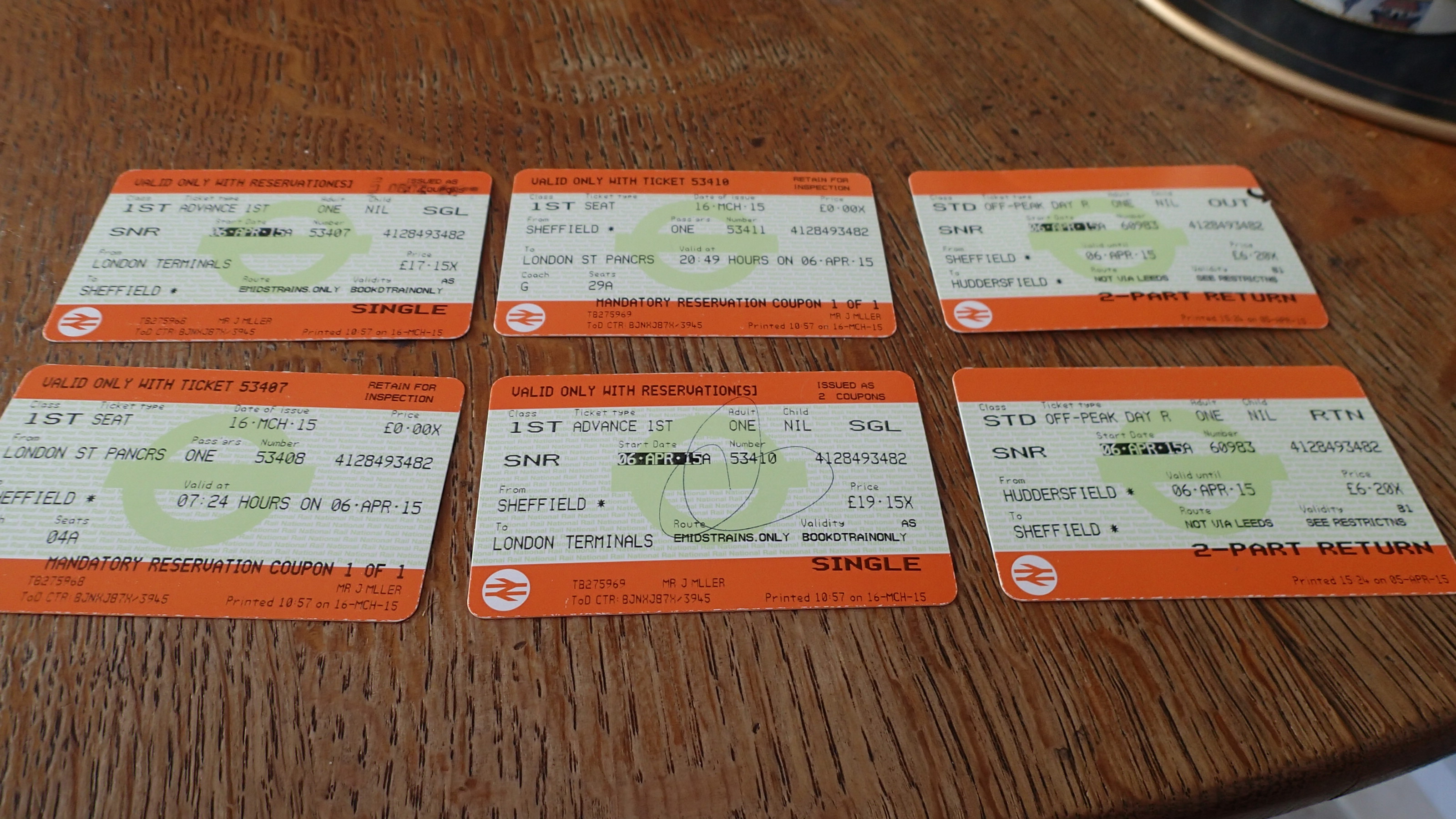
Tickets To Huddersfield
I travelled virtually along to Sheffield on the 07:24 for £17.15 and back on the crowded 20:49 for £19.15. Both tickets were for use with a Railcard in First Class and bought on-line from East Midlands Trains.
If I wanted to do that journey today, the cheapest ticket I can find on the web is £48.85
My Return from Sheffield to Huddersfield was bought from the ticket machine in Dalston Junction for £6.20, which was incidentally ten pence cheaper than one of my tavelling companion’s ticket bought on-line some days earlier.
