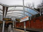
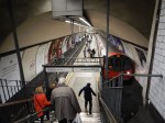
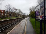
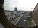
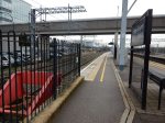
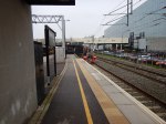
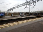
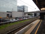
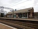
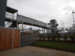
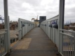
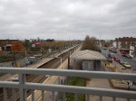
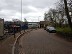
The New Apperley Bridge Station
Apperley Bridge station is a new station between Leeds and Shipley on the Leeds to Bradford Lines.

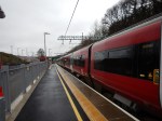
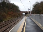
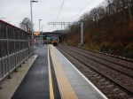

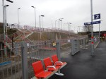

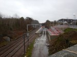
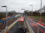
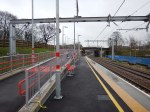

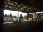
The station is a simple design, based around an existing bridge and uses ramps rather than lifts for step-free access.
It must make for a more affordable design. The new Kirkstall Forge station is reported to be being built using similar principles.
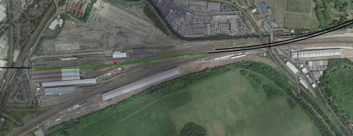
This Google Map shows the Location of Apperley Bridge station.

Apperley Bridge Station Location
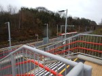
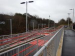
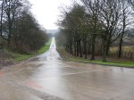
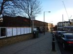
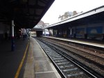
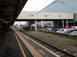
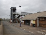
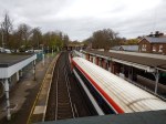
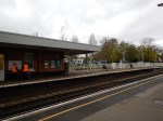
The station has been built by the wetsmost of the two branches. The Avenue leading away to the North doesn’t lead to the country seat of a man of means or breeding, but to what appears to be a large sewage works.
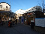
The two stations are reported in this web page as costing sixteen million pounds for the pair.
But judging by the heavyweight construction, the good-sized shelters, Network Rail have future proofed this station for a lot more passengers than they will expect in the next year.
Perhaps this section entitled The Future in the Wikipedia entry for the Airedale Line offers a clue!
This is said.
Recent Network Rail reports have looked at ways of increasing capacity on the line. Because of the difficulty of lengthening platforms at Shipley, it will be hard to introduce longer trains (i.e. 5 or 6 carriages) as is being proposed on the neighbouring Wharfedale Line. It is therefore proposed to run more trains per hour between Leeds and Keighley, with a new platform at Keighley to accommodate this. A new station atApperley Bridge opened in 2015 and Kirkstall Forge is due to open in January 2016, with both stations located between Leeds and Skipton via Shipley.
Could it be that the two new stations will also divert commuters into Leeds from Shipley?
Wikipedia appears to suggest that Shipley station has access problems, so perhaps diverting passengers to a new fully-accessible station increases capacity on the line.
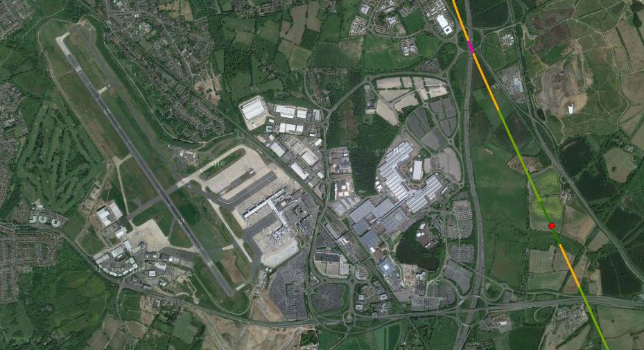
This Google Map shows that Shipley station isn’t your bog-standard two-platform station.

Shipley Station
I only know of one other station built in the middle of a triangular junction; Liverpool South Parkway. But that station was designed that way.
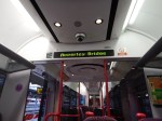
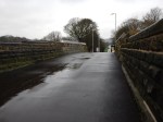
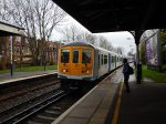
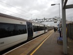
Incidentally, a guy at Appleby Bridge station told me, that it can take an hour to drive into Leeds in the rush hour from the village, but the train takes less than ten minutes.
The New Roof At Crystal Palace Station
In August 2010, I wrote A Day At Crystal Palace, after a visit to Selhurst Park to see Ipswich play. I took this picture of Crystal Palace station.

East London Line Platforms at Crystal Palace
Now compare it with these I took today.


As you can see, they’ve now fitted a roof.
I like it.
A Journey Round The Clapham Stations
This morning, I took a train to Clapham High Street station, before visiting the three Clapham stations on the Northern Line.
- I walked to Clapham North station.
- I took the tube to Clapham South station.
- I walked to Clapham Common station.
I then took the Northern Line back to Central London.
These are some of the pictures I took on the way.


One of main reasons for going was to look at the deep level shelter at Clapham South station that is mentioned in this article in the Wandsworth Guardian entitled Clapham’s Second World War shelter to become cafe and exhibition, You can’t miss it, as it is right before you as you come out of Clapham South station.
In my view it is an ideal place for a cafe. If it had been built, when C and myself lived in the Barbican, I can envisage us taking the three boys to have lunch in a cafe like that! The elder two had to walk and George got a ride in one of the first McClaren buggies. The massive push chairs used today, wouldn’t have gone on a Routemaster of that era.
I also wanted to see the two dangerous island platforms at Clapham North and Clapham Common, which are the last two left on the Northern Line. I can remember the island platform at Angel station, which was removed, when the station was rebuilt in the early 1990s. Today, in an article on Global Rail News, which is entitled Green light for Bank station upgrade, the details are given of the plans to widen the cramped and dangerous platforms at Bank station.
Having seen Clapham North and Clapham Common stations today, I do wonder if a diversion could be dug as at Angel, Bank and London Bridge, to create safe new stations. This new tunnel could surely be part of the works to add step-free access to one or both stations and connect the tunnels to Clapham High Street station.
What with the Northern Line Extension to Battersea, the rebuilding of Bank and Camden Town stations and all the resignalling of the past few years, the Northern Line could at last be fulfilling its potential.
Exploring The Sutton Loop Line
The Sutton Loop Line is not well known in North London, except as a routing shown on Thameslink train information displays.
This morning, I took the line from Tooting station and after a short stop at Sutton station, I continued on my way back into Central London.
These are some of the pictures that I took.


I think the trip did give me a better understanding of this line in South London.
These points are general.
Step Free Stations
Very few of the stations I passed through had any form of step-free access.
Some were island platforms, which have their advantages, but access up and down a single wide staircase to a road overbridge is so nineteenth century.
Variable Quality Stations
Some stations have had a refurbishment and others haven’t!
A Curious Timetable
Streatham to Sutton via Wimbledon calls at more stations, than the other way via Mitcham Junction and this is reflected in the times, with the shorter route taking fifteen minutes and the longer one thirty-one minutes
The curious timings on the loop, actually mean that from Streatham station northwards or southwards, the trains have an interval of very close to fifteen minutes.
So it would be prudent to check, that you’re always taking the best way to get to your destination station!
These points are specific to stations of sections of the line.
St. George’s Hospital
According to this article in he Local Guardian entitled St George’s Hospital Trust announces support for Tooting Broadway in Crossrail 2 plans, the hospital trust is not happy.
It would be ridiculous to spend the best part of an extra billion pounds on Crossrail 2 to put the line through Tooting Broadway station, rather than Balham station, when that money could probably be spent on a mixture of patient care , better bus links, and a lift or two at the Underground station. The latter will happen anyway, whether Crossrail 2 is built or not!
Could there be a better solution for step-free transport access to St. George’s Hospital?
Look at this Google Map of the hospital in relation to Tooting Broadway station and the Sutton Loop Line to the west of Tooting station.
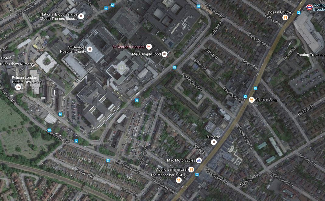
St. George’s Hospital, Tooting Broadway Station And The Sutton Loop Line
Tooting Broadway station is at the top right of the map and the Sutton Loop Line runs across the South West corner of the map.
If a new station were to be built on that line, with full step-free access, it would be closer to the Hospital, than any station on Tooting Broadway. It would also be close to some of the bus stops that serve the hospital.
Haydons Road Station And AFC Wimbledon’s New Stadium
This Google Map shows Haydons Road station and the site of AFC Wimbledon‘s new home at Wimbledon Stadium.

Haydons Road Station And AFC Wimbledon’s New Stadium
The stadium will be at the old greyhound stadium, which is the two green circles at the top.
The green scar from the stadium site to the east of the station, is the course of the River Wandle. Surely, a riverside walk should be created for supporters walking between the stadium and station.
The map also shows the amount of land wasted in the area by unnecessary cemeteries. How many houses could be built on the land they occupy?
Wimbledon Station
Trains on the Sutton Loop Line always use Platform 9 at Wimbledon station, which gives cross-platform access to Tramlink on Platform 10.
So one train might be going to Sutton and the next to Central London and beyond.
Wimbledon Chase And South Merton Stations
These two stations are shown on this Google Map.
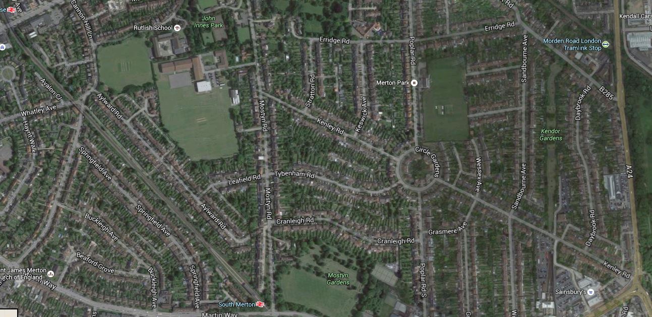
Wimbledon Chase And South Merton Stations
Wimbledon Chase station is at the top left and South Merton station is at the bottom, just tom the left of the middle.
You will notice, I’ve included the main A24 road on the map.
This is because that road could be used for an extension of Tramlink from South Wimbledon to Sutton via St. Helier Hospita;. This map shows that extension.
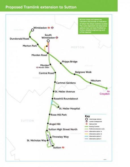
St Helier Tramlink
Transport for London and the London Borough of Merton are opening up a lot of possibilities here and I hope that a world-class solution emerges, to link the whole corridor together.
Morden South And Morden Stations
This Google Map shows the close relationship between Morden South station and Morden station
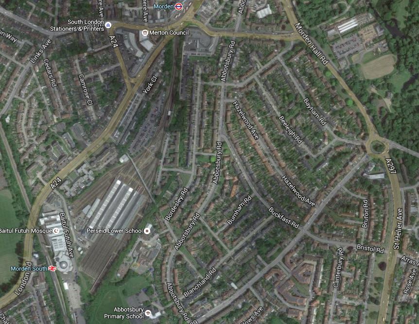
Morden South And Morden Stations
Their close location and the depot in betwen, has always puzzled me. It is explained in the History section for the Wikipedia entry for Morden station.
It was all down to railway politics, between Southern Railway and the Underground companies.
You just wonder though, if they were sorting out the lines around Wimbledon, that something could be done to make it easy to connect between the two stations.
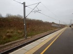
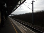
Hackbridge
I hadn’t heard about Hackbridge, which is a suburb in the London Borough of Sutton.
But there is a Hackbridge Masterplan on Wikipedia. This is the first paragraph.
The London Borough of Sutton is working to make Hackbridge the ‘UK’s first truly sustainable suburb’. There has been a regeneration scheme in Hackbridge which has a number of developments on many sites. These are mentioned as part of the Hackbridge Regeneration. Detailed plans include proposals for new eco-friendly homes, more shops, leisure and community facilities, jobs, sustainable transport and pedestrian/ cycle initiatives, improved networks and open spaces.
It all sounds good to me. This is a Google Map of the area.
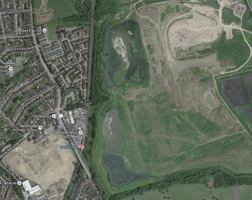
Hackbridge
Note the rail line going up the map with Hackbridge station about a quarter of the way up.At the top of the map, is an icon indicating the BedZed Pavilion.
If they are truly into green transport, it strikes me, that there needs to be another station between Hackbridge and Mitcham Junction, which is the next one to the North. As the Tramlink through Mitcham Junction runs down the eastern side of the site and has a stop at Beddington Lane on the north east corner, I would also feel that there scope for extensions to the through Hackbridge.
The Future Of The Sutton Loop
With all the investment in Thameslink, there is no doubt that the future of the Sutton Loop is secure, but what will it look like in ten or twenty years?
I think it seems to have suffered a lack of imaginative thinking in the past few years, but with Transport for London thinking hard about a new interchange hub at Streatham Common station, that I wrote about in Puzzled Over Streatham Common Station, I think we’ll see some more improvements.
A lot of the stations need to have a refurbishment and proper step-free access.
If this follows the pattern of previous lines in London and elsewhere, I think that after station improvement, this line will need additional services.
As it won’t be possible to get more trains through the core, then this could need for some form of local train or tram-train on the loop. Perhaps these would terminate at perhaps Streatham Common station, which I wrote about in Puzzled Over Streatham Common Station.
If two extra trains each way round the Sutton Loop were to be added, they could be timed to run every fifteen minutes between the existing services. So each station on the loop would get a four trains per hour service both ways.
One possibility would be to do the extra services with tram-trains, which after Streatham Common, went on to Croydon to connect up with the existing Tramlink routes.
As I said earlier trains go through Streatham to and from the loop every fifteen minutes, which would be every 7-8 minutes with the extra trains.
So if say you wanted to go to Central London, if you caught an intermediate train on the loop, you might have to wait 7-8 minutes for a Central London train.
The possibilities are endless.
Obviously, traffic patterns will determine how the line develops, but I predict that there will be a big future for the Sutton Loop.
Platform Space At Milton Keynes Central
In Future Rail Developments At Milton Keynes, I said that there with all the new services, there would have to be some extra platform space.
So I went to Milton Keynes Central station and took these pictures.
At a quick look there does appear to be more space, than is normal in stations of this size. But then it was only built in 1982.
Platform 2A
The Platforms and Layout section of the Wikipedia entry for the station, says this about the length of Platform 2A.
Platform 2A is a five-car south-facing bay platform.
I would assume, that the car length is the standard British Rail length of twenty metres.
The pictures clearly show that the platform is electrified.
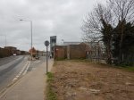
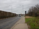
Tilbury Town Station
Tilbury Town station shows how you can take a basic station and by trying hard can make it acceptable to most visitors.
I never visited the station in say the nineteen-sixties, but I suspect it is a lot better now!
I very much liked the step-free bridge that is available to everybody who wants to cross the line easily and safely, whether they intend to travel on the trains or not.
What I didn’t like was that the A1089 road outside the station, from where you walk to Tilbury Fort or the Ferry Terminal, as it is a race-track for heavy trucks.
The Google Map shows Tilbury Town station and its position with respect to the Port, the London Cruise Terminal, the Ferry Terminal and Tilbury Fort.
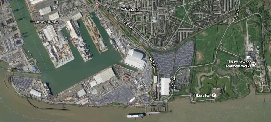
Tilbury
Tilbury Town station is at the top of the map by the A1089 road and the London Cruise Terminal is on the river. Conveniently there is a cruise ship alongside.
The railway to Tilbury Riverside station, which was next to the London Cruise Terminal was removed in 1992.
I would suspect that quite a few movers and shakers in the Tilbury area, feel that the closure of Riverside station was something that shouldn’t have been done, when they look back.
HS2’s Interactive Map
For those who are worried, need to know or just plain curious, HS2 have put a very good quality interactive map on their web site on this page.
These are some images, I have captured.
Stations are shown by red dots
Euston, St. Pancras and Kings Cross Stations With HS2
Euston, St. Pancras and Kings Cross Stations With HS2
The map clearly shows the three stations and the route of HS2 into Euston.
Note the following.
- HS2 clearly arrives at Euston on the western side of the station.
- The pedestrian route to St. Pancras could be more difficult than planners think.
- The station would appear to be extended towards Euston Road.
- Whilst the station is built, I suspect, that a good connection to the Metroipolitan/Circle can be created.
I think we’ll see some plans in the next few years, that make the connection between the three stations a lot better.
Old Oak Common Station
Old Oak Common Station
The map shows the myriad of lines in the area.
I believe that for many people using HS2 to and from London, will use this station, as its connectivity is so much more comprehensive than Euston.
Birmingham Interchange Station
Birmingham Interchange Station
Birmingham Curzon Street Station
Birmingham Curzon Street Station
Birmingham Moor Street and Birmingham New Street stations are to the south of the new station.
HS2 East Of Birmingham

HS2 East Of Birmingham
This map clearly shows how trains for the North via Birmingham will go into Birmingham and then reverse direction in Birmingham Curzon Street station.
Handsacre And HS2
Handsacre And HS2
This map shows where HS2 joins the West Coast Main Line at Handsacre.
Conclusion
The interactive map is a real credit to modern computing.
Every project that could benefit should have one.
Will we be seeing one for Crossrail 2?
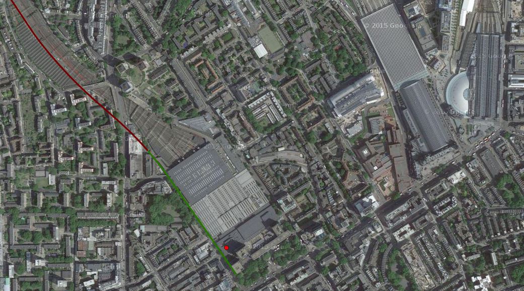
Wandsworth Common Station
This was the destination of my walk today, where I took pictures for Crossrail 2 Consultation – Wandworth Common Shaft
It is a strange station with two fast and two slow lines, that probably hasn’t been looked at by an architect since the 1920s.


As you can see, it’s not a station for those who need step-free access and it also had one of the lsargest platform-train gaps I’ve seen in the UK.
Ten London Overground Stations For Upgrade
This article on Rail Magazine is entitled Murphy wins LO station contract. This is said.
J Murphy & Sons has won a £6.5 million contract from Transport for London to upgrade ten London Overground stations with new shelters and seating, upgraded lighting, better paving and new handrails.
It sounds like the work is not of too much of a major nature, but is more about some small important features.
On a personal note, the only station named, that I use regularly is Hackney Downs.
Crossrail 2 October 2015 – Stations
This Crossrail 2 document is entitled A Typical Station.
Read the document and you’ll see that a typical station has the following.
- Two 250 metre long platform tunnels with platform edge doors.
- Several cross tunnels
- Shafts at each end of the platforms for ventilation and evacuation.
It does look as if they’ve gone for the simplest design possible, that meets all needs and regulations.
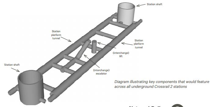
I’ve been in two Crossrail stations and it does seem that this design is simpler.
