An Exploration At Penge
I took the Overground to Penge West station and then walked to Penge East station. The walk is about 15 minutes.
The objective was to investigate the Penge Interchange proposed in the Transport Infrastructure Plan for 2050, After all, I can’t find any other reference to this on the Internet. Even if you search the whole of the Infrastructure Plan, Penge is only mentioned once.
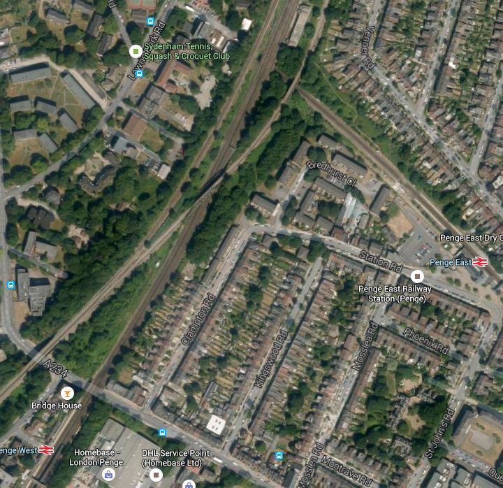
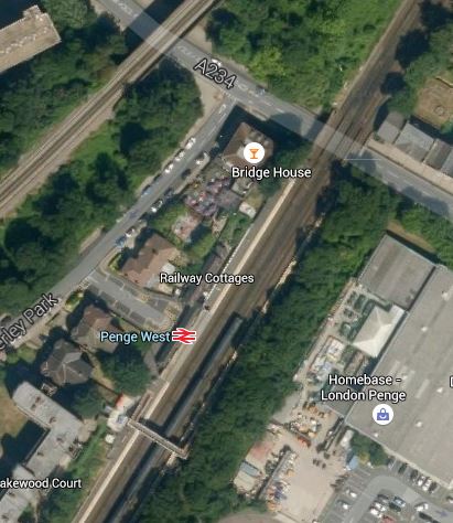
This is a Google Map showing both stations.
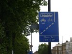
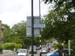
I took these pictures at Penge West station

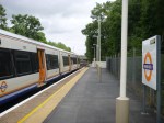
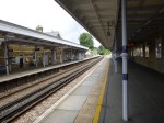
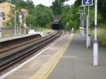
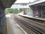
Penge West is a typical South London station, but it is not step-free and it has an uncovered bridge. There is also only one entrance and exit on the Northbound platform. It will have to be rebuilt with a new footbridge and a possible entrance/exit on the Southbound side. This Google Map shows the station and the surrounding area.
Penge West Station
It would appear that there is enough space to rebuild the station with a second entrance/exit on the Sounthbound side of the lines. The other line crossing the top left corner of the map, is the line that takes the East London Line to Crystal Palace.
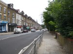
Whilst I walked to Penge East station, I took these pictures.

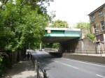
The bridges at Penge West station, probably rule out any connection of the two lines in a rebuilt station.
Incidentally, the walk is well-signposted except for the unfortunate sign directing you to Penge East station off the High Street, which is only visible when you’ve passed by.
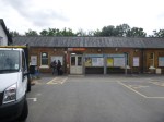
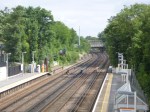
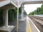
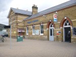
These are pictures of Penge East station.

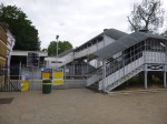
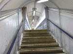

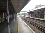
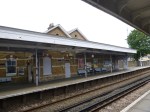
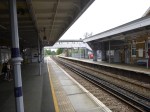

The station has the worst footbridge, I’ve seen for a long time and surely only the grace and favour of the woodworms holding hands, stops it from falling onto the railway. It is of course not step-free.
Believe it or not this dreadful footbridge is Listed. It also is a regular walking route across the railway for people not using the trains.
So making Penge East station comply with the disability Regulations would mean putting a second footbridge somewhere else.
The irresistible force of the Disability regulations has met the immoveable object of the Heritage Lobby. Wth which group would Network Rail least prefer to have a big fight?
This Google Map shows the area from Penge East station to where the lines go under the Brighton Main Line
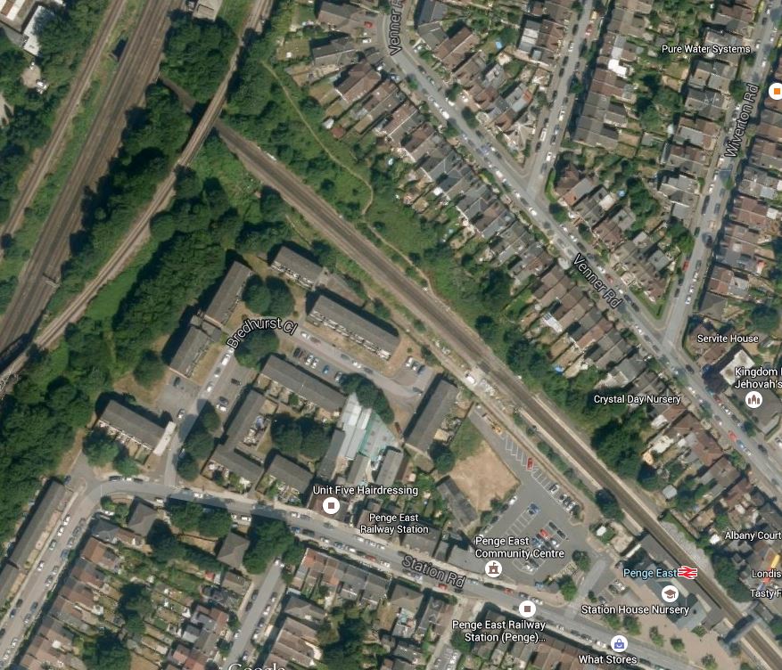
Penge East Station
I think that having looked at both Penge East and Penge West to improve services in the area, TfL and Network Rail have taken the decision to perhaps build a new Penge Interchange station, where the lines cross.
This has led to the inclusion of the single word, Penge, under a list of possible interchange stations in Transport for London’s future predictions. This Google Map shows the area where the lines cross.
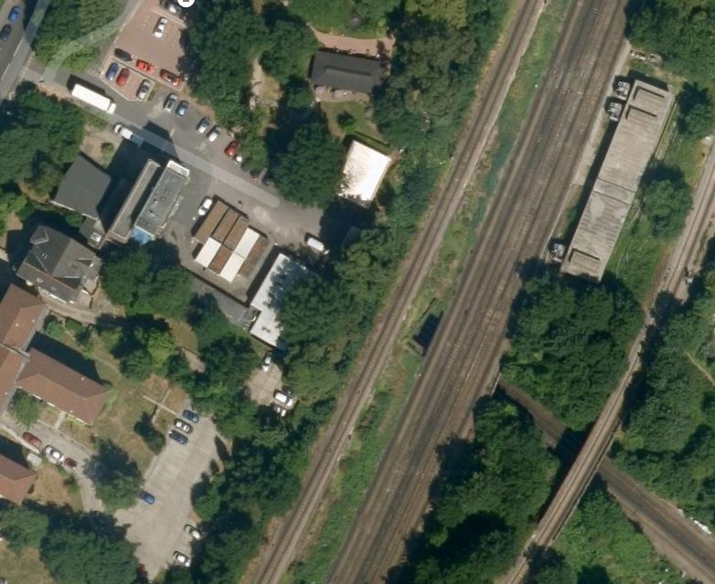
A Possible Site For A Penge Interchange Station
There are actually three groups of lines that cross the lines through Penge East.
- The single-track northbound Sydenham Spur linking Crystal Palace to the Brighton Main Line.
- The four-track Brighton Main Line with the slow lines on the outside.
- The single-track southbound Sydenham Spur linking the Brighton Main Line to Crystal Palace.
Depending on how much you would want to spend, you could build new platforms on the Brighton Main Line and the Sydenham Spur and link them by lifts to platforms on the line through Penge East.
A few points.
1. I think that the platforms would be extended from Penge East towards the new interchange.
2. The Listed footbridge at Penge East would be saved and the woodworm can be given help from craftsmen to hold the bridge up.
3. There would appear to be a service tunnel under the railway, that gives access to the building on the eastern side of the Brighton Main Line. Could this help in the design and construction of the station?
4. From the Google Map, there would appear to be space for an access to the station from Lawrie Park Road.
5. The area around Penge West station could probably be connected to the new complex by a footpath running along the railway lines. There could also be some rerouting of buses.
6. The station could probably be designed to create an East- West walking and cycling route under the railway.
7. Network Rail would get improved access to their building on the eastern side of the tracks.
It is also interesting to look at the passenger statistics for the stations in the area for 2013-14.
- Penge West – 0.5 million
- Penge East – 1.5 million
- Anerley – 0.7 million – South of Penge West
- Sydenham – 2.3 million- North of Penge West
These statistics provoke me to say, that if a Penge Interchange station was developed where the lines cross, would it be sensible to close the current Penge West station?
After my visit to Penge and my cursory investigation, I am led to the conclusion, that building a new Penge Interchange station, which possibly incorporates elements of the current Penge East station, and closing the lightly-used Penge West station, is not an impossible dream.

[…] I have a feeling that the design principles used here might be used at Brockley, Brixton and Penge. […]
Pingback by Birmingham’s Four-Poster Station « The Anonymous Widower | August 7, 2015 |
[…] believe that an interchange at Penge would link the East London Line to the South Eastern Main Line and trains between Victoria and […]
Pingback by No To Silvertown Tunnel « The Anonymous Widower | August 12, 2015 |
[…] Penge East is on the Victoria to Orpington Line and needs upgrading for step-free access. But it has the problem of a Listed footbridge, that should be burnt. I wrote about it in An Exploration At Penge. […]
Pingback by Is Crossrail Bringing Increased Frequencies To The East London Line? « The Anonymous Widower | October 14, 2015 |
[…] Penge East is on the Victoria to Orpington Line and needs upgrading for step-free access. But it has the problem of a Listed footbridge, that should be burnt. I wrote about it in An Exploration At Penge. […]
Pingback by Increased Frequencies On The East London Line « The Anonymous Widower | October 14, 2015 |
[…] Transport for London have proposed a Penge Interchange station in the Transport Infrastructure Plan for 2050, If it were to be built it would link the East London Line and the Chatham Main Line, where they crossed just North of Penge West station. I wrote about the station in An Exploration At Penge. […]
Pingback by An Ideal Oxted Line « The Anonymous Widower | February 13, 2016 |
They need new train like tfl rail / Elizabeth line or why can’t tfl rail take over southern services so that the tfl rail trains would go from London Victoria to orpington and stop at stations like penge east etc like they’ve done to the Woolwich line. Tfl rail should have a service going from Beckenham junction to Romford
Comment by Jayce | July 21, 2019 |
[…] An Exploration At Penge, took a train from Penge East station to Orpington […]
Pingback by Orpington Station – 3rd August 2015 « The Anonymous Widower | January 29, 2023 |