Marsh Barton Station – A Ride-To-Work Station
According to this article on pbctoday, work has started at the new Marsh Barton station in Exeter.
This first paragraph from the article makes it clear.
Graham has commenced works on the construction of the new £16m Marsh Barton railway station in Exeter.
This Google Map shows the location.
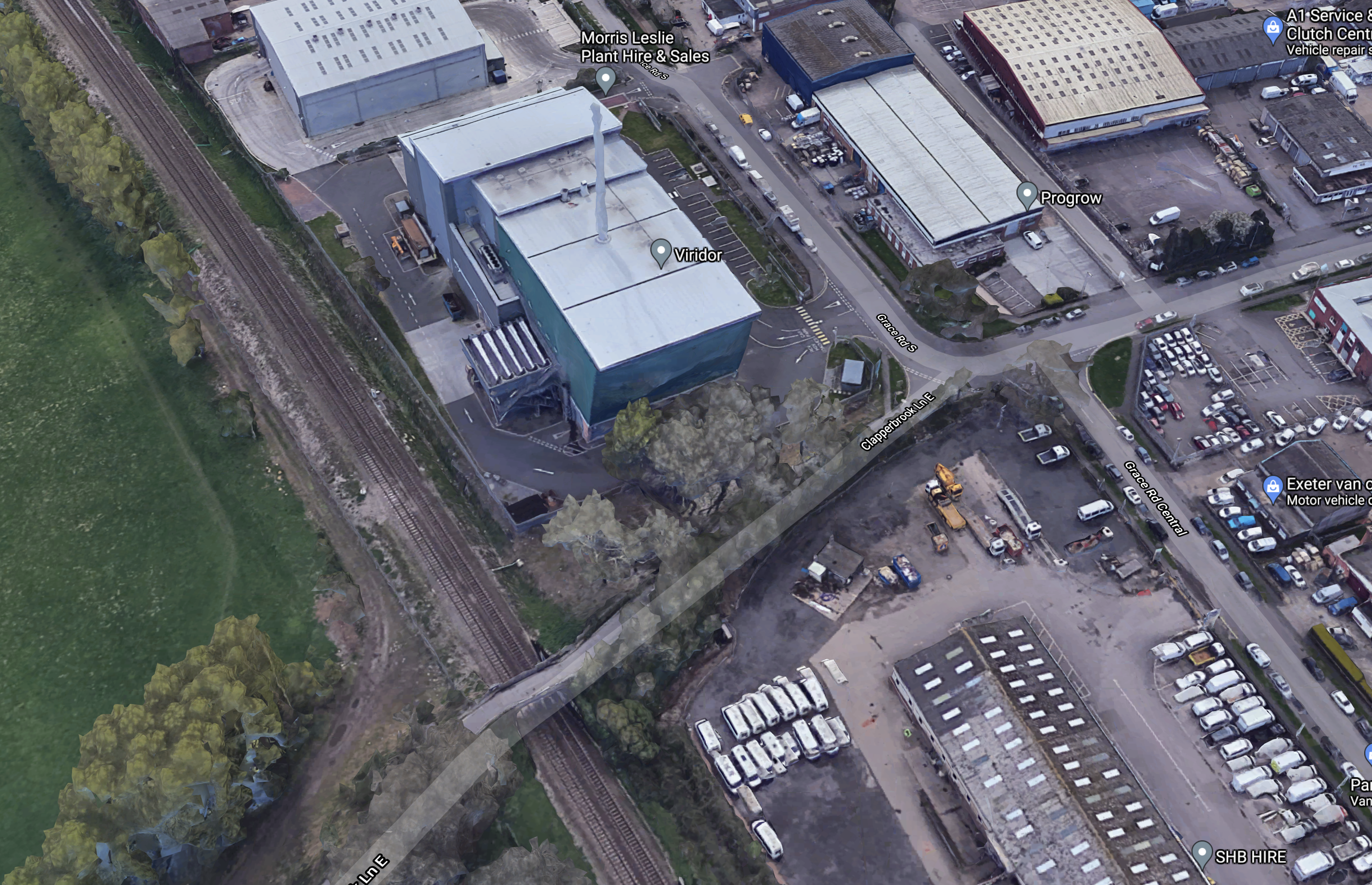
Note.
- The Riviera Line between Paignton and Exeter towards the Western side of the map.
- Clapperbrook Lane running to the South-West corner of the map over the railway.
- The large blue-clad building with the chimney, is the Viridor energy-from-waste plant.
- Marsh Barton itself is a large trading estate to the North-East of the railway.
The station will be built where Clapperbrook Lane crosses the railway,
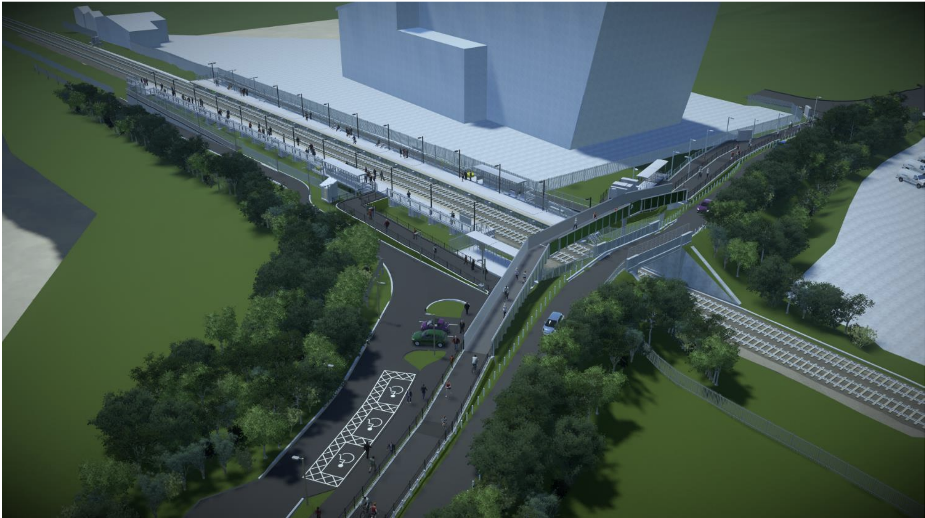
This document of the Devon County Council (DCC) web site gives more details about the station.
This image from the DCC document shows how the completed station will look.
These are my thoughts.
Crossing The Tracks
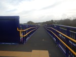
A cycle and foot bridge will be built parallel to the current Clapperbrook Lane East Bridge over the railway.
The DCC document says this about the bridge.
The key changes from the previous proposal relates to the ramps and access
between the two platforms. The previous design included ramps running parallel to
the railway, with long ramps and imposing structures due to Network Rail
requirements for their asset. The redesign now includes the ramps and a new bridge
constructed parallel to Clapperbrook Lane. This will instead be a Devon County
Council-owned asset and allows Devon County Council standards to be applied for
their pedestrian bridges. This is more in line with preferences expressed by disability
groups who supported shorter length but slightly steeper gradient with resting
platforms.
It looks to me that the final design will be much more aesthetically-pleasing than some of the structure Network Rail have erected lately.
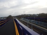
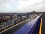
These pictures show Network Rail’s traditional approach at Horden station.

I feel the Devonian approach could be better, when I see it.
From the Google Map 3D image of the station, it looks like the bridge could be already under construction, so I don’t think, I’ll have long to wait.
The Platforms
The DCC document says that there will be two 124 metre long platforms, which will take six-car local trains.
- 3 x 2-car Class 150 trains will be 120.2 metres long
- 3 x 2-car Class 156 trains will be 138.2 metres long
- 2 x 3-car Class 165 trains will be 137.1 metres long
- 1 x 5-car Class 800 train is 130 metres long
It strikes me that although 124 metres can accommodate a formation of three Class 150 trains, it might be too short in the future.
Especially, as trains likely to be available in battery-electric versions, which will surely be used to decarbonise the Riviera Line in the future, all have cars of 23 metres or longer.
Both platforms appear to have just a single waiting shelter.
Cycle Parking
There are twenty parking spaces for cycles on each side of the line.
The DCC document says this about local housing and cycling.
The station will be within reasonable cycling distance of the 2,500 dwelling South
West Exeter strategic allocation and Alphington village and so forms an important
part of mitigating traffic impacts on routes on the western side of the city.
Is there enough provision for the secure storage of cycles?
Disabled Parking
There are just three parking spaces for disabled passengers.
Car Parking
There are no generally-available car parking spaces.
The DCC document says this about car parking.
The scheme will also support aims for low-car development aspirations as part of the
emerging Liveable Exeter housing plans, which includes proposals for strategic
levels of housing in the Marsh Barton area, all within easy walking distance of the
station.
But will the station persuade local residents to forgo driving into Exeter and use the train?
Who Will Use The Station?
The DCC document talks of Marsh Barton station being a destination station for those who work in the area.
It also says this about leisure use.
In addition, the existing Clapperbrook Lane adjacent to the station provides an important link into the Riverside Valley multi-use trail network for leisure trips as well as commuter journeys to RD&E and County Hall, within a short walk/cycle distance of the station. Being located adjacent to a high quality, attractive cycle network offers huge potential to improve integration between rail and cycling.
Currently the lane is very popular with over 400 cyclists per day recorded crossing the rail bridge; however, it is narrow with poor visibility and although lightly trafficked is not suitable for all young families, people with disabilities or people less confident on bicycles.
I have a feeling that the station will need some extra facilities to attract more passengers. Ideas like a drop-off and pick-up facility, a warm place to wait and perhaps a local shuttle bus come to mind.
But as I said in the title it is very much a Ride-To-Work station.
Conclusion
The station has an interesting feature in the bridge over the railway, which gives full step-free access.
But I do feel that some of the details of the station will need some extra thought.
From other pages on the web, it appears the station is being constructed under a Design and Build contract with experienced station builder; Graham Construction. So hopefully, the details will be properly sorted.
The proof of the quality of the design will be in the usage figures.

In view of your aptitude with Google Maps you may want to speculate as to restoring the branch from Marsh Barton to Newton Abbot via Heathfeild. Much of the route is not lost to development and from the main line at M B there appears to be ‘greenery’ all the way to Sainsbury’s car park. The web site “Old Maps ‘ can give you the route before it shut.
The line from Newton Abbot can be seen from the satellite photos for about 4.5 miles to Bovey Tracey. Sooner or later the maintenance of the line via Dawlish will break the bank, No attempt to lay granite reefs off Dawlish or any explanation from a contributor to Modern Railways to whom I wrote suggesting same.. I am aware of the Tavistock Okehampton route efforts.
Comment by Thomas Carr | May 27, 2021 |
Thanks! But I’ve always liked maps.
I’ll check it out!
We should remember that in the end, the sea always wins. Except possibly in Jack Hawkins films! But then he’s long since dead!
I actually think that one of the reasons for the work at Okehampton is that in times of troubles at Dawlish, Okehampton and Okehampton Parkway stations can be used as a railhead to get passengers between London and the South West.
Network Rail certainly thre a lot of resources at the project to rebuild the track.
Comment by AnonW | May 27, 2021 |
Thanks for postiing this
Comment by Marilyn H | October 28, 2021 |