East-West Rail: Through Bedford
This Google Map shows the route of East West Rail through Bedford.
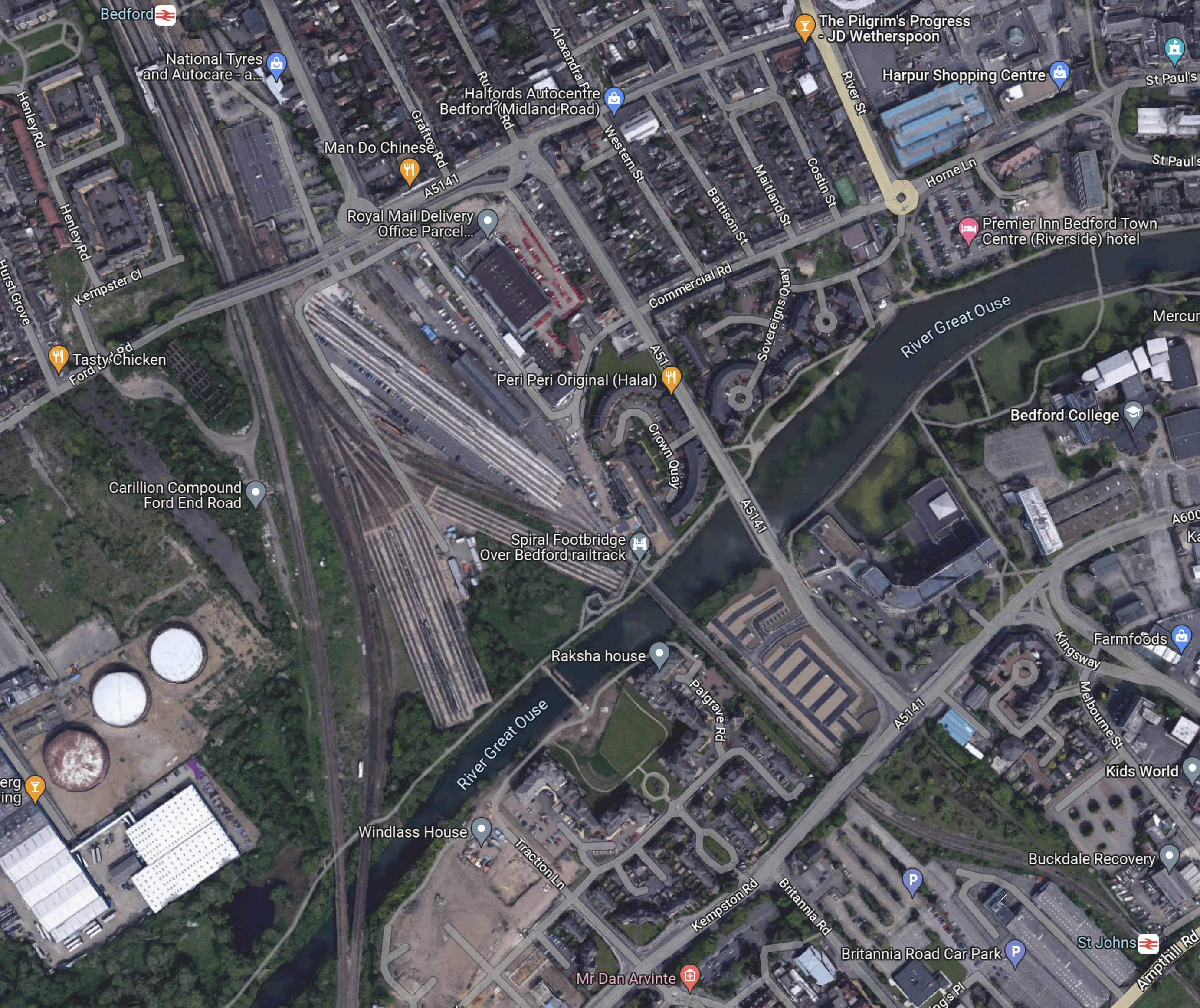
Note.
- Bedford St. Johns station in the South-East corner of the map.
- Bedford station is in the North-West corner of the map.
- Tracks run between the two stations to allow Marston Vale Line trains to terminate in Platform 1A at Bedford station.
- There are a lot of sidings for Thameslink trains South of Bedford station.
- The Great Ouse divides the town into two.
I’ll now explore further.
Bedford St. Johns Station
This Google Map shows Bedford St. Johns station.
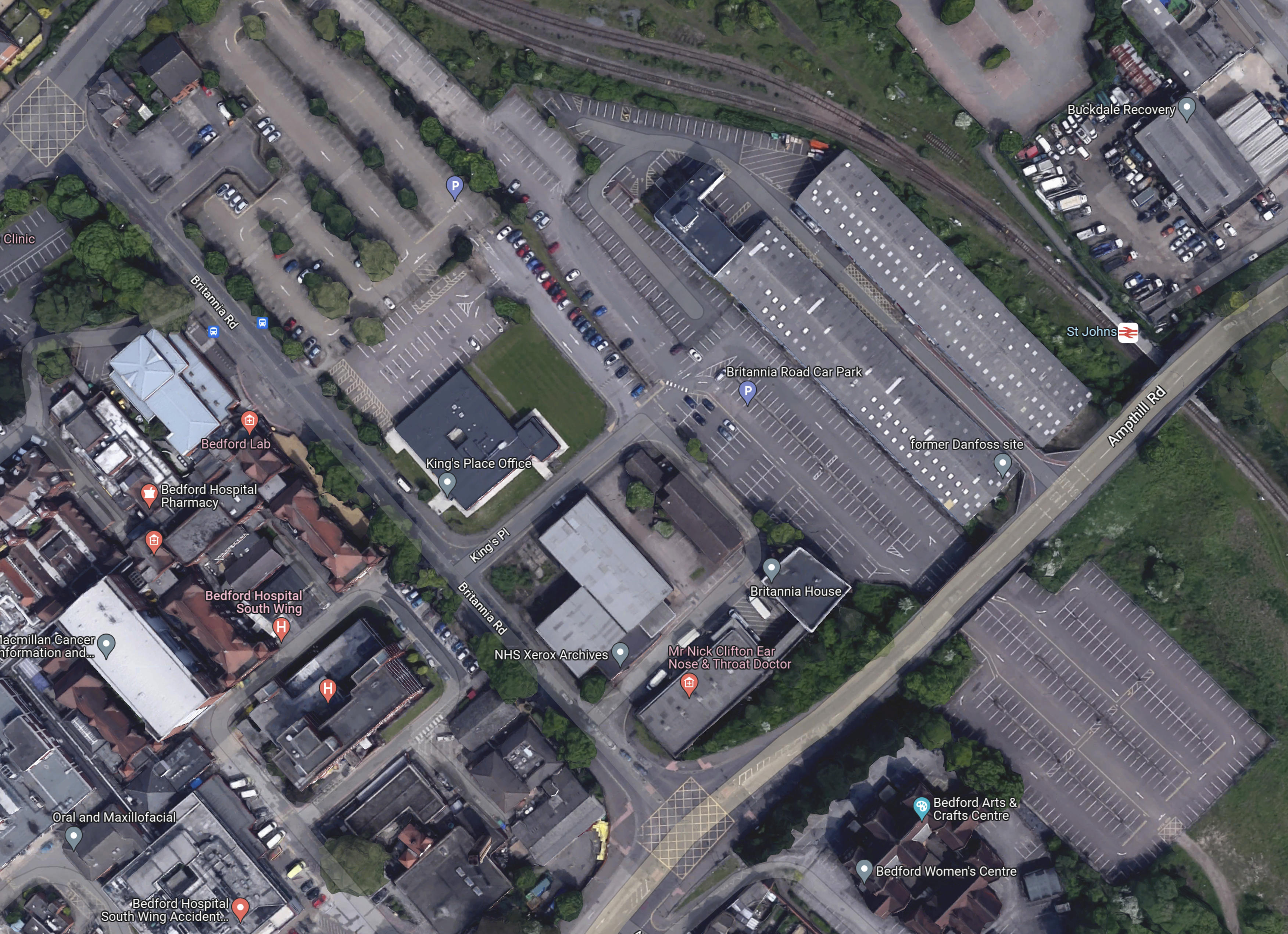
Note.
- Bedford St. Johns station towards the North-East corner of the map.
- The single-track Marston Vale Line passing through the station.
- The track becomes double track to the North of the station.
- Although not shown on the map, the Marston Vale Line becomes double track to the South of the station.
- If it was all double-track, this would surely make operation of the Marston Vale Line easier for two trains per hour (tph).
- In the South-West of the map is Bedford hospital.
The Wikipedia entry for Bedford St. Johns station, says this about the future of the station.
In March 2021, plans were unveiled which, if taken forward, would see Bedford St Johns railway station relocated as the track through the station will be realigned. In May 2023, EWRL announced that it proposes to relocate the station further north (to Kempston Road) to better serve Bedford Hospital.
That sounds sensible, as it would allow either a full two-platform step-free station or a smaller single-sided one-platform station to be built.
Over The Great Ouse
This Google Map shows the railway crossing the Great Ouse.
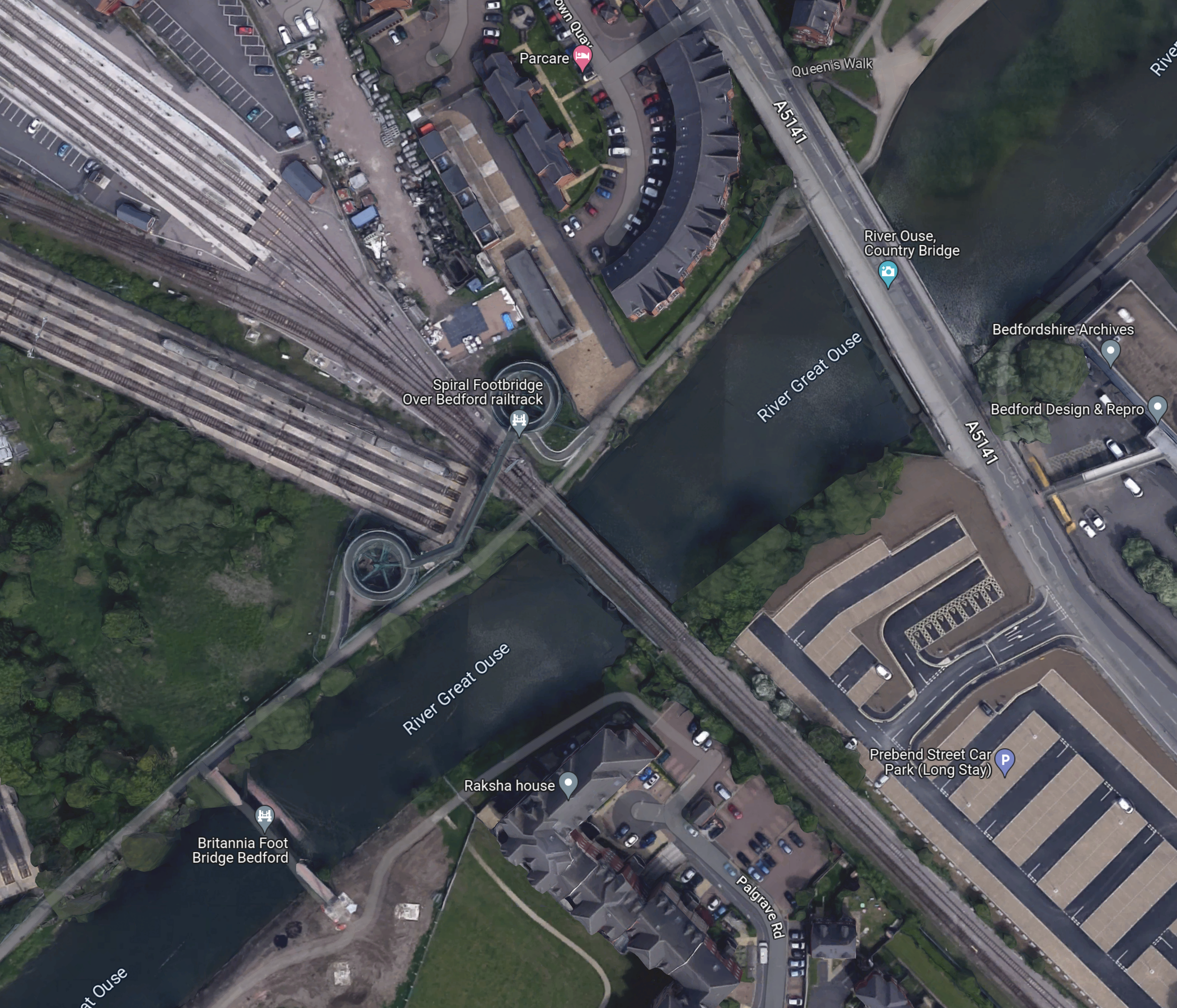
Note.
- The Marston Vale Line runs to the South -West of the long-stay car park in the South-East corner of the map.
- The Western bridge takes the line over the Great Ouse.
- It then runs between the sidings to Bedford station.
This picture, which was taken from the Spiral Footbridge on the North bank of the Ouse, shows the double-track rail bridge.
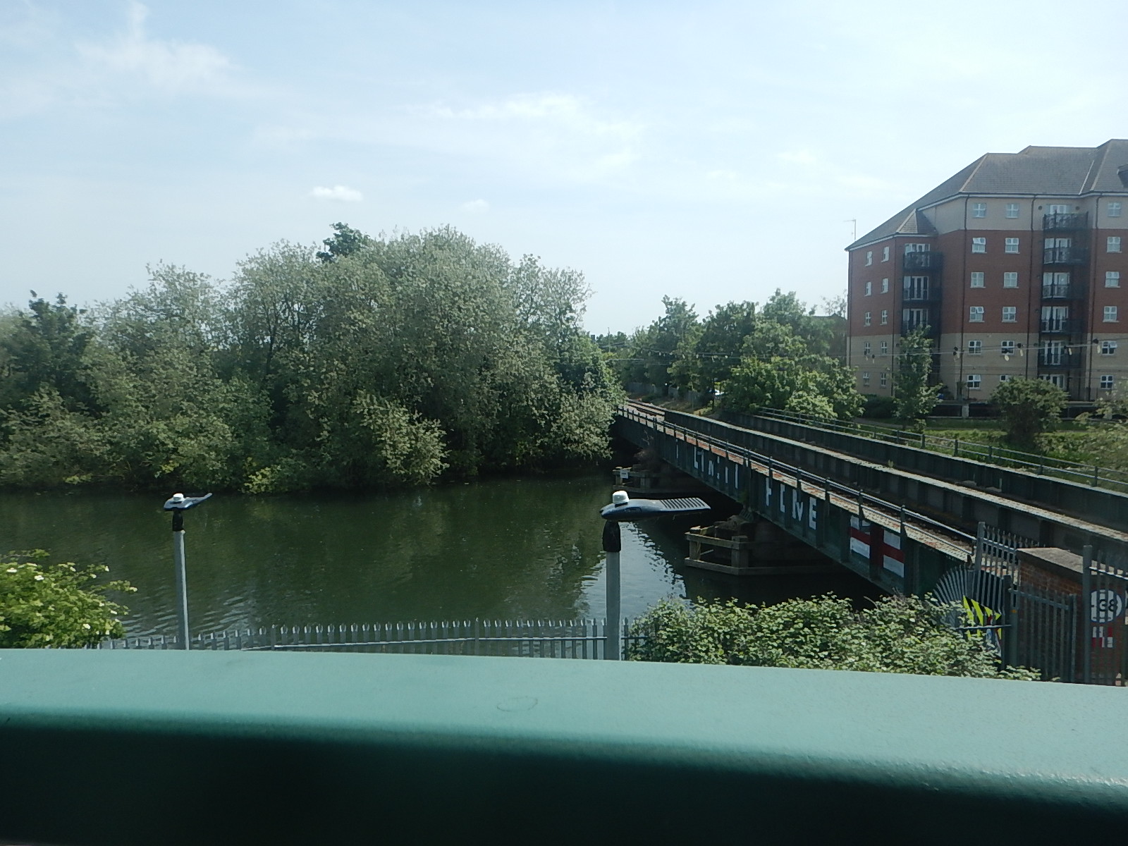
There are two tracks all the way from where the single-track divides to the North of Bedford St. Johns station.
The Southern Approaches To Bedford Station
This Google Map shows the Southern approaches to Bedford station.
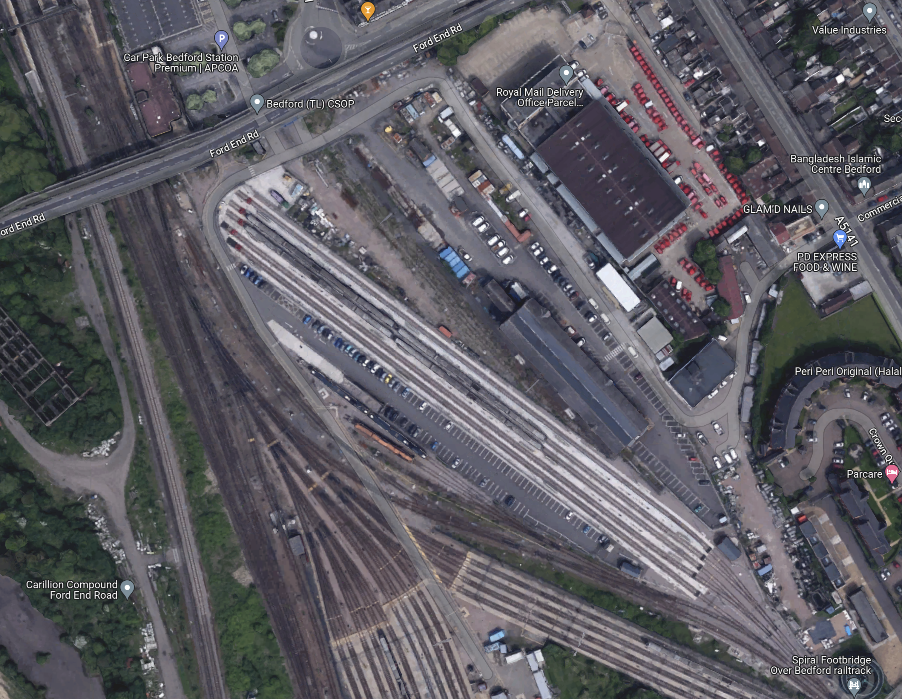
I have looked at the track layout and I’m fairly sure of the following.
- Current Marston Vale trains can go directly into Platform 1A without crossing any other tracks.
- Marston Vale trains can use Platform 1 if required.
- Thameslink trains can terminate in Platforms 1, 2 or 3.
- Southbound Corby trains can call in Platforms 1, 2 or 3.
- If they stop in Platforms 1 or 2, they appear to cross over South of Bedford station to the Midland Main Line.
If 2 tph were running on the Marston Vale Line; one fast and one stopping, a single platform should be able to handle the trains, if it was long enough.
Bedford Station
These pictures show Bedford station.

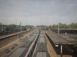

Note.
- The first two pictures were taken from the footbridge.
- The fast line between Platforms 3 and 4, is clearly visible in the second picture.
- Platform 1A is electrified.
This Google Map shows Platform 1A, where Marston Valley Line trains currently terminate.

Note.
- Platforms from the right are 1A and 1, 2 and 3 on the islands, with 4 to the left.
- Judging it against the three cars of the train in Platform 2, I reckon that Platform 1A could be updated to hold a six-car train.
Would a six-car train be long enough?
Initial East West Rail Services To Bedford
According to the Wikipedia entry for the East West Railway, these services will run on the railway between Oxford and Bedford.
- East West Railway – Oxford and Milton Keynes Central via Oxford Parkway, Bicester Village, Winslow and Bletchley – 2 tph
- East West Railway – Oxford and Bedford via Oxford Parkway, Bicester Village, Winslow, Bletchley, Woburn Sands and Ridgmont – 1 tph
- East West Railway – Aylesbury and Milton Keynes Central via Aylesbury Vale Parkway, Winslow and Bletchley – 1 tph
- West Midlands Trains – Bletchley and Bedford via Fenny Stratford, Bow Brickhill, Woburn Sands, Aspley Guise, Ridgmont, Lidlington, Millbrook, Stewartby, Kempston Hardwick and Bedford St Johns – 1 tph
Note.
- tph is trains per hour.
- There a fast train and a stopping train between Bletchley and Bedford.
- It appears that both these trains could terminate in Platform 1A at Bedford station.
I believe this will be possible with the current track layout, as the Marston Vale Line is almost all double-track.
East West Rail Services To Cambridge And Beyond
In this document on the East-West Rail Consortium web site, these services are suggested, for when the East West Rail is complete.
- An hourly train via Norwich terminating at Great Yarmouth.
- An hourly train via Ipswich terminating at Manningtree.
Would this mean three of four passenger tph on the Marston Vale Line?
If Cambridge and Oxford services, were running under digital signalling, I suspect trains could cross between the Thameslink and Marston Vale Lines, so that they could call in the through platforms at Bedford station.
How Would Trains Connect To The East At Bedford Station?
This Google Map shows the Midland Main Line through Bedform.
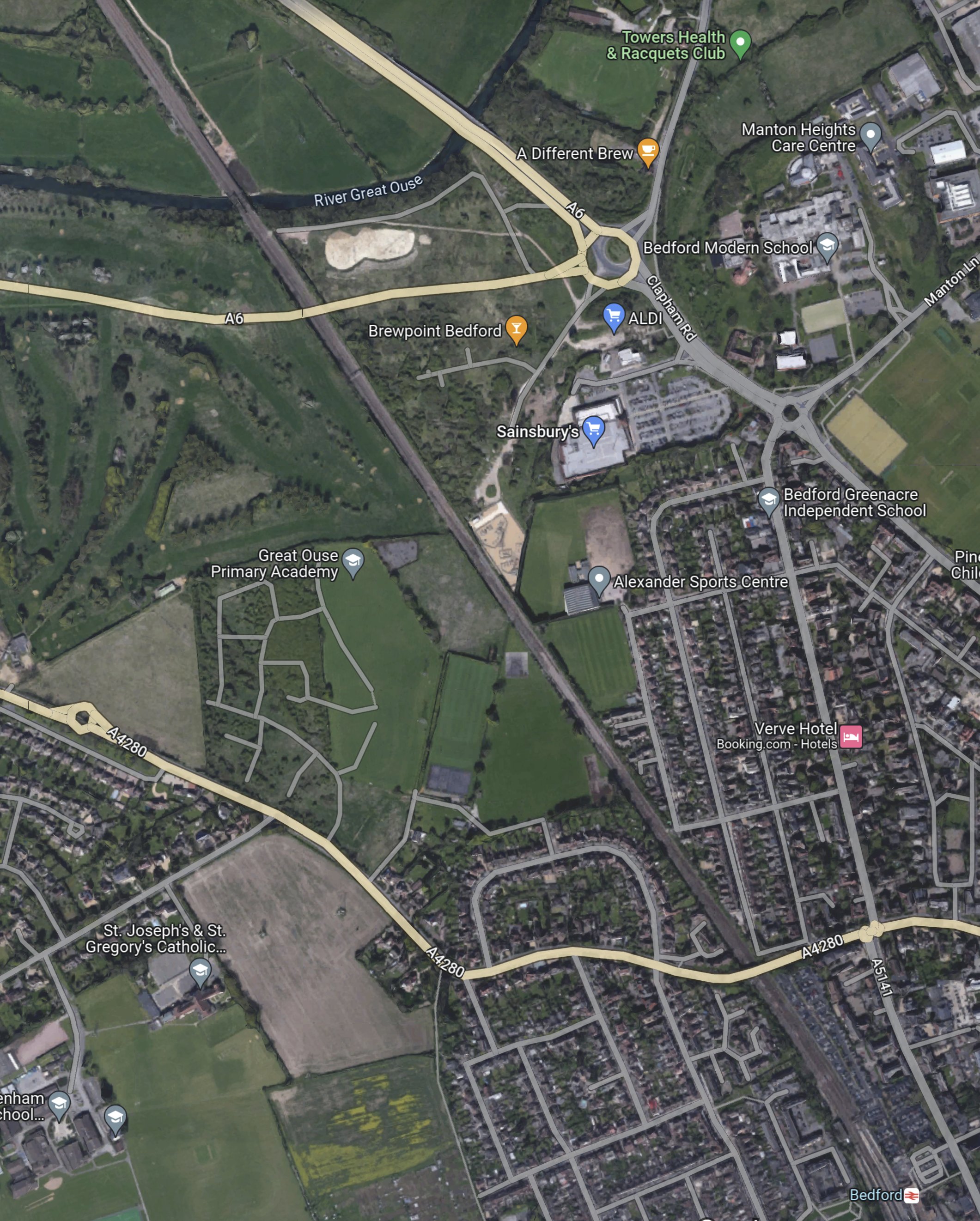
Note.
- Bedford station in the South-East corner of the map.
- The Midland Main Line runs diagonally from Bedford station across the map.
- The A6 seems to take a curious route in the North-West corner of the map, where it connects to a roundabout with an Aldi and a Sainsbury’s
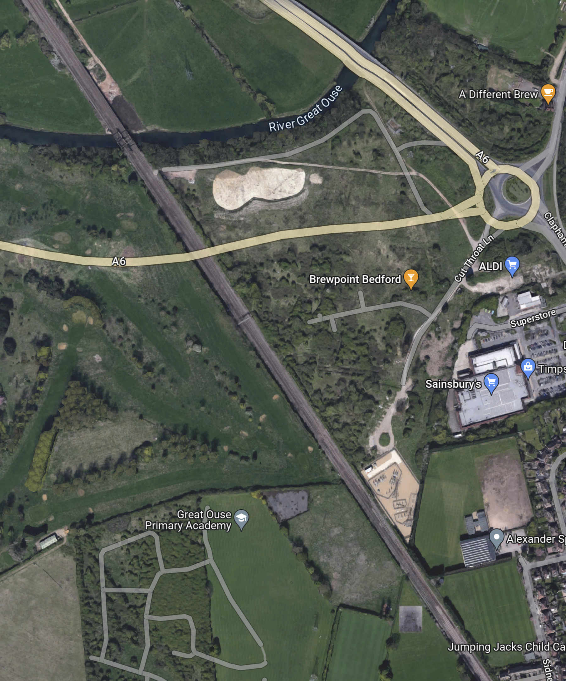
This Google Map shows the countryside to the North-East of the roundabout.
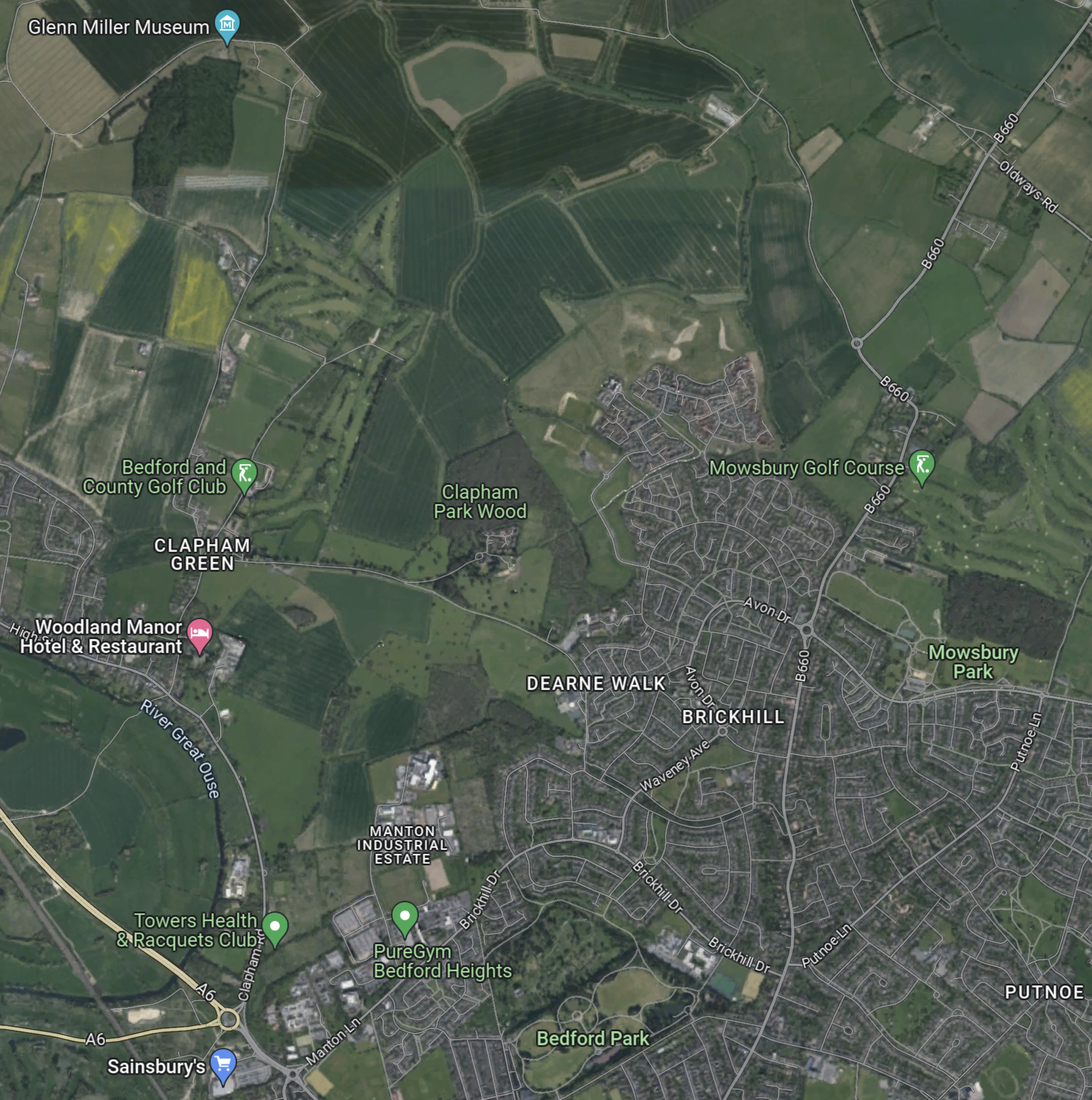
Judging by the colours of the fields to the North-East of the roundabout, I suspect, that a high proportion of the land is in one ownership.
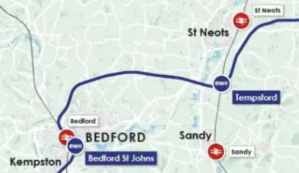
This map clipped from the East West Rail route map, shows the route between Bedford and the East Coast Main Line between St. Neots and Sandy stations.
This Google Map shows the area of the junction, that would connect the East West Rail tracks to the slow lines through Bedford station.
Note.
- The four-track Midland Main Line runs diagonally across the map.
- The beige-coloured diamond-shaped area by the railway is an electrical substation.
- There doesn’t appear to be many properties that would need to be demolished.
- There would need to be a viaduct over the A6.
- Once over the A6, the land seems to be in one ownership, which should ease building the railway across.
I feel it would be feasible, possibly with the use of a dive-under or flyover to connect the East West Rail tracks to the slow lines through Bedford station.

[…] East-West Rail: Through Bedford […]
Pingback by East-West Rail: Route For £5bn Bedford To Cambridge Link Announced « The Anonymous Widower | May 28, 2023 |
[…] East-West Rail: Through Bedford, I discuss how the East West Railway could branch away to the East from the Midland Main […]
Pingback by East West Rail: Could A New Rail Link ‘Tear Apart’ A Village? « The Anonymous Widower | June 14, 2023 |