Crossrail 2 Through East London
TfL have now published their preferred route for Crossrail 2 and in this post I will detail, how I think it will affect East London.
In this post, I will refer to the Crossrail currently being built as Crossrail 1 to avoid confusion.
The Progression Of Large Projects
I have been around the management of large projects for just over forty years, since I wrote my first software system for project management in 1973. From talking to project managers over that time, I have come to various conclusions, some of which will certainly affect the realisation of Crossrail 2.
The second system I wrote; Artemis, was very much involved in providing the necessary management for the development of North Sea Oil. Project managers told me many times, that things were getting easier and more affordable because of the development of bigger and better rigs, platforms and lifting capabilities. In parallel better techniques and methods were also being developed.
I was also told many times, that doing the second, third or fourth version of something like a concrete production platform, got easier each time, especially if substantially the same team could be used.
Crossrail 2 Is The Next In A Long Line
You could argue that Crossrail 2 will be the latest in a succession of large tunnelling projects under London, since the Second World War.
1 The Victoria Line was bored in the 1960s and I can remember seeing film of the digging of both this line’s tunnels and those at Dartford on the television. Pleasant and safe working, it was not! The BBC have posted a 1969 documentary called How They Dug The Victoria Line on iPlayer. It is a must watch!
2. The Jubilee Line was bored in two sections and was completed as we see it now in 2000. In some ways it is the first modern line and stations in London, where some the latter were built to be architectural gems, like some of London’s pre-war stations.
3. Around the turn of the millennium, the Docklands Light Railway was also extended with two branches and four tunnels under the Thames. I have a feeling that the tunnels of the DLR are the first under London to have wholly concrete as opposed to all or partly iron or steel linings. This video, shows the tunnel from Bank to Shadwell.
4. The London tunnels of HS1, were completed in 2007 to St. Pancras and were the first full-size rail tunnels to be dug under London, since the Snow Hill Tunnel opened in 1866.
5. Over the last few years, the forty-two kilometres of tunnels for Crossrail 1 have been bored under London. Like HS1’s tunnels they are full-size with overhead electrification and hopefully non-corroding concrete linings.
These five tunnels show a constant progression of larger and better-designed and constructed tunnels, that have been built by using a succession of bigger and better machines.
You also have a tremendous base of knowledge built-up by companies, engineers and tunnel workers, which as the recent documentary on the BBC about Crossrail showed, includes families and individuals, who’ve worked on all these five tunnels and a good few others besides!
It is my belief that when the politicians press the Go-button on Crossrail 2, the tunnels will make a painless progression under London as Crossrail 2 sneaks along the defined route.
Crossrail 1 And Crossrail 2 Compared
At first sight, both Crossrails would appear to be two large tunnels and train lines across London, from where lines fan out into the wider suburbs and nearby towns and cities at each end.
But there are some major differences.
Crossrail 1 is much more complicated than Crossrail 2. I suspect some will argue that if they were designing Crossrail 1 today, it would be very different to what is being built. For instance, of the major rail terminals in London, it only serves Liverpool Street and Paddington. I think that the design of Crossrail 2 cleverly builds on Crossrail 1 and helps get over some of the earlier line’s deficiencies.
Crossrail 1 was designed in an era, where passengers needed booking offices in stations. In the last couple of years, the growth in contactless ticketing is showing that booking offices can be closed and the space used for more productive purposes.
Crossrail 1 chose to have the major tunnel portals at Royal Oak, Pudding Mill Lane and Plumstead which would appear to be much more cramped and congested sites than those of Crossrail 2 at Tottenham Hale, New Southgate and Wimbledon.
In addition the surface sections of Crossrail 1 would appear to require a lot more work to bring them up to modern standards, than similar parts of Crossrail 2.
This efficient simplicity in the design will keep costs, time-scales and disruption during the construction phase of Crossrail 2, to a much lower level than Crossrail 1.
Crossrail 1 was skilfully threaded through the mass of tunnels under London, as the BBC documentary showed. The engineers could have gone deeper to get under the Northern Line at Tottenham Court Road but for some reason they didn’t. Perhaps going deeper would have meant difficulties and extra costs in the design of stations. Crossrail 2 will have to go deeper in the Dalston area to get under High Speed One and it will also have to pass Crossrail 1 at Tottenham Court Road. The tunnels of High Speed One are at a depth of 34 to 50 metres, so will we see Crossrail 2 bored across London below all the other foundations and infrastructure?
Crossrail 1 by virtue of its route through Central London has necessitated the expensive rebuilding of quite a few stations. It has also needed expensive new stations at Canary Wharf, Woolwich and Custom House. On the other hand, Crossrail 2 would appear not to require so many stations to be completely rebuilt, as the three central stations of Euston/St. Pancras, Tottenham Court Road and Victoria, will have been or are being rebuilt for other reasons and like Angel will have been rebuilt with provision to link to Crossrail 2. This will save time and costs in construction and probably mean that the disruption caused by Crossrail 2 would be much less than Crossrail 1.
The big station reconstruction will be Euston for HS2 and that will cause massive disruption to everything. Making sure the new station will connect easily to Crossrail 2, is a small problem in the grand scheme of things.
When Crossrail 1 opens, Whitechapel station will be the Jewel In The East. And this will not be just about how the station was designed and will look, but about the way it was built. Instead of digging down from the current station to the new Crossrail 1 tunnels, the thirty metres or so long shaft for the escalators and lifts is being dug upwards from the tunnels, using a coal mining technique called uphill excavation.
Currently the escalators in London with the highest vertical rise are those at Angel station, which rise twenty-seven metres, but this is a dwarf compared to some of the longest in the world. Crossrail 2 looks certain to break London’s record.
Crossrail 2 Could Be A Very Deep Line
I think we could see an unprecedented deep tunnel for Crossrail 2 across London, with tunnels in places over fifty metres below the surface. By comparison, Crossrail 1 is thirty metres deep at Whitechapel, which is not as deep as the Saint Petersburg metro , which has one station at a depth of eighty-six metres.
No major station rebuilding, the digging of stations from the tunnel up, longer escalators and other smaller improvements in techniques and machines , lead me to the conclusion, that the central section of Crossrail 2 will be one deep tunnel that excavates its way to the surface mainly direct into existing Crossrail 2-ready stations.
It will be a very cost effective and hopefully much quicker way of building a railway under London, which could cause a lot less disruption than the current Crossrail 1.
What Can Crossrail 2 Learn From Crossrail 1?
In my view from the outside, Crossrail 1 has been a pretty well-managed project. But it has skilfully used various ideas to make construction flow smoothly.
One big problem with large tunnelling projects is getting rid of all the spoil dug out of the tunnels. Crossrail 1 changed, the tunnelling strategy to remove excavated material by barge from Leamouth rather than the originally proposed complex conveyor system in Mile End.
To further use the spoil on the Wallasea Island Wild Coast Project was a master-stroke with a large dose of green.
It would appear that all three of Crossrail 2’s portals have good rail and/or water access to remove spoil. Will it be used to similar effect?
Crossrail 1 has been able to use archaeology for positive publicity to balance negative stories. I don’t think Crossrail 2 will be going through such rich veins of historical interest, but they will have to find a positive story to spin, that is not directly-related to the project.
Crossrail 1 had a major problem with the junction of the two eastern branches under Stepney. Instead of being heavy, they worked with the Stepney City Farm to create a solution acceptable to both parties. Crossrail 2 must work the same way in sensitive areas, like their proposed junction under Stamford Hill and the only new station on the line at Chelsea.
When people talk about Crossrail 1, the subject of disruption always comes up. In any plan for the design and construction of Crossrail 2, minimising disruption should be an important objective.
There is an entry entitled Controversy in the Wikipedia entry for Crossrail.
This is one of the things that is said.
There had been complaints from music fans, as the redevelopment of the area forced the closure of a number of historic music venues. The London Astoria, the Astoria 2, The Metro, Sin nightclub and The Ghetto have been demolished to allow expansion of the ticket hall and congestion relief at Tottenham Court Road tube station in advance of the arrival of Crossrail.
Crossrail 2 might well find that if they avoided unnecessary demolition, they might calm a few Nimbys.
What Can Crossrail 2 Learn From Other Metros?
From the little of Crossrail 1, I’ve seen in reality, and the masses of visualisations I’ve seen in places like the Crossrail 1 web site, the line strikes me as sound and solid, but not that adventurous in its approach to design and architecture. The stations with perhaps a couple of exceptions, do not have mould-breaking designs that characterise the Piccadilly and Jubilee Lines.
London Transport, the predecessor to Transport for London, was rightly famous for its design from typefaces and maps to stations and buses.
The rules still seem to be applied, but Crossrail 1 doesn’t seem to have extended them, in the way that the Victoria Line did and the Docklands Light Railway and the London Overground still are.
I recently went to Bilbao and saw Norman Foster’s award-winning Metro, which is very much a design-led system.
Crossrail 2 needs to find itself a modern extension of London Transport’s philosophy. They might perhaps start by stealing and Londonising the Bilbao’s fosteritos.
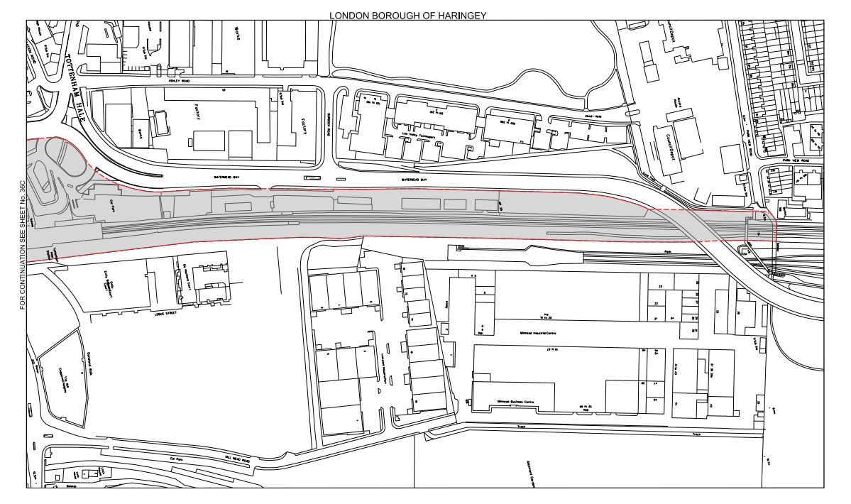
The Safeguarded Areas For Crossrail 2
Crossrail 2 has now firmed up the areas they want to be safeguarded from any possible development that might make building the line difficult.
Building.co.uk has also given a handy checklist of all the changes, that have been recently agreed.
The web site says this about safeguarding.
The updated route means that relevant planning applications in safeguarded areas will be referred to TfL for advice. If development interferes with Crossrail 2, either a compromise will be reached or the development will not be allowed.
It also says this about TfL and compulsory purchase.
TfL said it currently has no plans to compulsorily purchase properties along the route.
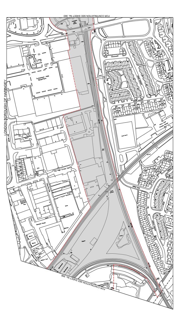
This page on the Crossrail 2 web site, explains all about safeguarded areas and acts as a key to the detailed maps.
The maps show the route of the line and how it effects individual areas, streets and houses.
The only problem is that the PDF maps are sometimes a bit on the skew, but hopefully they will be improved.
Crossrail 2 Through East London
I’m going to look at the area as it works it way through Hackney from Tottenham Hale to The Angel.
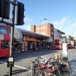
Tottenham Hale
The portal for the North Eastern branch is south of Tottenham Hale station, from where it goes up the West Anglia Main Line to Cheshunt, Broxbourne and Hertford East.
It is basically a good plan, as it would appear that the tunnel portal appears to be in an area with all the beauty and charm of East London after the Blitz. It is also located close to rail and water for the efficient and environmentally sound removal of tunnel spoil. Thames Water are even ceating the Walthamstow Wetlands in the area and may have innovative uses for some f the tunnel spoil.
This post entitled Crossrail 2 At Tottenham Hale, shows some maps and pictures and gives my thoughts in full.
South Tottenham/Seven Sisters
It looks increasingly like South Tottenham and Seven Sisters stations could share a double-ended Crossrail 2 station and become a major interchange between London Overground ‘s Gospel Oak to Barking and Lea Valley Lines, the Victoria Line, Crossrail 2 and National Rail services.
Such an interchange will support major development in a part of London, that desperately needs more housing, jobs and leisure and business opportunities.
This post entitled Crossrail 2 At South Tottenham/Seven Sisters, shows some maps and pictures and gives my thoughts in full.
The Junction Under Stamford Hill
The two northern branches of Crossrail 2, that go to New Southgate and Tottenham Hale respectively, would appear according to the safeguarding map on the Crossrail 2 web site, to join together under Stamford Hill.
It all seems to point to some clever strategy and alignments, that will allow the junction to be created deep underground, without disturbing anything or anybody on the surface.
This post entitled The Crossrail 2 Junction Under Stamford Hill, shows some maps and pictures and gives my thoughts in full.
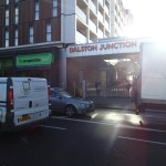
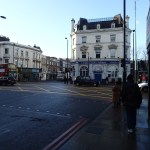
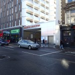
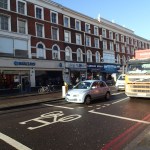
Dalston
If there is one area in East London that needs to see its existing transport links tidied up and new ones added, it is Hackney and Dalston.
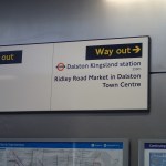
I have heard from Michele Dix of Crossrail 2, that they are looking at a double-ended station to serve both Dalston Kingsland and Junction stations. This was said.
We have been working closely with the London borough of Hackney on the early development of the proposals for how Crossrail 2 could ultimately serve Dalston. The work to date has been based around delivering a double-ended station, with one end being at Dalston Junction, and the other at Dalston Kingsland, thereby allowing the Crossrail 2 station to link to both existing stations. As Mr. Miller rightly points out, the distance between the existing stations is well suited to the 250m long platforms that will be required for the Crossrail 2 station, and the greater interchange opportunities to London Overground services also deliver significant benefits.
I believe that there is an opportunity to create a world class station that subtly brings together all the good elements of the area. The only necessary demolition would be the unloved Dalston Kingsland station. TfL have told me off the record, that Kingsland station will be replaced fairly soon.
This post entitled Crossrail 2 At Dalston, shows some maps and pictures and gives my thoughts in full about the stations.
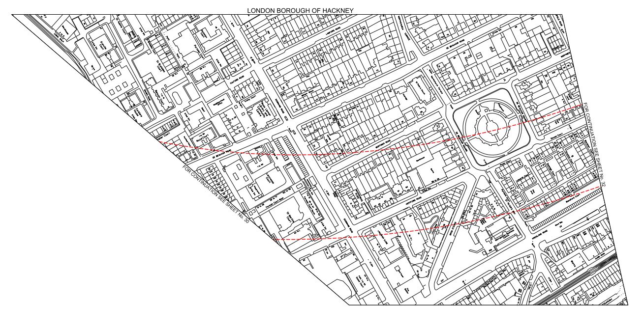
De Beauvoir Town
Looking at the safeguarding maps gives the impression that Crossrail 2 will swing under De Beauvoir Town before turning in the direction of the Angel and Kings Cross.
I think the only negative effect will be the possible use of the Bentley Road Car Park as a work site. Why else would it have been singled out for safeguarding?
This post entitled Crossrail 2 Under De Beauvoir Town, shows some maps and pictures and gives my thoughts in full.
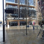
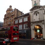
Angel
Just as at Stamford Hill, I feel that Crossrail 2 could effectively take a route through the hill at the Angel, well below the foundations of any building on top.
Angel station was rebuilt in the 1990s and this was after a route for Crossrail 2 was first safeguarded, so I suspect that creating a Crossrail 2 station at Angel would have been taken into account in the rebuilding.
I think the biggest decision to be made at the Angel, is whether the new station is double-ended with entrances on both sides of the hill or it just pops up into the current station.
As at Dalston, there is scope for the creation of an affordable world class station, which is subtly blended with the good buildings in the area.
How Will Crossrail 2 Be Built?
Crossrail 1 was built rather traditionally, in that the tunnels have been bored first and then the stations have been created. One thing that surprised me was that the surface sections, which have nothing to do with the tunnels were not prepared for Crossrail 1 a lot earlier.
This is probably because politicians dithered for years about giving the go-ahead for the line. More time and the better planning before tunnelling started would have enabled, the surface stations and possibly one or two of the Central London ones to be made Crossrail 1-ready.
Crossrail 2 has a big advantage over Crossrail 1, when it comes to the politics of the route and construction.
With the exception of a few stations in Hertfordshire and some in the boroughs of Elmbridge, Spelthorne and Epsom and Ewell, Crossrail 2 is a London project, where nearly everything is under the control of Transport for London and ultimately the Mayor. As the only work that will need to be done to outlying stations like Hertford East and Epsom, is bring the existing structures up to a modern standard, that will be capable of handling larger trains, I can’t imagine many complaints about Crossrail 2 from that quarter. It’s interesting to note, that now tunnelling is complete most of the negative stories from Crossrail 1 are about works on the surface section.
As construction of Crossrail 2 is unlikely to start for some years, the tunnelling can probably be scheduled to start after all of the stations have been upgraded to be Crossrail 2-ready.
When St. Pancras was rebuilt for High Speed One, provision was made for Thameslink, and in the same way when Euston and Victoria are rebuilt, I will be surprised if the designs don’t incorporate full provision for Crossrail 2.
Where I live in Dalston, which according to my letter says will have a double-ended station serving both Dalston stations, a TfL manager told me that Dalston Kingsland station is to be rebuilt in the next few years. So as Dalston Junction station was built with Crossrail 2 in mind, boring the tunnels through Dalston will only require threading two needles with the same thread simultaneously.
Probably the only station that needs to be created or rebuilt after or alongside the tunnelling is Chelsea Kings Road, which I suspect will be more politically difficult than any other.
A lot of other features of Crossrail 2, like trains, signalling and the design of tunnels, platforms, track and overhead line systems will probably be the same as Crossrail 1.
I would suspect that a decision will be made to use the same Class 345 trains for Crossrail 2, that are being built for Crossrail 1. The only difference would be that they will need to be dual-voltage to run on the third-rail lines in the south. But they could be built as a run-on to the trains needed for Crossrail 1 and possibly introduced early on the surface lines from Liverpool Street to Hertford North or Victoria to Epsom. I feel that a common weakness of Crossrail 1 and Thameslink, is that they are introducing new types of train as they are respectively building or updating the lines. By using a proven train type the risks associated with the project will be reduced.
So I think we will get a series of phases for Crossrail 2.
1. Introduce some of the new trains on some of the surface sections. New trains on these lines will be needed anyway, as some of the current ones are getting pretty tired and dated.
2. Rebuild Euston station for High Speed Two and make provision for connection to Crossrail 2. This phase alone is probably the most expensive and contentious rail project that will happen in London in the next few years and inextricably links the work for Crossrail 2 and HS2.
3. The current situation at Victoria station is difficult to say the least. Hopefully in 2018, it will have a much better Underground station, with two platforms at which Crossrail 2’s tunnellers will aim their boring machines.
4. Make all the existing stations on the surface lines, Crossrail-2 ready and to a modern standard. Much of the work on the surface sections will be done anyway under Network Rail’s Access for All program.
5. Bore the tunnels through Central London.
6. Fit out the tunnels and the new station platforms.
7. Build the station at Chelsea. This could be an independent last phase, as was Pimlico station on the Victoria Line
Obviously, there are other ancillary projects like the creation of a depot for the trains and as a lot of Phases 1 to 4 won’t interfere with Phases 5 and 6, it could be scheduled to be done at the same time, if planned properly.
As so many elements of Crossrail 2 should be the same as Crossrail 1, any good project manager would probably say costs would be saved by scheduling Crossrail 2 to follow Crossrail 1 by a couple of years or so.
Conclusion
I am optimistic that Crossrail 2 can set new standards of design, affordability, accessibility and neighbourliness as it is built across London in a much shorter time with less demolition and disruption than Crossrail 1.
Well! At least I’m very hopeful!
Crossrail 2 Under De Beauvoir Town
Crossrail 2 will go under De Beauvoir Town on its route through East London. This map from the Crossrail 2 web site shows the safeguarded area around De Beauvoir Square.
Crossrail 2 In De Beauvoir Town
The safeguarded area is shown with a red border. As with most of these maps, I’m posting, north is to the right and east is to the bottom. Hopefully, TfL will post some better and more understandable maps soon.
Crossrail 2 certainly won’t affect me, if I’m still around, as I live to the north-west of the square.
But as I explained in this post about Crossrail 2 At Dalston, the line will have to go deep to get under High Speed One, so I suspect that noise and vibration during construction and operation will be no worse than that line. I haven’t stood over High Speed One and tried to experience the trains, but does anybody know if they can heard or felt from above?
Incidentally, I can’t find any reports on the Internet about any problems.
As I also believe that stations will be built from the tunnel up, with all spoil being taken out through the tunnel and that as there seem to be no proposals to build any access shafts in the Dalston and De Beauvoir areas, I can see too much surface disruption being a problem.
To help matters there seems to be no plans to create massive stations as at Moorgate, Bond Street and Tottenham Court Road on Crossrail.
Hopefully Crossrail 2 will be a London’s first stealth railway!
Crossrail 2 At Dalston
In a post called An Opportunity For Dalston, I looked at how a double-ended station for Crossrail 2 might connect with both Kingsland and Junction stations. I felt it could bring major advantages to the area of not requiring any demolition, except for the unloved Kingsland station, much better interchange for passengers and improved pedestrians routes in the area.
I concluded that all was possible because the Victorians spaced the stations to enable a modern Crossrail station to fit in between. This map from the Crossrail 2 web site, shows the two stations and the safeguarded area.

Crossrail 2 In Dalston
The rail line at the far right or north is the North London Line with High Speed One beneath. The safeguarded area would appear to follow the Kingland High Road, but it does pass close to both stations.
I just thought it was logical and never envisaged that those working on the project would entertain a similar idea. But after contacting my MP, I have received a letter from Michele Dix, who is the Managing Director of Crossrail 2. This is a paragraph.
We have been working closely with the London borough of Hackney on the early development of the proposals for how Crossrail 2 could ultimately serve Dalston. The work to date has been based around delivering a double-ended station, with one end being at Dalston Junction, and the other at Dalston Kingsland, thereby allowing the Crossrail 2 station to link to both existing stations. As Mr. Miller rightly points out, the distance between the existing stations is well suited to the 250m long platforms that will be required for the Crossrail 2 station, and the greater interchange opportunities to London Overground services also deliver significant benefits.
Various factors will also drive the design of the Crossrail 2 station and the related Dalston Kingsland station at Dalston.
1. Crossrail 2 will have to get past and probably under High Speed One and the Dalston Curve, that takes the East London Line to Canonbury and Highbury and Islington. So it will be a deep line, where any stations will need escalators and/or lifts. These stations will also probably be built from the tunnel up, as parts of Whitechapel station are being built for Crossrail.
2. Could Dalston Kingsland station be designed as a station with entrances on both sides of Kingsland High Street, perhaps with a single island platform served by escalators and lifts?
3. Demolition of any quality buildings will stir up a lot of opposition.
4. There isn’t many places to put a work site, with the possible exception of the Car Park in Bentley Road which is in the safeguarded area.
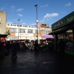
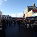
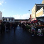
5.Surely the Ridley Road market could be improved by good design of the new stations.
I think there is a chance for a good architect with a bit of vision to create an innovative world class station.
Perhaps, we need our own versions of these distinctive fosteritos to access the Crossrail 2 station from the surface.


These were designed by Sir Norman Foster for the Bilbao Metro. Hence the name!
I also think that if the design is right, Crossrail 2 can sneak its way through Dalston, with little disruption and no demolition of a building worth saving.,
Why shouldn’t us plebs in Dalston have the best?
The Crossrail 2 Junction Under Stamford Hill
The two northern branches of Crossrail 2, that go to New Southgate and Tottenham Hale respectively, would appear according to this safeguarding map on the Crossrail 2 web site, to join together under Stamford Hill.
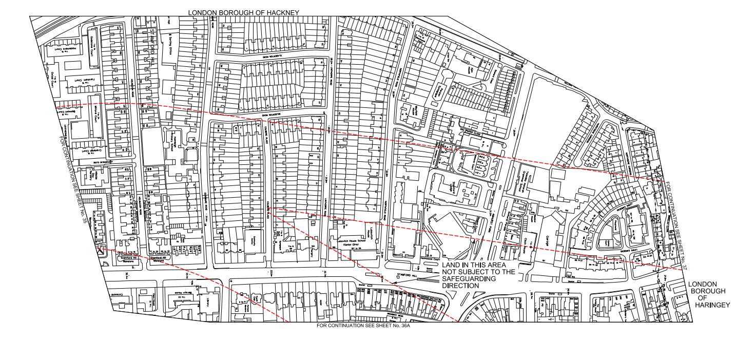
Crossrail 2 Northern Junction
This map is as it is presented on the Crossrail 2 web site, with north to the right and east to the bottom.
It looks like the junction will be in the area of Holmleigh Primary School. From the safeguarded area shown in red, it would appear that the New Southgate branch lines up north-south with the A10 road and the Tottenham Hale branch comes in from the north-east.
When the tunnels for Crossrail were built, a similar junction was needed to be built in Stepney. They obtained the access they needed by taking over part of Stepney City Farm. The work is described in a section in the Wikipedia entry.
In 2010 Crossrail took over approximately a third of the Farm’s site as part of the works to build a rail transport link connecting east and west London.[1] A map of the works as it affects the farm can be found in the annual report for Stepney City Farm Ltd from 2010_11(p. 6). This work is due to end in 2016 when the land will be returned to the farm. In January 2011 Crossrail opened up an archaeological dig at the construction site on the farm. A ventilation shaft next door to the farm leads down to the one of the largest mined caverns in Europe. In mitigation Crossrail worked closely with the farm to allow the existing animals to remain by making major improvements to the farm, especially the drainage of the fields and building a large barn for over-wintering the animals and a rural arts building to house the farm’s craftspeople
I visited in 2012 and was impressed at the good relationship between both sides.
So will a similar surface reconstruction be done with Holmleigh Primary School?
There may also be an alternative, in that the junction is just over a kilometre from the tunnel portal south of Tottenham Hale. So could a tunnel be dug from the portal and the cavern for the junction be excavated without digging down from the surface? The New Southgate branch would then go straight through the cavern on its way to Dalston, Islington and beyond.
I’m no tunnelling expert, but surely instead of digging down to create the cavern, digging in from the side is not that different.
I do think though, that the junction has been arranged deliberately under Stamford Hill, which will surely mean it is deeper underground than it otherwise would be. This must reduce any noise and vibration at the surface.
Remember too, that High Speed One was dug through this area a mile or so to the south. Wikipedia describes the digging of the tunnels like this.
The twin tunnels bored under London were driven from Stratford westwards towards St Pancras, eastwards towards Dagenham and from Dagenham westwards to connect with the tunnel from Stratford. The tunnel boring machines were 120 metres long and weighed 1,100 tonnes. The depth of the tunnels varies from 24 metres to 50 metres.
So the engineers will only probably be repeating something that was completed in 2007. But now they are more experienced and the machines are probably larger and more powerful.
It would be a major difference in the disruption caused by Crossrail 2 compared to Crossrail, if the line could be bored through Stamford Hill without any large construction shafts having to be dug from the surface.
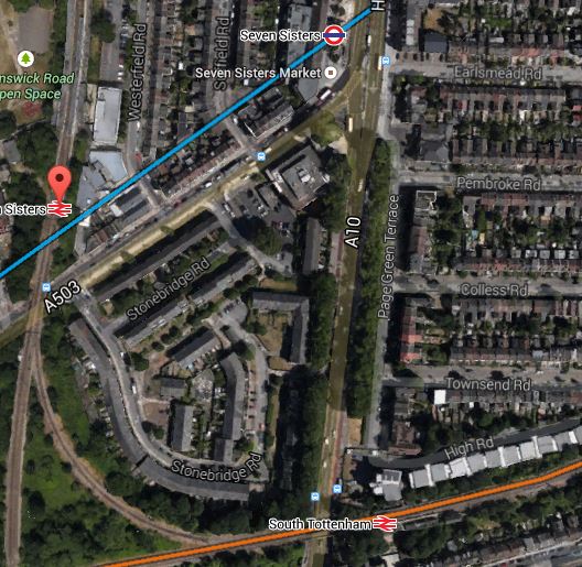
Crossrail 2 At South Tottenham/Seven Sisters
In this post, I speculated that South Tottenham and Seven Sisters stations could share a double-ended Crossrail 2 station. This is a map taken from the Crossrail 2 web site.
Crossrail 2 At Seven Sisters
The two rail lines are the Gospel Oak to Barking Line (GOBlin) going across the map and the Lea Valley Line into Liverpool Street via Hackney Downs going down. This Google Earth image gives another view.
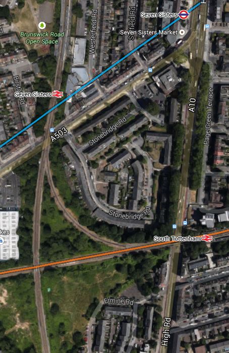
South Tottenham And Seven Sisters
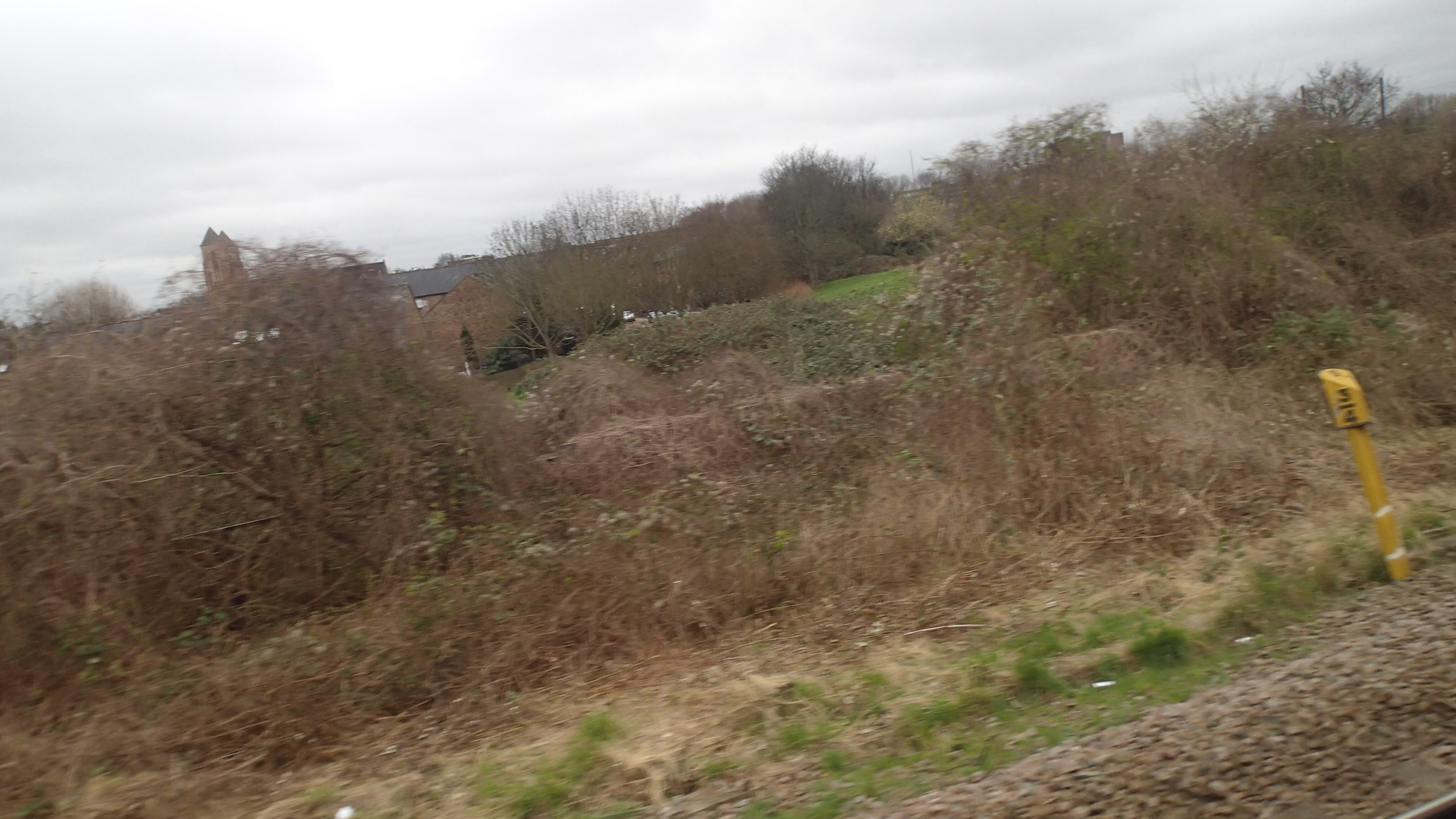
The orange line is the GOBlin and the blue one is the Victoria Line. Note the area south of the GOBlin, which has been safeguarded. Could this be used for a shaft to access the tunnels or help to build a large double-ended station? I took this picture of the area from a train going to Barking.
Safeguarded For Crossrail 2
It would probably be in a better state after Crossrail 2 had reinstated the land after use.
At least the distance between Seven Sisters and South Tottenham stations at about two hundred metres or so, would be pretty compatible with the length and size of a Crossrail-sized train and platforms.
So I come to the conclusion, that Seven Sisters station will built as a double-ended station and be a major interchange between London Overground ‘s Gospel Oak to Barking and Lea Valley Lines, the Victoria Line, Crossrail 2 and National Rail services. Such an interchange will support major development in a part of London, that desperately needs more housing, jobs and leisure and business opportunities.
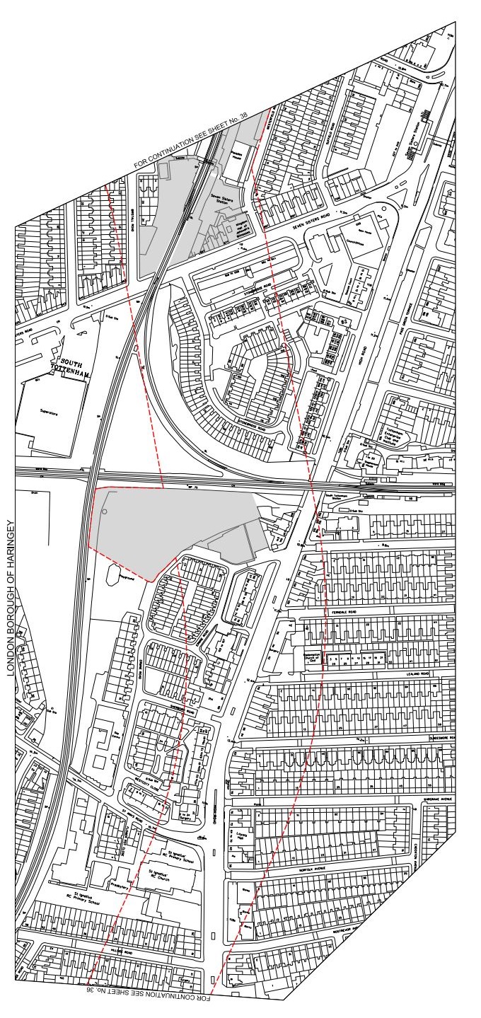
Crossrail 2 At Tottenham Hale
As regards Tottenham Hale this has been said recently.
A new tunnel entrance south of Tottenham Hale station to take the line from above to below ground
This is Crossrail 2‘s map of the area, which I obtained from this page on the Crossrail 2 web site.
Crossrail 2 At Tottenham Hale
Tottenham Hale station is at the top of the map and the Lea Valley Line to Liverpool Street and Stratford goes down the map. The other railway going across the map is the Gospel Oak to Barking Line. Note the curve that makes a triangular junction that encloses a large amount of safeguarded land, which is shaded and bounded in red. This is a Google Earth image of the area south of Tottenham Hale station.
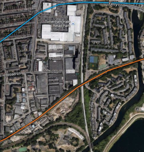
South Of Tottenham Hale
I’ve tried rather badly to match the two maps, but it does show that there would appear to be enough space to fit a tunnel portal into the area. This is a detailed look from Google Earth of the eastern end of the land enclosed by the triangle of lines.
Industrial Land At Tottenham Hale
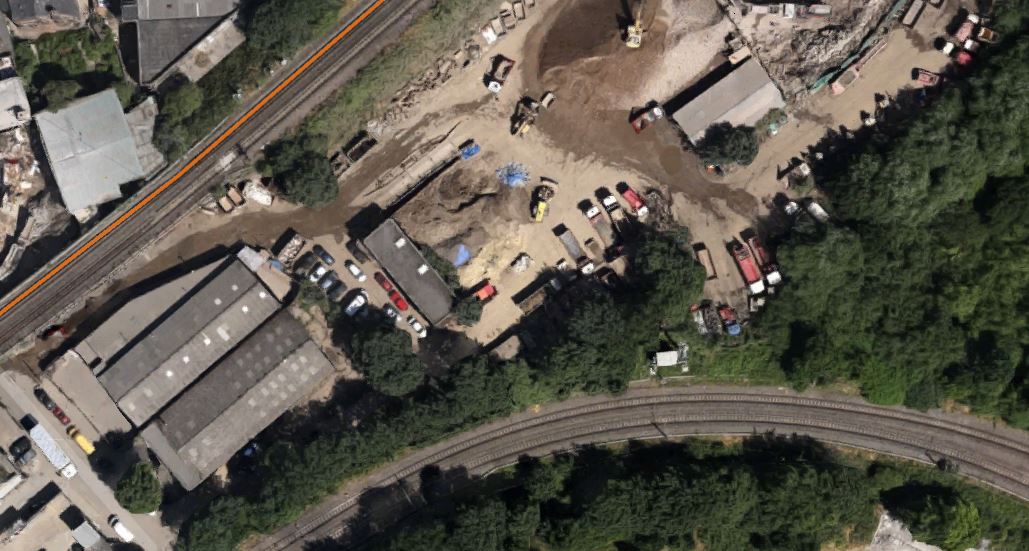
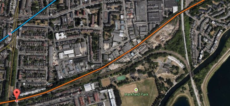
As the safeguarded route moves away to the west from here to join the New Southgate branch of the line, it is probably in this downmarket industrial area which appears to be a depot of some sort, that the Crossrail 2 tunnels will emerge. I actually put up a post entitled Could This Be Where Crossrail 2 Is Dug?, which shows this area.
As a site from where to build the tunnels, it has a lot to recommend it.
1. It is well served by railways and the River Lee and the related substantial canal, so it would be unlikely that there would be many heavy lorries associated with the construction.
2. There is little housing in the area and it would appear few or even none will be needed to be demolished for the construction. The only sensitive area would possibly be Markfield Park with the recreational developments and steam engine by the River.
3. There is plenty of space to create a surface junction with perhaps a flyover for operational reasons to connect to the Lea Valley Lines. On the other hand, the tunnels may turn north underground and just emerge alongside the Lea Valley Lines.
4. Perhaps crucially though, Tottenham Hale station, the Tottenham Hale Retail Park and the surrounding area are the subject of a big development to create almost a new town centre in South Tottenham, which I talked about in this post. I doubt this development will not be built to be totally Crossrail 2 ready.
Looking at these maps in detail, I can’t help feeling that in a few years time, there will be something special in this area, given that Thames Water and Waltham Forest Council are developing the reservoirs to the south-east of Tottenham Hale station into the Walthamstow Wetlands.
Some maps have shown Crossrail 2 surfacing north of Tottenham Hale station. This Google Earth image shows the area.
North Of Tottenham Hale Station
The strange structure underneath the lines through the station is the tunnel portal for the Victoria Line, where trains go to and from the Northumberland Park Depot.
I think the image shows why the Crossrail 2 tunnel portal can’t be north of the station.
Could This Be From Where Crossrail 2 Is Dug?
As I trundled along the Gospel Oak to Barking Line (GPBlin) between Blackhorse Road and South Tottenham stations, I took these pictures.
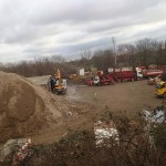
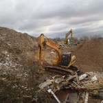


As the reservoirs to the east of all this dereliction are going to be turned into the new Walthamstow Wetlands, could this be used as the site from where Crossrail 2 is dug?
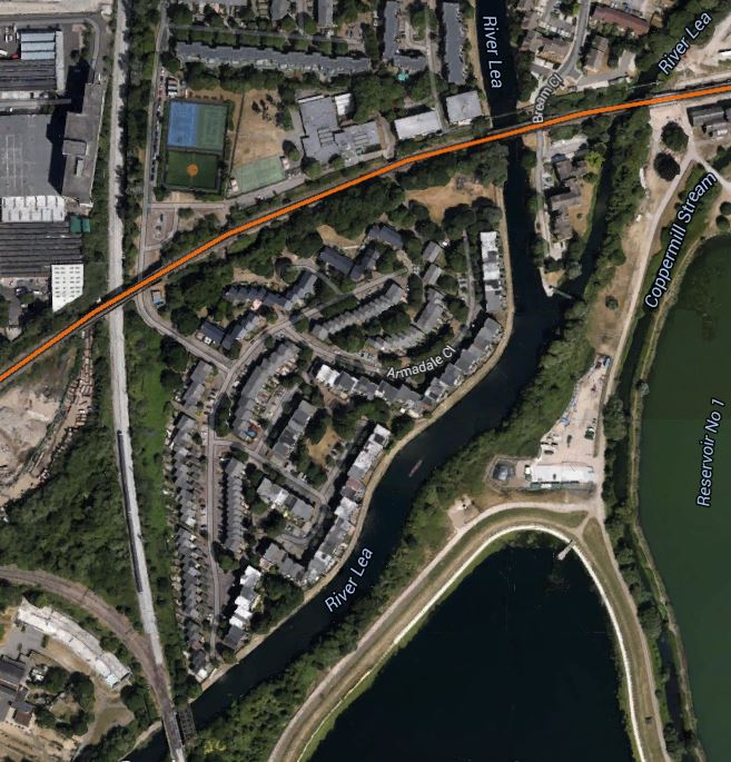
This image from Google Earth shows the area.
East Of SouthTottenham Station
The orange line is the GOBlin and the light blue is the Victoria line. The red arrow indicates South Tottenham station.
The area I photographed lies south of the GOBlin. Note how it is bordered by railways, with the West Anglia Main Line in the east and the double-track curve that connects the two lines in the south. Slightly to the south of where the two lines join at South Tottenham Junction, the River Lee runs close to the site in a south-westerly direction.
So the spoil from the tunnelling could either be used to help create the new wetlands or barged down London’s other navigable river to the Thames. When I worked for Enfield Rolling Mills at Brimsdown in the early 1960s. their supplies of copper wirebars were delivered by barge from London Docks using this route. In those days, the river wasn’t as clean as it is now, and there was quite a lot of commercial traffic.
Britain From Above has some wonderful pictures of the area from the 1930s here. This image shows the River Lee as it goes under the railway.

This modern picture from Google Earth gives a good comparison.
Note how the tracks on the West Anglia Main Line have been reduced from four to two by the closure of the easterly pair of tracks. Proposals for the line include four-tracking from just south of here to Broxbourne.
The large East Warwick Reservoir is just off the picture to the right and the timber yard is now housing.
The GOBlin is shown in orange on the second image and you can just pick it out on the 1933 aerial photo.
An Opportunity For Dalston?
Look at this map of the rail and Underground lines in East London going north around Dalston Junction.
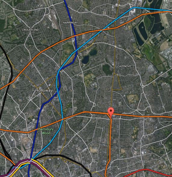
Map 1. Rail Lines Around Dalston
The light blue,dark blue, black and orange lines are the Victoria, Northern and Piccadilly lines and Overground respectively. Stations to note are.
1. Dalston Junction which is marked by the red arrow.
2. Tottenham Hale at the top right and is shown in more detail on this larger scale map.
Map 2. Tottenham, Seven Sisters Area
3. Seven Sisters is the next station as you come south-westerly from Tottenham Hale and is marked by both tube and national rail symbols on the second map.
4. Below and slightly to the right of Seven Sisters is South Tottenham on the Gospel Oak to Barking Line.
5. On the original map, Angel is towards the left at bottom, approximately south west from Dalston Junction. This is a larger scale map of the area.
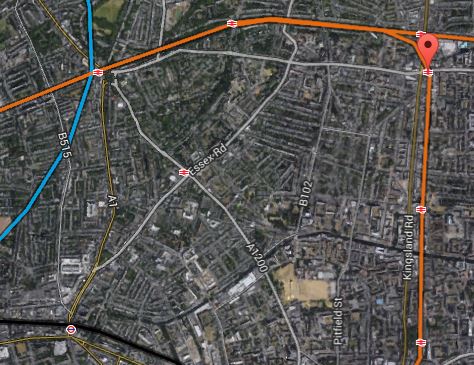
Map 3. Angel To Dalston Junction
In this map, Angel is close to the bottom left. Note how you can see Highbury and Islington, Essex Road and Canonbury stations north of the Angel and Haggerston and Hoxton stations south from Dalston Junction on the East London Line.
Roads, like Essex Road, Balls Pond Road and New North Road are visible, as is the Regent’s Canal.
From the limited information that has been published about Crossrail 2, I believe that the New Southgate branch will pass under Seven Sisters and very close to South Tottenham before meeting the other branch from Tottenham Hale somewhere near Walthamstow Marshes shown on Map 2 and in detail below.
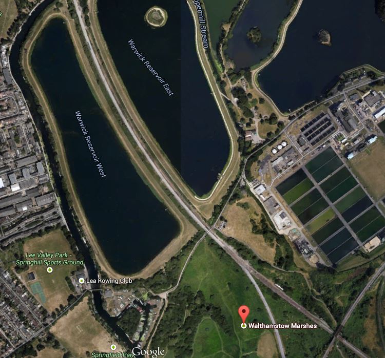
Walthamstow Marshes
The map shows how Walthamstow Marshes could also make an ideal site from where to build the tunnels.
1. It is a spacious site with good road access, where the running tunnels to New Southgate, Tottenham Hale and Central London may all meet.So if a big deep shaft could be dug here, as Crossrail 1 did on the Limmo Peninsular, it could be used to launch and retrieve the tunnel boring machines (TBM). Looking at how far the TBMs went from Limmo to Farringdon on Crossrail 1, which is a distance of 8.3 km, I suspect that their successors on Crossrail 2 could go a long way under London and given the right ground conditions, perhaps even all the way to Wimbledon.
2. The site is close to the West Anglia Main Line and surely this could be used to bring in heavy equipment and materials.
3. Around the west of the Marshes, the map shows the River Lea, which could be another transport artery into the site.
4. As there are several reservoirs there is plenty of raw material for the drink that builds the railways; tea.
5. The one problem is that the Marshes are a Site of Special Scientific Interest. But having seen how Crossrail 1 handled the potentially tricky situation at Stepney City Farm, I suspect that if they follow similar rules, then an amicable solution can be found.
From the junction near Walthamstow Marshes, Crossrail 2 has said that the line will go to the next two stations; Dalston Junction and the Angel.
This would mean that the line would run roughly north east to south west from the junction of the two branches of the line to the Angel. Whether it is aligned under a road, a railway or even the Regent’s Canal, would obviously be a matter for the engineers.
On this map, I have drawn the possible route in pink.

Map 4. Possible Crossrail 2 Route At Dalston
Not shown on Map 4 is the line of the Channel Tunnel Rail Link, which runs in a tunnel underneath the North London Line.
I believe that it might be possible to dig the tunnel so that it passes underneath both Dalston stations, despite the presence of the Channel Tunnel Rail Link. In this respect, I have great faith in the ability of London’s finest hole diggers to navigate correctly and not connect New Southgate and Tottenham Hale to France.
One of my Google Alerts today, picked up this article from the Hackney Gazette, entitled Crossrail 2 threatens another Georgian terrace in Dalston.
As someone who lives close to Dalston Junction and whose roots are very much in the area, I want what is best for the local area. I also have my own list of buildings that should be saved.
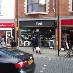
So I went down to Dalston Junction and took pictures of the area between and around the two stations, starting just south of Dalston Junction and then walking north, picking up some shopping in Sainsburys and having a coffee in fed on the way.


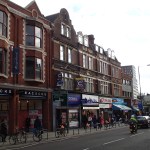

Quite frankly, I think that for most of the buildings, only some of the frontages and some interiors like that of the former eel and pie shop, are worth saving.
But as my pictures show the two main problems in the area are the movement of large volumes of both vehicular traffic and pedestrians.
As I don’t drive, I have no personal interest in the former, if the buses still get through.
But I regularly walk up and down the Kingsland Road to Sainsburys, Boots and the Market. The pavements are a nightmare, as they are narrow and very busy.
The new Dalston Junction part of the solution to the walking problem has been built, with a draughty but rain-free passage between the two station entrances.
So wouldn’t it be nice, if this passage could extend up to at least Dalston Kingsland station? If it did it might be a traffic generator for the underused bus station, which could do with more routes. A passage would of course make the interchange between the two stations easier.
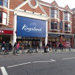
At least the Kingsland Shopping Centre is proposed to be redeveloped to a more modern layout. Pictures in the link, give hope that there could be a traffic-free route from at least Kingsland station to Dalston Lane, which somehow has to be crossed. The current arrangements of a light-controlled crossing works, but could be improved upon.
The walking link between the two stations will hopefully be improved when the new Dalston Kingsland station is rebuilt, as someone from London Overground indicated to me it will be, a few months ago.
Could something bigger be rolling through Dalston?
Something is and it’s called Crossrail 2.
In one of the pictures it shows a sign at Dalston Junction station, showing that it is 250 metres between the two stations.
I will make an assumption here, that Crossrail 2 will use the same Class 345 trains and platforms matched to their size as Crossrail 1. I think it would be a reasonable assumption to make, as this would mean a common fleet and a lot of repeated platform design.
And how long are the platforms on Crossrail 1?
They are 260 metres long.
So would it be possible to fit a double-ended station for Dalston, that avoided the Channel Tunnel Rail Link and was connected to the platforms at the two Dalston stations at each end?
I don’t know as I haven’t got the detailed dimensions, but the last time London Overground threaded a rail line under Kingsland High Street, they managed it without mishap. If the station followed the traditional hump-backed design, then it would rise up to the platforms, which would be deep under the area and could be connected to the two stations by escalators and lifts. If the Crossrail 2 station had a wide centre platform between the tracks, then it could also be used by passengers transferring between the two stations. The platforms would have platform edge doors, so there would be no safety or draught issues. It might even be possible to make the central Crossrail 2 platform wide enough for a cafe, kiosks and an information office.
The design would have advantages for passengers.
1. It would give full interchange between the North London Line, East London Line and Crossrail 2, which would make so many more journeys possible, like for example Turnpike Lane to Homerton or Shoreditch High Street to Ware, with just a single step-free change.
2. Dalston Junction is the first station on Crossrail 2, after the two northern branches have joined, so just as at Whitechapel on Crossrail, you could come down one branch walk across the platform, perhaps picking up a coffee on the way, and get on a train up the other branch.
3. In the case of an interchange between either the North or East London lines and Crossrail 2 it would be up or down on an escalator or in a lift, but between the East and North London Lines, you would have a nearly 250 metre walk as well. But the walk would be easier and more pleasant than the current one on the surface.
4. Would the ability to transfer at Dalston between the North London Line and Crossrail 2 serve Hackney sufficiently well, so that the need for the possible Hackney branch of Crossrail 2 could be delayed?
There could possibly be some advantages to Dalston
1. As the interchange between the East and North London Lines is now a safe walk out of the weather and traffic, would this be a good enough connection to make it unnecessary to reopen the Dalston Eastern Curve, thus releasing this land for something better in perpetuity.
2. But the great advantage of this plan to Dalston, is that it doesn’t require any demolition of buildings on the surface, except for the unloved Dalston Kingsland station.
3. Dalston Junction station already has a building that is big enough, but could you do away completely with buildings at Dalston Kingsland station? You might just have escalators ending level with the street and a simple glass front like the new Tottenham Court Road tube station. The money saved on the building could be used to add extra escalators and lifts. Perhaps on both sides of Kingsland High Street.
I probably have all this totally wrong, but I believe that Crossrail 2 could be a bigger opportunity for Dalston, if a double-ended station is built to serve both Junction and Kingsland.
It is only possible because the Victorians had the foresight to build the two Dalston stations the same distance apart as the length of a Crossrail station.
Crossrail 2’s Tunnels Under London
Length And Stations Of The Tunnels In Crossrail And Crossrail 2
Crossrail has been designed with 42 km of rail tunnels under London., with seven new underground stations at Paddington, Bond Street, Tottenham Court Road, Farringdon, Liverpool Street Whitechapel and Woolwich. In addition there are new above ground stations at Canary Wharf and Custom House.
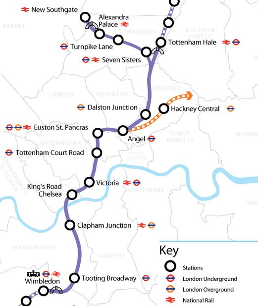
Crossrail 2 in contrast has according to this article in the Guardian has 35 km or as they say 22 miles of rail tunnels. According to this route shown on the Crossrail 2 web site, it will have underground stations at Alexandra Palace, Angel, Clapham Junction, Dalston Junction, Euston/St. Pancras, Kings Road/Chelsea, Seven Sisters, Tooting Broadway, Tottenham Court Road, Turnpike Lane and Victoria.
The Crossrail 2 Central Tunnel
I created this map from the one shown on the route page.
Crossrail 2 Central Tunnel
Note that there are three portals at Tottenham Hale, New Southgate and Wimbledon.
Thoughts About The Routes
Not much has been published about the finer details of the routes but some things stand out.
1. The two Northern branches to Tottenham Hale and New Southgate would appear to split around Coppermill Junction, which is close to a sizeable area of undeveloped land, that could probably serve the same purpose for Crossrail 2, as the Limmo Peninsular access shaft did for Crossrail.
2. The New Southgate branch, would appear to roughly follow underneath the route of the old Palace Gates Line. Logic says that if you tunnel along the line of an old raulway, which for much of its route, has not been built on, you can’t interfere with many buildings.
How Deep Will The Tunnel Be?
Crossrail is deep under London. This article on the Crossrail web site says that the construction shaft at the major tunnel junction at Stepney Green, has a depth of 34.5 metres. As at Tottenham Court Road station, they threaded the tunnels through within a few centimetres of the Northern Line, which is generally one of the deeper Underground lines, I suspect that there is a vast network of tunnels that have to be avoided., which in addition to the tube lines, include the Northern City line, HS1 and at least one newly-built electricity tunnel.
So would the designers of the tunnel make it deeper than all the others? The Wikipedia article on HS1 says this about the tunnels.
The depth of the tunnels varies from 24 metres to 50 metres.
As Crossrail 2 will cross HS1 in the Dalston area, it will have to go either above or below this line. I know very little about tunneling, but I do think that a deep tunnel under London at around or dseeper than 50 metres is possible.
The main problem with deep tunnels is connecting them to the stations above, so being able to do this in an affordable and acceptable manner to passengers, may limit the depth to which the tunnels go. I use Angel station with its long escalators that rise 27 metres regularly and I would prefer that an alternative solution was found, if stations on Crossrail 2 were deeper. Perhaps large modern and very fast lifts could be used, as these make the station totally step-free.
I don’t know whether this has been done on Crossrail, but when they built the Victoria Line they arranged that stations were hump-backed, so trains would slow down as they arrived in the station and accelerate away down the hill. Wikipedia says this.
Each platform constructed specifically for the Victoria line from new is 132.6 metres (435 ft) long. The line has hump-backed stations to allow trains to store gravitational potential energy as they slow down and release it when they leave a station, providing an energy saving of 5% and making the trains run 9% faster.
This sort of technique, which now is probably a lot easier using modern tunnel boring machines that can be precisely controlled, will probably be used on Crossrail 2 to in addition to the energy savings, bring the station platforms closer to the surface, which should make construction easier and more affordable.
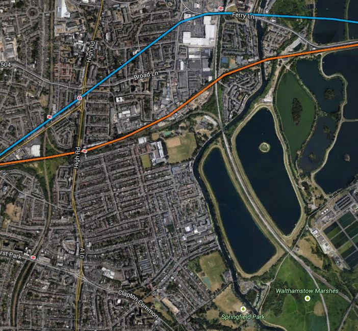
The Tottenham Hale Portal
This Google Earth map shows the area south of Tottenham Hale station.
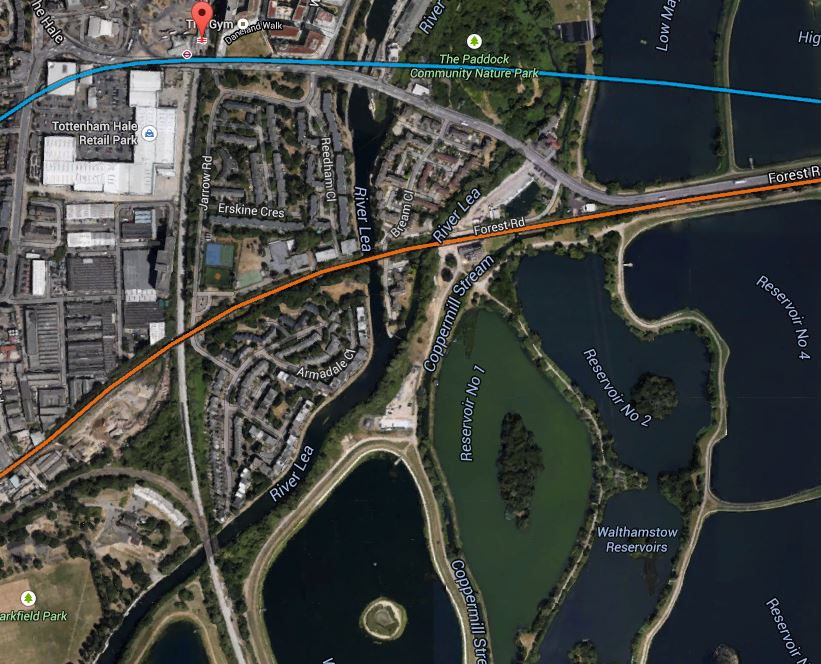
The Area South Of Tottenham Hale
Note :-
1. The West Anglia Main Line running in a north-south direction, from the red arrow that marks the station, which will be connected to Crossrail 2.
2. The blue line is the route of the Victoria Line.
3. The orange line is the Gospel Oak to Barking Line (GOBlin).
This is probably an ideal place to build a tunnel portal, as if it can’t be squeezed in alongside the West Anglia Main Line, there is a lot of open land in the area, that is only occupied by water, wildlife and illegally-dumped refuse.
There are plans to add extra tracks to the West Anglia Main Line as is detailed in Wikipedia. This is said.
It seems likely that two tracks will be built alongside the line to Cheshunt as part of Crossrail 2. Intermediate stations from Tottenham Hale will transfer to Crossrail 2 releasing capacity on the main line for additional trains.
A prudent Network Rail, would probably add these extra tracks, even if Crossrail 2 wasn’t to be built for say fifty years, as it would speed up services to Cambridge and Stansted.
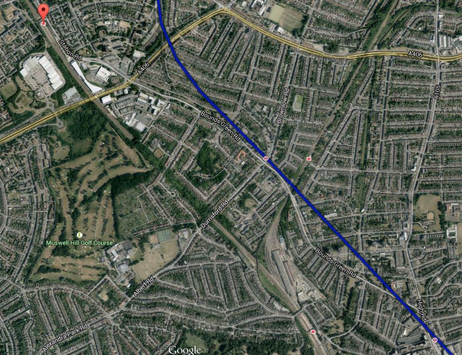
The New Southgate Portal
This Google Earth map shows the area south of New Southgate station, which is the destination of the branch of Crossrail 2
The Area South Of New Southgate Station
Note :-
1. The station is indicated by the arrow at the top, with the East Coast Main Line running roughly north-west to south-east.
2. The blue line is the Piccadilly Line.
I know the area well and it is one of the worst sections of the North Circular Road, being restricted by a railway bridge with two-way traffic. This enlarged view shows the crossing of the East Coast Main Line and the North Circular Road better.
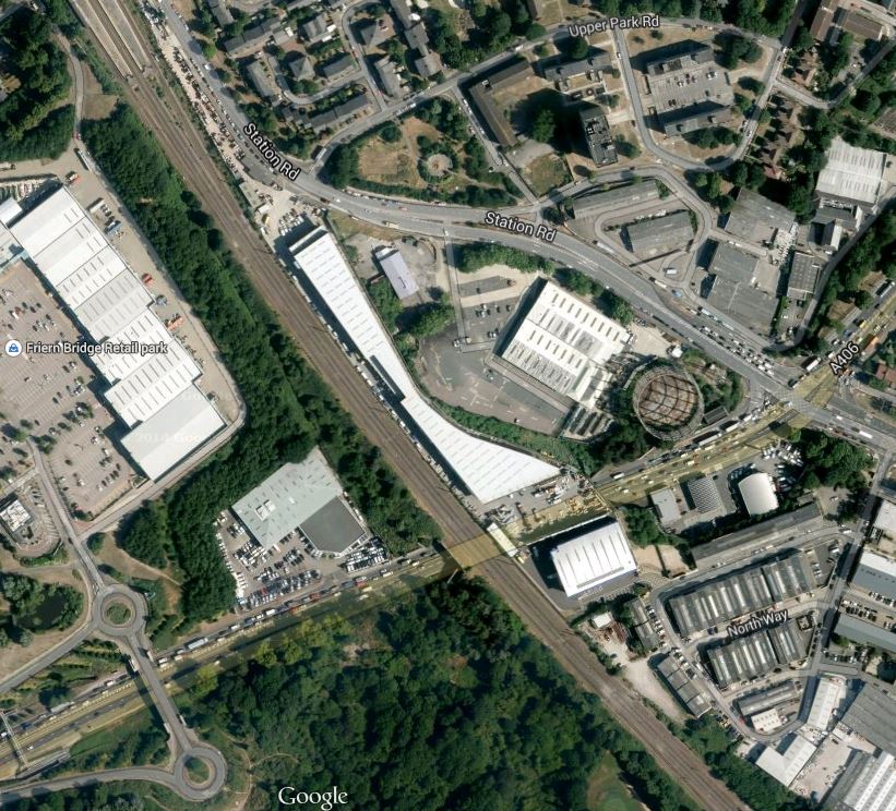
The East Coast Main Line Crossing The North Circular Road
In this view you can just see the platforms of New Southgate station at the top. The East Coast Main Line runs down the image, with the North Circular Road and the stalled traffic going across. The green area at the bottom is owned by the North London Waste Authority, who intended to build an incinerator there, But that idea seems to have been abandoned. I’m sure Transport for London can find a better use for it. This picture shows the bridge taking the Railway over the North Circular Road.
The Railway Bridge At New Southgate
I can’t imagine English Heritage rushing to save it, if Network Rail decided to replace it.
When I first heard that Crossrail 2 was being planned as going to New Southgate, I visited the station and wrote this post, in which I said this.
Looking at the map, as New Southgate station is close to the North Circular Road and is generally surrounded by industrial estates, although there is some housing, there would be scope to probably create a really good transport interchange with a large bus station and perhaps even a tram line along the North Circular Road from Brent Cross to Enfield or Southgate. If nothing else, all of the work should result in the notorious bottleneck on the road being eased.
I am still enthusiastic and very much feel that a very innovative station and transport interchange could be built here, especially if combined with putting the road in a concrete tunnel with development on top, as was done at Hatfield.
The Wimbledon Portal
This Google Earth map shows the railway line between Wimbledon station almost to Earlsfield station.
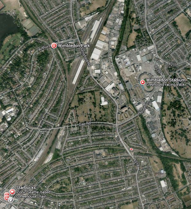
Wimbledon To Earlsfield
Note :-
1. Wimbledon station is at the bottom left and the South Western Main Line to Earlsfield runs at perhaps twenty degrees to the right of the vertical, with Earlsfield just off the image.
2. Near the top of the image level with Wimbledon Park station is Wimbledon Traincare Depot.
There would appear to be several places where the tunnels could emerge alongside the line, with somewhere around the Traincare Depot a prime candidate.
Thoughts About Stations
These are just a series of random thoughts about the stations and will be added to as time progresses.
1. Seven Sisters
As I was writing this I saw how the New Southgate branch followed the old Palace Gates Line between Alexandra Palace and Seven Sisters stations.
Look at this image showing the proximity of Seven Sisters and South Tottenham stations.
Seven Sisters And South Tottenham Stations
The blue line shows the route of the Victoria Line at Seven Sisters, which is a double-ended station of a unique and unusual design.
The orange line is the GOBlin and you can also see the curve that allows trains to pass between the GOBlin and the Lea Valley Line.
If I am correct that the junction between the two northern branches is close to Coppermill Junction, then the line of the tunnels will virtually pass under South Tottenham station in a south-east to north-west direction, probably perpendicular to the Victoria Line.
I think, if the tunnels were correctly aligned then a double-ended station could be created for Crossrail 2, where the south-eastern end could be connected by escalator and/or lifts into South Tottenham station and the north-western end could be connected into Seven Sisters station. I met an engineer who’d been in one of the new Crossrail stations and she said that to accomodate the 200 metre long Class 345 trains, the stations are massive. I can’t believe that Crossrail 2 stations will be any shorter, as they will surely use similar, if not identical trains.
One point to note, is as Crossrail 2 and the Victoria Line would cross at right-angles at Seven Sisters, the Crossrail 2 tunnels could be bored to be close underneath the bottom of the Victoria Line platforms, so that this connection, wouldn’t be a massive deep excavation, which required long escalators and lifts.
Only Transport for London would know if such a connection would be worthwhile. But I have a strong feeling that if the Gospel Oak to Barking Line was connected to Crossrail 2, the connection would be very beneficial.
2. Dalston Junction
If a double-ended station might be possible at Seven Sisters, it’s certainly possible to create one in Dalston, to connect Kingsland and Junction stations. Especially, as Dalston Kingsland station is going to be rebuilt in the next few years.
3. Euston/St. Pancras
This will be a large double-ended station and hopefully while they’re building the station, they sort out the dreadful maze of tunnels under Kings Cross and St. Pancras, which were obviously designed by an architect, who liked complicated knitting.
You have to remember that Euston to St. Pancras is not a short walk and at a rough measure it is not much short of 800 metres. So if you get in at the wrong end of the train, you’ve got a long walk.
It’s when I see messes like the Underground and Thameslink connections at Euston, St. Pancras and Kings Cross, that I feel we need to do something extremely radical.
I also feel that modern large capacity high speed lifts may be a solution to getting a simple and efficient solution, in getting up and down from a deep level railway.
4. Angel
I had a few thoughts about this station in this post.
I won’t repeat myself.
5. Tottenham Court Road
If Crossrail works out as the designers hope, we might be able to say more of the same here.
Tottenham Court Road is a bit like that trick when a magician folds a pretty young lady into a box and then puts several swords through the box without drawing blood.
Except that there are four train lines instead of swords.
6. Victoria
Victoria will be a tricky station to get right.
I also think that other developments in the next few years might make any speculation here redundant.
The lines south of the Thames are not very logical and were probably designed by the grandfather of the architect, who designed the pedestrian tunnels at Kings Cross/St. Pancras.
Hopefully Thameslink will make this better with the central stations from St.Pancras to London Bridge feeding passengers into a train every three minutes. If it does what it says on the tin, then Victoria might become a less busy station. But I doubt it!
What would help is to tie more and more services into cross-London services, where this was feasible. The East London Line could take fifty percent more trains and the West London Line is seriously underutilised.
Crossrail 2 itself might even help the situation at Victoria, as passengers will use it to get to Clapham Junction for their long distance train.
And I would also support Lord Adonis’s position of more orange trains.
7. Kings Road/Chelsea
Chelsea station or whatever it’s called is controversial. All the residents actually want is more space to park their tractors.
Seriously though, how about a station running under the Kings Road with lifts every fifty metres or so.
8. Clapham Junction
Clapham Junction will hopefully be served by the Northern Line Extension, by the time they start building Crossrail 2 and this might mean that some of the more desperate reasons for adding Clapham Junction to the tube network are partly satisfied.
As Clapham Junction is an immense station, a big underground station could be built that almost accesses all of the current platforms through individual connections.
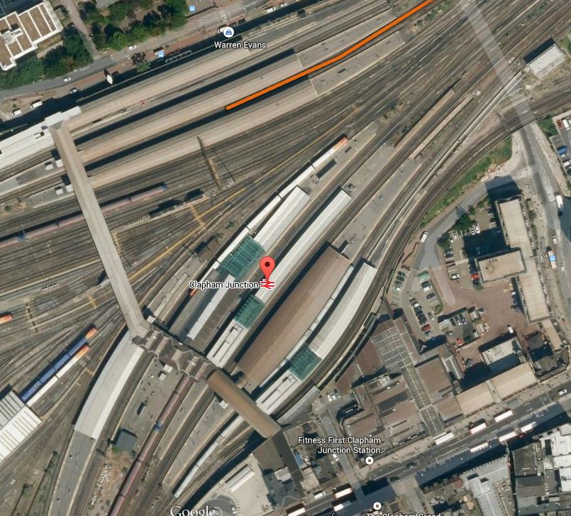
Clapham Junction Station
This would be possible, if it could be arranged that Crossrail 2 passed under Clapham Junction station at right angles to the lines through the station, in the vague direction of the overbridge towards the left of this image.
In some ways it would be like an upside down version of the new Reading station.
Crossrail 2 And The Angel
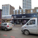
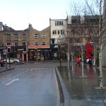
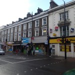
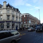
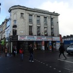
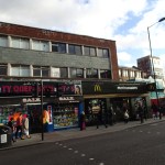
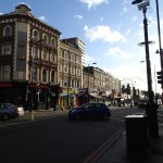
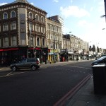
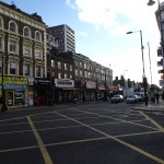
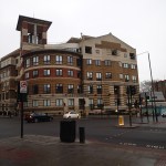
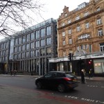
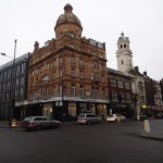
My Crossrail alert picked up this article in the Islington Tribune entitled Angel’s landmark Co-op building could go if £20bn Crossrail scheme goes ahead. The article says this.
Cllr Klute, an architect who has studied the plans in detail, said he was concerned that all the buildings on the west side of Upper Street from Angel tube to White Lion Street could be demolished.
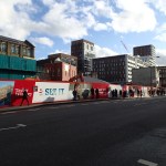
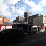
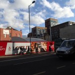
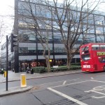
The building on the corner might be iconic, as the article says, but it is one of those buildings which probably doesn’t have the dimensions that fit the sort of high-tech businesses, that are being attracted to this area of London and will hopefully come even more, when Crossrail 2 opens. I took these pictures of the area.
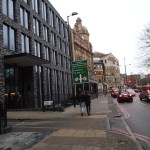
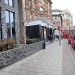
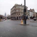

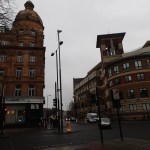
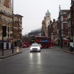
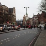
The four corners of the Angel junction have.
- The Co-op building or Angel Corner House that Councillor Klute wants to save at the north west.
- The Angel Building which was short-listed for the Stirling Prize in 2011 at the south west.
- Some rather tired low rise buildings at the south east.
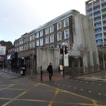
- The offices over Angel tube station which was built in the early 1990s at the north east.
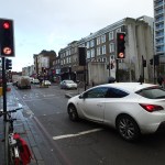
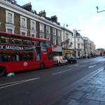
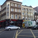
I can remember when I lived in London in the 1970s, that there were plans to create a large roundabout here to solve the traffic problems. Obviously you wouldn’t do that now, as it would create all sorts of probems about how to fit in the Crossrail 2 station.
As you can see in the pictures, the buses from Kings Cross cause problems as they turn out left from White Lion Street to go North. Not perhaps today, but the buses do cause problems on days when there is more traffic around.
There is just not enough space in the area to accommodate all of the traffic and the expanded station.
The pressing need is a left turn somewhere to get the buses from Kings Cross onto Upper Street and Essex Road, so the only way is to cut the corner through the Angel Corner Building that Councillor Klute wants to save.
As someone, who catches buses at the Angel to go down the Essex Road, the bottleneck at White Lion Street often means that buses come through rather sporadically.
An improved bus service would mean that I probably spent more of my shopping time at the Angel.
So how will Crossrail 2 affect those who currently get the 38, 56,73 and other buses to the Angel and beyond?
1. Between the Angel and Victoria, Crossrail 2 will take passengers from both the 38 and 73.
2. between the Angel and Seven Sisters, Crossrail 2 will take passengers from the 73.
3. Hopefully as both Kings Cross and Euston will be on Crossrail 2, the need for buses between Kings Cross and the Angel will be greatly reduced.
Looking at that, it says to my simple mind, that building Crossrail 2, might mean that there is less need to demolish the Angel Corner Building, as it might be possible to eliminate the left turn of buses, which creates such a problem.
If the space at the Angel and the buses turning north are one of the problems, then the bizarre design of the new station at the Angel in the early 1990s is another.
Plans for Crossrail 2 in the 1980s went via Angel and Essex Road from Kings Cross to Dalston. A few years later the 1990s route went via Highbury and Islington only.
So was the bizarre layout of Angel tube station down to this uncertainty? Who’d be an architect, when politicians keep changing their minds?
The article also says this.
Cllr Klute said if there is going to be a rail development he’d rather see a tube line running along the Hackney to Chelsea section. “It would probably be cheaper and a lot less disruptive and damaging,” he said. “It could also take in Essex Road and Old Street, which is less well connected.
“A tube train would also be of more use to Londoners. The fact that they want to run regional trains across Islington seems to suggest that they are more interested in shipping people from outside London rather than moving people around the capital.”
On the first point it would be madness to bore a tube line from Chelsea to Hackney, as you’d then have to build terminal stations at both ends to turnback the tube trains.
We already have two two different fleets being built for the new lines under London, with Class 700 trains for Thameslink and Class 345 trains for Crossrail. Engineering, operational, economic and political common sense, says that these two trains should have been virtually identical and made in Derby by Bombardier. Logic says that if Crossrail and Crossrail 2 trains are identical, then there should be cost and time savings in both train manufacture of the trains and design and building of the stations.
I would think from reading the second of Councillor Klute statements about regional trains, he tends to have thoughts that would be very much at home in UKIP.
Crossrail 2 isn’t perfect, but it will be needed in the late 2020s.
I think that by the time it is being built, improvements in construction, that in many cases are being used on Crossrail will be used to both save time and money, and build a better railway.
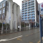
As a simple example, could the techniques used at Whitechapel enable Crossrail 2 stations to be built from the deep rail tunnels upwards, thus creating less disturbance to buildings on the surface.
Perhaps this would enable the Angel Corner Building to be gutted and left as a shell, in which the escalators could emerge and the new western entrance to Angel station could be built.
So the Angel would have an iconic station entrance on the west side of the main north-south route through the Angel. Hopefully, the new extended station would include a much needed subway across the road.
