Extending Westbourne Park Bus Garage
I have noticed this structure grow over the last few months and have wandered what it is.
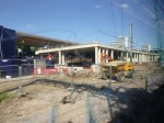


It now looks like it might be the extension to the bus parking area talked about in this article on Tower Transit in Wikipedia. This is said.
A new 180m bus parking area is to be built on a raised platform over railway lines as part of the Crossrail project.
This Google Map shows the garage squeezed under the Westway.

Westbourne Park Bus Garage
I think the Google Map was taken some time ago, as all that appears visible is probably the foundations furthest away from the bus garage.
It’s probably a sensible use for the site, where no-one would probably want to live sandwiched between the Westway and the Great Western Main Line.
It’s also a very good way of using the air space over the railway to effectively create new land.
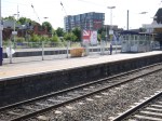
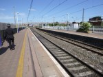
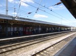
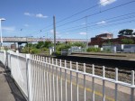
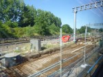
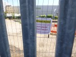
Southall Station – 4th July 2015
These pictures were taken at Southall station.


Ealing Council has also given planning permission for the new station and also for West Ealing station as is reported in this article on rail.co.uk.
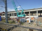
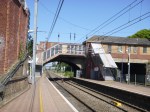
Acton Dive-Under – 4th July 2015
-I took these pictures as I passed the Acton Dive Under.
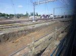
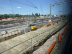

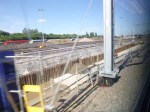

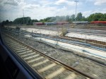
On this page on the Crossrail site, this is said.
The start of excavation follows nearly two years of work to re-configure the freight yard. The work on the dive-under is being managed by Network Rail and is expected to last until 2016.
Progress would appear to be in line with that statement.
I wouldn’t be surprised to see this work finished earlier than expected, as surely when the Acton Dive Under is complete, this must make the operation of the railway easier, as freight trains crossing from the sidings at Acton will cause less disruption.
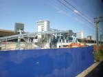
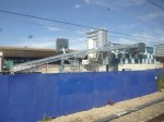
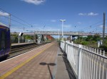
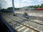
West Ealing Station – 4th July 2015
Work has started on the creation of the bay platform for the Greenford Branch at West Ealing station.


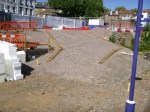
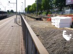

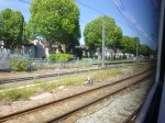
Some of these pictures were taken from a train that stopped at the station. The window intrudes on the right.
Ealing Council has also given planning permission for the new station and also for Southall station as is reported in this article on rail.co.uk.
It certainly appears that the builders have got of the marks quickly!
Could this be because it would make planning Crossrail and the station works easier, with the Greenford Branch just working a four times-per-hour shuttle to a bay platform well out of the way?
At Last, A Station For Crossrail With Style
With the exception of Canary Wharf and Custom House stations, a lot of the designs have been poorly-received by architectural critics.
So I was surprised and pleased to see this piece on the Crossrail web site describing the new West Ealing station. This picture of the new station building is shown.
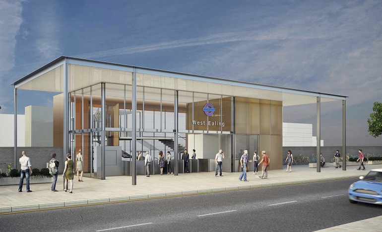
West Ealing Station
It has style and I also believe that it is designed to fit the purpose for which station buildings are now needed. All a station building needs to be today is a shelter for the barriers, ticket machines, staff and perhaps a retail kiosk or two. Get the people flow through them correct and they can be even smaller and more affordable.
It is interesting to look at the layout of the lines. This Google Map shows the situation at present.
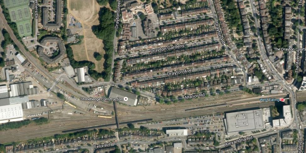
West Ealing Current Layout
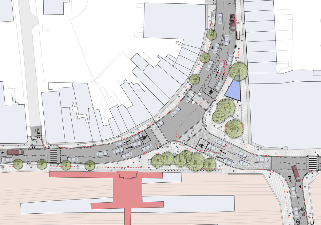
Note the Greenford Branch curving away to the North. This branch is probably an operational headache for rail managers, as the trains currently have to join the line to get to their terminus at Paddington station. After West Ealing station has been rebuilt, there will be a bay platform for trains on the branch. It is shown in this drawing I found on the Internet.
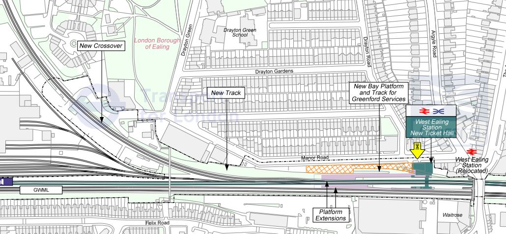
West Ealing New Layout
You have to wonder if the Greenford Branch will be developed and Wikipedia has a section on the branch’s future. Should it be electrified and should as Ealing Council have suggested the line be extended to Clapham Junction via the West London Line?
Undoubtedly, it should be electrified and the published plan of four trains per hour would certainly improve matters. But as with many things, we’re waiting for Crossrail and the plans for Old Oak Common to be vcompleted.
It does seem to me that the design for West Ealing station has set a new standard for Crossrail stations.
But as the first comment received has shown, there is a problem with access to the station from the South. This Google Map shows an enlarged view of the current station.
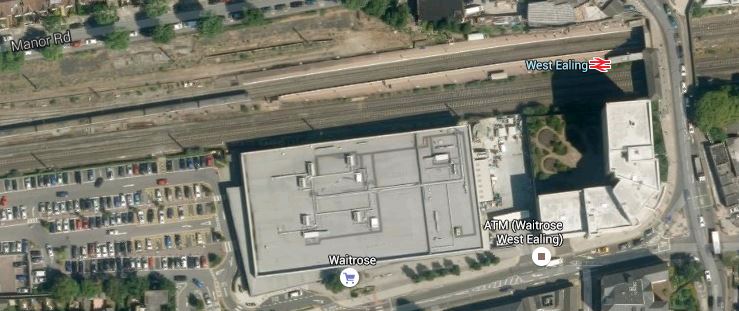
An Enlarged View Of West Ealing Station
Note how the supermarket and the car parks, backed by the two fast lines of the Great Western Main Line create a barrier that is impenetrable to any access to the station. Even if access were possible, it would be a long walk between Alexandria Road and the new station.
It strikes me that the only way better southern access to the station could have been enabled, would have been if the new station had been designed in conjunction with the supermarket, when that was developed.
It should be noted that at present West Ealing station has no car parking and do many of the locals feel that this should be provided in the new station?
To sum up, West Ealing station has problems in resolving some design issues, as it was not properly designed, when the supermarket and the land south of the railway was developed.
In my view, it illustrates one of the problems of the surface sections of Crossrail, They have been left to rot for years, when they should have been upgraded well before construction of the line started.
Freight At Maryland Station
I had to catch a train from that ruin in the East, Maryland, this afternoon. When I took pictures of all the stations before they are taken over by Crossrail, I gave Maryland a score of 2/10. As these pictures I took today, show of a freight train passing through, I think I was generous.


Sorting this dump out will need a real top quality architect with imagination. This Google Earth image shows the station and the roads around it.

Maryland Station
The following problems will challenge the design team.
1. The site is cramped and surrounded by busy roads.
2. The access to the station is along narrow pavements, even if they opened up the entrance on the South side.
3. The Crossrail platforms on the South side of the station are too short for the new trains and selective door opening will have to be used.
4. There would also appear to be few redeeming features in the current station. There isn’t any Victorian ironwork to preserve.
This is what is shown at present on the Crossrail web site.
Proposed Design
At least the number of trees has been increased!
I wish the architects the best of luck, but I sometimes feel that the only way to improve the station, would be to put a concrete raft over the whole area and build some tower blocks on top. At least they’d have good access to the rail system.
But then what do I know about architecture?
The New Freedom Pass Map
This document on the Transport for London web site, is the latest definitive map of where I can roam with my Freedom Pass.
The big addition for me is Shenfield, as although I don’t go there often, I could use it as the station to get my train for football at Ipswich.
I would have to change trains twice, but I could still arrive on the same 13:43 train into Ipswich.
But by using TfL Rail to Shenfield and then Abellio Greater Anglia from there, my Saturday Off-Peak Return, drops from £26.25 to £16.75, which is a saving of £9.50.
Similar savings even occur for a Tuesday evening match, as the cheapest fare drops from £28.70 to £19.35. It would also appear that you just buy an Off Peak Return, which is a saving in aggravation.
I’m only working on the current timetable, but I suspect that a new Anglia franchisee in a couple of years time, might stop all of the Ipswich and Norwich trains at Shenfield for Crossrail. It will probably be quicker to go from Liverpool Street, but there will be a lot of possibilities for saving money.
I also suspect that, when Crossrail opens, then Reading, like Heathrow and Shenfield, will appear on the Freedom Pass map, so instead of going to Paddington, will I join trains to Wales and the West Country at Reading.
The biggest effect on the economy of the spreading of the Freedom Pass, will be that more and more retirees will move into the capital, thus fuelling the rise in house prices.
So perhaps the best way to spend that pension pot is to buy a place in London.
Abbey Wood Explained
In my post on Crossrail at Abbey Wood Station, I expressed some puzzlement on how it will all be arranged. I said this.
It’s still not totally clear to me, where the tracks and platforms will go in Abbey Wood station. But so long as Crossrail and its contractors know, who cares?
So I’m pleased to read a full explanation in this article in Rail Engineer. They say this about the layout at Abbey Wood station.
Under Crossrail, the two existing platforms will both be rebuilt as island platforms by having a track each installed on the ‘back side’ of them. The northerly island, currently the Down platform to Kent, will be the Crossrail terminus while the current Up platform will become the one for the North Kent line.
In this picture that I took from a footbridge to the East of the station, North is to the left.

So Crossrail will be the two lines on the left and the North Kent Line will be on the right.
It isn’t perfect, as it means there is no cross-platform interchange between the two lines.
If you read the article in Rail Engineer, all will be explained.
TfL Rail Starts To Appear
It is not until next Sunday, the thirty-first, that Transport for London take over the Shenfield Metro services that will become part of Crossrail, but the signs are starting to appear.
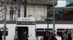

It would appear that the only different between the Abellio Greater Anglia and TfL Rail version of the station nameplate, is the banding at the top.
