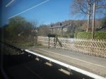
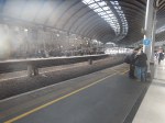
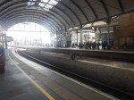
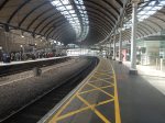
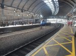
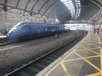
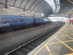
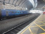
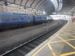
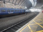
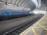
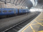
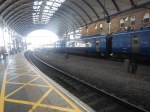
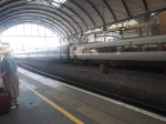
Creating More Capacity At King’s Cross Station
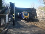
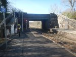
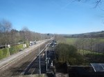
I took these pictures as I walked through King’s Cross station today.

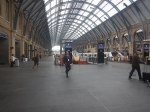
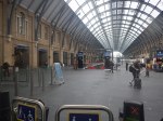
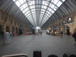
Note.
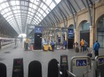
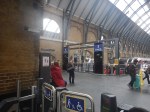
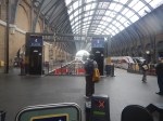
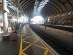
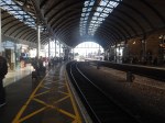
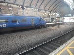
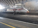
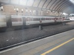
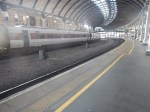
- Each of the eight platforms in the main train shed, has been formally divided into a and b sections.
- In the first picture, a sign to the right of the clock, showing 0a and 0b, indicates that Platform 0 has been similarly divided.
- I would assume, that any services run by 10-car trains would use both the a and b platforms.
- Services run by 5-car trains, can use any free ‘a’ or ‘b’ platform.
It would appear to me, that 18 x 5-car platforms must be able to handle more trains than 9 x 10-car platforms.
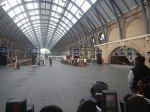
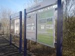
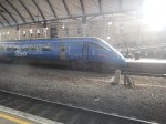
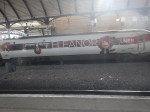
This information screen, which is one of several, explains what has been done.
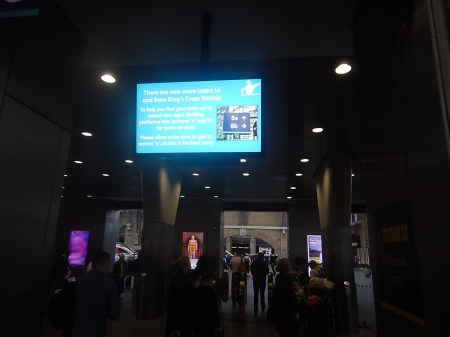
This is the message on the screen, which is only visible about once every ten minutes.
- There are now more trains to and from King’s Cross station.
- To help you find your train we’ve added new signs dividing platforms into sections ‘a’ and ‘b’ for some services.
- Please allow extra time to get to section ‘a’, as this is furthest away.
It’s not a good way to present information.
It is one of the worst examples of mushroom management, I’ve seen in a long time.
I suspect, that experienced travellers will understand it, but will the less experienced?
Will It Increase The Capacity?
I believe it is a well-known rule, that you get more bricks in a box, if they are all the same size and they are a fraction of the size of the box.
So by having five- and ten-car trains and platforms, Network Rail are minimising wasted space in the station, which is increasing the capacity.
The new digital signaling gives precise control of the trains and theoretically, would obtain the maximum number of trains in the station.
But all trains, that will use the station must follow these rules.
- Five- or ten-cars long.
- Trains must have a digital-signalling capability.
- Be able to cruise at 125 mph, so they can keep up with other trains.
Terminal stations on the East Coast Main Line, like Aberdeen, Bradford Forster Square, Edinburgh, Harrogate, Hull, Inverness, Leeds and others must also be capable of handling five- or ten-car trains.
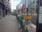
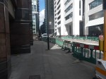
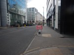
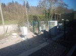
How Not To Resurface An Intersection
I took these pictures in the City of London at the North end of Moorgate this morning, where the road is crossed by Eldon Street and Ropemaker Street.


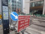


Note.
- I had only gone to the area to get a 141 bus to travel home and found that no buses were running on Moorgate.
- There was no information or signs displayed to help travellers.
- The Marks and Spencer’s store appeared to be completely cut off.
- I believe that this road is the responsibility of the London Borough of Islington, not the City of London.
- Luckily, Leon was unexpectedly open, so I popped inside to have a delicious Full English, gluten-free breakfast and a cup of tea, before my walk.
- Also, one of their staff was tall enough to see over the road works and ascertain, that the buses were running in Finsbury Square.
With difficulty, I was able to walk to the next bus stop on Finsbury Square and get safely home.
I have a few thoughts.
This Was Mushroom Management At Its Worst!
All it needed was a few signs on the bus stop by Moorgate station and dotted around the site to explain the situation, but no-one took the responsibility to provide the information.
Surely, This Is The Type Of Site, Where Hydrogen Powered Construction Equipment Should Be Used!
- It would provide better atmosphere for workers and passers-by.
- Some equipment would be quieter.
Should New Stations Be Shown On Google Maps With Opening Dates?
I recently posted a comment on The Times recently, where I suggested a guy was opening one of his coffee shops in a town, that was getting a new railway station.
Another, who commented, suggested that I look at Google Maps to see their relative positions.
The coffee shop was shown, but the station wasn’t.
Surely, once the position of the station is known, it should be marked on Google Maps with an opening date, as this could help people take important decisions about their life.
Blyth Bebside station on the new Northumberland Line between Newcastle and Ashington is already shown with the familiar logo, despite not opening until the 19th of October.
The other two unopened stations on the line, which are Northumberland Park and Bedlington, are going to open next year, are also shown with familiar logos, but no opening date.
Someone in Network Rail, needs to be given the responsibility to make sure that details like this are correct.
In the case of Blyth Bebside station, I can see two different captions indicating the station on Google Maps.
- Before October 19th 2025 – Blyth Bebside – Opens 19th Octopber 2025.
- After October 19th 2025 – Blyth Bebside – Opened 19th Octopber 2025.
Detailed labeling may even help deliveries during construction.
The Lack Of Information At Edinburgh Waverley Cost Me £55.10
The ongoing works at Edinburgh Waverley ruined my day. I had intended to come up to the city to take some photographs for this blog and see an old friend, who like me is widowed.
I also wanted to take a train to Leven to see the new stations.
I have a very unusual skin and on some days I can’t use ticket machines, so I need to use a human in a ticket office.
Today was one of those days and to complicate matters, I couldn’t find the ticket office.
I also wasted more time finding platform 17 for Leven.
Going back to London, where I live, my friend advised me to take the escalators from Princes Street to get into the station, which I have used many times before.
But they were shut and I missed the 16:13 Lumo to London by about a minute.
To get home, I had to buy another ticket on LNER for £55.10.
If there had been more information, perhaps in leaflets or from real people around the station, I would have had a much better day.
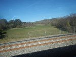
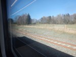
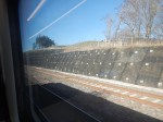
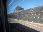
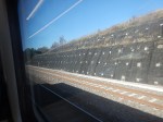
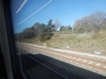
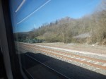
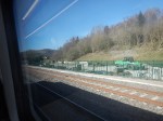
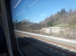
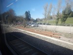
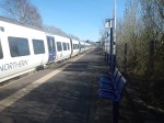
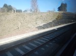
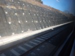
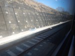
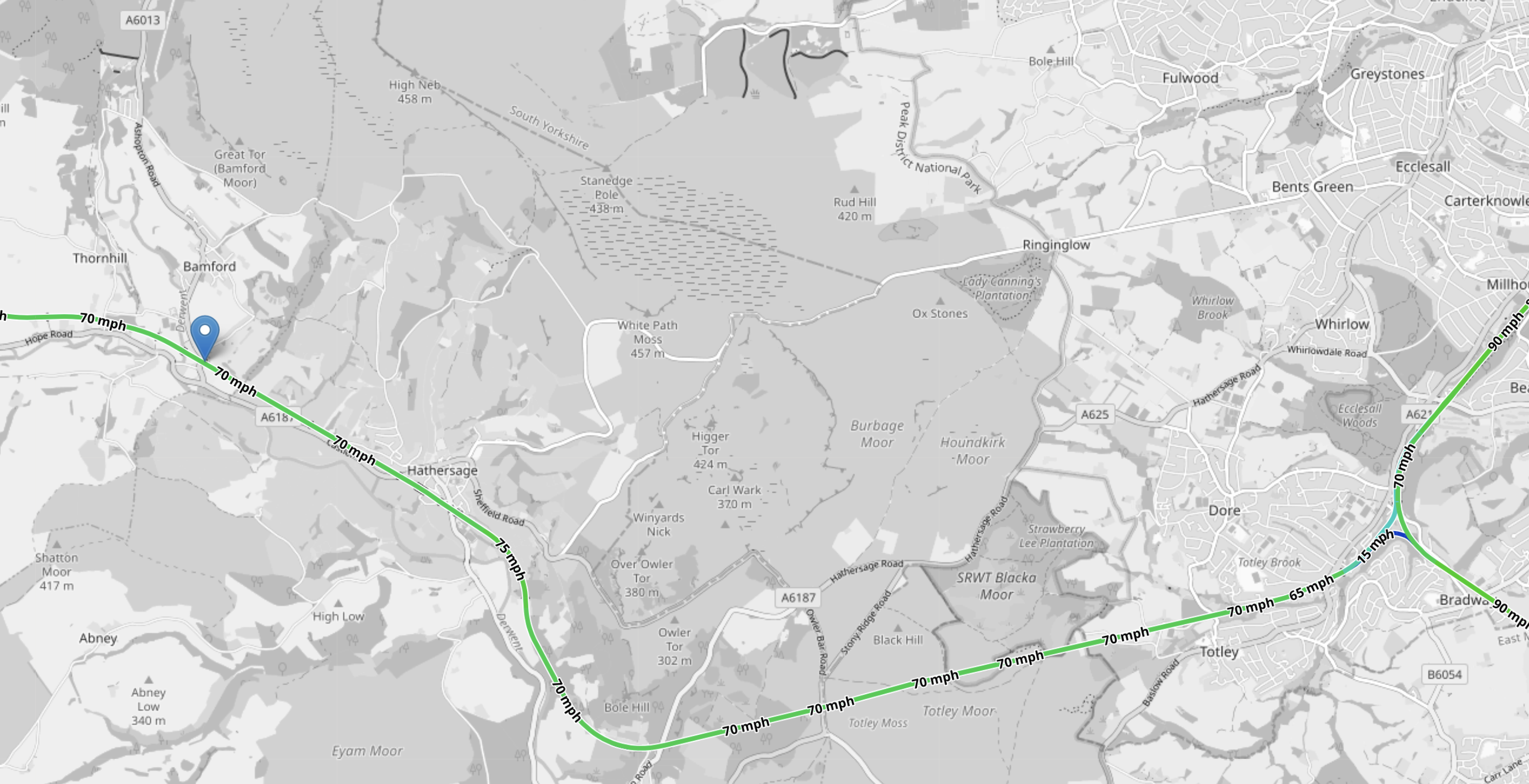
Between Dore & Totley And Bamford Stations – 1st April 2025
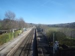
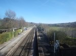
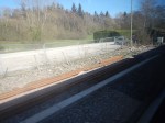
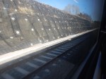
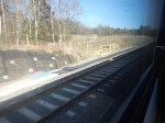
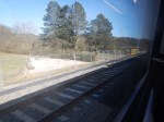
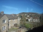
I wanted to see the newly-built passing loop between Heathersage and Bamford stations, so the easiest way was to go to Bamford station and return from Bamford station to Sheffield station.
I took these pictures along the outward route.
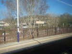


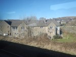


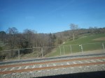

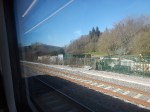
Note.
- Hathersage seems a tidy and attractive village.
- All the stations I visited, seem to be long on information.
- The last three pictures show the passing loop from the bridge at Bamford station.
- eathersage and Bamford stations are not step-free.
- The piling is of a similar quality to a larger scale of a surgeon sewing up a patient after a serious operation.
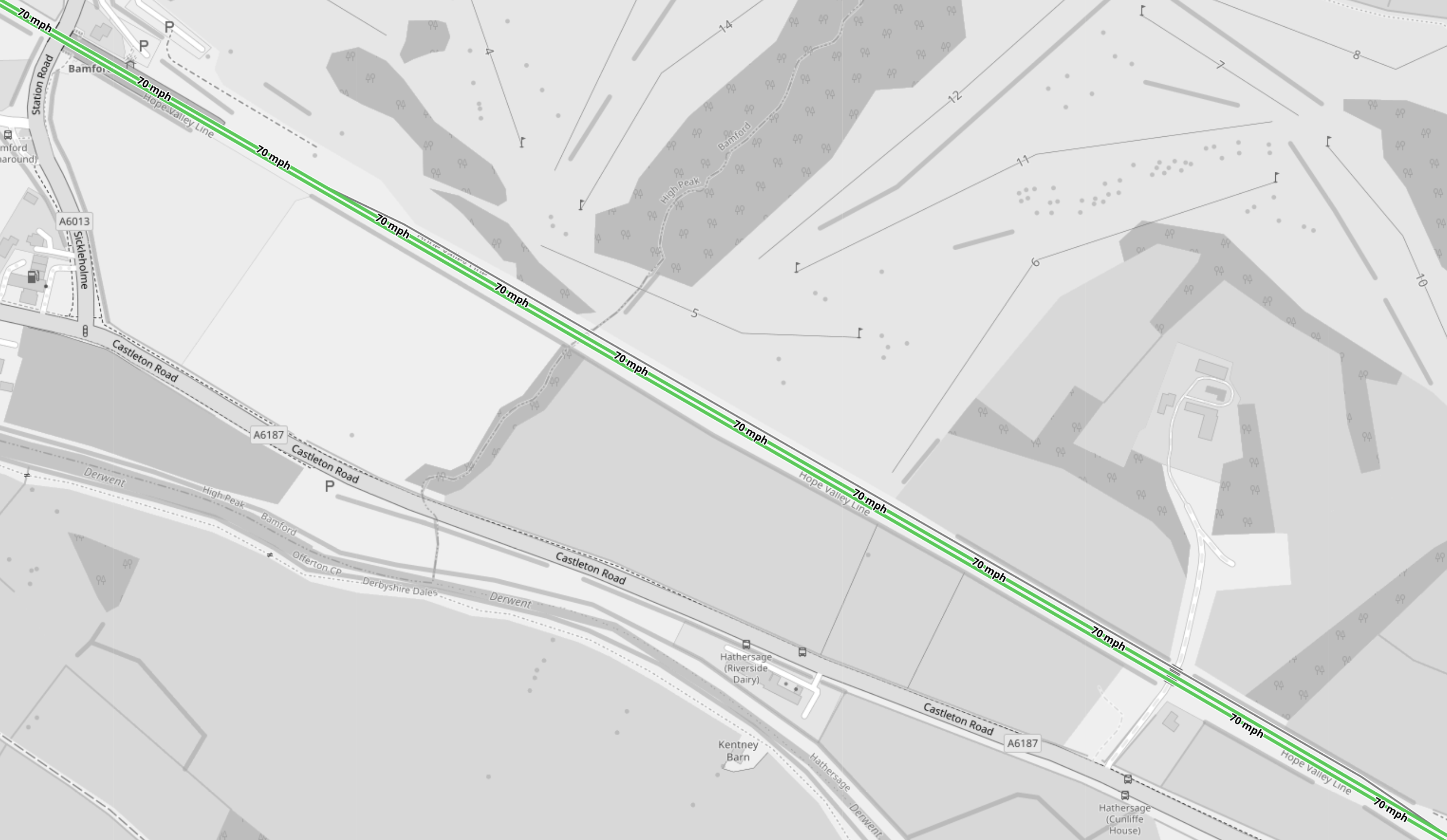
This OpenRailwayMap shows the loop.
Note.
- The three tracks of the passing loop appear almost straight.
- Are they level I wonder?
- The loop looks level from my pictures.
- Bamford station is 83.9 miles from Cleethorpes according to Real Time Trains.
- Dore & Totley station is 75 miles from Cleethorpes according to Real Time Trains.
- Dore & Totley and Bamford stations are 8.9 miles apart and TransPennine Express Class 195 trains take eight minutes to go between the two stations.
I’ll take an average speed of just under 70 mph on a straight and level track.
What speed would a battery-electric Class 802 train, be able to achieve?
This track seems to have been built for battery-electric InterCity Trains and their drivers to have fun.
If the engineers had wanted to make it better they could have used concrete slab track, but to my camera and my eyes, it looks to be extremely level.
I took these pictures along the return route.


Only by looking at all pictures and the map in detail in this post, can you get a feeling for what has been done.
The Wikipedia entry for the Hope Valley Line says this.
The work includes creating a 3,600 feet (1,100 m) passing loop between Bamford and Hathersage.
But this is no passing loop, as it’s much more of a passing straight!
It will be very interesting to see how many minutes can be saved between Dore & Totley And Bamford stations.
My Only Worry
This OpenRailwayMap shows the Eastern section of the Hope Valley Line.
Note.
- The triangular junction at Dore is at the East of the map.
- The blue arrow indicates Bamford station.
- The straight and level passing loop to the East of Bamford station.
- Click the map to show it to a larger scale.
Will this section of track, with trains going through at seventy mph, every few minutes be too dangerous for some people on the four stations on the route?
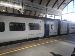
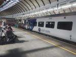
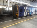
Changing Trains At Newcastle Station
In the last few weeks, I have changed trains at Newcastle station between the East Coast Main and the Northumberland Line four times.
I took these pictures on Sunday, when I changed twice.


Note.
- On my two train changes yesterday, I needed to buy a ticket for the next leg of my journey and I had to walk miles to the ticket office.
- The walk was rather straining on my dodgy knees.
- There are no signs to the ticket office and I only found it due to a helful human.
- In the morning, I missed my connection and had to wait an hour for the next train.
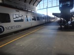
- A lot of these pictures show diesel multiple units, that were working the Northumberland Line to Ashington in Platform 1, surrounded by happy passengers.
- Platform 1 appears to be able to take at least a pair of Class 158 two-car diesel multiple units.
- Platform 1 appears to be electrified with 25 KVAC overhead wires, even if the Northumberland Line isn’t electrified.
- The staff seem extremely pleased with the success of the Northumberland Line.
The staff were very helpful, but it was all very much organised chaos.
But from what I saw yesterday, it appears that something powerful is stirring along the Northumberland Line.
Perhaps what the BBC predicted in Northumberland Line: Railway ‘Could Create Economic Powerhouse’ is starting to happen?
This was the sub-heading of the BBC article.
An “east coast economic powerhouse” stretching from Edinburgh to Leeds could be created if the Northumberland Line rail scheme goes ahead, a public inquiry has been told.
I’m well aware that one busy weekend doesn’t make a powerhouse.
But Northumberland Council must get ready for the next phases of the project.
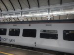
Larger Zero-Carbon Trains
In Alstom Hydrogen Aventras And The Reopened Northumberland Line, I suggested that Alstom hydrogen trains might be suitable for the Northumberland Line, but these trains have not been seen in the flesh, so they can probably be discounted.
But this is a picture I took yesterday of Platform 1 at Newcastle station.

Note.
- The wires of the electrification above the Class 158 diesel multiple unit.
- An out and back trip between Newcastle and Ashington is probably less than fifty miles.
In the Wikipedia entry for Merseyrail’s Stadler Class 777 trains, this is said.
In December 2022, a maximum test range of 135 km (84 miles) was achieved, which was “much longer than we expected”.
It would appear that a small fleet of perhaps three trains, that were fitted with pantographs for charging could work the Northumberland Line, without the need for substantial additions to the infrastructure.
In the Wikipedia entry for the new Tyne and Wear Metro’s Stadler Class 555 trains, this is said.
The new trains will be five cars long in fixed formations, with a Jacobs bogie between the inner cars. One centre car will be fitted with a Brecknell Willis pantograph to draw the power from the 1,500 V DC overhead lines. They will also be fitted with regenerative braking technology for greater energy efficiency, and a battery energy storage system that will allow the trains to remain powered and reach the nearest station if the overhead lines fail. This offers the potential to be used on routes that are not fitted with overhead lines that may be added to the network in the future.
As the Class 777 and Class 555 trains appear to be cousins, perhaps those innovative Swiss engineers at Stadler can come up with a 25 KVAC battery-electric Class 555 train, that could charge its batteries in Platform 1 at Newcastle station and then use battery power to get to Ashington and back.
With perhaps a couple of short lengths of 25 KVAC overhead electrification, I feel Stadler could create a battery-electric Class 555 train, that could handle.
- Newcastle and Ashington and on to Newbiggin, as I wrote about in Onward To Newbiggin-by-the-Sea For The Northumberland Line?.
- Newcastle and Carlisle
- Carlisle and Morpeth via Newcastle
- Hexham and Nunthorpe via Newcastle
How many other branches from electrified main lines in the UK, could be handled by such a train?
How about these routes for starters.
- Darlington and Bishop Auckland
- Darlington and Saltburn
- Preston and Blackpool South.
- Skipton and Preston via Colne.
- Lancaster and Morecambe
- Leeds Metro
- Llandudno Junction and Blaenau Ffestiniog
- Middlesbrough and Whitby.
- Sheffield and Huddersfield
- Sheffield and Leeds
- Sheeffield and Manchester Piccaduilly
Sheffield and York
The Class 555 trains would also have other advantages.
- In the Newcastle area, I’m sure the Tyne and Wear Metro could probably service them.
- They have the Stadler steps for easy access.
- Most Stadler trains, tram-trains and trams are good at climbing hills.
Great British Railways could do a lot worse, than buying a reasonable number of Class 555 battery-electric trains.
Travelling Between London Stations
When I came home from Moorgate this morning, I took my usual 141 bus.
I sat next to a lady about forty, who from her bags looked like she’d just arrived by plane at Gatwick Airport.
After a couple of attempts at conversation, it became obvious, that we didn’t have a common language.
She then produced her phone and indicated that she needed Liverpool Street station.
The 141 bus doesn’t serve Liverpool Street station, but it does serve the Western entrance to Liverpool Street station on the Elizabeth Line.
It looks to me, that she had been told by a human being, an app or the Internet, that the easiest way from London Bridge bus station to Liverpool Street station was to take the 141 bus from in front of the station and walk across to Liverpool Street station from Moorgate.
But.
- The Western entrance to Liverpool Street station has no information to indicate, that it gives access to Liverpool Street station.
- The bus information system indicates Moorgate station.
- The bus information system does not announce, that for Liverpool Street station, you should alight at Moorgate station.
Perhaps, the bus information system should indicates Moorgate/Liverpool Street station.
Conclusion
How many other transfers between London stations are similarly confusing?
Striking Train Drivers Want Extra Pay For Using Tablets
The title of this post, is the same as that of this article on The Times.
These four paragraphs explain the impasse.
Striking train drivers are demanding extra pay for using tablet devices at work.
The tablets, which are similar to iPads, are designed to send announcements to drivers and notify them of temporary speed limits on routes.
However, union chiefs are demanding so-called “technology payments” for members expected to use such devices.
Train companies usually have to rely on noticeboards to communicate with drivers. Messages, including safety instructions, are still placed at the end of platforms for drivers to see from their cabs.
Mark Harper, the transport secretary, i quoted as saying: “Aslef continues to stand in the way of vital reforms needed to safeguard the future of the railways.”
Are we in the 21st or the 19th centuries?
But the article leaves the best to last.
It has previously been reported that rail workers were given paid time off if they had to use a microwave at work. The rule from 1980 states:
All staff working with microwave ovens shall be permitted to take time off from work, with pay, for a medical check of any effects on them from the microwave ovens. Such checks shall be made at not less than six monthly intervals on request.
Does your partner demand similar rewards for putting your ready meal in the microwave?
There is also this comment from a reader.
I did 19 years as a driver, mainly with Southern. I remember when we were issued with mobile phones and later iPads there was a few dinosaurs who refused to charge them at home. Pathetic really. The iPad was great but only got 1 GB of mobile data. I destroyed that watching Tour du France when ‘spare’ and didn’t have any work allocated.
The worst Spanish practices mainly revolve around the facility time ASLEF reps get, and routinely abuse. At my depot 2 reps were released all day to scrutinise bank holiday diagrams. There were 7 diagrams to check. These diagrams are produced by software to make sure comply with regulations but need reps to sign off. No more than 5 minutes work but off all day. That’s 2 drivers, 8 or 9 times a year. These are the T&Cs changes that ASLEF won’t accept, under RDG offer diagram scrutiny would be taken away from reps.
Priceless! And all passengers and taxpayers are paying.
That Was Close!
I took this picture in Liverpool Street station on the Elizabeth Line.
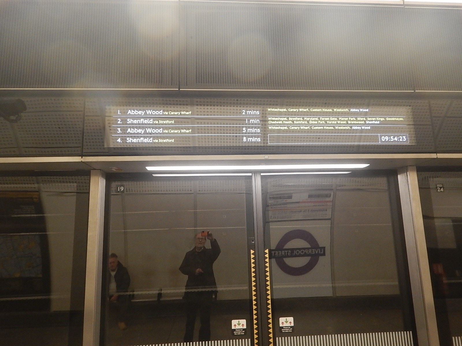
Note.
- The timings of the first two trains.
- The Shenfield train did arrive before the one for Abbey Wood.
How did it manage that? It looks like a another Fujitsu moment in the display to me!
A Community Engagement App For The Hope Valley Line Upgrade
The Hope Valley Line Upgrade has its own web site.
This is the sub-heading.
We’re upgrading the railway between Manchester and Sheffield to provide more reliable and faster journeys for passengers
The first paragraph gives the project timeline.
The project started in Spring 2021 and is due to be completed in Spring 2024.
There is also a section, that is entitled Community Engagement, where this is said.
Communication is very important to us and we will be writing to local residents with plenty of notice before work starts, as well as holding public engagement events throughout the project to keep the local community informed on its progress.
For regular updates on the main improvement work, you can also download the Hope Valley Railway Upgrade community engagement app, which will contain details of upcoming work activities, news, and initiatives and events for the local community.
That is new territory for Network Rail or at least the first time, I’ve seen one.
Until proven otherwise, it looks like it could be a good idea.
