Crossrail 2 October 2015 – Dalston Station
Are us plebs in humble Dalston going to get one of the best and busiest stations on Crossrail 2?
I wrote that opening statement in jest, but think about the proposed combined Dalston station’s position in London’s rail network.
- It is the most Northerly station before the two branches to New Southgate and Broxbourne link under Stamford Hill.
- Dalston Junction (Or is it Dalston South?) gives an escalator connection between Crossrail 2 and an up to twenty-four trains an hour to South-East London on the East London Line.
- Dalston Kingsland (Or is it Dalston North?) gives an escalator connection between Crossrail 2 and all those trains on the North London Line.
So Dalston will become the important interchange for a large number of cross-London journeys. Raynes Park to New Southgate may well be direct, but so many journeys like Norwood Junction to Brimsdown will just be a single change at Dalston.
Crossrail 2 will put Dalston in one of the most important places on the map of London’s rail network.
Crossrail 2’s proposal for Dalston Station
This Crossrail document is entitled Dalston Station.
The proposal in the document starts like this.
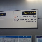
The Crossrail 2 station at Dalston would be a double-ended station, with an interchange at Dalston Junction at the southern end, and an interchange with Dalston Kingsland at the Northern end.
So we get three stations in one, which also means that at last there will be a true dry interchange between Dalston Kingsland station on the North London Line and Dalston Junction station on the East London Line.
This map from the document shows the layout of the two existing stations and their connection by means of two two-hundred and fifty metre long underground Crossrail 2 platforms.

Crossrail 2 Dalston Station
It would appear that two shafts will be sunk to the Crossrail 2 tunnels.
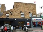
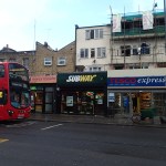
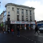
- The Southern one would be in the Tesco Express or the bar next door,
- The Northern one would be just to the north of Ridley Road in the block containing the NatWest Bank.
Note how much of the route of the Crossrail 2 tunnels, runs on the East side of Kingsland High Street, under the Shopping Centre and the new flats. The tunnels will be at least twenty metres down just to get past High Speed One, which runs under the North London Line and Dalston Kingsland station, so any older buildings will be well above any Crossrail 2 construction.
I would also suspect that High Speed One also makes designing and construction of the Kingsland end of the station challenging.
The Work Sites
The Crossrail 2 proposal for Dalston station is nothing but ambitious and to build it there will be no less than five work sites.
- Site A – Would be used as the main site for construction of the station tunnels and southern station shaft
- Site B – Would be used for construction of a new Crossrail 2 station entrance and ticket hall. The site includes properties on the southern side of Bradbury Street.
- Site C – Would be used for construction of the northern station shaft and escalator connection to the Crossrail 2 platforms
- Site D – Would be used for construction of a new bridge providing access from the new ticket hall to the westbound platform at Dalston Kingsland
- Site E – Would be used for construction of a station entrance and ticket hall, for interchange with Dalston Junction station.
But I would be very surprised if the work wasn’t phased so that the work-load in Dalston was spread and work is performed in a logical order.
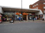
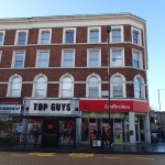
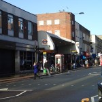
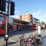
Dalston Kingsland station is a dump compared to Dalston Junction station, with all the charm, access problems and convenience of a Victorian tube station.
In a reasonable world, it would be replaced now, whether Crossrail 2 is built soon or postponed to the Twenty-Second Century.
The need for a Site D indicates that a new bridge will be built across the station to give access. As Site D is currently in the construction site for new flats called Fifty Seven East and Dalston Kingland station desperately needs step-free access, then surely this bridge should be built now!
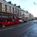
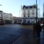
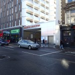
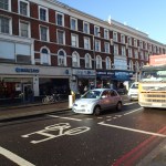
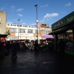
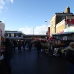
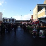
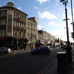
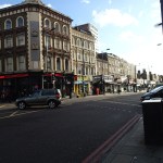
To further assess the work-sites, I walked along Tottenham Road to Site A, then crossed to Site E, before walking up Kingsland High Street to look at Sites B, C and D.


There is certainly, a lot going on and if everybody gets it right, it can become one of London’s more important High Streets.
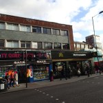
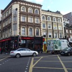
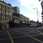
What Is Already Happening In Kingsland High Street?
Before I come to my conclusions, I’ll say a little about what is already happening.
- Plans may have been published to rebuild Dalston Kingsland station.
- There are more projects to build flats in the area. London needs housing and as these will be designed so they don’t affect Crossrail 2, they will go ahead.
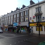
- The Dalston Kingsland Shopping Centre is supposed to be being rebuilt.
- There are also plans to improve the pedestrian flows on what is a very congested road for walkers.
- There will be other changes due to the Cycle Superhighway passing about fifty metres to the west of Kingsland High Street.
So in say four or five years time, we should have a better High Street and Kingsland station, whether Crossrail 2 is coming or not!
Conclusions
So what are my initial conclusions?
- Because of the station design, there will need to be some demolition at both current stations.
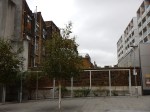
- Site A needs a full rebuild, as it has very little property of merit and I certainly wouldn’t miss the Subway, Tesco and the bar on the end. The shaft to access the new platforms, will probably be in the middle of the current Tesco.
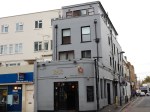
- Site B is in a bad state with much of the property locked up. Some of the properties on Bradbury Street will need to be demolished to rebuild Dalston Kingsland station, let alone build the Crossrail 2 station. Will anybody mourn?
- Site C is where the Northern shaft will be. There will be some demolishion.
- Site D is a curious one in that it is inside a site that is being developed.
- Site E is where the new entrance to |Dalston Junction and the Crossrail 2 station is going to be built. I’d have hoped that the Crossrail 2 passages would have been laid out in the redesign of the Overground station. What’s been published gives me doubts!
- How much of the demolition will be of properties worth keeping? Those that I photographed didn’t shout save me!
There are three sites on the High Street, which will be very much affected by the rebuilding of Dalston Kingsland station and building of Crossrail 2.
- Site A, where the Southern shaft for the station is located.
- Site B, where the Northern entrance to the new station is proposed, is substantially closed at present.
- Site C, opposite Dalston Kingsland station that will contain the Northern shaft for the station and escalator connection to the Crossrail 2 platforms.
All could be developed with new residential or commercial properties on top.
I believe that the proposed plan for the new Crossrail 2 station should be treated as what it is, just a proposal.
Or at least as far as the above ground presence is concerned.
All three sites could be developed as welcoming portals to enhance the public transport system as it serves the area around Dalston.
I would apply the principle, that access to the Crossrail 2 station, should be available from both sides of Kingsland High Street at both the Northern and Southern ends.
I will now look at each site in detail.
Site A
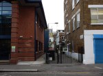
This is a Google Map showing Dalston Junction station and Site A.
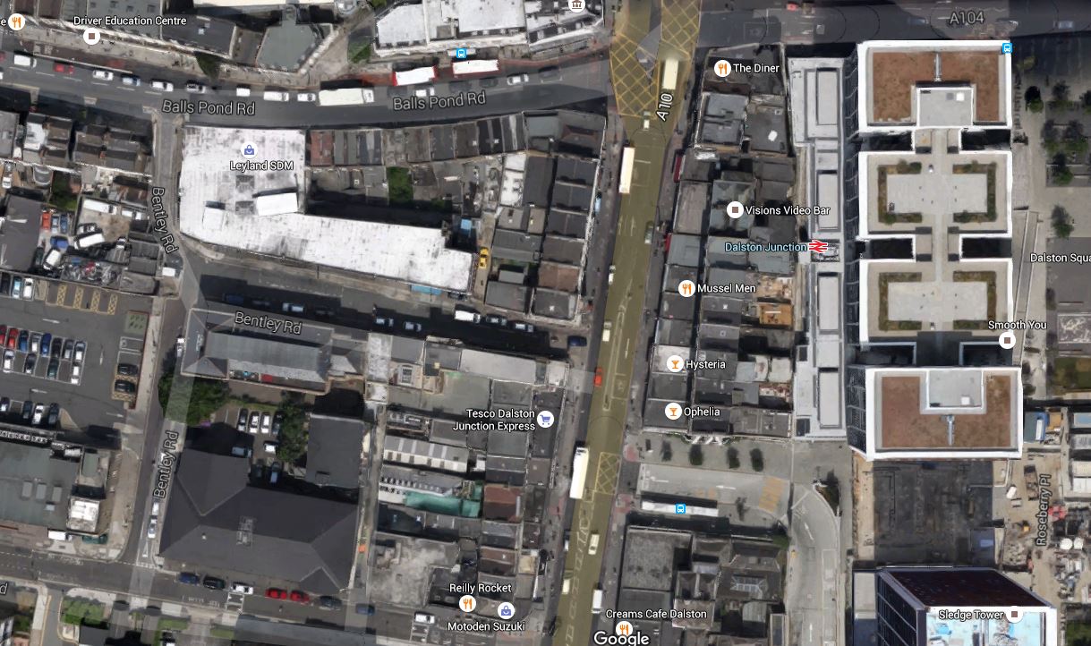
Dalston Junction Station And Site A
Note the station and its towers above in the East and Bentley Road Car Park in the West. You should be able to pick out the Tesco Express on the Kingsland Road.
I walk to Dalston Junction station most days to get the Overground. But it is not a good walking route.
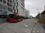
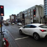
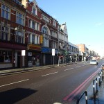
- The pavements along the Balls Pond Road and Kingsland Road are very narrow and you are squashed between traffic and large numbers of walkers.
- It is easier to walk up Tottenham Road, but as with the other route crossing Kingsland Road can be difficult.
- If you live to the South West of Dalston Junction station, it is probably easier to walk to Haggerston station, as I do sometimes.
- It is particularly difficult to cross at the cross roads where the Balls Pond Road meets the Kingsland Road.
As the frontage of Site A on the Kingsland Road will have to be substantially demolished, in an ideal world, provision would be made to access the escalator and lift connection to the Crossrail 2 station from the West side of Kingsland Road.
Perhaps when the frontage of Site A on Kingsland Road is rebuilt after Crossrail 2 works have finished, it should provide a subway under the road to the station and the sort of shops and cafes, that passengers like in their stations.
It would welcome those, who live to the South West of Dalston Junction station to the area, just as Dalston Square on the other side of the station welcomes those from the South East.
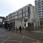
Site B
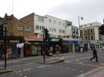
This is a Google Map showing Dalston Kingsland station and Sites B and C.

Dalston Kingsland Station And Sites B And C
Site B is to the North of Dalston Kingsland station, on the West side of Kingsland High Street.
Note that this map was made before the construction of Fifty Seven East started, as Peacocks is still on the West side of Kingsland High Street.
I feel that if they rebuild Dalston Kingsland properly, then then are possibilities to not only build residential or commercial development on top of Site B, but over the railway and the station as well.
Land is expensive and the station occupies almost as much space as Fifty Seven East, so surely a similar sized development over the station would be a welcome addition to London’s housing stock.
I would also hope that the design of the station includes the following.
- A step-free subway under Kingsland High Street to Ridley Road Market. This is probably a given, as the escalators to Crossrail 2 go down from Site C.
- As the station is close to the Cycling Superhighway, I suspect that it will be heavily used by cyclists, who would need lots of secure bike parking.
- Personally, I would like easy walking access along Bradbury Street as I regularly walk to Dalston Kingsland station along that route.
There are certainly lots of possibilities to make the existing Dalston Kingsland station a welcoming North West gateway to Crossrail 2 and Kingsland High Street.
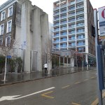
Site C
This is a Google Map showing Dalston Kingsland station and Sites B and C.
Dalston Kingsland Station And Sites B And C
Site C is to the North of Dalston Kingsland station, on the East side of Kingsland High Street. The NatWest bank, which is at the Northend of Site C is indicated.
Any development on this site must enhance the Ridley Road Market and provide that gateway for those travelling to and from the North East of the station.
It is essential that there is an entrance to the station on the East side of Kingsland High street, to give good connections to the market and the Shopping Centre.
My Ultimate Test Of The New Station
My ultimate test of the new Dalton station would be on a cold and wet day, to have the ability to arrive at Dalston Kingsland station on the North London Line, go down an escalator to Crossrail 2, where I can walk along to the Southern End, go up the escalator and exit the station on the West side through a rebuilt Site A.
And do it pushing my yet-to-be-born great-grandchild in a buggy! The spirit of my grandmother, who was born opposite Dalston Junction station would be very pleased!
An Opportunity For Dalston?
Look at this map of the rail and Underground lines in East London going north around Dalston Junction.
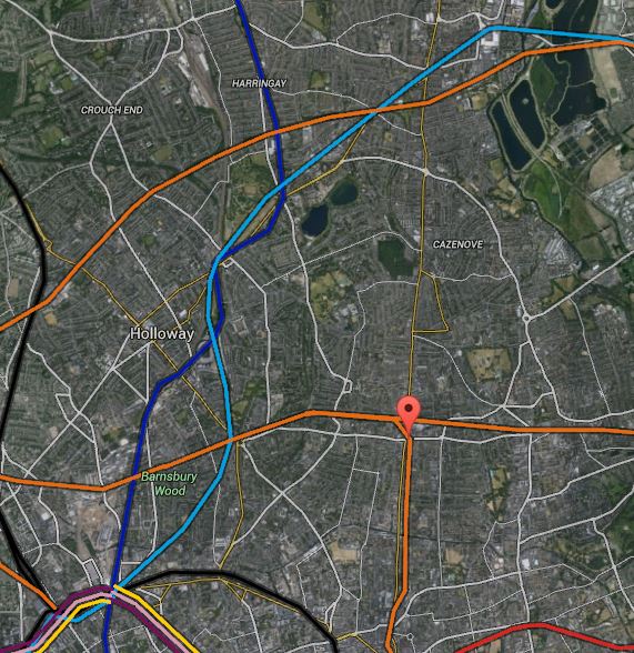
Map 1. Rail Lines Around Dalston
The light blue,dark blue, black and orange lines are the Victoria, Northern and Piccadilly lines and Overground respectively. Stations to note are.
1. Dalston Junction which is marked by the red arrow.
2. Tottenham Hale at the top right and is shown in more detail on this larger scale map.
Map 2. Tottenham, Seven Sisters Area
3. Seven Sisters is the next station as you come south-westerly from Tottenham Hale and is marked by both tube and national rail symbols on the second map.
4. Below and slightly to the right of Seven Sisters is South Tottenham on the Gospel Oak to Barking Line.
5. On the original map, Angel is towards the left at bottom, approximately south west from Dalston Junction. This is a larger scale map of the area.
Map 3. Angel To Dalston Junction
In this map, Angel is close to the bottom left. Note how you can see Highbury and Islington, Essex Road and Canonbury stations north of the Angel and Haggerston and Hoxton stations south from Dalston Junction on the East London Line.
Roads, like Essex Road, Balls Pond Road and New North Road are visible, as is the Regent’s Canal.
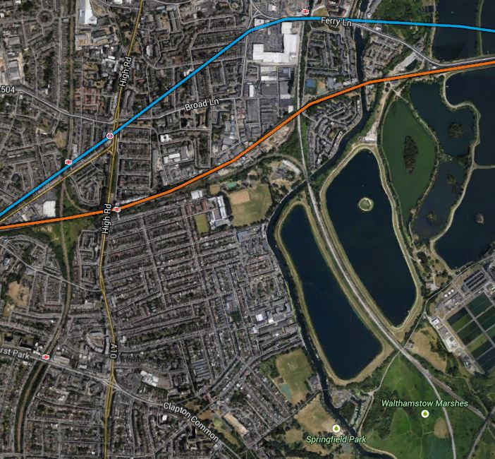
From the limited information that has been published about Crossrail 2, I believe that the New Southgate branch will pass under Seven Sisters and very close to South Tottenham before meeting the other branch from Tottenham Hale somewhere near Walthamstow Marshes shown on Map 2 and in detail below.
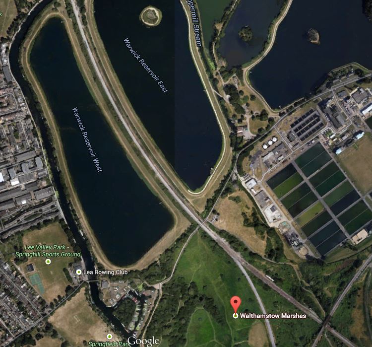
Walthamstow Marshes
The map shows how Walthamstow Marshes could also make an ideal site from where to build the tunnels.
1. It is a spacious site with good road access, where the running tunnels to New Southgate, Tottenham Hale and Central London may all meet.So if a big deep shaft could be dug here, as Crossrail 1 did on the Limmo Peninsular, it could be used to launch and retrieve the tunnel boring machines (TBM). Looking at how far the TBMs went from Limmo to Farringdon on Crossrail 1, which is a distance of 8.3 km, I suspect that their successors on Crossrail 2 could go a long way under London and given the right ground conditions, perhaps even all the way to Wimbledon.
2. The site is close to the West Anglia Main Line and surely this could be used to bring in heavy equipment and materials.
3. Around the west of the Marshes, the map shows the River Lea, which could be another transport artery into the site.
4. As there are several reservoirs there is plenty of raw material for the drink that builds the railways; tea.
5. The one problem is that the Marshes are a Site of Special Scientific Interest. But having seen how Crossrail 1 handled the potentially tricky situation at Stepney City Farm, I suspect that if they follow similar rules, then an amicable solution can be found.
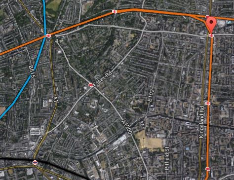
From the junction near Walthamstow Marshes, Crossrail 2 has said that the line will go to the next two stations; Dalston Junction and the Angel.
This would mean that the line would run roughly north east to south west from the junction of the two branches of the line to the Angel. Whether it is aligned under a road, a railway or even the Regent’s Canal, would obviously be a matter for the engineers.
On this map, I have drawn the possible route in pink.

Map 4. Possible Crossrail 2 Route At Dalston
Not shown on Map 4 is the line of the Channel Tunnel Rail Link, which runs in a tunnel underneath the North London Line.
I believe that it might be possible to dig the tunnel so that it passes underneath both Dalston stations, despite the presence of the Channel Tunnel Rail Link. In this respect, I have great faith in the ability of London’s finest hole diggers to navigate correctly and not connect New Southgate and Tottenham Hale to France.
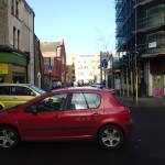
One of my Google Alerts today, picked up this article from the Hackney Gazette, entitled Crossrail 2 threatens another Georgian terrace in Dalston.
As someone who lives close to Dalston Junction and whose roots are very much in the area, I want what is best for the local area. I also have my own list of buildings that should be saved.
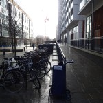
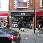
So I went down to Dalston Junction and took pictures of the area between and around the two stations, starting just south of Dalston Junction and then walking north, picking up some shopping in Sainsburys and having a coffee in fed on the way.


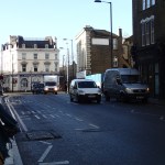


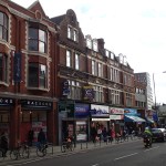

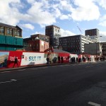
Quite frankly, I think that for most of the buildings, only some of the frontages and some interiors like that of the former eel and pie shop, are worth saving.
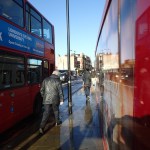
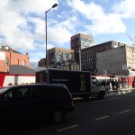
But as my pictures show the two main problems in the area are the movement of large volumes of both vehicular traffic and pedestrians.
As I don’t drive, I have no personal interest in the former, if the buses still get through.
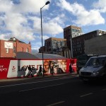
But I regularly walk up and down the Kingsland Road to Sainsburys, Boots and the Market. The pavements are a nightmare, as they are narrow and very busy.
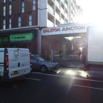
The new Dalston Junction part of the solution to the walking problem has been built, with a draughty but rain-free passage between the two station entrances.
So wouldn’t it be nice, if this passage could extend up to at least Dalston Kingsland station? If it did it might be a traffic generator for the underused bus station, which could do with more routes. A passage would of course make the interchange between the two stations easier.
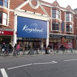
At least the Kingsland Shopping Centre is proposed to be redeveloped to a more modern layout. Pictures in the link, give hope that there could be a traffic-free route from at least Kingsland station to Dalston Lane, which somehow has to be crossed. The current arrangements of a light-controlled crossing works, but could be improved upon.
The walking link between the two stations will hopefully be improved when the new Dalston Kingsland station is rebuilt, as someone from London Overground indicated to me it will be, a few months ago.
Could something bigger be rolling through Dalston?
Something is and it’s called Crossrail 2.
In one of the pictures it shows a sign at Dalston Junction station, showing that it is 250 metres between the two stations.
I will make an assumption here, that Crossrail 2 will use the same Class 345 trains and platforms matched to their size as Crossrail 1. I think it would be a reasonable assumption to make, as this would mean a common fleet and a lot of repeated platform design.
And how long are the platforms on Crossrail 1?
They are 260 metres long.
So would it be possible to fit a double-ended station for Dalston, that avoided the Channel Tunnel Rail Link and was connected to the platforms at the two Dalston stations at each end?
I don’t know as I haven’t got the detailed dimensions, but the last time London Overground threaded a rail line under Kingsland High Street, they managed it without mishap. If the station followed the traditional hump-backed design, then it would rise up to the platforms, which would be deep under the area and could be connected to the two stations by escalators and lifts. If the Crossrail 2 station had a wide centre platform between the tracks, then it could also be used by passengers transferring between the two stations. The platforms would have platform edge doors, so there would be no safety or draught issues. It might even be possible to make the central Crossrail 2 platform wide enough for a cafe, kiosks and an information office.
The design would have advantages for passengers.
1. It would give full interchange between the North London Line, East London Line and Crossrail 2, which would make so many more journeys possible, like for example Turnpike Lane to Homerton or Shoreditch High Street to Ware, with just a single step-free change.
2. Dalston Junction is the first station on Crossrail 2, after the two northern branches have joined, so just as at Whitechapel on Crossrail, you could come down one branch walk across the platform, perhaps picking up a coffee on the way, and get on a train up the other branch.
3. In the case of an interchange between either the North or East London lines and Crossrail 2 it would be up or down on an escalator or in a lift, but between the East and North London Lines, you would have a nearly 250 metre walk as well. But the walk would be easier and more pleasant than the current one on the surface.
4. Would the ability to transfer at Dalston between the North London Line and Crossrail 2 serve Hackney sufficiently well, so that the need for the possible Hackney branch of Crossrail 2 could be delayed?
There could possibly be some advantages to Dalston
1. As the interchange between the East and North London Lines is now a safe walk out of the weather and traffic, would this be a good enough connection to make it unnecessary to reopen the Dalston Eastern Curve, thus releasing this land for something better in perpetuity.
2. But the great advantage of this plan to Dalston, is that it doesn’t require any demolition of buildings on the surface, except for the unloved Dalston Kingsland station.
3. Dalston Junction station already has a building that is big enough, but could you do away completely with buildings at Dalston Kingsland station? You might just have escalators ending level with the street and a simple glass front like the new Tottenham Court Road tube station. The money saved on the building could be used to add extra escalators and lifts. Perhaps on both sides of Kingsland High Street.
I probably have all this totally wrong, but I believe that Crossrail 2 could be a bigger opportunity for Dalston, if a double-ended station is built to serve both Junction and Kingsland.
It is only possible because the Victorians had the foresight to build the two Dalston stations the same distance apart as the length of a Crossrail station.
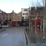
Tidying Up Dalston Kingsland Station
They would appear to be getting to grips with the vegetation at Dalston Kingsland station.
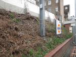

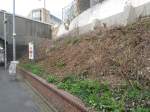

As the Dalston Eastern Curve Garden is under threat from the expansion of the shopping centre, why don’t they ask that team to improve the station?
One surprising thing, is that you rarely see a vandalised garden in Hackney. This doesn’t fit the stereotype.
How Did They Get The Graffiti Up There?
I took this picture at Dalston Kingsland station.

How Did They Get The Graffiti Up There?
Obviously, they couldn’t have used a ladder, so it must somehow have been painted from the top.
