Plans Shown Off For A Bridge Across The Thames At The Barrier
The title of this post is the same as that of an article on IanVisits.
This Google Map shows the location of the Thames Barrier.
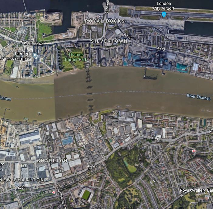
Note the City Airport to the North and Charlton to the South.
I think it could be a valuable link for pedestrians and cyclists.
The Northern End
The Northern end of the bridge would be a pleasant five-minute stroll through Thames Barrier Park to the Pontoon Dock DLR station, as this Google Map shows.
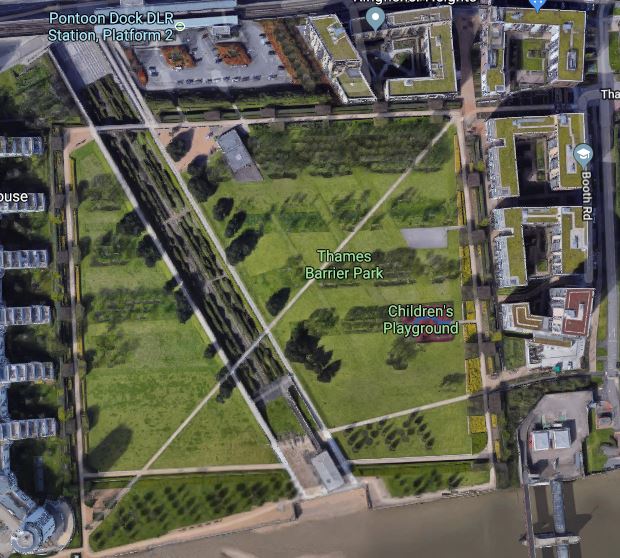
Note that there is a cafe in the park.
The Southern End
What would happen at the Southern end of the bridge is less clear, as this Google Map shows.
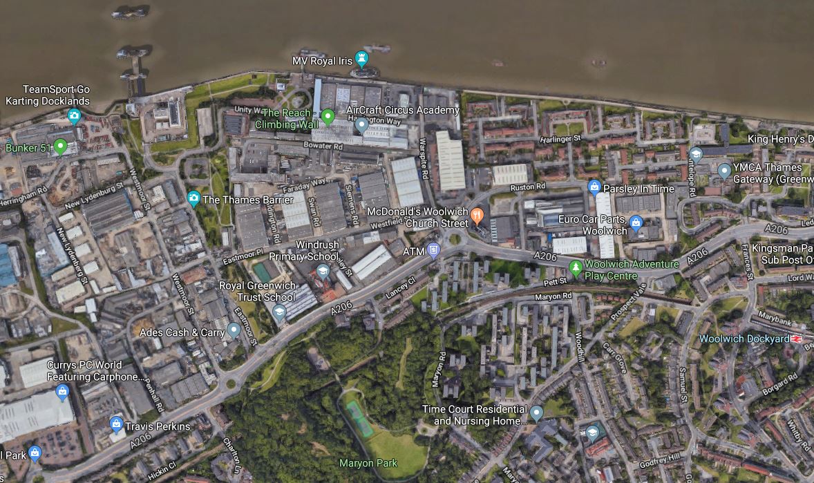
The Thames Barrier is visible at the top of this map.
Could a network of cycle and walking routes be created between Maryon Park and the bridge?
These could also extend East to Charlton station and The Valley and West to Woolwich Dockyard station, which is just on the map.
Conclusion
I think it could be a valuable link for pedestrians and cyclists, through a new cross-river park.
June 4, 2019 Posted by AnonW | Transport/Travel | Cycling, Docklands Light Railway, Thames Barrier, Thames Barrier Pedestrian Bridge, Walking | Leave a comment
About This Blog
What this blog will eventually be about I do not know.
But it will be about how I’m coping with the loss of my wife and son to cancer in recent years and how I manage with being a coeliac and recovering from a stroke. It will be about travel, sport, engineering, food, art, computers, large projects and London, that are some of the passions that fill my life.
And hopefully, it will get rid of the lonely times, from which I still suffer.
Why Anonymous? That’s how you feel at times.
Charities
Useful Links
Top Posts
- Crafty Electrification On The Rhymney Line
- The Proposed Lionel Road Station On the West London Orbital Railway
- Platforms 11 and 12 At Stratford
- New Railway Line For West London Proposed
- Changing Between The Circle/District Lines And Victoria Line At Victoria Tube Station
- Kent On The Cusp Of Change - Longfield Station
- Grand Central DMU To Be Used For Dual-Fuel Trial
- The London Tramlink Is Now Shown Properly On The Tube And Rail Map
- The Barbican Entrance To The Elizabeth Line - 10th June 2022
- The Design Of The Class 378 Trains Keeps The Gospel Oak To Barking Line Running
WordPress Admin
-
Join 1,884 other subscribers
Archives
Categories
- Advertising Architecture Art Australia Banks Battery-Electric Trains BBC Buses Cambridge Coeliac/Gluten-Free Construction COVID-19 Crossrail Death Decarbonisation Design Development Docklands Light Railway Driving East Coast Main Line Electrification Elizabeth Line Energy Engineering Entertainment Floating Wind Power Flying Football France Freight Germany Global Warming/Zero-Carbon Good Design Gospel Oak And Barking Line Greater Anglia Great Western Railway Heathrow Airport High Speed Two Highview Power Hydrogen-Powered Trains Innovation Internet Ipswich Town King's Cross Station Law Liverpool London London Overground London Underground Manchester Marks and Spencer Network Rail New Stations Offshore Wind Power Olympics Phones Politics Project Management Religion Research Scotland Shopping Solar Power Stations Step-Free Stroke Television Thameslink The Netherlands Trains United States Walking Weather Wind Power Zopa
Tweets
Tweets by VagueShot


