Walking From De Beauvoir Town To London Fields
This walk follows the route that I traced in Cycling Across De Beauvoir Town.
I’ll show the Google Map from that post
Cycling Across De Beauvoir Town
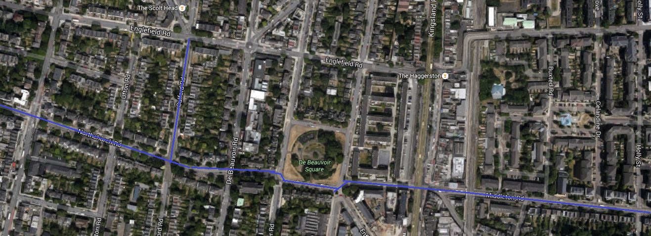
The route, which I started on Southgate Road is traced by the blue line. I continued up Middleton Road to London Fields.
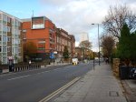
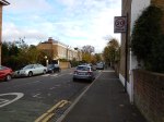
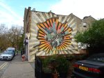
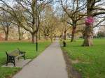
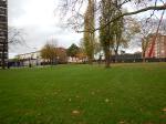
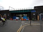
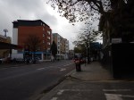
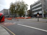
These are pictures I took on the way.


It is an absolutely flat route, except for the dip under the railway. This will surely encourage people to walk and cycle along it.
Cycling Across De Beauvoir Town
When I wrote Walking From Haggerston Station To Mare Street, I hadn’t realised how the scheme to effectively convert Middleton Road into a car-free route, would affect De Beauvoir Town.
Look at this Google Map, which shows the car-free route across London Fields.

Car-Free Route Through London Fields
The map is rather vague about what happens when it crosses the Kingsland Road and all it shows is a wavy line, which if you enlarge it and use a magnifying glass, has something like Northchurch Road written on it. This Google Map shows the area from Southgate to Kingsland Roads.
Cycling Across De Beauvoir Town
I think as Middleton Road links up to the South Side of De Beauvoir Square, that the downward kink in the route is De Beauvoir Square, so the route goes past St.Peter’s Church and then up Northchurch Road. For the first part of Northchurch Road, the route is following the route of the Cycle Superhighway CS1, that goes up Culford Road.
The two cycling routes are marked in blue on the map.
If the traffic scheme in London Fields is made permanent, I think I will be pleased, as it would give me a car-free cycle route from my house to the Cultural Quarter of Hackney.
If there were Boris Bike stations in De Beauvoir and London Fields, I wouldn’t even have to buy a bike.
On the other hand the London Fields scheme could generate a lot of cycling traffic through De Beauvoir Town.
Others might not be so pleased!
Later I walked the route and there are photographs of it in Walking From De Beauvoir Town to London Fields
Walking From Haggerston Station To Mare Street
I did this walk as the area from East of Haggerston Road through London Fields is going to be traffic calmed, as described in this page on the Hackney Council website.
This report in the Hackney Citizen is entitled London Fields residents clash over car-cutting measures. This is said.
Residents are at loggerheads over council proposals for a car-free zone to the west of London Fields.
During the three-month trial period, due to begin in January, Middleton Road and surrounding streets will be blocked off to motorists, allowing cyclists and pedestrians to travel freely down Middleton Road.
Residents will still be permitted motor access to all streets.
Nothing is as difficult as getting the correct mix of traffic. They also provided this map.
Car-Free Route Through London Fields
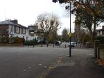
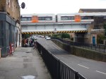
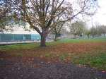
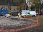
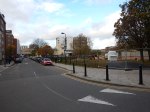
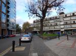
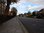
So I took a lot of pictures as I walked.


My observations.
- It was a charming walk, through fairly wide streets with lots of trees. Hackney is no crime-ridden wasteland!
- There was no sign of any traffic calming.
- The area has a high level of cycling. I suppose being flat helps.
- There were a few cases of traffic rushing about.
- Stonebridge Gardens is being upgraded with a new design.
I remember the area from the 1970s, when C ran a short life house for ex-prisoners, just off Mare Street. You could say the area has improved, without too much drastic change. This Google Map shows the area, where I walked.

Haggerston To London Fields
Haggerston station is on the East London Line at the West (left) and London Fields station on the Lea Valley Line is to the right of the green space that is London Fields, with its fifty metre heated outdoor pool. Mare Street is the A107 running down the map to the right of the railway.
I live just a few hundred metres from the top left corner of the map.
It will be interesting to repeat this walk, when the traffic calming is complete and they’ve finished painting the bridge.
