A Four-Poster Station
When most railways in the world were built, no-one bothered about the disabled, the elderly and people pushing prams or trailing heavy cases, so station design was based around able-bodied people.
There were examples, like Caledonian Road, where the step-free access is up with the best of modern practice, but stations like that are a rarity.
In my visits around the country, I’m increasingly finding stations where there are several lifts, often made by the same company who made the stairlift advertised by Dame Thora Hird. I don’t know the cost of lifts but it strikes me that they must make all of these lift installations value for money.
Over the last few weeks, I’ve come across several places in this country, where two lines cross at an angle on different levels, where a connection might be of value to passengers.
The link between Hackney Downs and Hackney Central stations, is such a connection and it would appear to be successful. I’ve certainly not read any criticism in the media on either operational or aesthetic grounds. I’m sure if an incident as small as a child dropping and losing a ten pence piece had happened, there’d be headlines all over the place blaming Boris.
In Birmingham, there is the Cross-City Line, which conveniently passes in a cutting under Birmingham Moor Street station after stopping at New Street station. But there is no connection.
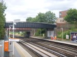
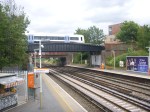
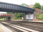
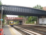
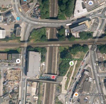
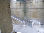
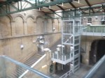
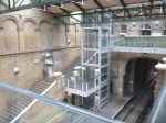
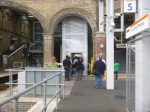
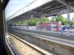
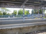
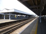
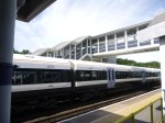
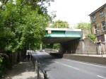
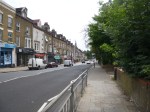
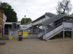
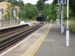
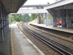
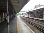
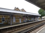
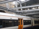
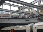
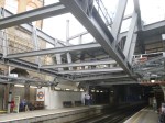
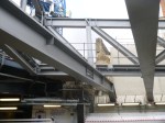
Then today, I was at Brockley, where in their Transport Infrastructure Plan for 2050, Transport for London are proposing a Brockley High Level station.
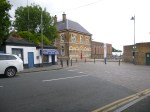
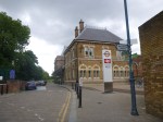
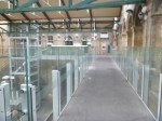
Brockley station sits underneath and is crossed by the Bexleyheath Line and these pictures show the station and the line crossing above.
This Google Map shows the two lines crossing.
Brockley Station
There was a station called Brockley Lane on the Bexleyheath Line, but it closed in 1917.
I believe that modern structural engineering would allow the addition of two platforms to the sides of the rail bridge carrying the Bexleyheath Line. From the look of the bridge, it seems to be in very good condition.
In the case of Brockley station, the current platforms already reach under the bridge and to connect the two pairs of platforms. There would be four lifts with one in each corner. So there would be a lift between both North-South platforms and both East-West platforms! At Brockley, because the height between the two levels isn’t too great, stairs could also be provided if it felt passenger traffic required it. Some form of alternative way of getting off the high level platforms would be needed for emergency reasons.
The advantages of this approach are.
1. There is no serious track changes necessary at Brockley, as the new platforms are built alongside an existing rail line, but obviously there would need to be some signalling work.
2. The lifts would be the standard structures we see all over the UK rail network, modified to fit the application.
2. All interchanges will be step free.
3. As much station infrastructure can be provided on each platform, as it felt the passengers would need, thus keeping costs to a minimum. At Brockley, perhaps a shelter and a refuge for the staff, would be sufficient.
4. If gated access was not provided to the two high-level platforms on the Bexleyhealth Line, a safe Emergency Exit would probably meet the needs of evacuation.
The only disadvantage I can see, is that the two high-level platforms would need to be well-sheltered, as I suspect, it could be very cold and blowy up there at times.
In all my travels, I’ve never seen a station designed like this. Although some of the stations on the Docklands Light Railway like Deptford Bridge feature platforms suspended alongside the railway with access at both ends. But the budget there didn’t stretch to four lifts! That station incidentally is suspended on a bridge across a major road.
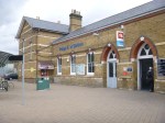
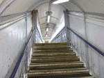
A Station That Needs Its Lifts
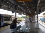
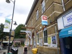
Crystal Palace station is an architectural gem, although it has no Listed status.
It has been restored sympathetically by Transport for London to comply with modern disability access routines, but the station does not seem to have lost the Victorian persona that would have been obvious, when it opened in the mid-1850s.
The pictures don’t do it justice.
But they do show the height that modern free-standing lifts can handle. Even if, as was happening today, the lifts are rather busy.
Certainly, Crystal Palace station is one that needs its lifts.
It makes you wonder how ladies in full Victorian dress with long wide skirts, tightly laced into corsets coped with the stairs.
It looks like the way the station has been restored would allow an appropriate film with a Victorian theme to be filmed without getting the modern lifts into shot.
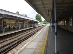
Herne Hill Station
The more I read about Herne Hill station, the more I’m fascinated with its problems. The Wikipedia entry starts with these two paragraphs.
The station building on Railton Road was opened in 1862 by the London, Chatham and Dover Railway. Initial service was only to Victoria, but by 1869 services ran to the City of London, King’s Cross, Kingston via Wimbledon, and Kent, including express trains to Dover Harbour for continental Europe. The arrival of the railways transformed Herne Hill from a wealthy suburb with large residential estates into a densely populated urban area.
In 2011, Network Rail recommended terminating all northbound Thameslink trains from Herne Hill at Blackfriars from 2018, freeing up capacity on the Thameslink cross-London section for trains via London Bridge. The Department for Transport announced in January 2013 that services from Herne Hill would continue travelling across London after 2018.
The first paragraph illustrates one of the problems at Herne Hill. To my mind, the real problem is that we have Victoria towards the west of London acting as a terminal for trains from Kent and the Eastern part of Surrey, which then have to cross major North-South services like Thameslink and the London Bridge to Sussex services. It’s a crazy mess that has been well over a hundred years in the making, because successive rail management has sidestepped the problem.
Network Rail’s design for Thameslink was probably the best they could do in this pressure cooker, but it annoyed too many civil servants and politicians, so it couldn’t be allowed. I’ve seen this so often in major projects, where engineers, designers and other professionals have recommendd one course of action, but polticians have said you can’t do that, as my gardener will lose his allotment.
In Improving the East London Line about Herne Hill station, I said this.
It has problems, as it would appear a gallon is being squeezed into a gill pot! If you read this article in London Reconnections, you’ll see that it is not just a serious problem, but an almost impossible one.
To make matters worse, Network Rail’s proposed solutions have seemed to be hindered by the Dulwich Estate retaining significant planning powers, which only an Act of Parliament can resolve.
With all my scheduling experience,I can’t help feeling that Thameslink is going to be a disaster unless something is done to sort out the knitting in the Herne Hill area or the number of trains through the area, is matched to the capacity.
This extract from Wikipedia explains why capacity is low at Herne Hill.
The four tracks are served by two island platforms; northbound trains call at the western platform and southbound trains the eastern platform, providing cross-platform interchange between the two routes.
There are flat junctions at each end of the station: Herne Hill North Junction, where the lines to Loughborough Junction and Brixton diverge; and Herne Hill South Junction, where the lines to West Dulwich and Tulse Hill diverge. Thameslink and Southeastern services cross each other’s paths at the junctions, constraining capacity on both routes. The station also has a turnback siding on its eastern side, adjacent to Milkwood Road.
Imagine two roads crossing at an angle, where there were traffic signals letting through a few vehicles at a time. Slow isn’t it?
The only solution would be to have a flyover, but there are too many local objectors to this.
We could always dig the guys up who designed this mess and hang them. But although we might feel better, it wouldn’t help the problem.
So I just thought I had to go and look at this troubled station and pour my four-pennyworth of burning oil on the problem. I took these pictures.
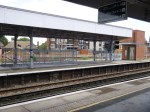
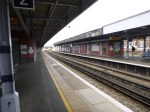
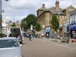

The pictures show the station is in good condition with good disabled access. There are also four bakeries and lots of cafes and restaurants for those who jump train at Herne Hill because of the slow progress.
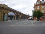
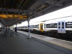
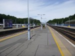
Orpington Station – 3rd August 2015
After An Exploration At Penge, took a train from Penge East station to Orpington station.
These pictures I took, show a well-appointed station with full step-free access and a selection of long through and bay platforms.


Could Orpington be one of the extra destinations that are needed by the East London Line?
It takes thirty four minutes of travelling time to get to Whitechapel changing at New Cross at the moment, so it is actually closer than West Croydon, which takes forty minutes.
The route passes through a series of important and busy stations like New Cross, Lewisham and Petts Wood. It could either be via Beckenham Junction and Bromley South or via Hither Green and Chislehurst.
Using Opington as a destination for the East London Line would appear to connect a lot of South East London to Crossrail at Whitechapel and the Jubilee Line at Canada Water.
It would also fit in well with Transport for London’s desire to take over services in South East London. The Wikipedia entry says this.
However, since taking over the West Anglia services, TfL have once again proposed to take over the suburban routes, currently operated by Southeastern after their franchise ends. The opposition to TfL taking over routes from Kent County Council have softened after a London Assembly meeting, which Kent County Council attended. Kent have set out “red lines” to its support, stating no Southeastern Mainline service should be negatively affected by a take over by TfL.
So bringing an uprated East London Line to Orpington might appear on the surface to fit in well with TfL’s ambitions.
It certainly seems that they have big ambitions in South East London.
Could it be Borough Jealousy?
Councils like Bromley have seen the improvements in transport and the related benefits in Northern boroughs like Hackney, Islington and Brent and want a piece of Orange action themselves.
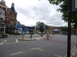
An Exploration At Penge
I took the Overground to Penge West station and then walked to Penge East station. The walk is about 15 minutes.
The objective was to investigate the Penge Interchange proposed in the Transport Infrastructure Plan for 2050, After all, I can’t find any other reference to this on the Internet. Even if you search the whole of the Infrastructure Plan, Penge is only mentioned once.
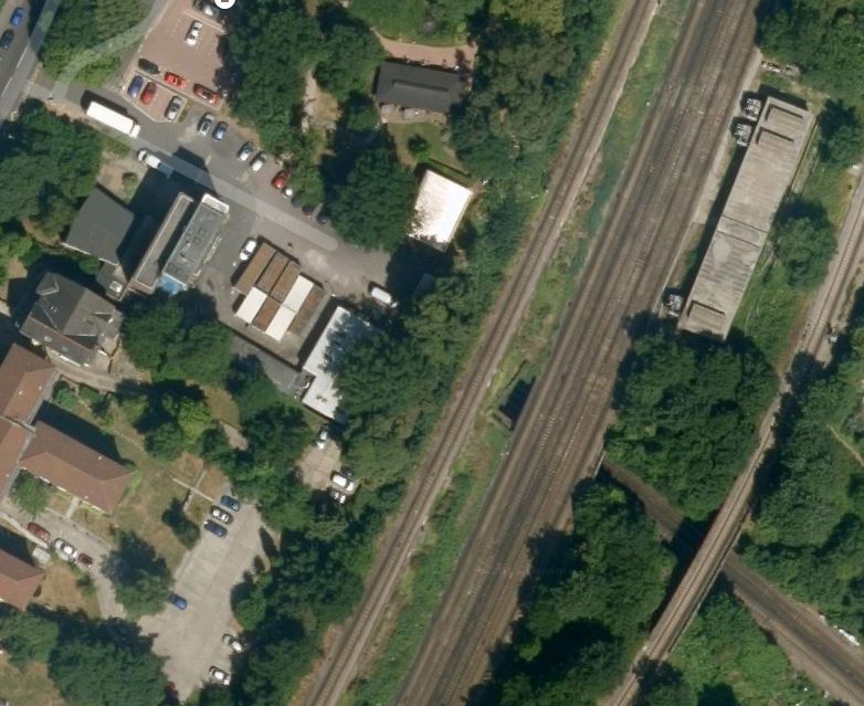
This is a Google Map showing both stations.
I took these pictures at Penge West station
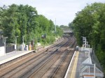
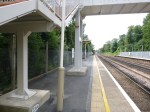

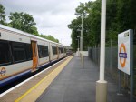
Penge West is a typical South London station, but it is not step-free and it has an uncovered bridge. There is also only one entrance and exit on the Northbound platform. It will have to be rebuilt with a new footbridge and a possible entrance/exit on the Southbound side. This Google Map shows the station and the surrounding area.
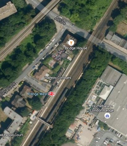
Penge West Station
It would appear that there is enough space to rebuild the station with a second entrance/exit on the Sounthbound side of the lines. The other line crossing the top left corner of the map, is the line that takes the East London Line to Crystal Palace.
Whilst I walked to Penge East station, I took these pictures.

The bridges at Penge West station, probably rule out any connection of the two lines in a rebuilt station.
Incidentally, the walk is well-signposted except for the unfortunate sign directing you to Penge East station off the High Street, which is only visible when you’ve passed by.
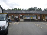
These are pictures of Penge East station.


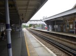

The station has the worst footbridge, I’ve seen for a long time and surely only the grace and favour of the woodworms holding hands, stops it from falling onto the railway. It is of course not step-free.
Believe it or not this dreadful footbridge is Listed. It also is a regular walking route across the railway for people not using the trains.
So making Penge East station comply with the disability Regulations would mean putting a second footbridge somewhere else.
The irresistible force of the Disability regulations has met the immoveable object of the Heritage Lobby. Wth which group would Network Rail least prefer to have a big fight?
This Google Map shows the area from Penge East station to where the lines go under the Brighton Main Line
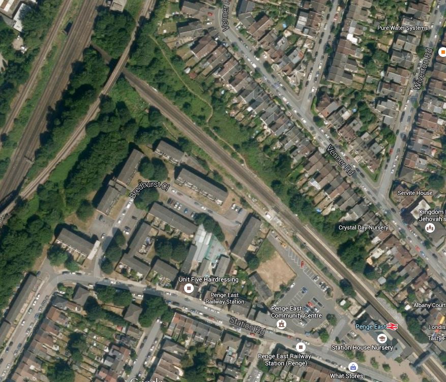
Penge East Station
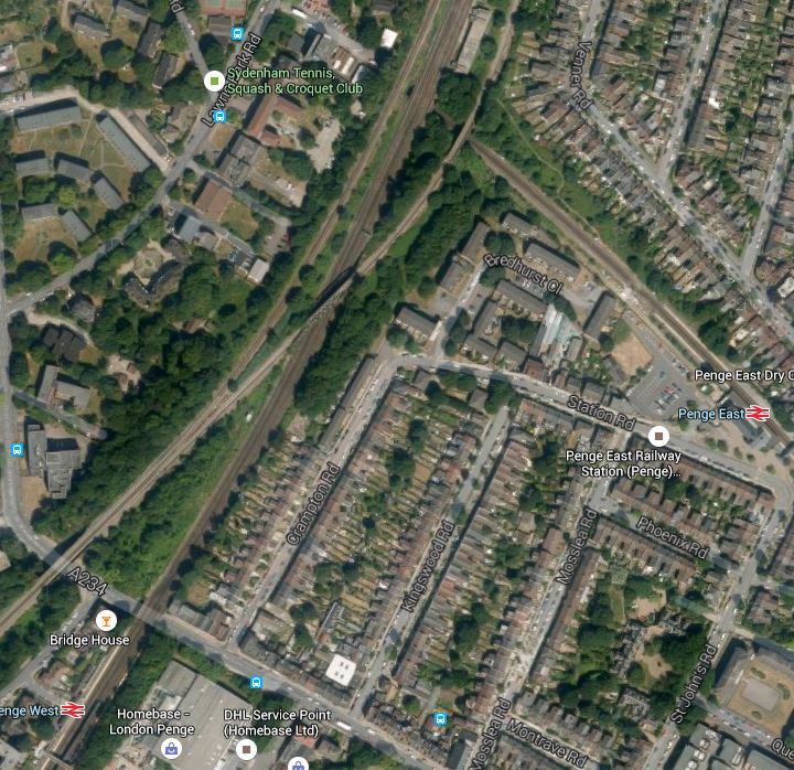
I think that having looked at both Penge East and Penge West to improve services in the area, TfL and Network Rail have taken the decision to perhaps build a new Penge Interchange station, where the lines cross.
This has led to the inclusion of the single word, Penge, under a list of possible interchange stations in Transport for London’s future predictions. This Google Map shows the area where the lines cross.
A Possible Site For A Penge Interchange Station
There are actually three groups of lines that cross the lines through Penge East.
- The single-track northbound Sydenham Spur linking Crystal Palace to the Brighton Main Line.
- The four-track Brighton Main Line with the slow lines on the outside.
- The single-track southbound Sydenham Spur linking the Brighton Main Line to Crystal Palace.
Depending on how much you would want to spend, you could build new platforms on the Brighton Main Line and the Sydenham Spur and link them by lifts to platforms on the line through Penge East.
A few points.
1. I think that the platforms would be extended from Penge East towards the new interchange.
2. The Listed footbridge at Penge East would be saved and the woodworm can be given help from craftsmen to hold the bridge up.
3. There would appear to be a service tunnel under the railway, that gives access to the building on the eastern side of the Brighton Main Line. Could this help in the design and construction of the station?
4. From the Google Map, there would appear to be space for an access to the station from Lawrie Park Road.
5. The area around Penge West station could probably be connected to the new complex by a footpath running along the railway lines. There could also be some rerouting of buses.
6. The station could probably be designed to create an East- West walking and cycling route under the railway.
7. Network Rail would get improved access to their building on the eastern side of the tracks.
It is also interesting to look at the passenger statistics for the stations in the area for 2013-14.
- Penge West – 0.5 million
- Penge East – 1.5 million
- Anerley – 0.7 million – South of Penge West
- Sydenham – 2.3 million- North of Penge West
These statistics provoke me to say, that if a Penge Interchange station was developed where the lines cross, would it be sensible to close the current Penge West station?
After my visit to Penge and my cursory investigation, I am led to the conclusion, that building a new Penge Interchange station, which possibly incorporates elements of the current Penge East station, and closing the lightly-used Penge West station, is not an impossible dream.
Whitechapel Station – 3rd August 2015
There has been another busy weekend at Whitechapel station.


There has been no news of problems, that will delay the opening of the temporary entrance in the Autumn.
