Brentford’s New Stadium Is A Step Nearer
This article in the Construction Enquirer is entitled Go-ahead for Brentford FC stadium and 650 homes.
The article describes how detailed planning permission has been secured and that given the result of a Public Enquiry is settled, construction will be completed for Brentford to move in at the start of the 2018-19 season.
The new stadium will have a capacity 20,000 as opposed to 12,300 for Griffin Park.
This Google Map shows the new stadium’s location in Lionel Road South.
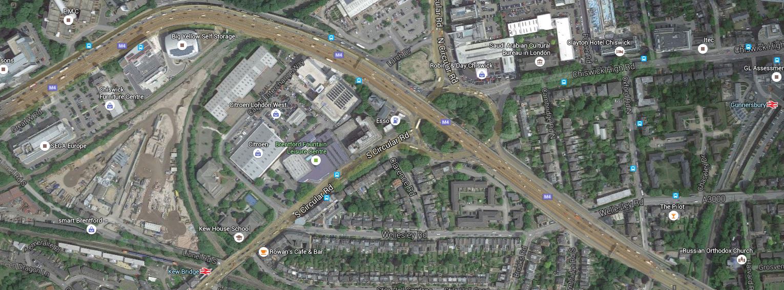
Brentford’s New Stadium
Most of the site and all of the stadium are within the triangle of rail lines above Kew Bridge station, which is at the bottom of the map. The M4 Motorway curves round the North side of the site.
Maps from the club, show that the stadium lies alongside the railway line at the top of the triangle.
This Google Map shows an enlargement of just the area of the development.
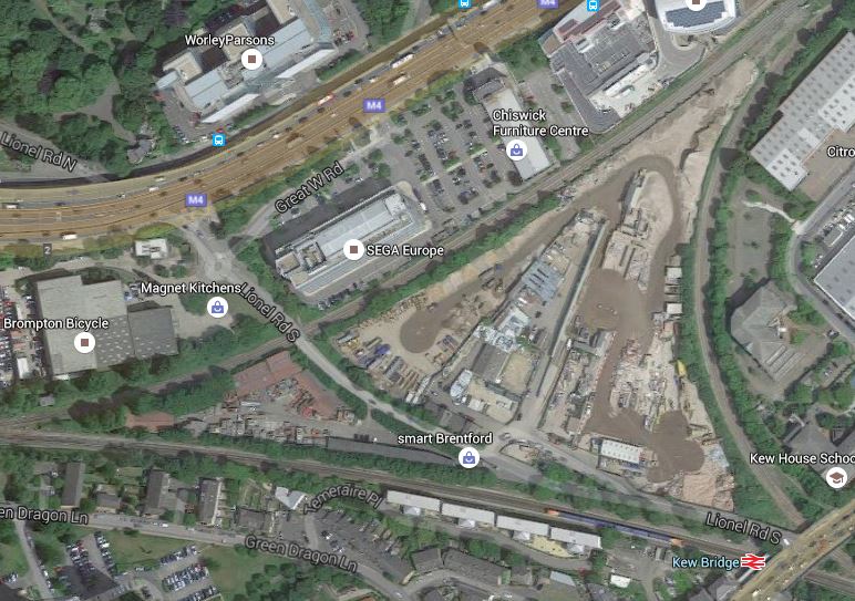
Enlarged Map Of Site
This line goes between Brentford and South Acton stations, although there are currently no passenger services, but there have been services in the last twenty years. It should be noted though that Transport for London have thought about using this line to extend the London Overground to Hounslow station.
Having met one of TfL’s property experts, I feel that they would be amenable to plans to use the air space above the line.
The line at the bottom of the triangle is the Hounslow Loop Line, where Kew Bridge station is very convenient for the ground.
The triangle is completed by a curve that connects the North London Line to the Hounslow Loop Line.
It should also be noted that at the eastern edge of the main map is Gunnersbury station, which along with Kew Bridge station is one of the proposed ways to get to the stadium.
I do wonder, if TfL’s ambitions for the London Overground, would be heklped by a station on the line at the top of the triangle.
On a first look, it looks like a good attempt to squeeze a football stadium into West London.
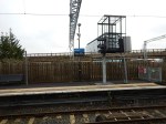
Rochester’s New Station
This morning an article on the BBC, entitled, Rochester’s £26m railway station opens to trains, caught my eye.
So I just had to go and look at Rochester station and take some pictures.


I think the twenty-six million pounds has given Rochester a stylish new station.
- It’s been perfectly positioned to give good access to the City Centre.
- Note that a light-controlled crossing will be added outside the station.
- It’s been built as a gateway to the city and when you arrive you have good views of the river, the castle and the cathedral.
- The toilets must be the best in any smaller station.
- Remember too, that there are still details to finish, like the walls and the railings.
Let’s hope other architects and builders aspire to the high standard that Rochester has set!
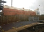
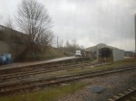
The Bletchley Flyover
The Bletchley Flyover is a large flyover that allows trains to cross the West Coast Main Line at Bletchley station.
This Google Map shows the area of Bletchley station and the flyover.
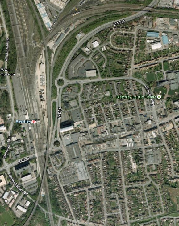
Bletchley Flyover
The double-track Bletchley Flyover starts in the South-West corner of the map and crosses the West Coast Main Line at an acute angle before, splitting into two separate double-track lines, alongside the station and north of the circular roundabout.
- One branch goes North along the West Coast Main Line to Milton Keynes.
- One branch goes East along the Marston Vale Line to Fenny Stratford and Bedford.
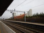
It is a massive structure as these pictures show.

I think the problems of incorporating the following services through Bletchley are going to be challenging.
- Oxford to Milton Keynes
- Marylebone to Milton Keynes via Aylesbury.
- Oxford to Bedford.
- Freight Services.
This section in the FAQ of the East West Rail web site is entitled What train services will run on East West Rail (Western Section)? It says that frequencies of one train per hour will be run, but that more information will be released in 2016.
Will one probably four car train per hour be enough?
This would mean that two trains per hour would visit Milton Keynes. As Platform 2A at Milton Keynes Central can accommodate five car trains and it is electrified, it would appear that that station is ready for the East West Rail Link.
The difficulty also depends if the passenger services stop at Bletchley.
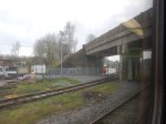
The current plans talk of two high-level platforms on the flyover.
This enlarged Google Map shows the platforms and footbridge at Bletchley station and the flyover.

Bletchley Station Platforms And The Bletchley Flyover
Note.
- The entrance to the station is on the west side.
- The two island platforms are 2/3 and 4/5, with two outer platforms 1 and 6.
- Trains on the Marston Vale Line terminate in Platforms 5 and 6.
- The flyover is the easternmost pair of lines.
- It splits into the Milton Keynes and Bedford lines level with the footbridge.
- The two proposed high-level platforms would be on the narrower part of the flyover, south of the footbridge.
A second entrance to Bletchley station has been proposed for the east side in Saxon Street.
One other thing that could help, is there are aspirations to move the concrete plant out of its location between the flyover and Bletchley station. It is certainly no asset to the area.
The following train services, would appear to have to use the flyover.
- Oxford to Milton Keynes
- Milton Keynes to Oxford
- Marylebone to Milton Keynes
- Milton Keynes to Marylebone
If trains between Oxford and Bedford, didn’t need to call at Milton Keynes, they would also be able to go straight over the flyover.
If they did need to call at Milton Keynes, then a train from Oxford to Bedford could take the following route.
- Over the flyover taking the branch to Milton Keynes.
- Call at Milton Keynes in an appropriate platform.
- Reverse out and then call in either Platform 5 or 6 at Bletchley.
- Reverse out and then take the Marston Vale Line.
Effectively, they would call at both the new high-level and current platforms at Bletchley station.
If I was running a train service from say Norwich or Ipswich to Oxford, to maximise my passenger levels, I would want my trains to call at the following stations.
- Cambridge
- Bedford – To also connect to services to Nottingham and Sheffield.
- Milton Keynes – To also connect to services on the West Coast Main Line.
The FAQ says that trains between Oxford to Bedford would not go to Milton Keynes.
I know that passengers would complain, if they had to stand on a draughty Bletchley station for say ten minutes, whilst waiting for a train to Milton Keynes, to get their Glasgow train.
To further complicate matters will other services could want to go between Milton Keynes and Bedford. On current plans, it is probably impossible without a reversal of direction at Bletchley.
A perfect design, would have a double-track chord connecting the Marston Vale Line to the Northbound West Coast Main Line.
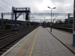
Platform Space At Milton Keynes Central
In Future Rail Developments At Milton Keynes, I said that there with all the new services, there would have to be some extra platform space.
So I went to Milton Keynes Central station and took these pictures.
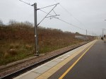


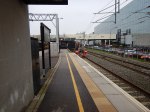
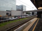
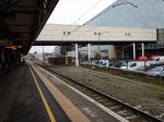
At a quick look there does appear to be more space, than is normal in stations of this size. But then it was only built in 1982.
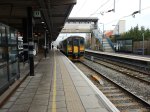
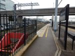
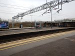
Platform 2A
The Platforms and Layout section of the Wikipedia entry for the station, says this about the length of Platform 2A.
Platform 2A is a five-car south-facing bay platform.
I would assume, that the car length is the standard British Rail length of twenty metres.
The pictures clearly show that the platform is electrified.
