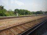
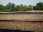
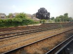
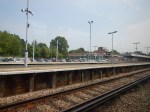
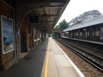
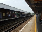
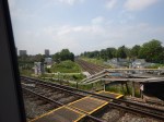
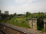
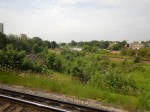
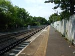
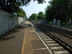
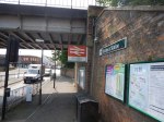
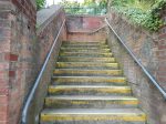
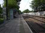
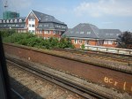
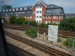
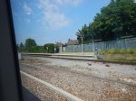
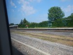
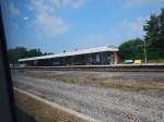
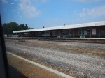
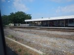
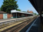
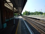
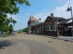
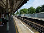
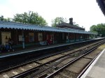
Beckenham Junction Station
Beckenham Junction station is one of the stations on a proposed South London Outer Orbital
These are pictures I took of the station, as I passed through.
Beckenham Junction offers the following connections.
- A link to Tramlink.
- A link to Thameslink in the peak hours.
- A link to Victoria via Herne Hill
- A link to London Bridge via Crystal Palace.
I also think that as I said in Do We Make The Assets Sweat At Crystal Palace Station?, that there will be a good one-change link to Beckenham Junction from the East London Line.
There are worst stations to get stuck!
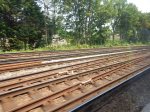
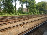
Bromley Junction
In the June 2016 Edition of Modern Railways in an article is entitled Turning South London Orange.
One of the proposals is to create A New South London Orbital Rail Route.
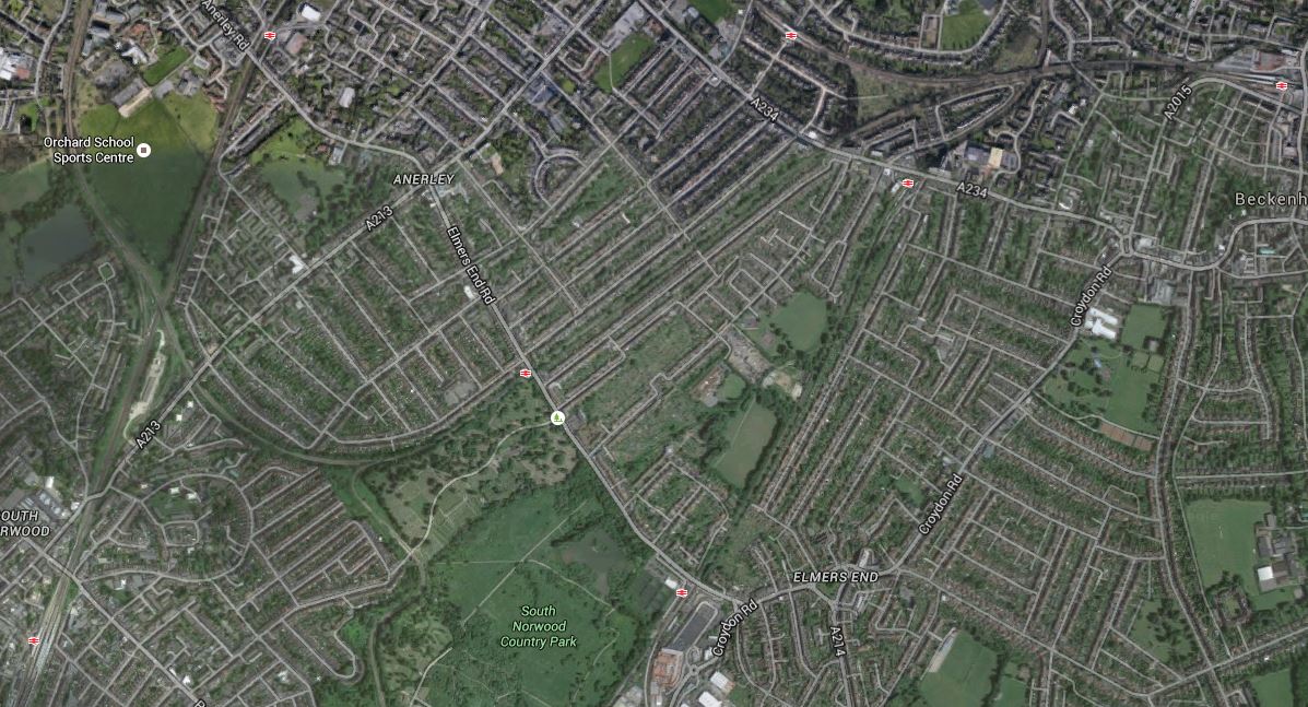
The writer of the proposal suggests that there would be a three kilometre tunnel between Norwood Junction and Kent House to connect the East and West halves of the route.
I believe that if the tunnel were to be built that the Southern portal would be located in the region of Bromley Junction, which is North of Norwood Junction station.
This Google Map shows the area.
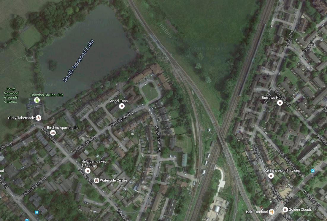
Bromley Junction
The lines are as follows.
The line going North West goes to Crystal Palace.
The line going North East is the Brighton Main Line to New Cross Gate and London Bridge.
The East London Line to Whitechapel and Dalston Junction shares the tracks of the Brighton Main Line.
The continuation of the Crystal Palace line turns east to Beckenham Junction and Bromley South and Orpington.
The Brighton Main Line continues South to Norwood Junction, East Croydon and Brighton.
This map from carto.metro.free.fr shows the lines around the junction.
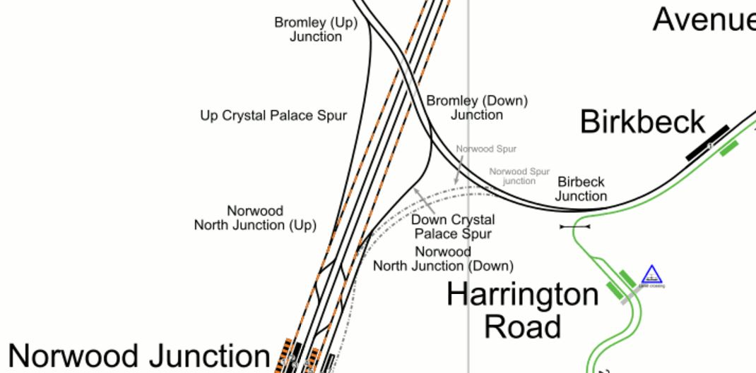
Lines Around Bromley Junction
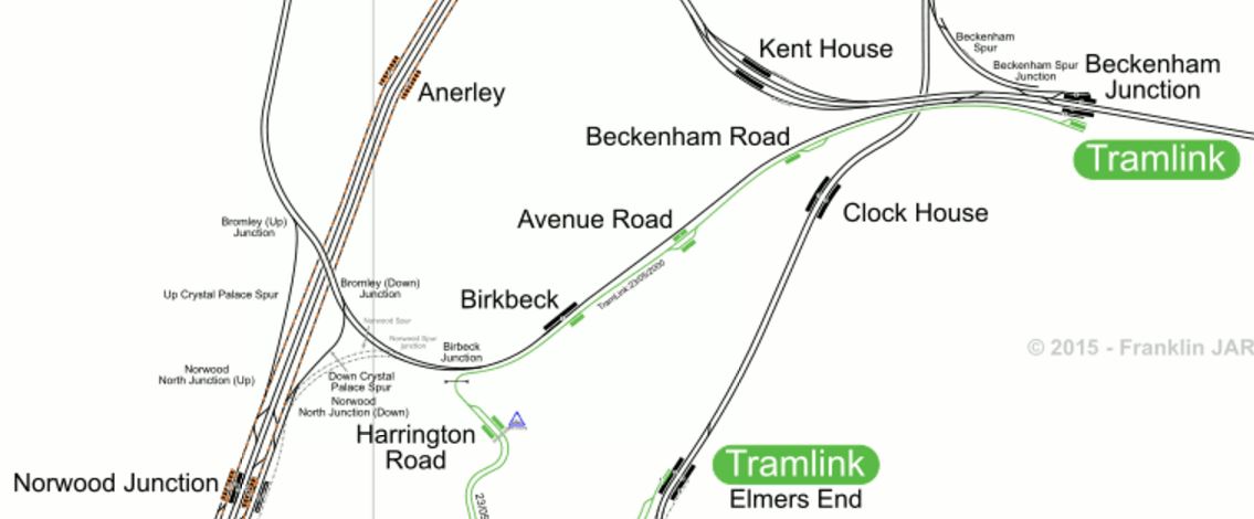
Note how to accommodate the tram from Harrington Road to Beckenham Junction via Birkbeck, the route from Crystal Palace to Beckenham Junction has been single-tracked.
It would also appear that this line was once connected to Norwood Junction station by the Norwood Spur.
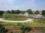
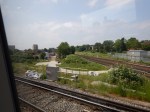
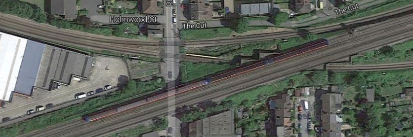
These pictures show the Bromley Junction.
I wouldn’t believe it would be impossible to build a new connection between Birkbeck and Norwood Junction stations.
The traffic through Birkbeck station is as follows.
- 2 tph to Beckenham Junction (Southern)
- 2 tph to London Bridge via Crystal Palace and Peckham Rye (Southern)
As the line is single-tracked that works out as a total of 4 tph.
I believe that with modern signalling and better track layout, that this figure could be increased.
So would it be possible to run trains on a new South London Orbital Route through the area?
Four tph on both routes would mean that there would be up to sixteen trains through the single-track in every hour. Difficult and it would need to be well-signalled and well-driven and possibly under full automatic control, but as a Control Engineer, I don’t believe it would be impossible, given that the trains on the orbital route would not be stopping between Norwood Junction and Beckenham Junction stations.
Could Tramlink Use The Heavy Rail Lines In South London?
Look at these pictures, I took at Birkbeck station, where one track is for heavy rail and the other is for London Tramlink.


When I took these pictures, I wondered, if it would ease the expansion of the Tramlink network, if trains and trams could share lines.
I am not talking about tram-trains, but more a useful approach to benefit both types of transport.
So lets list the problems.
Rail And Wheel Profile
One of the problems in Sheffield with the introduction of tram-trains is that the rail profile needs to be changed to one that is compatible with the existing trams and the new Class 399 tram-trains.
But to be fair it is a trial and problems will be thrown up.
Platform Height
As someone, who has travelled all over Europe on trams, trains and tram-trains, one of the biggest problem is getting the platform height right, so that everybody including those in wheel-chairs can get on and off easily.
On a scale of five, we generally score about four, but we mustn’t be complacent and I think it will get better.
Some continental countries have problems as their trains have a low step and you step up into the train. This is because traditionally, they had low platforms, whereas for some time, we’ve been aiming for step across.
Karlsruhe has been running tram-trains on their Stadtbahn for over twenty years and are putting in a tunnel to take the tram-trains under the city.
This is said about platform height.
In addition, the platforms of the station’s tunnel will have pedestals that are about 15 metres long with a height of 55 cm above the rail so that the first two doors of Stadtbahn trains will have step-less entry. This will make possible stepless entrance on lines S 4 / S 41 and S 5 / S 51 / S 52 in Karlsruhe for the first time, reflecting a trend that has long been standard elsewhere. The platforms cannot consistently have a height of 55 cm, because the tunnel will be used by trams and DC services of the Stadtbahn, which have an entry level on the modern lines of 34 cm.
If the Germans have to go to that sort of solution, with all their experience, then platform height must be difficult to get right.
I have not heard anything about the platform design at Rotherham Central station, where the platforms must accept trains as different as Pacers and Class 399 tram-trains.
Power Supply
The current trams need overhead power, which with most tram systems is 750 VDC.
So if you want to run Tramlink trams on third-rail lines in South London, you’ll need to put up overhead wires or fit the trams with contact shoes.
It is my view, that for Health and Safety reasons and some design ones too, that running trams using third-rail power will not be practical.
Remember, passengers know they can walk across the tram lines and frequently do, so whatever happens, you don’t want live rails under the trams.
So any rail route, that will be running trams will have to have the 750 VDC overhead supply.
In the Sheffield trial, to extend the Sheffield Supertram, a freight route to Rotherham is being electrified at 750 VDC, rather than the main line standard of 25 KVAC.
Signalling Systems
Rail and tram signalling are different. But after a successful tram-trial in Sheffield, the problems of trams and train sharing the same track, should have risen to the surface.
Rules Of The Tracks
Trams and trains run under different rules.
One main difference is that trams have a maximum speed of 25 mph, whereas trains run at whatever speed the line permits.
So for safety and other reasons, if trams and trains were sharing a length of track, they would have to run under the same set of rules.
I suspect this would mean that the maximum speed would be 25 mph.
In some ways the problems are the equivalent of managing traffic at an airport like Southend, where light aircraft share the runways and airspace with Airbus-319s.
I don’t think it is an insurmountable problem, as two-car diesel multiple units have shared tracks with 125 mph expresses and hevy freight trains for years.
An Ideal Mix Of Trains
So is an ideal solution to use 750 VDC overhead wires for the trams and diesel trains?
Possibly!
But you could always use IPEMUs or EMUs with an on-board battery.
Supposing there is a chord or link line, that would be ideal to be used by trams and say the ubiquitous Electrostars that are popular in South London.
Wires would be put up and all Electrostars using the line, would have to have enough battery capacity to bridge the gap in the track with no electrification.
West Croydon Station
A possible application might be at somewhere like West Croydon station.
The map from carto.metro.free.fr, shows the heavy rail lines through the station and the tram lines around it.
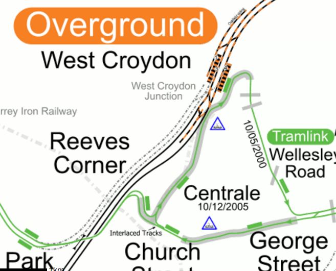
Lines Around West Croydon Station
I’m sure that the engineers in Karlsruhe would have had the trams going through the station to give same-platform interchange to and from trains.
Conclusion
Network Rail has a lot of tools in the box and I think that as technology develops, we’ll see some interesting ideas.
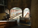
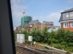
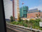
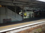
Do We Make The Assets Sweat At Crystal Palace Station?
Crystal Palace station is of a high standard, but given the amount of money spent, do we make the assets sweat?
These pictures show the station.


This is a Google Map of the station.
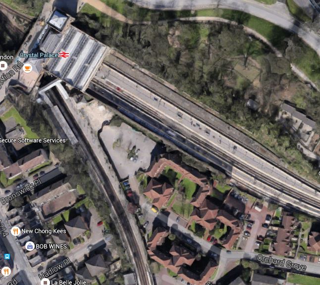
Crystal Palace Station
And this map from carto.metro.free.fr shows the platform and line layout.

Crystal Palace Platforms And Lines
Note.Platform 3, which is one of the terminating platforms for East London Line services is next to Platform 2, which is the platform for Beckenham Junction, West Croydon and Sutton.
- Unfortunately, the space between seems to have been used for new and expensive housing.
- At present most, if not all East London Line services seem to terminate in Platform 5 not Platform 3.
- Platform 3 would appear to have better walking connections to the two North-bound platforms 1 and 4.
So is this making the best use of the station?
In Increased Frequencies On The East London Line, I stated that from 2018, there will be two additional trains from Dalston Junction to Crystal Palace.
This will make 6 tph in total.
Let’s hope that these extra trains will connect to onward trains.
It would be so nice to go to Platform 3 at Crystal Palace every ten minutes, just walk across to Platform 2 and get a train a few minutes later to Beckenham Junction or even Bromley South and/or Orpington. In an ideal world, that would be followed a couple of minutes later by a train to West Croydon, Waddon, the new Bebbington station, Wallington and Sutton.
At the present time, only two tph from Dalston Junction give a reasonable connection, but you wait around fifteen minutes.
One point that the maps clear up, is that there would appear to be little space for a tram platform.
Was this why the proposal was dropped?
But if the frequency of trains between Crystal Palace and Beckenham Junction could be six tph, would a tram link be needed?
At present they are just 2 tph. But surely, once Thameslink is complete and there are more paths available to London Bridge, I’m certain that the frequency could be increased.
It needs to be at least 4 tph.
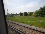
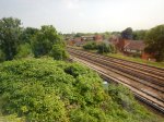
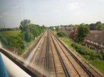
From Balham To West Croydon
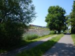
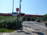
This series of pictures show the first part of a journey I took to get to Leatherhead station from Balham station.


Note.
- The Victoria end of the Brighton Main Line going South from Balham.
- The simple nature of some stations like West Norwood and Gipsy Hill.
- Sainsburys 5p orange bags are everywhere. All others are crap!
- Bromley Junction and how the route crosses the London Bridge end of the Brighton Main Line to the North of Norwood Junction station.
This map from carto.metro.free.fr shows the route from Balham to Norwood Junction (Just off map!) via Streatham Hill, West Norwood, Gypsy Hill and Crystal Palace.
Balham To Norwood Junction
Note how the Brighton Main Line goes South from Balham via Streatham Common and Norbury.
There certainly seems to be a lot of space for more development of the railway and/or housing.
Sutton Station
Sutton Station is one of the stations on a proposed South London Outer Orbital
These are pictures I took of the station and the town as I passed through.
Sutton is one of those stations, that will see a dramatic improvement in services in the next few years.
- Thameslink will get newer higher-capacity Class 700 trains.
- The Tramlink may finally reach the town. I wrote about this and a further extension in Why The London Tramlink Should Be Extended To The Royal Marsden Hospital.
Given all the development around the station, more services will be desperately needed.
Sutton will develop into a major hub station like Wimbledon, but with not anywhere near as many services as East Croydon.
A South London Orbital Route should call at Sutton to tap into the stations excellent connectivity.
Cheam Station
Cheam Station is one of the stations on the route a proposed South London Outer Orbital, although I doubt the limited-stop service would call.
I took these pictures as we passed through.
It is a curious station, quite unlike any others you see on the electrified lines South of the Thames. The layout is explained in the History section in the Wikipedia entry.
The station is almost 16 miles (26 km) from London Bridge station. Over the years Cheam station expanded, and was rebuilt and the rail bed widened in preparation for the installation of AC overhead electric services, which would have included the building of an additional central platform island. Due to the outbreak of the First World War, the full planned expansion was cancelled and was never completed. Nevertheless, the through lines were still in place until the late 1970s when the Bognor Regis and Portsmouth express services were withdrawn from the Sutton and Dorking route to serve an expanding Gatwick Airport. The wide space between the tracks still remains and shows where the fast lines had been laid prior their removal. The brick main buildings are on the down side of the station.
How different would trains be South from London, if the electrification was overhead?
Leatherhead Station
Leatherhead Station is one of the stations on a proposed South London Outer Orbital
These are pictures of the station, with a couple of the town.


Note.
- It is not the best equipped station with respect to refreshments.
- There is rather a pleasant park between the station and the town centre.
- Trains go to Victoria, Waterloo, Dorking and Guildford.
- My Zone 6 to Leatherhead ticket with a Senior Railcard cost just £2.65.
There are probably many worse stations and towns to meet a friend or relative for lunch. At Leatherhead on a nice day, you could have a picnic, if you brought everything on the train.
A New South London Orbital Rail Route
In the June 2016 Edition of Modern Railways in an article is entitled Turning South London Orange.
One of the proposals is to create new orbital route across South London.
The route is proposed to go through these stations, after starting at Woking.
- Guildford
- Horsley
- Leatherhead
- Epsom
- Sutton
- Wallington
- West Croydon
- Norwood Junction
- Beckenham Junction
- Bromley South
- St. Mary Cray
- Swanley
After Swanley, two of the proposed four trains per hour (tph) would go to the Medway stations, with the other two going to Maidstone East.
What Does The Route Do For Me?
From, where I live at the Northern end of the East London Line, this might seem a proposal with not much benefit to North Londoners.
But the link to the proposed route at Norwood Junction and West Croydon stations could prove very valuable.
- Getting to London terminals for the South like Victoria, Waterloo and Charing Cross, is not an easy journey, especially in busy times.
- Thameslink is promising to remove the one-change-route via New Cross Gate to get to East Croydon and Gatwick.
- Getting to Kent is particularly difficult, unless you use High Speed 1 from Stratford.
Crossrail 2 will help matters in a few years, but more needs to be done.
As an example of the difficulties we face in Hackney, today, I want to go to New Malden to take some pictures for A Very Bad Level Crossing Problem.
- Angel station is on the wrong branch of the Northern Line to get to Waterloo.
- I could take a 76 bus to Waterloo.
- I could take an East London Line train to Clapham Junction.
- I could take a Victoria Line train to Vauxhall.
- I could take a bus to Bank and get the Drain to Waterloo.
In the end i took the bus to Bank for the Drain.
You can see why Crossrail 2 is important for Hackney, Haringey, Tower Hamlets and Waltham Forest.
The new route may not help me today, but for many other journeys that need to be done from North East London, it creates an important by-pass of the inaccessible South London termini.
Two planned improvements will help this appalling connectivity in the next couple of years.
- |Crossrail will open up Kent from Abbey Wood. But why doesn’t it connect to Ebbsfleet International?
- Increased frequencies on the East London Line will increase services to Clapham Junction to 6 tph.
But there will be no major improvement until Crossrail 2 opens.
So Is The New South Orbital Route Feasible?
The Modern Railways article says this.
The major infrastructure addition would be a 3.2 km tunnel running northwards from Norwood Junction to Kent House, west of Beckenham Junction.
This map from carto.metro.free.fr shows the stations on and around the proposed route of the tunnel.
Norwood Junction To Kent House
I would assume that the tunnel would be double-track to accommodate the four tph, that are proposed for the route and its turn-up-and-go service.
This Google Map shows the same area.
Norwood Junction To Beckenham Junction
Norwood Junction station is in the South-West corner of the map, with Beckenham Junction station in the North-East.
A friend of mine lives in the area and I wonder what he and his wife think of a tunnel under their house!
It may be possible to dig the tunnel in an affordable way, but I suspect another route could be used to bridge the gap between Norwood Junction and Beckenham Junction stations.
I don’t think that four trains per hour in both directions could be squeezed through the single-track section through Birkbeck station, but if they could it would avoid building the expensive tunnel.
There is always the option of splitting the service, as has been proposed for services across Suffolk, that I wrote about in Better East-West Train Services Across Suffolk. In that concept you have an island platform, where the trains meet and passengers just walk across to continue their journey. If say, Norwood Junction were to be used as the station for the split, then the Western service would go between Woking and Norwood Junction and the Eastern service between Norwood Junction and Swanley.
It’ll be interesting to see if the Newmarket scheme is ever built and if it is, how passengers react to it. If it comes over as a success, I think we’ll be seeing more innovative layouts to create new services from existing infrastructure with nothing more than minimal changes.
The Aim Of The Service
The Modern Railways article also says this.
The aim would be to provide a limited stop ‘turn up and go’ service that is competitive with the car, with train interiors designed to a comparable standard of comfort with more seats and Wi-Fi, rather than being of the metro-style used closer to the centre of the capital.
That I like! Sounds like the author is talking Class 387 trains with Wi-fi!
Thoughts On Stations Served
I’m giving each station their own separate posts.
West Croydon
Norwood Junction
Note that I’ve also included some lesser stations for completeness.
Conclusions
The conclusions are best put together for the various sections and features of the line.
Conclusions In The East
Swanley station with its four long platforms arranged in two islands is the key to the East.
Two tph to and from each of the Medway Towns and Maidstone East would give a turn-up-and-go service across the South of London through Bromley, Croydon, Sutton and Epsom.
But given that the station currently has the following services.
- 2 tph West Hampstead Thameslink to Sevenoaks
- 1 tph Victoria to Dover Priory
- 1 tph Victoria to Canterbury West
- 1 tph Victoria to Ashford International
It wouldn’t take a lot of imagination to see Swanley as a major interchange, providing 4 tph services to a whole range of destinations across London and in East Kent.
Sadly, at the moment Ebbsfleet International for Continental trains isn’t possible, but Ashford International is.
I feel that.
- Continental services will increase in importance, over the next few years.
- St. Pancras International will run out of capacity,
- Some Continental services will terminate at Ebbsfleet International.
Which leads me to feel that getting from Victoria and across South London quickly to Ebbsfleet International will be increasingly important.
A direct Swanley to Ebbsfleet link would be ideal.
But as I showed in Rochester Station, that problem could be solved by an enlarged Crossrail.
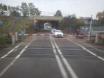
A Very Bad Level Crossing Problem
I have a Google Alert for “Crossrail” and it picked up this article in This is London, which is entitled How Should This New Malden Level Crossing Be Redeveloped When Crossrail 2 Arrives?. This is said.
Residents are being invited to put forward their views on a New Malden level crossing that could be closed by the arrival of Crossrail 2.
Kingston’s Liberal Democrats are asking residents to come forward with suggestions of how to redevelop the Elm Road level crossing, with the party asking how nearby Dickerage Road and New Malden High Street could cope with the extra traffic.
Possible outcomes according to the party’s consultation could include building of bridge or closing the crossing all together.
To get a better feel, this is a Google Map of the crossing.
Elm Road Level Crossing
Note.
- New Malden station is to the East, Berrylands station is to the West and Norbiton station is to the North-West.
- New Malden and Berrylands station are on the busy South Western Main Line.
- Crossrail 2 trains will serve all three stations.
- The level crossing is only on the line to Norbiton.
This map from carto.metro.free.fr shows the lines in the area.

Lines Around New Malden
Note the other level crossing North of Motspur Park station.
I believe that these maps, show that something must be done, as obviously there probably shouldn’t be any level crossings on a Crossrail route.
There are also other level crossings on the Crossrail 2 route, at or near these stations.
- Brimsdown – Before Crossrail 2
- Enfield Lock – Before Crossrail 2
- Hampton Court
- Motspur Park
- Northumberland Park – Before Crossrail 2
A quick look and my local knowledge of the crossings in the North, make me feel, that none is as difficult as the crossing near New Malden station.
I went to New Malden station and walked to the crossing.


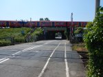
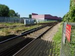

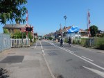
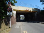
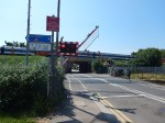
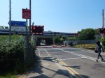
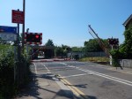
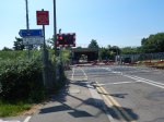
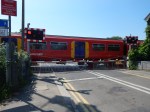
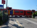
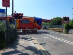
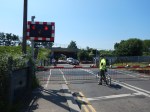

in some ways at eleven in the morning, the crossing wasn’t that busy. A lot of the traffic was on foot.
At the present time, in the off peak there are six trains an hour going through Norbiton station, to or from the New Malden direction, so this must mean that the barriers go down six times or four if the two trains to Norbiton cross at the level crossing.
Crossrail 2 will mean that the barriers will be down longer in each hour.
- Crossrail’s Class 345 trains are two hundred metres long, so if Crossrail 2 uses the same trains, these will be longer than the current eight-car trains of a hundred and sixty metres.
- Crossrail 2 will probably run at a higher frequency.
So something may have to be done.
As the number of pedestrians, buggy-pushers, runners and cyclists will increase, I think that all solutions would accommodate a bridge or subway, for non-vehicular users.
It might even be possible to dig a shallow subway, with both steps and ramps, under the two tracks of the branch, as has been done at Brimsdown station.
The overall solution depends on how much traffic uses the level crossing.
But as there appears to be no industrial premises, that generate lots of truck traffic nearby, I wonder if the best solution for road traffic, is to keep the road crossing as it is. Perhaps with the addition of improved barriers, displays and warnings.
- Building a bridge or a tunnel would be a very difficult and disruptive exercise.
- A bridge would be very expensive, as it would have to go over the main line as well.
- Still having a crossing would give access for the emergency services, even if they had to wait two or three minutes.
- This would also mean that someone pushing a wheelchair or a heavy buggy could cross on the level, perhaps after a wait.
I’m sure that the solution to this level crossing will not be one that requires massive expenditure, as after a proper survey, engineers will probably come up with a simple, safe and affordable solution.
