A Bespoke Tram-Train For The UK
Trams, tram-trains, trains and anything that runs on rails is generally very expensive.
Does this partly explain, why the UK has relatively few urban tramways and railways?
In Stadler Presents Mock-Up Of Tram-Trains For German And Austrian Operators, I discussed how five German and Austrian operators had got together to create a common tram-train design, that would be suitable for all the operators.
The mayor of one of the cities involved in the joint order, said savings of the order of a million euros per vehicle may have resulted from the common design.
I would also feel that savings in operational costs, design of infrastructure, spares inventory and other costs would also result.
Identical tram-trains would make through running between networks easier.
Where Could Tram-Trains Be Used In The UK?
Consider.
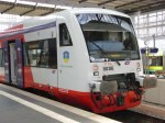
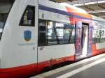
- Currently, tram-trains are running in Sheffield and a battery-electric version of the same Stadler Citylink tram-train will soon be running in Cardiff.
- Cardiff, is developing a Cardiff Crossrail on tram-train principles across the city.
- Sheffield have said that they will be replacing their trams and I believe they could use developments of their excellent Stadler tram-trains.
- Sheffield is likely to extend their tram system and might include tram-trains to Doncaster.
- Cities that have talked about adding tram-trains to their tram networks include Birmingham, Blackpool, Manchester and Nottingham.
- Leeds is developing a metro system, which could be developed using tram-train principles.
- Glasgow has talked about a tram-train to Glasgow Airport for some time.
- The East-West Rail Link is proposing a tram-train link between Ipswich and Felixstowe to allow more freight trains into the Port of Felixstowe.
There could be quite a number of tram-trains being used in the UK, especially if they are used as at Felixstowe, to increase freight capacity into ports.
These are a few of my thoughts.
Battery-Electric Tram-Trains
I would envisage, that a lot of the new tram-trains would operate using batteries. Especially, as battery-electric trains are showing quite long ranges of upwards of thirty miles.
Already trams in Birmingham and trains on Merseyside, are operating using batteries and it avoids the expense of putting up catenary, if enough exists to charge the trams.
Replacement of Diesel Multiple Units By Battery-Electric Tram-Trains
There are some branch lines, where diesel multiple units run off a branch of an electrified main line.These services could be decarbonised by changing the rolling stock.
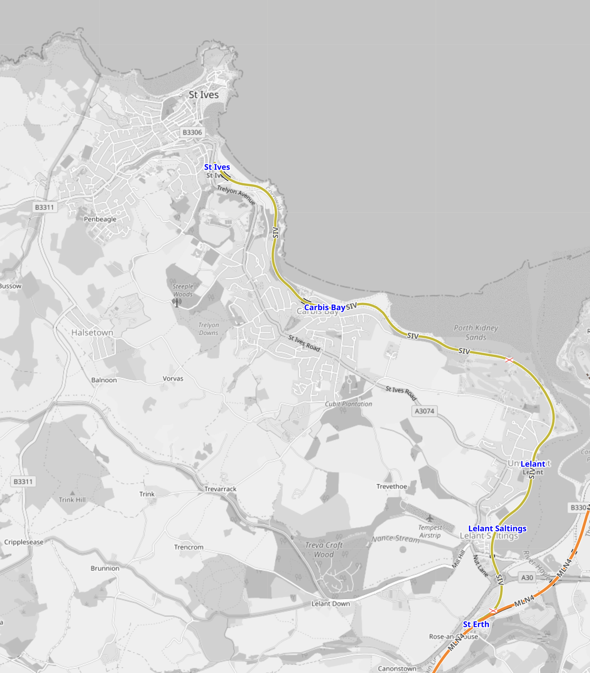
This OpenRailwayMap shows the St. I’ves Bay Line in Cornwall.
Note.
- The St. Ives Bay Line is shown in yellow.
- The Southern terminal is St. Erth station, where it connects to the Cornish Main Line, which is shown in orange.
- The Northern terminal is St. Ives station, which is towards the top of the map.
- The St. Ives Bay Line is 4.25 miles long.
- No tracks are electrified.
- There are three intermediate stations.
This second OpenRailwayMap shows St. Erth station in more detail.
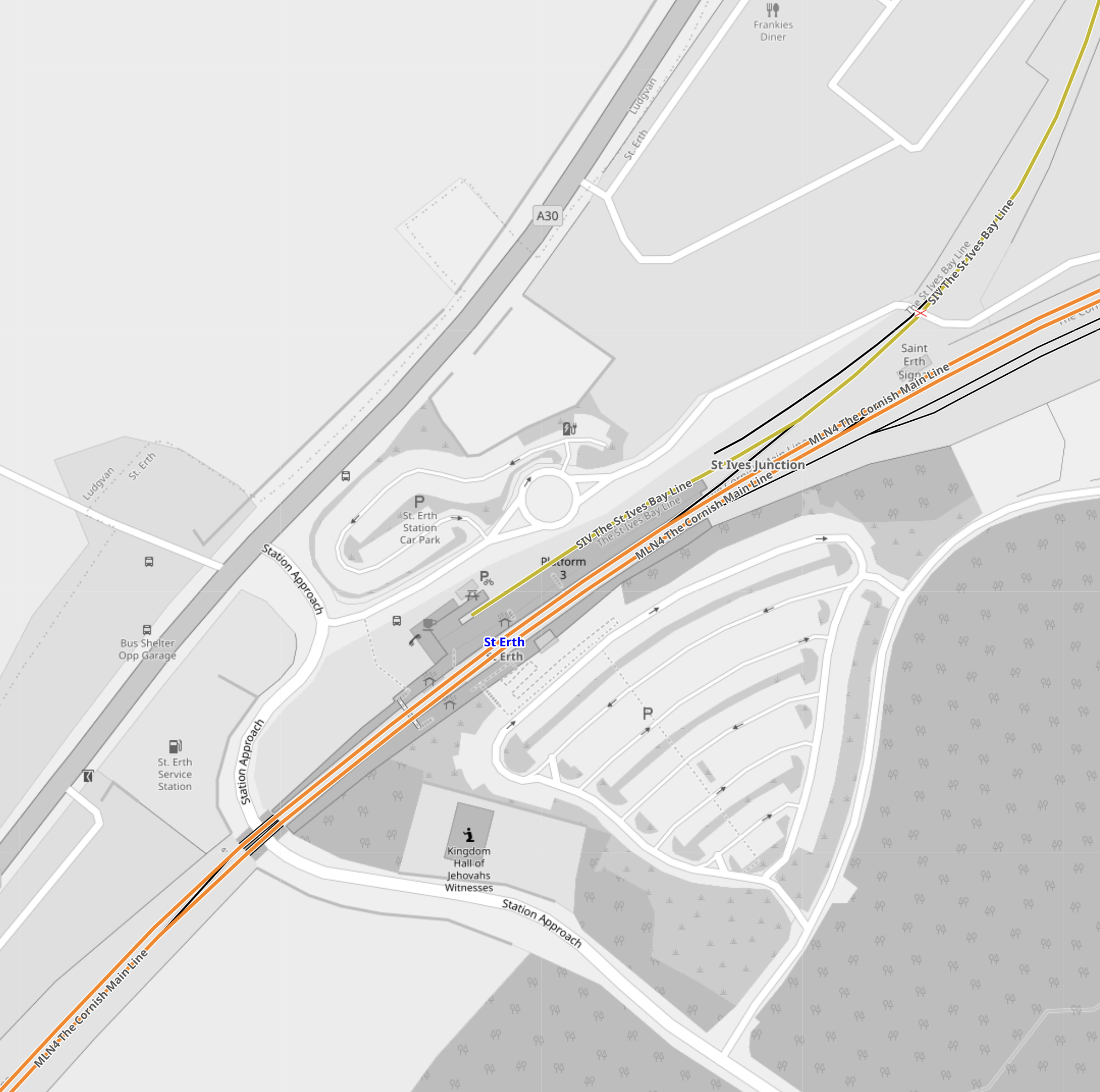
Note.
- The St. Ives Bay Line has its own platform at the side of the station.
- I am fairly certain, that some form of charging could be installed in this platform.
- At the other side of the Cornish Main Line are two sidings, which could be used for cleaning and maintenance.
A neat zero-carbon branch line could easily be created.
New Branch Lines To New Developments
In Sheffield Region Transport Plan 2019 – A New Tram-Train Route To A New Station At Waverley, I gave my view on a tram-train loop from the Sheffield-Lincoln Line to serve the Advanced Manufacturing Centre and new housing at Waverley.
The tram-train would run as a train to the branch line for the development and then run as a battery-electric tram, through the development.
As the Midland Main Line to Sheffield will be electrified, the tram-trains could be charged on the electrification in Sheffield station.
Build Them In Doncaster
Wabtec are closing Doncaster works.
Surely this would be the site to assemble the scores of tram-trains that could be needed in the UK.
Conclusion
Tram-trains could do a lot to improve the railways of the UK.
They would also help to decarbonise the existing system.
Plans For New Tram In Wales’ Capital City Revealed
The title of this post, is the same as that of this article on the BBC.
The BBC Article is a good introduction to Cardiff Crossrail.
This is my one thought.
As Cardiff and the valleys will be using Stadler Citylink tram-trains, I think it will be likely similar vehicles will be used across Cardiff.
Riding Into the Future: Germany’s Pioneering Hydrogen-Powered Tram Project
The title of this post, is the same as that as this article on bnn Breaking.
This is the sub-heading.
Explore Germany’s groundbreaking project to develop a fuel cell-powered tram, leading the charge in sustainable urban mobility and reimagining the future of public transportation.
These are the first two paragraphs.
In the quiet, industrious corners of Germany, a revolution is unfolding on the tracks of public transportation. A consortium led by Hörmann Vehicle Engineering, alongside partners Heiterblick, Flexiva Automation & Robotik, and Technische Universität Chemnitz, has embarked on a groundbreaking journey to conceptualize, design, and test what could be the world’s next leap in eco-friendly mass transit: a hydrogen-powered tram. The project, aptly named the Hydrogen Tram for Next Generation, merges the realms of innovation, sustainability, and practicality, aiming to redefine urban mobility in ways we’ve only begun to imagine.
The project’s heart beats with a simple yet ambitious goal: to create a fuel cell-powered tram that doesn’t just exist as a prototype but thrives as a model for future public transportation. This initiative isn’t just about building a tram; it’s about reimagining the entire ecosystem surrounding urban mobility. From devising a robust refueling strategy to simulating operations and testing the fuel cell system, the collaborators are leaving no stone unturned. The project, with a generous €8 million budget, is buoyed by support from the federal government’s national hydrogen and fuel cell technology innovation program. This isn’t merely an experiment; it’s a statement of intent by Germany to lead the charge in sustainable transit solutions.
I have a few thoughts.
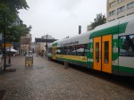
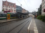
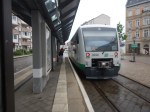
Chemnitz
These pictures show Chemnitz and its trams.


Note.
- Chemnitz used to be called Karl Marx Stadt.
- Chemnitz has some hybrid trams and tram-trains.
- I described how the Chemnitz trams work in Chemnitz Trams And The Chemnitz Model.
Chemnitz could be a very suitable place to try out the technology.
Hence, the involvement of Chemnitz University in the project doesn’t surprise me.
Tram-Trains
This article on Railway Gazette International, which is entitled Hydrogen Tram Development Project Underway, is also about the same project.
This is the first paragraph.
The Hydrogen Tram for Next Generation project has been launched to develop a fuel cell-powered vehicle which would enable services to be extended into new areas and tram-train routes created without the need for electrification.
It looks like this was added in the translation.
Tram Trains In South London
In The Third-Rail Tram-Train, I postulated using third-rail tram trains to extend the London Tramlink.
Since then Merseyrail have tried to extend, their third-rail electrified network and been told they couldn’t.
I have written these posts about using tram-trains to extend the London Tramlink.
- Could There Be A Tram-Train Connection At Reeve’s Corner?
- Would Third-Rail Tram-Trains Affect The Design Of The Proposed Streatham Interchange Station?
- The Cranleigh Line
- Thoughts On The Sutton Loop Line
- Could Third-Rail Tram-Trains Work The Epsom Downs Branch?
- Could Third-Rail Tram-Trains Be Used To Increase Services In South London?
- Could Beckenham Junction To Birkbeck Be Run Using Third-Rail Tram-Trains?
- Could Tram-Trains Be Used To Advantage In Croydon?
So would a hydrogen-powered tram-train be useful technology to extend the London Tramlink?
It just could be!
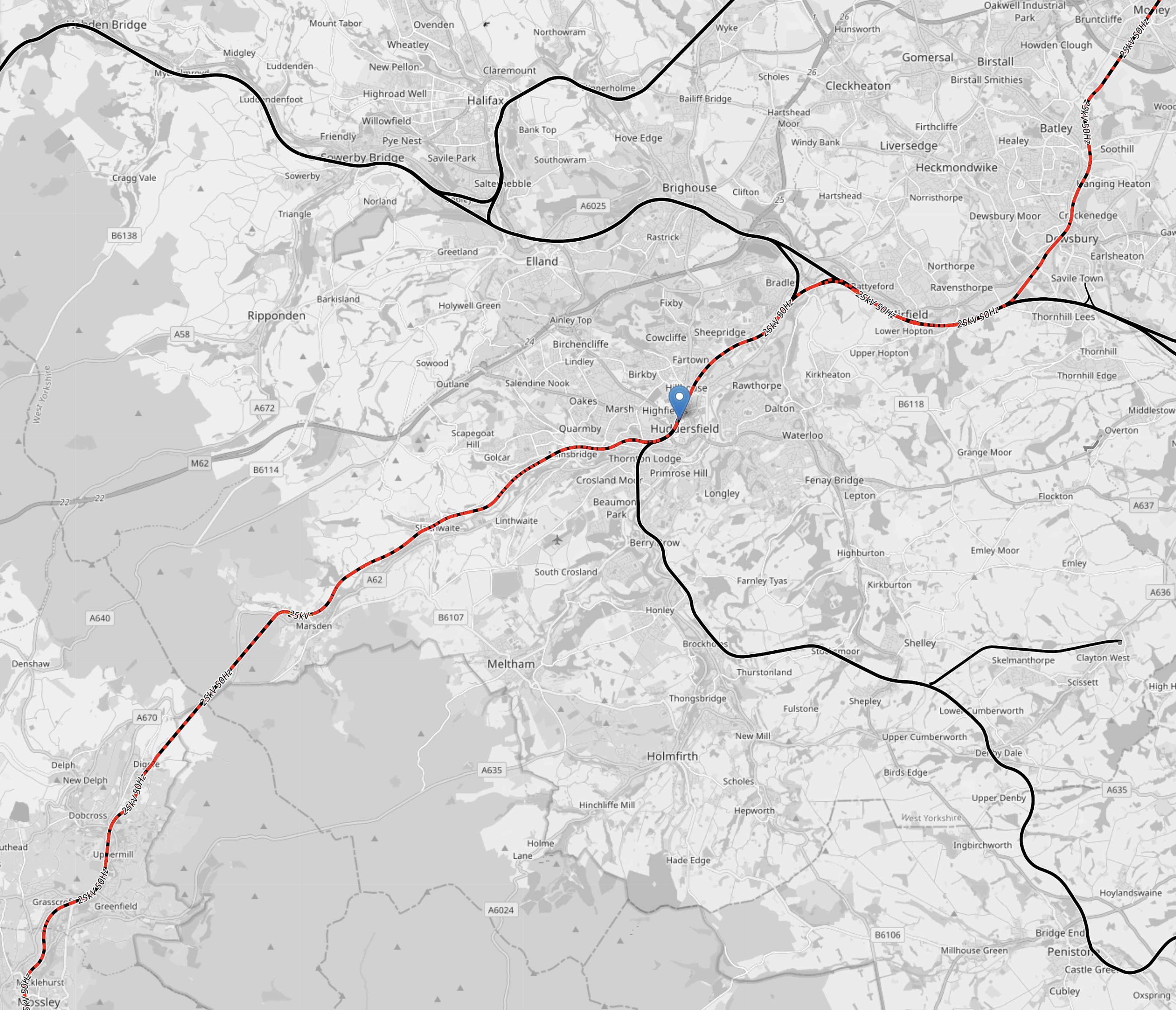
Zero-Carbon Between Manchester and Sheffield
This OpenRailwayMap shows the electrification across the Pennines.

Note.
- Red lines are electrified with 25 KVAC overhead.
- Mauve lines are tram lines electrified with 750 VDC overhead.
- The mauve lines in the West are the Manchester Metrolink.
- The mauve lines in the East are the Sheffield Supertram
- Black lines are not electrified.
- Red and black lines are currently being electrified.
- The blue arrow at the bottom of the map indicates Buxton.
- To the North of Buxton, the line linking Manchester and Sheffield is the Hope Valley Line.
- Running North-East from Manchester is the main TransPennine route between Leeds and Manchester via Dewsbury and Huddersfield.
This OpenRailwayMap shows the TransPennine route between Morley and Mossley stations.
Note.
- Colours are as before.
- Morley station is in the North-East corner of the map.
- Huddersfield station is indicated by the blue arrow in the middle of the map.
- Mossley station is in the South-West corner of the map.
In a few years time, there will be 25 KVAC overhead electrification all the way between Leeds and Manchester via Dewsbury and Huddersfield.
This OpenRailwayMap shows the routes around Manchester and Sheffield and the connecting routes between Barnsley, Huddersfield, Manchester and Sheffield.
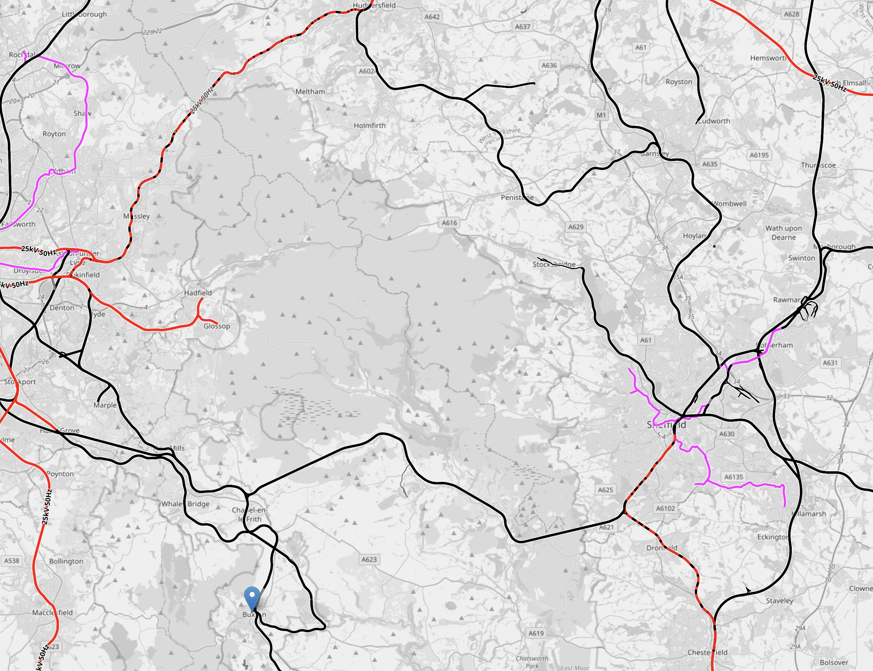
Note.
- Colours are as before.
- The blue arrow at the bottom of the map indicates Buxton.
- The line to Stocksbridge runs North-West from Sheffield.
- To its East the Penistone Line runs to Huddersfield via Barnsley.
- Manchester has a series of lines to the East that need to be electrified.
How many of these lines could be integrated into the tram systems of Manchester and Sheffield, by the use of hydrogen-powered tram-trains?
Hydrogen-powered tram-trains could share lines with battery-electric trains.
Tram-trains could run from say Cathedral in Sheffield to Piccadilly Gardens in Manchester.
Using self-powered trains would cut the need for expensive infrastructure.
The possibilities are endless and carbon free.
Conclusion
Hydrogen-powered trams and tram-trains could be a valuable tool for decarbonising trams and trains.
Baltic States Agree To Develop Plan To Railway Network’s Conversion According To EU Standards
The title of this post is the same as that of this article on Baltic News Network.
These are the first two paragraphs.
During a meeting of European transport ministers in Brussels, participants agreed that all member states the railway network of which differs from the EU standard, have until 2025-2026 to develop a plan to transition to 1 435 mm. This applies to Latvia as well, as reported by Ministry of Transport.
Latvia and other Baltic States still have railway networks built in accordance with Russian standard of 1 520 mm, whereas the majority of other European countries have railway standard of 1 435 mm. This is also the standard that will be used for the Rail Baltica line.
I have some thoughts.
- Putin won’t like it, as his trains won’t fit the gauge, so it will cramp his invasion plans.
- Will gauge change apply to Spain and Ireland?
- If the Irish Republic converts, will Ulster say no? Undoubtedly they will!
- Will it also apply to trams, as there are quite a few metre gauge tramways.
I doubt that it will ever happen everywhere.
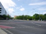
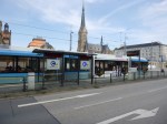
The West Midlands Metro Reaches Towards Five Ways
Whilst I was in Birmingham today, I took a ride on the West Midlands Metro as far as Library and then walked along the route as far as I could get.
I took these pictures,
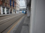
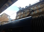
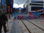
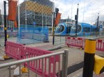
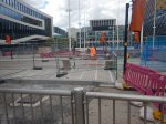


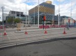


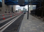
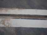


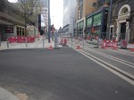

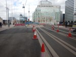
Note.
- The tracks fit neatly into the road.
- There appears to be no poles for wires to the West of the Library.
- It looks like the trams will be running under battery power between Library and Five Ways.
A worker told me, that it could open in a couple of months.
Will Edinburgh trams use a similar system?
Beeching Reversal – Reinstatement of Bolton-Radcliffe / Bolton – Bury
This is one of the Beeching Reversal projects that the Government and Network Rail are proposing to reverse some of the Beeching cuts.
This article in the Bury Times is entitled Plans For Bolton Metrolink Route To Radcliffe See New Bid Submitted. This is the introductory paragraphs.
A bid to secure funding for a tram link between Bolton and Radcliffe has been submitted to the government.
Mark Logan, the MP for Bolton North East, hopes to secure part of the Department for Transport’s £500m Restoring Your Railway Ideas Fund to connect the town to the major public transport network.
The proposal submitted shows Metrolink connecting Bolton, Radcliffe and Bury by reviving an existing disused track bed; bridging the gap between some of the more deprived areas along the route.
This Google Map shows the triangular area between Bolton, Radcliffe and Bury.
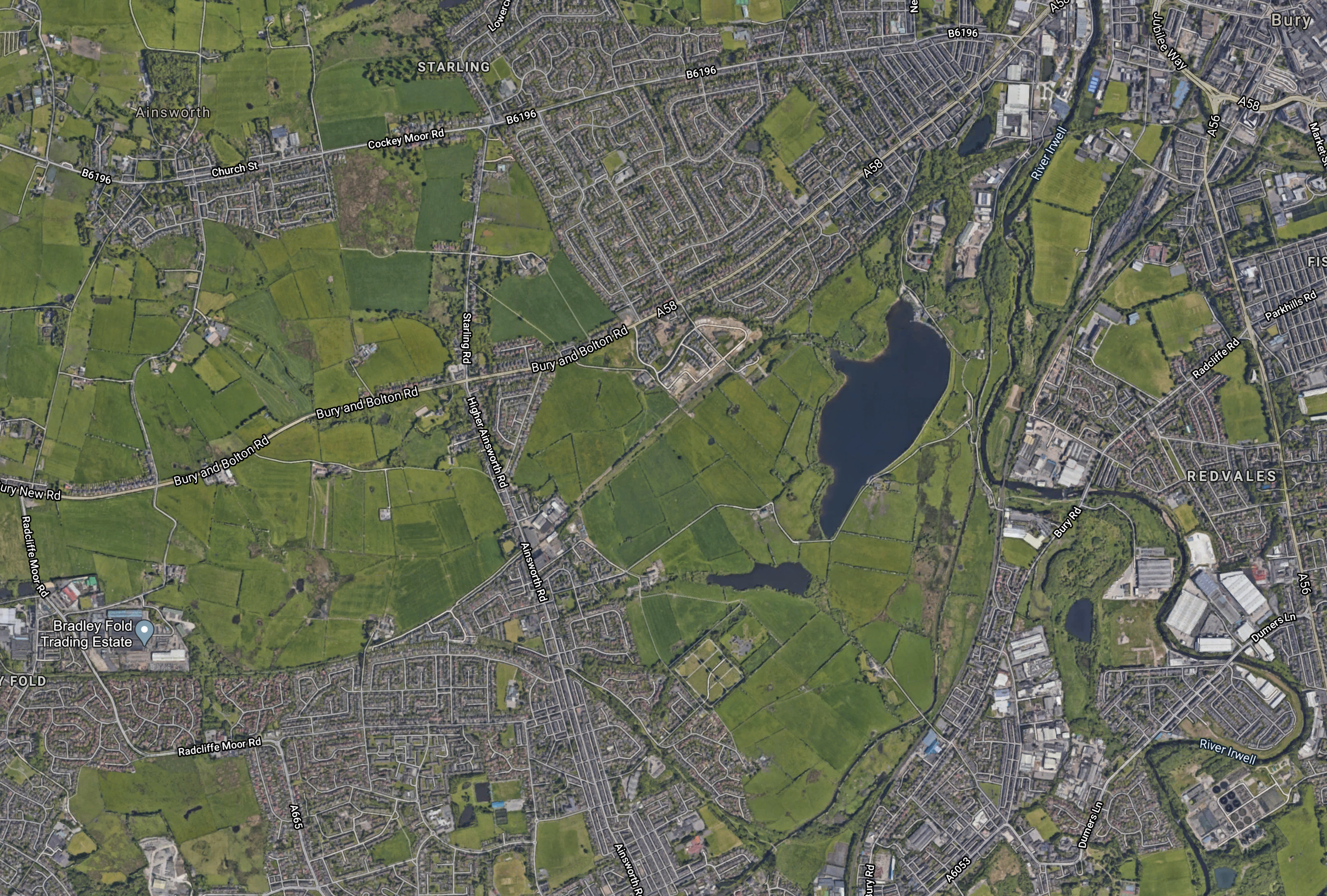
Note.
- Bolton is just off the Western edge of the map.
- Bury is in the North East corner of the map.
- Radcliffe is at the Southern edge of the map, close to the point of the triangular green space.
- There is already a Metrolink line between Bury and Radcliffe.
If you look at this map on a larger scale, you can see the scars of old railway lines between Bolton and Bury and Bolton and Radcliffe.
I will take a more detailed look at this proposal.
Bolton
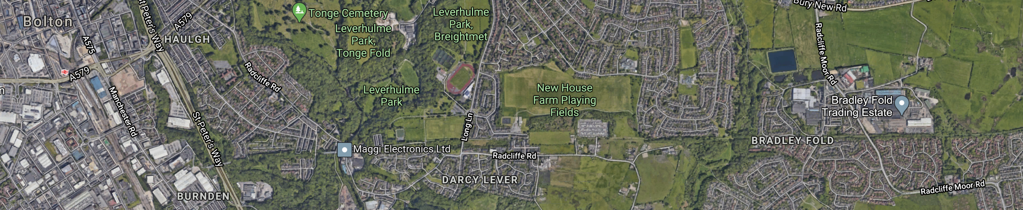
This Google Map shows the Western point of the triangle, where it connects towards Bolton.
Note.
- The disused railway appears to run South of the Bradley Fold Trading Estate.
- It then split into two branches in the middle of the map.
- The Northern branch goes off in a North-Easterly direction to Bury.
- The Southern branch goes off in a South-Easterly direction to Radcliffe.
I’ve followed the route of the disused railway to the West and it goes all the way to the centre of Bolton.
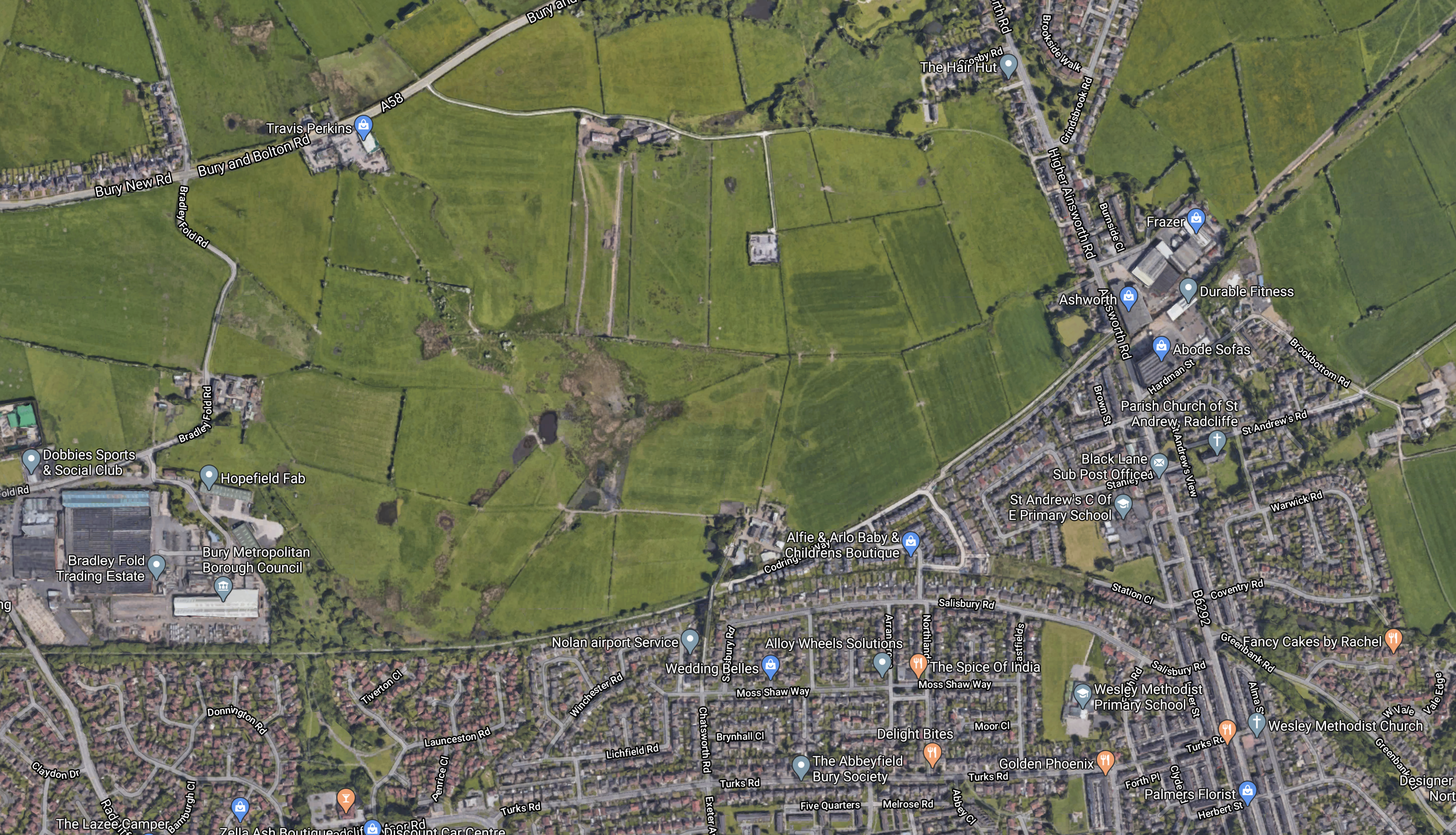
This Google Map shows between Bolton and Bradley Fold.
This railway used to be part of the Liverpool and Bury Railway. This map, which has been clipped from Wikipedia, shows the route.

This information came in a comment from FS (Thanks!) and there are some interesting bridges and viaducts on the route.
Looking at the route from my virtual helicopter, much of the route between Bolton and Radcliffe, is now a walking and cycle route, so there will have to be some careful design to get shared use right.
Radcliffe
This Google Map shows the Radcliffe point of the triangle.

Note.
- The Bury Line of the Manchester Metrolink runs down the Eastern side of the map.
- The Radcliffe tram stop, with its Park-and-Ride is in the South-East corner of the map.
- The disused railway from Bolton joins the map in the North-West corner.
This Google Map avows the Radcliffe tram stop.
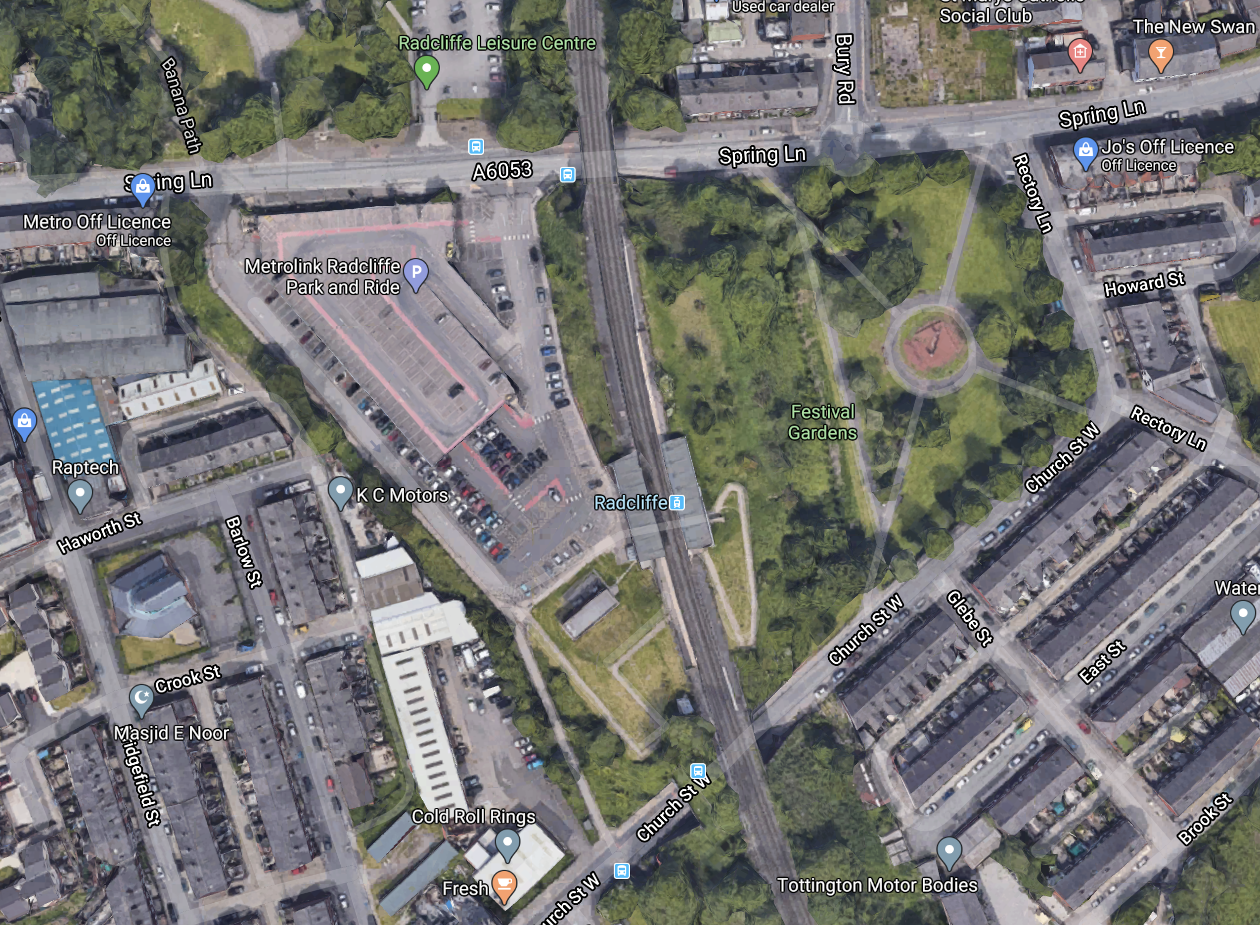
I don’t think it would be the most challenging of projects to connect the Radcliffe tram stop to a tram branch to and from Bolton.
- There seems to be plenty of space on both sides of the main road.
- Extra platforms could probably be added for Bolton trams if required.
Although, there could be problems threading the route, through the new housing and over the viaducts and bridges.
Bury
This Google Map shows the South-West approaches to Bury.

Note.
- Bury Interchange is in the North-East corner of the map.
- The tracks and sidings of the East Lancashire Railway can be seen running South-West from the centre of Bury.
- The proposed line from Bolton enters the map in the South West corner.
Where will the new line terminate, as getting across the town might be expensive?
New Tram Stops
There is a Wikipedia entry, which is entitled Proposed Developments Of Manchester Metrolink, which says nothing about the Bolton – Radcliffe and Bolton – Bury Lines.
But it does indicate, there may be two new stops between Bury Interchange and Radcliffe tram stop.
Buckley Wells
The Wikipedia entry for Buckley Wells tram stop says this.
Buckley Wells is a proposed tram stop on the Bury Line of Greater Manchester’s Metrolink light rail system. It is to be between Bury Interchange and Radcliffe Metrolink station, in the Buckley Wells area of Bury, north of Fishpool and south of Bury town centre.
The proposed site of Buckley Wells stop, by the A56 road, is owned by Transport for Greater Manchester, was proposed in 2003, offering (in addition to the Metrolink stop and services for southern Bury) a park and ride facility, and opportunity to provide an interchange with the East Lancashire Railway.
This Google Map shows the wider area of the site.

Note.
- The Bury Line of the Manchester Metrolink runs SW-NE across the map.
- The A56 Manchester Road runs roughly North-South and crosses over the Bury Line.
- The tracks and sidings of the East Lancashire Railway, can be seen in the North-West corner of the map.
- The main route of the East Lancashire Railway can be seen crossing the Bury Line in the North-East corner of the map.
If you follow the Bury Line back towards Manchester, there is a connection between the Manchester Methrolink and the East Lancashire Railway.
Elton Reservoir
The Wikipedia entry for Elton Reservoir tram stop says this.
Elton Reservoir, also known as Warth, is a proposed tram stop on the Bury Line of Greater Manchester’s Metrolink light rail system. It is to be located between Bury Interchange and Radcliffe Metrolink station, southeast of Elton Reservoir and south of Bury town centre.
This Google map shows the wider area of the site.

Note.
- The Bury Line runs North-South from the North-East corner of the map.
- The stop is being proposed for new housing, that might be built in the area.
It should be noted that the proposed Bolton – Bury tram line would run on the reservoir side of the houses in the North-West corner of the map.
Infrastructure
On a quick look, the two new lines and the two new tram stops, don’t appear to be too challenging.
The only parts that appear difficult might be.
- Running the trams between Bolton Town Centre and Bradley Fold.
- Running the trams into Bury Town Centre.
- Some of the Radcliffe route seems to have been built on.
But there doesn’t seem to be any bridges over major roads or waterways.
Conclusion
There is a lot to like about these two new tram routes.
Freight Tram-Train To Be Tested In Karlsruhe
The title of this post is the same as that of this article on Railway Gazette.
This is the introductory paragraph.
Trials with a prototype freight tram or tram-train are to start in Karlsruhe and the surrounding area in 2022. The concept is being drawn up with a view to improving urban life by reducing road traffic and the emissions it generates.
There are other cargo trams in Germany, like the CarGoTram in Dresden and I think it is a concept, we’ll see in other places.
In High Speed Urban Freight Logistics By Rail, I wrote about Rail Operations Group’s plans to run freight services between London Gateway and Liverpool Street station.
It may be different technology, but it has similar objectives.
Beeching Reversal – Light Railway Extension To The Barnstaple Branch (Chivenor Braunton) “TawLink”
This is one of the Beeching Reversal projects that the Government and Network Rail are proposing to reverse some of the Beeching cuts.
This is an unusual project for two reasons.
- It is based on light railway or tram technology.
- The case for the extension is fully set out in the Taw Link web site.
None of the other projects, that I have documented have such a comprehensive statement of their case for acceptance.
The Introduction
This is taken from the home page of their web site.
Combe Rail CIO is proposing a modern, light railway between Barnstaple and Braunton. The North Devon Local Plan already urges the protection of former railway routes, to allow for future re-instatement. This former railway route is 98% intact, with sufficient width to accommodate a new single-track railway line alongside the Tarka Trail and South West Coast Path.
It’s now accepted that new and re-opened railways unlock economic growth. The success of the Borders Railway in Scotland is a spectacular example of this. The challenge of North Devon’s ever-growing population demands similar, forward-looking infrastructure planning.
Some of the other projects, that I have documented, could do with such a clear Statement of Intent.
The Route
This graphic from the Route page on web site shows the route.
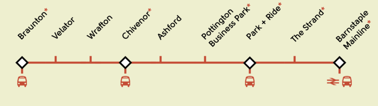
And this Google Map shows the area.
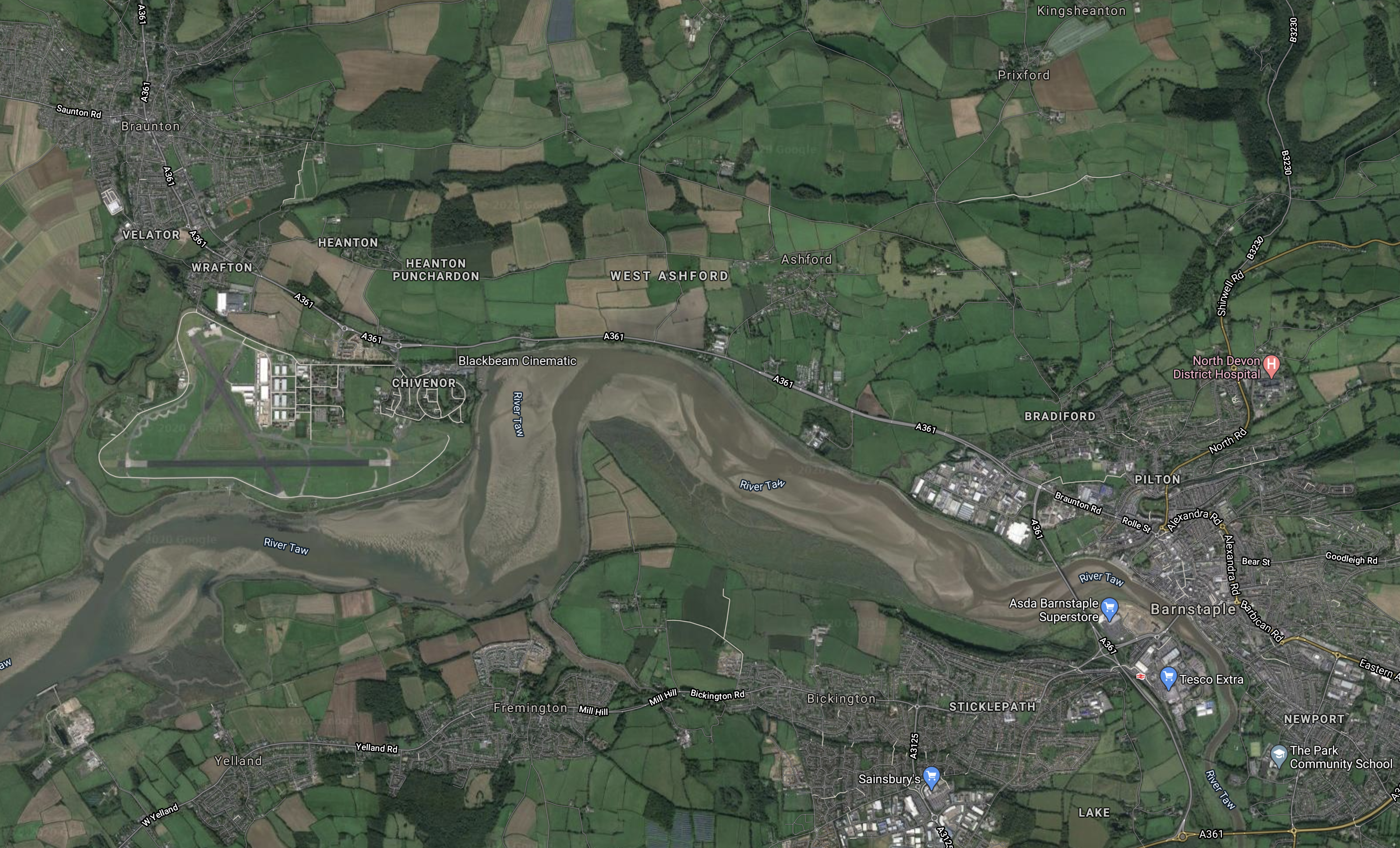
Note.
- Braunton is in the North-West corner of the map.
- Barstaple is in the South-East corner of the map.
- The River Taw runs East-West across the map.
- The runways of the former RAF Chivenor, which is now a Royal Marine Base, can be found.
If you enlarge the map by clicking on it, many of the stations on the TawLink can be picked out.
This paragraph from the Route page describes the route.
Starting from Caen Street in Braunton, it will run tramway-style along Station Road, and then use the old railway formation all the way to the Civic Centre car park in Barnstaple. It will then street-run past the front of the former Town Station and along Castle Street to The Strand in the heart of Barnstaple. There are two options for crossing the river Taw – either to street-run along Long Bridge, or to share the proposed reinstated (former railway) bridge. The line will then street-run along Stickelpath Terrace to re-connect to the National Rail Network at Barnstaple (Mainline.) Intermediate stations will be provided at Velator, Wrafton (for Perrigo), Chivenor (Business Park and The Landings), Ashford (Garden Centre and Braunton Inn) Pottington (Business Park) and Barnstaple Park-and-Ride (near the A39 downstream bridge – which could potentially have a huge catchment area.)
As the proposals for the Reinstatement Of The Bodmin-Wadebridge Railway, are doing, these proposals are replacing a walking and cycle path with a walking/cycling/single-track rail route.
This pair of South-West proposals could set an important design precedent, that can be applied in other places across the UK.
Are These Two Routes Substantially Level?
Thinking about this similar design, were the two original rail routes built as level as possible, so they are now easy walking and cycling routes?
I suspect, that there’s only a couple of metres difference between the two ends of this route at Barnstaple. So it could be the case here!
If thar is the case, it would mean that less energy would be needed to travel the route!
The Trams
This paragraph from the Trams page on the web site describes the trams.
This will be a modern community- and commuter railway, which will run throughout the year. Its scenic location will also make it highly attractive to tourists. It will use lightweight, battery-electric vehicles – like traditional trams, but without the overhead wires – capable of running safely on-road, and quickly off-road. These vehicles are environmentally-friendly, and very quiet. Visually, and in terms of infrastructure, the railway will be low-impact.
I have liked the concept of coastal trams, even since I rode in the one along the Belgian coast, which I wrote about in Riding The Coast Tram.
A Level Route Would Be Beneficial
If I am right about the level nature of the route, this would mean smaller and lighter batteries would be needed to power the trams.
Through-Running
I suspect through-running would not be possible, unless the Tarka Line between Exeter and Barnstaple is electrified, as it is a rather challenging route for a light rail vehicle.
The vehicles also don’t probably have enough capacity, for what can be a busy route in the Peak.
Conclusion
I like this proposal and I have a feeling it will be imitated in the future.
Beeching Reversal – Reinstatement Of The Bodmin-Wadebridge Railway
This is one of the Beeching Reversal projects that the Government and Network Rail are proposing to reverse some of the Beeching cuts.
The basic outline of this Beeching Reversal project is described in the section called RailTrail Project in the Wikipedia entry for the Bodmin and Wenford Railway, where this is a simplified version of what is said.
The railway company is currently planning to extend beyond its western terminus at Boscarne Junction towards Wadebridge alongside the Camel Trail. Known as the RailTrail project, phase one would see the railway extended to Nanstallon Halt, phase two to Grogley Halt and phase three to Wadebridge Guineaport.
In areas where the width of the trackbed does not allow both a railway and a footpath side-by-side, short diversions are proposed. For example, at Grogley, the Camel Trail could be re-routed along a former “headshunt”, which was part of the original railway before it was replaced by a later deviation.
There is some controversy, over the reduction in width of the Camel Trail.
This Google Map shows the River Camel through Wadebridge, where the extension appears to be proposed to finish.
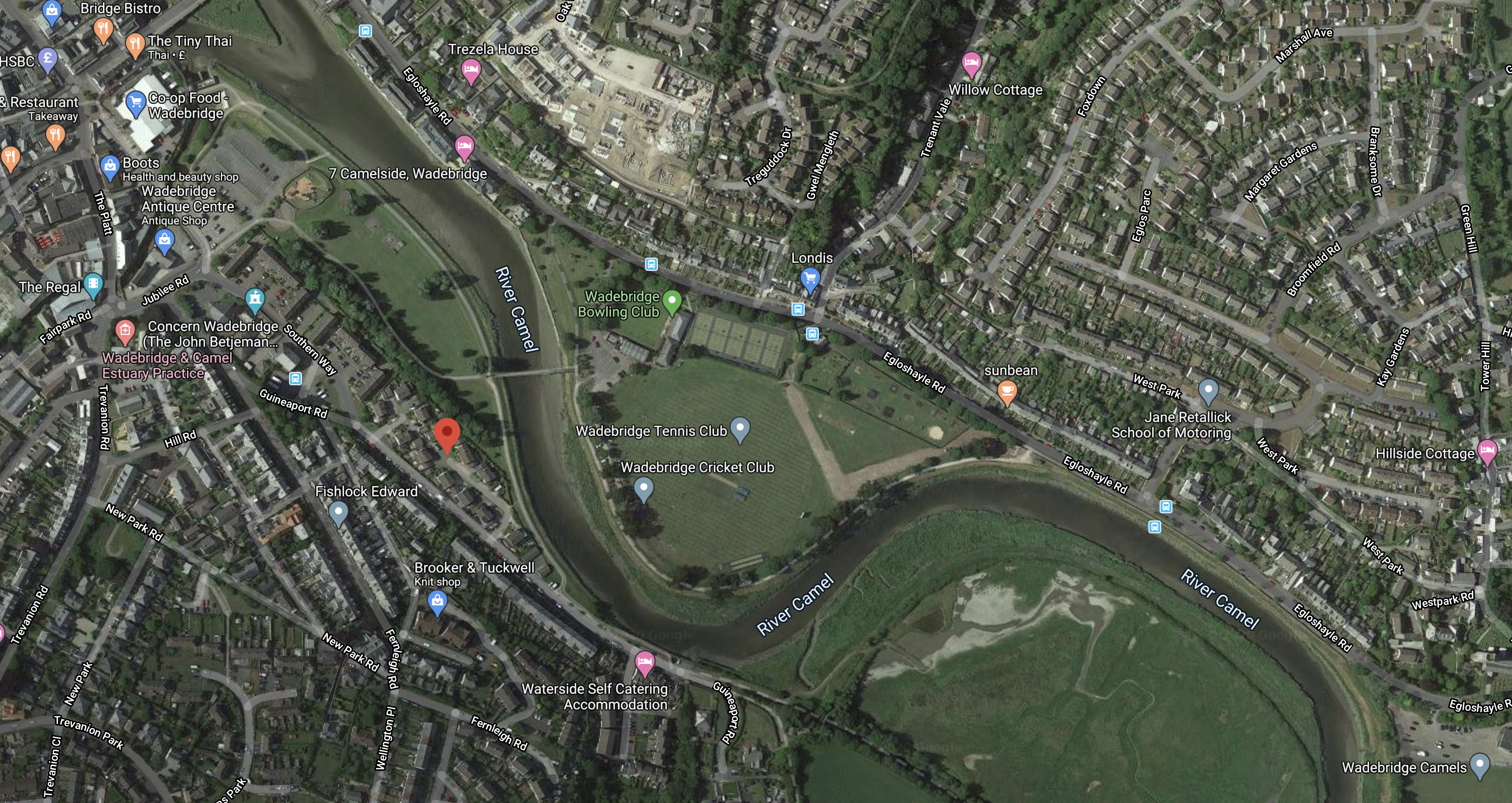
Note.
- The Guineaport area of Wadebridge is marked by a red arrow-dot.
- The Future Plans section of the Wikipedia entry for Wadebridge station, says that the new station will be beyond Guineaport.
- The Camel Trail is marked on Google Maps as a dotted line and it can be followed to where it meets the Bodmin and Wenford Railway at Boscarne Junction station.
This Google Map shows Boscarne Junction station.
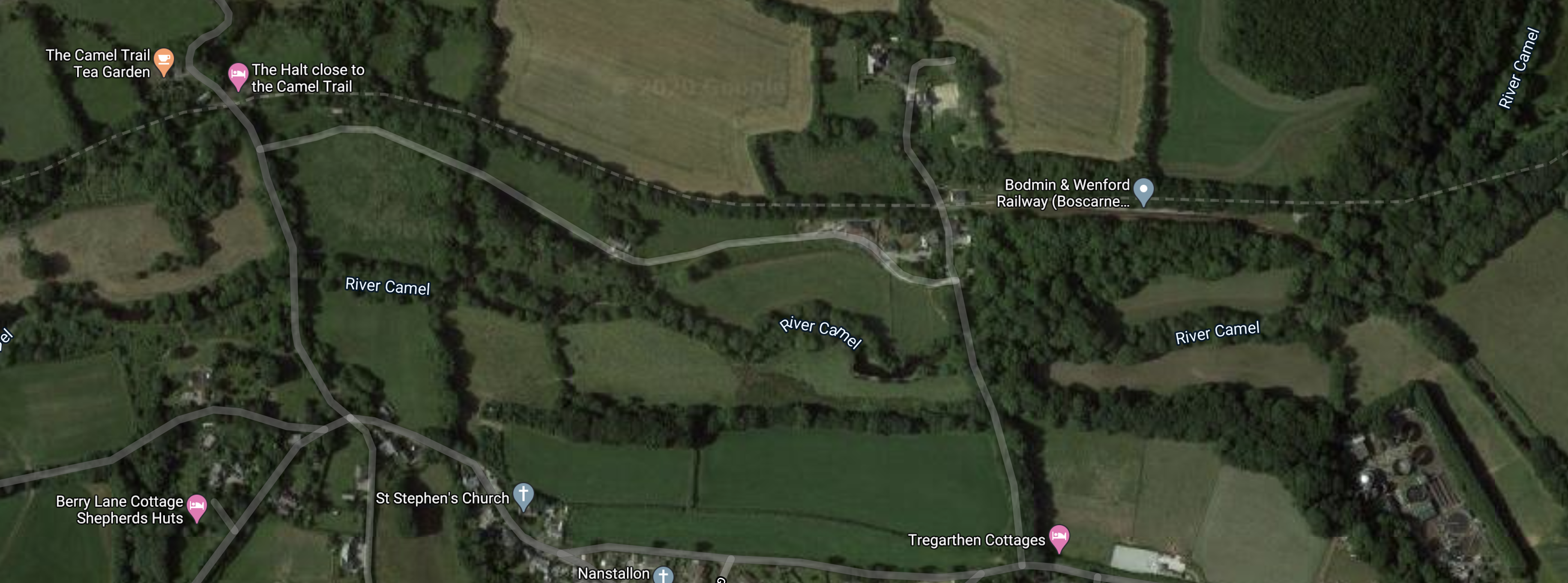
Looking from my helicopter, I am fairly sure that the RailTrail can be squeezed in with a footpath.
What Sort Of Railway Would It Be?
These are my thoughts.
Will It Be Double Or Single-Track?
It will be single-track, as there is not enough space for two.
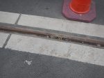
I would suspect, they could use similar construction to these tram tracks in Blackpool.
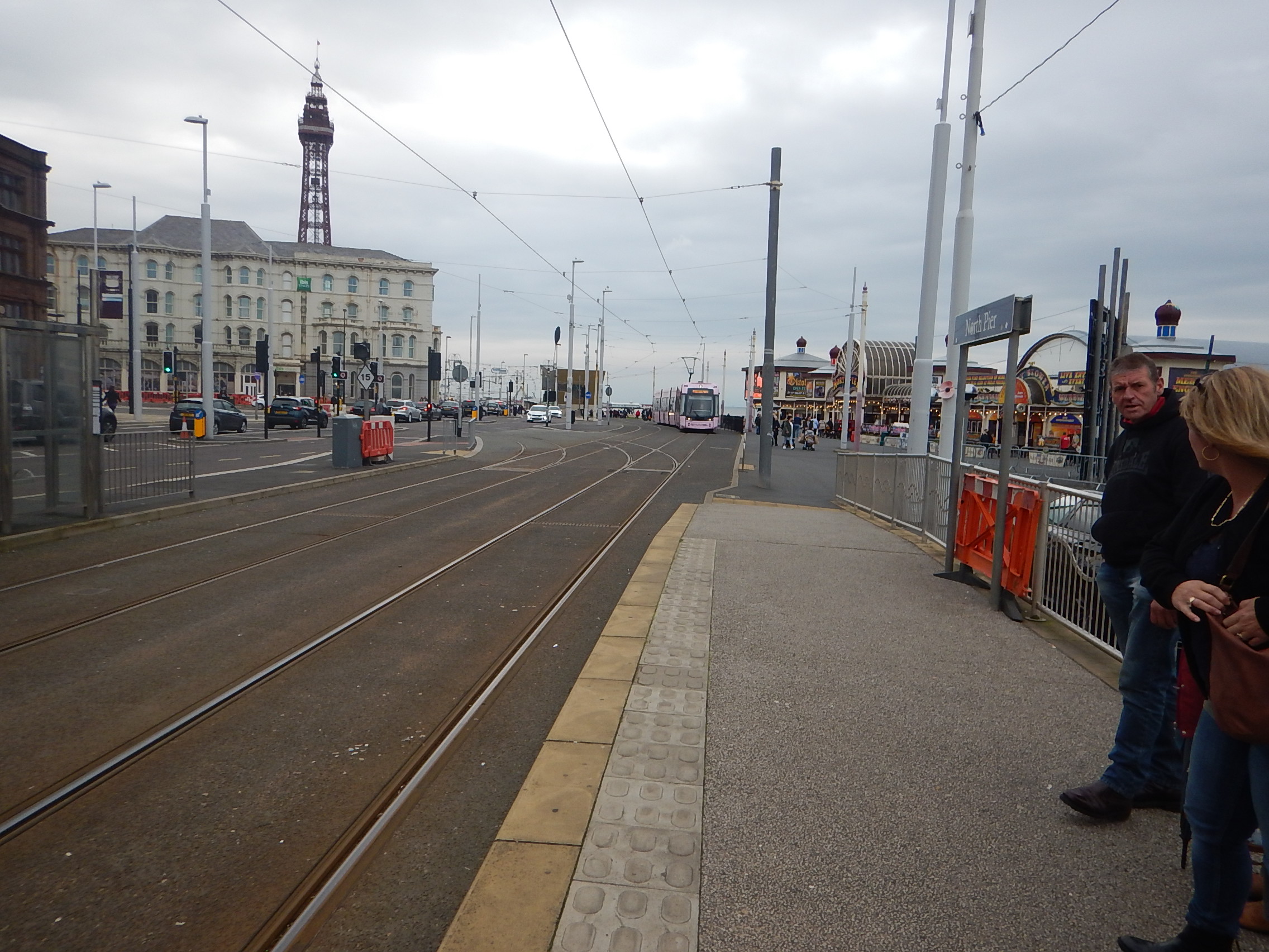
Effectively, the RailTrail could be a high-strength road, with a rail track set to one side, and appropriate markings, rails and safety signage.
How Long Will The New Track Be?
Google gives these distances.
- Padstow and Boscarne – 14.4 miles
- Padstow and Bodmin – 16 miles
- Wadebridge and Boscarne – 6 miles
- Wadebridge and Bodmin – 7.4 miles
I have added Padstow, as this town on the sea, used to be the rail terminus.
Should The Route Go To Padstow?
This Google Map shows the Padstow end of the Camel Trail.
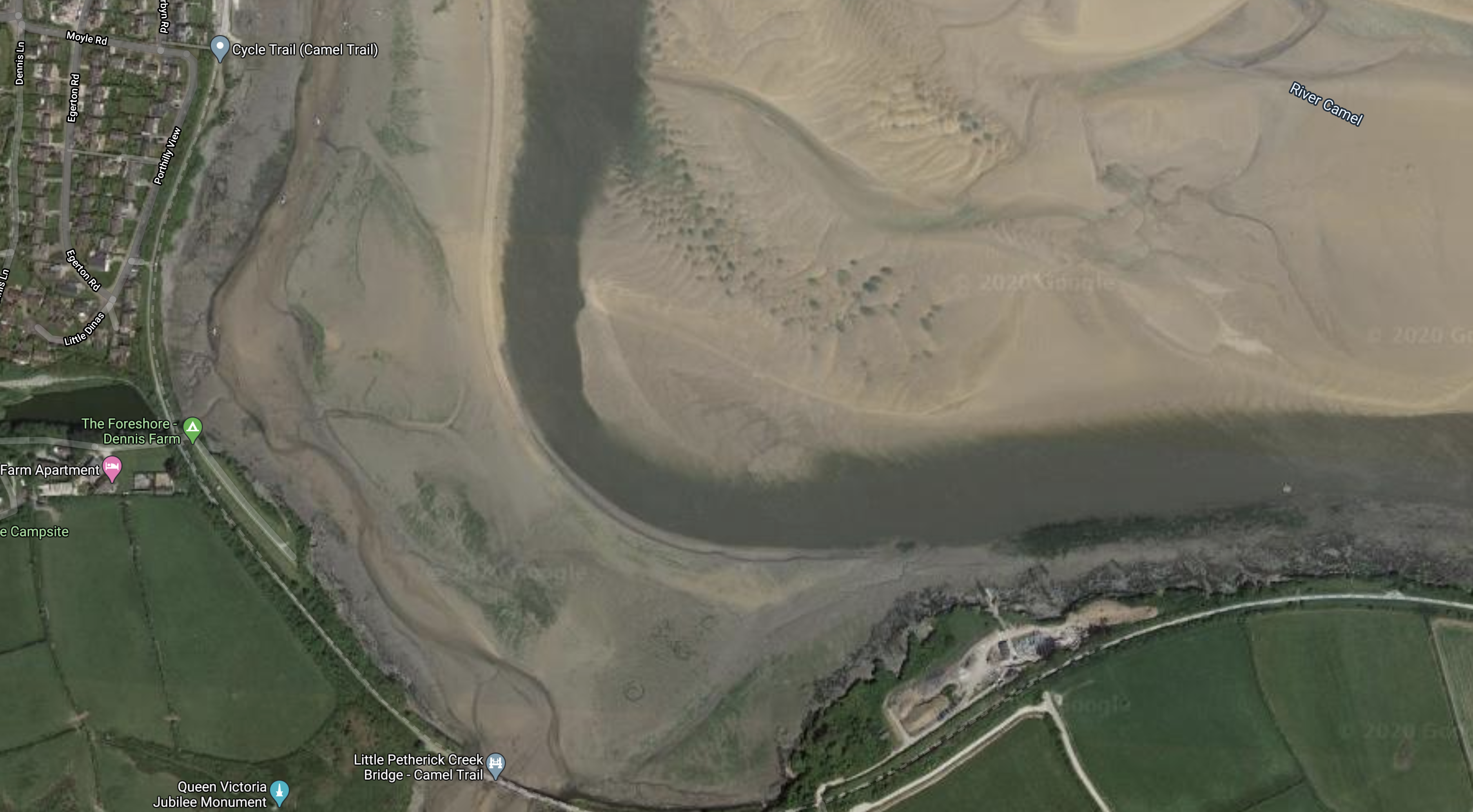
But there could be a major problem.
At the bottom of the map is the Little Petherick Creek Bridge.
- It’s probably OK for a cycle trail, but would it be strong enough for heavy rail use.
- On the other hand, is it past its replace date and Cornwall County Council might like to pass the responsibility to Network Rail?
There is also more land to build a station at Padstow.
It could even be built on the East side of the bridge, so that the heaviest thing it would carry would be pedestrians.
Would A Shared RailTrail Work?
One of the most interesting train systems, that I have seen is in Zwickau in the former East Germany, where instead of buying more trams to connect to other towns and cities, they devised a train-tram system using standard diesel multiple units.
The Zwickau system is more complicated than it would need to be in the UK, as the trains have to share tram-tracks of a different size, so there are three-railed tracks; two for the metre gauge trams and an extra one for the standard gauge trains.
I have never seen anywhere else, where rail vehicles of different gauges share rails.
The trains run under virtually the same rules as street running trams do in Birmingham, Blackpool, Croydon, Edinburgh, Manchester, Nottingham and Sheffield.
- You can cross the road all round them.
- Trains are limited to slow speeds.
- The trains are independently powered.
- The trains cross level crossings.
- There is no electric power for the trains.
- The trains are double-manned and the crew keep a good look out!
Note, in the pictures, that the trains have flashing orange warning lights.
Could a GWR Class 800 train run along the RailTrail?
- The train would be a five-car unit.
- The train would be fitted with environmentally-friendly battery power, so it would be emission-free and almost silent.
- There would be a charging facility in the platform at Bodmin General station to top up the battery, before the train ran on the RailTrail.
- As in Zwickau, the track would be buried in the ground. so it could be safely used by trains and not be a hazard to pedestrians.
- The train would have a slow speed crawling mode, so it could proceed along the RailTrail with extreme care.
With the right timetable, the modern trains could share with the Bodmin and Wenford’s heritage trains.
Could Wadebridge Get A Direct Service To London Paddington?
Why not?
Places like Bradford, Harrogate, Huddersfield and Skipton appear to be being added to LNER’s network, by joining and splitting Class 800 trains at Leeds.
I wouldn’t be surprised to see a five-car Class 800 train with a battery capability running from Wadebridge to Plymouth, where is joined with another train from Newquay, Penzance or Plymouth, before running as a ten-car train to London Paddington.
Conclusion
I like this scheme and it could be a prototype for other similar ones.
Coronavirus Pushes Switch From Cash To Card Payment
The title of this post is the same as that as this article on Railway Gazette.
This is the introductory paragraph.
Cash sales of tickets on the Metlink transport network in Greater Wellington will end on March 23, in a move which Metlink said was designed ‘to stay one step ahead of Covid-19 and give our passengers and staff more peace of mind’.
Should all buses, trams and trains go cash-free and contactless in the UK?
