Completing Northern Powerhouse Rail
The Northern Powerhouse Rail/High Speed Two Connection To Manchester Airport Station
This OpenRailwayMap shows the rail connections that terminate at Manchester Airport station.
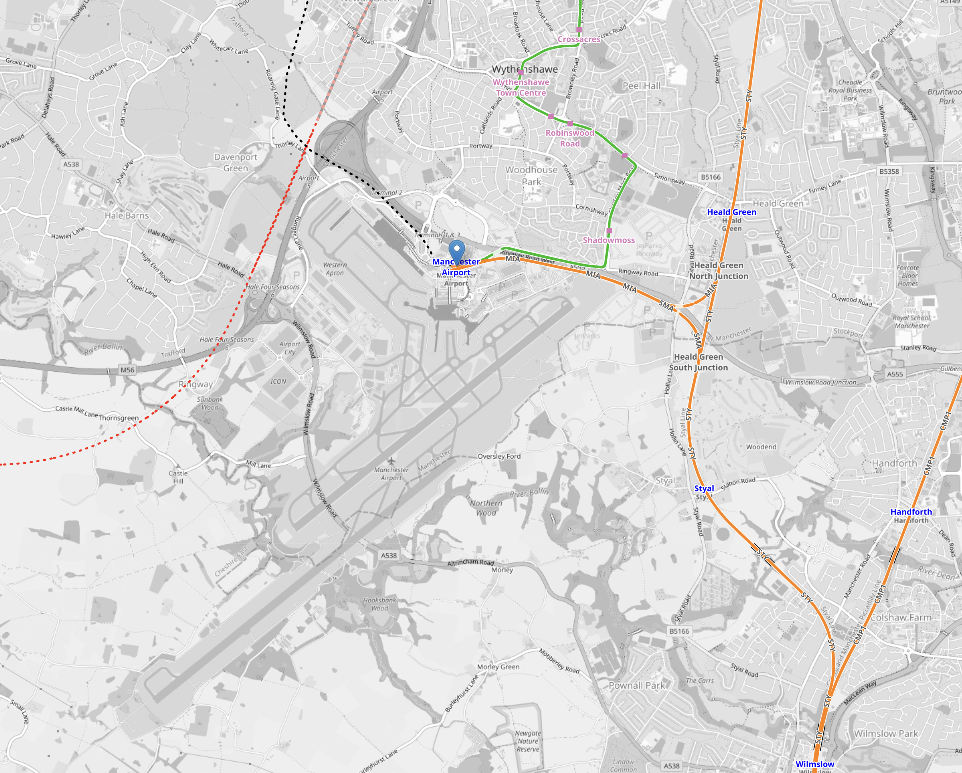
Note.
- The two runways are clearly shown.
- Manchester Airport station is indicated by the blue arrow near the top of the map.
- The orange tracks are rail lines.
- The green lines are Manchester Metrolink tracks.
- Rail and tram services approach the airport station from the East.
- The red dotted line is the current proposed path of Northern Powerhouse Rail/High Speed Two
- The black dotted line appears to be an extension of the tram line to the airport.
This second OpenRailwayMap shows the lines around the airport station to a larger scale.
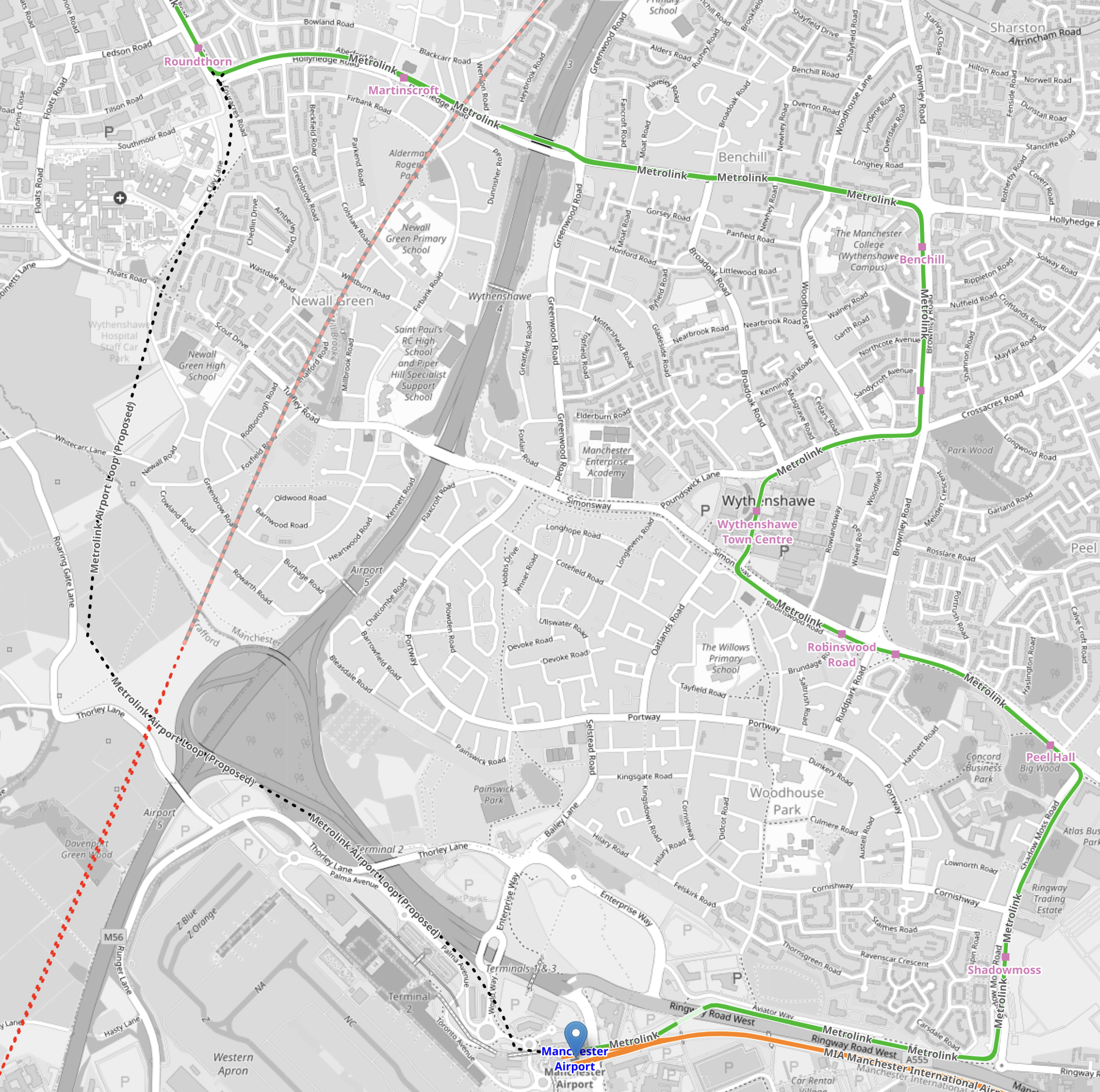
Note.
- Manchester Airport station is indicated by the blue arrow at the bottom of the map.
- The orange tracks are rail lines.
- The green lines are Manchester Metrolink tracks.
- The red dotted line is the current proposed path of Northern Powerhouse Rail/High Speed Two.
- The Manchester Metrolink now makes a loop around the Airport.
I think the following will happen.
- A large proportion of passengers and staff travelling between Manchester Airport and Manchester City Centre will use Northern Powerhouse Rail/High Speed Two.
- Passengers and staff, who live locally will use the Manchester Metro loop.
- Northern Powerhouse Rail/High Speed Two will replace some of the current train services.
- Some services on the Castlefield Corridor will migrate to Northern Powerhouse Rail/High Speed Two.
There could be as many as twelve trains per hour (tph) between Manchester Airport and Manchester City Centre on Northern Powerhouse Rail/High Speed Two. But a new urban line like that, which was mostly in a tunnel could probably handle 20 tph.
Manchester Airport And Crewe
This OpenRailwayMap shows the railways between Manchester Airport and Crewe stations.
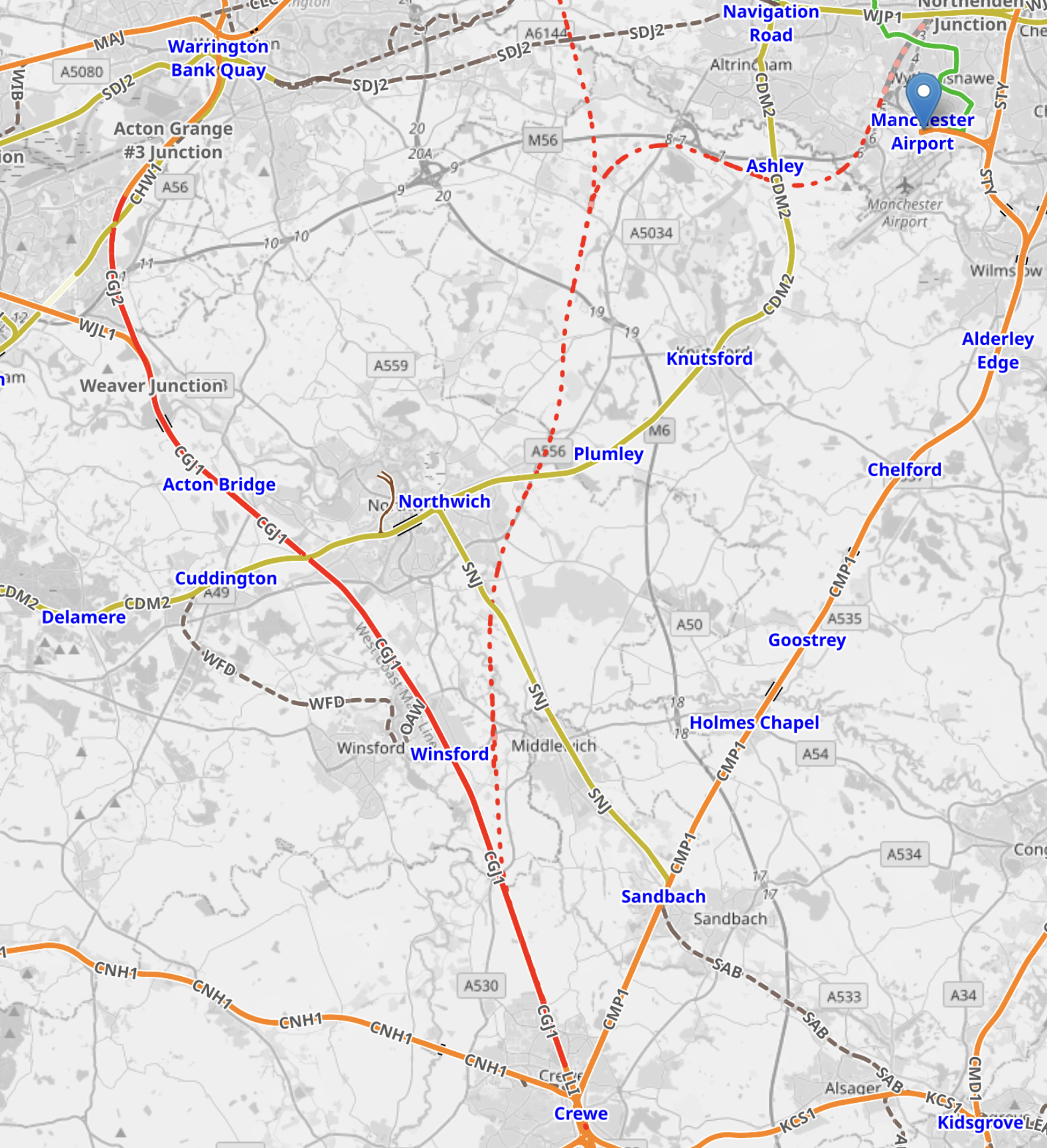
Note.
- Manchester Airport station is indicated by the blue arrow at the top of the map.
- The orange tracks are rail lines.
- The red track going down the left hand side of the map is the West Coast Main Line.
- The green lines are Manchester Metrolink tracks.
- The red dotted line is the current proposed path of Northern Powerhouse Rail/High Speed Two.
- Crewe station is at the bottom of the map in the middle.
There could be as many as 12 tph between Manchester Airport and Crewe.
Manchester Airport And Manchester Piccadilly
This OpenRailwayMap shows the railways between Manchester Airport and Manchester Piccadilly stations.
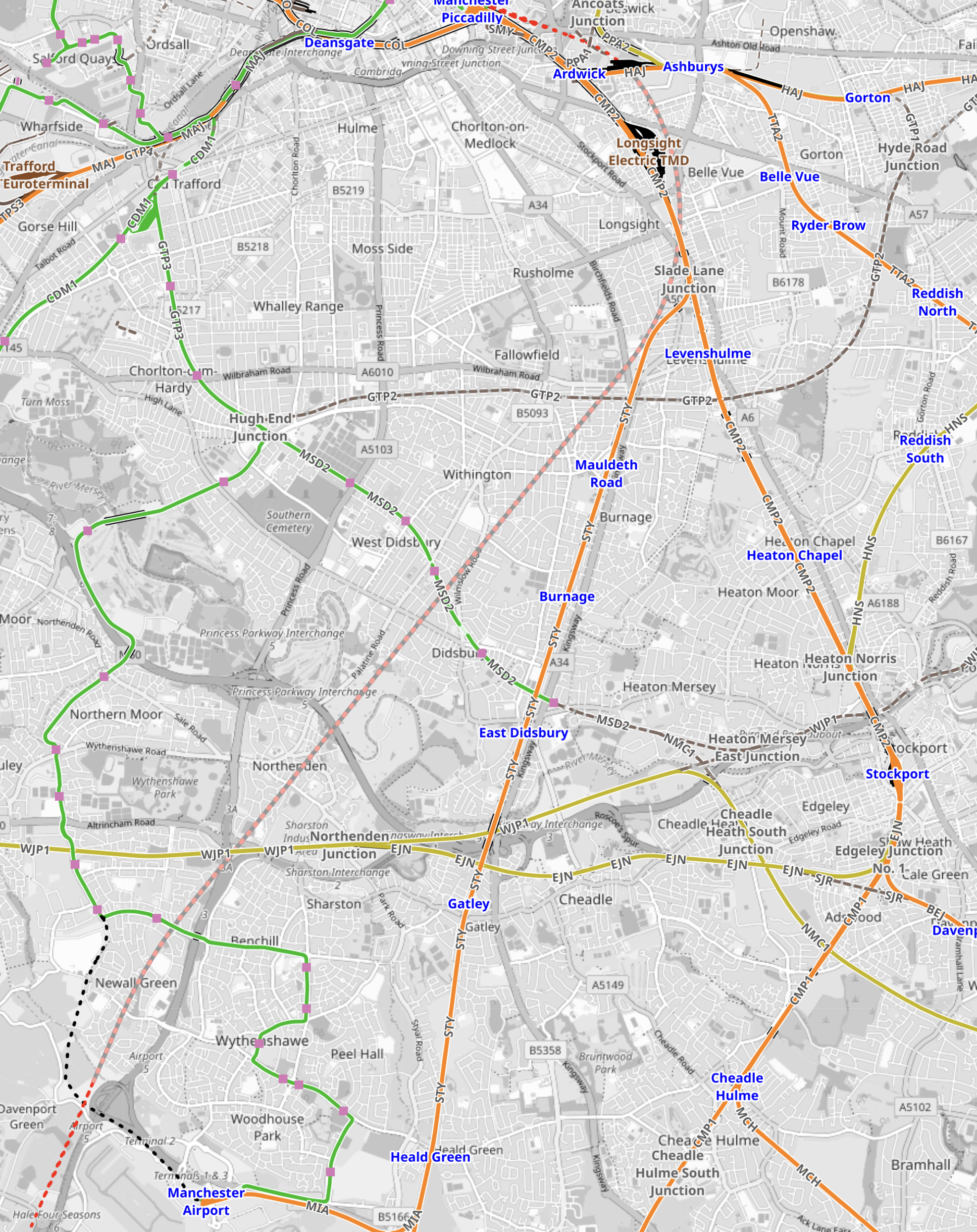
Note.
- Manchester Airport station is in the South-West corner of the map.
- The orange tracks are existing rail lines.
- The green lines are Manchester Metrolink tracks.
- The red dotted line going up the middle of the map is the current proposed path of Northern Powerhouse Rail/High Speed Two.
- Manchester Piccadilly station is at the Northern end of Northern Powerhouse Rail/High Speed Two.
This OpenRailwayMap shows the City Centre between Manchester Piccadilly and Manchester Victoria stations.
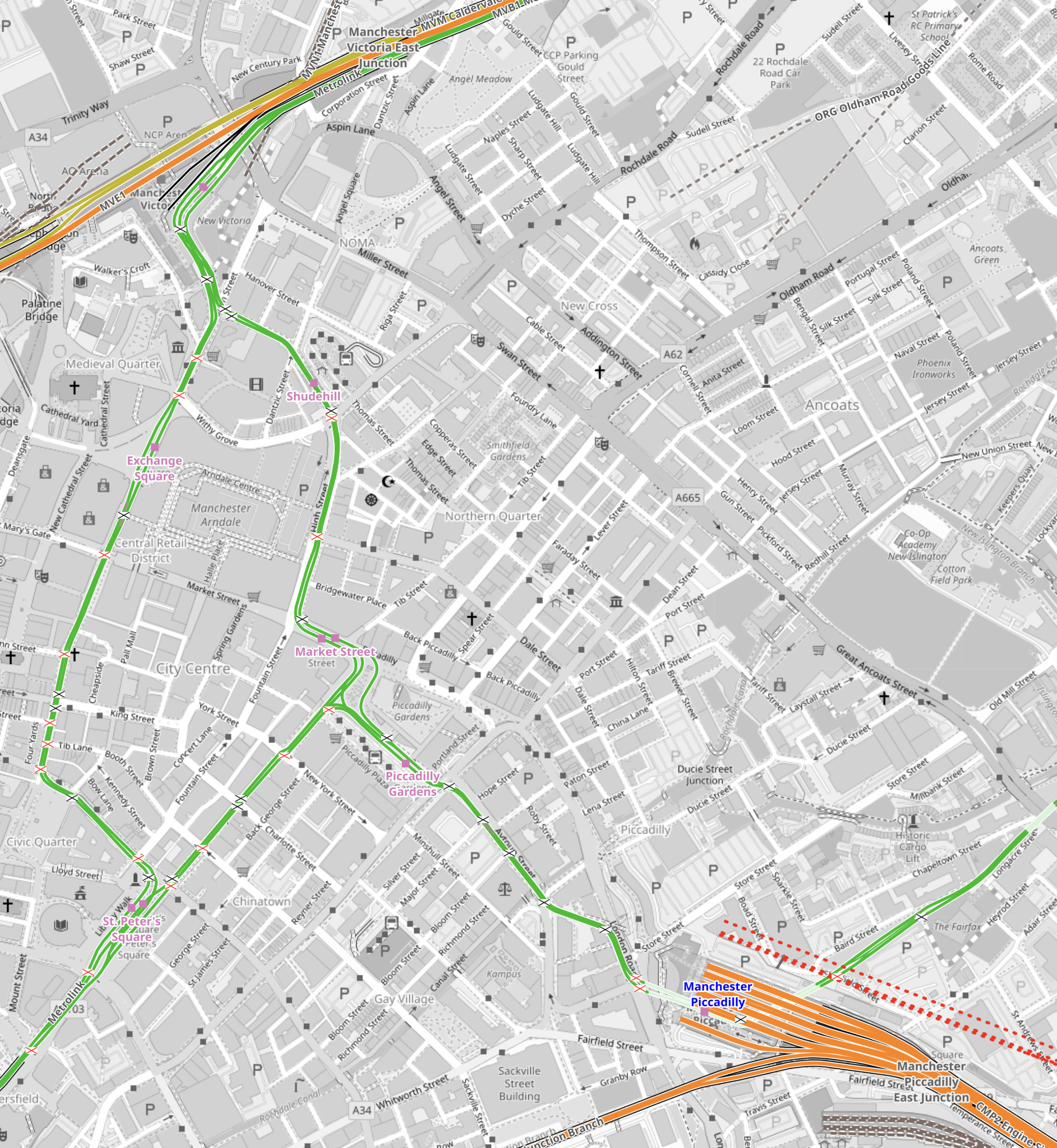
Note.
- Manchester Piccadilly station is in the South-East corner of the map.
- The red dotted lines creeping into the map is the current proposed path of Northern Powerhouse Rail/High Speed Two.
- All the platforms in Manchester Piccadilly station can be picked out, with the Castlefield Corridor breaking away to the West.
- The current plans will need demolition of buildings to the North of Manchester Piccadilly station.
- Manchester Victoria station is in the North-West corner of the map.
- The green line of the Manchester Metrolink route picks out the walking route between Manchester’s two main stations.
- About halfway between Manchester Piccadilly and Manchester Victoria stations is the open space of Piccadilly Gardens.
This Google Map shows Piccadilly Gardens.
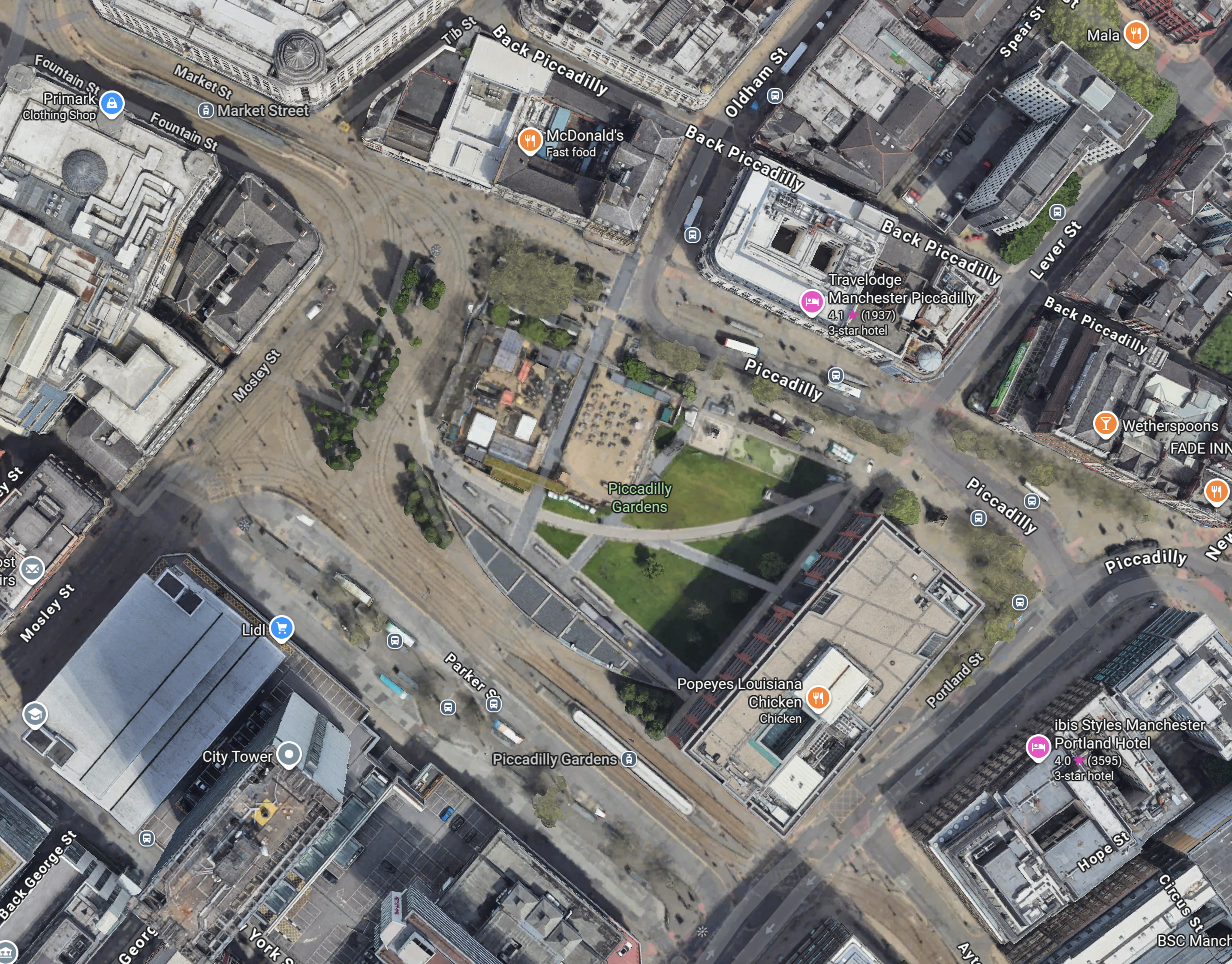
Note.
- The Manchester Metrolink running through.
- There are two Metrolink stops ; Market Street and Piccadilly Gardens, in the area.
- It appears any stop on the Manchester Metrolink can be reached with no more than a single change from one of these two stops.
Looking at the map showing Victoria and Piccadilly stations, I wonder, if a Lizzie Line of the North could be built under Manchester City Centre.
- There would be underground platforms at Piccadilly station, with two through platforms and two to terminate trains from the South.
- Local services from Piccadilly station could continue as now, although services to Manchester Airport could be simplified.
- There would be an underground station at Piccadilly Gardens with two through platforms , to connect with an expanded Manchester Metrolink, buses and walking routes.
- There would be underground platforms at Victoria station, with two through platforms and two to terminate trains from the East.
- Local services from Victoria could continue as now.
- There could be as many as 12 tph between Manchester Victoria, Piccadilly Gardens, Manchester Piccadilly and Manchester Airport.
Just as the Lizzie Line was slotted into London, with the minimum of disruption, I am fairly certain, a similar but smaller construction process could be carried out in Manchester City Centre.
- Manchester doesn’t have an Underground to avoid.
- The stations could be very similar to each other and like Custom House station on the Lizzie Line, they could be built with giant concrete Lego.
- There would only be four stations to create.
- The tunnel would be about fifteen miles at most.
- The tunnel would not need to be electrified as the trains could run on batteries.
As a Manchester Rail Tunnel has been talked about for decades, I suspect there is a big knowledge base of ground conditions, which would help with the design and construction.
Between Manchester Victoria And Leeds
Consider.
- The electrification between Manchester Victoria and Stalybridge stations has recently been switched on.
- Part of the electrification between Leeds and York stations has been switched on.
- Full electrification is being installed between Leeds and Manchester Victoria stations.
This OpenRailwayMap shows the Huddersfield Line between Manchester Victoria station and a few miles short of Huddersfield station.
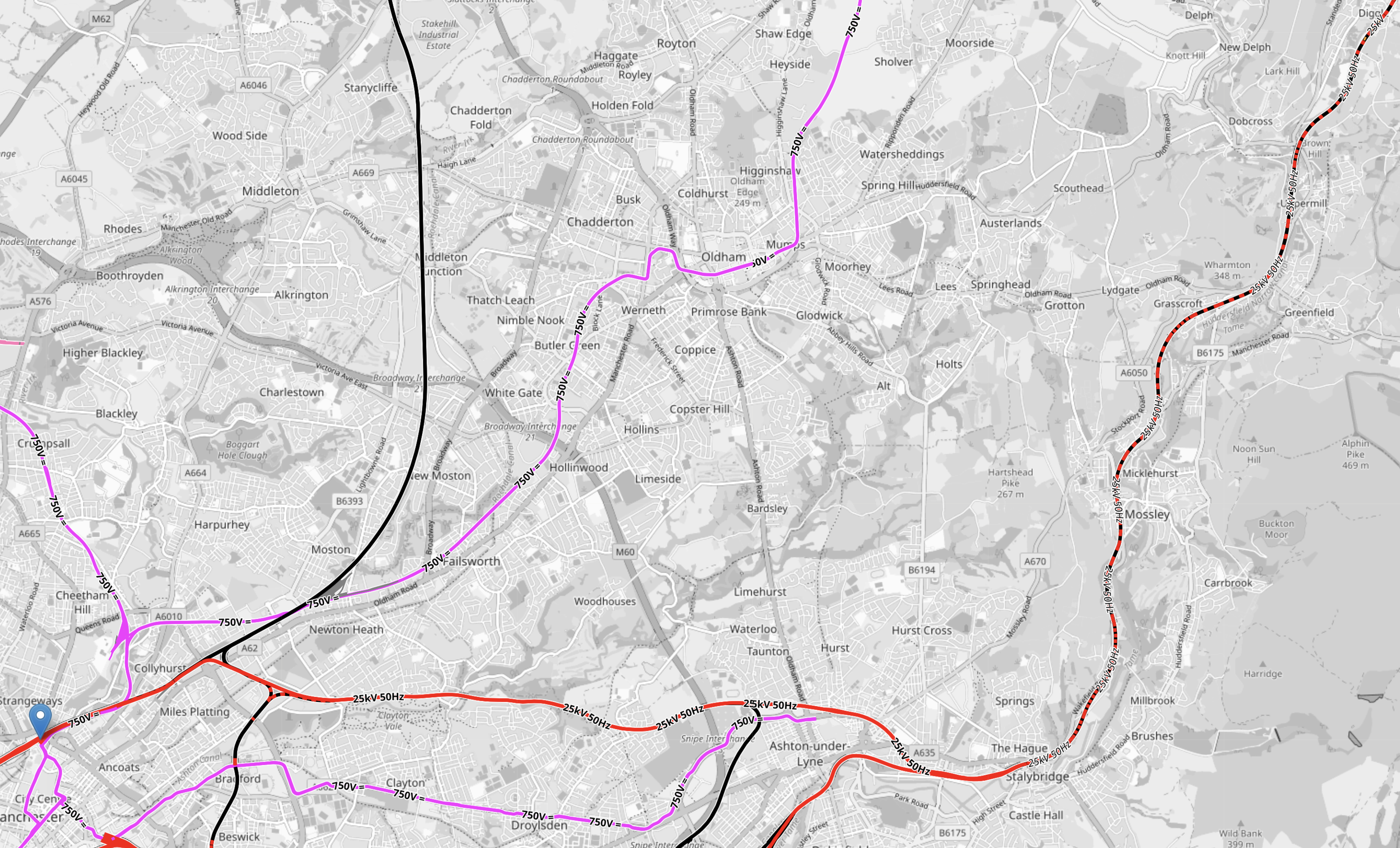
Note.
- Manchester Victoria station is indicated by the blue arrow in the South-West corner of the map.
- Huddersfield station is just off the map in the North-East corner.
- Manchester Victoria and Stalybridge stations is fully electrified and shown in red.
- Stalybridge and Huddersfield stations is being electrified and is shown as black and red dotted.
- Electrification between Huddersfield and Leeds is underway under the TransPennine Upgrade.
This section will be completed, when the Manchester City Centre Rail Tunnel is connected to the Huddersfield Line.
Connecting The Manchester City Centre Rail Tunnel To The Huddersfield Line
This Google Map shows where the Huddersfield Line crosses the M60 Motorway to the West of Ashton-under-Lyme.

Note.
- The newly-electrified Huddersfield Line runs across the map.
- The M60 Motorway is on the left.
- There are facilities for athletics, cricket and football.
I wouldn’t be surprised if the Eastern portal of the Manchester City Centre Rail Tunnel was in this area.
But looking at Google Maps between this site and Manchester Victoria, there are other sites.
Conclusion
I now feel that it is possible to create a Northern Powerhouse Rail/High Speed Two route using a tunnel under Manchester.
Obviously, there is more work to be done.
