Does The UK Need More Passenger Train Capacity Between London And Scotland?
I went from London Euston to Wigan North Western and Blackpool North stations on Wednesday.
Just after the Bank Holiday, the train to the North, which was going to Glasgow Central, seemed fairly busy, but I suspect that a few more souls could have been squeezed in.
Coming South in the early evening, there was a lot more space, but those that had gone to Scotland for the Bank Holiday weekend had probably returned.
At the moment, I am getting a lot of adverts like this, when I read The Times on-line.

It looks to me, that Avanti West Coast, are ecouraging travellers to use trains to travel to and from Glasgow.
How Many Anglo-Scottish Trains Are There?
- Avanti West Coast – 6 tpd – London Euston to Edinburgh Waverley via Birmingham New Street
- Avanti West Coast – 6 tpd – London Euston to Glasgow Central via Birmingham New Street
- Avanti West Coast – 1 tph – London Euston to Glasgow Central via Trent Valley
- CrossCountry – 1 tph – Plymouth to Edinburgh Waverley
- LNER – 2 tph – London King’s Cross to Edinburgh Waverley
- Lumo – 6 tpd – London King’s Cross to Edinburgh Waverley and Glasgow Queen Street
- Lumo – 4 tpd – London Euston to Stirling
- TransPennine Express – 1 tp2h – Manchester Airport to Glasgow Central
- TransPennine Express – 1 tp2h – Manchester Airport to Edinburgh Waverley
- TransPennine Express – 4 tpd – Liverpool Lime Street to Glasgow Central
Note.
- tpd is trains per day.
- tph is trains per hour.
- tp2h is trains per two hours.
- The two Avanti West Coast services via Birmingham New Street alternate.
- The Avanti West Coast London Euston to Glasgow Central via Trent Valley service runs 15 tpd.
- The two TransPennine Express services from Manchester Airport to Scotland alternate.
My initial estimate is that there are 5 x 15 tph +16 tpd or 91 tpd.
How Many Anglo-Scottish Trains Are There On HS2?
In the original design for HS2, this was the service pattern.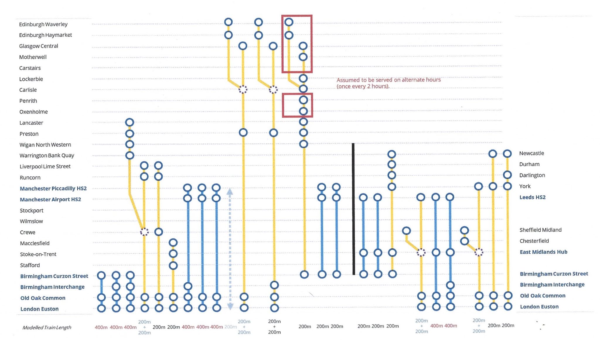
Note.
- Train 10 runs hourly between London and Scotland via Old Oak Common and Preston and splits at Carlisle with one train serving Edinburgh Waverley and the other Glasgow Central.
- Train 11 runs hourly between London and Scotland via Old Oak Common, Birmingham Interchange and Preston and splits at Carlisle with one train serving Edinburgh Waverley and the other Glasgow Central.
- Train 12 runs hourly between Birmingham Curzon Street and Scotland and serves Edinburgh Waverley and Glasgow Central alternatively.
It looks like HS2 contributes 5 tph between England and Scotland or 75 tpd.
But as HS2 is currently configured, these Anglo-Scottish trains will still run.
- CrossCountry – 1 tph – Plymouth to Edinburgh Waverley
- LNER – 2 tph – London King’s Cross to Edinburgh Waverley
- Lumo – 6 tpd – London King’s Cross to Edinburgh Waverley and Glasgow Queen Street
- Lumo – 4 tpd – London Euston to Stirling
- TransPennine Express – 1 tp2h – Manchester Airport to Glasgow Central
- TransPennine Express – 1 tp2h – Manchester Airport to Edinburgh Waverley
- TransPennine Express – 4 tpd – Liverpool Lime Street to Glasgow Central
If these trains continue to run my estimate is that there will be 4 x 15 tph +14 tpd or 74 tpd by classic routes.
This will mean 149 Anglo-Scottish tpd in total.
How Do You Get Between Leeds, Bradford, Sheffield and Hull, and Scotland?
If you look at the diagram, which shows the service pattern for HS2, note the following.
- HS2 does not provide a service between Leeds, York, Durham, Darlington and Newcastle, and Scotland.
- HS2 doesn’t connect to Bradford.
- HS2 doesn’t go past Leeds, but the current LNER services also serve Bradford Forster Square, Harrogate, Shipley and Skipton stations.
There is also no direct trains from the Leeds/Bradford area to Glasgow.
But Consider.
- The Settle and Carlisle Line runs between Skipton and Carlisle and used to host the Thames-Clyde Expresses that were run by the London Midland & Scottish Railway.
- The Wikipedia entry for the Thames-Clyde Express is an interesting read.
- Bradford Forster Square station was recently extended with two platforms , that can handle 10-car trains.
- Bradford Forster Square station has seven trains per day from London via Leeds.
- With a reverse at Bradford Forster Square station trains can call at Leeds, Bradford Forster Square and Skipton stations before taking the Settle and Carlisle Line to Carlisle.
- The Thames-Clyde Express used to take the Glasgow South Western Line to Glasgow Central calling at Dumfries and Kilmarnock.
- LNER’s Class 897 tri-mode trains will probably be able to handle the Settle and Carlisle and the Glasgow South Western Line, without using the diesel engines.
- East Midlands Railway’s Class 810 trains, when fitted with batteries, should probably be able to do the same.
There are a lot of possibilities of how the Settle and Carlisle Line can be used to increase zero-carbon connectivity between Glasgow and London.
The route wouldn’t be the fastest route, but it could be one of the most scenic.
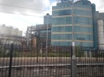
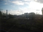
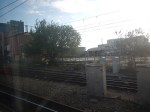
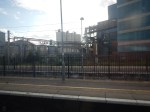
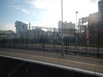
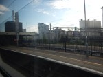
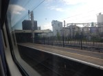
The Former Unilever Site At Warrington – 6th May 2026
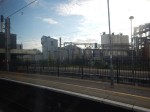
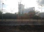
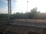
I went past this site twice yesterday on my way to and from Blackpool.
I took these pictures going Northwards.
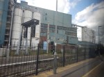
And I took these pictures going Southwards.
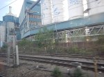
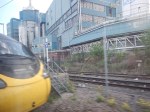
A quick search of the Internet on my phone revealed.
- It was a former soap works, that had previously been owned by Unilever.
- The site was now going to be developed as a data centre.
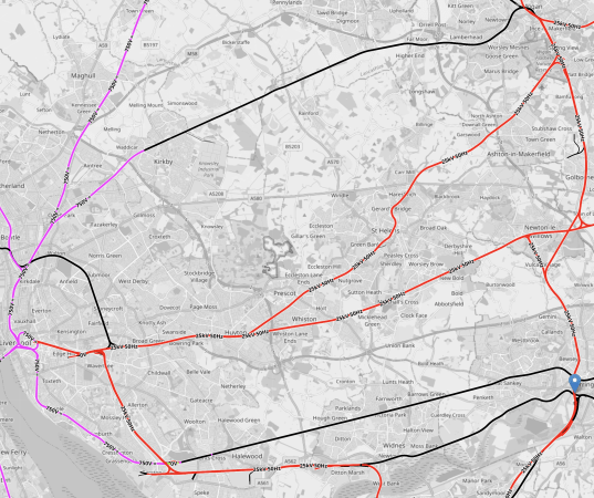
This OpenRailwayMap shows the railways through the area.
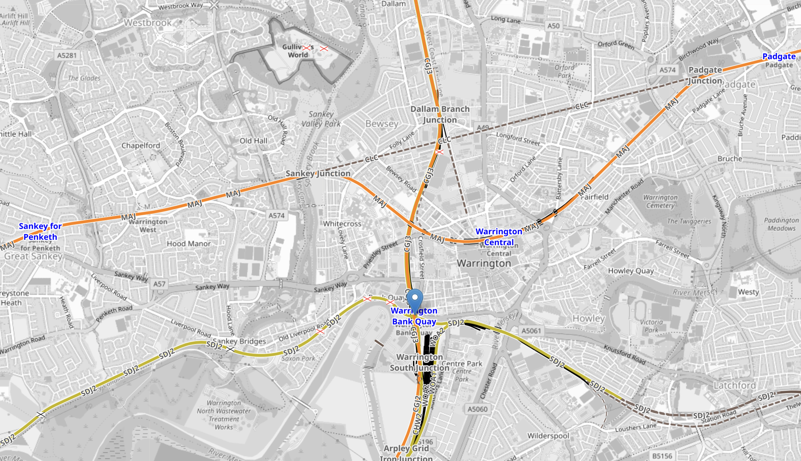
Note.
- Warrington Bank Quay station is indicated by the blue arrow in the middle of the map.
- The Unilever site is to its North-West.
- Warrington Bank Quay station is a major station on the West Coast Main Line and will probably be on High Speed Two, which will share tracks with the West Coast Main Line.
- The two East-West lines are not electrified.
- Warrington West is a relatively new station, that I wrote about in 2020, in The New Warrington West Station.
This OpenRailwayMap shows the railway lines between Liverpool and the coast in the West and the West Coast main Line in the East.
Note.
- The Merseyrail third rail network shown in lilac.
- Electrified tracks shown in red.
- Tracks without electrification shown in black.
- Warrington Bank Quay station indicated by the blue arrow.
- The West Coast Main Line (WCML) runs North-South at the Eastern edge of the map.
- Wigan North Western station is in the North East corner of the map.
- Wigan North Western and Warrington Bank Quay stations are both on the WCML.
Five lines connect the Liverpool local network to the WCML.
- The top unelectrified line connects the new Headbolt Lane station to Wigan Wallgate station.
- The most Northerly electrified line connects Liverpool Lime Street and Wigan North Western stations via Huyton station.
- The second electrified line connects Liverpool Lime Street and Manchester via Newton-le-Willows station.
- The most Northerly of the bottom pair of unelectrified lines connects Liverpool Lime Street and Manchester via Warrington Central station.
- The final line is a freight line between Liverpool and Manchester along the Mersey. This line runs under the WCML
The last line is likely to be upgraded to become Northern Powerhouse Rail between Liverpool Lime Street and Manchester via Manchester Airport.
This picture shows a freight train passing under Warrington Bank Quay station.

This OpenRailway Map shows how the lines cross to the South of Warrington Bank Quay station.
Note.
- The electrified North-South line is the West Coast Main Line (WCML).
- There is quite a good amount of space.
Could the junction be designed, so that HS2 trains could go between Manchester and London?
Making The Most Of What Is Left Of High Speed Two
High Speed Two is in a bit of a mess.
In the original design for HS2, this was the service pattern.
Note.
- Trains to the left of the vertical black line are Phase 1 and those to the right are Phase 2.
- Full-Size trains are shown in blue.
- Classic-Compatible trains are shown in yellow.
- The dotted circles are stations, where trains split and join.
- In the red boxes routes alternate every hour.
Click on the diagram to enlarge it.
The Eastern Leg Has Been Cancelled
This means that these trains have been cancelled.
- Train 15 – 200 m HS2 FS – Birmingham Curzon Street and Leeds via East Midlands Hub
- Train 16 – 200 m HS2 FS – Birmingham Curzon Street and Leeds via East Midlands Hub
- Train 17 – 200 m HS2 CC – Birmingham Curzon Street and Newcastle via East Midlands Hub, York, Darlington and Durham
- Train 18a – 200 m HS2 CC – London Euston and Sheffield via Old Oak Common, East Midlands Hub
- Train 18b – 200 m HS2 CC – London Euston and Leeds via Old Oak Common and East Midlands Hub
- Train 19 – 400 m HS2 FS – London Euston and Leeds via Old Oak Common and East Midlands Hub
- Train 20 – 400 m HS2 FS – London Euston and Leeds via Old Oak Common, Birmingham Interchange and East Midlands Hub
- Train 21a – 200 m HS2 CC – London Euston and Sheffield via Old Oak Common, East Midlands Hub and Chesterfield
- Train 21b – 200 m HS2 CC – London Euston and York via Old Oak Common and East Midlands Hub
- Train 22 – 200 m HS2 CC – London Euston and Newcastle via Old Oak Common and York
- Train 23 – 200 m HS2 CC – London Euston and Newcastle via Old Oak Common, York, Darlington and Durham
Note.
- All trains are one train per hour (tph)
- Train 18 splits and joins at East Midlands Hub, so runs as a 400 m train between London Euston and East Midlands Hub.
- Train 21 splits and joins at East Midlands Hub, so runs as a 400 m train between London Euston and East Midlands Hub.
- There are now no Birmingham and Leeds services.
- There are six spare HS2 paths between London Euston and Birmingham.
In my opinion, the big losers are travelers between Leeds and Birmingham, as travelers between London and Leeds can use the East Coast Main Line, which caters for several destinations in Yorkshire and the North-East.
Services Between London Euston and Birmingham
Services between London Euston and the Birmingham area are as follows.
- Train 1 – 400 m HS2 FS – London Euston and Birmingham Curzon Street via Old Oak Common
- Train 2 – 400 m HS2 FS – London Euston and Birmingham Curzon Street via Old Oak Common and Birmingham Interchange
- Train 3 – 400 m HS2 FS – London Euston and Birmingham Curzon Street via Old Oak Common and Birmingham Interchange
- Train 7 – 400 m HS2 FS – London Euston and Manchester Piccadilly via Old Oak Common, Birmingham Interchange and Manchester Airport
- Train 11a – 200 m HS2 CC – London Euston and Edinburgh Waverley via Old Oak Common, Birmingham Interchange , Preston, Carlisle and Edinburgh Haymarket
- Train 11b – 200 m HS2 CC – London Euston and Glasgow Central via Old Oak Common, Birmingham Interchange , Preston and Carlisle
- Train 12 – 200 m HS2 CC – Birmingham Curzon Street and Edinburgh Waverley/Glasgow Central via Wigan North Western, Preston, Lancaster, Oxenholme, Penrith, Carlisle, Lockerbie, Carstairs and Edinburgh Haymarket/Motherwell
Note.
- All trains are one train per hour (tph)
- Train 11 splits and joins at Carlisle, so runs as a 400 m train on the Trent Valley Line.
- Train 12 runs alternatively to Edinburgh Haymarket and Edinburgh Waverley/Motherwell and Glasgow Central.
- All these services will join the Trent Valley Line at Handsacre junction.
There are 5 x 400 metre trains and 1 x 200 metre train.
Services Between London Euston and Manchester
Services between London Euston and the Manchester area are as follows.
- Train 6 – 200 m. HS2 CC – London Euston and Macclesfield via Old Oak Common, Stafford and Stoke-on-Trent
- Train 7 – 400 m HS2 FS – London Euston and Manchester Piccadilly via Old Oak Common, Birmingham Interchange and Manchester Airport
- Train 8 – 400 m HS2 FS – London Euston and Manchester Piccadilly via Old Oak Common and Manchester Airport
- Train 9 – 400 m HS2 FS – London Euston and Manchester Piccadilly via Old Oak Common and Manchester Airport
- Train 13 – 200 m HS2 FS – Birmingham Curzon Street and Manchester Piccadilly via Manchester Airport
- Train 14 – 200 m HS2 FS – Birmingham Curzon Street and Manchester Piccadilly via Manchester Airport
Note.
- All trains are one train per hour (tph)
- Macclesfield should be able to handle one 200 m. HS2 Classic-Compatible train per hour, as it is shorter and has less passengers than an 11-car Pendolino.
- All Manchester Piccadilly services call at Manchester Airport.
- All these services will join the Trent Valley Line at Handsacre junction.
There are 3 x 400 metre trains and 3 x 200 metre train.
Services Between London Euston and Liverpool, Lancaster and Scotland
Services between London Euston and Liverpool, Lancaster and Scotland are as follows.
- Train 4a – 200 m. HS2 CC – London Euston and Lancaster via Old Oak Common, Crewe, Warrington Bank Quay, Wigan North Western and Preston
- Train 4b – 200 m. HS2 CC – London Euston and Liverpool via Old Oak Common, Crewe and Runcorn
- Train 5 – 200 m. HS2 CC – London Euston and Liverpool via Old Oak Common, Crewe and Runcorn
- Train 10a – 200 m HS2 CC – London Euston and Edinburgh Waverley via Old Oak Common, Preston, Carlisle and Edinburgh Haymarket
- Train 10b – 200 m HS2 CC – London Euston and Glasgow Central via Old Oak Common, Preston and Carlisle
- Train 11a – 200 m HS2 CC – London Euston and Edinburgh Waverley via Old Oak Common, Birmingham Interchange , Preston, Carlisle and Edinburgh Haymarket
- Train 11b – 200 m HS2 CC – London Euston and Glasgow Central via Old Oak Common, Birmingham Interchange , Preston and Carlisle
- Train 12 – 200 m HS2 CC – Birmingham Curzon Street and Edinburgh Waverley/Glasgow Central via Wigan North Western, Preston, Lancaster, Oxenholme, Penrith, Carlisle, Lockerbie, Carstairs and Edinburgh Haymarket/Motherwell
Note.
- All trains are one train per hour (tph)
- Train 4 splits and joins at Crewe, so runs as a 400 m train on the Trent Valley Line.
- Train 10 splits and joins at Carlisle, so runs as a 400 m train on the Trent Valley Line.
- Train 11 splits and joins at Carlisle, so runs as a 400 m train on the Trent Valley Line.
- Train 12 runs alternatively to Edinburgh Haymarket and Edinburgh Waverley/Motherwell and Glasgow Central.
- All these services will join the Trent Valley Line at Handsacre junction.
There are 3 x 400 metre trains and 2 x 200 metre train.
How Many Services Ran Between London And Lancashire, Liverpool and Manchester In The Proposed Timetable?
- Train 4a – 200 m. HS2 CC – London Euston and Lancaster
- Train 4b – 200 m. HS2 CC – London Euston and Liverpool
- Train 5 – 200 m. HS2 CC – London Euston and Liverpool
- Train 6 – 200 m. HS2 CC – London Euston and Macclesfield
- Train 7 – 400 m HS2 FS – London Euston and Manchester Piccadilly
- Train 8 – 400 m HS2 FS – London Euston and Manchester Piccadilly
- Train 9 – 400 m HS2 FS – London Euston and Manchester Piccadilly
Note.
Macclesfield may be in Cheshire, but for my purposes in this calculation, it’s also in South Manchester.
There are 4 x 400 metre trains and 2 x 200 metre train.
But as I stated in Manchester Piccadilly Station Platform Layout, until the track and the tunnel to Manchester Airport and Manchester Piccadilly is built, 400 m HS2 Full-Size will have to be replaced by 200 m HS2 Classic Compatible trains, as no other train will fit the existing Manchester Piccadilly station.
This would mean that 6 x 200 m HS2 Classic Compatible trains will run.
I can turn these two schedules into seats per hour.
Consider.
- The current service is 3 x 11-car Pendolinos per hour, which is 607 seats per train or a total of 1821 seats per hour.
- A 200 metre HS2 Full-Size and a 200 metre HS2 Classic Compatible train, both have 504 seats.
This means that the proposed timetable has 5040 seats, but only 3528 seats, if HS2 FS trains can’t be used and have to be replaced by 200 metre HS2 Classic Compatible train.
I can build this table.
- Current – Pendolinos – 1821 seats per hour.
- Interim – Using 200 metre HS2 Classic Compatible trains – 3528 seats per hour – This is a 94 % increase over the current figure.
- Full – Using 200 metre HS2 Full Size trains in tunnels to Manchester Piccadilly – 5040 seats per hour – This is a 177 % increase over the current figure.
Note.
In Manchester Piccadilly Station Platform Layout, I stated that it is my belief, that an Interim timetable can be achieved by replacing all 11-car Pendolinos by 200 metre HS2 Classic Compatible trains.
Could More Capacity Be Added By Adding A Blackpool Service?
In Blackpool North Station Platform Layout, I looked at the possibilities of adding a Blackpool service to HS2.
This was my conclusion.
I believe Blackpool North station could handle as least one pair of 200 metre HS2 Classic-Compatible Trains to and from London Euston every hour.
It might be able to handle two such trains in every hour.
Adding two pairs of 200 metre HS2 Classic-Compatible Trains between London Euston and Blackpool every hour, would add 1008 seats.
If it is possible to add two pairs of 200 metre HS2 Classic-Compatible Trains, my table would be as follows.
- Current – Pendolinos – 1821 seats per hour.
- Interim – Using 200 metre HS2 Classic Compatible trains – 5544 seats per hour – This is a 204 % increase over the current figure.
- Full – Using 200 metre HS2 Full Size trains in tunnels – 7056 seats per hour – This is a 287 % increase over the current figure.
I must admit, the percentage increases have surprised me, but I have checked and checked them.
Is The Interim Solution Plus Two Trains Between London Euston And Blackpool North The Solution?
Consider.
- Crewe, Warrington Bank Quay, Wigan North Western and Preston, get two extra services to London Euston, Old Oak Common and Birmingham Interchange.
- All trains will be 200 metre HS2 Classic Compatible trains.
- Crewe, Warrington Bank Quay, Wigan North Western and Preston, Manchester Piccadilly will not need major upgrades.
- Manchester Airport would not be served initially, but a tunnel connecting Crewe, Manchester Airport and Manchester Piccadilly could be added later.
- There is no connection between Birmingham and Leeds and the East Midlands.
Could HS2 Serve Holyhead?
In Could HS2 Trains Continue To Wales?, I show that if Crewe And Chester Is Electrified, then a HS2 Classic Compatible train fitted with batteries should be able to go between London Euston and Holyhead in a couple of minutes under three hours.
It could be a good start!
Manchester Piccadilly Station Platform Layout
In this post, I will look at the current platform layout at Manchester Piccadilly station and see if it could be updated for High Speed Two.
This OpenRailwayMap shows the current platform layout at the station.
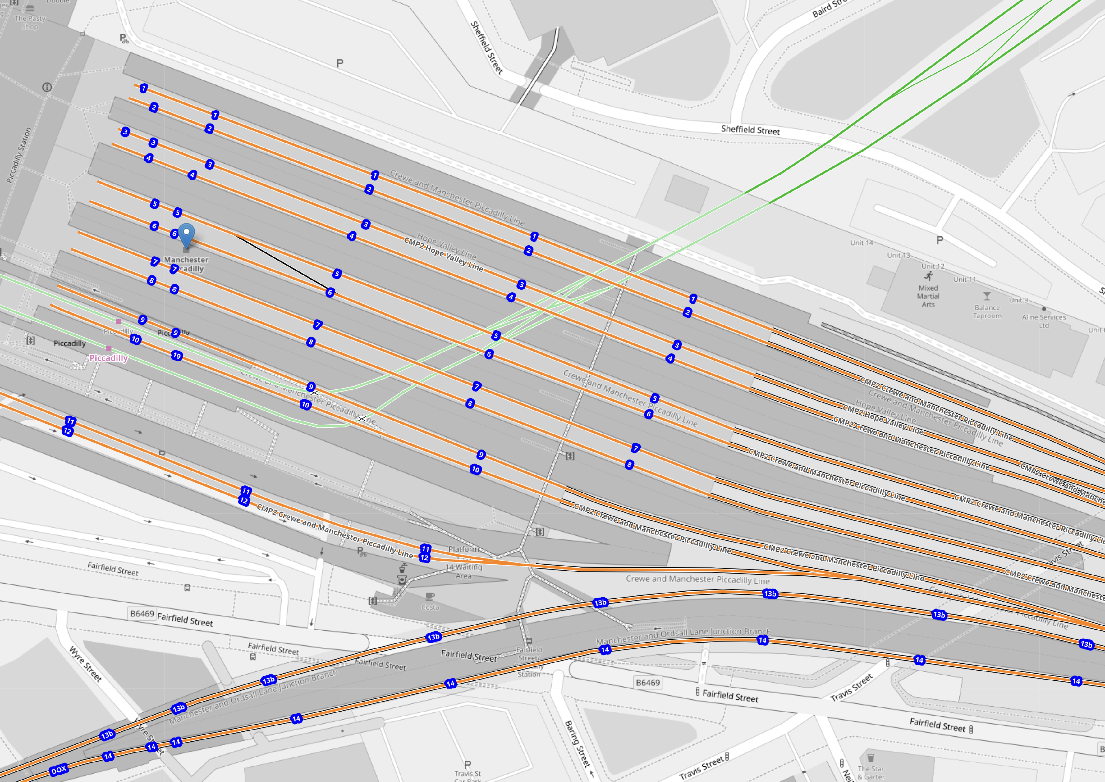
Note.
- There are twelve platforms in the main station, which are numbered 1 to 12 from North to South.
- There are also two platforms to the South of the main station, which are on the Castlefield Corridor and numbered 13 and 14.
- The current Avanti West Coast services use Platforms 5 to 8.
- Platforms 1 to 8 seem well-spaced.
- The Internet gives the length of Platform 1 as 238 metres, so it can be used as a ruler on all the platforms.
- The green tracks are for the Manchester Metrolink, which runs under the station.
I will now take a detailed look at the four platforms used by Avanti West Coast services, which are 5 to 8.
- The platforms are 340, 277, 277 and 340 metres long respectively.
- All four platforms can handle 11-car Pendolino Class 390 trains, which are 265.3 metres long.
- All four platforms will also handle 8-car HS2 Classic-Compatible trains, which will be 200 metres long.
- The platforms also seem to have a straight run-in to the buffers, which is about 260 metres long.
- This straight section is long enough to accommodate an 11-car Pendolino or an 8-car HS2 Classic-Compatible train.
I would think it reasonable that an 8-car HS2 Classic-Compatible train could take over the service of an 11-car Pendolino, but running on HS2 infrastructure, where it exists.
The current Avanti West Coast service to Manchester Piccadilly is as follows.
- 1 tph – 9-car or 11-car – London Euston and Manchester Piccadilly via Milton Keynes Central, Rugby, Stoke-on-Trent, Macclesfield and Stockport
- 1 tph – 9-car or 11-car – London Euston and Manchester Piccadilly via Nuneaton, Stoke-on-Trent and Stockport
- 1 tph – 9-car or 11-car – London Euston and Manchester Piccadilly via Stafford, Crewe, Wilmslow and Stockport
In the original design for HS2, this was the service pattern.
Note.
- Trains to the left of the vertical black line are Phase 1 and those to the right are Phase 2.
- Full-Size trains are shown in blue.
- Classic-Compatible trains are shown in yellow.
- The dotted circles are where trains split and join.
- In the red boxes routes alternate every hour.
Click on the diagram to enlarge it.
Services to Manchester Piccadilly and the Manchester area are as follows.
- Train 6 – 200 m. HS2 CC – London Euston and Macclesfield via Old Oak Common, Stafford and Stoke-on-Trent
- Train 7 – 400 m HS2 FS – London Euston and Manchester Piccadilly via Old Oak Common, Birmingham Interchange and Manchester Airport
- Train 8 – 400 m HS2 FS – London Euston and Manchester Piccadilly via Old Oak Common and Manchester Airport
- Train 9 – 400 m HS2 FS – London Euston and Manchester Piccadilly via Old Oak Common and Manchester Airport
- Train 13 – 200 m HS2 FS – Birmingham Curzon Street and Manchester Piccadilly via Manchester Airport
- Train 14 – 200 m HS2 FS – Birmingham Curzon Street and Manchester Piccadilly via Manchester Airport
Note.
- All trains are one train per hour (tph)
- Macclesfield should be able to handle one 200 m. HS2 Classic-Compatible train per hour, as it is shorter and has less passengers than an 11-car Pendolino.
- All Manchester Piccadilly services call at Manchester Airport.
I believe this allows two possible solutions.
- A largely tunneled solution, that gives access to enough 400 m platforms underneath or alongside Manchester Piccadilly station.
- An interim solution, that replaces 11-car Pendolinos with 200 m. HS2 Classic-Compatible trains.
I will answer this question first.
Will HS2 Use A Tunnel Between Manchester Airport And Manchester Piccadilly Station?
I asked Google AI and received this answer.
Yes, in the original HS2 proposals, a 7.5-mile twin-bore tunnel was planned to run between Manchester Airport and the Ardwick area, surfacing near Manchester Piccadilly. This tunnel was designed to carry the high-speed line underneath the built-up areas of south Manchester and into the terminal station.
Key Details of the Proposed Tunnel:
Purpose: To connect the new Manchester Airport High Speed Station with Manchester Piccadilly station.
Structure: A 7.5-mile (approx. 12km) twin tunnel.
Route: Following the airport, the line would enter the tunnel, traveling towards Piccadilly station.
Location: The tunnel handles the approach to Manchester city centre, allowing the high-speed tracks to bypass surface-level congestion in the south Manchester suburbs.
Note: While this was the planned route for Phase 2b, the future of the northern leg of HS2 has been subject to change and government reviews, which may impact these designs
The Full Solution
This will entail the following.
- A two-platform underground station at Manchester Airport, that is capable of handling 400 m. HS2 Full-Size trains.
- A large enough extension to Manchester Piccadilly station that is capable of terminating enough 400 m. HS2 Full-Size trains.
- The extension to Manchester Piccadilly station could be underneath or alongside, the current station.
- A 7.5 mile twin-bore tunnel between the two stations.
I also believe the full solution will need the completion of the high speed line between Handsacre junction and Crewe.
That would be an expensive and difficult solution, so we will need an interim solution.
The Interim Solution
This will entail the following.
- All HS2 services into Manchester Piccadilly will be run by 8-car 200 m. HS2 Classic-Compatible trains.
- They will use Platforms 5 to 8 in Manchester Piccadilly station, which are 340, 277, 277 and 340 metres long respectively.
- The Manchester Piccadilly services will not call at Manchester Airport.
- The Macclesfield service will run to serve Stafford and Stoke-on-Trent.
- I also believe the interim solution will not need the completion of the high speed line between Handsacre junction and Crewe.
My project management experience leads me to believe, that after HS2 is completed to Handsacre junction, Manchester Piccadilly station could be served by 8-car 200 m. HS2 Classic-Compatible trains.
How Many Trains Will The Interim Solution Run Through The Trent Valley Line?
If the interim solution is to work, then HS2 trains for North of Handsacre Junction will have to take their chances on the Trent Valley Line.
This OpenRailwayMap shows the route of the Trent Valley Line between Handsacre Junction and Crewe.
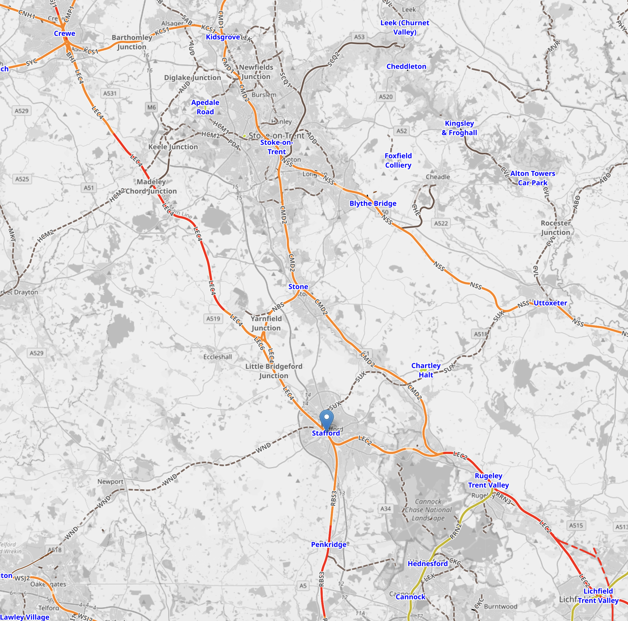
Note.
- Stafford station is marked with a blue arrow.
- Crewe station is in the North-West corner of the map.
- Lichfield Trent Valley station is in the South-East corner of the map.
- The Northern end of HS2 is should dotted around Lichfield Trent Valley station
- Rugeley Trent Valley station is to the North-West of Lichfield Trent Valley station.
- Crewe, Stafford, Rugeley Trent Valley and Lichfield Trent Valley stations are all on the Trent Valley Line, which runs North-West and South-East across the map.
- Handsacre junction is to the North of Lichfield Trent Valley station and links the North end of HS2 to the the Trent Valley Line.
This second OpenRailwayMap shows Handsacre junction in more detail.
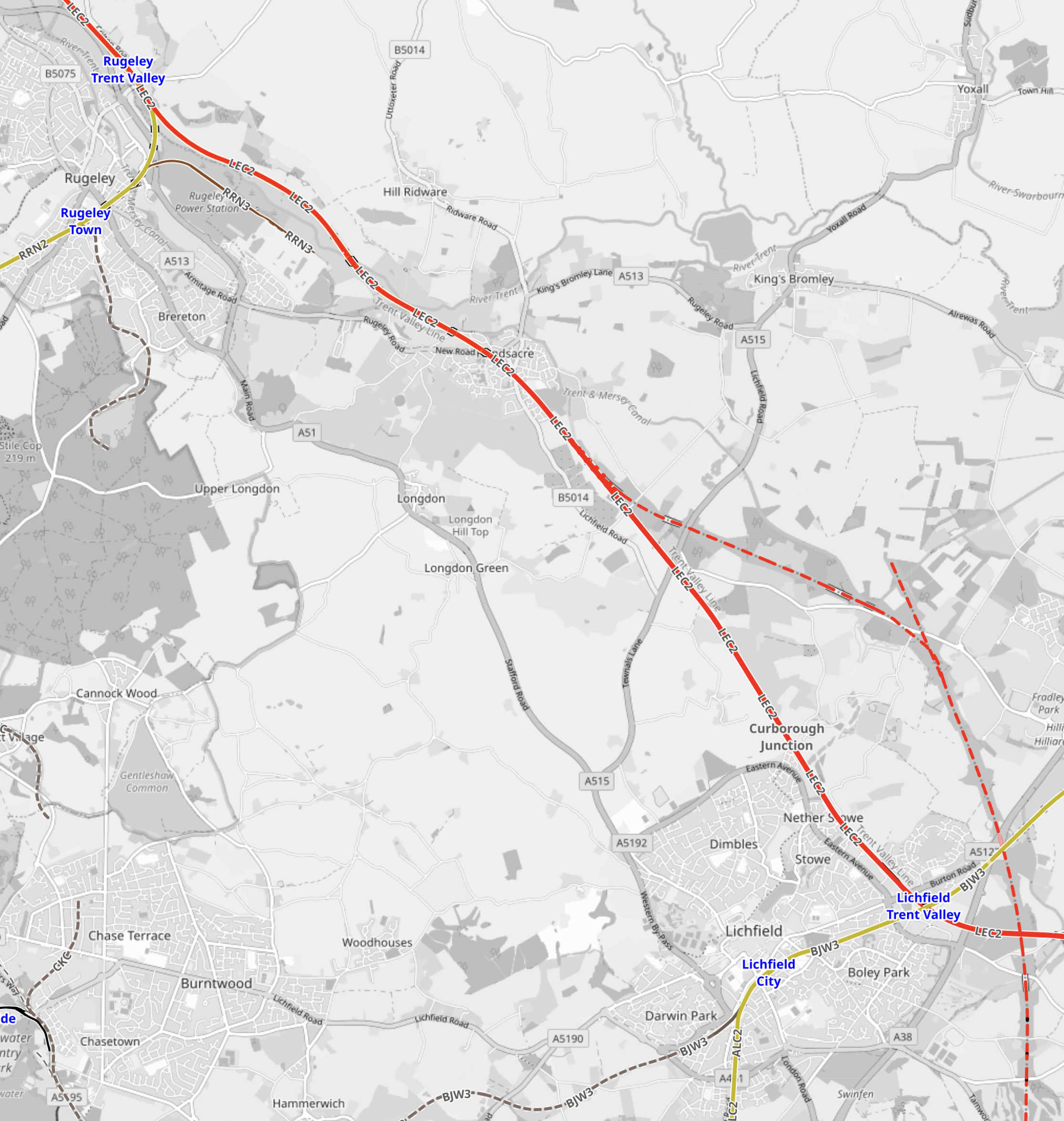
Note.
- Rugeley Trent Valley station is in the North-West corner of the map.
- Lichfield Trent Valley station is in the South-East corner of the map.
- The Trent Valley Line runs diagonally across the map between the two stations.
- The route of HS2 is shown as a dotted red line in the South-East corner of the map.
- HS2 and the Trent Valley Line will join at Handsacre junction.
The stub of HS2 in the North-East corner of the map, will eventually link to Crewe.
The following services will join the Trent Valley Line at Handsacre junction.
- Train 4a – 200 m. HS2 CC – London Euston and Lancaster via Old Oak Common, Crewe, Warrington Bank Quay, Wigan North Western and Preston
- Train 4b – 200 m. HS2 CC – London Euston and Liverpool via Old Oak Common, Crewe and Runcorn
- Train 5 – 200 m. HS2 CC – London Euston and Liverpool via Old Oak Common, Crewe and Runcorn
- Train 6 – 200 m. HS2 CC – London Euston and Macclesfield via Old Oak Common, Stafford and Stoke-on-Trent
- Train 7 – 200 m HS2 CC – London Euston and Manchester Piccadilly via Old Oak Common and Birmingham Interchange
- Train 8 – 200 m HS2 CC – London Euston and Manchester Piccadilly via Old Oak Common
- Train 9 – 200 m HS2 CC – London Euston and Manchester Piccadilly via Old Oak Common
- Train 10a – 200 m HS2 CC – London Euston and Edinburgh Waverley via Old Oak Common, Preston, Carlisle and Edinburgh Haymarket
- Train 10b – 200 m HS2 CC – London Euston and Glasgow Central via Old Oak Common, Preston and Carlisle
- Train 11a – 200 m HS2 CC – London Euston and Edinburgh Waverley via Old Oak Common, Birmingham International, Preston, Carlisle and Edinburgh Haymarket
- Train 11b – 200 m HS2 CC – London Euston and Glasgow Central via Old Oak Common, Birmingham International, Preston and Carlisle
- Train 12 – 200 m HS2 CC – Birmingham Curzon Street and Edinburgh Waverley/Glasgow Central via Wigan North Western, Preston, Lancaster, Oxenholme, Penrith, Carlisle, Lockerbie, Carstairs and Edinburgh Haymarket/Motherwell
- Train 13 – 200 m HS2 CC – Birmingham Curzon Street and Manchester Piccadilly
- Train 14 – 200 m HS2 CC – Birmingham Curzon Street and Manchester Piccadilly
Note.
- All trains are one train per hour (tph)
- Train 4 splits and joins at Crewe, so runs as a 400 m train on the Trent Valley Line.
- Train 10 splits and joins at Carlisle, so runs as a 400 m train on the Trent Valley Line.
- Train 11 splits and joins at Carlisle, so runs as a 400 m train on the Trent Valley Line.
- Train 12 runs alternatively to Edinburgh Haymarket and Edinburgh Waverley/Motherwell and Glasgow Central.
In any hour, it looks like eight single trains and three pairs will run along the Trent Valley Line.
How Close In Minutes Can Trains Run On The Trent Valley Line?
I asked Google AI and received this answer.
On the modernised Trent Valley Line (part of the West Coast Main Line), trains can run at high frequencies, often with fast, long-distance services operating with headway (spacing) of approximately 3 to 5 minutes, though typically, a 2-4 train per hour per direction service pattern is standard, equating to 15–30 minute intervals between similar services.
Capacity: The line is a four-track railway between Rugby and Stafford, allowing fast, long-distance express trains (up to 125 mph) to overtake slower, local, and freight trains.
Service Frequency: High-frequency, high-speed travel is standard.
Constraints: While the infrastructure supports close spacing, schedules are constrained by capacity at major bottlenecks and the requirement for consistent track maintenance.
It’s probably tight, but not impossibly so. Especially, as Train 6 to Macclesfield cuts off through Stoke-on-Tent after Stafford.
What Is The Capacity Of Each Train Timetable Between London Euston And Manchester Piccadilly/Macclesfield?
Consider.
- An 11-car Pendolino has 607 seats.
- I’m assuming all Pendolinos are 11-car trains.
- An 8-car HS2 Classic-Compatible train has 504 seats.
- I’m assuming that HS2 Full Size trains have the same capacity as the Classic Compatible trains.
These are figures for each timetable.
Current Timetable
3 x 11-car Pendolino = 1,821 seats. per hour
Interim Timetable
4 x 8-car 200 m. HS2 Classic-Compatible trains = 2,016 seats per hour, which is a 10.7 % increase over today.
Full Timetable
7 x 8-car 200 m. HS2 Classic-Compatible trains = 3,538 seats per hour, which is a 93.7 % increase over today.
How Many Trains Run On Each Section Of HS2?
Current Timetable
None
Interim Timetable
These are my estimates of trains per hour on each section.
- London Euston and Birmingham – 11 tph
- Birmingham and Stafford – 11 tph
- Stafford and Crewe – 10 tph
- Stafford and Macclesfield – 1 tph
- Crewe and Liverpool – 2 tph
- Crewe and Manchester Piccadilly – 5 tph
- Crewe and Preston – 4 tph
- Preston and Lancaster – 4 tph
- Lancaster and Carlisle – 3 tph
- Carlisle and Edinburgh Waverley – 2.5 tph
- Carlisle and Glasgow Central – 2.5 tph
There would appear to be spare capacity for up to six trains per hour, South of Crewe.
Full Timetable
These are my estimates of trains per hour on each section.
- London Euston and Birmingham – 11 tph
- Birmingham and Stafford – 11 tph
- Stafford and Crewe – 10 tph
- Stafford and Macclesfield – 1 tph
- Crewe and Liverpool – 2 tph
- Crewe and Manchester Airport- 5 tph
- Manchester Airport and Manchester Piccadilly – 5 tph
- Crewe and Preston – 4 tph
- Preston and Lancaster – 4 tph
- Lancaster and Carlisle – 3 tph
- Carlisle and Edinburgh Waverley – 2.5 tph
- Carlisle and Glasgow Central – 2.5 tph
There would still appear to be spare capacity for up to six trains per hour, South of Crewe.
Conclusions
Theses are my conclusions.
- There Are At Least Six Free Train Paths In Every Hour Between London And Crewe
This is partly because the Eastern leg was cancelled. But it does seem silly to waste them.
I believe Blackpool would be a good place to serve and I said so in Could High Speed Two Serve Blackpool North?
Other possible places would be Chester, Holyhead and Scotland.
2. There Will Need To Be A Tunnel To Connect Manchester Piccadilly And Manchester Airport
This is because you can’t knock all the houses down to build the link.
The Channel Tunnel Rail Link is tunnelled under Dalston in East London for the same reason.
3. Manchester Piccadilly and Manchester Airport services will be five Trains Per Hour
Two of these five trains will go to Birmingham Curzon Street and three to London Euston.
I would expect that the Manchester Tunnel will be an important project for the finances of Manchester Airport.
4. When The Manchester Tunnel Is Built, This Will Double Seat Capacity Between London And Manchester Piccadilly
This is because it will allow 400 metre trains between London Euston and Manchester Piccadilly.
5. HS2 Can Run To Manchester Without Building The Manchester Tunnel Or A High Speed Line Between Crewe And Birmingham
This surprised me at first, but it appears, that it’s because HS2 Classic-Compatible trains are shorter than 11-car Pendolinos.
6. HS2 Can’t Run To Manchester Airport Without Building the Manchester Tunnel.
It’s all because of the houses in between.
7. Single 200 m. HS2 Classic Compatible trains, Can Use The Unmodified Manchester Piccadilly.
This is because they are shorter than 11-car Pendolinos. But pairs can’t, as they are too long!
8. Stockport Gets A Raw Deal From HS2
Currently, Stockport, gets three 11-car Pendolino services between London Euston and Manchester Piccadilly.
Under the Interim Solution, these services will continue as HS2 Classic-Compatible trains are shorter than 11-car Pendolinos.
But under the Full Solution, HS2 trains will be in the Manchester Tunnel between Manchester Airport and Manchester Piccadilly.
9. The Interim Solution Will Work
I am more and more convinced, that a proposed solution which entails the following will work.
- A new service from London Euston to Macclesfield via Old Oak Common, Stafford and Stoke-on-Trent is introduced.
- 11-car Pendolinos are replaced by 8-car HS2 Classic-Compatible trains, which are shorter.
- The Trent Valley Line is updated, so that it can handle 11 trains per hour, that will eventually be transferred to the new HS2 line between Handsacre junction and Crewe.
- London Euston and Manchester Piccadilly will get three trains per hour via HS2 to Handsacre junction the Trent Valley Line.
- There will be no major work to be done at Manchester Piccadilly.
- Three trains per hour between London Euston and Manchester Piccadilly could still call at Stockport.
I also believe that this solution can be easily built, as it is mainly improving the existing route between Handsacre junction and Manchester Piccadilly via Crewe and Stockport.
Ministers Sack Top Rail Adviser Who Spoke Out Over HS2 Train Debacle
The title of this post, is the same as that of this article on The Times.
This is the sub-heading.
Chris Gibb, an industry veteran, said plans to shorten HS2 trains would likely inflate costs, slow services beyond Birmingham and result in fewer seats
These three paragraphs add more details.
A leading government adviser has been fired for criticising Whitehall plans to reduce the length of HS2 trains, it can be revealed.
Chris Gibb, a non-executive director of the nationalised train operator, is understood to have had his contract terminated by ministers this weekend after allegedly breaching media engagement rules.
Gibb was appointed to the board of the Department for Transport Operator Limited (DFTO) in 2020, having worked in the rail industry for more than 40 years. DFTO is the state-owned company that oversees train companies as they are brought into full public ownership.
This paragraph appears to detail what Gibb has said that caused offence.
Gibb said there was “no doubt that if HS2 opened by replacing 11-coach Pendolinos with eight-coach trains, these would be full and leave people behind on day one”.
So I will audit, what he said.
Now that Leeds is not going to be served by HS2, Manchester Piccadilly, is the only station other than Birmingham Curzon Street, that will terminate 400 m. trains, and the Birmingham station will be brand-new, so hopefully, that will be designed for the right capacity.
Manchester Piccadilly currently handles three trains per hour from London.
- Milton Keynes Central, Rugby, Stoke-on-Trent, Macclesfield and Stockport
- Nuneaton, Stoke-on-Trent and Stockport
- Stafford, Crewe, Wilmslow and Stockport
Trains are usually Class 390 11-car Pendolino with 607 seats
These will be replaced by.
- 200m. train – Euston and Macclesfield via Old Oak Common, Stafford and Stoke-on-Trent.
- 400m. train – Euston and Manchester Piccadilly via Old Oak Common, Birmingham International and Manchester Airport.
- 400m. train – Euston and Manchester Piccadilly via Old Oak Common and Manchester Airport.
- 400m. train – Euston and Manchester Piccadilly via Old Oak Common and Manchester Airport.
Trains will be 200m 8-car HS2 train which will have 504 seats. 400m trains will be two trains running as a pair.
I can add up the hourly seats.
Currently, if the three trains per hour are 11-car Pendolinos, then the hourly London-Manchester capacity is 1821 seats.
On HS2, if the four and a half trains per hour are 8-car HS2 trains, then the hourly London-Manchester capacity is 9 x 504 or 4536 seats, or a 149% increase in capacity.
- And HS2 doesn’t serve Macclesfield, Stockport or Wilmslow!
- Four 200m. HS2 trains would give a 121 % increase in capacity.
- Perhaps, as there is spare capacity on HS2 between Crewe and London, another service could be fitted into the hourly scheme of things.
How about Blackpool?
How Many 8-car HS2 Trains Would Be Needed To Replace The Capacity Of The Current Service?
To provide an hourly London-Manchester capacity of 1821 seats with 8-car HS2 trains would need around 3.6 trains.
Even in the unreal world that in which politicians exist, I doubt fractions of a train exist.
So I suspect, a practical timetable could be.
- 200m. train – Euston and Macclesfield via Old Oak Common, Stafford and Stoke-on-Trent.
- 200m. train – Euston and Manchester Piccadilly via Old Oak Common, Birmingham International and Manchester Airport.
- 200m. train – Euston and Manchester Piccadilly via Old Oak Common and Manchester Airport.
- 200m. train – Euston and Manchester Piccadilly via Old Oak Common and Manchester Airport.
This would be 2016 hourly seats, which is an increase of about 10 %
Please check my figures, as they could explain a lot.
Completing Northern Powerhouse Rail
The Northern Powerhouse Rail/High Speed Two Connection To Manchester Airport Station
This OpenRailwayMap shows the rail connections that terminate at Manchester Airport station.
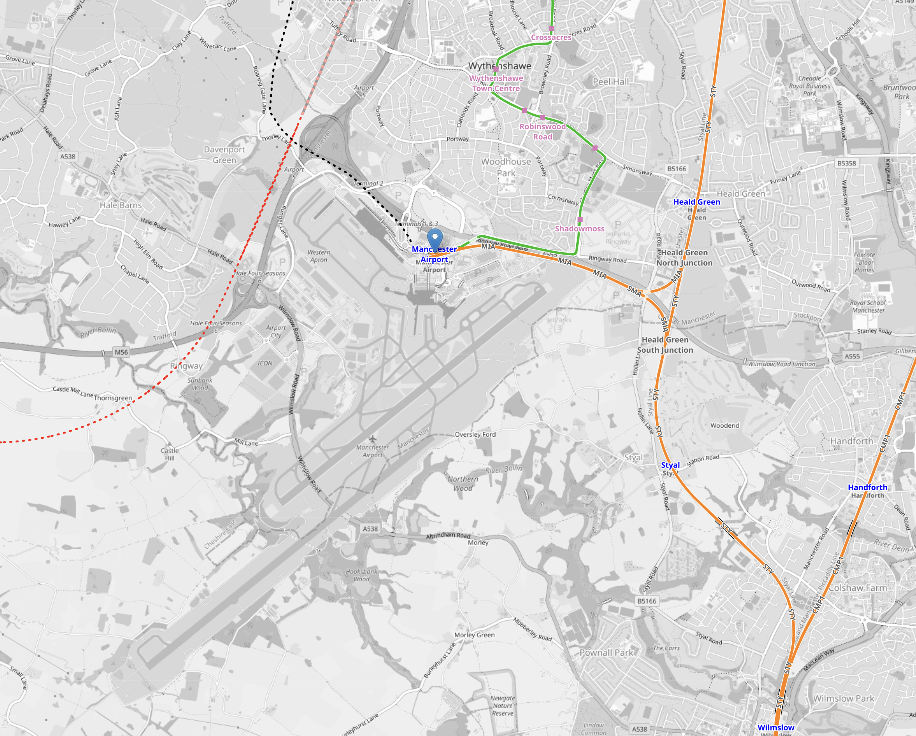
Note.
- The two runways are clearly shown.
- Manchester Airport station is indicated by the blue arrow near the top of the map.
- The orange tracks are rail lines.
- The green lines are Manchester Metrolink tracks.
- Rail and tram services approach the airport station from the East.
- The red dotted line is the current proposed path of Northern Powerhouse Rail/High Speed Two
- The black dotted line appears to be an extension of the tram line to the airport.
This second OpenRailwayMap shows the lines around the airport station to a larger scale.
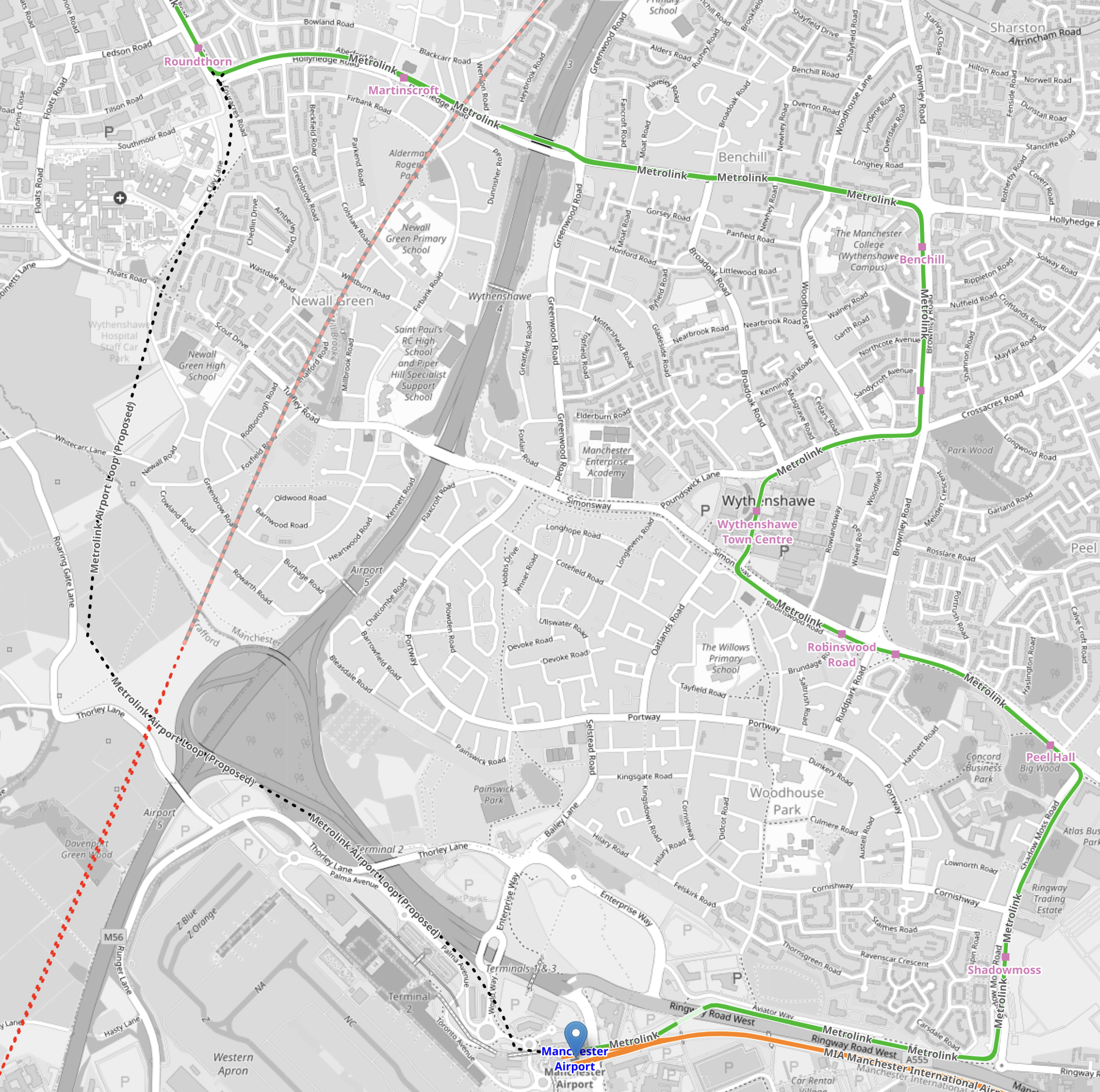
Note.
- Manchester Airport station is indicated by the blue arrow at the bottom of the map.
- The orange tracks are rail lines.
- The green lines are Manchester Metrolink tracks.
- The red dotted line is the current proposed path of Northern Powerhouse Rail/High Speed Two.
- The Manchester Metrolink now makes a loop around the Airport.
I think the following will happen.
- A large proportion of passengers and staff travelling between Manchester Airport and Manchester City Centre will use Northern Powerhouse Rail/High Speed Two.
- Passengers and staff, who live locally will use the Manchester Metro loop.
- Northern Powerhouse Rail/High Speed Two will replace some of the current train services.
- Some services on the Castlefield Corridor will migrate to Northern Powerhouse Rail/High Speed Two.
There could be as many as twelve trains per hour (tph) between Manchester Airport and Manchester City Centre on Northern Powerhouse Rail/High Speed Two. But a new urban line like that, which was mostly in a tunnel could probably handle 20 tph.
Manchester Airport And Crewe
This OpenRailwayMap shows the railways between Manchester Airport and Crewe stations.
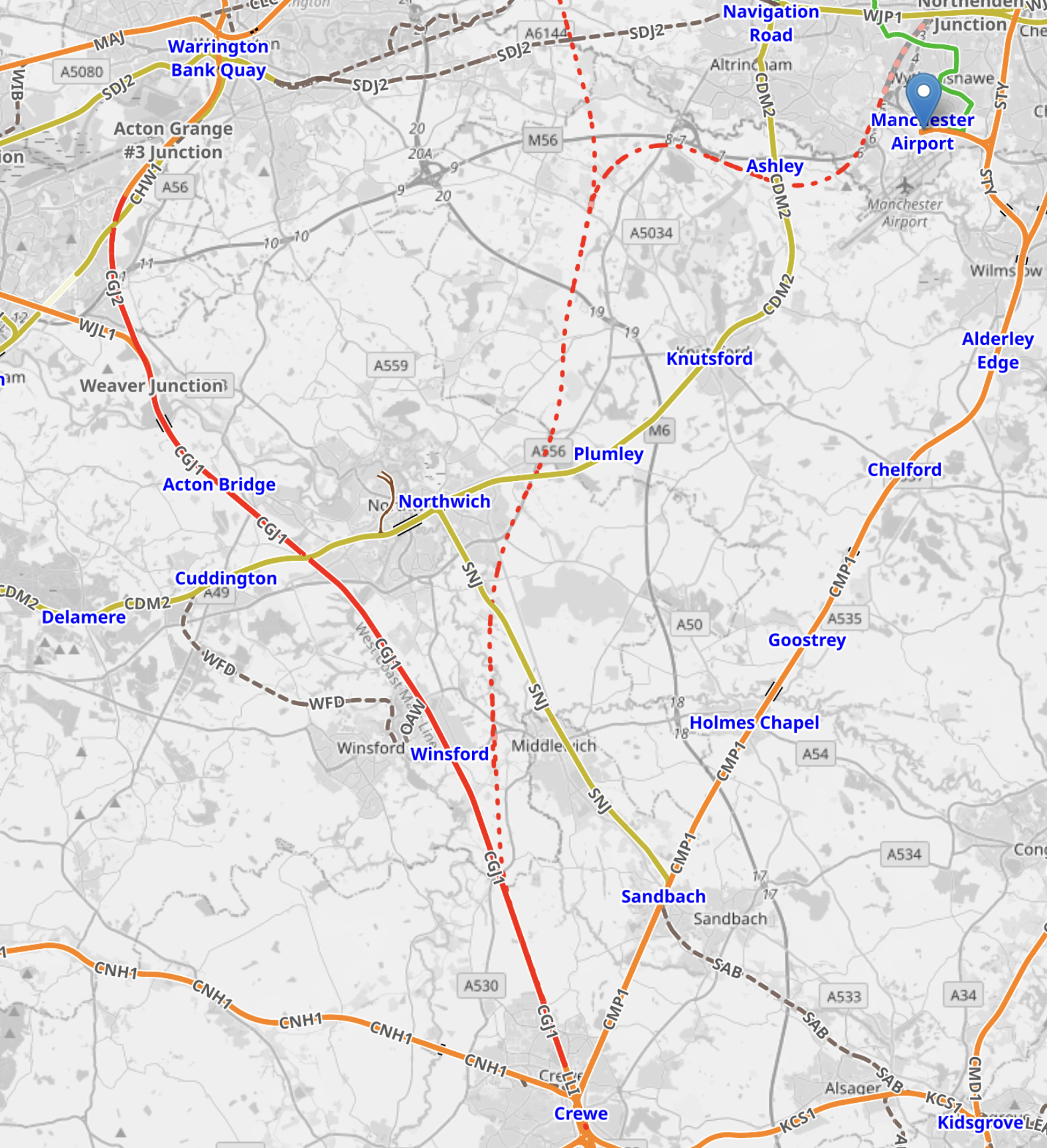
Note.
- Manchester Airport station is indicated by the blue arrow at the top of the map.
- The orange tracks are rail lines.
- The red track going down the left hand side of the map is the West Coast Main Line.
- The green lines are Manchester Metrolink tracks.
- The red dotted line is the current proposed path of Northern Powerhouse Rail/High Speed Two.
- Crewe station is at the bottom of the map in the middle.
There could be as many as 12 tph between Manchester Airport and Crewe.
Manchester Airport And Manchester Piccadilly
This OpenRailwayMap shows the railways between Manchester Airport and Manchester Piccadilly stations.
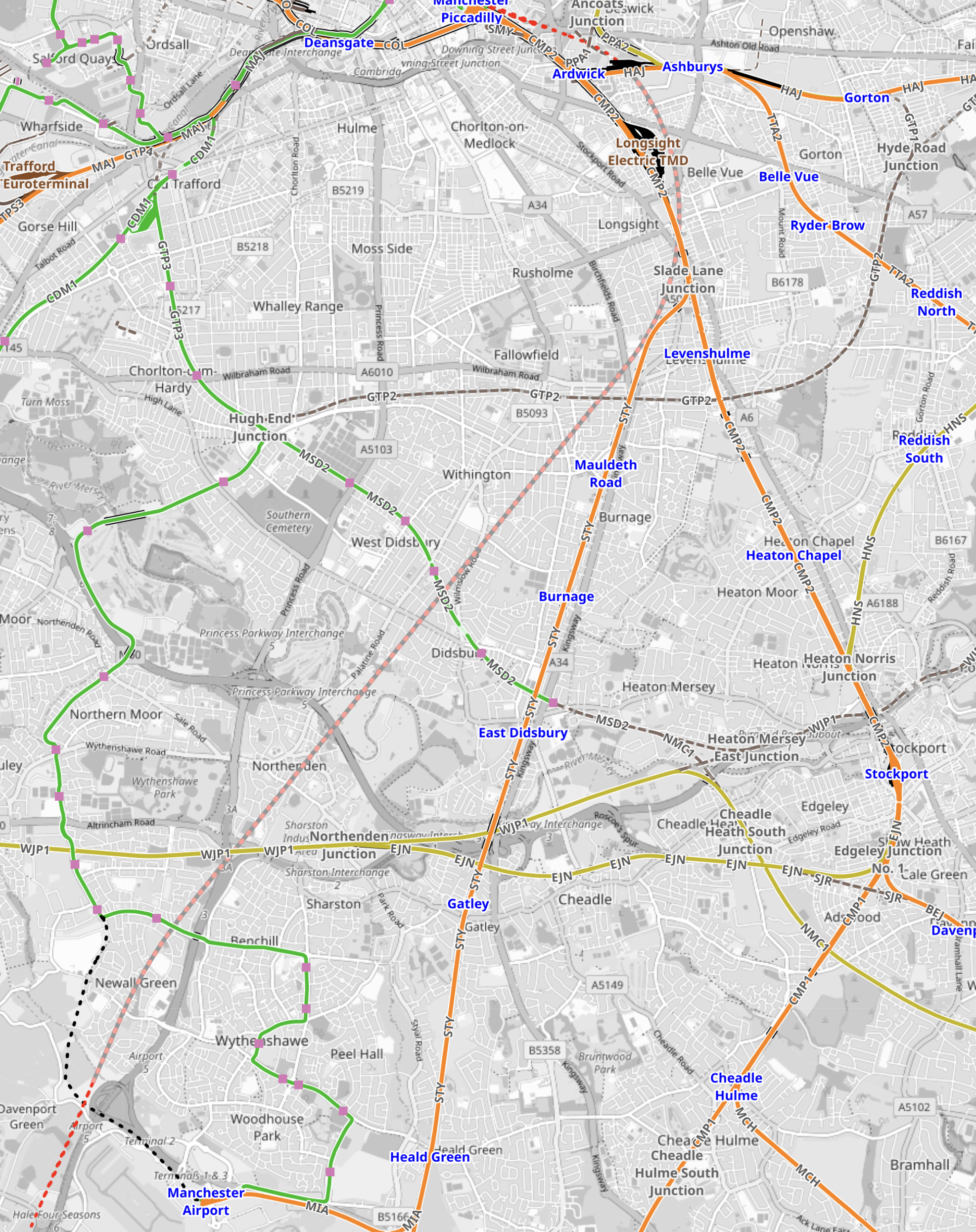
Note.
- Manchester Airport station is in the South-West corner of the map.
- The orange tracks are existing rail lines.
- The green lines are Manchester Metrolink tracks.
- The red dotted line going up the middle of the map is the current proposed path of Northern Powerhouse Rail/High Speed Two.
- Manchester Piccadilly station is at the Northern end of Northern Powerhouse Rail/High Speed Two.
This OpenRailwayMap shows the City Centre between Manchester Piccadilly and Manchester Victoria stations.
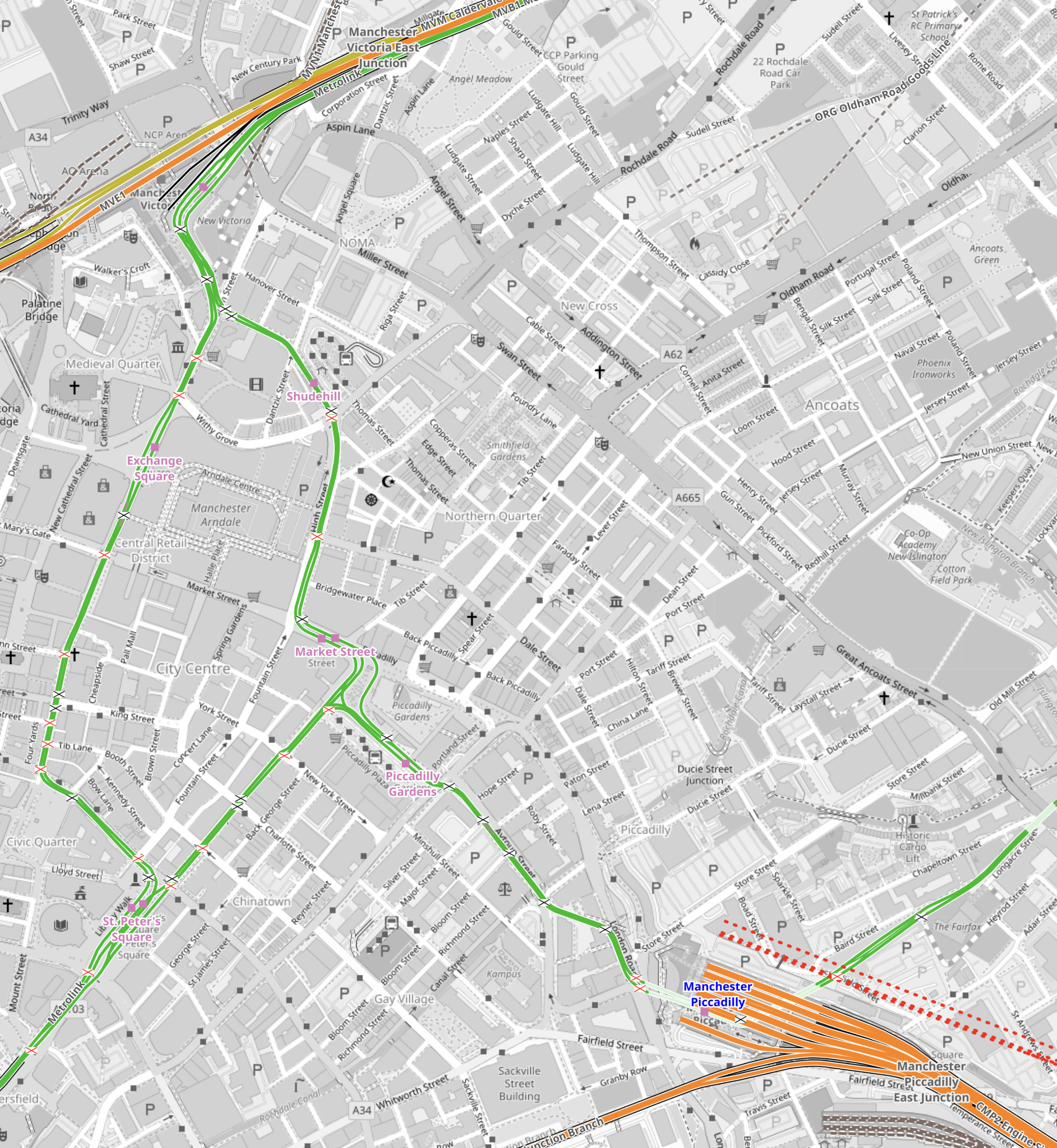
Note.
- Manchester Piccadilly station is in the South-East corner of the map.
- The red dotted lines creeping into the map is the current proposed path of Northern Powerhouse Rail/High Speed Two.
- All the platforms in Manchester Piccadilly station can be picked out, with the Castlefield Corridor breaking away to the West.
- The current plans will need demolition of buildings to the North of Manchester Piccadilly station.
- Manchester Victoria station is in the North-West corner of the map.
- The green line of the Manchester Metrolink route picks out the walking route between Manchester’s two main stations.
- About halfway between Manchester Piccadilly and Manchester Victoria stations is the open space of Piccadilly Gardens.
This Google Map shows Piccadilly Gardens.
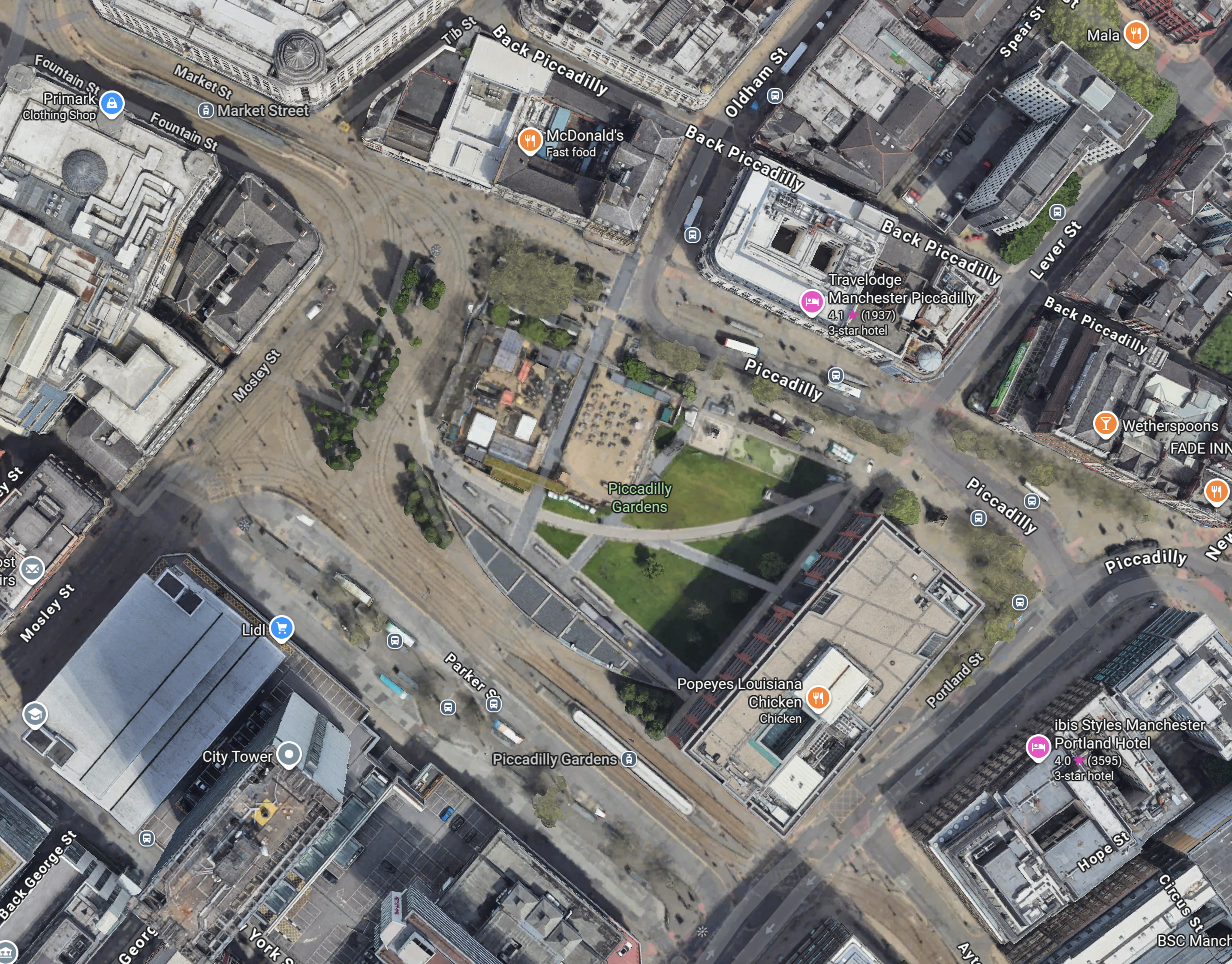
Note.
- The Manchester Metrolink running through.
- There are two Metrolink stops ; Market Street and Piccadilly Gardens, in the area.
- It appears any stop on the Manchester Metrolink can be reached with no more than a single change from one of these two stops.
Looking at the map showing Victoria and Piccadilly stations, I wonder, if a Lizzie Line of the North could be built under Manchester City Centre.
- There would be underground platforms at Piccadilly station, with two through platforms and two to terminate trains from the South.
- Local services from Piccadilly station could continue as now, although services to Manchester Airport could be simplified.
- There would be an underground station at Piccadilly Gardens with two through platforms , to connect with an expanded Manchester Metrolink, buses and walking routes.
- There would be underground platforms at Victoria station, with two through platforms and two to terminate trains from the East.
- Local services from Victoria could continue as now.
- There could be as many as 12 tph between Manchester Victoria, Piccadilly Gardens, Manchester Piccadilly and Manchester Airport.
Just as the Lizzie Line was slotted into London, with the minimum of disruption, I am fairly certain, a similar but smaller construction process could be carried out in Manchester City Centre.
- Manchester doesn’t have an Underground to avoid.
- The stations could be very similar to each other and like Custom House station on the Lizzie Line, they could be built with giant concrete Lego.
- There would only be four stations to create.
- The tunnel would be about fifteen miles at most.
- The tunnel would not need to be electrified as the trains could run on batteries.
As a Manchester Rail Tunnel has been talked about for decades, I suspect there is a big knowledge base of ground conditions, which would help with the design and construction.
Between Manchester Victoria And Leeds
Consider.
- The electrification between Manchester Victoria and Stalybridge stations has recently been switched on.
- Part of the electrification between Leeds and York stations has been switched on.
- Full electrification is being installed between Leeds and Manchester Victoria stations.
This OpenRailwayMap shows the Huddersfield Line between Manchester Victoria station and a few miles short of Huddersfield station.
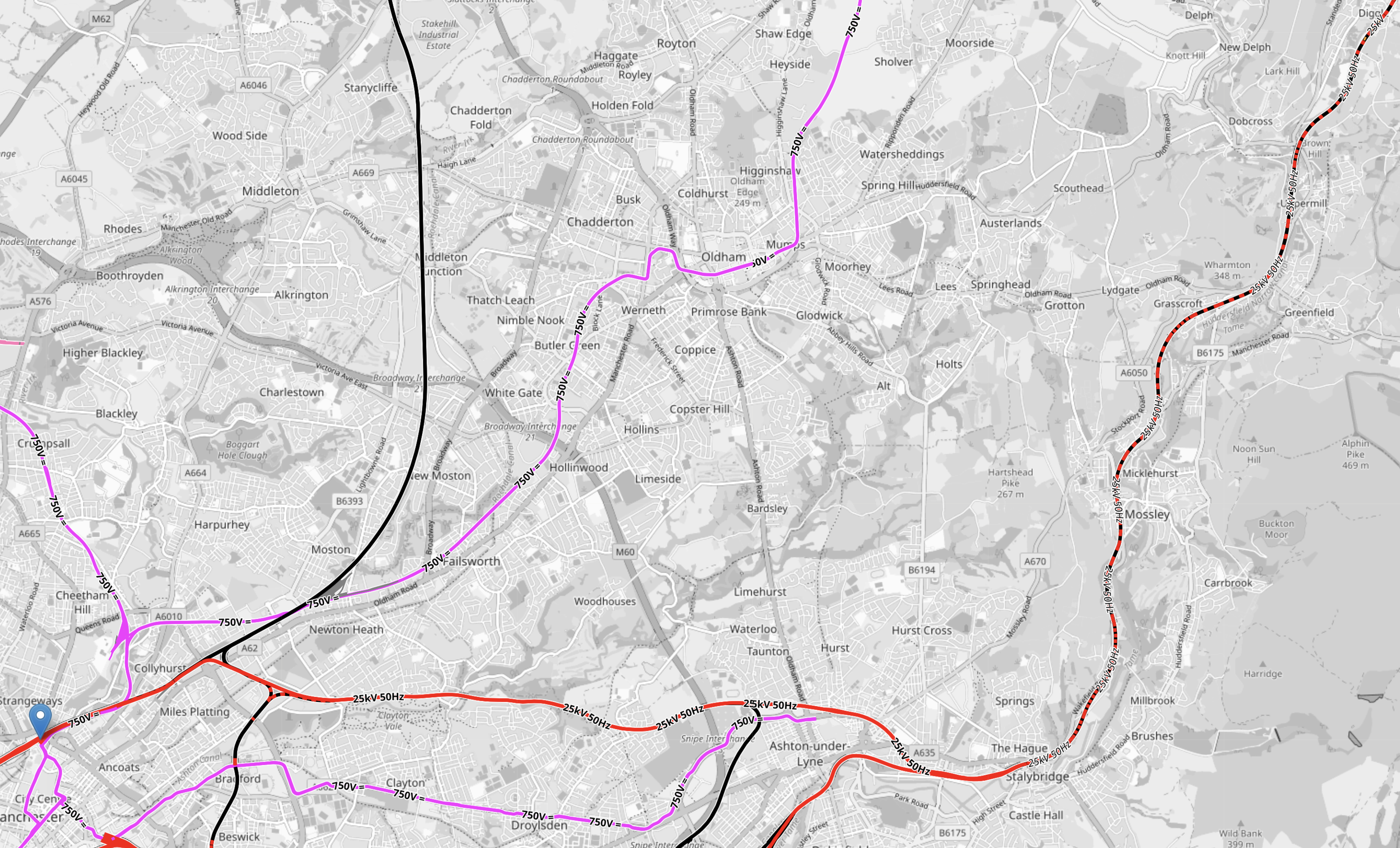
Note.
- Manchester Victoria station is indicated by the blue arrow in the South-West corner of the map.
- Huddersfield station is just off the map in the North-East corner.
- Manchester Victoria and Stalybridge stations is fully electrified and shown in red.
- Stalybridge and Huddersfield stations is being electrified and is shown as black and red dotted.
- Electrification between Huddersfield and Leeds is underway under the TransPennine Upgrade.
This section will be completed, when the Manchester City Centre Rail Tunnel is connected to the Huddersfield Line.
Connecting The Manchester City Centre Rail Tunnel To The Huddersfield Line
This Google Map shows where the Huddersfield Line crosses the M60 Motorway to the West of Ashton-under-Lyme.

Note.
- The newly-electrified Huddersfield Line runs across the map.
- The M60 Motorway is on the left.
- There are facilities for athletics, cricket and football.
I wouldn’t be surprised if the Eastern portal of the Manchester City Centre Rail Tunnel was in this area.
But looking at Google Maps between this site and Manchester Victoria, there are other sites.
Conclusion
I now feel that it is possible to create a Northern Powerhouse Rail/High Speed Two route using a tunnel under Manchester.
Obviously, there is more work to be done.
