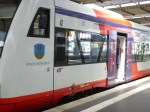
How Will The East Coast Main Line Timetable Change Affect Sheffield?
This article in the October 2025 Edition of Modern Railways is entitled Industry Gears Up For December ECML Timetable Change.
This is the first paragraph.
Major changes are planned to trains along the East Coast main line from 14 December as the long-heralded timetable takes effect.
In this post, I will see how the changes detailed in the article in Modern Railways will affect Sheffield and Doncaster.
Aberdeen-Edinburgh
This is said about Aberdeen and Edinburgh services.
Monday-Saturday services will not change between Aberdeen and Edinburgh, with all intermediate stations served at similar times.
The LNER service to and from King’s Cross will call additionally at Doncaster, Newark Northgate and Peterborough; the last LNER Monday-Friday departure from Aberdeen will terminate at Doncaster instead of Leeds, and the first LNER Monday-Saturday train to Aberdeen will start from King’s Cross at 05:48 instead of Leeds.
Note.
- An hourly fast train between Edinburgh and King’s Cross will have a journey time of 4 hours and 10 minutes, which is a saving of at least 12 minutes.
- There is an Aberdeen-Manchester air service, but no Edinburgh-Manchester or Leeds-Scotland air services.
- In Could London And Central Scotland Air Passengers Be Persuaded To Use The Trains?, I speculated about how air passengers could be tempted to use the trains between London and Central Scotland.
- It looks to me, that LNER are strengthening their services between Doncaster and Scotland.
- Will that 05:48 King’s Cross departure for Aberdeen, enable a working day in Aberdeen and return?
Is LNER’s aim to get travellers to use the trains between Doncaster and Scotland, as an alternative to driving or trains from Leeds?
Alnmouth and Berwick
This is said about Alnmouth services.
Quicker LNER journey times are promised to stations South of York, with King’s Cross-Alnmouth journey times up to 15 minutes quicker.
More TPE trains will run between Newcastle, Morpeth, Alnmouth, Berwick, Reston, Dunbar, East Linton and Edinburgh Waverley.
The number of trains calling at Durham on weekdays will fall from 18 to 13 Southbound and from 15 to 10 Northbound.
This is said about Berwick services.
LNER trains will call every two hours during the middle of the day, and the number of weekday trains to King’s Cross falls from 15 to 11 Southbound with a 13 to nine fall Northbound. More TPE trains will call.
Note.
- Lumo serves Newcastle, Morpeth and Edinburgh.
- Reston and East Linton are new stations.
- The stations between Newcastle and Edinburgh need adequate parking to attract commuters.
It looks to me, that LNER are timing the trains to attract day trips along the East Coast Main Line.
Bradford Forster Square/Interchange
This is said about Bradford Forster Square services.
The number of weekday trains will remain as per May 2025, but on Sundays, the number of trains serving Forster Square increases from two to six each way on a two-hourly interval. LNER stopping patterns change, with fewer trains calling at Peterborough and none at Grantham or Retford.
Trains currently stop at Peterborough, Doncaster, Wakefield Westgate, Leeds and Shipley, but surely a more regular six trains per day (tpd) is preferable.
This is said about Bradford Interchange services.
At Interchange, Grand Central Trains will run at different times to the May 2025 timetable, with King’s Cross journeys up to 20 minutes quicker. One GC each way will call at Peterborough, while some will stop at Pontefract Monkhill on Sundays for the first time.
Note.
- Trains currently stop at Peterborough, Doncaster, Pontefract Monkhill, Wakefield Kirkgate, Mirfield, Brighouse, Halifax and Low Moor
- Is the twenty minutes time saving due to the new digital signalling to the South of Doncaster?
- Is this another open access operator being allowed to do what they do best?
This looks to be a very useful service, which serves several stations, with no other service to London.
Doncaster
This is said about Doncaster services.
Additional trains calling at destinations including Birmingham New Street, Sheffield, York, Newark and Berwick-upon-Tweed. LNER Aberdeen/Inverness trains will call at Doncaster. EMR trains will be retimed at Doncaster to provide better connections with LNER’s revised timetables, but journeys from Doncaster to Sleaford and Spalding will require a change at Lincoln. This change has been made to “enable improved connections” at Peterborough, Sleaford, Lincoln and Doncaster. The number of trains calling at Stevenage falls from 24 to 19 Southbound and 24 to 21 Northbound, with Grantham stops dropping by seven trains to 28 Southbound and 4 to 29 Northbound.
If CrossCountry Trains were to switch their trains to Hitachi InterCity Battery trains, I believe that a version of these trains could handle routes like Plymouth and Aberdeen.
- This would speed up services.
- Trains would run close together and thus increase capacity.
- Services could even be faster.
So expect a replacement order for CrossCountry Trains diesel multiple units soon.
Glasgow
LNER gave up serving Glasgow Central from King’s Cross in the December 2024 timetable change.
In Lumo Will Extend Its King’s Cross And Edinburgh Service To Glasgow, I talked about Lumo extending their King’s Cross and Edinburgh service to Glasgow Central station.
Hull
This is said about Hull services.
On Mondays-Fridays, Hull Trains will provide an extra train from London.
The LNER Monday-Friday Hull-Doncaster train will be withdrawn;
Northern will operate a 20:25 departure to Doncaster; calling at Brough and Selby.
Note.
- It looks like Great British Railways have surrendered Hull and Beverley to Hull Trains.
- Hull Trains are converting their Class 802 trains to battery-electric power.
- It is likely that Hull Trains upgraded trains will be able to use the Great Northern and Great Eastern Joint Line via Lincoln on battery power.
The new timetable appears to be ready for the future of Hull Trains.
Leeds
This is said about Leeds services.
LNER services will depart to King’s Cross at xx.10 and xx.40.
Northern will introduce an extra mostly hourly service between Leeds and Sheffield calling at Wakefield Westgate. They will depart about 30 minutes earlier or later than the CrossCountry service.
Note.
- I would expect the two King’s Cross and Leeds services which would both stop at Doncaster and Wakefield Westgate would set the timings between Doncaster and Leeds.
- Currently, of the four trains that run to and from Leeds every two hours, two are planned to terminate at Leeds, one at Harrogate and one at Bradford Forster Square.
- There is also a daily service between King’s Cross and Skipton via Leeds.
- I can envisage another service between King’s Cross and Ilkley via Leeds, Kirkstall Forge, Guiseley, Burley-in-Wharfedale and Ben Rhydding.
- I can envisage another service between King’s Cross and Huddersfield, via Leeds, White Rose, Morley, Batley, Dewsbury, Ravensthorpe, Mirfield and Deighton.
- I can envisage another service between King’s Cross and Hebden Bridge, via Leeds, White Rose, Morley, Batley, Dewsbury, Ravensthorpe, Mirfield, Sowerby Bridge, Mytholmroyd and Brighouse.
- An alternative to Hebden Bridge would be Rochdale, which already has four platforms and is on the Manchester Metrolink
- It appears that Bradford Forster Square, Harrogate, Huddersfield, Leeds and Skipton stations can turn nine or ten-car trains and Ilkley can turn five-car trains.
- I also believe that one of Hitachi’s InterCity Battery trains could use battery power to take the spectacular Settle and Carlisle Line to Carlisle or even Glasgow Central.
- If needed pairs of five-car trains could split and join at Leeds, with one train waiting at Leeds and the other train going on to another destination.
- The CrossCountry and Northern Trains services on the Sheffield and Leeds route via Doncaster and Wakefield Westgate would probably need to be modern battery-electric trains to maximise the capacity on the route.
There certainly seem to be opportunities to give a number of stations in Yorkshire an all-electric service to King’s Cross with a two-hourly frequency, in a time of a few minutes over two hours.
Lincoln
This is said about Lincoln services.
One more LNER train from King’s Cross will run, with the first train arriving earlier and the last train later. There will no longer be an LNER train serving Stevenage with passengers having to change at Newark Northgate or Peterborough. An improved service will run to and from Nottingham, with an increase from one to two trains per hour on Mondays-Saturdays. An hourly service will run to Crewe, and a new Matlock-Nottingham-Lincoln-Cleethorpes service will run. EMR will cease all bar morning peak direct trains to/from Leicester. Newark Northgate-Lincoln trains will be reduced from five to four on Mondays-Fridays, eight to four on Saturdays and ten to eight on Sundays.
Note.
- Travellers between Lincoln/Nottingham and the North/Scotland will have two trains per hour to Newark Northgate, where there will be two tph to the North/Scotland.
- The hourly Crewe service will give access to Liverpool Manchester and the West Coast Main Line.
- Will there still be a Liverpool and Norwich service or will this be replaced by East-West Rail?
There seems to be a big sort out to EMR services.
Newcastle
This is said about Newcastle services.
The number of trains serving King’s Cross increases from 35 to 53 Southbound on weekdays and from 36 to 52 Northbound. One train every hour will run non-stop to York. More TPE trains will run Northbound (see Alnmouth and Berwick), while Northern is retiming services on the Northumberland Line in anticipation of Northumberland Park and Bedlington stations opening in early 2026. A semi-fast hourly service between Newcastle and Middlesbrough will run on Mondays-Saturdays and there will be an hourly stopping service between them.
Note.
- There will be a big increase in services between King’s Cross and Newcastle.
- Is the aim to persuade travellers to use trains rather than airlines?
- LNER also runs one train per day (tpd) between King’s Cross and Middlesbrough.
- Grand Central Trains will be running at a frequency of six tpd between King’s Cross and Sunderland via Thirsk, Northallerton, Eaglescliffe, Hartlepool and Seaham.
Hull appears to have been left to Hull Trains and Glasgow to Lumo, and Sunderland appears to be left for Grand Central Trains.
Conclusions
I am coming to some conclusions about services on the East Coast Main Line, with respect to Sheffield.
Doncaster Is A Well-Equipped Station
Doncaster is the nearest station to Sheffield on the East Coast Main Line.
- Over the last few years, Doncaster station has been improved.
- It has a subway with a more than adequate number of lifts.
- The station has nearly 600 parking spaces.
- There is a taxi rank.
- There is no Marks & Spencer’s food store, which is important for a coeliac like me.
- There are thirty bus stands close to Doncaster station.
- Doncaster station is well-equipped with cafes, a pub and coffee stalls.
- All trains to Aberdeen, Bradford Forster Square, Bradford Interchange, Edinburgh, Hull, King’s Cross, Leeds, Sheffield and Wakefield seem to stop at the station.
- There are several local trains per hour.
- Changing trains is not a strenuous exercise.
Doncaster is one of the UK’s better regional stations.
Doncaster Needs A Connection To The Sheffield Supertram
One of the first things, I do when I arrive in a strange town or city is look for the local public transport network.
In 2019, Sheffield published an ambitious plan for their tram network, which I wrote about in Sheffield Region Transport Plan 2019 – Doncaster Sheffield Airport.
The post contained this map, of Sheffield’s plans for the trams.
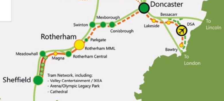
Doncaster and Doncaster Sheffield Airport are connected to the current end of the tram-train route at Rotherham Parkgate.
This OpenRailwayMap shows the rail lines between Rotherham Parkgate and Doncaster.
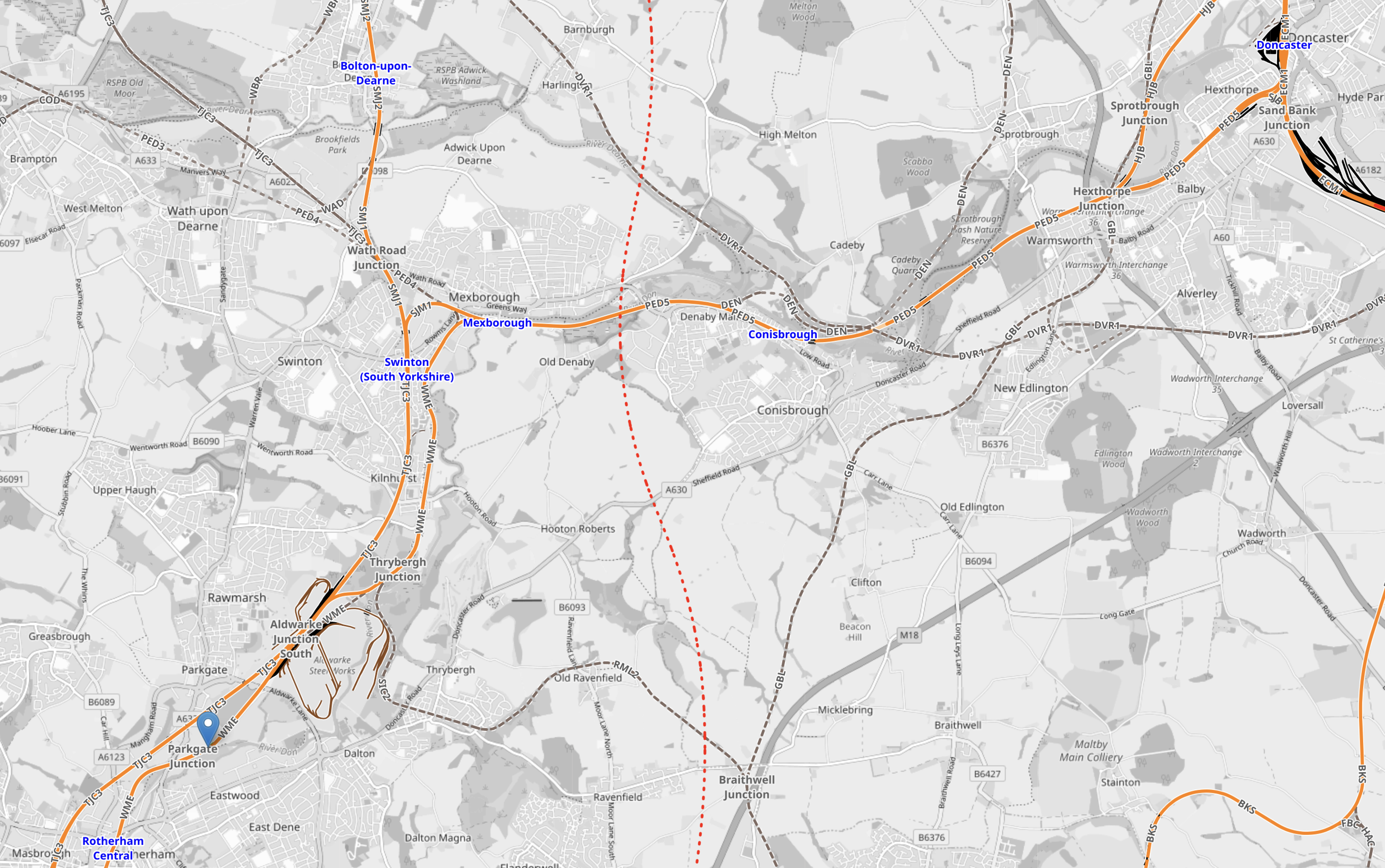
Note.
- Doncaster station is in the North-East corner of the map.
- Rotherham Central station is in the South-West corner of the map.
- The blue arrow in the South-West corner indicates Rotherham Parkgate tram stop.
- Swinton, Mexborough and Conisbrough stations can be picked out.
- The dotted red line running North-South across the map is the route of the ill-fated Eastern Leg of High Speed Two.
It is a simple application of tram-train technology to connect Doncaster station and Doncaster Sheffield Airport to the Sheffield Supertram.
With all the comings and goings on the East Coast Main Line at Doncaster station, I believe that the tram-train connection to Sheffield and Rotherham is essential.
The Cities Of Bradford, Doncaster, Leeds, Sheffield and Wakefield Can Have a High-Frequency Rail Connection
Consider.
- Four stations are all step-free with a bridge or subway served by lifts.
- Bradford Forster Square station has level access to the platforms from the street.
- The rail lines between the five stations are electrified, with the exception of Sheffield and Doncaster.
- Services between the cities are run by CrossCountry Trains, Grand Central Trains, Hull Trains, LNER and Northern Trains.
- Most maximum speeds are not unduly slow.
Consequently the five cities can have a high-frequency rail connection in excess of four tph.
Could this be the basis of a Five-Cities Metro?
Open Access Services
There are six open access services running on the East Coast Main Line.
- Grand Central Trains – King’s Cross-Bradford Interchange via Peterborough, Doncaster, Pontefract Monkhill, Wakefield Kirkgate, Mirfield, Brighouse, Halifax and Low Moor – 4 tpd
- Grand Central Trains – King’s Cross-Sunderland via Peterborough, York, Thirsk, Northallerton, Eaglescliffe and Hartlepool – 6 tpd
- Hull Trains – King’s Cross-Hull via Stevenage, Grantham, Retford, Doncaster, Selby, Howden, Brough – 4 tpd
- Hull Trains – King’s Cross-Beverley via Stevenage, Grantham, Retford, Doncaster, Selby, Howden, Brough, Hull and Cottingham – 2 tpd
- Lumo – King’s Cross-Edinbugh via Stevenage, Newcastle and Morpeth – 5 tpd
- Lumo – King’s Cross-Glasgow Queen Street via Stevenage, Newcastle, Morpeth, Edinburgh and Falkirk High – 2 tpd
Note.
- tpd is trains per day.
- All seem to serve an exclusive area, except Lumo.
- In a couple of years, all could be using Hitachi trains.
- I suspect some services will swap their diesel generators for batteries.
Battery-power would allow some services to be zero-carbon, even when using the GNGE diversion.
Completing Northern Powerhouse Rail
The Northern Powerhouse Rail/High Speed Two Connection To Manchester Airport Station
This OpenRailwayMap shows the rail connections that terminate at Manchester Airport station.
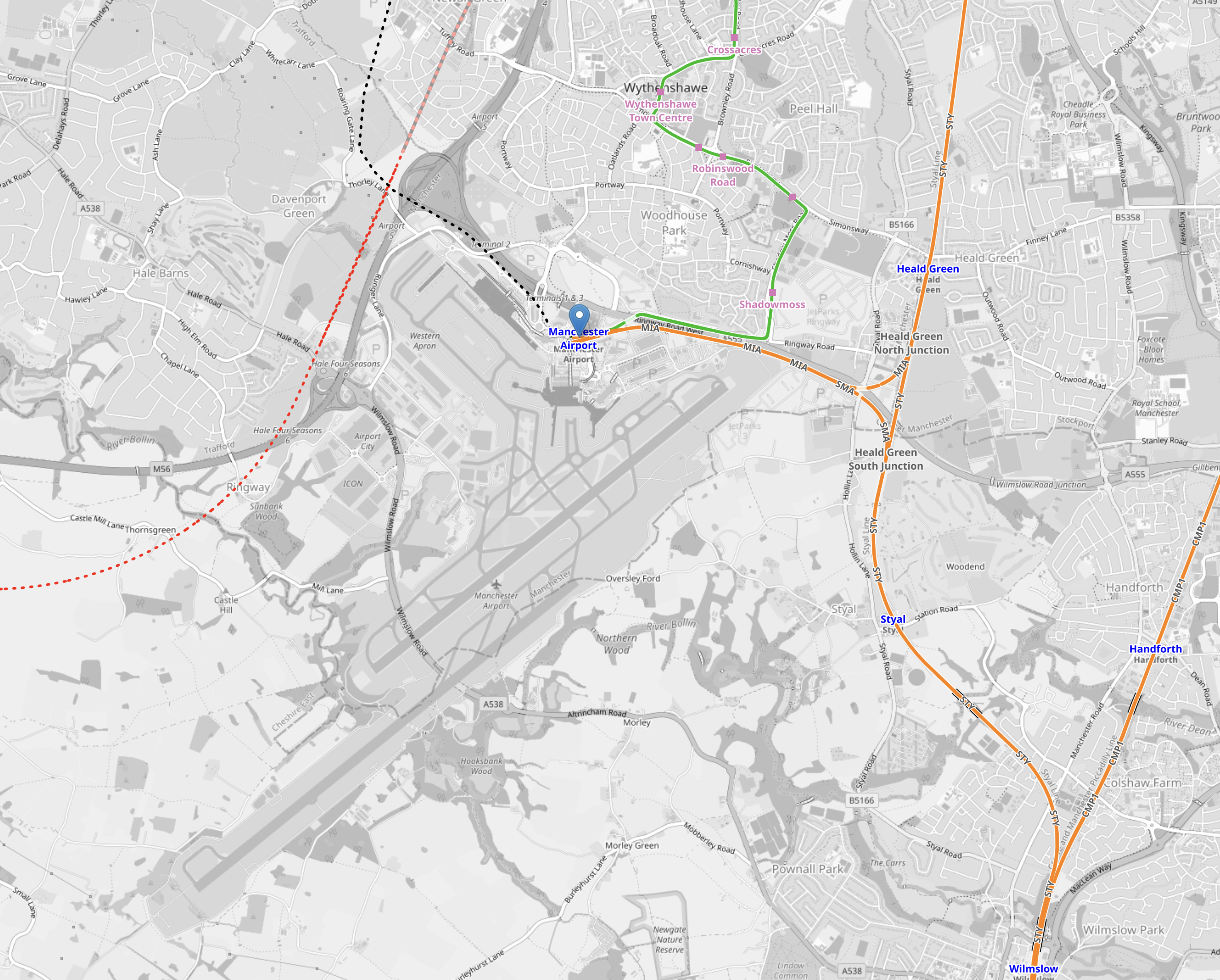
Note.
- The two runways are clearly shown.
- Manchester Airport station is indicated by the blue arrow near the top of the map.
- The orange tracks are rail lines.
- The green lines are Manchester Metrolink tracks.
- Rail and tram services approach the airport station from the East.
- The red dotted line is the current proposed path of Northern Powerhouse Rail/High Speed Two
- The black dotted line appears to be an extension of the tram line to the airport.
This second OpenRailwayMap shows the lines around the airport station to a larger scale.
Note.
- Manchester Airport station is indicated by the blue arrow at the bottom of the map.
- The orange tracks are rail lines.
- The green lines are Manchester Metrolink tracks.
- The red dotted line is the current proposed path of Northern Powerhouse Rail/High Speed Two.
- The Manchester Metrolink now makes a loop around the Airport.
I think the following will happen.
- A large proportion of passengers and staff travelling between Manchester Airport and Manchester City Centre will use Northern Powerhouse Rail/High Speed Two.
- Passengers and staff, who live locally will use the Manchester Metro loop.
- Northern Powerhouse Rail/High Speed Two will replace some of the current train services.
- Some services on the Castlefield Corridor will migrate to Northern Powerhouse Rail/High Speed Two.
There could be as many as twelve trains per hour (tph) between Manchester Airport and Manchester City Centre on Northern Powerhouse Rail/High Speed Two. But a new urban line like that, which was mostly in a tunnel could probably handle 20 tph.
Manchester Airport And Crewe
This OpenRailwayMap shows the railways between Manchester Airport and Crewe stations.
Note.
- Manchester Airport station is indicated by the blue arrow at the top of the map.
- The orange tracks are rail lines.
- The red track going down the left hand side of the map is the West Coast Main Line.
- The green lines are Manchester Metrolink tracks.
- The red dotted line is the current proposed path of Northern Powerhouse Rail/High Speed Two.
- Crewe station is at the bottom of the map in the middle.
There could be as many as 12 tph between Manchester Airport and Crewe.
Manchester Airport And Manchester Piccadilly
This OpenRailwayMap shows the railways between Manchester Airport and Manchester Piccadilly stations.
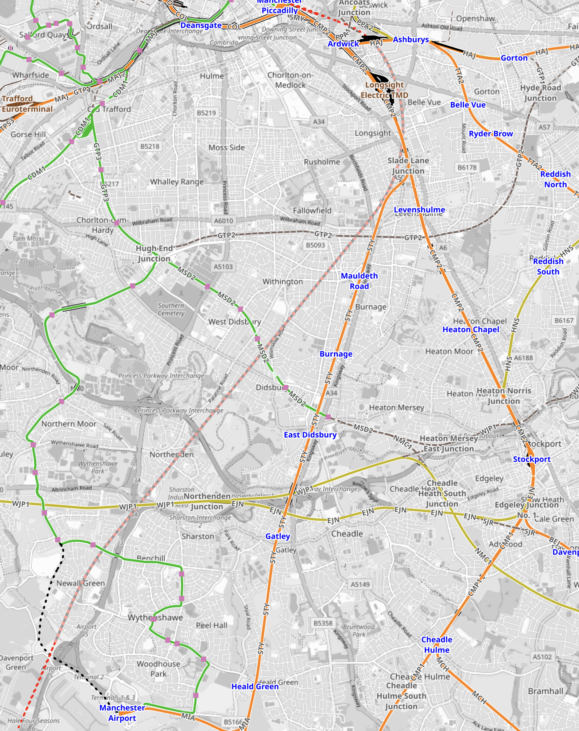
Note.
- Manchester Airport station is in the South-West corner of the map.
- The orange tracks are existing rail lines.
- The green lines are Manchester Metrolink tracks.
- The red dotted line going up the middle of the map is the current proposed path of Northern Powerhouse Rail/High Speed Two.
- Manchester Piccadilly station is at the Northern end of Northern Powerhouse Rail/High Speed Two.
This OpenRailwayMap shows the City Centre between Manchester Piccadilly and Manchester Victoria stations.
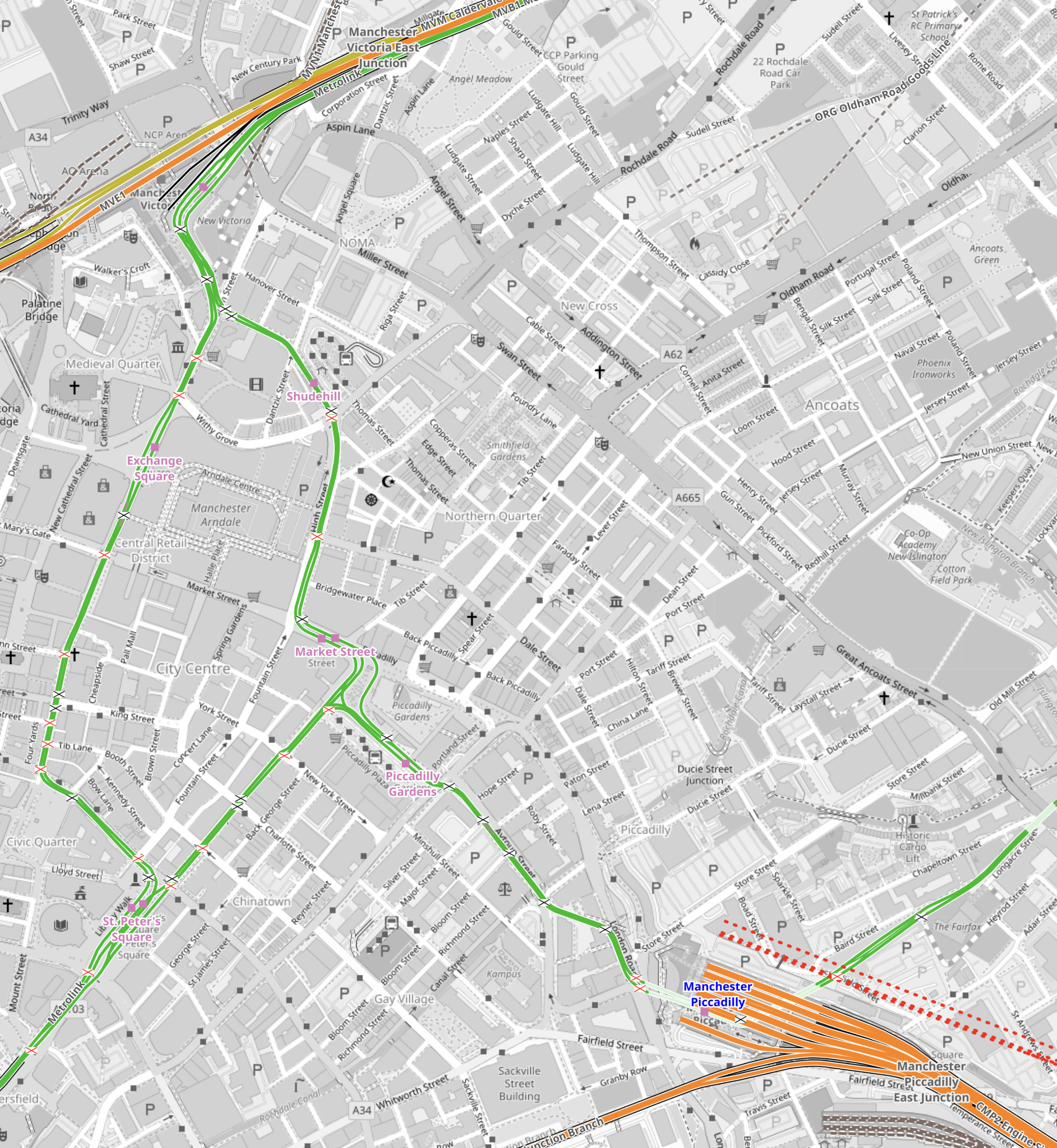
Note.
- Manchester Piccadilly station is in the South-East corner of the map.
- The red dotted lines creeping into the map is the current proposed path of Northern Powerhouse Rail/High Speed Two.
- All the platforms in Manchester Piccadilly station can be picked out, with the Castlefield Corridor breaking away to the West.
- The current plans will need demolition of buildings to the North of Manchester Piccadilly station.
- Manchester Victoria station is in the North-West corner of the map.
- The green line of the Manchester Metrolink route picks out the walking route between Manchester’s two main stations.
- About halfway between Manchester Piccadilly and Manchester Victoria stations is the open space of Piccadilly Gardens.
This Google Map shows Piccadilly Gardens.
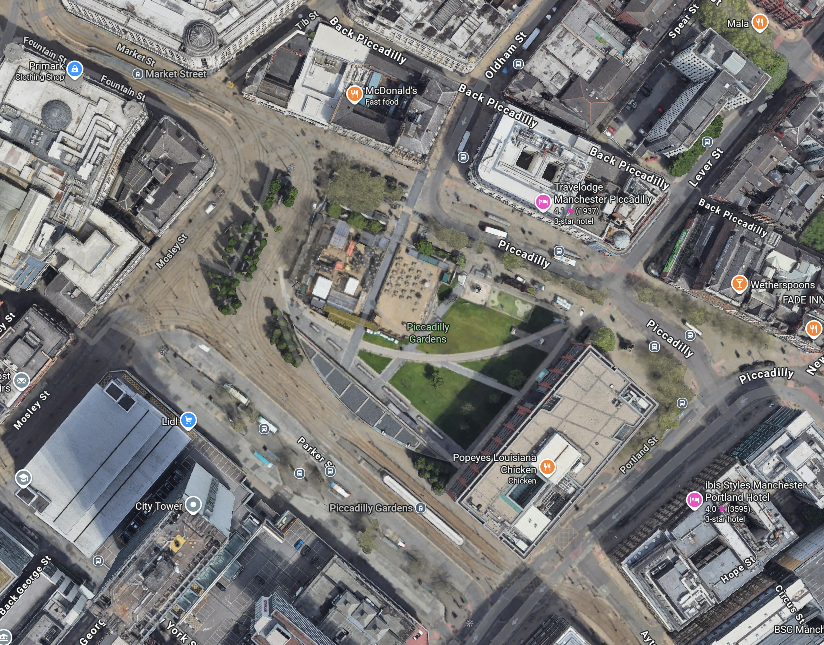
Note.
- The Manchester Metrolink running through.
- There are two Metrolink stops ; Market Street and Piccadilly Gardens, in the area.
- It appears any stop on the Manchester Metrolink can be reached with no more than a single change from one of these two stops.
Looking at the map showing Victoria and Piccadilly stations, I wonder, if a Lizzie Line of the North could be built under Manchester City Centre.
- There would be underground platforms at Piccadilly station, with two through platforms and two to terminate trains from the South.
- Local services from Piccadilly station could continue as now, although services to Manchester Airport could be simplified.
- There would be an underground station at Piccadilly Gardens with two through platforms , to connect with an expanded Manchester Metrolink, buses and walking routes.
- There would be underground platforms at Victoria station, with two through platforms and two to terminate trains from the East.
- Local services from Victoria could continue as now.
- There could be as many as 12 tph between Manchester Victoria, Piccadilly Gardens, Manchester Piccadilly and Manchester Airport.
Just as the Lizzie Line was slotted into London, with the minimum of disruption, I am fairly certain, a similar but smaller construction process could be carried out in Manchester City Centre.
- Manchester doesn’t have an Underground to avoid.
- The stations could be very similar to each other and like Custom House station on the Lizzie Line, they could be built with giant concrete Lego.
- There would only be four stations to create.
- The tunnel would be about fifteen miles at most.
- The tunnel would not need to be electrified as the trains could run on batteries.
As a Manchester Rail Tunnel has been talked about for decades, I suspect there is a big knowledge base of ground conditions, which would help with the design and construction.
Between Manchester Victoria And Leeds
Consider.
- The electrification between Manchester Victoria and Stalybridge stations has recently been switched on.
- Part of the electrification between Leeds and York stations has been switched on.
- Full electrification is being installed between Leeds and Manchester Victoria stations.
This OpenRailwayMap shows the Huddersfield Line between Manchester Victoria station and a few miles short of Huddersfield station.
Note.
- Manchester Victoria station is indicated by the blue arrow in the South-West corner of the map.
- Huddersfield station is just off the map in the North-East corner.
- Manchester Victoria and Stalybridge stations is fully electrified and shown in red.
- Stalybridge and Huddersfield stations is being electrified and is shown as black and red dotted.
- Electrification between Huddersfield and Leeds is underway under the TransPennine Upgrade.
This section will be completed, when the Manchester City Centre Rail Tunnel is connected to the Huddersfield Line.
Connecting The Manchester City Centre Rail Tunnel To The Huddersfield Line
This Google Map shows where the Huddersfield Line crosses the M60 Motorway to the West of Ashton-under-Lyme.

Note.
- The newly-electrified Huddersfield Line runs across the map.
- The M60 Motorway is on the left.
- There are facilities for athletics, cricket and football.
I wouldn’t be surprised if the Eastern portal of the Manchester City Centre Rail Tunnel was in this area.
But looking at Google Maps between this site and Manchester Victoria, there are other sites.
Conclusion
I now feel that it is possible to create a Northern Powerhouse Rail/High Speed Two route using a tunnel under Manchester.
Obviously, there is more work to be done.
Thoughts On Tram-Trains In Manchester
The State Of Public Transport In the North
Over the last few years plans have been put in place to improv the state of the public transport of the major cities of the North and progress has started to happen, with new trains, trams and light rail systems being planned and in some cases coming into service.
Birmingham, Coventry And The West Midlands
A lot of investment has been made and it is continuing.
- Birmingham New Street station has been rebuilt.
- Coventry and Wolverhampton stations have been remodelled.
- Two new stations were built in Birmingham for the Commonwealth Games.
- A large number of new Class 730 local trains are being brought into service.
- Birmingham stations are being updated for High Speed Two.
- The West Midland Metro has been extended at both ends and a second line is under construction.
Transport in the wider West Midlands has been greatly improved.
Derby, Nottingham, Sheffield And The East Midlands
The major investment in this area is the electrification of the Midland Main Line and the provision of new Hitachi electric Class 810 trains.
In addition the following has been done.
- The Hope Valley line between Manchester and Sheffield has been improved.
- Derby station has been improved.
- The local trains have been refurbished.
- The power supply has been improved.
- An application for an Open Access service to Sheffield has been made.
The improvements in the East Midlands, will not be on the same scale as in the West Midlands, but they will make a difference.
Leeds, Bradford And West Yorkshire
For decades, West Yorkshire and especially Bradford has lagged behind the rest of the North.
But at least things are stirring.
- Plans have been laid to create a through station in Bradford.
- Leeds station has been refurbished.
- An extra platform is being added at Bradford Forster Square station.
- The TransPennine Upgrade is underway to electrify between Huddersfield and York.
- Hitachi have developed a battery-electric high speed train for the TransPennine route.
- Bradford is installing a hydrogen electrolyser, so that the city can have hydrogen buses to cope with the hills.
- Plans are now being developed to create a metro for Leeds and Bradford.
West Yorkshire is closing the gap to the rest of the North.
Liverpool And Merseyside
Again, a lot of investment has been made.
- The approaches to Liverpool Lime Street station have finally been sorted, with more tracks and new signalling.
- Liverpool Lime Street station has been improved and is now one of the finest stations in Europe.
- Trains are now approaching High Speed Two times between Crewe and Liverpool.
- More services between London and Liverpool can now be planned, with the arrival of new Class 807 trains.
- Some new stations have been built and more are planned.
- A large number of new Class 777 local trains are being brought into service.
Transport in the wider Merseyside has been greatly improved.
Newcastle, Tyneside And Northumberland
The area is getting investment, but not as much in proportion as others.
- The Metro trains are being replaced and the Metro itself, is getting a major update.
- The East Coast Main Line has received improvements to power supplies, signalling and some bottlenecks.
- The Northumberland Line to Ashington is being brought back into operation.
It’s a start, but if the Northumberland Line is a success, I can see a call for more line re openings.
Manchester And Greater Manchester
If you look at each of the areas, they generally have one or more large projects.
- Birmingham, Coventry And The West Midlands – Birmingham New Street station, Class 730 Trains, High Speed Two, West Midland Metro
- Derby, Nottingham, Sheffield And The East Midlands – Midland Main Line, Class 810 Trains, Hope Valley Line, Open Access To Sheffield
- Leeds, Bradford And West Yorkshire – Leeds station, Bradford improvements, TransPennine Upgrade, Battery-Ekectric Trains, Leeds Metro
- Liverpool And Merseyside – Liverpool Lime Street Improvements, Class 807 Trains, Class 777 Trains
- Newcastle, Tyneside And Northumberland – Metro upgrade with New Trains, Northumberland Line
So what improvements are in the pipeline for Greater Manchester?
This Wikipedia entry is entitled Proposed Developments Of Manchester Metrolink.
The proposed developments include in the Wikipedia order.
- New Metrolink Stop: Stop to serve new housing development proposed at Elton Reservoir on the Bury Line.
- New Metrolink Stop: Stop to serve new housing development proposed at Sandhills on the Bury Line.
- New Metrolink Stop: Stop to serve new housing development proposed at Cop Road on the Oldham and Rochdale Line.
- Airport Line extension to Terminal 2: A short extension of the Airport Line from the current Manchester Airport station to the site of the expanded Terminal 2.
- Airport Line extension to Davenport Green: An extension of the Airport Line from Roundthorn to the site of the proposed Manchester Airport High Speed station on the HS2 high speed network.
- Oldham–Heywood via Rochdale tram-train pathfinder: A tram-train service utilising the heavy rail Calder Valley line to connect Oldham to Heywood through Rochdale railway station.
- Manchester Airport–Wilmslow via Styal tram-train pathfinder: A tram-train service operating on the southern section of the heavy rail Styal Line between Manchester Airport and Wilmslow in Cheshire.
- South Manchester–Hale via Altrincham tram-train pathfinder: An extension of Metrolink’s Altrincham Line using tram-train to reach Hale on the heavy rail Mid-Cheshire line.
- Improved Metrolink frequency between Piccadilly and Victoria stations: Increasing capacity to provide a direct service from Rochdale and Oldham to Manchester Piccadilly.
- Interventions to improve Metrolink capacity and reliability: Includes improvements to turnback facilities and double-tracking currently single-track sections.
- Further interventions to improve Metrolink capacity and reliability: Includes longer vehicles, a third depot and double-tracking currently single-track sections.
- Manchester–Stalybridge extension: An extension of the East Manchester Line from Ashton-under-Lyne to Stalybridge.
- Manchester–Middleton extension: A proposed spur from the Bury Line connecting to the town of Middleton.
- Oldham–Middleton extension: A spur from Oldham to Middleton.
- MediaCityUK–Salford Crescent: A line connecting the MediaCityUK tram stop to the Salford Crescent railway station interchange. Further new Metrolink.
- Connections between Salford Crescent, Inner Salford and the City Centre: Extension of the MediaCityUK–Salford Crescent line into the regional centre.
- Completion of the Airport Line (Wythenshawe Loop): Completion of the Wythenshawe Loop by connecting the Metrolink lines between the Davenport Green and Manchester Airport Terminal 2 extensions.
- Port Salford/Salford Stadium extension: Extending the Trafford Park Line from the Trafford Centre to a proposed container terminal at Port Salford.
- Glossop tram-train: A tram-train service utilising the Glossop line between Manchester and Glossop in Derbyshire.
- Marple tram-train: A tram-train service utilising the Hope Valley line branches north of Marple towards Manchester.
- Manchester–Wigan via Atherton tram-train: A tram-train service utilising the Atherton section of the Manchester–Southport line between Manchester and Wigan.
- Manchester–Warrington tram-train: A tram-train service utilising the southern route of the Liverpool–Manchester lines between Manchester and Warrington.
- Stockport–Hazel Grove tram-train: A tram-train service between Stockport and the suburb of Hazel Grove.
- Stockport–Manchester Airport tram-train: A tram-train service between Stockport and Manchester Airport.
- Rochdale–Bury via Heywood tram-train: Extension of the Oldham–Heywood tram-train pathfinder from Heywood to Bury.
- Manchester Airport–Mid Cheshire tram-train: A tram-train service from Manchester Airport using a proposed Western Link rail line to the Mid-Cheshire line.
- Stockport–Ashton via Denton and Reddish tram-train: A tram-train service utilising the Stockport–Stalybridge line from Stockport to Ashton.
- Cornbrook–Manchester Airport via Timperley tram-train: A tram-train service from Cornbrook using the Altrincham line to Timperley, the Mid Cheshire line to Baguley, then the Wythenshawe Loop to Manchester Airport.
- Regional centre metro tunnel: Providing capacity for more services on the network.
- Oldham–Greenfield via Grotton extension: A Metrolink spur from Oldham town centre to Greenfield railway station on the Huddersfield line.
- Oldham–Royton extension: A Metrolink spur from the Oldham and Rochdale line to the town of Royton.
Note.
- The number of times that tram-trains are mentioned.
- But with its numerous rail and tram lines, Greater Manchester is ideally suited for conversion to tram-trains.
- There are three pathfinder routes for tram-trains, which will be converted first to prove the technology.
These are my detailed thoughts on tram-trains in Greater Manchester,
All Routes Could Be Run By Identical Tram-Trains
If this can be arranged, it is surely preferable from the operator, staff and passengers point-of-view.
Tram-Trains Can Run On Secondary Routes Like The Calder And Hope Valley Lines
In Manchester, this would enable some routes to be swapped from the rail to the tram network.
It would also allow trams to run between networks, so you could have a direct tram service between say Stockport and Sheffield on the Hope Valley Line.
Tram-Trains Can Be Faster
Tram-trains can be faster, when running on rail lines, so they don’t hold up expresses.
What Do Tram-Trains Look Like?
This is one of Sheffield’s Class 399 tram-trains at Rotherham Parkgate.
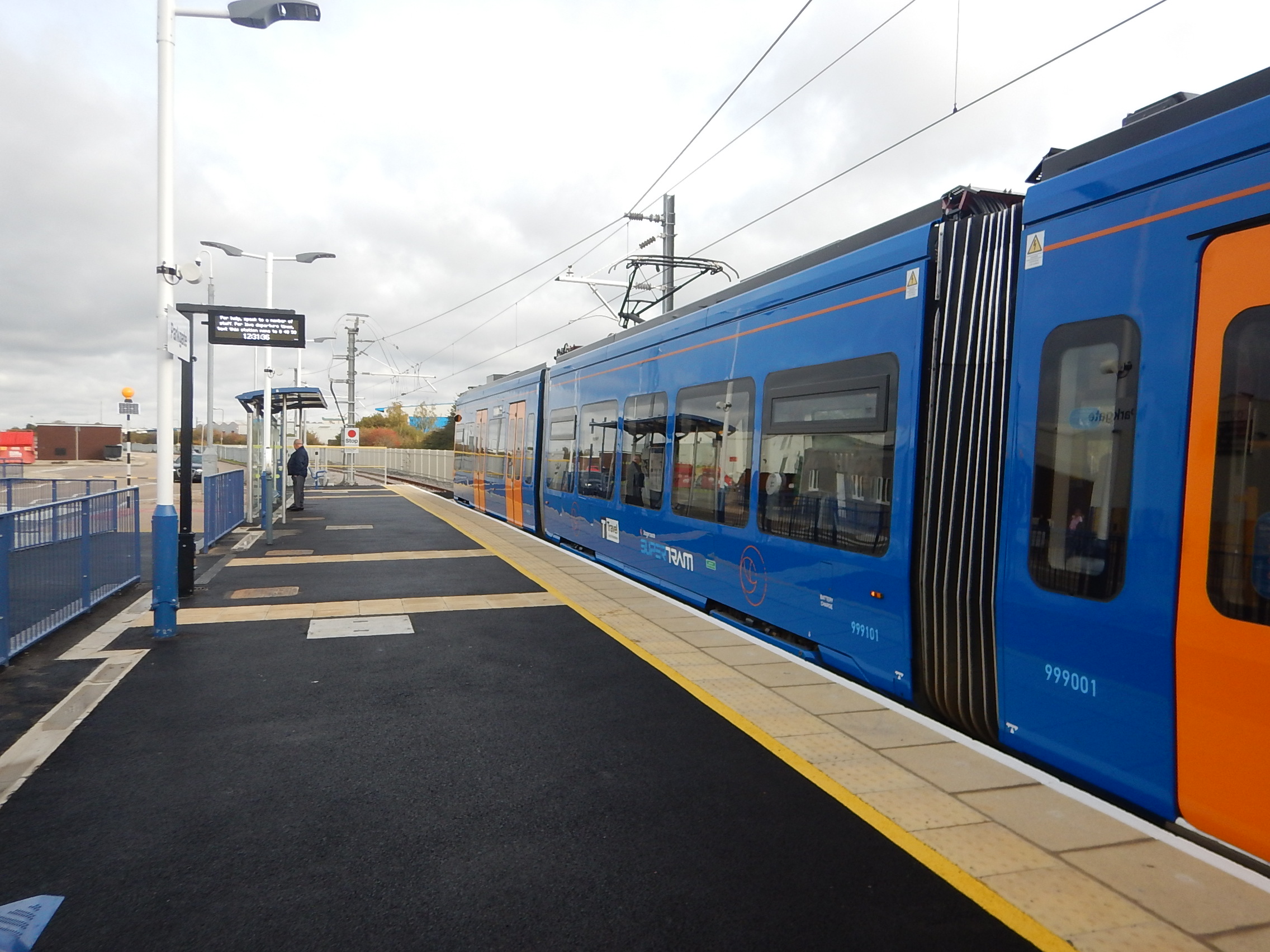
Note.
- This tram-train is a member of the Stadler Citylink family.
- this version can be powered by either 750 VDC or 25 KVAC.
- The Welsh version will also have battery-power.
- It is a three-car tram train.
- There is step-free access.
The Wikipedia entry for the Stadler Citylink has lots more details.
Stadler have just launched a new smaller one- or two-car tram-train.
This image from the press release shows the prototype hydrogen-powered one-car RS ZERO.
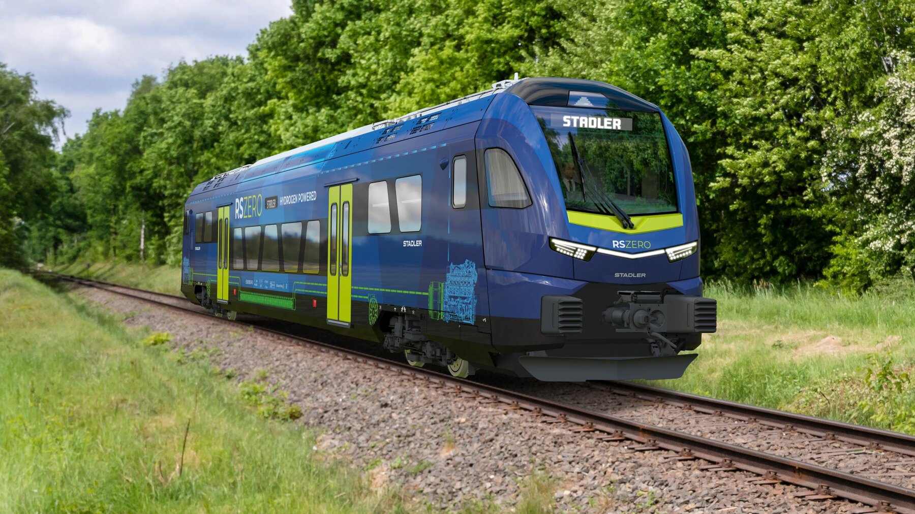
Note.
- The Regio-Shuttles can run as up to seven car trains.
- These RS ZERO are powered by overhead electrification, battery or hydrogen power.
- They can carry 170 passengers at 75 mph.
- They can run as train-trams using the Chemnitz model on compatible tram networks.
- The interiors are very flexible.
- An RS ZERO can be fitted with toilets for the posher parts of Manchester.
- Typically, a one-car RS ZERO handles a similar passenger load to a one-car Metrolink vehicle.
The more I compare the RS ZERO with the Metrolink’s trams, the more it looks like Stadler’s design has a Metrolink order firmly in its sights.
A Simple Tram-Train Example
The Altrincham Line of the Metrolink, runs between Altrincham and Deansgate-Castlefield in Central Manchester.
- Tram-trains would be capable of sharing the tracks with the current trams.
- Initially, they would run an identical service to the same destinations in the North.
- At either Navigation Road or Altrincham stations, they would switch to the heavy rail track.
- They would then travel to Hale or whatever station is determined to be the terminus.
Tram-trains would be a simple way of extending a tram service along a heavy eail line.
The Range Of The RS ZERO
This article on the Railway Gazette is entitled Prototype RS Zero Hydrogen Or Battery Railcar For Secondary Lines Unveiled At InnoTrans, has this paragraph.
The hydrogen powered RS Zero has a range of more than 700 km in the single car version, and a two-car version would offer more than 1 000 km. Battery trains will offer ranges of 80 to 110 km or 90 to 180 km. The maximum speed is 120 km/h.
As Chester and Manchester is only 45 miles or 72.4 kilometres, ways and means of running the battery versions on the route should be possible.
In fact, as Stockport and Manchester Piccadilly is already electrified at 25 KVAC and a return trip to Manchester Piccadilly from Stockport probably takes about twenty-five minutes, I would envisage that an RS ZERO would leave Stockport for Chester with a full battery. As Stockport and Chester is only 39.2 miles or 63 kilometres, the RS ZERO should do the trip if it started with a full battery and had a short length of electrification at Chester to top up the battery, if needed.
Other Possible Tram-Train Routes From Stockport
It is indicated the Metrolink would like to run other tram-train routes from Stockport.
- Ashton – Not sure of the route
- Buxton – 31.8 km
- Hazel Grove – 5 km – Electrified
- Manchester Piccadilly – 9 km – Electrified
- Manchester Airport – Not sure of the route
- Sheffield – 59 km – Will be electrified at Sheffield
Note.
- This would speed up Sheffield services.
- Buxton would be an interesting route and would probably use Newton’s friend to help on the return.
I suspect that nearly all local services from Manchester through Stockport could be run by battery-electric or hydrogen tram-trains.
The Glossop Line Could Be Converted To Tram-Train
It’s already electrified so why not?
Conclusion
It strikes me, that a lot of Manchester’s suburban rail network could be converted to RS ZERO tram-trains.
The RS ZERO tram-trains could also be used on existing tram routes to convert them to tram-train operation and extend them.
As a bonus Manchester’s trains would be substantially decarbonised.
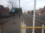
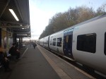
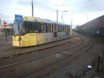
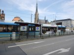
Rochdale Station – 12th November, 2024
Yesterday, I went to Rochdale station, to ascertain, the suitability of running a Lumo service between Euston and Rochdale stations.


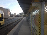


Note.
- The building in the style of a mosque, is actually a Catholic church.
- The island tram platform is at right angles to the railway lines through the station.
- The tram takes you a short distance to the North to the town centre.
This map shows the station and the tram stop.
Note.
- The station has four platforms and two tram platforms.
- The two outer train platforms are quite long.
- The West-facing bay platform could probably take a five-car Lumo train.
- The tram platform runs North from the station.
- There is a co-working space by the tram-stop.
- There is a cafe in the station.
- There is a manned ticket office.
- Car parking is free.
- There are sixteen bicycle spaces.
With some tidying up, this could be a neat interchange.
These are my thoughts.
Will Rochdale Station Accommodate One Of Lumo’s Five-Car Trains?
The Wikipedia entry for Rochdale station, says this about the Bay Platform 4, that was used for the Cltheroe train.
In 2015, construction on a fourth railway platform began. The 135m-long bay platform was completed in 2016 and is used to relieve congestion at Manchester Victoria, where terminating trains would otherwise occupy the through platforms; numerous services now continue on to Rochdale as opposed to terminating at Victoria. It is located at the south end of the main island platform, with the southbound through line having been re-aligned slightly further east to accommodate the new terminating line and is used by the half-hourly stopping service from Blackburn/Clitheroe via Bolton and Victoria.
A 135 metre platform should be able to accommodate a five-car train with 27 metre carriages, so it looks like a 5-carriage Lumo train with 26-metre cars would fit in the bay platform 4.
Will Rochdale Station Accommodate A Pair Of Lumo’s Five-Car Trains?
Consider.
- Lumo’s Hitachi trains, like all their siblings can run in pairs. As I reported in Ten-Car Hull Trains, Hull Trains do it regularly.
- Rochdale station may or may not be able to accommodate a pair of five-car trains, but say if one of Manchester’s Premier League clubs was playing in the FA Cup Final, I’m sure they would find a way to run a ten-car train to London.
- It looks like Warrington Bank Quay, Newton-le-Willows, Eccles and Manchester Victoria could all take 10-car trains.
- Euston probably can as well, as 9-car and 11-car Class 390 trains are 217.5 and 265.3 metres respectively long respectively and a 10-car Lumo train would only be 260 metres.
Perhaps, one train can start at Rochdale and the other at Manchester Victoria, before they join at Victoria and go to London as a pair.
Could The Lumo Service Be Extended Across The Pennines?
Distances Along the Calder Valley Line to Leeds are as follows.
- Rochdale 10.4 miles –
- Hebden Bridge – 23.6 miles
- Halifax – 32.7 miles
- Low Moor – 37.5 miles
- Bradford Interchange – 40.4 miles
- Leeds – 49.8 miles
Note.
- The 70 km. rang of a Lumo train will be 43.5 miles.
- The train can be charged at both end stations and will be fully charged, when it leaves Manchester Victoria and Leeds.
- There are short lengths of electrification at Manchester Victoria and Leeds.
- There may be extra electrification between Bradford Interchange and Leeds, in the next few years.
I am fairly certain, that a battery-electric Lumo Class 803 train will be able to provide a London Euston and Leeds service.
How Long Will Services Take?
Timings on the extended route from London Euston to Manchester Victoria, Rochdale, Bradford and Leeds would take.
- London-Euston – Warrington Bank Quay – One hour and forty-four minutes – Current Avanti timings.
- Warrington Bank Quay – Newton-le-Willows -Eleven minutes – Current Northern timings.
- Newton-le-Willows – Eccles -Ten minutes – Current Northern timings.
- Eccles – Manchester Victoria – Ten minutes – Current Northern timings.
- Manchester Victoria – Rochdale – Fourteen minutes – Current Northern timings.
- Rochdale – Hebden Bridge – Sixteen minutes – Current Northern timings.
- Hebden Bridge – Halifax – Fifteen minutes – Current Northern timings.
- Halifax – Low Moor – Six minutes – Current Northern timings.
- Low Moor – Bradford Interchange -Ten minutes – Current Northern timings.
- Bradford Interchange – Leeds – Nineteen minutes – Current Northern timings.
Totals.
- London and Manchester Victoria – Two hours and fifteen minutes.
- London and Rochdale – Two hours and twenty-nine minutes.
- London and Bradford – Three hours and six minutes.
- London and Leeds – Three hours and twenty-five minutes.
I suspect times could be speeded up a bit.
Proposed Developments Of Manchester Metrolink
This sub-title has its own Wikipedia entry.
Developments that would be beneficial to a Lumo service might include.
A station at Cop Road on the Oldham and Rochdale Line, that would support new housing.
Tram-trains between Oldham and Heywood On the Calder Valley Line.
These two developments will directly bring more passengers to the Lumo service, but because the Lumo service has links with the Metrolink at Eccles, Manchester Victoria and Rochdale any Metrolink improvements should benefit the Lumo service.
Destination Manchester
The title of this post is the same as the title of this page on the London North Western Railway web site.
The page introduces, the operator’s proposed new service to Manchester.
As a progressive rail operator we’re always looking to develop our services and timetables to provide a better travelling experience for our customers. We are ambitious and our team seek innovative solutions to create new journey opportunities.
That’s why we have developed proposals for our trains to begin serving Manchester for the first time. Under the plans, our existing hourly service between Crewe and London Euston would be extended to Manchester city centre from summer 2026.
Following the cancellation of the northern leg of HS2, these proposals will provide much-needed connectivity between Manchester, the West Midlands and London, with thousands of extra seats every day.
In more detail, the extended London Euston and Crewe service to Manchester Victoria station, will create the following.
- Additional capacity and comfortable, affordable journeys to and from Manchester city centre
- A great alternative to car and coach travel, with fares up to 50% cheaper than the main intercity train operator
- New regular direct services to Warrington for passengers at Milton Keynes, Rugby and Lichfield
- New regular direct services to Manchester for passengers at Rugeley, Lichfield, Tamworth and Atherstone
Note.
- The service will pass through Warrington Bank Quay, Stockport, Earlestown, Newton-le-Willows, Eccles and Salford Central to reach Manchester Victoria, so could be a comprehensive service to the Northern and Western parts of Manchester City Centre. It would just depend on the stopping pattern in the City Centre.
- There would be good connections to Manchester Metrolink at Eccles and Manchester Victoria.
- All stations on the Manchester Metrolink can be reached either direct or with a single change from Manchester Victoria.
- Manchester Metrolink is touch-in and out with a credit card.
- Manchester Victoria is very well connected by rail to cities and important destinations across the North including Blackburn, Blackpool, Bradford, Burnley, Halifax, Hebden Bridge, Huddersfield, Leeds, Liverpool, Preston, Wigan and York.
- The page talks of a London Euston and Manchester Victoria time of three hours and ten minutes.
- Manchester Stations is a group of the four stations; Manchester Piccadilly, Manchester Oxford Road, Manchester Victoria and Deansgate. Often a ticket to Manchester Stations is a few pounds cheaper and more convenient, if you are visiting several places in the City Centre.
The London Euston and Manchester Victoria service looks to me to be a well-thought out proposal.
A New Connection To Manchester Airport
Under a title of Anything Else on the page on the London North Western Railway web site, this is said.
As well as the proposal to extend our London Euston-Crewe services to Manchester Victoria, we are also proposing to begin running trains to Manchester Airport. This will involve extending our existing service between Stafford and Crewe, providing direct connectivity to the airport from Stoke-on-Trent and Staffordshire. More details on this proposal will be announced in due course.
Note.
- The extended Stafford and Manchester Airport service could call at Stone, Stoke-on-Trent, Longport, Kidsgrove, Alsager, Crewe, and possibly Wilmslow and Styal.
- Stafford, Stone, Stoke-on-Trent, Longport, Kidsgrove and Alsager would gain direct services to and from Manchester Airport.
- It would appear that the current Stafford and Crewe service waits in Stafford station for at least fifteen minutes.
- The current Stafford and Crewe service appears to always use platform 6 at Stafford.
- The current Euston and Crewe service appears to always use platform 3 at Stafford.
- The current Crewe and Euston service appears to always use platform 1 at Stafford.
- The current Birmingham and Liverpool service appears to always use platform 5 at Stafford.
- The current Liverpool and Birmingham service appears to always use platform 4 at Stafford.
I suspect that trains can be timetabled, so that the following is possible.
- An hourly London Euston and Manchester Airport service with a quick step-free change at Stafford between the London Euston and Manchester Victoria service and the Stafford and Manchester Airport service.
- An hourly Manchester Airport and London Euston service with a quick step-free change at Stafford between the Manchester Airport and Stafford service and the Manchester Victoria and London Euston service.
- An hourly Birmingham New Street and Manchester Airport service with a quick cross-platform change at Stafford between the Birmingham New Street and Liverpool Lime Street service and the Stafford and Manchester Airport service.
- An hourly Manchester Airport and Birmingham New Street service with a quick step-free change at Stafford between the Manchester Airport and Stafford service and the Liverpool Lime Street and Birmingham New Street service.
Note.
- I suspect more changes at Stafford could be cross-platform.
- I also suspect that it is possible to arrange that all services to the same destination, leave from the same platform, at the same time or times each hour.
- It would appear too, that if you want a cheap ticket price to Liverpool Lime Street, Manchester Victoria or Stoke-on-Trent, then you may have to change at Stafford.
It appears all more affordable London Northwestern Railway trains will go via Stafford.
I have some further thoughts.
Stafford And Manchester Airport Timings
With all the stops, it looks like Stafford and Manchester Airport will take about 78 minutes, but if they used the West Coast Main Line and didn’t stop the time could be reduced to just under an hour.
The Class 730 Trains
The services will be run by 110 mph Class 730 trains.
In 2018, there was talk of a bi-mode 125 mph Aventra, which I wrote about in Bombardier Bi-Mode Aventra To Feature Battery Power.
Currently, the Class 730 trains are 110 mph trains.
Would it help timetabling and capacity if these trains could be stretched to 125 mph?
Avanti West Coast
Several Avanti West Coast services stop at Stafford.
Their services could be half-an-hour quicker to Stafford, but they wouldn’t have the same stopping patterns.
In response to the competition, Avanti West Coast might run a few Manchester Airport Expresses using their new Class 805 trains.
A Second Service Between Stoke And Manchester Airport
I feel this might be needed and perhaps it could be faster, by using the direct route between Stafford and Crewe.
Avanti West Coast could use it to create a one-change fast service between London Euston and Manchester Airport, if they felt such a service were to be needed.
Conclusion
I like this proposal.
But there is a lot of fine tuning to do!
FirstGroup’s Lumo Seeks To Launch Rochdale – London Open Access Service
The title of this post, is the same as that of this article on Railway Gazette.
These two paragraphs outline the service.
FirstGroup has applied to operate Rochdale – London open access passenger trains, more than 20 years after a short-lived through service ran between the two destinations.
On May 17 FirstGroup said that it had applied to the Office of Rail & Road to launch six Lumo-branded return journeys per day linking London Euston and Rochdale via the West Coast Main Line. The trains would call at Warrington Bank Quay, Newton-le-Willows, Eccles and Manchester Victoria.
These are my thoughts.
The Route Isn’t Fully-Electrified
The route is electrified between London Euston and Manchester Victoria stations, but the 10.4 miles between Manchester Victoria and Rochdale is not electrified.
In Extra Luggage Racks For Lumo, I also talk about the possibility of fitting traction batteries to Lumo’s Class 803 trains, so they could handle the 88.5 mile diversion on the East Coast Main Line via Lincoln.
Trains with a traction battery, with an 88.5 mile range, would be able to travel between Manchester Victoria and Rochdale and return.
How Long Would London Euston And Rochdale Take?
Consider.
- The fastest London Euston and Warrington Bank Quay services take 1 hour and 44 minutes
- The fastest Warrington Bank Quay and London Euston services take 1 hour and 47 minutes
- Northern’s Class 195 trains take between 44-51 minutes Rochdale and Warrington Bank Quay with three stops.
- Northern’s Class 195 trains take between 29-32 minutes Manchester Victoria and Warrington Bank Quay with two stops.
- I will add two minutes for the extra stop.
These are my estimates for overall journey times.
- London Euston and Manchester Victoria – 2 hours and 15 minutes
- London Euston and Rochdale – 2 hours and 29 minutes
- Manchester Victoria and London Euston – 2 hours and 21 minutes
- Rochdale and London Euston – 2 hours and 40 minutes
The fastest direct Avanti West Coast services between London Euston and Manchester Piccadilly take 2 hours and 6 minutes.
Could The Service Be Extended To Leeds?
For my timings between Rochdale and Warrington Bank Quay, I used Northern’s Leeds and Chester service.
This service goes between Manchester Victoria and Leeds calling at Rochdale, Todmorden, Hebden Bridge, Halifax, Bradford Interchange, New Pudsey and Bramley.
I estimate it would take about 3 hours 32 minutes.
When Bradford has a new through station, I wouldn’t be surprised if a train operator looked at this route between London Euston and Leeds.
As Leeds and Manchester Victoria is only 49.8 miles, Lumo’s battery electric trains, with 88.5 mile batteries sized for the Lincoln diversion on the East Coast Main Line, would have no difficulty serving Leeds, where they would charge before return.
Could Lumo Run Pairs Of Five-Car Trains Between London Euston and Manchester Victoria?
As I said in Ten-Car Hull Trains, Lumo’s sister company; Hull Trains, runs the occasional ten-car service.
Perhaps for a big football match or other event, Lumo might like to run ten-car trains between Manchester Victoria and London Euston.
I suspect they could do it if the platforms were long enough, but they wouldn’t be able to run a 260 metre ten-car train to Rochdale, as that station only has a 135 metre long platform.
Warrington Bank Quay Station Will Get Six Extra Non-Stop Trains To And From London
This would provide real competition to Avanti West Coast over this route.
Newton-le-Willows Station Is Only A Few Miles From The Town Of St. Helen’s
Newton-le-Willows station has 400 parking spaces and 32 disabled parking spaces.
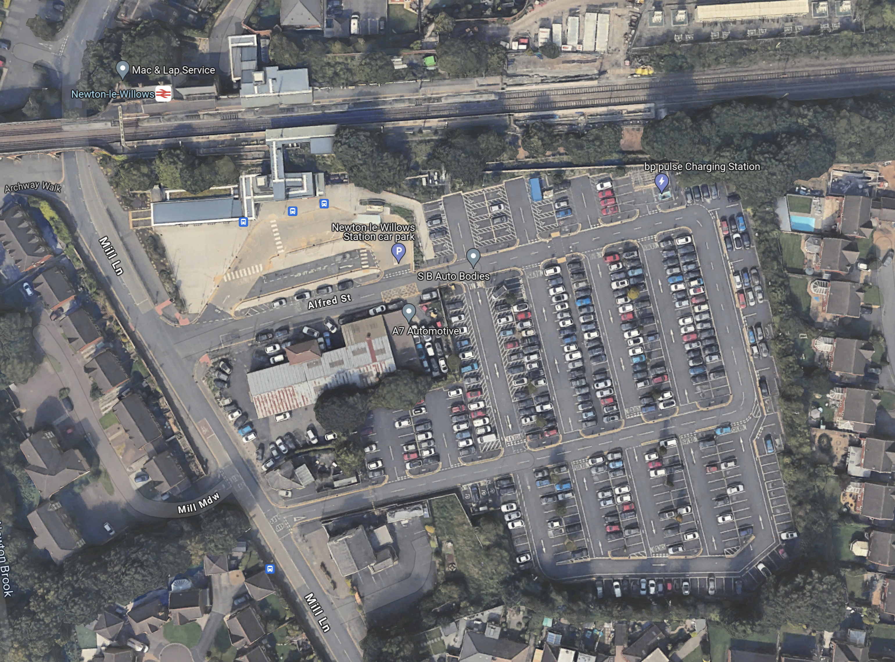
Note.
- The parking is all free!
- There are regular local trains to Chester, Leeds, Liverpool Lime Street, Manchester Airport and Wigan North Western.
A six trains-per-day service to and from London, will help fill up the parking spaces.
Eccles Station Is Within Walking Distance Of Eccles Interchange
This OpenRailwayMap shows Eccles station and Eccles Interchange.
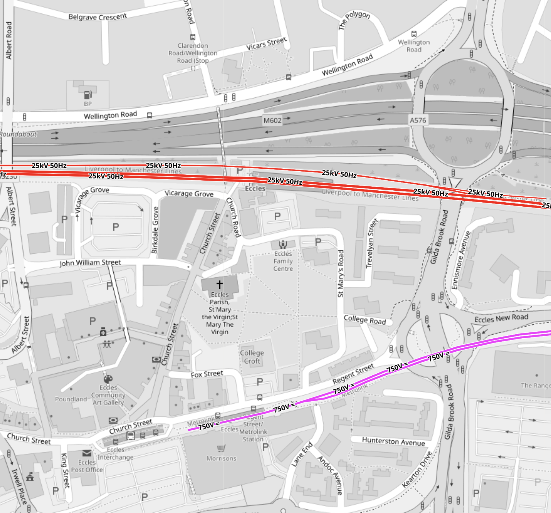
Note.
- The mauve tracks are the Manchester Metrolink.
- They terminate in the South-West at Eccles Interchange.
- The red tracks are the Liverpool-Manchester lines.
- Eccles station is a Northerly walk from Eccles Interchange.
This connection must be useful to more than a few.
I suspect if you’re going between London and Media City UK, Salford Quays or Piccadilly Gardens, you may be better to change to the Metrolink at Eccles.
Will Lumo’s Rochdale Service Run As A Flight With Avanti’s Glasgow Service?
Flighting is where two or more trains going on the same route run a few minutes apart.
- Every hour, on the half hour, an Avanti West Coast service for leaves London Euston for Glasgow Central.
- As with Lumo’s Rochdale service, the first stop is Warrington Bank Quay station.
- The Lumo service would leave London Euston a few minutes after Avanti’s Glasgow service.
- The distance between the two trains would be such, that if the first train stopped, the second train could stop safely.
- Digital signalling as is being installed on UK rail lines would make it easier to ensure safe separation.
But the benefit would be that both trains ran fast to Warrington Bank Quay station.
A Day-Trip To Manchester
If I’m right about the 2 hours and 15-21 minutes between London Euston and Manchester Victoria, then a day-trip would certainly be feasible.
Last Trains
This is a table of the last train times for Lumo between Newcastle and London.
- Weekdays – 20:27 21:35
- Saturdays – 18:27 19:22
- Sundays – 19:24 20:21
Note.
- The first time is the last Northbound departure.
- The second time is the last Southbound departure.
- Are these late enough for football matches?
I shall be interested to see the proposed last train times for the Manchester route.
- Will they be timed so you can get a tram from the Etihad or Old Trafford stadium after an evening match, that allowed you to get the last train back to London from Manchester Victoria?
- Taylor Swift gave the Manchester Arena a lot of favours with her concerts. Would you have been able to see her concert and get the last train back to London?
A few extra full trains wouldn’t hurt Lumo’s finances.
Conclusion
It looks like, this could be a very worthwhile service.
Riding Into the Future: Germany’s Pioneering Hydrogen-Powered Tram Project
The title of this post, is the same as that as this article on bnn Breaking.
This is the sub-heading.
Explore Germany’s groundbreaking project to develop a fuel cell-powered tram, leading the charge in sustainable urban mobility and reimagining the future of public transportation.
These are the first two paragraphs.
In the quiet, industrious corners of Germany, a revolution is unfolding on the tracks of public transportation. A consortium led by Hörmann Vehicle Engineering, alongside partners Heiterblick, Flexiva Automation & Robotik, and Technische Universität Chemnitz, has embarked on a groundbreaking journey to conceptualize, design, and test what could be the world’s next leap in eco-friendly mass transit: a hydrogen-powered tram. The project, aptly named the Hydrogen Tram for Next Generation, merges the realms of innovation, sustainability, and practicality, aiming to redefine urban mobility in ways we’ve only begun to imagine.
The project’s heart beats with a simple yet ambitious goal: to create a fuel cell-powered tram that doesn’t just exist as a prototype but thrives as a model for future public transportation. This initiative isn’t just about building a tram; it’s about reimagining the entire ecosystem surrounding urban mobility. From devising a robust refueling strategy to simulating operations and testing the fuel cell system, the collaborators are leaving no stone unturned. The project, with a generous €8 million budget, is buoyed by support from the federal government’s national hydrogen and fuel cell technology innovation program. This isn’t merely an experiment; it’s a statement of intent by Germany to lead the charge in sustainable transit solutions.
I have a few thoughts.
Chemnitz
These pictures show Chemnitz and its trams.


Note.
- Chemnitz used to be called Karl Marx Stadt.
- Chemnitz has some hybrid trams and tram-trains.
- I described how the Chemnitz trams work in Chemnitz Trams And The Chemnitz Model.
Chemnitz could be a very suitable place to try out the technology.
Hence, the involvement of Chemnitz University in the project doesn’t surprise me.
Tram-Trains
This article on Railway Gazette International, which is entitled Hydrogen Tram Development Project Underway, is also about the same project.
This is the first paragraph.
The Hydrogen Tram for Next Generation project has been launched to develop a fuel cell-powered vehicle which would enable services to be extended into new areas and tram-train routes created without the need for electrification.
It looks like this was added in the translation.
Tram Trains In South London
In The Third-Rail Tram-Train, I postulated using third-rail tram trains to extend the London Tramlink.
Since then Merseyrail have tried to extend, their third-rail electrified network and been told they couldn’t.
I have written these posts about using tram-trains to extend the London Tramlink.
- Could There Be A Tram-Train Connection At Reeve’s Corner?
- Would Third-Rail Tram-Trains Affect The Design Of The Proposed Streatham Interchange Station?
- The Cranleigh Line
- Thoughts On The Sutton Loop Line
- Could Third-Rail Tram-Trains Work The Epsom Downs Branch?
- Could Third-Rail Tram-Trains Be Used To Increase Services In South London?
- Could Beckenham Junction To Birkbeck Be Run Using Third-Rail Tram-Trains?
- Could Tram-Trains Be Used To Advantage In Croydon?
So would a hydrogen-powered tram-train be useful technology to extend the London Tramlink?
It just could be!
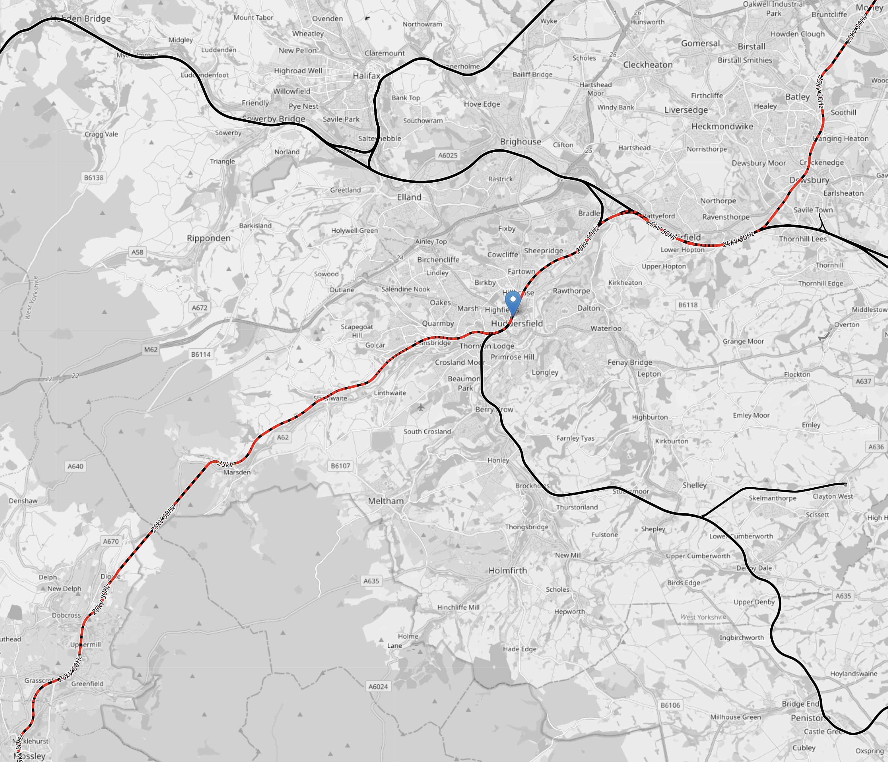
Zero-Carbon Between Manchester and Sheffield
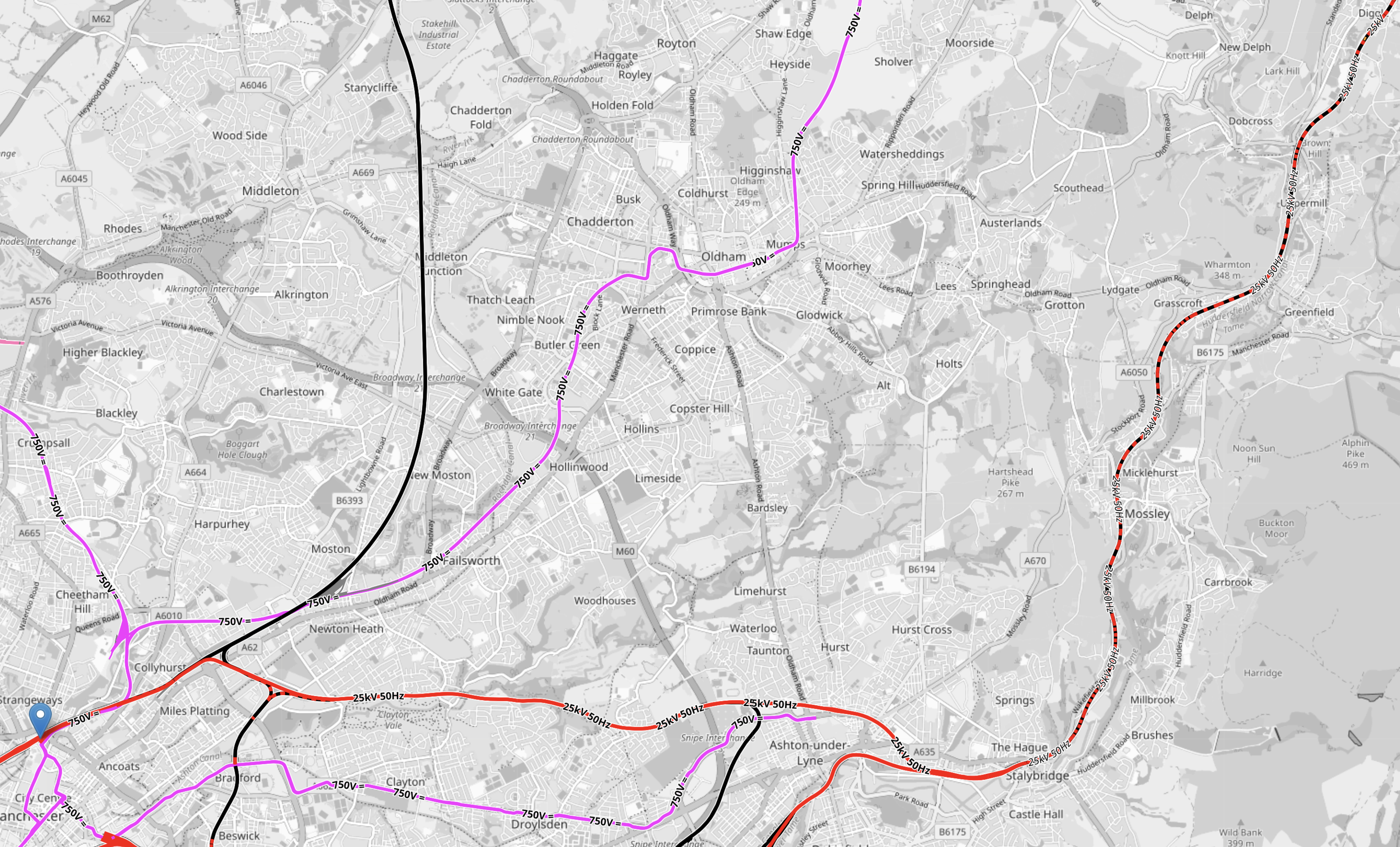
This OpenRailwayMap shows the electrification across the Pennines.

Note.
- Red lines are electrified with 25 KVAC overhead.
- Mauve lines are tram lines electrified with 750 VDC overhead.
- The mauve lines in the West are the Manchester Metrolink.
- The mauve lines in the East are the Sheffield Supertram
- Black lines are not electrified.
- Red and black lines are currently being electrified.
- The blue arrow at the bottom of the map indicates Buxton.
- To the North of Buxton, the line linking Manchester and Sheffield is the Hope Valley Line.
- Running North-East from Manchester is the main TransPennine route between Leeds and Manchester via Dewsbury and Huddersfield.
This OpenRailwayMap shows the TransPennine route between Morley and Mossley stations.
Note.
- Colours are as before.
- Morley station is in the North-East corner of the map.
- Huddersfield station is indicated by the blue arrow in the middle of the map.
- Mossley station is in the South-West corner of the map.
In a few years time, there will be 25 KVAC overhead electrification all the way between Leeds and Manchester via Dewsbury and Huddersfield.
This OpenRailwayMap shows the routes around Manchester and Sheffield and the connecting routes between Barnsley, Huddersfield, Manchester and Sheffield.
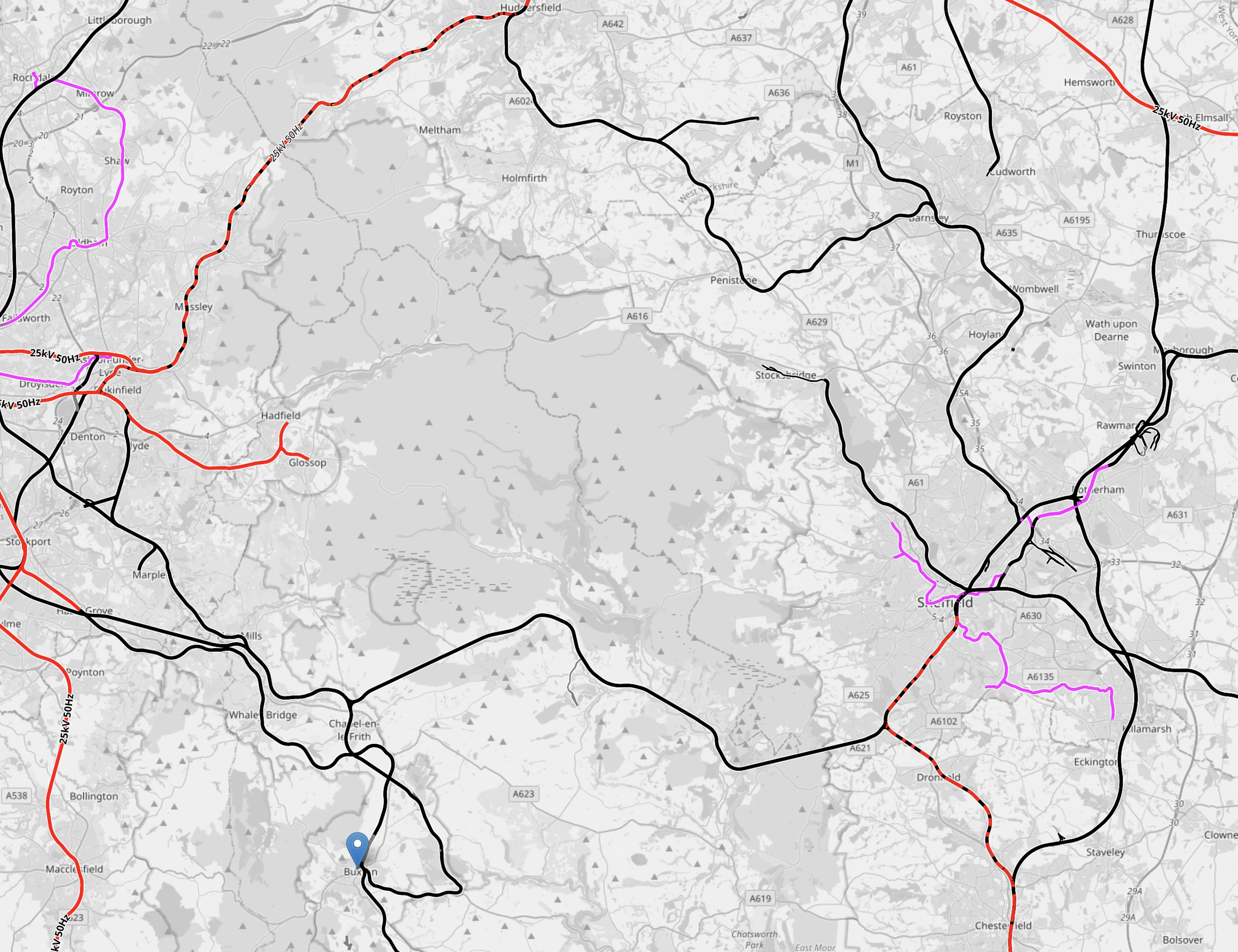
Note.
- Colours are as before.
- The blue arrow at the bottom of the map indicates Buxton.
- The line to Stocksbridge runs North-West from Sheffield.
- To its East the Penistone Line runs to Huddersfield via Barnsley.
- Manchester has a series of lines to the East that need to be electrified.
How many of these lines could be integrated into the tram systems of Manchester and Sheffield, by the use of hydrogen-powered tram-trains?
Hydrogen-powered tram-trains could share lines with battery-electric trains.
Tram-trains could run from say Cathedral in Sheffield to Piccadilly Gardens in Manchester.
Using self-powered trains would cut the need for expensive infrastructure.
The possibilities are endless and carbon free.
Conclusion
Hydrogen-powered trams and tram-trains could be a valuable tool for decarbonising trams and trains.
Could Manchester Airport Be Accessed From The West By A Tunnel Under The M56?
This OpenRailwayMap shows the railways of East London between Dalston Junction and Stratford International stations.
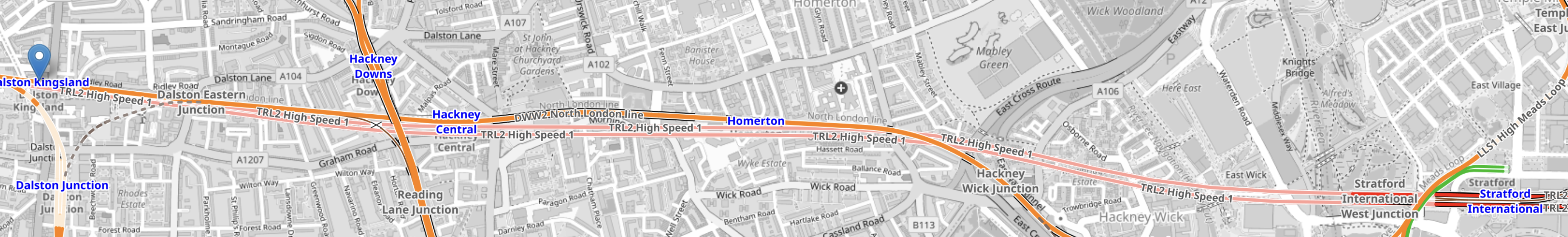
Note.
- Dalston Kingsland station is marked with an arrow in the West of the map.
- Stratford International station is marked by the blue lettering in the East of the map.
- The orange line between them is the North London Line.
- There are also two pink lines, which indicate High Speed One, which is dug several metres below the North London Line.
It can’t be much different to dig a high speed railway underneath a motorway. Has anybody done this?
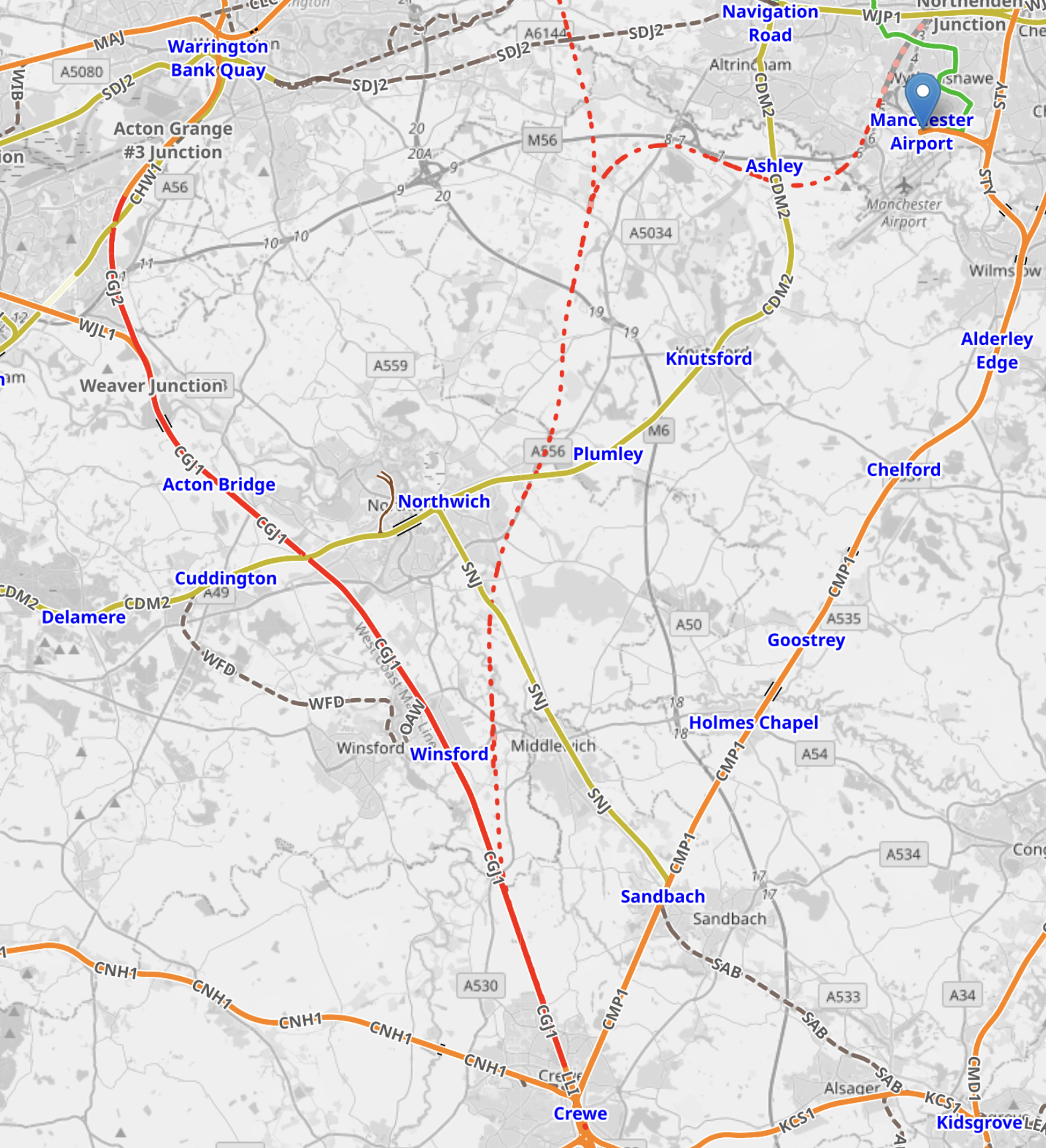
This OpenRailwayMap shows the railways leading to Manchester Airport.
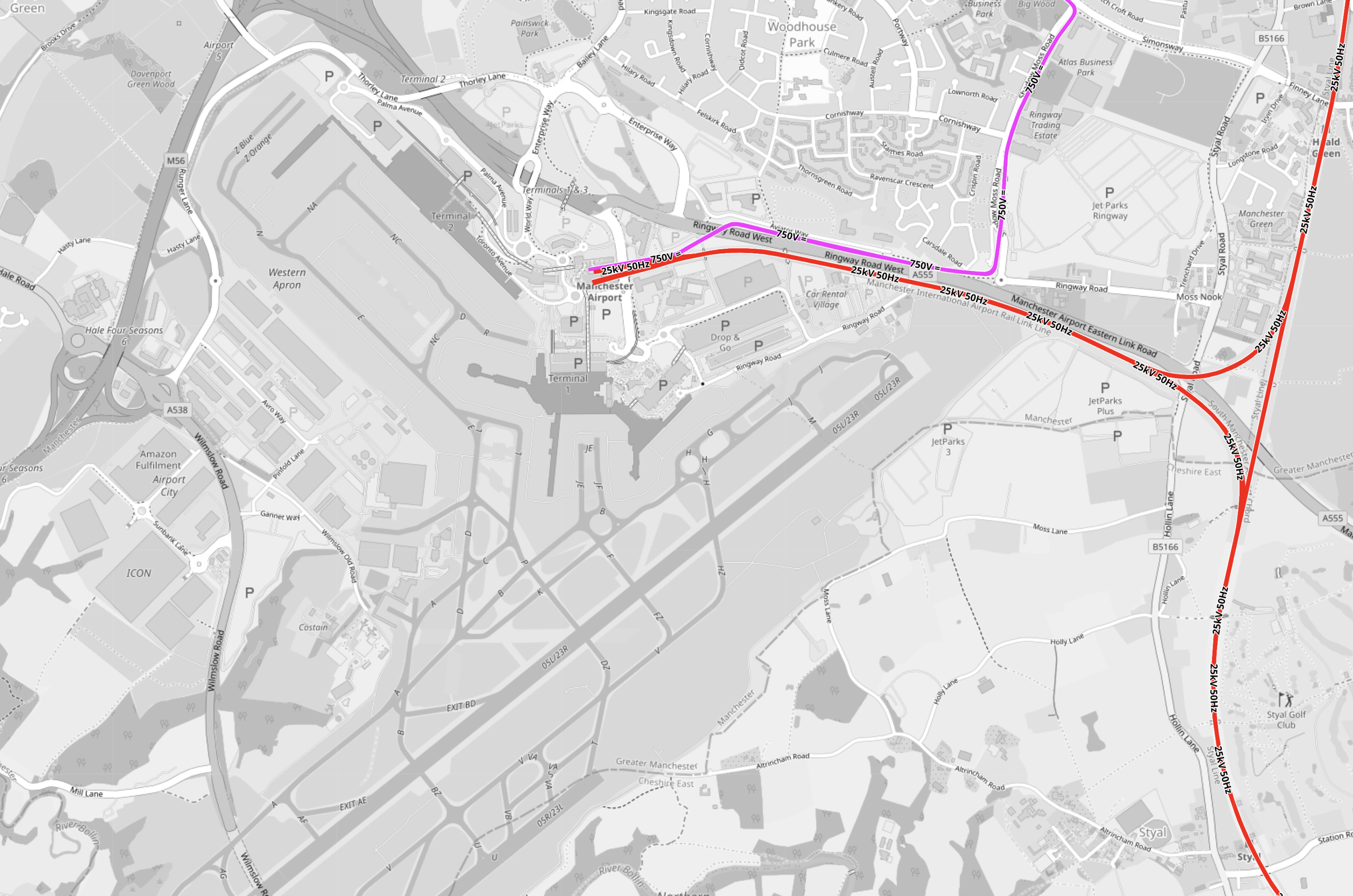
Note.
- Junctions 5 and 6 of the M56 motorway are on the Western edge of the Airport.
- The red tracks are the Styal Line.
- The mauve tracks are the Metrolink.
- It should be noted that railway lines pass under Heathrow Airport’s runways.
Point 4 makes me sure, that Manchester Airport can have a station connected to the West by a railway under the M56.
This OpenRailwayMap shows the railways around Weaver Junction on the West Coast Main Line, where the trains branch off to Liverpool.

Note.
- The West Coast Main Line goes down the Eastern side of the map.
- Warrington Bank Quay is the next station to the North.
- The Liverpool Branch goes off to the West.
- The M56 tuns diagonally across the map from the North-East corner crossing both both branches of the West Coast Main Line.
This Google Map shows where the M56 crosses over the West Coast Main Line to Warrington Bank Quay.

Note.
- The M56 motorway is obvious.
- The Eastbound motorway goes to Manchester Airport and Manchester.
- The junction is numbered 11.
- The railway runs down the Western side of the map.
I believe that it would be possible to connect a railway running East under the motorway to the West Coast Main Line.
This Google Map shows where the M56 crosses over the Liverpool branch of the West Coast Main Line.
Note.
- There is no motorway junction here.
- The North-East bound motorway goes to Manchester Airport and Manchester.
- The railway runs slightly diagonally across the bottom of the map.
- The Westbound railway goes to Runcorn and Liverpool.
- The Eastbound railway goes to Weaver Junction, Crewe and the South.
There would only need to be a connection between Liverpool and the railway under the motorway going to and from Manchester Airport.
I have some further thoughts and questions.
This Is Just My First Thought
I am happier about the connection to the Liverpool branch than the Northern connection.
But then I feel there are several routes at both junctions, some of which will take a wider route.
How Long Will The Tunnels Be?
Between Junctions 11 and 6 on the M56 is 16 miles.
At What Speed Would The Trains Run?
I suspect that once on the straight section between Junctions 11 and 6, speeds of up to 90 or 100 mph should be possible, but speeds would probably be lower at the junctions to the West Coast Main Line.
How Would It Connect To Manchester Piccadilly?
The tunnel would continue the other side of the Airport and it’s a further 9.4 miles to under Manchester Piccadilly.
In The Rival Plans For Piccadilly Station, That Architects Say Will ‘Save Millions’, I wrote about Weston Williamson’s plan for Manchester Piccadilly station.
This was their visualisation.

Note.
- In the visualisation, you are observing the station from the East.
- The existing railway lines into Piccadilly station are shown in red.
- Stockport and Manchester Airport are to the left, which is to the South.
- Note the dreaded Castlefield Corridor in red going off into the distance to Oxford Road and Deansgate stations.
- The new high speed lines are shown in blue.
- To the left they go to Manchester Airport and then on to London, Birmingham and the South, Warrington and Liverpool and Wigan, Preston, Blackpool, Barrow-in-Furness, the North and Scotland.
- To the right, they go to Huddersfield, Bradford, Leeds, Hull and the North East, and Sheffield, Doncaster and the East.
- Between it looks like a low-level High Speed station with at least four tracks and six platforms.
- The high speed lines could be oriented so they ran East-West, rather than North-South in this visualisation.
- The Manchester Metrolink is shown in yellow.
The potential for over-site development is immense. If the Station Square Tower was residential, the penthouses would be some of the most desirable places to live in the North.
Onward From Manchester Piccadilly
I would hope that a connection could be made to the Huddersfield Line to the East of Manchester Piccadilly station, so that trains could use the TransPennine Upgrade all the way to Leeds.
Manchester Buzzing To Put Rail Into Its Bee Network
The title of this post, is the same as that of this article on the Railway Gazette.
These two paragraphs introduce the article.
Locally branded stations and integrated ticketing are among the improvements to Greater Manchester’s local rail services envisaged from 2025 under a landmark devolution deal.
The deal agreed with the government on March 15 brings GM Mayor Andy Burnham and local council leaders significant additional powers in several policy areas, including transport. The single funding settlement is similar to those in place covering Scotland and Wales, but this and a similar deal for the West Midlands is the first time such a flexible grant has been granted to English regions.
Included in the deal are the following.
A London-Style Network
It is described in this paragraph.
Greater Manchester has set itself a target of rolling out so-called ‘London style’ transport across modes by 2030. While Transport for Greater Manchester already directly manages the Metrolink light rail network, buses are now being brought under tighter regulation through a franchising model, and TfGM aspires to introduce integrated smart ticketing across the city-region. Today, while paper travelcards can be bought covering buses, Metrolink trams and trains, these are poorly marketed and often more expensive than the fares offered by individual bus operators; there is also no ability for daily or weekly price capping to be introduced.
I hope that Manchester follows London’s rules.
- One card and any bank or credit card gives full access to buses, trains and trams.
- Daily, weekly and monthly caps.
- Freedom Pass or equivalent for those that need them.
- Comprehensive transport mapping.
- Visitor-oriented travel information offices in major stations.
I feel very strongly about the last two, as measures like these encourage visitors to return.
Trials of the ticketing should start by the end of the year.
The Bee Network
This is outlined in this sentence.
Together, the local transport network is to be branded ‘the Bee Network’, reflecting an enduring emblem of the area’s industrial heritage.
I like the name.
- The bee is one of the symbols of the city according to this Wikipedia entry.
- Bees are on the coat of arms of the City of Manchester.
- Bee symbols are used by Manchester and local businesses.
But perhaps most importantly, the bees were a symbol of recovery of the city after the May 2017 Manchester Arena bombing.
The Addition Of Twenty Percent Of the Local Rail Network
This is outlined in this sentence.
Under the agreement announced on March 15, around 20% of local rail services, currently operated by Northern Trains and managed under contract with the Department for Transport, will be brought into the Bee Network.
These rail services are to be added.
- Wigan – Manchester Victoria via the West Coast Main Line and a proposed station at Golborne, which could open from 2025.
- Stalybridge – Southport via Atherton
- Glossop – Hadfield – Manchester Piccadilly
- Rose Hill Marple – Manchester Piccadilly
- Buxton – Manchester Piccadilly
- Alderley Edge – Manchester Piccadilly
I shall discuss each route in detail separately.
New Trains?
Consider.
- The Wigan and Alderley Edge routes are shared with 125 mph trains.
- The diesel trains on the Buxton and Rose Hill Marple routes will need to be replaced.
- The Buxton route is a very stiff climb.
- Do the Class 323 trains to Glossop and Hadfield need to be replaced?
- The Buxton, Southport and Rose Hill Marple routes are not fully-electrified.
I would have two separate fleets.
A small number of 110 mph electric trains for the Wigan and Alderley Edge routes. Class 350, 360, 379 and 386 trains would be possibilities.
An appropriate number of electric for the other routes. Some would have a battery capability to handle the partially-electrified routes. Merseyrail’s Class 777 could be ideal.
Note.
I am fairly certain, that the Class 777 trains can run as tram-trains, which would be useful for Manchester.
A rough calculation indicates that the ideal battery sizes for Southport and Buxton, could be similar.
The battery for the Rose Hill Marple route would be smaller.
There could be advantages if Merseyrail and Manchester had similar high quality trains.
Integration Of The Various Modes Of Transport
This is outlined in this paragraph.
Meanwhile, the Greater Manchester Combined Authority is to establish a North West Regional Business Unit and GM Rail Board to improve local scrutiny of rail service performance and shape the integration with other modes in the Bee Network.
This is critical to the successful development of the Bee Network.
Conclusion
It’s now up to Manchester to first make it work and then develop it for the benefit of the people and businesses of the City, and not forgetting the visitors.
Integration Of The Various Modes Of Transport
This is outlined in this paragraph.
Meanwhile, the Greater Manchester Combined Authority is to establish a North West Regional Business Unit and GM Rail Board to improve local scrutiny of rail service performance and shape the integration with other modes in the Bee Network.
This is critical to the successful development of the Bee Network.
Manchester Arena Attack: Families ‘Disgusted’ By Memorial Trespassing
The title of this post, is the same as that of this article on the BBC.
These are the introductory paragraphs,
Families of people killed in the Manchester Arena attack have said they were “disgusted” after a memorial site for the 22 victims was trespassed on.
The Glade of Light memorial in the city centre remains a building site and does not officially open until the new year.
Two bereaved families said they were appalled to find the security fences pulled down on Sunday.
The article also said this.
Ms Curry said she found hundreds of people were walking through the area, which is supposed to be closed to the public.
She said one man stood on a memorial stone and was abusive when challenged, another woman vomited all over the area, and groups of youths were openly smoking drugs.
I can’t understand what led to this aggressive trespass.
When, I am in certain cities, there does seem to be more low life on the streets than you habitually see in London.
I do wonder, if it is partly because of London’s transport regulations and actions as laid down by the Mayor and Transport for London.
London has an extensive CCTV network and after the London bombings of July the seventh and the shooting of Jean Charles de Menezes in 2005, I’m sure it was improved.
Did the improved CCTV and the police action in the shooting the unfortunate Brazilian, deter a lot of low life from going to the centre?
Ken Livingstone or was it Boris, introduced a policy of banning alcohol on London’s transport system.
The precise details are given in this recent article on the Sun.
I have a feeling it had a positive effect, but did it mean that less drunks found their way to the centre?
In 2011, I sat next to a guy on a Manchester bus going from Piccadilly Gardens to Bury. I noticed that about a dozen youths were harassing the driver, trying to get his fare money and remarked on this to my companion.
My companion on hearing my London accent, said you don’t get that in London because of the contactless ticketing, as there is no fare money on the bus.
I was surprised at his reply and asked him to explain. It turned out he was a Trade Union Official, who looked after bus workers in Manchester. He told me his Union wanted a London-style contactless ticketing system, as it had drastically cut the number of attacks on staff in London.
Having worked with the Metropolitan Police on the analysis of data, they have also found that contactless ticketing helps in the tracing of people through London’s transport network and has solved several serious crimes.
Conclusion
I feel that terrorism and London’s reaction to it, banning of alcohol on public transport, contactless ticketing and other measures have helped keep drunks and those up to no good out of the centre.
