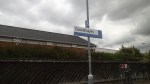
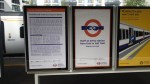
After Overground – Edmonton Green – 31st May 2015
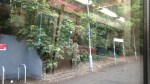
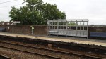
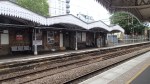
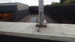
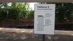
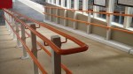
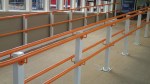
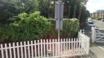
When I visited Edmonton Green Station some time ago, it was in the process of being updated with lifts.


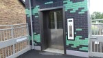

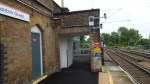
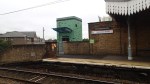

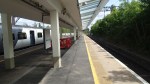
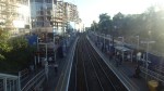
As the pictures show it is one of the first stations on the Lea Valley Lines other than the totally flat Enfield Town, to be updated to full step-free access.
This page on the Enfield Council web site, says how the station rebuilding was financed and the problems encountered in the design and building.
The Council are working in partnership with Network Rail to deliver two lifts at Edmonton Green Station to enable step free access to both Platforms 1 and 2.
The Council has been awarded £850k for the project following a successful bid for funding from the Department for Transport’s Access for All programme. However, the total cost of the project is estimated to be £2m and the balance of funding is being provided by the Council, utilising a mixture of contributions from nearby development schemes and grant funding from Transport for London .
The construction of the lifts provides many challenges because of the constrained nature of the site, the need to cater for passengers throughout the works and the fixed budget.
In addition, the station is at the heart of Edmonton Green and within a Conservation area, so it needs to be of good design. The focus at present is therefore trying to find the optimum design solution for the lift shafts, given all of the above constraints.
It looks like it was challenging.
I think it illustrates that the cost of putting two lifts into a conservation area and making sure that the station is acceptable to all parties is a couple of million. Good building isn’t cheap.
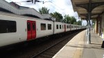
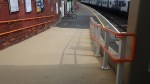
But at least Edmonton Green is now a station with platforms that look like they’ll take eight car trains and possibly twelve-car ones if needed.
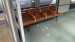
Obviously details like handrails and information displays need to be updated and the station needs a good clean and a paint, but it shouldn’t need much expensive work for the next decade or two.
It can certainly be used as a standard to which all stations on the Lea Valley Lines can aspire.
Wandering On Day One Of The New Overground And TfL Rail
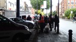
Today was the first official day of the addition of the Lea Valley Lines to the Overground and the first day that the Shenfield Metro was being run by TfL Rail. I went for a couple of wanders and these are some of the pictures I took.


There were a couple of problems in that the there weren’t enough drivers at TfL Rail for whatever reason and the Romford to Upminster branch of the Overground wasn’t working.
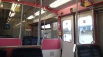
The Chat On The Overground
This morning, I went for a wander on some of the new Overground lines that have been incorporated today, just to see how much there is to do, to bring them up to an acceptable standard.
But the chat between staff and passengers wasn’t about refurbished trains or stations, but about the fact that those with Freedom Passes now have no restrictions on any of the lines taken over by the Overground.
So older commuters can now use their Freedom Pass to travel to and from work, even if it’s the rush hour.
The M25 South Of Waltham Cross
If you travel along the M25 between junctions 25 (A10) and 26 (A121), you pass south of an area which I know well from my teens. Obviously the motorway wasn’t there in those days and a lot of the area was closed off as it was the Royal Gunpowder Mills. Some of the area has been developed, but a lot is still pretty much undeveloped or farmland, as this Google Earth image of the area shows.

M25 South Of Waltham Abbey
Note how two of the Lea Valley Lines pass North-South through the area.
The line between Turkey Street and Theobalds Grove, known as the Southbury Loop, crosses the motorway on its way to its terminus at Cheshunt, just to the East of the large factory, which is News International’s Print Works at the top left of the image.
Further to the East is the West Anglia Main Line between Enfield Lock and Waltham Cross, which is just to the west of the collection of large distribution depots.
So you have a large area of relatively undeveloped land with four stations at the corners. Turkey Street and Theobalds Grove are now part of the London Overground and Enfield Lock and Waltham Cross are proposed to be on Crossrail 2.
So although the connections to London aren’t bad they are going to get a lot better.
Surely, with these rail connections this area could be developed sensibly.
I’ve always felt that London needs more Park-and-Ride sites. In fact there isn’t one rail station, where you can come off the M25 drive a kilometre or so, perhaps pick-up or drop-off a passenger, and return easily to the motorway.
As to being able to park all day or just an evening, whilst you do business or visit a friend relative, then you can just about forget it. Especially, as those stations with parking never have enough of it.
A couple of times, since I’ve stopped driving, I’ve needed to be picked up near the M25, either to guide someone to my house or perhaps go to a football match with a fellow sufferer. There are few suitable places, so we generally end up using eithe Cockfosters or Newbury Park Tube Stations.
What is needed is a series of rail/car/bus interfaces all along the motorways and not just on the M25.
I took these pictures from a train going between Turkey Street and Theobalds Grove stations.
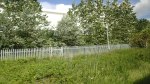
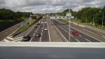
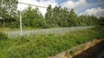
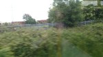
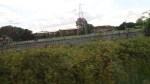
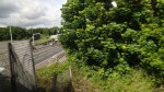
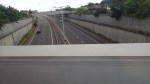
The M25 dominates and there is a few large developments, like the News International Print Works and lots of undeveloped green space.
,So could such an interchange be developed somewhere on this section of the M25 near Waltham Cross, perhaps with a Service Area and a Park-and-Ride. It would certainly ease transport difficulties for many.
Green Scars Across East London
When the Lea Valley Lines were built across East London in the 1800s, they didn’t seem to box them in with houses, like they did elsewhere in the capital.
This Google Earth image shows several stations between Bruce Grove in the North, Harringay Green Lanes in the West and Stoke Newington in the South.
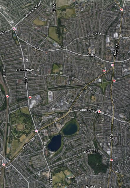
Green Scars Across East London
Note the green scars between the stations, where the lines often take up quite a small part of the available land. Look at this Google Earth image of the area between Seven Sisters station and South Tottenham station.

Seven Sisters
Surely, the development possibilities for this space, when linked to a new station are endless, even if you just develop a park.
7/10 For Day Zero For The New Overground Lines
You might ask how I can give the 7/10 for the new Overground lines, when the service hasn’t officially started.
But I didn’t see anything wrong and there was a lot of positivity from staff and passengers. Here’s a few things I noticed.
1. Freedom Passes
Transport for London obviously know their passenger model and the Freedom Pass holder I spoke to who said she would use the line from Enfield at all times of the day, must mean that TfL know they can accommodate the extra passengers, who will turn up early in the morning and in the rush hour to go home.
Perhaps, the small modal shift say from vehicular transport to trains, will actually free up the roads.
I’ll just let the data do the talking, when passenger numbers are published in a few months.
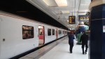
2. The Deep Clean At Enfield Town
It looks like they’ve deep cleaned Enfield Town station for the launch and if this is indicative of the standard we’ll see at the piles of bricks, that double as stations, they’ve inherited from Abellio Greater Anglia, then the good burghers of East London will be pleasantly surprised.
To be hard on London Overground, choosing Enfield Town station for the launch was a bit of a cheat, as the station is naturally step-free and it was built in 1957, as opposed to the 1840s for most of the stations.
It is certainly built and cleaned to a standard, that few if any, would complain about.
3. Staff
The staff seemed positive in a lot of ways, just as they do in a typical Overground or Underground station.
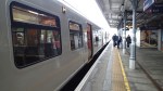
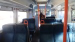
4. Trains
The trains, I travelled in today were clean and one lady thought that Abellio Greater Anglia could have done more to keep them clean.
If London Overground follow the cleaning procedures they use on the North and East London Lines, where litter is regularly collected throughout the day, the passengers will be pleased.
5.Future Overcrowding
From experiences with the current Overground, I can see a small problem. And that is overcrowding.
But whereas on the North and East London Lines providing more capacity is a problem, on the Lea Valley Lines, all platforms can take eight car trains, as they do in the rush hour and you can always couple two Class 315 trains or Class 317 trains together. And as Class 345 trains are delivered for Crossrail, more of these will come available.
6. Future Investment
London Overground have acquired these routes from Abellio Greater Anglia, with all the skill of an East End trader who sold car aerials in Ridley Road Market.
They have similar costs to Abellio Greater Anglia in terms of trains, track charges and stations, but they get more of the revenue, as they are a not-for-profit organisation and don’t have external owners.
So they get the benefit of all the investment they make, provided of course it is sound! But Transport for London have said they are going to put £25million into the Lea Valley Lines.
But it won’t be just Transport for London putting money into the Overground. The proposed new station at Hackney Wick has a variety of sources of funding and I think we’ll see other stations built by external developers, so that their houses, offices or industrial units are more desirable.
In this section in Wikipedia, it says that the current trains will be replaced by thirty-nine new trains in 2017. New trains always attract more passengers, but unlike the current Overground lines, adding more capacity will not involve any expensive platform lengthening.
7. Everybody Will Want Overground
The only serious long term problem, they have is that if the Lea Valley Line takeover is as successful as the current Overground, then there will be a clamour for other lines to be taken over, or at least run on the same lines.
I have a feeling that there are going to be some very unhappy train operating companies, who lose some quite lucrative routes in the next few years.
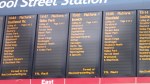
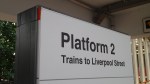
Testing The Journey Planners
I’ve just tested the Network Rail and Transport for London Journey Planners for the first London Overground journey from Liverpool Street to Walthamstow Central tomorrow.
They gave the same time of 07:33. I’ll be on the train, if the barriers agree.
A First Glimpse Of The New Tube And Rail Map
There was a copy of this map at Enfield Town station.
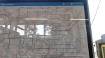
Incidentally, I probably look at this map more than I ever look at the standard tube map, as I generally need it when coming home from an unfamiliar rail station south of the Thames.
One of these maps should be prominently displayed at all rail stations in at least the grester South East of England. This was originally said to me by a Virgin employee at somewhere like Coventry, as they’re always getting asked where unusual London stations are by passengers. So he thought one on the London-bound platform would be a good idea and passengers could look it up for themselves.
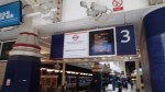
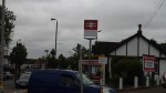
The Orange is Starting To Appear
Today, I took the Enfield branch of the Lea Valley Lines up to Enfield Town station, to see whether there was any signs of rebranding for the London Overground.
As you can see there were!
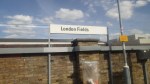


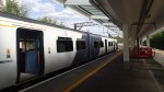

As one picture shows, they were changing what they could today for the start of service tomorrow.
Boris is coming to Enfield Town station on Monday, so they’ve obviously cleaned that station first. And very clean it was too, with lots of new shelters and seats.
The only problem was the new rubber floor had the smell of new rubber, but that will dissipate by Monday.
I chatted for a few minutes to a member of staff and to a couple of fellow travellers. All seemed very pleased and a fellow Freedom Pass holder was pleased that she could now use her pass before 09:30 in the morning.
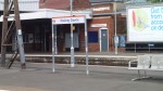
West Hampstead Station: A Tangle Of Property Development And People To Solve
West Hampstead station is one of those North London Line stations, that has narrow platforms, which need lengthening and a cramped station building with no step-free access. The station also sits in the middle of a large property development. This Google Earth image shows the station.
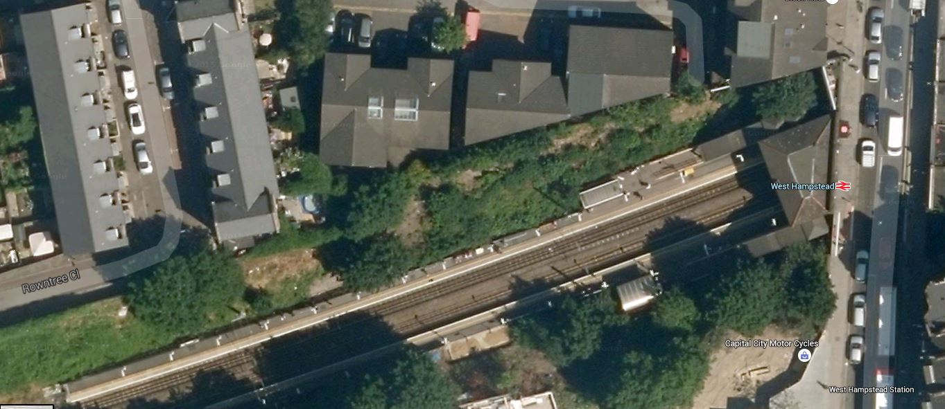
West Hampstead Station
This was obviously taken before the development started. There were plans for a grand West Hampstead Interchange, drawing the four rail line in the area; Underground, Overground, Thameslink and Chiltern together in modern stations linked by a boulevard.
This page on the London Borough of Camden web site, is a pointer to some documents. This Google Earth image shows the various rail lines.
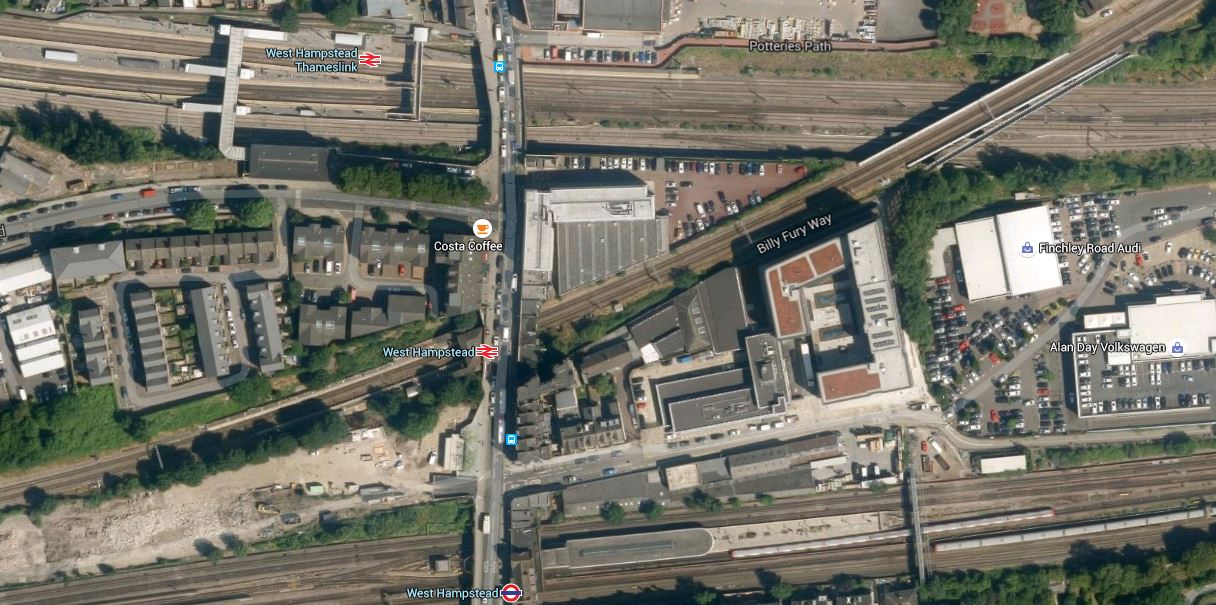
West Hampstead Lines
There is actually more lines than is obvious here. Starting from the top (north), the lines and stations are.
1. Thameslink passing through West Hampstead Thameslink station – From 2018 this will be a very much increased service.
2. Midland Main Line passing through West Hampstead Thameslink station – The number of services stopping here to places like Sheffield, Nottingham, Derby and Corby may well increase as the line to Sheffield is electrified.
3. North London Line passing through West Hampstead station – This is being upgraded to take five-car trains.
4. Jubilee Line passing through West Hampstead Tube station – A station not to the standard of the Jubilee Line Extension.
5. Metropolitan Line passing alongside West Hampstead Tube station, but without platforms.
6.Chiltern Main Line passing alongside West Hampstead Tube station, but without platforms.
This is Wikipedia’s schematic of the lines.
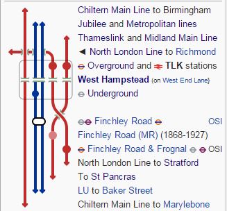
West Hampstead Lines
I would say that the best way to sum up the area is using that old estate agent’s phrase of development potential.
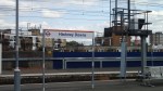
So how is West Hampstead station getting on?
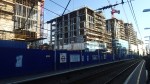
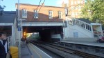
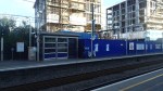

There certainly seems to be lots of flats growing up by the side of the railway and these seemed to have replaced the trees. There was a bit of fuss about the thirty-five trees being removed, which I can sympathise with, but surely a better plan would be to take away as much traffic as possible from West End Lane and make it a proper tree-lined boulevard. But any council that suggested that would be voted out by the 4×4 owners.
There’s a preview of the new West Hampstead station on West Hampstead Life.
I’m not impressed and it is rather a poor design compared to Hackney Wick.
Only time will tell, but rail developments will have a big effect on the number of people using the stations at West Hampstead.
1. The opening of the full Thameslink service in 2018.
2. More trains from West Hampstead Thameslink station to the North on full electrification to Sheffield.
3. The possible opening of Metropolitan and Chiltern Main Line platforms in a rebuilt Underground station.
4. Network Rail and Transport for London have stated that they will increase the capacity on the London Overground, by increasing the number of trains and running six-car trains. Certainly they will do this on the East London Line, which will get twenty-four trains an hour.
It is my view that all of this extra rail traffic, will necessitate the turning of West End Lane into a proper pedestrian boulevard with very much reduced traffic levels. The only alternative would be to create a pedestrian tunnel.
