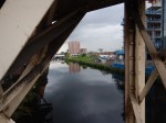
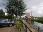
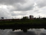
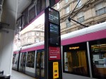
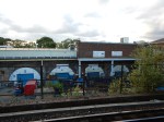
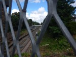
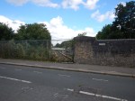
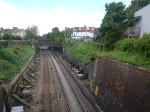
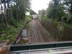
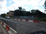
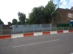
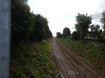
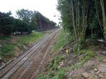
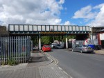
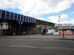
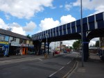
Carlisle To Glasgow By The Scenic Route
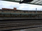
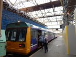
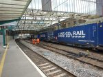
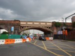
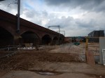
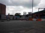
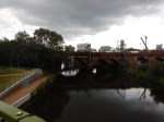
One of the reasons for my trip to Carlisle station, that I wrote about in Carlisle Station Gets A Makeover, was to explore the Glasgow South Western Line, which was the only line in the Borderlands, that I hadn’t explored.
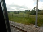
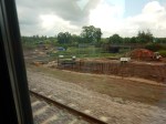
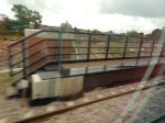
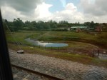
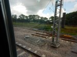
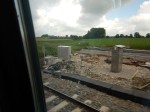
These pictures tell the story.
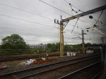
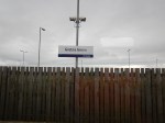
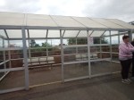

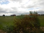


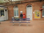
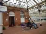
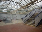
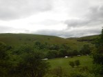

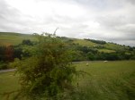


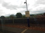
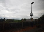
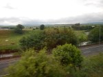
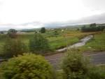
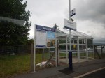
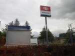
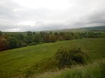
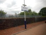


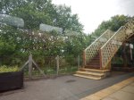
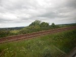
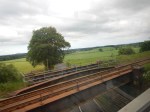
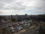


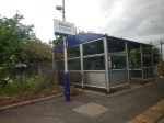

My first reaction to the line is that, the well-maintained stations need more services.
I’ll put my thoughts in the following section.
More Services
Abellio Scotrail have ordered new electric Class 385 trains from Hitachi, which comprise eighty train sets, that total 192 carriages.
These can’t run on the Glasgow South Western Line, but will replace several modern diesel multiple units for service all over Scotland.
I suspect that if the Borders Railway gets four car trains, then there would be some lengthening and increase of frequency on this route.
Incidentally, the conductor on the train I took, said that more services will certainly come.
An Improved Diversion Route
What is more likely to drive improvements is the need for a diversion or alternative route for the West Coast Main Line between Glasgow and Carlisle.
Reasons could include.
- The West Coast Main Line is very busy.
- Diversions because of blockades or bad weather.
- There is a need for more Anglo-Scottish freight services.
- Freight services will be increasingly hauled by electric or bi-mode locomotives.
Unlike many diversion routes, the Glasgow South Western Line is an 80 mph line with sections of double-track and 100 mph maximum speed
Electrification
Electrification of the diversion route, would probably be essential, as most traffic on the West Coast Main Line uses electric traction.
The conductor I spoke to, was surprised that British Rail hadn’t electrified the line in the 1970s, at the same time of the major West Coast Electrification.
As schemes go, it wouldn’t be the most expensive of schemes., as the line appeared to go through fairly easy countryside, with not many bridges and tunnels.
But the biggest advantage is that at both ends of the line, there are electrified lines, that can be used to provide power for the line at both ends.
Look at this Google Map of Gretna Green station‘s position with relation to the West Coast Main Line..
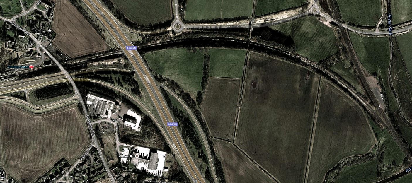
Gretna Green Station And The West Coast Main Line
At the Northern end of the line, there is masses of electrification in and around Glasgow.
Electrification of the route must have other advantages.
- Services could be provided by Class 385 trains.
- Kilmarnock gets an electric train service.
But surely, the biggest, is that modern electric trains would speed up the service considerably.
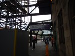
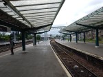
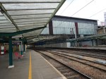
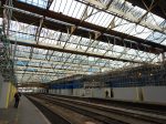
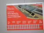
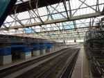
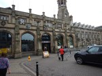
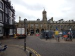
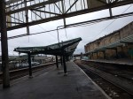
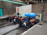
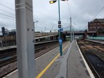
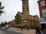
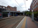
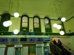
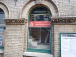
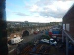
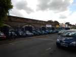
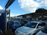
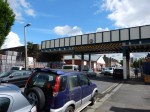
Carlisle Station Gets A Makeover
In If Manchester Victoria And Birmingham New Street Were The First Two Courses, Is Carlisle The Third?, I wrote how Carlisle station was going to get a £14.7 million upgrade including a new ETFE roof.
These pictures show the progress.


Note.
- There are two through lines in the station for freight and other trains that don’t stop.
- The four bay platforms at Carlisle are all electrified to some extent and it wouldn’t be the biggest task to make the station fully-electrified.
- It looked to me like a lot of the magnificent station building, isn’t being used to its full potential.
- The welcoming square outside the station needs an upgrade to become a real gateway to Carlisle.
I think that after the makeover, it will be a second very high-class station to mark the border between England and Scotland.
Carlisle could be in a unique position in a few years.
- It is already the best connected city in the Borderlands.
- Published plans mean that electric express trains will serve Birmingham, Edinburgh, Glasgow, Liverpool, Manchester and Manchester Airport, at least once an hour, with some places getting at least double.
- As I wrote in Arriva Rail North’s New Trains, new CAF Civity trains will be arriving, in both electric and diesel variants.
- After the current landslide at Armathwaite is cleared up on the Settle-Carlisle Line, these new trains will surely be running at least an hourly service to Leeds.
- The new trains will be providing an improvement in comfort, speed and possibly frequency on the hourly service to Newcastle, on the Tyne Valley Line.
- The new trains, would surely work their magic on the Cumbrian Coast Line around the Lake District.
- Scotrail is getting new trains too, and will some be used to provide a better service to Glasgow via Dumfries and Kilmarnock, using the Glasgow South Western Line.
If this doesn’t increase the numbers of tourists taking a rail-based exploration holiday of the Borderlands and the Lake District, I would be extremely surprised.
I’m not the only person, who thinks this way, as in the July 2016 Edition of Modern Railways, Theo Steel discusses options for the increase in traffic on the Settle to Carlisle Line.
In addition, other developments may happen, that will also increase Carlisle’s importance to the Anglo-Scottish railway system.
- The events of this winter, where the West Coast Main Line was closed because of bad weather, could see the Glasgow South Western Line improved and electrified to provide a valuable diversion route for train services between England and Glasgow.
- There could be a need for more Anglo-Scottish freight trains, but the West Coast Main Line is very busy. So will this mean that freight trains will increasingly use secondary routes like Settle-Carlisle and the Glasgow South Western Line.
- Carstairs station sits between Carlisle, Edinburgh and Glasgow and I can’t believe that Scotrail won’t use their new trains to improve services through the town. As ever, the improvements in services around Carstairs, will probably be driven by the need for new housing and commuting to Glasgow and Edinburgh.
The big question though, is whether the Borders Railway will ever get to Carlisle. If it does, then Carlisle will be ready with a refurbished and electrified platform, alongside the one currently used for services on the Glasgow South Western Line.
Network Rail seem to deserve a few plaudits for their foresight in preparing Carlisle station for the future.
Shared Space In Preston
Done properly, I think shared space can transform a town or city centre.
These are pictures of the centre of Preston.
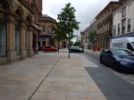
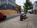

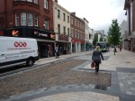
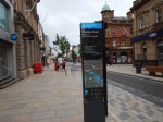
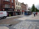

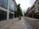

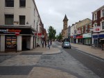
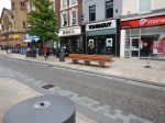
It seemed to be working well as I left, during the morning go-to-work period.
A Walk Around The Ordsall Chord
I took this walk around the Ordsall Curve.
I’d taken one of Manchestewr’s free city centre buses and a walk to the Spinningfields area.
This Google Map shows the layout of lines in the area.
The Area Of The Ordsall Chord
Walking North-East to South-West along Water Street, the bridges in order are as follows.
- The Prince’s Bridge is a disused road bridge, noticeable because of its zig-zag construction, which will be demolished. There’s more on the bridge on this page on Manchester History.
- Then there is the single-track line, that the Museum of Science and Industry used to run their replica locomotive.
- The Windsor Link Railway which connect Salford Crescent and Deansgate stations, appears to share a wide bridge with the line to the museum.
- The last bridge is the direct historic line between Liverpool Lime Street and Manchester Piccadilly.
This Google Map shows the lines as they cross the Irwell in detail.
Across The Irwell
Note in the North-West corner of the map, the line between Salford Crescent and Manchester Victoria stations via Salford Central can be seen.
The Ordsall Chord will run in a North-South direction between this line and the line to Manchester Piccadilly.
Under Proposal in the Wikipedia entry for the chord, this is said.
The Ordsall Chord would preserve connectivity between the relocated East-West services and the city’s existing main rail interchange at Manchester Piccadilly. It would also improve rail access to Manchester Airport, which at present cannot be reached easily from Victoria. Without the chord, such operations would require for trains to be run on and then reversed back at Salford Crescent.
The would enable services such as.
- Huddersfield, Leeds and York to Manchester Airport.
- Leeds to Crewe without a change or a reverse in Manchester.
- Huddersfield to London without a change.
It will also enable services on the Northern branches out of Manchester to be connected to those going South, with stops at both Victoria and Piccadilly in Manchester. This will mean that passengers needing to cross Manchester will probably be able to change trains once, rather than use the tram. it should also mean that both major Manchester stations will be able to use their capacity better, as trains will go through Manchester rather than terminate in the city.
No-one could argue that building the chord is simple, although released images show it to be dramatic.

An Artists Impression Of The Ordsall Chord
Note.
- In the image, you can see the historic Liverpool to Manchester Line behind the bridge.
- Deansgate and Manchester Piccadilly stations are to the left with Salford Central and Manchester Victoria to the right.
After walking past the bridges, I crossed the river and followed Trinity Way virtually all the way to Salford Central station.
As I walked, I took these pictures.


The one thing that surprised me about this visit, was that propgress in the short time, they’ve had since all the legals were settled, seems to have been purposeful.
From Salford Central station, I was able to get a train to Preston, where I stayed the night.
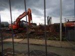
The New Norton Bridge Junction In Action
I was travelling between Birmingham New Street and Manchester Piccadilly stations on a Cross-Country train.
After leaving Stafford station, the train took the new route through Norton Bridge Junction on the flyover over the West Coast Main Line to j0in the line to Manchester. The Norton Bridge page on the Network Rail web site, links to this map.
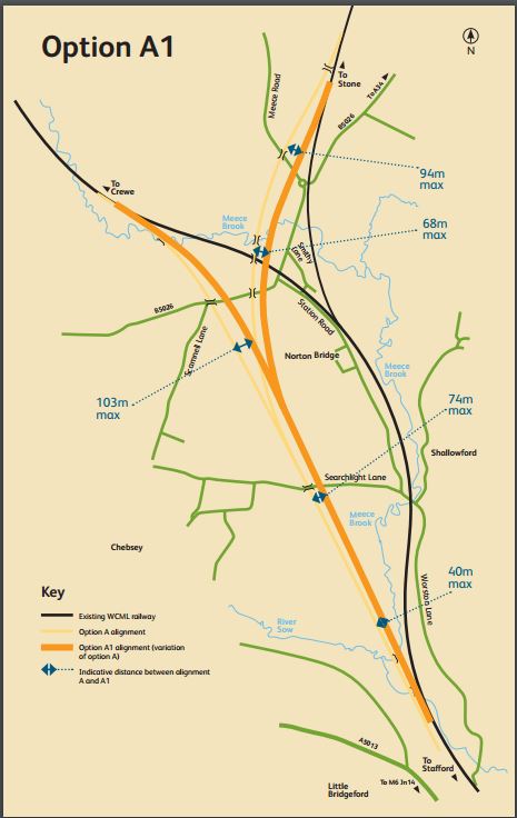
The New Norton Bridge Junction
Trains continuing up the West Coast Main Line take the black route, whereas trains to and from Manchester use the orange line and the branch to the North-East.
This pictures show my progression threough the junction.
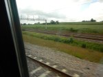
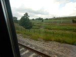
I was sitting on the right side of the train.
It looks like the new route is being electrified.
Would this mean that an electrified service could be run on the following route?
- Euston
- Birmingham International
- Birmingham New Street
- Wolverhampton
- Stafford
- Stoke-on-Trent
- Manchester Piccadilly
- Preston
- Carlisle
- Glasgow/Edinburgh
There is also a current electrified route, using the Crewe to Manchester Line and the Styal Line.
- Wolverhampton
- Crewe
- Manchester Airport
- Manchester Piccadilly
Throw in the Ordsall Chord and I suspect that Virgin Trains, TransPennine and Northern Rail have been looking at their traffic, to see if the reconfigured and electrified Norton Bridge Junction could be to their and Manchester Airport’s advantage.
It should also be pointed out, that much of the line from Preston to Crewe, Stoke and Stafford will have line speeds of on or about 100 mph and the new generation of trains like Aventras, Class 700s and Class 800s will be able to take advantage.
It seems to me, that the Norton Bridge Junction and Orsall Chord projects at £250 million according to this document and £85 million according to Wikipedia, respectively, will help to improve services all along the corridor from Preston to Rugby via Manchester, Manchester Airport, Wolverhampton, Birmingham and Coventry.
Only when you take a train from Birmingham to Manchester and look seriously at Norton Bridge Junction, do you realise its significance.
Midland Metro Arrives In New Street
These pictures show the Midland Metro and its new extension to Birmingham
New Street station.

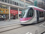

I’d taken a train to Birmingham Snow Hill station and my only criticism, is that the signage at Snow Hill didn’t indicate how to get to the new tram stop.
Knicker Twisting In Worcestershire
This article on Worcester News is entitled Worcestershire Parkway public inquiry shelved after pay-out.
It describes the latest round in the saga of getting Worcestershire Parkway station built.
Wikipedia says this.
On 21 February 2015 Worcestershire County Council advertised for contractors for the construction of the railway station to include platforms, station building, passenger footbridge and lifts with a commencement date of late September 2015 with completion in May 2017. On 25 August 2015 planning permission was granted, with work expected to have started in 2016.
A potential legal battle between Worcester County Council and Norton Parkway Developments, who currently own the land, started in 2016. Norton Parkway Developments has refused to hand over the land to the council as they feel that they are in a position to complete the development themselves.
So it seems like another row between a Council and developers over a station, to follow the one at Battersea.
It’s Not April The First
This story could be titled Architect Benedict O’Looney Discovers Lost Victorian Waiting Room In Peckham.
But in their article the BBC has used Peckham Rye station’s ‘lost’ waiting room to re-open after 50 years.
This is said.
It was once considered to be one of the grandest station waiting rooms in South London, but for decades the space at Peckham Rye railway station was bricked up and forgotten about.


Between Walthamstow Queen’s Road And Leyton Midland Road Stations
These pictures show the Gospel Oak and Barking Line (GOBlin) between Walthamstow Queen’s Road and Leyton Midland Road stations.


This part of the route isn’t as interesting as the section I covered in The Bridges Of Walthamstow.
Note.
- In my peek at Walthamstow Queen’s Road station, nothing much seemed to have happened at the station.
- The track in the Gospel Oak direction appears to have been removed and track replacement seemed to be happening in the region of the Baker’s Arms Bridge.
- The cutting is well-buttressed between the Shrubland Road Bridge and the relatively-new Alobert Road Bridge
- You can see pairs of piles for electrification gantries east of Queen’s Road Bridge.
- The embankment that carries the line through North East London appears to start around the Boundary Road Bridge.
- The railway arches don’t seem to be in the worst of conditions, even if they do have a touch of the Arthur Daley’s.
What I find strange about this line is the lack of a station at Bakers Arms. It’s not that there ever was one, but as the line crosses the major Lea Bridge Road and on this line, that is usually a good enough reason for a station, I’m surprised the Victorians didn’t build one.
The Barking Gospel Oak Rail User Group suggest one in this page on their web site.
There may be a lot of reasons to build a station at Bakers Arms.
- It is near to several new hotels and housing developments.
- It is better positioned than the two adjoining stations.
- It is well served by lots of buses.
- It is on a busy main road.
But contrary to that.
- The buses can take you to the better connected stations of Walthamstow Central and Lea Bridge, in under fifteen minutes.
- It might be a difficult site on which to build a station.
- Reopening the Hall Fsrm Curve may be a better option.
It should probably have been built, when one of the adjoining developments was constructed.
‘Wheelchair vs. Buggy’ Case Goes To The Supreme Court
The latest in this story from Wetherby is in this article on the BBC, which is entitled Supreme Court to hear ‘wheelchair vs buggy’ bus case.
I think it is interesting that this case comes from Wetherby, which I suspect doesn’t have such an intensive bus service as I have here in London or as there is in Manchester, Newcastle or Liverpool.
In London, I have never seen an argument over the wheelchair space on a bus, although I have seen some severe, but helpful reorganising, when a wheel-chair needs to be accommodated.
In London because bus frequencies are higher and there are generally shelters these days, I would suspect that most people, be they able-bodied, in a wheel-chair or with a buggy, accept that they may have to wait for the next bus.
But if there is only one bus an hour, it’s chucking it down and there’s no shelter, it’s more likely that passengers will refuse to co-operate.
So one way to mitigate problems like this, is to provide a better bus service, with more buses, better shelters and improved information.
But that all costs money!
I am not disabled, although I don’t drive because of an eyesight problem. I also because of my stroke, could have ended up in a wheelchair, so I sympathise, with those who have to use a wheelchair or electric buggy to get about.
I regularly, see passengers in wheelchairs use London buses, with their central entrance/exit, which leads straight into the wheelchair space. The design, also means the driver can deploy the ramp and do everything they need without leaving the cab. In loading a wheelchair, I’ve also seen buggy-pushers take advantage of the deployed ramp to get out of the bus to fold the buggy before getting back on.
But outside of London, where often the wheelchair user has to get in the front entrance by the driver, this creates all sorts of delays and I’ve seen on a crowded bus, virtually everybody on the lower-deck get off, to allow the wheelchair to pass through.
I wonder if outside of London, there is more resentment of wheel-chair users on buses, than there is in the capital.
In my view, all new buses should be designed for central wheelchair entrance/exit as this is so much more efficient.
I once had a discussion with a Manchester Buses union rep on a Manchester bus. He was all for the London system of no-money-on-buses, with a front entrance and central-exit passenger flow, as it cut attacks on staff.
Since then, London has gone even further and now with the ability to use any contactless bank card as a ticket, London now has one of the most advanced bus-ticketing system in the world.
We need a standardised bus-system all over the UK. It might actually encourage more people to use this often-neglected form of public transport, which would generate more revenue for a better system.
