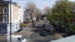
Police On The Trains/Tubes In South London
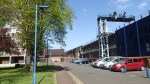
I came back from Wimbledon to Dalston Junction tonight, by taking a train into Waterloo and the a Jubilee Line train to Canada Water before taking the Overground north.
South of the Thames there were police everywhere, but from Canada Water onwards, I didn’t see any sign of the boys and girls in blue.
But I didn’t see any trouble either!
One officer told me they were being careful as it was Friday night. It all seemed to be effective!
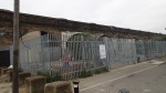
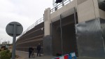
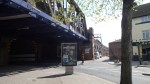
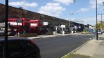
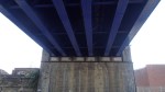
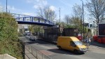
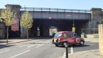
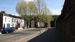
From New Cross To London Bridge
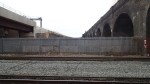
I took a train from New Cross to London Bridge to see if I could get any pictures of the Bermondsey dive-user works.
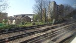
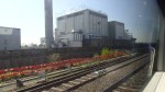

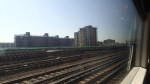
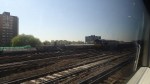
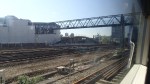
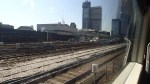
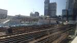

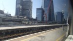
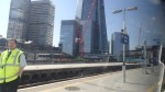
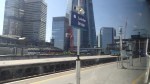
One think that is noticeable from the pictures, is the amount of space there is for the lines into London Bridge. At the present Thameslink isn’t running and it would appear there are two ready-ballasted tracks between the junction to New Cross Gate and London Bridge.
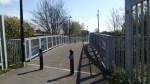
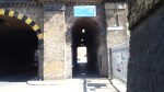
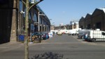
New Cross Station Is Finished
In a post last September, where I went up and down the East London Line, I took a few pictures of New Cross station. I changed trains at the station today and took these pictures.
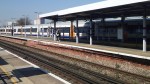
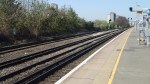
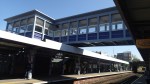

It certainly looks a lot better. The sun helped too!
My only problem with the station is that changing trains to go south after travelling from Dalston Junction is a walk across a platform and very easy, but return journeys mean a platform change over the bridge.
Perhaps one day, they’ll extend the East London Line trains to a proper terminal at another station. like Hayes as I suggested in this post, so northwards changes would be simpler.
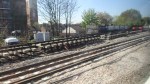
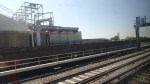
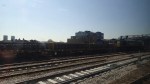
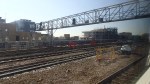
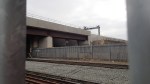
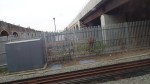
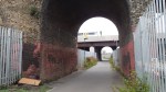
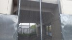
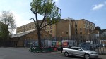
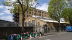
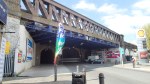
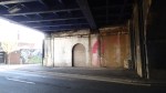
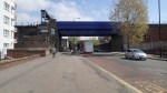
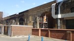
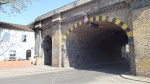
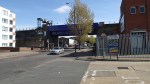
A Modern Take On Victorian Railway Arches
I took these pictures of the new viaduct that is being built as part of the works concerning the Bermondsey Dive-Under.


This artist’s impression is from Network Rail and shows the dive-under.
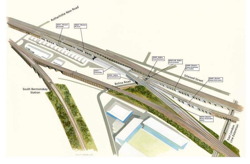
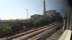
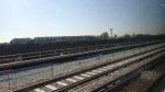
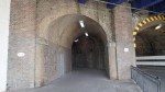
Bermondsey Dive-Under
I actually walked along the side of the East London Line Extension, which crosses under the three sets of railway lines running through the area, towards the right of the picture.
The two lines shown in my gallery are the two viaducts towards the top. Note how both are shown going into a concrete tunnel, with the other line, which will carry the Thameslink trains over the top. You can also see the viaduct being built in this Google Earth image.
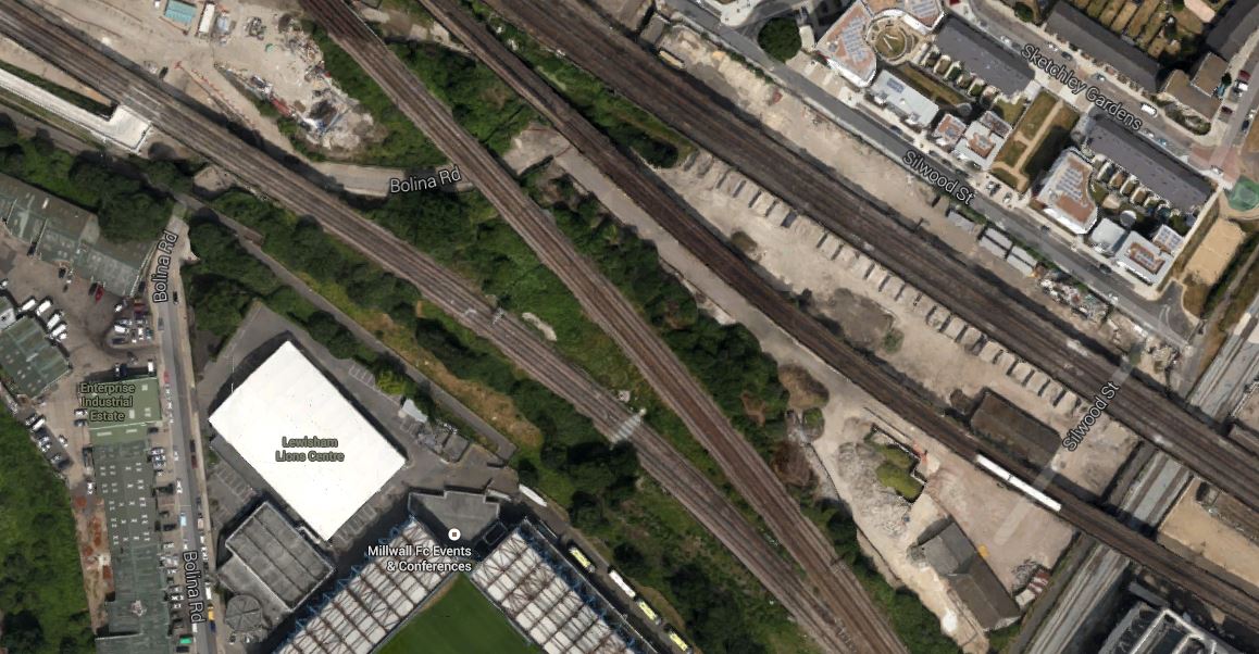
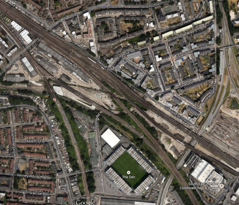
Bermondsey Dive-Under
I think the viaduct is being built alongside the rail line closest to the top-right of the image. Are the white shapes, the concrete shells of the arches shown in the gallery?
The sets of lines from top to bottom are as follows.
1. This set of lines along which I think the new arches have been built will take trains on the South Eastern Main Line between London Bridge and New Cross and on into Kent.
2. This set of lines also takes services between London Bridge and New Cross, although at the moment no trains are running on these lines.
3. This set of lines will take Thameslink services to New Cross Gate and beyond.
4. This set of lines links London Bridge and New Cross Gate.
It’s all very complicated and if anybody can correct anything or add more, please let me know.
I do think that untangling the spaghetti left by the Victorians, probably caused a lot of sleepless nights amongst Network Rail employees.
I also wonder, whether Network Rail will be creating small business units in the large number of new arches.
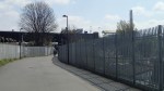
Would This Be The Easiest Station To Build In The UK?
Provision was made for Surrey Canal Road station when Phase 2 of the East London Line Extension was built a few years ago.
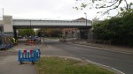
The pictures show that the work to create a new station wouldn’t be too great. They have decided to rename it to New Bermondsey station. The new station is close to Millwall FC as this Google Earth image shows.
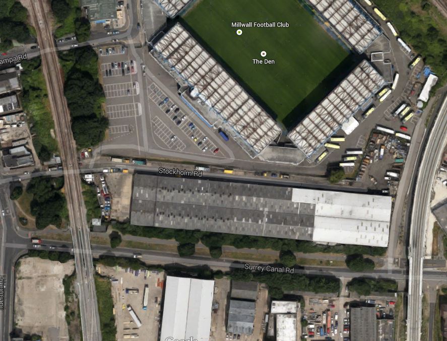
Millwall FC And New Bermondsey Station
The station is in the bottom right-hand corner of the image, where the railway crosses Surrey Canal Road and construction could start this year.
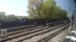
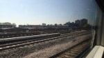
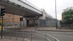
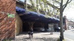
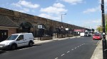
Exploring Around The Bermondsey Dive-Under
As the post entitled Uncovering The Past On Thameslink showed, the railway lines around South Bermondsey station are complicated to say the least and at the moment they are more so due to the construction of the Bermondsey Dive-Under. This Google Earth image shows the main viaduct out of London Bridge as it goes south east.
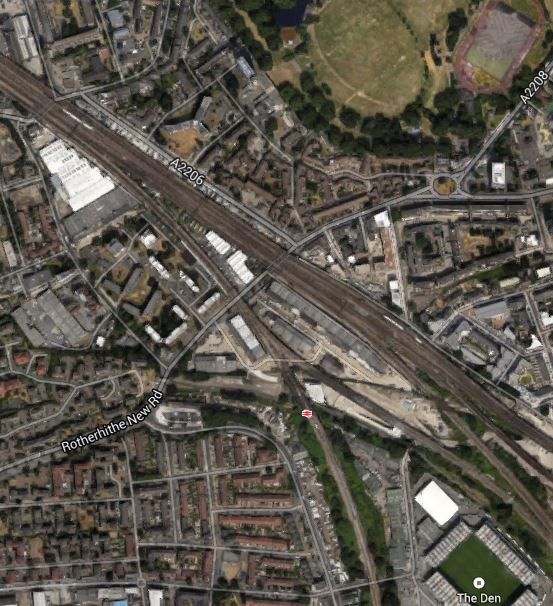
Exploring Around The Bermondsey Dive-Under
The top left corner of the image shows the old Peek Frean biscuit factory and at the bottom right there is Millwall’s ground. I took these pictures as I walked around.
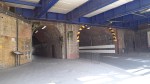

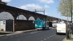


The arches are certainly a good example of Network Rail’s extensive collection of railway arches used for non-rail commercial pyrposes.
Uncovering The Past On Thameslink
The definition of archaeology according to the Oxford English Dictionary is.
The study of human history and prehistory through the excavation of sites and the analysis of artefacts and other physical remains.
So perhaps calling digging up an old nineteenth century station is stretching the definition a bit far.
But this report on the BBC web site about the uncovering of the disused Southwark Park station is fascinating none-the-less. This is an extract from the report.
The station was discovered as engineers constructed the Bermondsey Dive Under, which will see two Victorian viaducts partially-demolished and rebuilt to allow trains from south east London and Kent to dive down, under a new route carrying Thameslink services from Croydon.
There’s more here on the Ian Visits site and here on the Thameslink web site. This is a Google Earth image of the area.
Bermondsey Dive-Under
Note The New Den, which is Millwall’s ground and SELCHP incinerator to its right. The image highlights the complicated nature of the lines into London Bridge station. The line that runs between the football ground and the incinerator in a south-easterly direction is the Thameslink line between London Bridge and New Cross Gate. The smaller line that crosses this line at right angles is the Overground line between Surrey Quays and Clapham Junction.
Where this Overground line crosses Surrey Canal Road just off the bottom of this image, construction should start on the new New Bermondsey station later this year.
Southwark Park station was under the tracks , where Rotherhithe New Road crosses underneath.
Similar But Different!
London and Paris are rival cities and their two transport networks share some of the same characteristics.
But there are differences. The Paris metro was designed as a whole and was deliberately built with close stations, in a grid that covered the centre of the city. For political reasons, it was also built mainly in the city centre. This gives it various strengths and weaknesses that are different to London’s.
As a regular visitor to Paris, I’ve only ever used a bus once, whereas in the centre of London, I use them all the time. Is this because the Metro covers the centre in a denser manner than the London Underground does or is it because London’s buses have an unequalled bus information and mapping system.
In recent years, London has been building Crossrail and Thameslink, which are its version of the Paris RER and London has also developed a collection of run-down railways into the vaguely-circular London Overground. One of the aims of this railway, was to avoid going into the centre and out again, when you needed to go around the city.
So now Paris is developing the similarly laid-out Grand Paris Express, with similar aims. The layout is shown in this map.

Grand Paris Express
But there are differences. Whereas London has used full-size trains on existing railways with stations about two minutes apart, Paris is using smaller Metro sized trains calling at frequent stations and new tunnels and tracks will be constructed.
It’s a case of you pays your money and you makes your choice!
I think the only certainty, is that Paris’s ring Metro, will cost a lot more to build than it did to build London’s ring Overground. This article on Property Investor Europe says that the Grand Paris Express will cost ten billion more than the original estimate of twenty billion euro. That’s twice as much as London’s Crossrail!
The construction will also be a lot more disruptive, as new tunnels, stations and lines are built.
The West Midland’s Transport Map
I snipped this off the Network West Midlands web site.
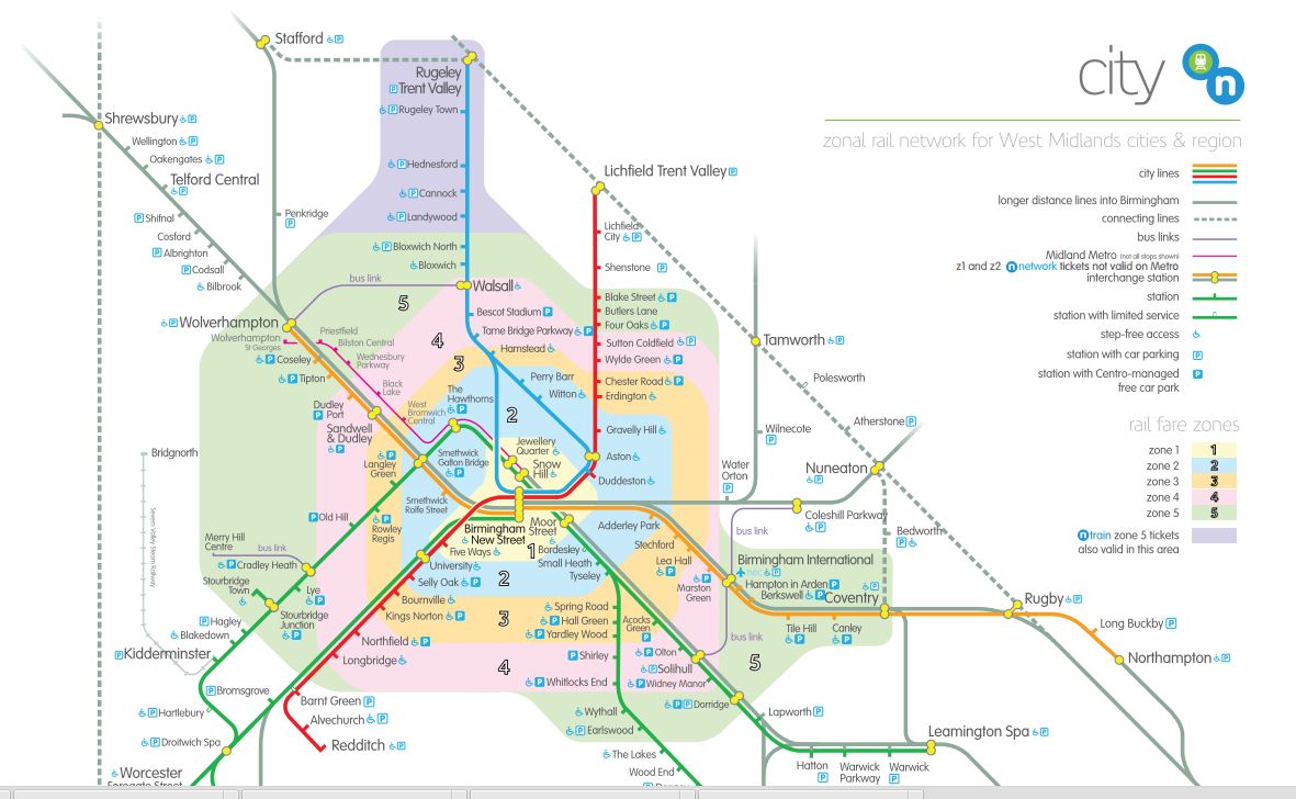
West Midlands Transport Map
Will it ever be as recognisable as the London map?
Up And Down The Lickey Incline
When I was growing up in the 1950s, books for boys, used to have pictures of massive steam or diesel locomotives working in twos and even threes to bring heavy freight and passenger trains up inclines in places like the Rocky Mountains and the Alps.
In the 1950s and 1960s, it was quite common to see two engines double-heading a freight train, but it is a practice you rarely see now, except in special circumstances. This video shows a single nuclear flask double-headed by two Class 57 locomotives.
Occasionally, in places in the world, where there are steep gradients, an extra banking engine will be added at the rear to help push the train up the incline. You can imagine it, whilst crossing serious mountains or possibly even on the the Highland Main Line, where I rode in the cab of an InterCity 125 from Edinburgh to Inverness.
But you wouldn’t think you’d see this technique on the south-west approach to Birmingham from Bromsgrove!
You would be wrong, as this video shows. It was uploaded in 2007.
It shows a Class 66 locomotive taking a coal train up the Lickey Incline, assisted by a similar locomotive at the rear. If you search YouTube for Lickey Incline, you’ll find some real engineering pornography, like massive steam locomotives being assisted by four smaller tank engines.
But in a few years time, the pictures will all be different, as the Cross-City Line from Lichfield via Birmingham is being electrified to Bromsgrove and Redditch. Bromsgrove will also be getting a new four-platform station, which should open in November according to this article in the Bromsgrove Advertiser. Three new Class 350 trains have been ordered to provide a much-improved service, of three trains an hour to each of the two southern termini.
It looks like the improvements to the southern end of the Cross-City line with come out at around £65 million and the new Bromsgrove station at £17.4 million according to various reports on the Internet.
I would think this investment is money well-spent, as the line is the busiest commuter railway outside London.
I think that if the next government devolves transport to local areas, then other projects like this will be undertaken in the West Midlands.
For example, the reinstatement of passenger services on the Camp Hill Line is a long term aspiration of the city.
