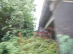
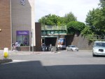
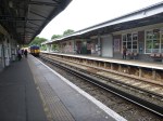
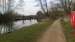
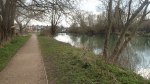
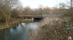
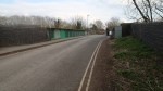
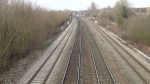
Between South Tottenham And Crouch Hill Stations
The stretch of the Gospel Oak to Barking Line between South Tottenham and Crouch Hill stations is almost rural, as the pictures show.


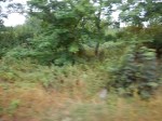


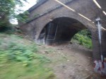
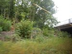

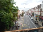

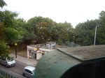
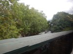

Note the pictures where the line passes over the junction of Seven Sisters and St. Ann’s Road, which was the site of the former St. Ann’s Road station. This Google Map shows most of the route of the line.
The GOBlin In North London
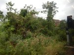
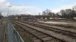
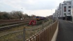
The area between St.Ann’s Road and South Tottenham stations, has been mentioned for a possible Seven Sisters station on the GOBlin, in Transport for London’s Plan for 2050.
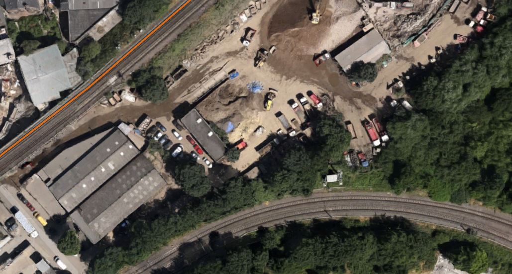
The only things there at present is a lot of overgrown land and a Wickes store. It must be ripe for development as much-needed housing with a station on the GOBlin and a walking connection to the current Seven Sisters station for the Lea Valley Lines, the Victoria Line and in the future Crossrail 2.
Properly developers could make a lot of money here and the only complainers will probably be the low life who use the scrubland for nefarious purposes.
Could The Gospel Oak to Barking Line Transform East London?
Two reports on the web prompted me to write this post.
The first was an article on CityMetric entitled Forget Road Bridges. TfL Should Extend The Overground To Thamesmead And Abbey Wood, which prompted me to write No To Silvertown Tunnel.
The second report was on various web sites with headlines like Enfield Council Shortlists Developers For Meridian Water.
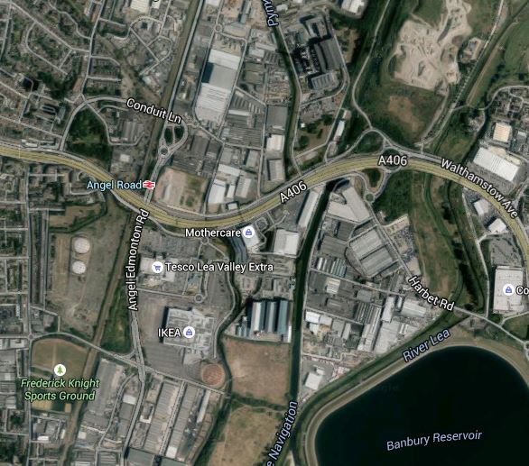
Enfield Council is planning to build substantial numbers of new homes at a 85 ha site called Meridian Water near Lee Valley Regional Park over the next couple of dcades.
To help the development at Meridian Water, the station at Angel Road is to be improved and this page on the Meridian Water web site gives details. This extract details the development of the station and the related rail line and transport interchange.
The station will be a thriving new hub that combines rail and bus services to provide better access to Meridian Water for future residents and businesses. Meridian Water is a new £1.5 billion, 85 hectare, eco-development which will provide up to 5,000 new homes and up to 3,000 new jobs. The improvements, which will be completed in the next five years, will bring benefits for those that currently live and work in the area, as well as the new residents of the Meridian Water development. The project is being funded with £2.5 million from the Greater London Authority with a further £1 million from Enfield Council. This new station combined with additional investment in three tracking the railway, will bring forth a four trains per hour service at Angel Road Station.
All good stuff and very much about motherhood and apple pie in the manner of the way that the Metropolitan Railway used to sell Metroland.
But let’s not knock it for that, as London needs lots of new housing and the current station, Angel Road, which will be renamed Meridian Water, is one of the worst transport interchanges in the UK,. They’ve probably got better stations in many of the worst slums in The Third World.
Angel Road is just two platforms and a bridge as Before Crossrail 2 – Angel Road shows, whereas the average station in deepest Africa or South America, probably has at least someone, who’ll help you or sell you a tasty local morsel or a bottle of fizzy drink.
Whilst looking at developments in this area, it is worth looking at the wider area and investigate how transport links might develop. This Google Map shows the Lower Lea Valley from Angel Road and Meridian Water in the North to Lea Bridge Road in the South.
Lower Lea Valley
In addition to the housing developments at Meridian Water, more housing is being developed around Tottenham Hale station and other places in the area. But the development that will have the biggest impact on the area is not these developments but Thames Water and Waltham Forest’s massive plan to create the Walthamstow Wetlands. The project web site has this strap-line.
Transforming Walthamstow Reservoirs into a new urban wetland reserve for London
I have written about the Walthamstow Wetlands before in Before Crossrail 2 – Walthamstow Wetlands and now the project has its own web-site, I shall be following this exciting project a lot more. I believe the project has a lot going for it, but also it could be very important for Thames Water, who over the last few years haven’t exactly had the best of publicity at all times, what with our water bills and the Thames Tideway Scheme.
Because so much of London’s water is stored in the Lea Valley, it is very much in their interest to be good neighbours to the people and wildlife of the area.
The map also shows the rail links through the area.
1. The Lea Valley Lines
The Lea Valley Lines go northwards from Liverpool Street, Stratford and Hackney going up to Broxbourne, Hertford, Cambridge and Stansted Airport and as indicated earlier, extra tracks are being added and stations like Angel Road are being upgraded. A new station at Lea Bridge is also being built.
2. The Victoria Line
The Victoria Line goes underneath the area and links Central London to Tottenham Hale and Walthamstow. The line was built on the cheap in the 1960s and I have dreamed of what might have been. This August the line is closed to rectify one of its shortcomings, which will increase the capacity of the line.
3. The Chingford Branch Line
The Chingford Branch line crosses the Lea Valley Lines and the Walthamstow Wetlands as it links Chingford to Hackney and Liverpool Street. It is a line that can’t be extended, but there are plans to link it to the Lea Valley Lines by reinstating the Hall Farm Curve to allow trains to run from Stratford and Lea Bridge to Walthamstow and Chingford.
4. The Gospel Oak to Barking Line
The Gospel Oak to Barking Line (GOBlin) is the forgotten and down-trodden Cinderella, who could gatecrash the party in the Lea Valley and be a star of East London’s transport system.
Over the next few years, the following will or may happen to the line.
- Electrification
- Extension to Barking Riverside
- New four-car electric trains
- Smaller numbers of day-time freight trains.
- Increased passenger train frequency
The first three are hopefully cast in stone, as to cancel them now, would probably cost more than doing them. Especially, as the new trains have been ordered.
I am hopeful, that once the line is upgraded and electrified, this will enable freight operators to switch to electric traction, that could mean quieter services that might possibly run through at night.
As an aside, if I was standing for London Mayor, I would say I would put a limit of perhaps two non-electric trains a day on both the GOBlin and the North London Line. The freight operators would protest, but Class 66 locomotives have no business going through residential areas and crowded stations. Especially, when environmentally acceptable locomotives are available.
If the number of day-time freight trains could be reduced, this would allow more passenger services.
5. Crossrail 2
Crossrail 2 will have a big impact, when and if it arrives, as it will serve Tottenham Hale, Northumberland Park and Angel Road.
Before I finish this post, I have to ask, if we are doing enough with our transport network to serve large developments like Meridian Water, the Walthamstow Wetlands and Barking Riverside.
So what would I look at?
1. Crossrail 2
Politicians of all colours and tendencies are putting their faith in Crossrail 2.
But, I believe that the line, although surveys show it is much-needed, is a bit like the US Cavalry in a 1950s film, arriving in force after the poor settlers or ranchers have virtually been wiped out by the Indians.
We should prepare for Crossrail 2, so that all the engineering and architectural connections are there and all surface stations are upgraded over the next few years. This would mean that building Crossrail 2 would be just a matter of accurately threading the needles and then linking the tunnels to the existing stations.
Perhaps we should think of Crossrail 2 as a series of closely-related projects, rather than one huge mega-project.
- The main tunnels from Walthamstow Marshes to Wimbledon.
- The rebuilding of Central London stations to make them Crossrail 2-ready. Tottenham Court Road is already awaiting the tunnellers.
- The upgrading and rebuilding of the surface stations and rail infrastructure.
The great advantage of this, is that political responsibility for a lot of the work like the upgrading of surface stations, can be shared with the relevant Local Authority.
This post started with Enfield Borough Council and the Meridian Waters project and wandered into rail infrastructure, because Angel Road station is an important part of that project.
I doubt I’ll ever live long enough to see the opening of Crossrail 2. But I live in hope!
2. Improving Connectivity On The Gospel Oak to Barking Line
The Gospel Oak to Barking Line hasn’t got the best connectivity to other lines and it is also blessed with some difficult out of station interchanges for even strong walkers.
Walthamstow is an example, where the walk between Queen’s Road and Central isn’t that long but it is tortuous. This Google Map shows the area.
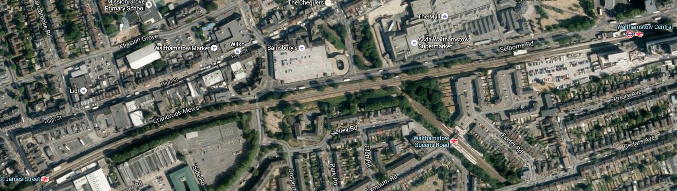
Walthamstow Stations
The East-West line is the Chingford Branch, with St. James Street station in the West and Central in the East. Croosing this line is the GOBlin with its station at Queen’s Road.
Surely something better could be done in Walthamstow. Interchange for someone pushing themselves in a wheelchair would be very difficult.
There is also an out of station interchange between Wansted Park on the GOBlin and Forest Gate on the lines out of Liverpool Street, which in a few years time will be Crossrail. This map shows the area.

Wanstead Park And Forest Gate
It is an area, where some selected development could be of value, especially as the GOBlin passes over the Liverpool Street Lines. I’ve walked this interchange a couple of times and the following would help.
- Step-free access at both stations. Forest Gate is getting this with Crossrail.
- A light-controlled crossing at Wansted Park station
- A minor rerouting of the buses so that some passing through the area stop at both stations.
This would mean that someone pushing themselves in a wheelchair could use the interchange.
One station that needs to be improved is Blackhorse Road, which connects the GOBlin to directly to the Victoria Line. This Google Map shows the area.
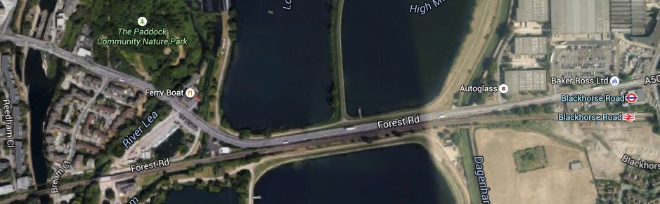
Blackhorse Road Stations
Note that the station site is not particularly cramped and it would be a not-to-difficult walk to the Walthamstow Wetlands, especially if you could hop on a bus for a couple of stops.
There is also the possibility of an improved station at Harringay Green Lanes, where a large amount of property development is possible according to this document on the Harringey Council web site. I talked about the possibilities in The Piccadilly And Victoria Lines, Manor House Station And Harringay Green Lanes Station, where I believe a flagship station could be built across Green Lanes.
This section in the Wikipedia entry for the GOBlin, lists other ideas for extra connectivity for the line.
But I believe there are three other important interchanges that will or may happen and I describe them in the next three sections.
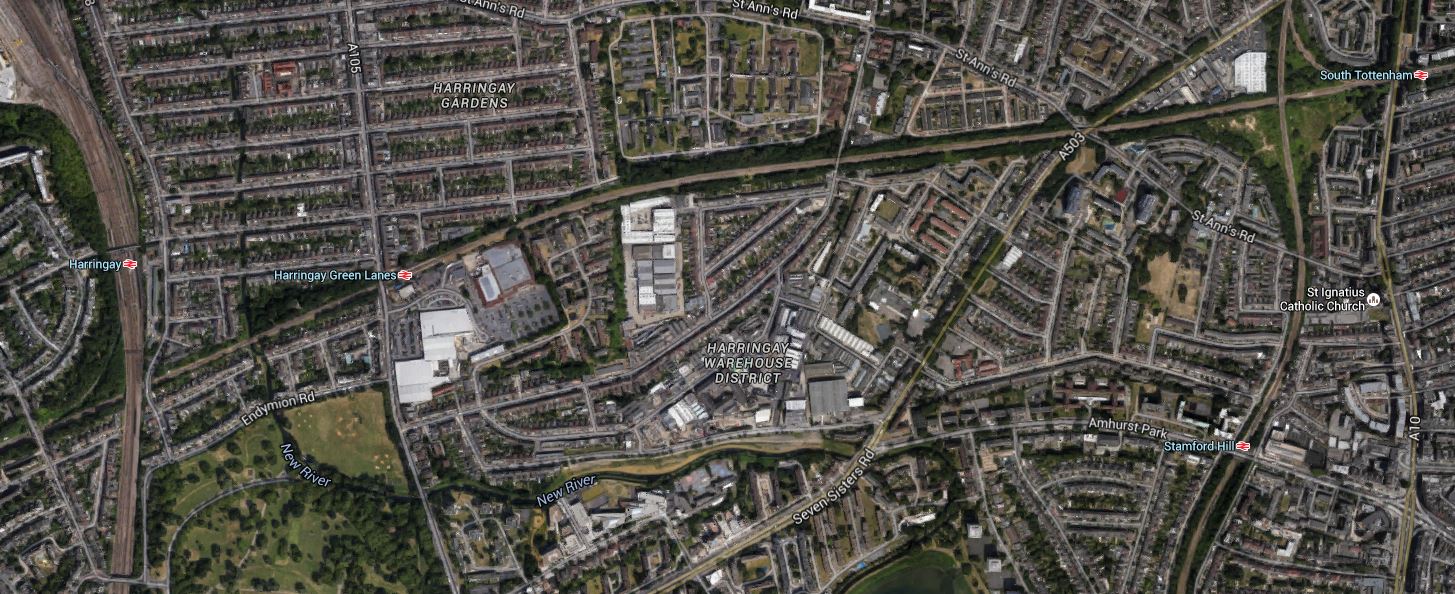
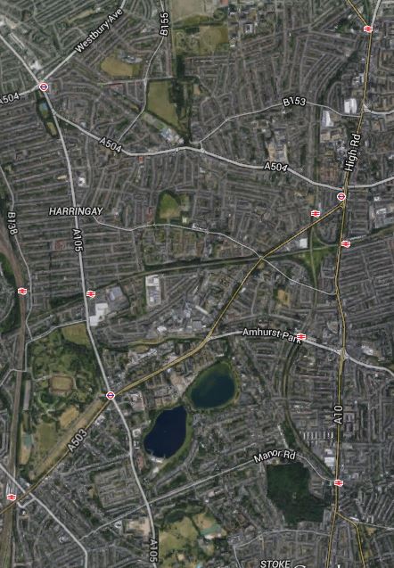
3. Seven Sisters Interchange With Gospel Oak to Barking Line
Transport for London’s Plan for 2050, has a section in an Appendix with the heading of News links and/or Stations for Strategic Interchange. In a list of places where this might be done are the words Seven Sisters (GOB). Seven Sisters station is currently a valid out of station interchange with South Tottenham station on the Gospel Oak to Barking Line. In Crossrail 2 At South Tottenham/Sevens Sisters, I speculated as to how the two stations could be linked by a large double-ended Crossrail 2 station. This Google Map shows the two stations.
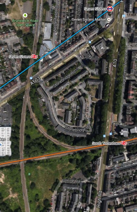
South Tottenham And Seven Sisters
There are also other possibilities here, like building a new station, housing or commercial development or allowing trains to link from the Northbound Lea Valley Lines through Seven Sisters to the Eastbound GOBlin. But whatever happens here, the GOBlin will eventually be linked to the Victoria Line and Crossrail 2.
Search the Internet and You’ll find little about this project, which is just two words buried in a TfL report.
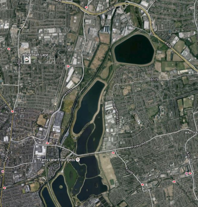
4. Extending The GOBlin To Angel Road
This is speculation on my part, but the Meridian Water development will need more than just the one station at Angel Road. As the GOBlin goes across the southern part of the development site, is there an opportunity for an innovative connection through the development to Angel Road? This is a Google Map of the area from Angel Road in the North to Blackhorse Road in the East.
Blackhorse Road To Angel Road
The connection might be difficult for a train, but use a Class 399 tram-train and it could twist and turn its way between Blackhorse Road and Angel Road stations amongst the reservoirs and the developments to serve both those developments and the Walthamstow Wetlands.
5. Extending The GOBlin To Thamesmead And Abbey Wood
In No To Silvertown Tunnel, I examined the possibilities of extending the GOBlin from Barking Riverside over or under the Thames to Thamesmead and Abbey Wood station, where it would join up with Crossrail.
I felt that this would best be done using Class 299 tram-trains as they could go walk-about on both sides of the river giving much needed connectivity to the housing on both sides of the river. If it could be done, I felt that a bridge shared with pedestrians and cyclists would be the best way to join the two banks of the Thames.
6. The Hall Farm Curve, High Meads Loop and Dalston Eastern Curve
These three curves, if reinstated for passenger trains would create routes between the Chingford Branch and Lea Bridge, Stratford and any desirable station to the West. Reopening the Dalston Eastern Curve would give access to the East London Line for Crossrail at Whitechapel and South of the Thames.
As there could be spare capacity on the East London Line, which has been designed for twenty-four trains per hour, there could be a myriad of ways it can be used to increase the services under the Thames, so what Transport for London might do would be pure speculation on my part.
But I think they will eventually use these three curves to improve services in the Lea Valley.
7. Tram-Trains On The GOBlin
This may seem a bizarre idea, but having seen these hybrid vehicles all over Germany, I believe tram-trains are the way to add extra destinations to core electrified lines. On the Gospel Oak to Barking Line, in addition to being used to connect to Angel Road, as I showed previously, they could also be used with a tunnel or a bridge to extend the line from Barking Riverside under or over the river to Thamesmead and Abbey Wood.
People might worry that when running as trains, they may need different stations to the other trains, but the Germans seem to be able to design stations that accept both vehicles and I suspect the planned Rotherham extension of the Sheffield Supertram, will come up with solutions applicable to our standards. As to the required overhead lines, the Class 399 tram-trains can run using any of the voltages used for trams and trains in the UK.
There may be other places on the GOBlin and the other rail lines in East London, where tram-trains could be used effectively.
This will obviously be up to the planners, but I will be very surprised if tram-trains don’t infiltrate there way into many places all over the UK. At the moment transport planners, haven’t the experience of seeing a well-designed tram-train system working in the UK, but after what I believe will be a successful trial in Rotherham, I think we’ll see planners embracing the technology with open arms.
Conclusion
The GOBlin won’t be Cinderella any more!
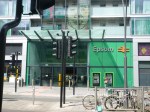
Before Crossrail 2 – Epsom
I knew that Epsom station had been given a new building, but this modern creation surprised me.
This Google Map from a couple of years ago, shows the layout of the tracks and platforms.

Epsom Station
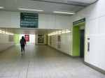
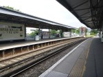
The bridge over Waterloo Road certainly needs rebuilding for Crossrail 2 and the platforms will have to be lengthened. Will two terminal and two through platforms be enough for this busy station?
It may not be for everywhere and everybody’s taste, but plenty of stations could be improved by modern developments such as this, especially if in some places they use the space over the railway. Read this news item in the Epsom Guardian, which describes the opening celebration, which says the following about the development.
The £20m development, which has revamped the station’s ticket hall, facade, car park, waiting shelters, toilets and cycle storage, was carried out by Network Rail and developer Kier, in partnership with Solum Regeneration.
Its new shops, hotel and apartments, which include some affordable housing units, have funded the development.
So it looks like Epsom got functional modern station building, with an impressive list of facilities, at a very affordable cost.
The provision of a low-cost chain hotel in the development, is being seen increasingly often. Two London stations I use regularly; Dalston Junction and Walthamstow Central, have both had similar hotels to Epsom built in the last few years.
The developers, Solum Regeneration are a partnership between Network Rail and Kier. The latter is the fourth largest construction company in the UK.
The company seems to be associated with several station redevelopments.
If you read the news page on the Solum Regeneration web site, you’ll find developments at Christchurch, Guildford, Haywards Heath Redhill, Twickenham and Walthamstow Central.
If you read some of the comments in local papers on these developments, the locals are do object, often to the height of developments. But you have to ask, if they would prefer a run-down station with no facilities, which costs a fortune to run and just puts up the price of rail tickets.
I do wonder how many of the objectors, live comfortably in large houses and never use the train.
I wonder too what reaction some of Underground stations designed by Charles Holden, that we laud today as magnificent, got in the 1930s.
Some of his creations like Oakwood, Cockfosters and Turnpike Lane look incredibly stark even today and some can be rather draughty places. But these were practical buildings for a purpose and we are now generally proud of them.
We probably won’t give Listed status to stations like Dalston Junction, Epsom and Walthamstow Central, but as we use them, we’ll say that this is a lot better than it was and speeds me on my journey. We mustn’t forget that stations are functional buildings and they must be pleasant places to pass through and of course work.
Property development is one way to pay for a nice new station and if we don’t like it, we should make sure the Council looks after our interests.
Before Crossrail 2 – Meridian Water
Meridian Water is a large property development in North London which sits in the curve of the North Circular Road between Edmonton and Walthamstow, with the large Tesco and IKEA stores on its Southern boundary and the Edmonton incinerator to the North. Wikipedia describes the current site like this.
The Meridian Water development site is centred 1.2 km south east of the town centre of Edmonton Green. It comprises an area of approximately 0.82 km², 0.72 km² of which is land capable of development.
In economic geography the site consists largely of vacant or ailing industrial/transport use, and in natural geography is characterised by the waterways of the mid-Lea which pass through or beside it to the east: theRiver Lee Navigation, the Lee Diversion, the River Lee Flood Relief Channel, and Pymmes and Salmons Brook.
It is very much a part of North London, that is not doing its best to boost the prosperity of the city. The developers have a £1.5billion plan for the development of the site. This Google Map shows the area.
Meridian Water
Most of the site is between the North Circular Road and the various rivers and canals, although a portion is on the north side of the A406. This aerial photograph with the development marked in red comes from this page on the Enfield Council web site.
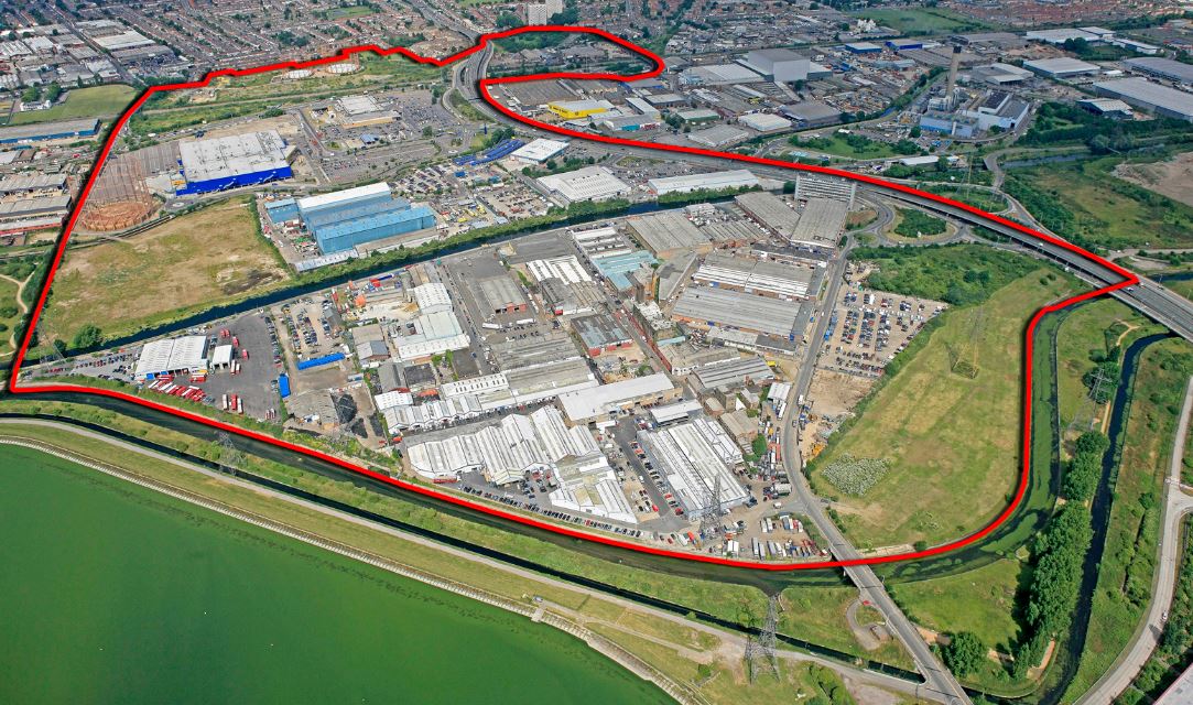
Aerial View Of Meridian Water
What has this massive development got to do with Crossrail 2?
Note the loop in the red boundary to the top of the picture. That encloses Angel Road station, which is clearly shown on the Google Map.
Meridian Water needs good transport links and this report in the Enfield Independent describes what Enfield Council and the developers are doing about it.
Enfield Borough Council has named the firm it has chosen to turn Angel Road Rail Station into a ‘thriving’ new hub.
Atkins, a global design and engineering firm, has been chosen to design the new rail and bus terminal, which will see an increased service of four trains per hour.
It is also stated in some place that the station will be renamed Meridian Water.
As Angel Road is on the list of probable Crossrail 2 stations in the Lea Valley, only a stupid developer would not want to have their development directly linked to Crossrail 2 and all the cornucopia of destinations it brings.
I also wonder how much the developers would pay to have the upgraded Meridian Water station, as a terminus, from where trains could turn back under London.
Green Scars Across East London
When the Lea Valley Lines were built across East London in the 1800s, they didn’t seem to box them in with houses, like they did elsewhere in the capital.
This Google Earth image shows several stations between Bruce Grove in the North, Harringay Green Lanes in the West and Stoke Newington in the South.
Green Scars Across East London
Note the green scars between the stations, where the lines often take up quite a small part of the available land. Look at this Google Earth image of the area between Seven Sisters station and South Tottenham station.

Seven Sisters
Surely, the development possibilities for this space, when linked to a new station are endless, even if you just develop a park.
Sorting Out Highbury Corner And Highbury And Islington Station
Highbury Corner is an important transport hub in Islington, where traffic from the City starts to squeeze up the A1 to get North. It also contains the important but badly-designed rail station of Highbury and Islington. This Google Earth image shows the area.
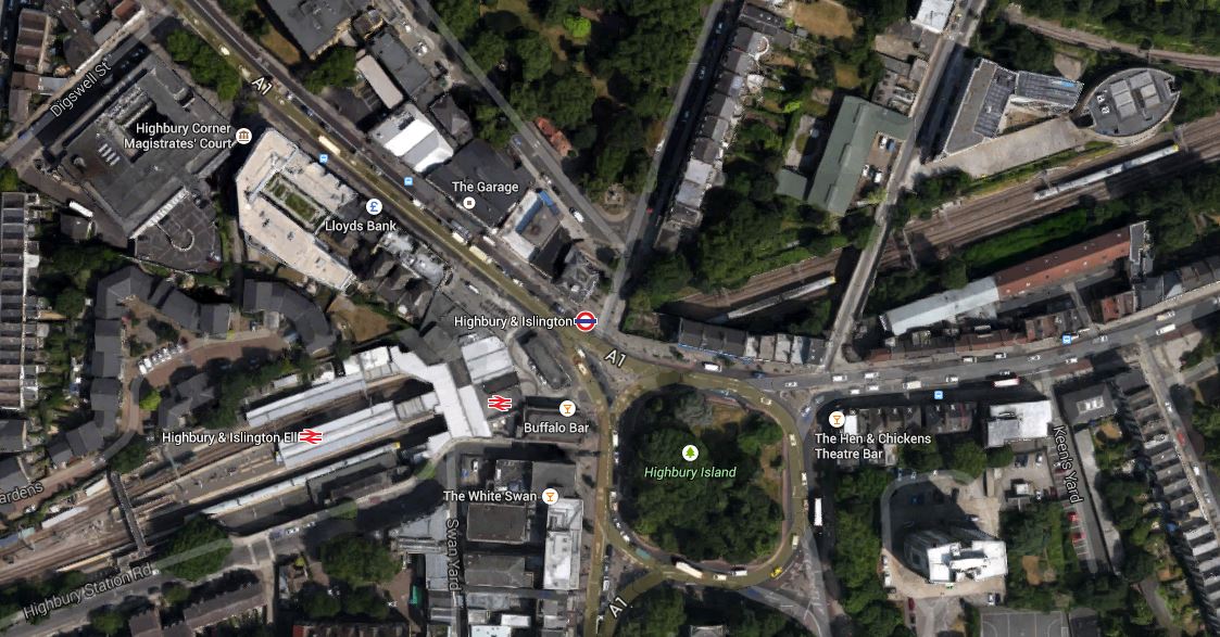
Highbury Corner
Note the green space named as Highbury Island in the middle of the junction with traffic going all the way round in both directions.
The road leading off to the North West (top-left) is the A1, which goes up the Holloway Road to Archway, which is another major junction, that needs a good sorting. The road leading to the East is St. Paul’s Road, which leads to the Balls Pond Road and Dalston Junction. The roads leading to the south from the island are extremely congested at all times and all the way to the Angel and Old Street respectively. They are the sort of roads, that make me glad, I don’t drive any more.
The junction is a pedestrian’s nightmare, as you are constantly crossing busy roads on light-controlled crossings.
What I find particularly difficult is that to get from the stop where buses from my house arrive in St.Paul’s Road to Highbury and Islington station involves two road crossings. It’s so tiresome, that often if I need the Victoria or Northern City Line at the station, I’ll walk to Dalston Junction station and get the North London Line for two stops. Coming home, I’ll get the North London Line back to Dalston Junction and then get any of four buses back towards Highbury Corner to my house.
It’s not quicker, but it’s certainly easier and definitely more pleasant in bad weather.
This illustrates how bad Highbury Corner is for buses, which like the vehicle routes need a very good sorting.
Add to this that Highbury and Islington station is a dreadful 1960s station, that has inadequate access to the two deep lines. To be fair though, access to the four London Overground platforms is a lot better. I have written before that there could also be access to these platforms from the other end, but that may well happen, when a new station is developed.
At the present time, work is ongoing to clear the area in front of the station, by removing the old Post Office, before the main bridge that carries the A1 over the railway is replaced.
In July 2004, Islington Council produced a planning framework for the area. It is packed full of information and some worthwhile proposals.
It suggests the following.
1. Giving public access to Highbury Island and turning it into a green oasis with facilities.
2. Proposals to simplify the traffic flows, with a strong hint, that traffic on the Western side of the Highbury island be closed off.
3. In the rebuilding of the station, it says that building could incorporate extensive development over the North London Line tracks for residential or other purposes.
4. Using the old Highbury and Islington station on the North side of the junction to create a new access for escalators and lifts to the lines deep under the station.
The report also told me, the purpose of the strange elliptical building on the north side of the North London Line, which is at the top-right of the Google image. It’s the vent shaft for the Channel Tunnel Rail Link.
Hopefully, in the next few years, we’ll see the sorting out of the area.
1
Crossrail 2 At Tottenham Hale
As regards Tottenham Hale this has been said recently.
A new tunnel entrance south of Tottenham Hale station to take the line from above to below ground
This is Crossrail 2‘s map of the area, which I obtained from this page on the Crossrail 2 web site.
Crossrail 2 At Tottenham Hale
Tottenham Hale station is at the top of the map and the Lea Valley Line to Liverpool Street and Stratford goes down the map. The other railway going across the map is the Gospel Oak to Barking Line. Note the curve that makes a triangular junction that encloses a large amount of safeguarded land, which is shaded and bounded in red. This is a Google Earth image of the area south of Tottenham Hale station.
South Of Tottenham Hale
I’ve tried rather badly to match the two maps, but it does show that there would appear to be enough space to fit a tunnel portal into the area. This is a detailed look from Google Earth of the eastern end of the land enclosed by the triangle of lines.
Industrial Land At Tottenham Hale
As the safeguarded route moves away to the west from here to join the New Southgate branch of the line, it is probably in this downmarket industrial area which appears to be a depot of some sort, that the Crossrail 2 tunnels will emerge. I actually put up a post entitled Could This Be Where Crossrail 2 Is Dug?, which shows this area.
As a site from where to build the tunnels, it has a lot to recommend it.
1. It is well served by railways and the River Lee and the related substantial canal, so it would be unlikely that there would be many heavy lorries associated with the construction.
2. There is little housing in the area and it would appear few or even none will be needed to be demolished for the construction. The only sensitive area would possibly be Markfield Park with the recreational developments and steam engine by the River.
3. There is plenty of space to create a surface junction with perhaps a flyover for operational reasons to connect to the Lea Valley Lines. On the other hand, the tunnels may turn north underground and just emerge alongside the Lea Valley Lines.
4. Perhaps crucially though, Tottenham Hale station, the Tottenham Hale Retail Park and the surrounding area are the subject of a big development to create almost a new town centre in South Tottenham, which I talked about in this post. I doubt this development will not be built to be totally Crossrail 2 ready.
Looking at these maps in detail, I can’t help feeling that in a few years time, there will be something special in this area, given that Thames Water and Waltham Forest Council are developing the reservoirs to the south-east of Tottenham Hale station into the Walthamstow Wetlands.
Some maps have shown Crossrail 2 surfacing north of Tottenham Hale station. This Google Earth image shows the area.
North Of Tottenham Hale Station
The strange structure underneath the lines through the station is the tunnel portal for the Victoria Line, where trains go to and from the Northumberland Park Depot.
I think the image shows why the Crossrail 2 tunnel portal can’t be north of the station.
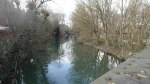
A Walk From Oxford Station
At Oxford station, I took a walk in a loop by the water and then along the railway, before crossing it on a bridge and returning along the Oxford Canal to the station.


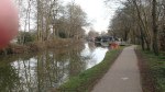
It is a good walk, but it does need a few maps and fingerposts. This Google Earth image shows where I walked.
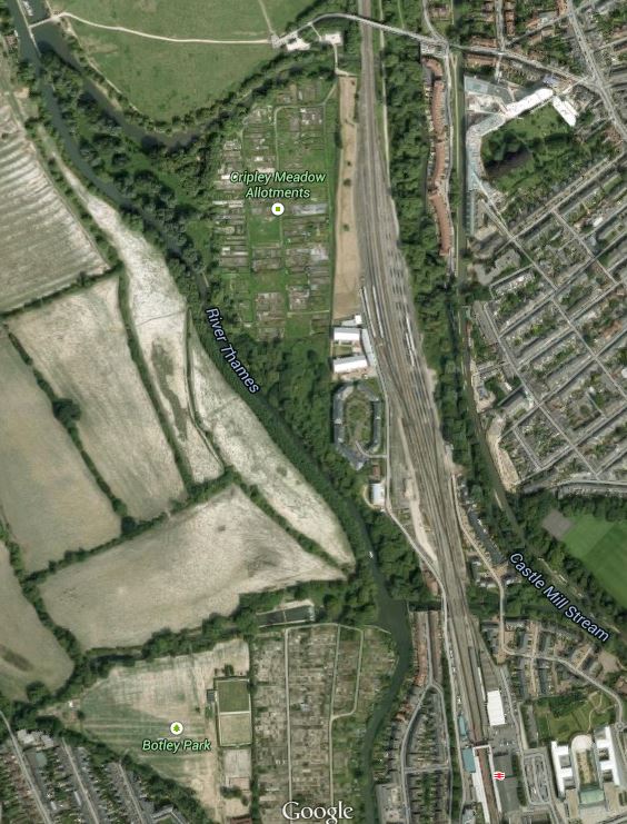
North Of Oxford Station
Note the bridge at the top and the station at the bottom.
I only took about an hour to do the walk and my main aim was to investigate the railway north of Oxford station, but Oxford station would certainly be a good place to start a walk either into the city or along the Thames or the Oxford Canal.
One thing that the walk showed me, was how much railway land there is in the area and with all the developments in services to the station, I’m sure it will be put to good use.
In some of the pictures you can see the Castle Mill development, which was nominated for the 2013 Carbuncle Cup.
From the railway side it looks fine, but I suspect from the river it grates in some peoples’ minds.
There is a noise debate rumbling on about the railway, which hopefully electrification will kill. But there will still be quite a few Class 66 hauled freight trains going through.
Will Brent Cross Thameslink Station Get The Go-Ahead?
This was said in this article in the Standard last night.
At the same time, the Chancellor is promising a £97 million downpayment for a new station at Brent Cross, a major redevelopment area highlighted in his National Infrastructure Plan with last December’s Autumn Statement. It could help start construction of 7,500 homes. Another £7 million will go to the Croydon growth zone, aiming to create 4,000 homes. A further £1 million will fund the new London Land Commission to help create a “Domesday Book” of surplus public-sector land and brownfield sites for redevelopment.
London desperately needs more housing and building it around the Shopping Centre and a new Brent Cross Thameslink station at Brent Cross, astride the North Circular Road on surplus railway land must be a good idea.
This is a Google Earth image of the area.
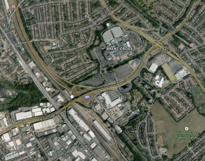
Brent Cross
The Midland Main Line on which the station will be built runs north-south at the western edge of the image, with Hendon station just visible at the top beside the M1.
The Shopping Centre is clearly marked and the A41 passes beside it towards the east.
The whole area is dominated by the roads and flyovers of the M1, A5, A41 and North Circular Road, which are choked with traffic. As the developers of the new Brent Cross Cricklewood development are spending £4.5 billion over the next twenty years and have stated they are improving the roads and other transport links in the area, together with creating four new parks, could we see all of these roads either buried in tunnels or more likely roofed over so that all traffic is put out of sight and mind?
According to the development web site, one of first things being done is this.
Renew and revive Clitterhouse Playing Fields and Claremont Park creating two beautiful community parks, as well as starting to create Brent Riverside Park.
Let’s hope this defines how they mean to carry on. Clitterhouse Playing Fields are at the south-east corner of the Google image.
The developers and their architects could have great fun with this development.
Looking at the position of the station, one place to put it could be where the Midland Main Line crosses the North Circular Road in an echo of how Blackfriars station was recently rebuilt over the Thames.
I can see in my mind, a shining glass palace with a roof garden above the roads with an enormous red rail sign, saying “I’m Brent Cross Thameslink, Ride Me!”
It would be the signature for the whole development.
The new station would also be a major interchange where passengers to and from the East Midlands and South Yorkshire changed between the new electric trains on the Midland Main Line and London’s rail system.
Why Public Transport Development Is Good For Everybody
This story from New Civil Engineer entitled Northern Line Extension Was Catalyst For Nine Elms Development should be read by everyone from the average guy on the Dalston Omnibus through politicians and those running businesses to property developers.
Like Kirkstall Forge, where the developers of the site are helping to fund the improvements, the development of the Northern Line Extension is substantially funded by the developers., so London gets the extension at a much lower cost.
I think we’ll see more deals like these in the next few years. London’s next big development of this type appears to be in fashionable Haringey to the around Tottenham Hale station. The link is to the Council web site and the says this.
Plans to create a new district centre at Tottenham Hale have moved forward after Haringey Council announced that it is working on a proposal to bring forward a joint venture (JV) to redevelop the area.
Discussions are ongoing to create a JV between the council and Hermes Real Estate and Argent which would see land joined together to create 2000 new homes and 400 new jobs.
The announcement follows news that Tottenham Hale has been designated a Housing Zone by the Mayor of London which will see £45m of public money invested in unlocking sites, paving the way with mixed-tenure homes, with up to 50% affordable, along with new transport links, new bridge access to Lee Valley Regional Park, new public spaces, shops and restaurants, and new employment opportunities.
Every Council in the country, should be pursuing schemes like these around rail stations, that enhance their towns and cities for both residents and visitors.
