Birmingham Has Now Got Liths
I was pleased to see that Birmingham has now got maps on liths all over the city centre.

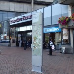
It certainly makes finding your way easier and I used a totally different and more interesting route to get to Carluccio’s from Moor Street station.
Now they need decent street and route maps on every bus stop in the city.
Searching For East Putney Station
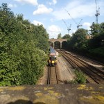
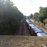
East Putney station is the first station south of the Thames on the Wimbledon branch of the District Line and it lies within walking distance of the Carluccio’s. But finding it wasn’t easy, as there were no maps or signposts.


When I eventually got to the station I questioned the station man about this and he said it was all a devious plot. Or something like that!
Note that the railway I crossed over is the line between Waterloo and Richmond.
East Putney station is a curious station in that it effectively lies within the junction of two lines, although no passenger services run on the other track.
A 3D Map Of London
This 3D map of London is at the Building Centre close to Tottenham Court Road station.


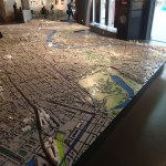


Unfortunately, dalston is just off the map, But it was good nevertheless.
Edinburgh’s Poor Bus Information
In London the bus information is superb, with route and street maps at any stop with a shelter. Even rudimentary stops have a text number and a small map.
But this is all you get in Edinburgh.

Edinburgh’s Poor Bus Information
If you are not familiar with the city, what possible use is this map, especially as there are no walking maps except for a solitary lith on Princes Street.
As a major tourist city, Edinburgh has to be labelled as Could Do Better.
Especially as the tram stops are a map free zone.
I Track Down An Elusive Night Bus Map
A couple of weeks ago, when I was returning home, I thought I saw a new Transport for London Night Bus Map, drawn like a cross between one of their bus spider maps and the well-known, loved and understood tube map.
As I couldn’t find one either physically or on the Transport for London web site and I was coming round to the conclusion I’d imagined seeing the map.
But I finally found one today, that I could photograph at Walthamstow bus station.

North East London Night Bus Map
This one is for the whole of North East London, whereas mostbus spider maps are for a specfic location like say Kings Cross. It certainly better than the old black and white night ones for a larger area.
Why is it London maps seem to get better and better and much of the rest of the country seems to be stuck in 1950s or even earlier.
Maps And Information In Berlin
This is a subject that I find important and feel that if a town or city wants to be a Grade One tourist destination, then they must have good maps and information.
London has always had a street map at each Underground station and this policy has been extended to most of the proper bus shelters. It’s a policy that Londoners and tourists must like, as more and more maps and information is appearing, with yellow topped liths popping up everywhere.
Warsaw it seems has started to add liths and maps for tourists, with quite a few finger posts too.
But I only one map on the street in Berlin.

A Solitary Map
There are maps at stations, but they are not up to the detailed level, you get in other cities, including some German ones.
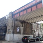
Searching For George Stephenson’s Bridge
One of the major components of the Northern Hub is the Ordsall Chord. This is so important it has its own web site.
Would you believe that where logically the curve should go, there is a Grade One listed bridge put up by George Stephenson?
The various heritage sites are shown here on the Ordsall Chord web site.
So I went to take some pictures of the area.

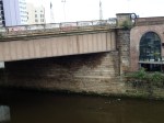
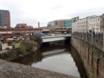
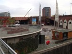
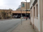
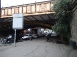
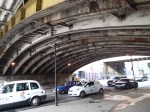
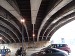
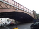
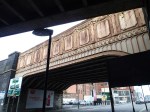
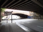
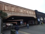
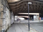
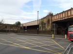
There are several bridges there and quite frankly none appears to have much elegance.
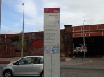
The solitary Salford lith was useless, as it only gave details about Salford. I was virtually outside Manchester Victoria station and that wasn’t shown.
Salford and Manchester may be two separate cities, but the rest of the world sees them as one and they should act as such, otherwise visitors will come back with tales of this impenetrable city and discourage their friends from coming.
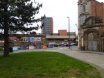
Navigating Around Bexhill
Why is it that so many towns that want to attract visitors, have such poor maps and information? I saw just one solitary lith by the De La Warr Pavilion.

A Lonely Lith In Bexhill
But the worst crime was the only usable walking map at the station, which was positioned for those, who were tall enough to be basketball players.
How many people after visiting a town, where they got lost, go back and tell their friends about their experiences?
Let’s hope that Bexhill increases the number of liths and especially puts one outside the station.
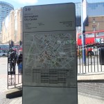
Leeds Has Now Got Liths
Last time that I went to Leeds, this wasn’t there outside the station.

Leeds Has Now Got Liths
It’s good to see more towns and cities jumping on London’s bandwagon. The system is called Walk It Leeds and there’s more here.
I think that in a few years time, every city and town will have a top class wayfinding system. The next thing that needs sorting out, is a system so that visitors can use the buses easily.
Most of these systems are computer generated, so to do another place, just needs to put in the co-ordinates of where you want a map and run the program, changing the colours and logos to suit.
Lost In Millwall
I usually like going to the New Den to see a football match, as to get from Dalston Junction station to the ground is simple and it is a stadium with good viewing.
I knew that going yesterday wasn’t going to be easy, as South Bermondsey station, which is connected to the ground by a walkway was closed due to engineering works.
So I went the way I usually go, which is to take the Overground to Canada Water station and then get one of the single-decker buses to a stop named Millwall FC.
The bus was full, but the usually-friendly Millwall supporters were not bothering me. Sometimes, I think that their reputation is worse than the reality. But I arrived at the ground, as I intended, a few minutes before kick-off.
It should be said, that London’s talking buses make it easy to find your way in strange parts of London. Other cities should follow the example.
The match was probably Ipswich’s worst display of the season, with the spark of the previous Championship encounter against QPR completely missing. The only positive thing to say, is that Millwall played well enough to stay up, so that should be another easy away game to get to, next season.
After the match, my normal route home via South Bermondsey and London Bridge stations was not on, so I decided to walk to TfL’s recommended alternative of Surrey Quays station.
I got lost, as there were no maps in this part of London. Where I live in Hackney, there are liths and maps all over the place.
So in the end I got to the station by walking in a great circle.
As I suspect the works at South Bermondsey will be going for some time, something needs to be done.
