Connectivity Around Clapham
I’ve talked a lot lately about improving the rail lines and especially their connectivity in South London in quite a few posts lately.
So I extracted this map from carto.metro.free.fr
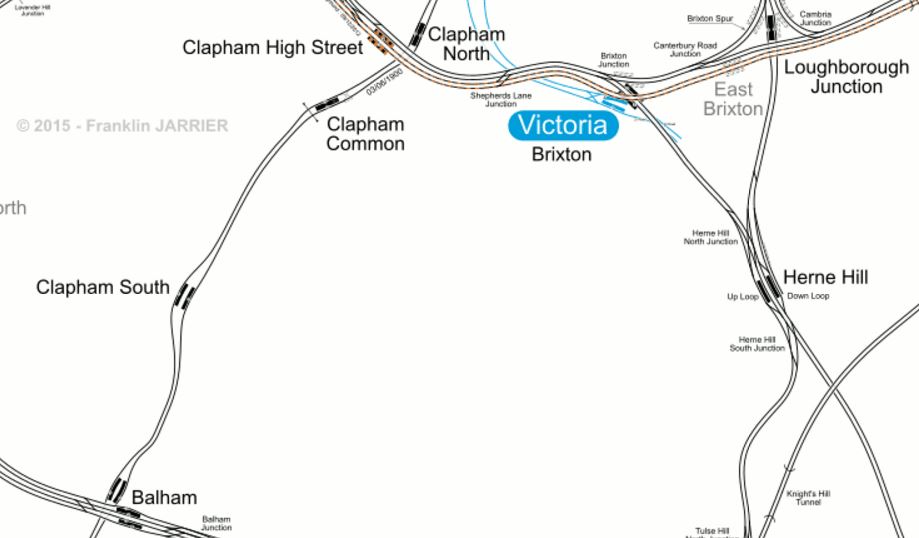
Clapham Lines
I think we have to congratulate the French behind these accurate metro maps.
Note the following.
- In a few years time, there will be two high-capacity North-South routes through the area; Thameslink and the Northern Line, which meet with the Bakerloo Line at Elephant and Castle station.
- Thameslink at Farringdon station and the Northern Line at Moorgate and Tottenham Court Road will have excellent connections to Crossrail.
- Thameslink goes through Herne Hill and Loughborough Junction and will have at least six eight-car trains all day, with extra services in the peak.
- Herne Hill is a big railway bottleneck, with as yet no sensible proposal to solve it.
- The Northern Line will have at least twenty trains per hour all day, between Morden and Kennington stations.
- The Victoria Line is also important to the area, as it will provide a thirty trains per hour service to from Brixton to Walthamstow Central via Stockwell on the Northern Line.
- The East London Line connects Clapham Junction in the west via Clapham High Street and Surrey Quays to Highbury and Islington in the north-east.
- The East London Line is getting crowded and increased frequencies will happen in 2019.
- The Law of New Routes, Stations and Trains will mean that Thameslink will attract traffic and the trains will quickly get busy.
- In the future Balham station could be served by Crossrail 2.
I believe that expecting Crossrail 2 to solve South London’s transport problems, is a bit like waiting for the United States to help the beleaguered good guys out in the First and Second World Wars.
Like the Americans, Crossrail 2 will arrive, but we have to make the best of what we’ve got in the meantime.
Perhaps these projects will help.
More And Better Designed Stations
Transport for London (TfL) have very sophisticated train and passenger modelling systems, which enable them to propose where improvements to stations should be made.
Sometimes this type of analysis, gives surprising results, that are counter-intuitive.
For example, I pointed out in Faster London Trains Could Make Your Commute Even Longer, how French research had shown this premise, to sometimes be true.
But the research also showed that in certain cases, extra stations could make journeys faster.
From my personal observations at Angel station, I sometimes think that trains arrive and depart faster on the wider southbound platform, rather than the narrow northbound one.
Camberwell Station On Thameslink
A couple of miles north of Loughborough Junction station is the disused Camberwell station, which Transport for London are proposing to reopen.
In their report on the Bakerloo Line Extension, TfL give this concise summary on reopening Camberwell station.
A new station at Camberwell would be a significantly lower cost option to a Tube extension, whilst serving the same catchment area. Investigations show significant journey time improvements could accrue to Camberwell passengers and that operationally there may be scope to integrate re-opening of the station into the launch of the completed Thameslink programme.
We will therefore undertake further planning work with Network Rail and the London Borough of Southwark to assess the proposal.
From their statement, it would appear that TfL have done an extensive analysis.
I would not be surprised, if this enthusiastic statement wasn’t followed through.
Northern Line Stations
Several of the Northern Line stations are relics of the line’s Victorian past and stations are slated for major improvements over the next few years.
- Bank – A big development has just been announced.
- Camden Town – I wrote about the proposed development of Camden Town station in The Camden Town Upgrade Exhibition.
- Elephant and Castle – A big property development is planned, which incorporates a new Northern Line station.
- Moorgate – Crossrail will improve the station.
- Old Street – Developments are planned in the area, which could result in an improved station.
These developments will probably mean that after the Northern Line Extension to Battersea is completed, most major stations between Camden Town and Kennington will have been upgraded.
Only the two Northern branches and the Morden branch will have not received a substantial number of upgraded stations with complete step-free access, wide safe platforms and escalators.
I think we’ll see other improvements to stations, especially an upgrading of the two island platform stations at Clapham North and Clapham Common.
The Herne Hill Loop On The Victoria Line
One constraint on the efficiency of the Victoria Line, is reversing the trains at Brixton station. There have been proposals in the past to crete a reversing loop with another station on the loop at Herne Hill station. I wrote about it in detail in Will The Victoria Line Go To Herne Hill?
This extension will only be built, if it is value-for-money in improving the Victoria line, despite the positive secondary effects it might have in the Herne Hill area!
An Interchange Hub At Streatham Common Station
Transport for London has recently proposed a interchange hub at Streatham Common, which I wrote about in Puzzled Over Streatham Common Station.
In my article, I showed that a well-designed hub could connect the following lines.
- The Sutton Loop Line Of Thameslink – Linking To Wimbledon and Sutton
- The Brighton Main Line
- Tramlink – With the possible use of tram-trains.
- East London Line – Linking to East London, Kent and Essex
- West London Line – Linking to Old Oak Common for HS2 and the West Coast Main Line
I very much think that the idea of an interchange hub at Streatham Common is a masterstroke.
Especially, as it will take the pressure off Wimbledon and East Croydon!
Another Branch Of The East London Line
The East London Line currently has four trains per hour in both directions across South London to and from Clapham Junction station.
This branch is getting very busy and from 2019, an extra two trains per hour will use this route.
But will Clapham Junction be able to cope with the extra services?
If it can’t, a possible alternative would be to run some trains from Peckham Rye via Tulse Hill to a terminus at Streatham Common.
Clapham High Street, Brixton And Brockley Interchanges
These are three possible interchanges with the Easst London Line in South London.
- Clapham High Street and Clapham North stations could be connected, if it was decided to improve the Northern Line through Clapham.
- Interchange between all the lines at Brixton station has been mentioned by TfL and I wrote about it in Could The Various Lines At Brixton Be Connected?
- TfL have also suggested that Brockley station could be a potential interchange hub and I wrote about it in A Report On The Bakerloo Line Extension
Each will have advantages and disadvantages.
Conclusion
There are a lot of possible projecs to improve the train services in the Clapham area.
What TfL have in their traffic database will decide the pattern of trains the area.
Exploring The Sutton Loop Line
The Sutton Loop Line is not well known in North London, except as a routing shown on Thameslink train information displays.
This morning, I took the line from Tooting station and after a short stop at Sutton station, I continued on my way back into Central London.
These are some of the pictures that I took.


I think the trip did give me a better understanding of this line in South London.
These points are general.
Step Free Stations
Very few of the stations I passed through had any form of step-free access.
Some were island platforms, which have their advantages, but access up and down a single wide staircase to a road overbridge is so nineteenth century.
Variable Quality Stations
Some stations have had a refurbishment and others haven’t!
A Curious Timetable
Streatham to Sutton via Wimbledon calls at more stations, than the other way via Mitcham Junction and this is reflected in the times, with the shorter route taking fifteen minutes and the longer one thirty-one minutes
The curious timings on the loop, actually mean that from Streatham station northwards or southwards, the trains have an interval of very close to fifteen minutes.
So it would be prudent to check, that you’re always taking the best way to get to your destination station!
These points are specific to stations of sections of the line.
St. George’s Hospital
According to this article in he Local Guardian entitled St George’s Hospital Trust announces support for Tooting Broadway in Crossrail 2 plans, the hospital trust is not happy.
It would be ridiculous to spend the best part of an extra billion pounds on Crossrail 2 to put the line through Tooting Broadway station, rather than Balham station, when that money could probably be spent on a mixture of patient care , better bus links, and a lift or two at the Underground station. The latter will happen anyway, whether Crossrail 2 is built or not!
Could there be a better solution for step-free transport access to St. George’s Hospital?
Look at this Google Map of the hospital in relation to Tooting Broadway station and the Sutton Loop Line to the west of Tooting station.
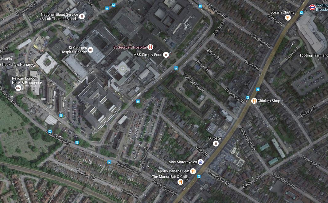
St. George’s Hospital, Tooting Broadway Station And The Sutton Loop Line
Tooting Broadway station is at the top right of the map and the Sutton Loop Line runs across the South West corner of the map.
If a new station were to be built on that line, with full step-free access, it would be closer to the Hospital, than any station on Tooting Broadway. It would also be close to some of the bus stops that serve the hospital.
Haydons Road Station And AFC Wimbledon’s New Stadium
This Google Map shows Haydons Road station and the site of AFC Wimbledon‘s new home at Wimbledon Stadium.

Haydons Road Station And AFC Wimbledon’s New Stadium
The stadium will be at the old greyhound stadium, which is the two green circles at the top.
The green scar from the stadium site to the east of the station, is the course of the River Wandle. Surely, a riverside walk should be created for supporters walking between the stadium and station.
The map also shows the amount of land wasted in the area by unnecessary cemeteries. How many houses could be built on the land they occupy?
Wimbledon Station
Trains on the Sutton Loop Line always use Platform 9 at Wimbledon station, which gives cross-platform access to Tramlink on Platform 10.
So one train might be going to Sutton and the next to Central London and beyond.
Wimbledon Chase And South Merton Stations
These two stations are shown on this Google Map.
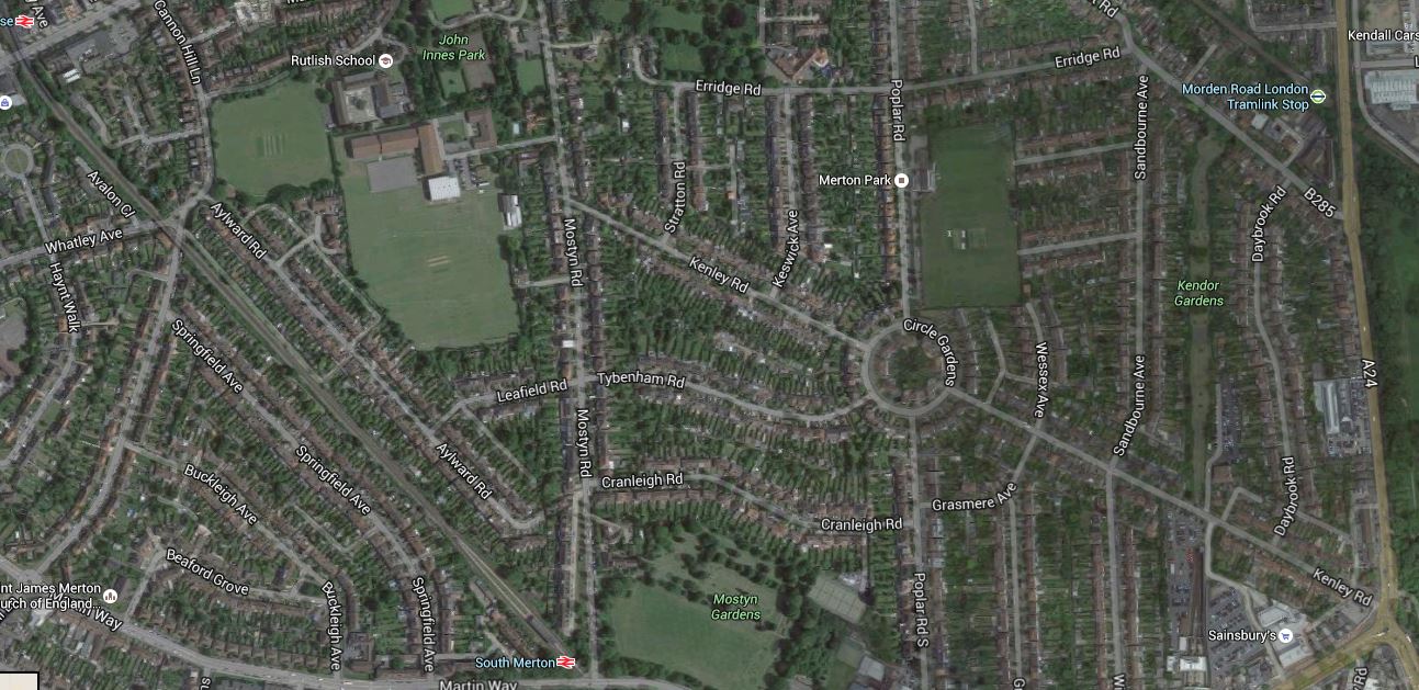
Wimbledon Chase And South Merton Stations
Wimbledon Chase station is at the top left and South Merton station is at the bottom, just tom the left of the middle.
You will notice, I’ve included the main A24 road on the map.
This is because that road could be used for an extension of Tramlink from South Wimbledon to Sutton via St. Helier Hospita;. This map shows that extension.
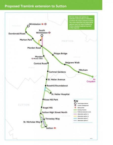
St Helier Tramlink
Transport for London and the London Borough of Merton are opening up a lot of possibilities here and I hope that a world-class solution emerges, to link the whole corridor together.
Morden South And Morden Stations
This Google Map shows the close relationship between Morden South station and Morden station
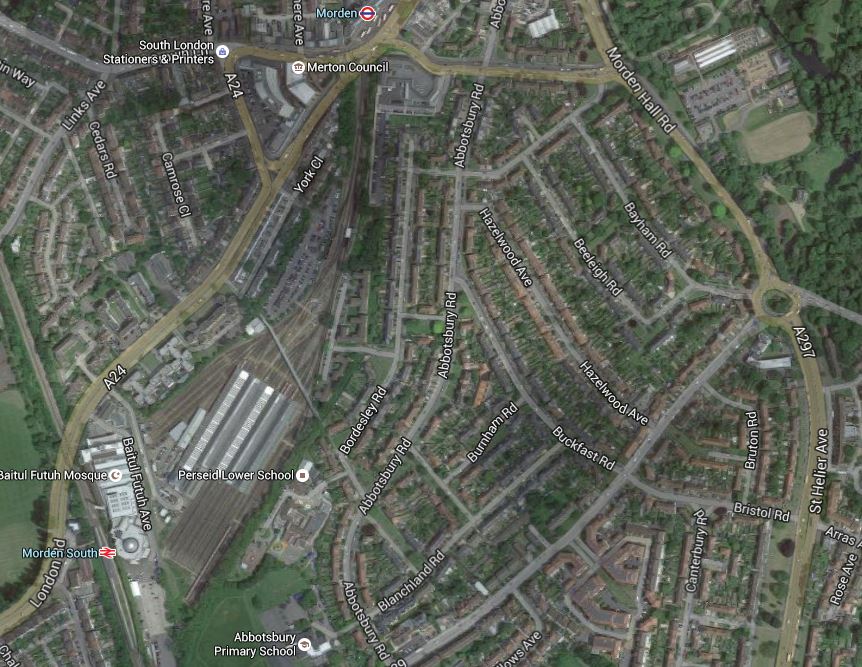
Morden South And Morden Stations
Their close location and the depot in betwen, has always puzzled me. It is explained in the History section for the Wikipedia entry for Morden station.
It was all down to railway politics, between Southern Railway and the Underground companies.
You just wonder though, if they were sorting out the lines around Wimbledon, that something could be done to make it easy to connect between the two stations.
Hackbridge
I hadn’t heard about Hackbridge, which is a suburb in the London Borough of Sutton.
But there is a Hackbridge Masterplan on Wikipedia. This is the first paragraph.
The London Borough of Sutton is working to make Hackbridge the ‘UK’s first truly sustainable suburb’. There has been a regeneration scheme in Hackbridge which has a number of developments on many sites. These are mentioned as part of the Hackbridge Regeneration. Detailed plans include proposals for new eco-friendly homes, more shops, leisure and community facilities, jobs, sustainable transport and pedestrian/ cycle initiatives, improved networks and open spaces.
It all sounds good to me. This is a Google Map of the area.
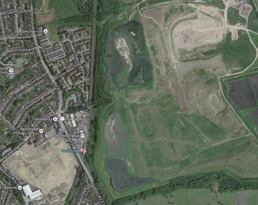
Hackbridge
Note the rail line going up the map with Hackbridge station about a quarter of the way up.At the top of the map, is an icon indicating the BedZed Pavilion.
If they are truly into green transport, it strikes me, that there needs to be another station between Hackbridge and Mitcham Junction, which is the next one to the North. As the Tramlink through Mitcham Junction runs down the eastern side of the site and has a stop at Beddington Lane on the north east corner, I would also feel that there scope for extensions to the through Hackbridge.
The Future Of The Sutton Loop
With all the investment in Thameslink, there is no doubt that the future of the Sutton Loop is secure, but what will it look like in ten or twenty years?
I think it seems to have suffered a lack of imaginative thinking in the past few years, but with Transport for London thinking hard about a new interchange hub at Streatham Common station, that I wrote about in Puzzled Over Streatham Common Station, I think we’ll see some more improvements.
A lot of the stations need to have a refurbishment and proper step-free access.
If this follows the pattern of previous lines in London and elsewhere, I think that after station improvement, this line will need additional services.
As it won’t be possible to get more trains through the core, then this could need for some form of local train or tram-train on the loop. Perhaps these would terminate at perhaps Streatham Common station, which I wrote about in Puzzled Over Streatham Common Station.
If two extra trains each way round the Sutton Loop were to be added, they could be timed to run every fifteen minutes between the existing services. So each station on the loop would get a four trains per hour service both ways.
One possibility would be to do the extra services with tram-trains, which after Streatham Common, went on to Croydon to connect up with the existing Tramlink routes.
As I said earlier trains go through Streatham to and from the loop every fifteen minutes, which would be every 7-8 minutes with the extra trains.
So if say you wanted to go to Central London, if you caught an intermediate train on the loop, you might have to wait 7-8 minutes for a Central London train.
The possibilities are endless.
Obviously, traffic patterns will determine how the line develops, but I predict that there will be a big future for the Sutton Loop.
Puzzled Over Streatham Common Station
Transport for London’s proposal for the Bakerloo Line Extension comes with a very nice map of the various projects that will be carried out to improve rail services in South London.
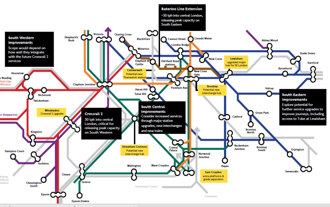
Rail Improvements South Of The Thames
It is all good stuff and most is easily explained.
The black boxes are about more general and larger projects, whereas the yellow boxes are comments about specific stations.
The projects; large and small, fit together like a jigsaw. And not a particularly difficult one to understand!
Of the larger projects, the simple extension of the Bakerloo Line to Lewisham station via two new stations and New Cross Gate station is a masterstroke.
- It provides a thirty trains per hour rail link through the Old Kent Road Opportunity Area.
- It gives all those living on the East London Line, as I do, a much needed connection to the Bakerloo Line.
- Coupled with an upgraded Lewisham station, it gives South East London access to the Underground.
- The project can be opened without an expensive set of new trains.
- New Cross Gate and Lewisham stations have space for construction.
- The extension can be built with minimal closure of the Bakerloo Line.
- The project is almost a repeat of the Northern Line Extension.
- No-one’s current train service will be discontinued.
- There is no replacing heavy rail with smaller Underground trains.
- If in the future, the line needs to be extended, this will be no problem, if Lewisham station is designed correctely.
The only negative, is that the plan doesn’t provide a much-needed rail link in Camberwell.
But Transport for London have done there research and have concluded that reopening the disused Camberwell station on Thameslink could be a worthwhile alternative.
The TfL report gives this concise summary.
A new station at Camberwell would be a significantly lower cost option to a Tube extension, whilst serving the same catchment area. Investigations show significant journey time improvements could accrue to Camberwell passengers and that operationally there may be scope to integrate re-opening of the station into the launch of the completed Thameslink programme.
We will therefore undertake further planning work with Network Rail and the London Borough of Southwark to assess the proposal.
It is a second masterstroke.
Camberwell station will probably get a similar service to Loughborough Junction station. I’m not sure what it will be, but something like four eight-car trains an hour both ways. In around fifteen minutes, passengers could be at.
- Balham for the Northern Line and Crossrail 2
- Elephant and Castle for the Bakerloo and Northern Lines
- Blackfriars for the Circle and District Lines
- Farringdon for Crossrail and the Metropolitan Line.
- Kings Cross St Pancras for main line services and the Victoria Line.
Camberwell station could easily be double-ended, with entrances on both sides of Camberwell New Road.
Camberwell would get at least a high-capacity four trains per hour service to virtually everywhere, with just a single change.
And this could be delivered by 2020, if they get the turbo-charged engineering skates out.
On the South London map, there are some other stations mentioned.
- Brockley – Potential new interchange hub
- East Croydon – Extra platforms & grade separation
- Lewisham – Upgraded major hub for SE London
- Streatham Common – Potential new interchange hub
- Wimbledon – Crossrail 2 upgrade
All of these station upgrades are understandable, with the exception of Streatham Common station.
I can only believe that Transport for London have a cunning plan for this station and the tangle of lines to its North.
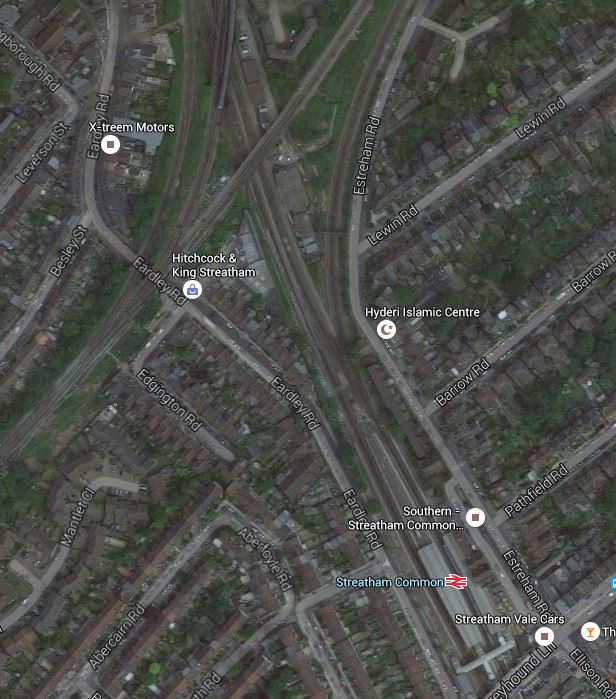
Streatham Common Station And The Tangle Of Lines
So what would an interchange hub be like?
In the simplest design, two platforms would be built across the lines through Streatham Common station alongside the Sutton Loop Line. They would be connected to extended platforms from the existing station, by stairs and lifts.
I think there would be space to build some bay platforms into the station, so that Streatham Common station could be used as a terminus.
This schematic of the rail lines is from carto.metro.free.fr
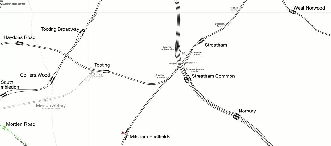
Lines At Streatham
Note how there are very few rail lines, south of Streatham towards Mitcham Eastfields station. Wikpedia says this about the station.
The station is located at Eastfields Road level crossing, in an area previously poorly served by public transport. The nearest station was Mitcham Junction, which along with Mitcham tram stop, was over 1 mile (1.6 km) from the district.
I wrote about the station in Mitcham Eastfields Station.
The lines that currently go or could go through the Dtreatham stations are set out in the following sections.
The Sutton Loop Line Of Thameslink
Streatham station is the last station on Thameslink before the Sutton Loop starts and finishes. Stations on the Sutton Loop include.
- Tooting
- Haydons Road
- Wimbledon
- Wimbledon Chase
- South Merton
- Morden South
- St. Helier
- Sutton Common
- West Sutton
- Sutton
- Carshalton
- Hackbridge
- Mitcham Junction
- Mitcham Eastfields
The fourteen stations have the following service.
- Currently, there are two trains per hour in each direction on the loop.
- Only Mitchan Junction and Wimbledon have connecions to Tramlink.
- I think Streatham to Streatham takes about forty-five minutes of travelling time.
- These trains eventually terminate and come back at St. Albans or Luton in the Peak.
- When the ongoing Thameslink Programme is finished, there will be two eight-car Class 700 trains in each direction every hour.
When the Thameslink Programme was planned, Network Rail intended to terminate these services at Blackfriars.
Residents and their politicians objected! Wikipedia says this.
Network Rail had planned to terminate Sutton Loop Thameslink trains at Blackfriars station, rather than have them continue through central London as at present. This upset many residents in South London and their local politicians, who saw it as a reduction in services rather than an improvement. In response to pressure, government has ordered Network Rail to reverse the decision.
I think this illustrates a certain sensitivity about train services in the area. Do they think that other places like Balham, Croydon and Wimbledon, get all the goodies?
So we have four trains an hour through the core section of Thameslink going on the Sutton Loop.
Although, this shouldn’t affect the services on the loop, could this cause problems for passengers on the trains through Wimbledon and Sutton, as long-distance trains are being used for short local journeys.
For example, you might have mothers with buggies taking babies and children to nurseries and schools, mixed up with commuters, who want to go north of the Thames.
A simple solution would be to have more trains going round the loop, so that instead of just two trains per hour each way, there were perhaps four or even more.
But where would they come from?
They could come a long way from somewhere like Orpington or Cannon Street, which would mean finding paths all over South East London and perhaps beyond.
Or perhaps they could just do the loop and start and finish at either Streatham or an expanded Streatham Common.
As Streatham is just a two platform station, with little space to expand, a bay platform in Streatham Common might be one solution.
Possible Reason for an expanded Streatham Common station – The station could be the terminus of a two train per hour local service around the Sutton Loop.
The Brighton Main Line
The Brighton Main Line goes from Victoria to East Croydon with fast trains generally only stopping at Clapham Junction station en route. However services pass through several important stations like Balham and Streatham Common without stopping.
Could there be advantages in stopping some of these services at an upgraded Streatham Common?
I don’t know under normal circumstances, but there may be good operational reasons for services to be able to call at Streatham Common station.
Possible Reason for an expanded Streatham Common station – The station could be a valuable interchange between Brighton Main Line and other services.
Tramlink
Although Tramlink doesn’t go anywhere near Streatham at present, it does have a main route, south of the area.
There is also a distinct lack of rail services in the area between Streatham and Mitcham, which led to the building of Micham Eastfields station.
In Wikipedia, it says that extensions to the Tramlink have been proposed North and South of Croydon. This is said about North of Croydon.
To the north of Croydon, it is proposed to use a highway alignment based on London Road. To the south of Thornton Heath Pond, the use of a shared carriageway is a possibility. North of this point the road becomes the A23 again, but there are likely to be some opportunities for trambaan type segregation to Norbury and between Norbury and Streatham, although Norbury is a pinch point. The proposal is to terminate the line at Streatham railway station, providing an interchange to the extended East London Line
Possible Reason for an expanded Streatham Common station – The station could be a destination for Tramlink.
Tram-Trains
In areas of Germany, where there are both trains and trams, the Germans are getting very enthusiastic about tram-trains which can run on both networks.
If tram-trains, were to be used on a possible Tramlink Extension to Streatham, they could join the railway at a convenient station, like Norbury or Streatham Common and become trains to go round the Sutton Loop.
Possible Reason for an expanded Streatham Common station – Tram-trains on Tramlink.
The East London Line
I use the East London Line a lot and it has the problem of success.
Trains have grown from three to five cars and some recent trips from Denmark Hill to Dalston Junction have shown, that at times standing is common.
Increased frequencies in 2018/2019, will ease the problems, but would another terminus in South London be a good idea for the East London Line?
The capacity of the core section of the East London Line is twenty-four trains per hour, so even from 2018/2019, there are four more paths available.
So could we see some services going to Streatham Common station perhaps via Peckham Rye, Tulse Hill and Streatham?
A factor that might apply here, is can Platform 1 at Clapham Junction cope with enough trains from Dalston Junction?
Possible Reason for an expanded Streatham Common station – A terminus for a branch of the East London Line.
The West London Line
Southern’s hourly service between South Croydon and Milton Keynes calls at Streatham Common station.
London Overground has a service of around four trains per hour on the West London Line between Clapham Junction and Willesden Junction, which Southern’s service augments for part of the route.
But there are problems with the West London Line.
- There are some extended service intervals at times.
- The Southern service doesn’t call at Willesden Junction.
- West London Line services call at different platforms at Clapham Junction.
- As with the East London Line, could platform space at Clapham Junction be a problem for the West London Line of the Overground
Unlike the East London Line, the West London Line is not a turn-up-and-go service.
So could there be advantages to use Streatham Common station, as a southern terminus for services through the West London Line?
Possible Reason for an expanded Streatham Common station – A terminus for the West London Line.
HS2
When HS2 opens in 2026, getting to Euston station will not be easy, as it is unlikely that Crossrail 2 will have been started, let alone up and running.
Passengers will need to get to a Northern or Victoria Line station and have a deep and possibly tedious journey across Central London.
Thameslink will be of use to some, but there will be a walk or a short-but-difficult tube journey between St. Pancras and Euston.
But HS2 will stop at Old Oak Common station on the North London Line. If the West London and East London Lines were to be extended to Streatham Common station, either could be a good alternative route to HS2 and the West Coast Main Line.
I estimate that Streatham Common to Old Oak Common will take thirty three minutes, compared to Morden to Euston on the Northern Line, which can take forty-one minutes.
Possible Reason for an expanded Streatham Common station – The station could be an important hub, collecting passengers for HS2 and the West Coast Main Line
Crossrail 2
Crossrail 2 is not planned to call at Streatham Common station, although it might go underneath in its route from Balham to Wimbledon.
Even so, I suspect that an expanded Streatham Common station will be to the advantage of Crossrail 2.
As I said earlier the station can help improve services on the Sutton Loop, which would have effects.
- Bring more passengers to Wimbledon for Crossrail 2.
- If extra stations were added to the Sutton Loop, these could help solve the Tooting Broadway/Balham wars.
- Could a new station be built at St. George’s Hospital, between Tooting and Haydons Road stations?
But the biggest benefit would be that Streatham Common station, would be an alternative hub, for those wanting to avoid Wimbledon during the building of Crossrail 2.
Possible Reason for an expanded Streatham Common station – Crossrail 2
East Croydon
When East Croydon station is being extended or the grade separation at Windmill Bridge Junction is being built, surely a well-connected interchange at Streatham Common, could be an asset towards helping to maintain a service.
Even under normal circumstances with a decent tram and train connection to Croydon, Streatham Common station may take the pressure off public transport in Croydon.
Possible Reason for an expanded Streatham Common station – Alternative routes for Croydon
Conclusions
Build a Streatham Common interchange hub!
It is just a pity that Crossrail 2 can’t have a station at Streatham Common.
Is the Streatham Common interchange hub, a third masterstroke?
By Rail From Bedford To Northampton
One of my Google Alerts picked up this article from the Northampton Chronicle, which is entitled Rail campaigners reject calls by St James residents to re-open Northampton link road.
There used to be a Bedford to Northampton Line, but it has been gradually abandoned, despite interest in using it for the following.
- As an extension to Thameslink to Northampton.
- As a freight route to the West Midlands.
I also feel that with Bedford likely to be an important station on the East-West Rail Link, surely the rail link to Northampton shouldn’t be compromised, so that it can’t be reinstated.
- It would make journeys between Cambridge, Ipswich and Norwich and Northampton and the West Midlands a lot easier.
- Freight from between Felixstowe and the West Midlands would have an alternative route.
I don’t think anything will happen soon, but the expansion of Thameslink and the East West Rail Link to Bedford will make everybody think.
An Opportunity At Catford
I’d never been to Catford before, but several things drew me to the area.
- Catford Bridge station is mentioned as a possible stop for the Bakerloo Line Extension.
- Maps show it is very close to Catford station and I wondered why they weren’t one station.
- Catford is mentioned in the Appendix of TfL’s Transport Plan for 2050, as a place for a new link and/or station.
This Google Map shows the two stations.
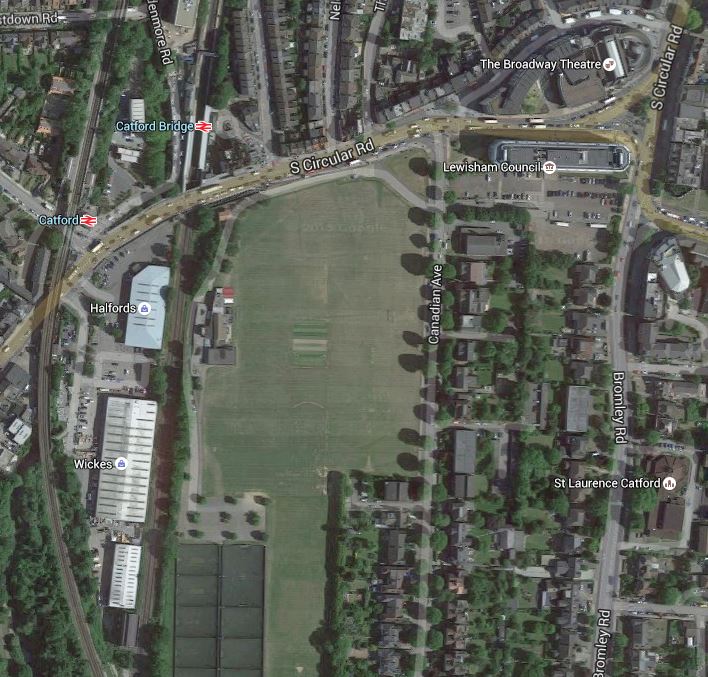
Catford Stations
The two stations are only about eighty metres apart and they are not that far from Catford Town Centre. The big drawback is that the road between the stations and the centre is the dsreaded South Circular Road, so it is busy with traffic.
To be fair to Lewisham Council, they have produced this document entitled Catford Town Centre Local Plan.
The plans are sensible and envisage improving the area of the two stations considerably.
This pictures show the area now.


Barratts are building a large number of dwelling on the former Catford Stadium site between the stations. They call it Catford Green and there are more details on the Lewisham Council web site. This is said on the council web site.
The development – located between Catford’s two stations and Ladywell Fields – will comprise 13 blocks up to a maximum of eight storeys in height, along with associated landscaping, including naturalisation of the River Ravensbourne and the creation of a public plaza between the stations, plus a footbridge to Doggett Road.
I’m no architect, but even I can see that the site has a lot of possibilities, especially as the lines through Catford are on a viaduct and are thus higher than the lines through Catford Bridge. So perhaps this natural slope could be used to advantage.
Remember too, these facts.
- Over a million people use both stations in a year.
- Interchange passengers are over fifty thousand a year.
- I think it is true to say that neither station is very customer-friendly and I suspect Catford is rather cold and draughty.
- Catford station will see new Class 700 trains in a few years, as it is on Thameslink.
The effects that the last fact will have on passenger numbers, won’t be negative.
I think it will be unlikely if the two stations are not linked to each other and the town centre by an imaginative development, within the next few years.
The Class 700 Trains Are Coming
I could add hopefully to the title of this post.
Thameslink needs the Class 700 trains currently being built and tested by Siemens.
When fully delivered these trains will not only fully replace the current Class 319 trains and the stop-gap Class 387 trains, but the Class 365 trains that work the Cambridge and Peterborough services into Kings Cross, which after Thameslink is completed will go through the tunnel to the Deep South.
So what do we know of the delivery schedule?
This set of blog posts from Sparky Scrum gives a good insight into the Class 700 trains and some tantalising clues. Take this for example.
Siemens are now busy constructing the units and doing its various testing to get the fleet delivered on time. That includes next year sending TOC staff on do the initial training on the fleet on a real track at full speed the Desiro City is capable off. This will speed their introduction when they arrive for passenger service early 2016. With 115 trains to deliver by the end of summer 2018, we’re will see a peak introduction of units of 1 per week by the end of 2016. The first service train on the GN into Kings Cross is expected in 2017. There is many interesting and exciting time ahead for Thameslink. This year sees the revealing of that vision with the trains now public and in a few months the winner bidder will be announced.
If nothing else, everybody seems to be being professional. One train delivery a week sounds impressive. If it happens!
So by the end of 2018, if their delivery schedule is met, there will be sixty eight-car and fifty-five twelve-car Class 700 trains churning through the tunnels under London at twenty trains an hour.
I’ll believe that when I see it, but there will be substantial numbers of Class 700 trains running between Bedford, Cambridge and Peterborough in the North to Brighton, Sutton and Sevenoaks in the South, by December 2018.
If deliveries go to plan, this will release the current fleet of forty Class 365 trains, twenty-nine Class 387 trains, thirteen Class 321 trains, possibly up to thirty five Class 319 trains and some other stock like some Class 377 trains.
Add to this that Porterbrook have now ordered another possibly twenty trains, it would seem that by the end of 2018, we should have more than enough electric trains to provide new electric services. Provided of course, that Network Rail can get the wires up.
All Wired Up And Ready To Go?
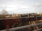
I took these pictures of the Canal Tunnels as we left Kings Cross for York.
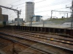
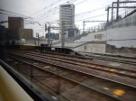
As the title implies the Canal Tunnels look almost ready.
I wonder when the first trains will go through the tunnels. Wikipedia says that the Class 700 trains will enter service between 2016 and 2018.
The New Three Bridges Depot
The new Thameslink depot at Three Bridges for the Class 700 trains opened today according to this report on Rail News.
I passed the depot a few days ago and took these pictures.
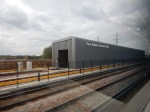
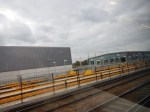


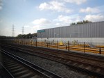


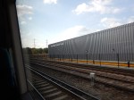
I didn’t see any of the new trains as I passed.
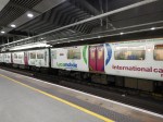
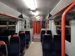
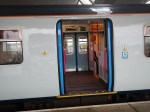
The Class 319 Trains Keep Rolling On
Class 319 trains were built for Thameslink in the 1980s.

I was using the line to get from St. Pancras to Blackfriars and in a few years time, when twenty-four trains an hour run on the line, it’ll almost be like another Underground line across the city from North to South.
Class 319s are not the most attractive of trains and advertising doesn’t help. The good news is that are reliable 100 mph trains and with a refurbishment, they’ll last a few more years yet, as Northern Rail have shown.
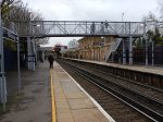
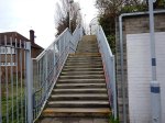
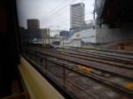
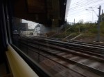
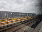
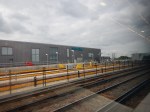
Herne Hill Station
The more I read about Herne Hill station, the more I’m fascinated with its problems. The Wikipedia entry starts with these two paragraphs.
The station building on Railton Road was opened in 1862 by the London, Chatham and Dover Railway. Initial service was only to Victoria, but by 1869 services ran to the City of London, King’s Cross, Kingston via Wimbledon, and Kent, including express trains to Dover Harbour for continental Europe. The arrival of the railways transformed Herne Hill from a wealthy suburb with large residential estates into a densely populated urban area.
In 2011, Network Rail recommended terminating all northbound Thameslink trains from Herne Hill at Blackfriars from 2018, freeing up capacity on the Thameslink cross-London section for trains via London Bridge. The Department for Transport announced in January 2013 that services from Herne Hill would continue travelling across London after 2018.
The first paragraph illustrates one of the problems at Herne Hill. To my mind, the real problem is that we have Victoria towards the west of London acting as a terminal for trains from Kent and the Eastern part of Surrey, which then have to cross major North-South services like Thameslink and the London Bridge to Sussex services. It’s a crazy mess that has been well over a hundred years in the making, because successive rail management has sidestepped the problem.
Network Rail’s design for Thameslink was probably the best they could do in this pressure cooker, but it annoyed too many civil servants and politicians, so it couldn’t be allowed. I’ve seen this so often in major projects, where engineers, designers and other professionals have recommendd one course of action, but polticians have said you can’t do that, as my gardener will lose his allotment.
In Improving the East London Line about Herne Hill station, I said this.
It has problems, as it would appear a gallon is being squeezed into a gill pot! If you read this article in London Reconnections, you’ll see that it is not just a serious problem, but an almost impossible one.
To make matters worse, Network Rail’s proposed solutions have seemed to be hindered by the Dulwich Estate retaining significant planning powers, which only an Act of Parliament can resolve.
With all my scheduling experience,I can’t help feeling that Thameslink is going to be a disaster unless something is done to sort out the knitting in the Herne Hill area or the number of trains through the area, is matched to the capacity.
This extract from Wikipedia explains why capacity is low at Herne Hill.
The four tracks are served by two island platforms; northbound trains call at the western platform and southbound trains the eastern platform, providing cross-platform interchange between the two routes.
There are flat junctions at each end of the station: Herne Hill North Junction, where the lines to Loughborough Junction and Brixton diverge; and Herne Hill South Junction, where the lines to West Dulwich and Tulse Hill diverge. Thameslink and Southeastern services cross each other’s paths at the junctions, constraining capacity on both routes. The station also has a turnback siding on its eastern side, adjacent to Milkwood Road.
Imagine two roads crossing at an angle, where there were traffic signals letting through a few vehicles at a time. Slow isn’t it?
The only solution would be to have a flyover, but there are too many local objectors to this.
We could always dig the guys up who designed this mess and hang them. But although we might feel better, it wouldn’t help the problem.
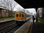
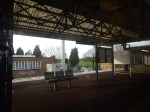
So I just thought I had to go and look at this troubled station and pour my four-pennyworth of burning oil on the problem. I took these pictures.
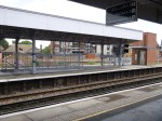
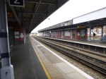
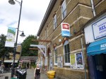
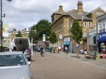
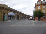

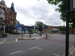
The pictures show the station is in good condition with good disabled access. There are also four bakeries and lots of cafes and restaurants for those who jump train at Herne Hill because of the slow progress.
