Could Manchester Airport Be Accessed From The West By A Tunnel Under The M56?
This OpenRailwayMap shows the railways of East London between Dalston Junction and Stratford International stations.
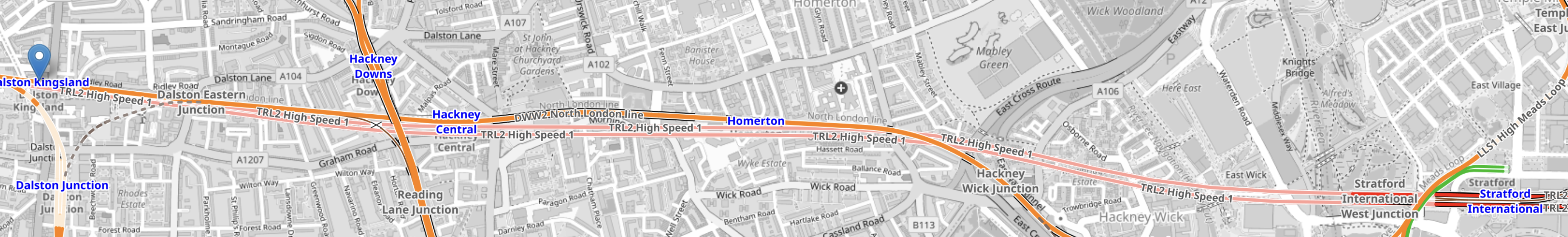
Note.
- Dalston Kingsland station is marked with an arrow in the West of the map.
- Stratford International station is marked by the blue lettering in the East of the map.
- The orange line between them is the North London Line.
- There are also two pink lines, which indicate High Speed One, which is dug several metres below the North London Line.
It can’t be much different to dig a high speed railway underneath a motorway. Has anybody done this?
This OpenRailwayMap shows the railways leading to Manchester Airport.
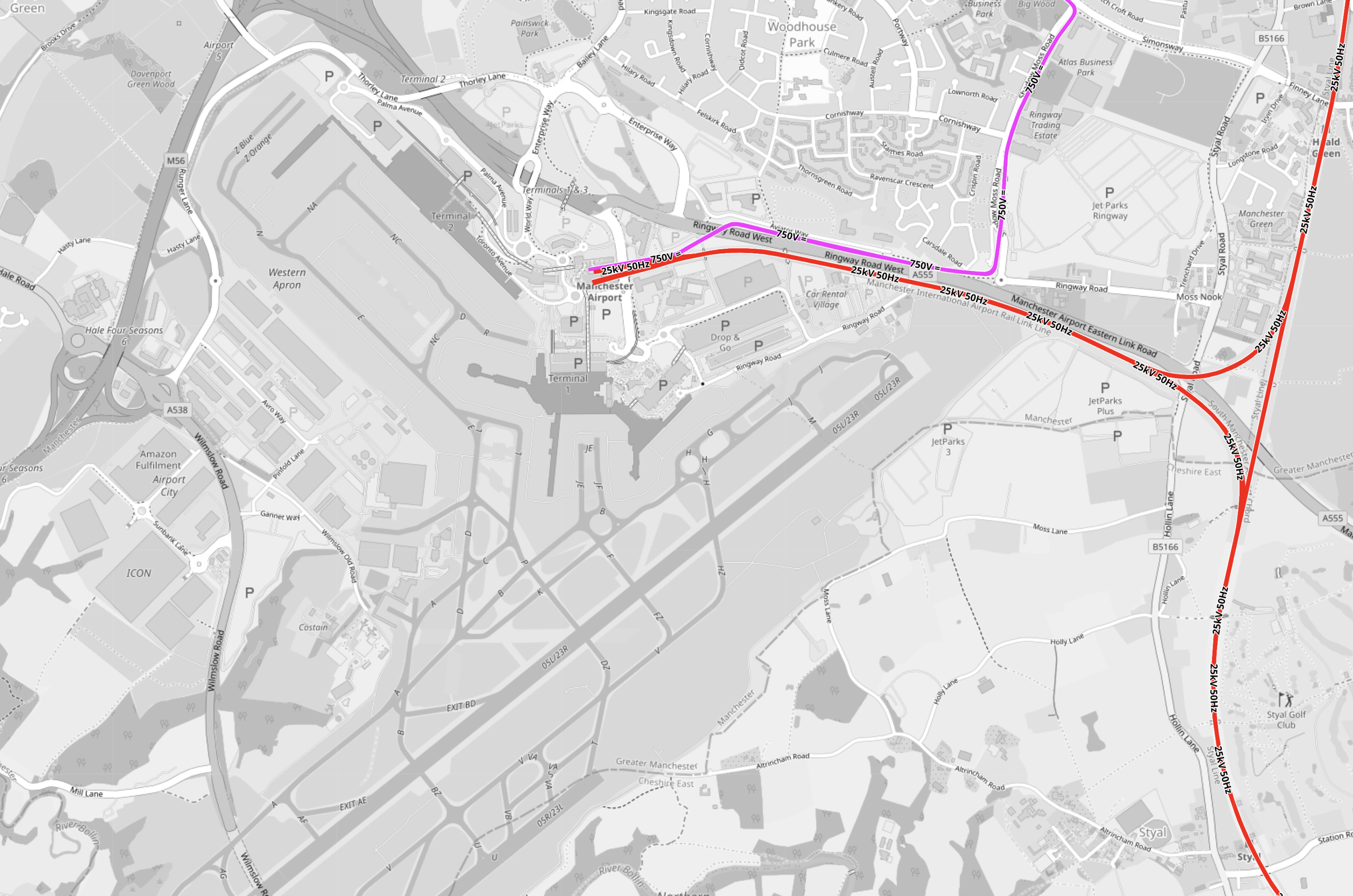
Note.
- Junctions 5 and 6 of the M56 motorway are on the Western edge of the Airport.
- The red tracks are the Styal Line.
- The mauve tracks are the Metrolink.
- It should be noted that railway lines pass under Heathrow Airport’s runways.
Point 4 makes me sure, that Manchester Airport can have a station connected to the West by a railway under the M56.
This OpenRailwayMap shows the railways around Weaver Junction on the West Coast Main Line, where the trains branch off to Liverpool.

Note.
- The West Coast Main Line goes down the Eastern side of the map.
- Warrington Bank Quay is the next station to the North.
- The Liverpool Branch goes off to the West.
- The M56 tuns diagonally across the map from the North-East corner crossing both both branches of the West Coast Main Line.
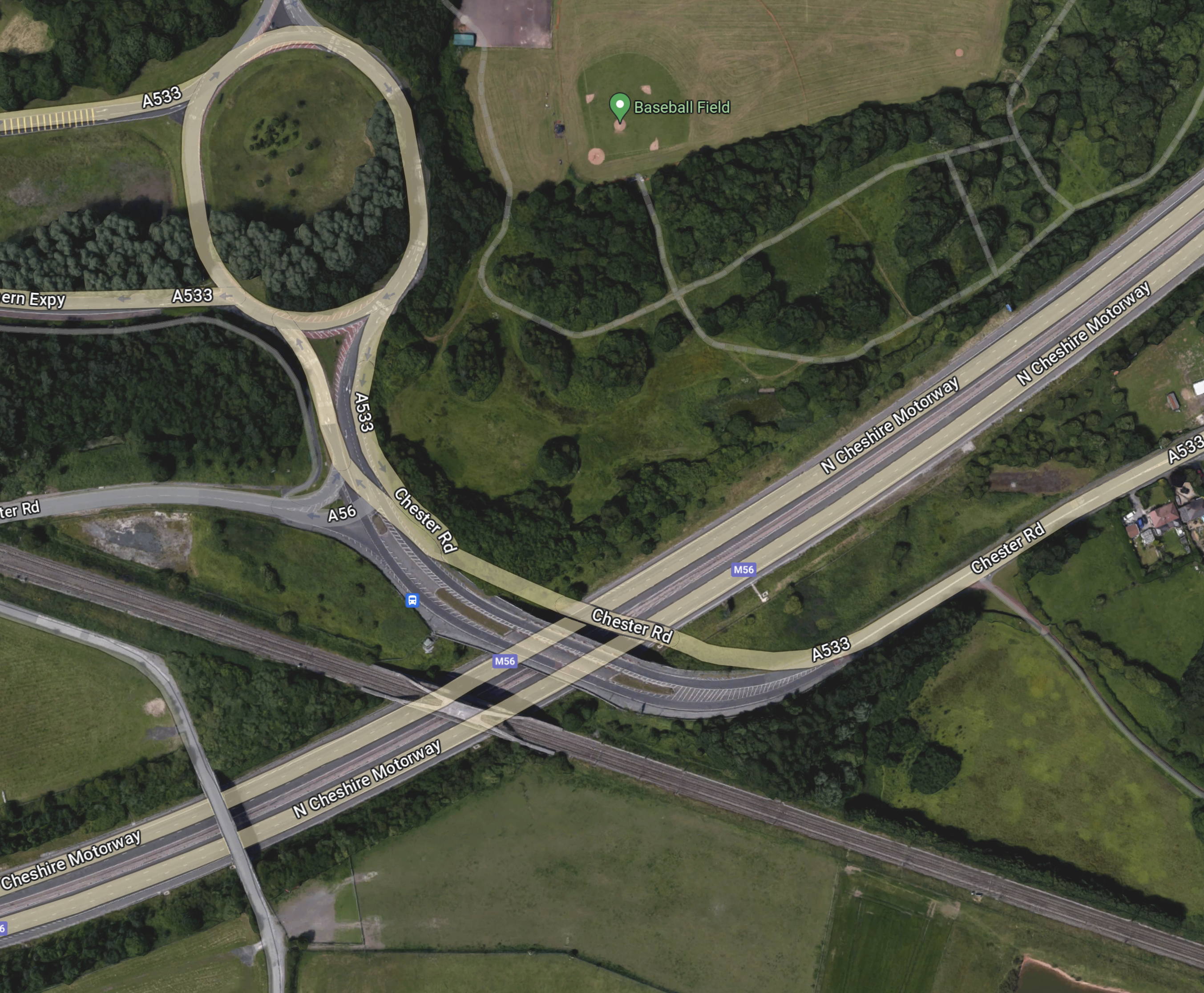
This Google Map shows where the M56 crosses over the West Coast Main Line to Warrington Bank Quay.

Note.
- The M56 motorway is obvious.
- The Eastbound motorway goes to Manchester Airport and Manchester.
- The junction is numbered 11.
- The railway runs down the Western side of the map.
I believe that it would be possible to connect a railway running East under the motorway to the West Coast Main Line.
This Google Map shows where the M56 crosses over the Liverpool branch of the West Coast Main Line.
Note.
- There is no motorway junction here.
- The North-East bound motorway goes to Manchester Airport and Manchester.
- The railway runs slightly diagonally across the bottom of the map.
- The Westbound railway goes to Runcorn and Liverpool.
- The Eastbound railway goes to Weaver Junction, Crewe and the South.
There would only need to be a connection between Liverpool and the railway under the motorway going to and from Manchester Airport.
I have some further thoughts and questions.
This Is Just My First Thought
I am happier about the connection to the Liverpool branch than the Northern connection.
But then I feel there are several routes at both junctions, some of which will take a wider route.
How Long Will The Tunnels Be?
Between Junctions 11 and 6 on the M56 is 16 miles.
At What Speed Would The Trains Run?
I suspect that once on the straight section between Junctions 11 and 6, speeds of up to 90 or 100 mph should be possible, but speeds would probably be lower at the junctions to the West Coast Main Line.
How Would It Connect To Manchester Piccadilly?
The tunnel would continue the other side of the Airport and it’s a further 9.4 miles to under Manchester Piccadilly.
In The Rival Plans For Piccadilly Station, That Architects Say Will ‘Save Millions’, I wrote about Weston Williamson’s plan for Manchester Piccadilly station.
This was their visualisation.

Note.
- In the visualisation, you are observing the station from the East.
- The existing railway lines into Piccadilly station are shown in red.
- Stockport and Manchester Airport are to the left, which is to the South.
- Note the dreaded Castlefield Corridor in red going off into the distance to Oxford Road and Deansgate stations.
- The new high speed lines are shown in blue.
- To the left they go to Manchester Airport and then on to London, Birmingham and the South, Warrington and Liverpool and Wigan, Preston, Blackpool, Barrow-in-Furness, the North and Scotland.
- To the right, they go to Huddersfield, Bradford, Leeds, Hull and the North East, and Sheffield, Doncaster and the East.
- Between it looks like a low-level High Speed station with at least four tracks and six platforms.
- The high speed lines could be oriented so they ran East-West, rather than North-South in this visualisation.
- The Manchester Metrolink is shown in yellow.
The potential for over-site development is immense. If the Station Square Tower was residential, the penthouses would be some of the most desirable places to live in the North.
Onward From Manchester Piccadilly
I would hope that a connection could be made to the Huddersfield Line to the East of Manchester Piccadilly station, so that trains could use the TransPennine Upgrade all the way to Leeds.

[…] Could Manchester Airport Be Accessed From The West By A Tunnel Under The M56? […]
Pingback by High Speed Two Lite « The Anonymous Widower | October 6, 2023 |
Get your cheque book out – shall we say £10,000,000,000 as a deposit?
Comment by R. Mark Clayton | October 7, 2023 |