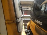
Eurostar Orders First Double-Decker Trains
The title of this post, is the same as that of this article on the BBC.
This is the sub-heading.
Eurostar has revealed plans to run double-decker trains through the Channel Tunnel for the first time.
These three paragraphs add more details.
The cross-channel rail operator has confirmed it will order up to 50 trains from manufacturer Alstom, eventually increasing the size of its fleet by nearly a third.
The expansion plans would include investing heavily in a crucial London depot, it said.
But questions remain over whether the facility has enough space for both Eurostar and potential rival operators to use it.
This my solution to the problem outlined in the last paragraph.
Note, that I wrote the software that planned the building of the Channel Tunnel and the rail links to London and was also friends with the project manager of the 1960s attempt to build a Channel Tunnel.
We need more terminal platforms and depot space in the UK to handle Eurostar’s extra trains and the other companies who want to run to London.
We should split services into two groups.
Group 1 would terminate as now in an updated St. Pancras with more passenger handling capacity, which could probably be built over the tracks at the Northern end of the station. Trains would still be stabled at Temple Mills.
Group 2 would terminate at Ebbsfleet International, which would have extra platforms, a new depot, masses of car parking and a coach terminal.
Some trains from both groups could also stop at Ashford International.
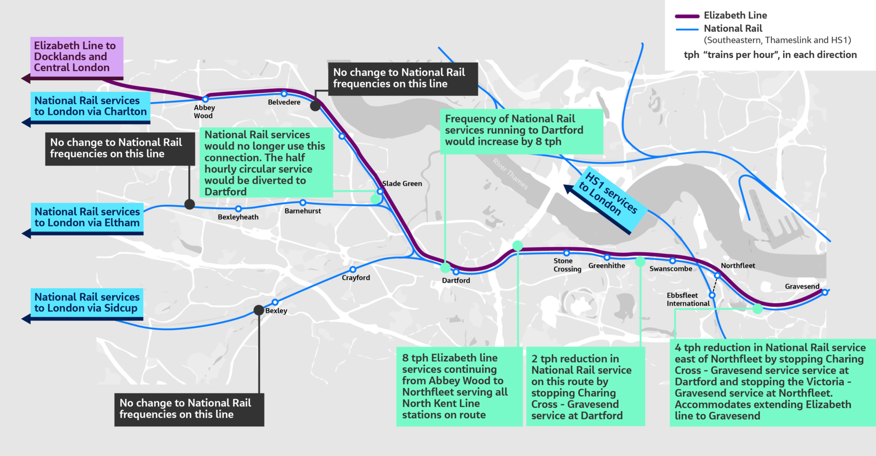
To access Ebbsfleet from Central London and also create a Heathrow link to the Channel Tunnel, the Lizzie Line would be extended to Northfleet, where there is space to handle up to eight trains per hour in new platforms built in two disused sidings.
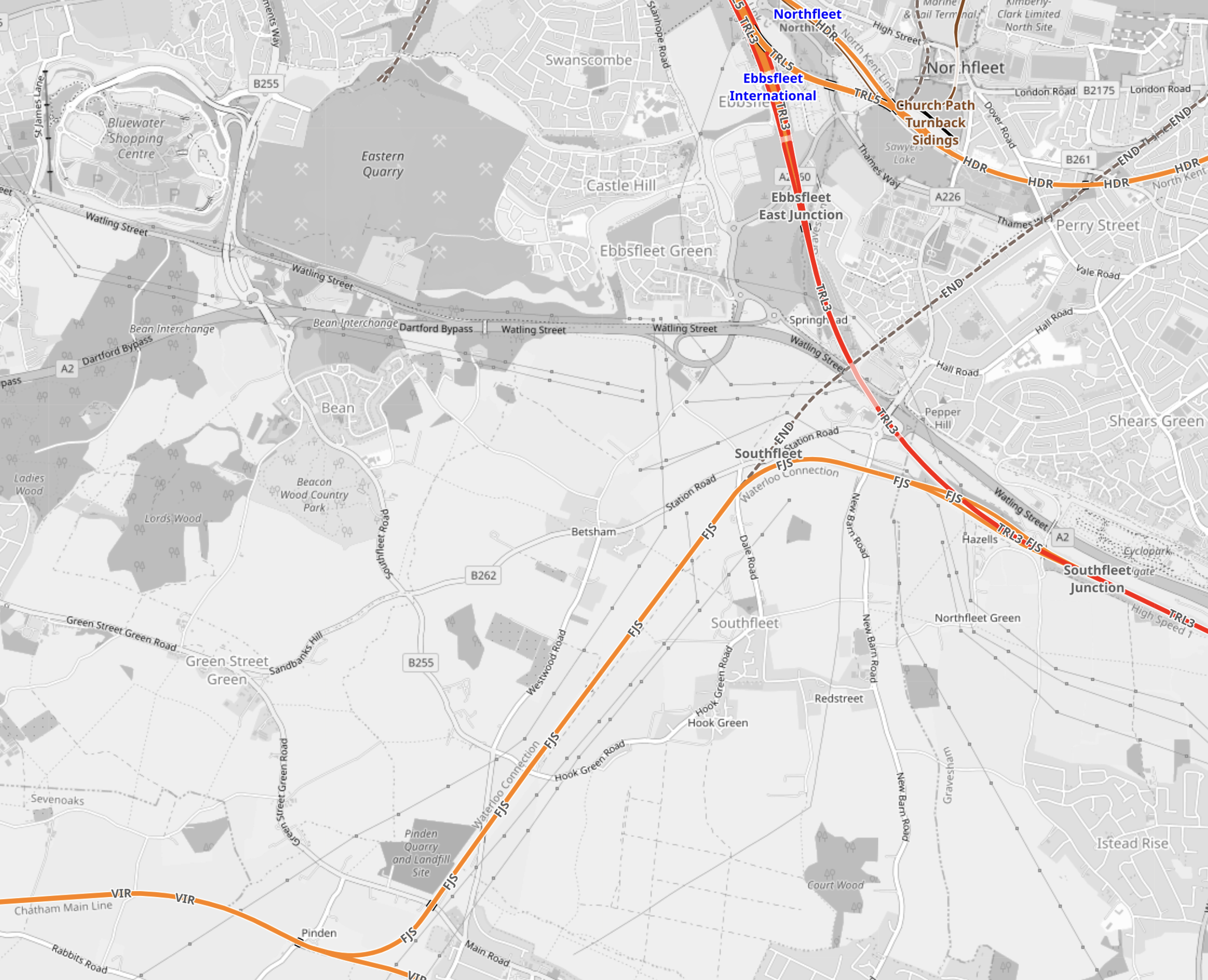
This OpenRailwayMap shows the location of Northfleet and Ebbsfleet stations.
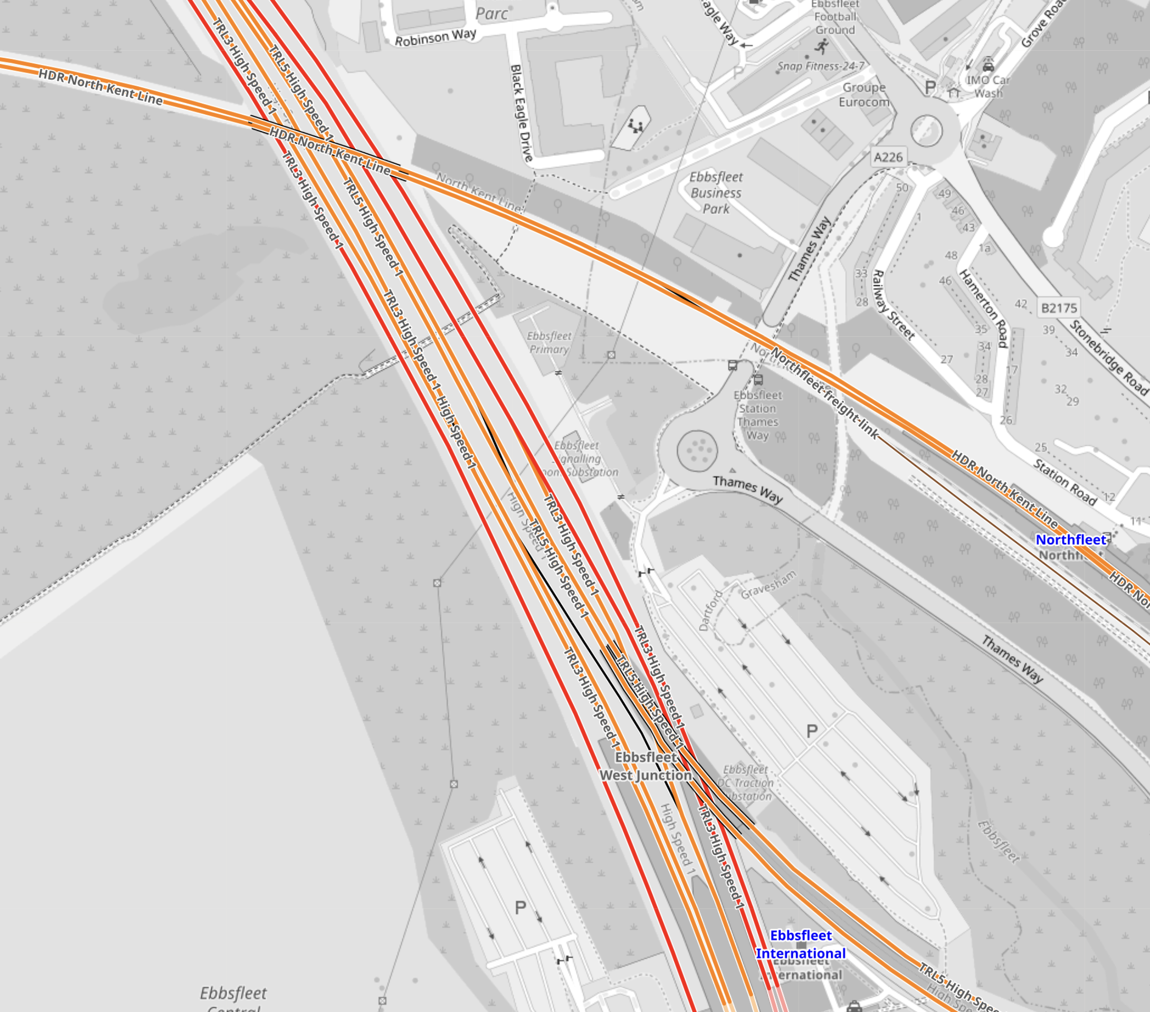
Note.
- Ebbsfleet International station at the bottom of the map.
- The red tracks are High Speed One.
- The orange tracks are third-rail electrified lines.
- The orange tracks going across the map is the North Kent Line.
- Northfleet station is at the right edge of the map on the North Kent Line.
- Northfleet and Ebbsfleet stations are less than a kilometer apart.
- Ebbsfleet has a lot of car parking spaces.
I believe a spectacular cable-car or other link would connect Northfleet and Ebbsfleet stations.
These are some other thoughts.
Ebbsfleet International Station Has Good Motorway Access
This Google Map shows the location of Ebbsfleet International station in relation to the motorways.
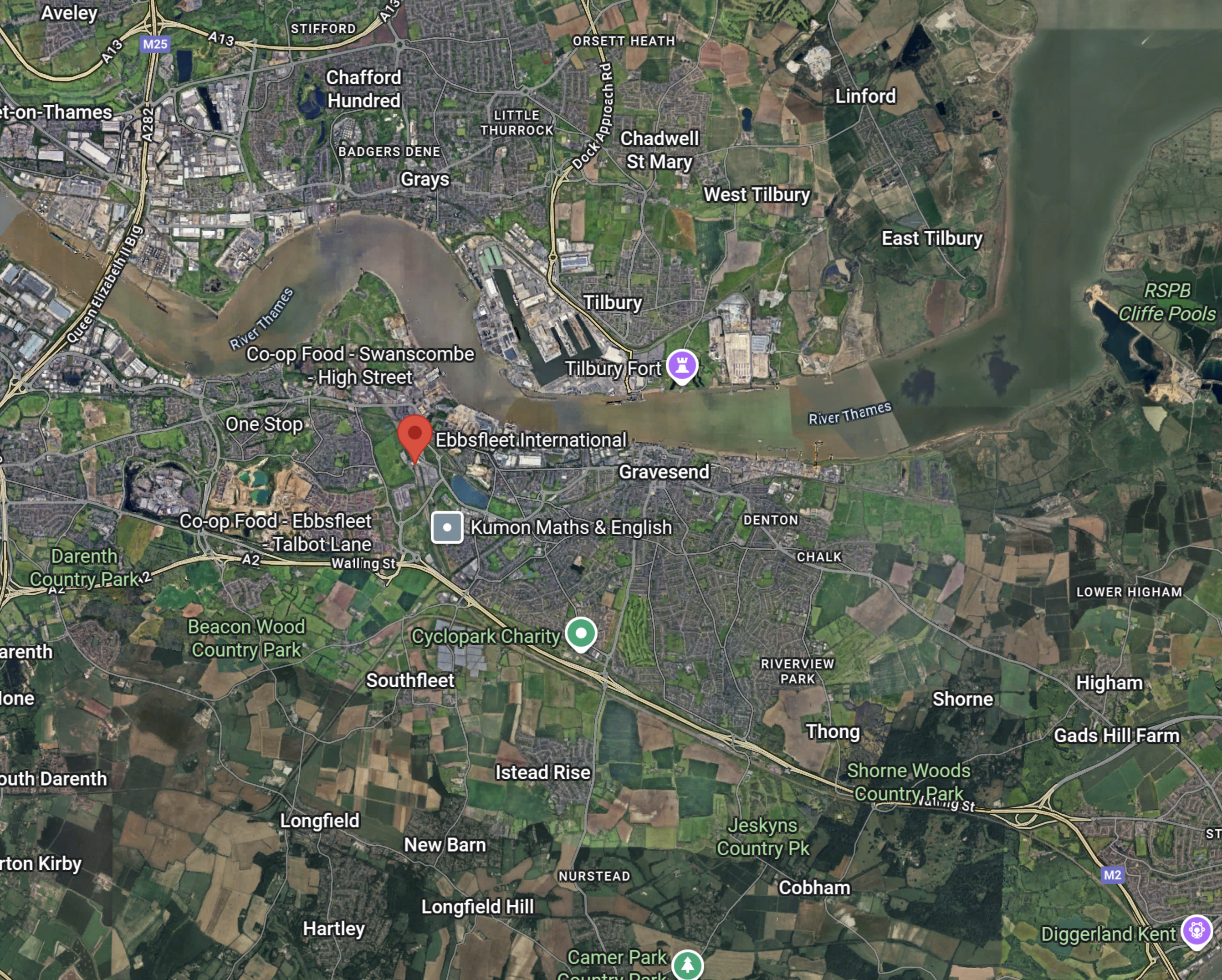
Note.
- The A2/M2 road runs across the bottom half of the map.
- The red arrow marks the position of Ebbsfleet International station.
- The Dartford Crossing is a few miles West of the station.
In my last few years, as an Ipswich season ticket holder, I regularly had a lift to Ebbsfleet International from a friend and the route to the station from the M25 and the A2/M2 wasn’t bad.
But it will be getting better.
This map from the Government’s consultation on the Lower Thames Crossing, shows the road layout in a few years.
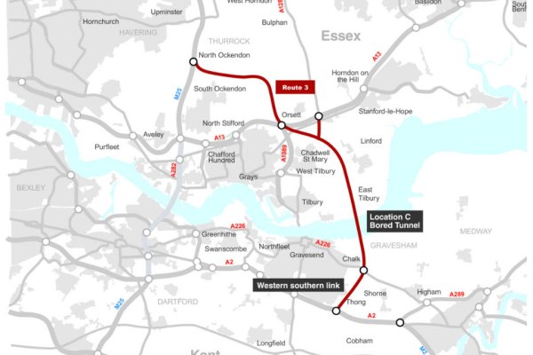
Note.
- The Lower Thames Crossing is shown in red.
- Ebbsfleet International station is about a mile South of Northfleet
- The new crossing will connect to the A2, a few miles East of the link road to the station.
Travellers from much of the East of and Middle England could use the new crossing to get to Ebbsfleet International station.
These are current times from Google.
- Birmingham – 2 hours and 41 minutes
- Cambridge – 1 hour and 17 minutes
- Edinburgh – 7 hours and 44 minutes
- Fishguard – 5 hours and 29 minutes
- Glasgow – 7 hours and 6 minutes
- Holyhead – 5 hours and 29 minutes
- Hull – 4 hours and 1 minute
- Ipswich – 1 hour and 29 minutes
- Leeds – 3 hours and 55 minutes
- Liverpool – 4 hours and 40 minutes
- Manchester – 4 hours and 28 minutes
- Milton Keynes – 1 hour and 37 minutes
- Newcastle 5 hours and 25 minutes
- Norwich – 2 hours 23 minutes
- Nottingham – 2 hours and 55 minutes
- Peterborough – 1 hour and 54 minutes
- Sheffield – 3 hours and 35 minutes
- Stoke-on-Trent – 3 hours and 25 minutes
- York – 4 hours and 16 minutes
Note.
- I would suspect that the opening of the Lower Thames Crossing will knock 10-15 minutes off these times.
- Edinburgh, Glasgow, Hull, Leeds, Newcastle, Nottingham, Peterborough, Sheffield and York would probably be quicker to Europe with a change to Continental train services at St. Pancras, rather than Ebbsfleet International.
- With improvements to rail services, more of these journeys will be quicker by train.
- High Speed Two should connect Birmingham, Liverpool, Manchester and Stoke-on-Trent to London, by the mid 2030s.
But there are some, who always feel their car is safer in a car park!
Ebbsfleet International Station Has A Large Amount Of Car Parking
This map shows the car parks at Ebbsfleet International station.
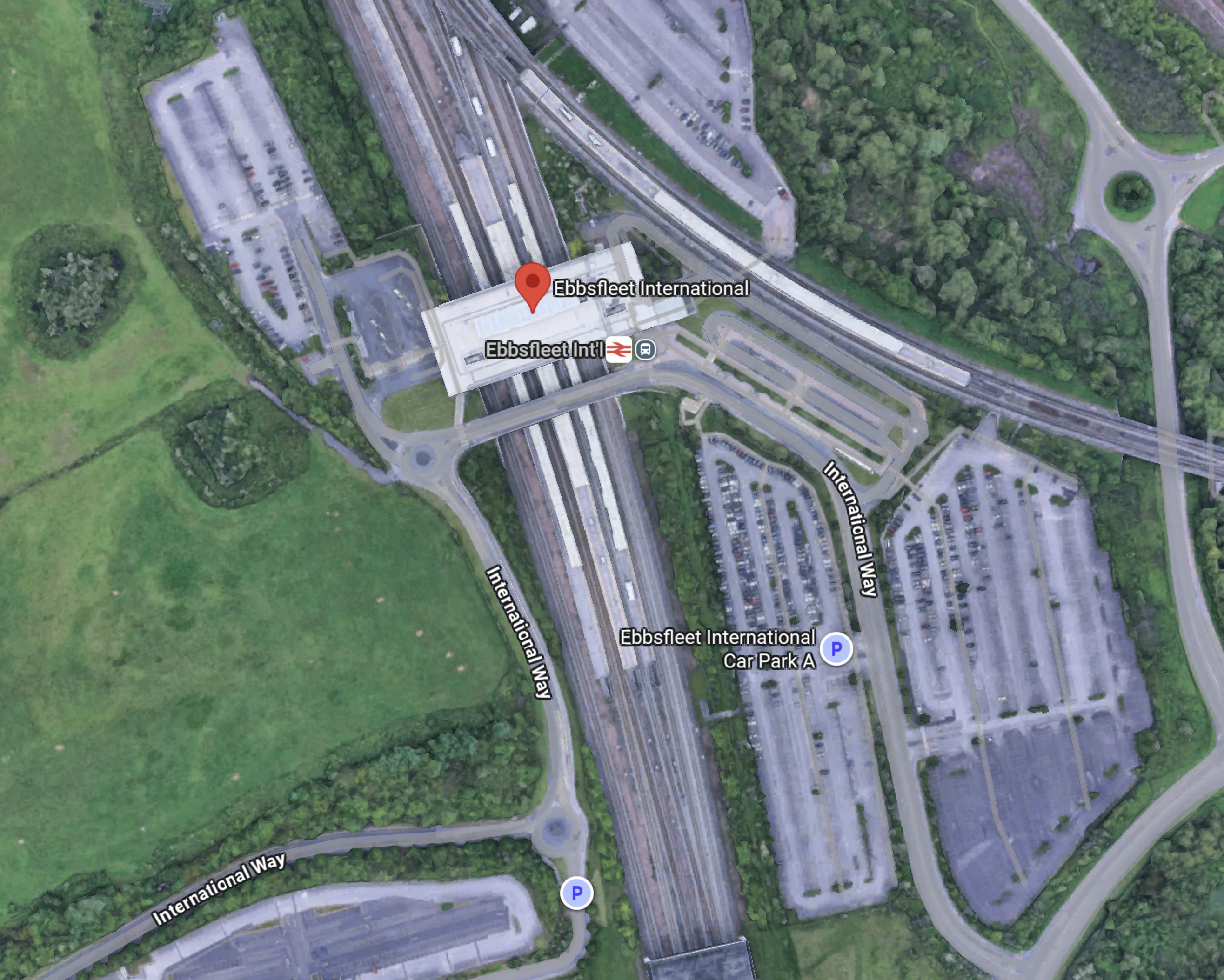
Note.
- Some of the parking areas are marked with a P.
- It is easy to pick-up and drop passengers.
- The car parks could be double-decked to add more spaces if needed.
- According to the Ebbsfleet International web site, the station currently has 5225 parking spaces, 68 accessible car parking spaces.
For those that have a lot of luggage or a large family, taking the car to Ebbsfleet International may be the best option.
Ebbsfleet International Station Should Have A Coach Station
Consider.
- In the next few years, hydrogen-powered coaches with a thousand kilometre range will come to dominate the long distance coach market.
- Mercedes and Wrightbus are know to be developing long-distance hydrogen-powered coaches.
- Hydrogen-powered coaches will be able to reach all of England and Wales and a large part of Scotland from Ebbsfleet International.
- Ebbsfleet International is closely connected to the UK motorway network.
- Continental coaches using the Channel Tunnel, could use Ebbsfleet as a coach interchange with the UK.
- Ebbsfleet International could also handle customs services for Continental coach services, which would take the pressure off the Channel Tunnel and the ferries.
- Ebbsfleet International could also have a coach link to Gatwick Airport.
These and other reasons make me feel, that a coach terminal at Ebbsfleet International is essential.
A Green Connection Between The Two Halves Of The European Union For the Gretas Of This World
Consider.
- There is no zero-carbon route between the island of Ireland and Continental Europe.
- Eurostar is all-electric between London and Continental Europe, but only serves a limited number of destinations.
- Low- or zero-carbon ferries are being designed, that run on hydrogen.
- Trains between London and the Irish ferries are diesel-powered.
- The simplest solution would surely be to run hydrogen-powered coaches between Ebbsfleet International and Fishguard and/or Holyhead. Both journeys would take three and a half hours.
Hydrogen-powered coaches are under development by Wrightbus.
I also asked Google AI if anybody is planning zero-carbon ferries between the UK and ireland and received this answer.
Yes, there are plans for zero-carbon ferries between the UK and Ireland, with a specific “Green Corridor” feasibility study underway for the Holyhead to Dublin route, and a separate, separate commuter service project planned between Belfast and Bangor. The Belfast Maritime Consortium is developing the zero-carbon commuter service, and a separate “Green Corridor” feasibility study is assessing potential low-carbon pathways between Holyhead and Dublin
I believe the green connection is feasible, provided the following happens.
- Ebbsfleet International is reopened and developed as a station for Continental Europe.
- The zero-carbon ferries are developed.
- The busmasters from Ballymena deliver the ultimate hydrogen-powered coach.
- Hydrogen and other fuels are made available, where they is needed.
This could do wonders for the economy of the island of Ireland.
Out of curiosity, I did ask Google AI, what is the longest coach route in the UK and received this answer.
The longest scheduled coach journey in the UK is the Scottish Citylink route from Glasgow to Uig on the Isle of Skye (route 915 or 916), which is about 230 miles and takes around 7 hours and 50 minutes. Historically, there have been much longer international bus routes, such as the Penn Overland tour from London to Ceylon, but these were not regular, scheduled services.
So my proposal at five hours and 29 minutes is only a short hop.
I also believe that with good project management that the additional infrastructure could be built by 2030, with little or no disruption to existing services.
The Future Of HS2 Could Lie In Its Original Vision
The title of this post, is the same as that of this article on Railway Gazette.
This is the sub-heading.
High Speed 2 should be rescoped to run from London Euston to Crewe, taking advantage of the lessons learned and supply chain foundations established during Phase 1, says Dyan Perry, Chair of the High Speed Rail Group.
The article has been written by Dyan Perry, who knows her railways and especially high speed ones well.
These two first paragraphs introduce her arguments.
High Speed 2 stands at a defining crossroads. Phase 1 from Old Oak Common to Birmingham has the green light, and under the new leadership of HS2 Ltd CEO Mark Wild the project is undergoing a positive and much needed ’reset’. With around 31 000 jobs currently supported, more than 75% of tunnelling completed and construction underway on two-thirds of HS2’s viaducts, momentum is building again.
This fresh injection of energy is welcome after years of shifting goalposts and cuts to the project’s scope. However, while Phase I pushes ahead, the handbrake has been pulled on the next critical phases of the project: the route from the West Midlands to Crewe and Old Oak Common to London Euston.
In the short term, this may appear fiscally sensible. However, as with all infrastructure investments, the project and potential returns must be viewed through a long-term lens. After all, a half-built railway moulded by short-term decision-making risks squandering investment to date and losing billions of pounds of taxpayers’ money.
The High Speed Rail Group (HSRG) has these recommendations.
- A “Euston to Crewe” Core.
- West Midlands to Crewe must be given the go-ahead before the powers to do so run out. This would provide much needed capacity on the West Coast Main Line.
- Use the lessons learned on Phase 1 to build West Midlands to Crewe more effectively.
- Build a streamlined, cost effective station at Euston.
- HSRG believes a concession let for a London to Birmingham and Crewe railway line, one that takes learning from the High Speed One financing model, could generate between £7·5bn and £10bn in concession value, a significant return for taxpayers.
High Speed Two needs a cohesive long term plan.
I very much agree with what Dyan and the HSRG are saying.
I also have some related thoughts.
High Speed East Coast
I am a Control Engineer by training and I’ve felt for some time, that the some of the bottlenecks on the East Coast Main Line to the South of Doncaster could be solved by intelligent digital signalling.
I believe that the major cities of the North-East of England and Eastern Scotland would be best served by direct high speed trains from London on the East Coast Main Line. I also think, that such an approach would deliver similar times to High Speed Two via Birmingham.
North of York
Just as stations on the West Coast to the North of Crewe will be served by High Speed Two and the West Coast Main Line, stations North of York will be served by trains going up the East Coast Main Line.
The Element Of Competition
I said earlier, that if a 30-year concession were to be sold for the West Coast Main Line, it could raise between £7.5bn and £10bn.
So why not sell a concession for the East Coast Main Line?
A further benefit, is that competition between the two concessions and the budget airlines, might bring down timings and prices, just as competition did in the Railway Races of 1888 and 1895.
High Speed North Wales
I have believed for some time, that there is a need for a zero-carbon (green) route between London and Dublin and ultimately between the Channel Tunnel and Dublin.
The last Conservative government promised to electrify Crewe and Holyhead along the North Wales Coast.
This route could deliver passengers to Holyhead for a zero-carbon high speed catamaran to Dublin.
The EU would be a beneficiary and might like to help fund the route.
Could An Open Access Operator Develop A Train Service Along The South Coast of The UK Between Kent and Fishguard?
Before I go into detail, I will answer a question that explains the terminology and the why’s and wherefores’ of the title of this post.
What Is An Open Access Operator?
This is the first paragraph of the Wikipedia entry of an Open Access Operator.
In rail transport, an open-access operator is an operator that takes full commercial risk, running on infrastructure owned by a third party and buying paths on a chosen route and, in countries where rail services run under franchises, are not subject to franchising.
In the UK, these are all open access operators, that are running services.
Note.
- Other groups are developing services.
- Regional, High Speed, International, Local and Sleeper services seem to be offered by various open access operators.
- Grand Central is a subsidiary of Deutsche Bahn,
- Hull Trains and Lumo are both subsidiaries of FirstGroup.
Open Access operators seem to operate in most European Union countries.
Why Run Between Kent and Fishguard?
- The main purpose of the train service would be to provide a low-cost rail connection between the island of Ireland and particularly the Republic of Ireland, with the Southern part of England and the European Union.
- At both ends of the route the train service would connect to ferries.
- At the Eastern end, the train service would also connect to Eurostar services through the Channel Tunnel.
- The Port of Dover could be efficiently connected to Dover Priory Station.
- Dover Priory Station could be the Eastern terminus.
- The service could stop at Folkestone Central station, if ferries call at the Port of Folkestone in the future.
- The service could stop at Ashford International station for Eurostar services.
- Fishguard Harbour station has been built as a train terminus for the Port of Fishguard.
- Fishguard Harbour station could be the Western terminus.
This could be a busy service.
Where Would The Trains Call?
Intermediate stations would depend on passenger umbers, but could start as Folkestone Central, Ashford International, Hastings, Eastbourne, Brighton, Portsmouth & Southsea, Southampton Central, Romsey, Salisbury, Warminster, Westbury, Trowbridge, Bradford-on-Avon, Bath Spa, Bristol Temple Meads, Bristol Parkway, Newport, Cardiff Central, Gowerton, Llanelli and Carmarthen.
How Long Would The Journey Be?
The journey would be around 377 miles and I suspect could take about three and a half hours with modern digital signalling.
Surprisingly, the route is fully-electrified except for the following.
- Ashford International and Ore – 27.9 miles
- Southampton Central and Bristol Parkway – 82 miles
- Cardiff Central and Fishguard Harbour – 115.6 miles
All gaps should be able to be bridged using battery power.
I suspect trains would be Hitachi high speed battery-electric trains.
Would Any European Funding Be Available?
This is an interesting question, as the service does join up two separate sections of the European Union.
Eurostar Cancels All Today’s Trains After Tunnel Floods
The title of this post, is the same as that of this article on the BBC.
This is the sub-heading.
Eurostar has cancelled all of Saturday’s services to and from London St Pancras due to flooding in a tunnel under the River Thames, throwing new year travel into chaos.
These are the first two paragraphs.
This morning, Eurostar said it hoped later services could run but it has now cancelled all 41 trains.
All Southeastern’s high-speed services to Ebbsfleet, which use the same line, have also been cancelled.
I know the tunnel shouldn’t flood, but Eurostar don’t seem to have an adequate emergency plan to keep things moving, when it does.
The plan would obvious depend on where and what the problem was, but if something goes wrong at the London end of High Speed One, then surely the remaining infrastructure should be used to run an emergency service.
With flooding in the tunnel between Stratford International and Ebbsfleet International, trains could only run as far as Ebbsfleet, but surely an hourly shuttle could be run between Ebbsfleet and both Brussels and Paris.
The problem would surely be getting travellers between St. Pancras and Ebbsfleet International.
- There can be no trains between Central London and Ebbsfleet International, as the tunnel is flooded and can’t be used.
- Rail replacement buses would be difficult to organise at such short notice.
- I doubt rail replacement buses could be run from St. Pancras station, as traffic is generally solid in the area of the station at all times.
The nearest station to Ebbsfleet International is Northfleet station, which has four trains per hour (tph) to and from London; two each to St. Pancras and Charing Cross.
I have walked between Ebbsfleet International and Northfleet stations, but in times of disruption, I’m sure buses operating a shuttle would be better.
The Wikipedia entry for Northfleet station, explains, why the pedestrian link has not been built, in this paragraph.
The station is very close to Ebbsfleet International station (the NNE entrance is only 334 yards (305 m) from Northfleet’s station), but passengers (using public transport) will find it far easier to access Ebbsfleet International from Gravesend or Greenhithe, as these stations are more accessible and offer easy access to Fastrack bus services. The walking route between the two stations is 0.6 miles (1 km) or 0.8 miles (1.3 km) and a suitable pedestrian link has not been built because of funding issues and objections from Land Securities.
Perhaps after the pantomime this Christmas, the connection will be improved.
So4’s Law will probably mean, that if it is built, it will only be used by travellers and those working at Ebbsfleet International station for whom it is more convenient.
Could A Mega-Station Be Built For The Channel Tunnel?
This article on Railway Gazette International, is entitled Start-Up Announces Amsterdam To London And Paris High Speed Train Ambitions.
It talks about how Dutch start-up; Heuro wants to run fifteen trains per day (tpg) between London and Amsterdam.
The article then has this paragraph, which details other operators, who are wanting to run services between London and the near Continent.
Heuro’s announcement comes after Spanish start-up Evolyn announced plans in October for a Paris – London service, while on November 11 British newspaper The Daily Telegraph reported that Sir Richard Branson and Phil Whittingham, former head of Virgin Trains and Avanti West Coast, were also drawing up plans to compete with Eurostar and had held discussions with infrastructure managers.
This leads me to the conclusion, that there will be a need for more capacity for trains and/or passengers at some time in the future.
- There are six International platforms at St. Panvcras International station, which can each probably handle four trains per hour (tph), so I suspect the station could handle 24 International tph.
- As a modern high speed train can carry over 500 passengers, that is 12000 passengers per hour.
- Visit St. Pancras station in the morning and it is often crammed with travellers coming from and going to Europe.
I suspect that the number of trains may not be a problem, but the number of passengers will.
We could always join Shengen, but then that would be an open door to all the would-be migrants to the UK.
This Google Map shows Stratford International station.
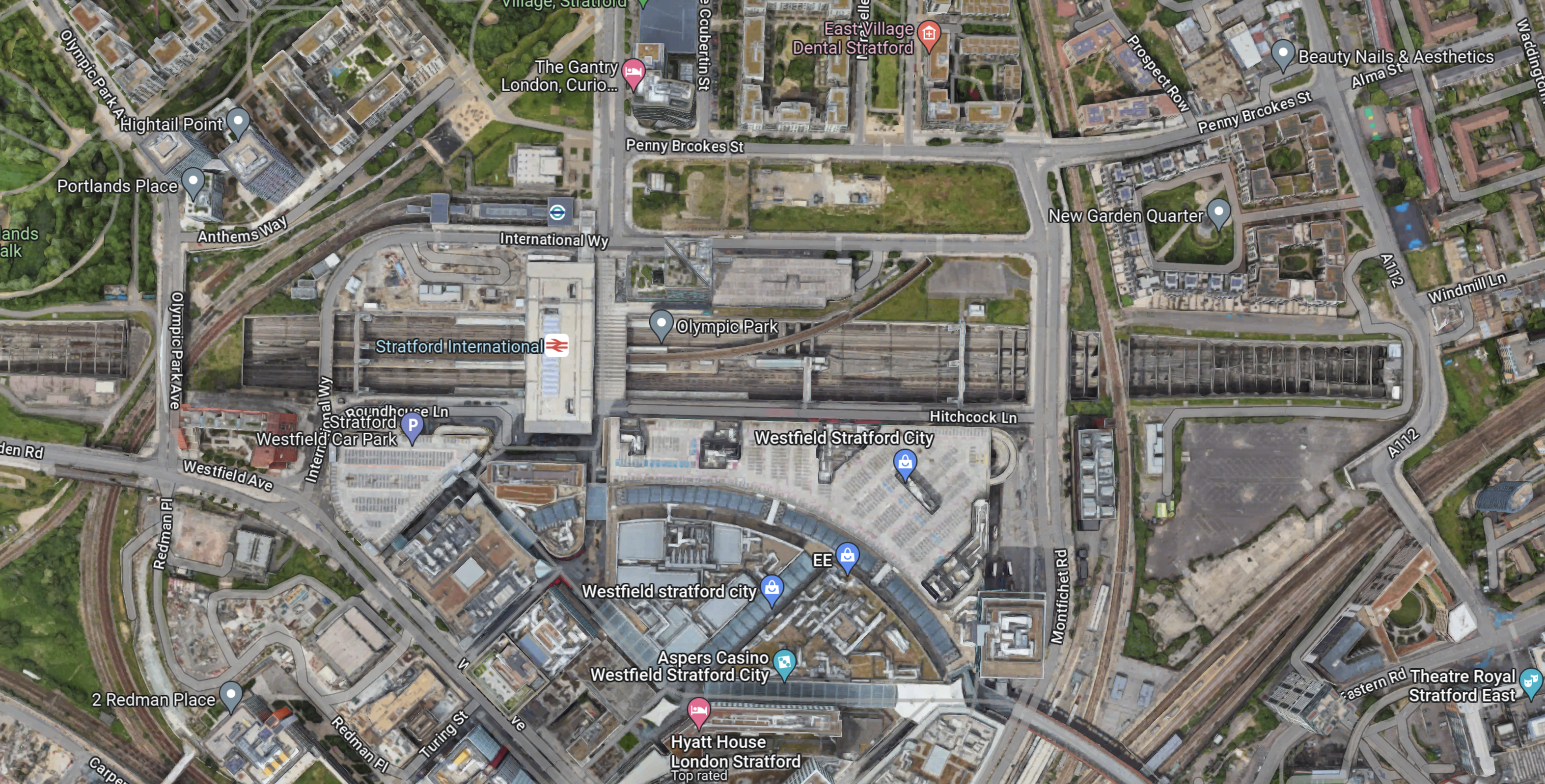
Stratford International station is in a soulless concrete cavern, that lies across the middle of the map.
In Platforms 1 And 4 At Stratford International Station, there are a lot of pictures of the station.
I think it would be extremely difficult to add extra platforms and passenger facilities to the station.
This Google Map shows Ebbsfleet International station.
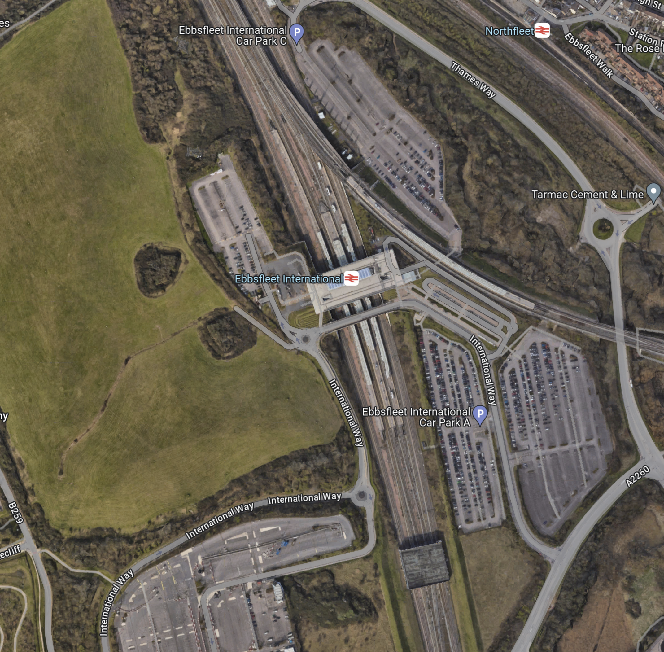
Note.
- Ebbsfleet International station, with its two International and four domestic platforms is in the middle of the map.
- The station is surrounded by car parks with a total of 5,000 spaces.
- Northfleet station is in the North-East corner of the map.
There is a lot of land, without any buildings on it.
These are my thoughts.
Enough Extra Bay Platforms To Handle The Additional Trains
There would appear to be space for perhaps two bay platforms to terminate trains.
But would passengers we happy being dumped outside Central London?
Would An Elizabeth Line Extension To Ebbsfleet Be Needed?
There are various plans to link the Elizabeth Line tp Ebbsfleet International.
In Elizabeth Line To Ebbsfleet Extension Could Cost £3.2 Billion, I showed this map from the Abbeywood2Ebbsfleet consultation.
There doesn’t appear to be too much new infrastructure, except for a proper connection between Northfleet and Ebbsfleet stations. References on the Internet, say that the similar-sized Luton DART connection at Luton Airport, cost around £225 million.
The Elizabeth Line connects to the following.
- Bond Street
- Canary Wharf
- City of London
- Farringdon for Thameslink
- Heathrow Airport
- Old Oak Common for High Speed Two
- Liverpool Street station
- Oxford Street
- Paddington station
- Slough for Windsor
- Tottenham Court Road for the British Museum, Oxford Street, Soho, Theatreland and the Underground.
- West End of London
- Whitechapel for the Overground and Underground
For many people like me, the Elizabeth Line at Ebbsfleet will provide one of the quickest ways to get to and from European trains.
Ebbsfleet Has Space For A Bus Station
A bus station with comprehensive routes could be built at Ebbsfleet station, which I don’t think will be possible at St. Pancras.
It would also be possible to provide an easy route to Gatwick Airport along the M25.
Hotel Accommodation
This is surely necessary.
It would make an ideal base for tourists and business people, who wanted to visit several of the large cities connected to Ebbsfleet.
A Very Large Car Park
Consider.
- Heathrow Airport is looking at providing upwards of 50,000 car parking spaces.
- Some travellers are seriously allergic to public transport and will always use their car.
- Many travellers these days want to take a severely outside case with them, when they’re only having a weekend in Paris.
I feel that a mega-station for Europe will need upwards of 10,000 car parking spaces. All of them with vehicle-to-grid chargers.
A Very Large Storage Battery
According to this page on the E-on web site, the average size of the battery in an electric vehicle is 40 kWh.
If 5,000 car parking spaces were to be fitted with vehicle-to-grid charging (V2G), that would be 2 MWh of energy storage, that could be used by National Grid, to store surplus electricity.
Get V2G right and it could make a serious contribution to your parking costs.
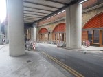
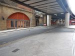
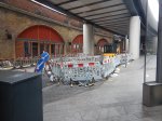
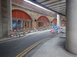
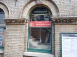
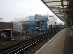
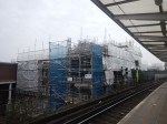
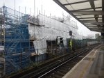
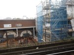
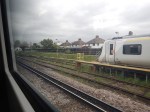
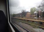
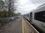
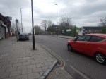
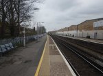
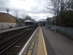
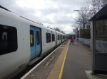
Pictures Of Ebbsfleet Station
These are some pictures I took at Ebbsfleet station today.

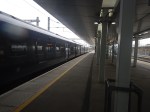
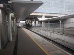


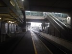


Note.
- The station is a fairly boring concrete, glass and steel construction.
- The SouthEastern HighSpeed services also go to St. Pancras, so they don’t offer any different connectivity towards the capital.
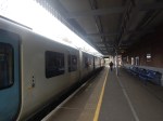
In addition, the SouthEastern HighSpeed Class 395 trains aren’t step-free at the platforms, as these pictures shows.
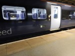
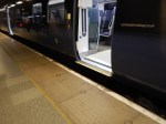
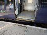
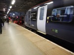
As I came back into St. Pancras International station, staff were struggling to load a wheelchair onto a train using a ramp.
Would A Two-Station Solution Increase Capacity?
High Speed Rail lines have high capacity trains and there are examples of more than one station at the end of a route.
- The London end of High Speed Two will have stations at Old Oak Common and Euston.
- The Manchester end of High Speed Two will have stations at Manchester Airport and Manchester Piccadilly.
- The Edinburgh end of the East Coast Main Line has stations at Waverley and Haymarket.
- The Amsterdam end of Eurostar and Thalys has stations at Rotterdam, Schipol Airport and Amsterdam.
A selection of stations gives choice and convenience for travellers.
Conclusion
I believe that selective development of Ebbsfleet International station could be used to take the pressure away from St. Pancras International station.
These developments could include.
- A comprehensive bus station
- Elizabeth Line to Northfleet
- Hotel Accommodation
- Lots Of Car Parking
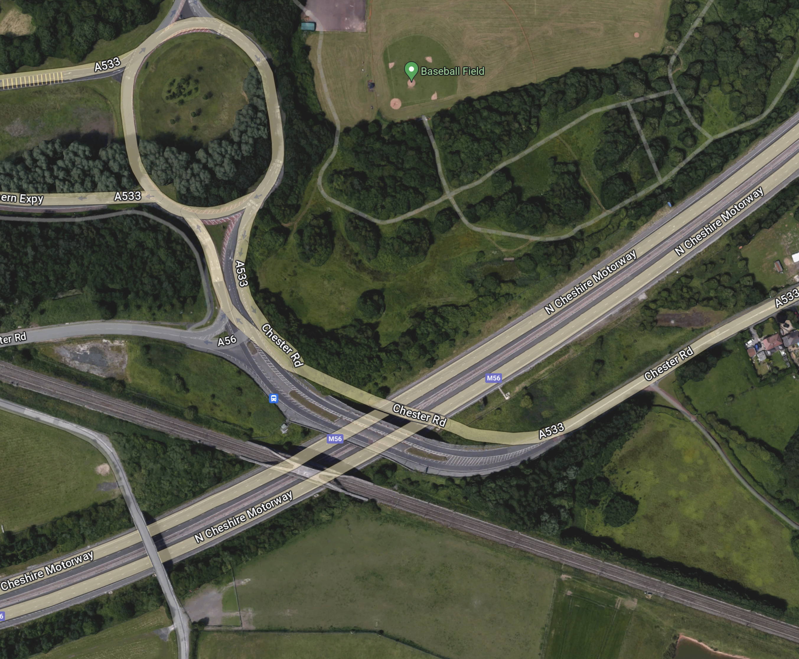
Could Manchester Airport Be Accessed From The West By A Tunnel Under The M56?
This OpenRailwayMap shows the railways of East London between Dalston Junction and Stratford International stations.
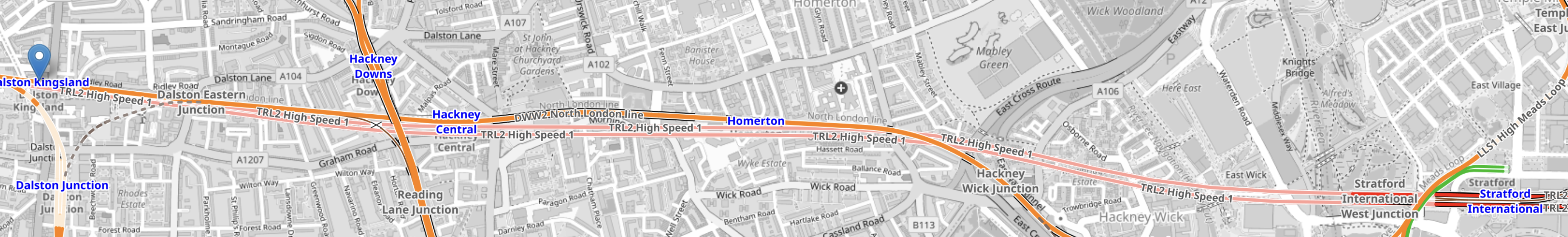
Note.
- Dalston Kingsland station is marked with an arrow in the West of the map.
- Stratford International station is marked by the blue lettering in the East of the map.
- The orange line between them is the North London Line.
- There are also two pink lines, which indicate High Speed One, which is dug several metres below the North London Line.
It can’t be much different to dig a high speed railway underneath a motorway. Has anybody done this?
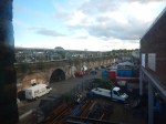
This OpenRailwayMap shows the railways leading to Manchester Airport.
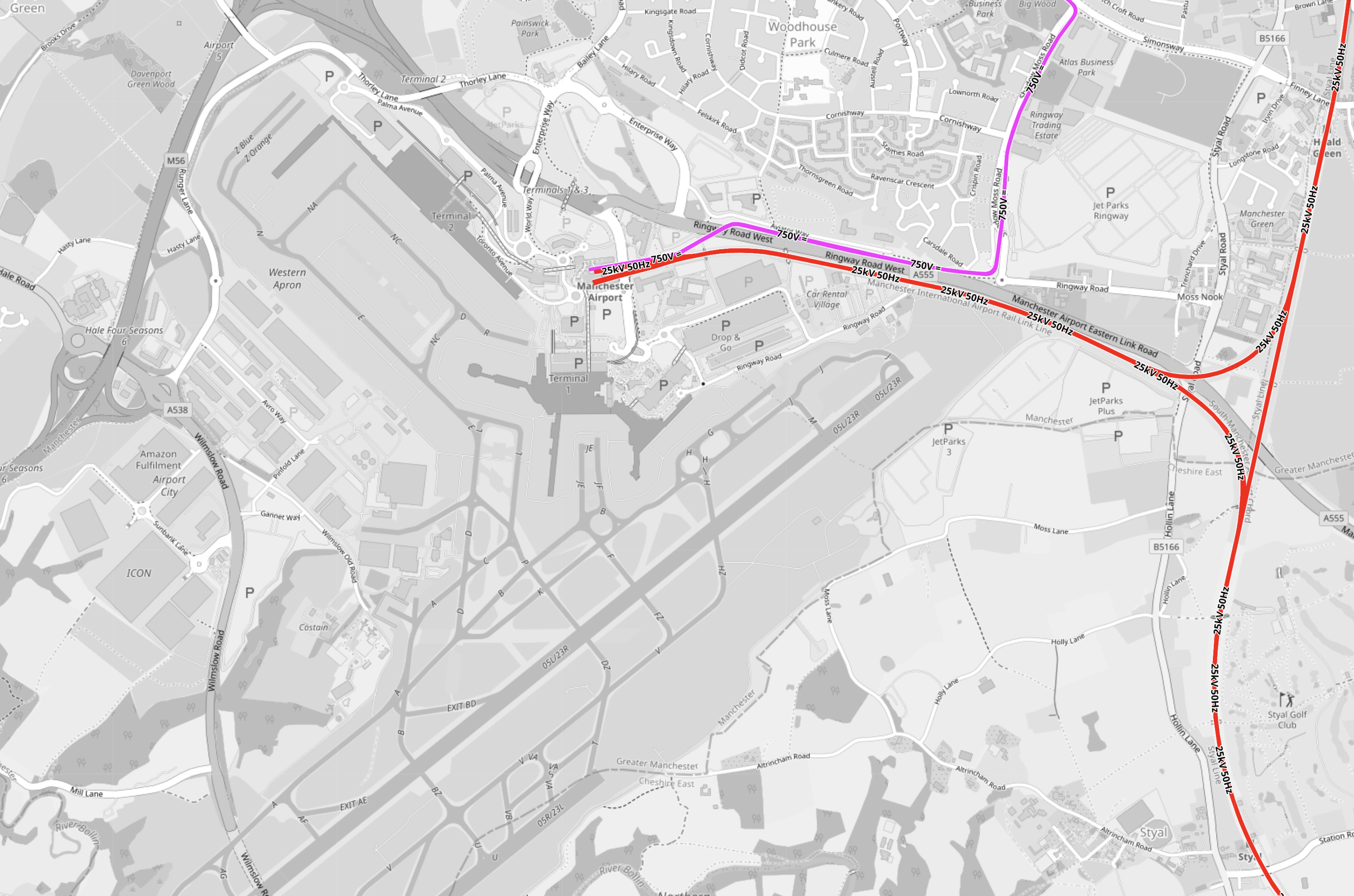
Note.
- Junctions 5 and 6 of the M56 motorway are on the Western edge of the Airport.
- The red tracks are the Styal Line.
- The mauve tracks are the Metrolink.
- It should be noted that railway lines pass under Heathrow Airport’s runways.
Point 4 makes me sure, that Manchester Airport can have a station connected to the West by a railway under the M56.
This OpenRailwayMap shows the railways around Weaver Junction on the West Coast Main Line, where the trains branch off to Liverpool.

Note.
- The West Coast Main Line goes down the Eastern side of the map.
- Warrington Bank Quay is the next station to the North.
- The Liverpool Branch goes off to the West.
- The M56 tuns diagonally across the map from the North-East corner crossing both both branches of the West Coast Main Line.
This Google Map shows where the M56 crosses over the West Coast Main Line to Warrington Bank Quay.

Note.
- The M56 motorway is obvious.
- The Eastbound motorway goes to Manchester Airport and Manchester.
- The junction is numbered 11.
- The railway runs down the Western side of the map.
I believe that it would be possible to connect a railway running East under the motorway to the West Coast Main Line.
This Google Map shows where the M56 crosses over the Liverpool branch of the West Coast Main Line.
Note.
- There is no motorway junction here.
- The North-East bound motorway goes to Manchester Airport and Manchester.
- The railway runs slightly diagonally across the bottom of the map.
- The Westbound railway goes to Runcorn and Liverpool.
- The Eastbound railway goes to Weaver Junction, Crewe and the South.
There would only need to be a connection between Liverpool and the railway under the motorway going to and from Manchester Airport.
I have some further thoughts and questions.
This Is Just My First Thought
I am happier about the connection to the Liverpool branch than the Northern connection.
But then I feel there are several routes at both junctions, some of which will take a wider route.
How Long Will The Tunnels Be?
Between Junctions 11 and 6 on the M56 is 16 miles.
At What Speed Would The Trains Run?
I suspect that once on the straight section between Junctions 11 and 6, speeds of up to 90 or 100 mph should be possible, but speeds would probably be lower at the junctions to the West Coast Main Line.
How Would It Connect To Manchester Piccadilly?
The tunnel would continue the other side of the Airport and it’s a further 9.4 miles to under Manchester Piccadilly.
In The Rival Plans For Piccadilly Station, That Architects Say Will ‘Save Millions’, I wrote about Weston Williamson’s plan for Manchester Piccadilly station.
This was their visualisation.

Note.
- In the visualisation, you are observing the station from the East.
- The existing railway lines into Piccadilly station are shown in red.
- Stockport and Manchester Airport are to the left, which is to the South.
- Note the dreaded Castlefield Corridor in red going off into the distance to Oxford Road and Deansgate stations.
- The new high speed lines are shown in blue.
- To the left they go to Manchester Airport and then on to London, Birmingham and the South, Warrington and Liverpool and Wigan, Preston, Blackpool, Barrow-in-Furness, the North and Scotland.
- To the right, they go to Huddersfield, Bradford, Leeds, Hull and the North East, and Sheffield, Doncaster and the East.
- Between it looks like a low-level High Speed station with at least four tracks and six platforms.
- The high speed lines could be oriented so they ran East-West, rather than North-South in this visualisation.
- The Manchester Metrolink is shown in yellow.
The potential for over-site development is immense. If the Station Square Tower was residential, the penthouses would be some of the most desirable places to live in the North.
Onward From Manchester Piccadilly
I would hope that a connection could be made to the Huddersfield Line to the East of Manchester Piccadilly station, so that trains could use the TransPennine Upgrade all the way to Leeds.
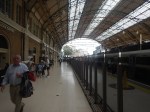
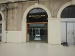
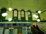
The Platform 1 End Of Victoria Station – 2nd August 2023
I took these pictures of Platform 1 at Victoria station and Wilton Road, which runs along the side of the station.
This gallery shows Platform 1, how it is accessed and the retail units that you pass to access the platform.


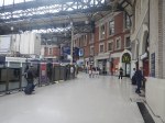


Note.
- The glass barrier between the retail units and the toilets and Platform 2.
- Passengers for Platform 1 have to walk down to gates that are at the far end of the retail units.
- The Victoria end of Platform 1 is set back from the other platforms.
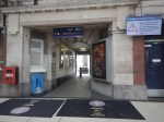
This gallery shows Wilton Road.


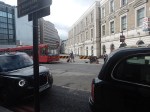
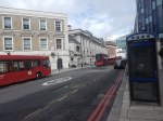


Note.
- Wilton Road is immediately outside of the station
- Parts of the outside of the station has quality stonework.
- There is a bus stand close to the station.
- There is a taxi rank on the other side.
- There is an entrance to the station.
- There is also an entrance to the Underground station, if you walk to the front of the station.
This gallery shows Hudson’s Place.


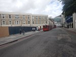


Note.
- The shops inside the station by Platforms 1 and 2 are behind the three-story Victorian facade.
- An M & S sign is in one window.
- There is an entrance to the station.
What is happening behind the hoardings in the middle of Hudson’s Place?
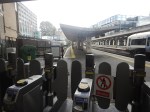
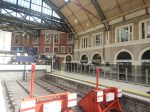
This gallery shows Platforms 1 and 2.
Note.
- Platform 1 is surprisingly long,
- I’ve seen steam specials in the platform with the engine at the country end.
- Platform 2 is also long.
This gallery shows the gateline upgrade and a few odds and sods.


Note.
- The platforms 3 and 4 would appear to be shorter and can only take eight-car trains.
- The gatelines in the two halves of the station are being upgraded and new destination boards are being upgrade.
This table gives the platform lengths for Platforms 1 to 7.
- Platform 1 – 270 metres
- Platform 2 – 359 metres
- Platform 3 – 180 metres
- Platform 4 – 203 metres
- Platform 5 – 247 metres
- Platform 6 – 245 metres
- Platform 7 – 286 metres
Note.
- Platforms 3 and 4 will only take eight-car trains, which are 160 metres long.
- All other platforms will take twelve-car trains, which are 240 metres long.
- A single High Speed Two Classic Compatible Train os 200 metres long.
This OpenRailwayMap shows the platforms at Victoria station.
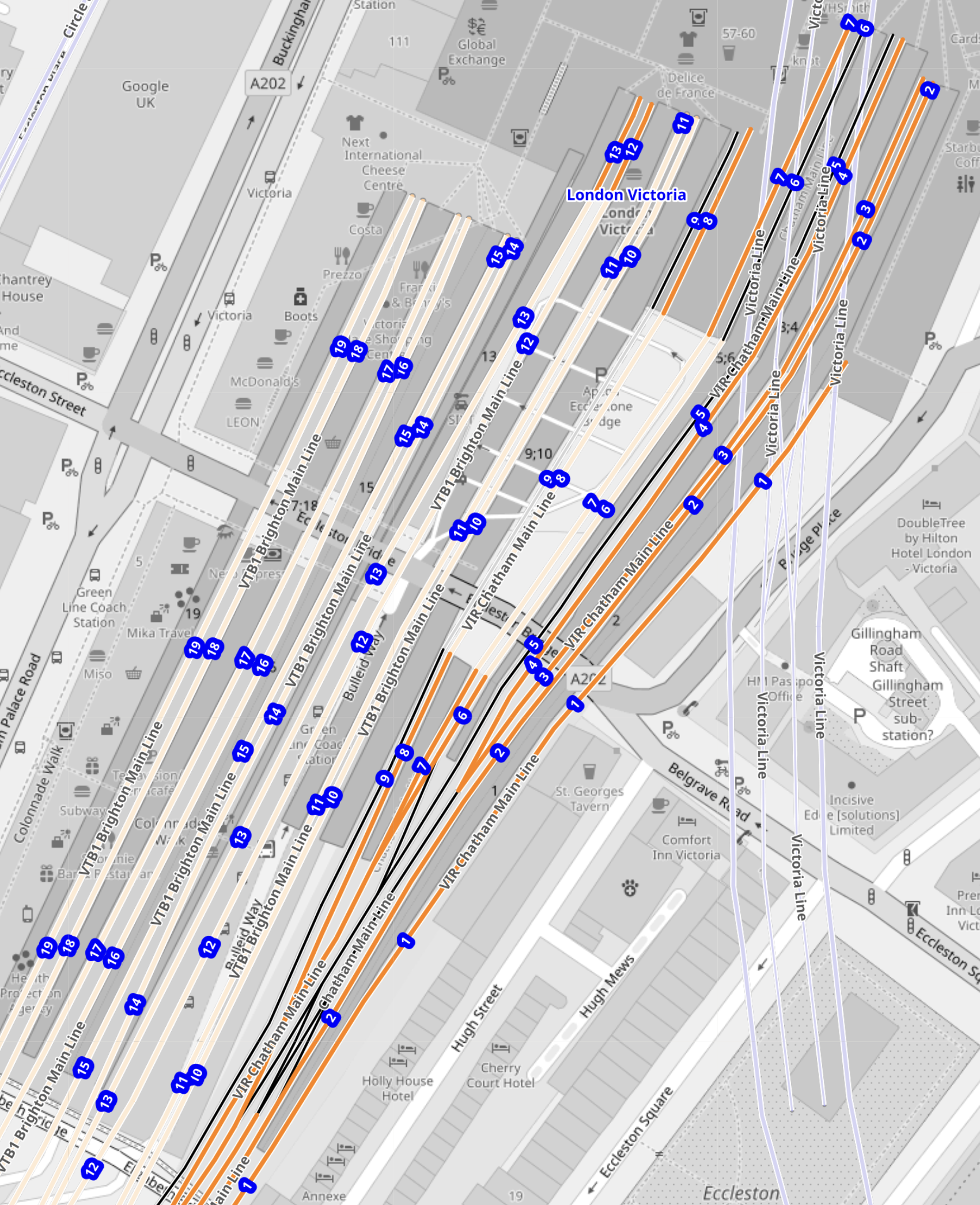
Note.
- The platforms are numbered starting with one on the right.
- The blue numbers give the platform numbers.
- Platform 1 is stepped-back from all the others.
- Platform 2 is the longest platform.
- Platforms 1 and 2 share an island platform.
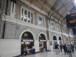
This second OpenRailwayMap shows the North-East corner of the previous map to a larger scale.
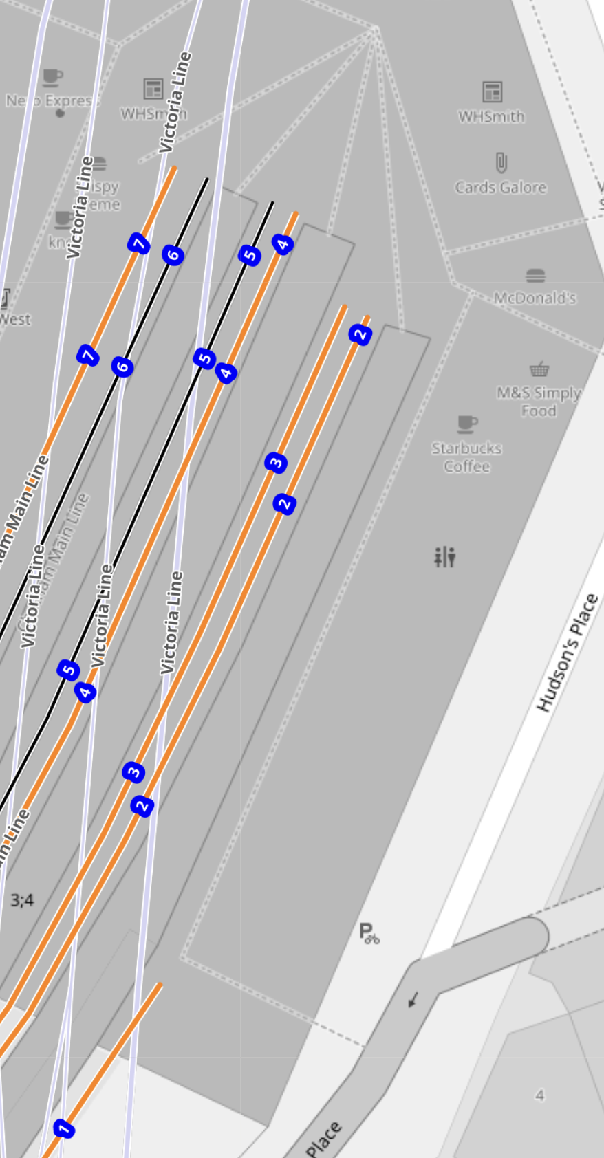
Note that there are retail units for WH Smith, Cards Galore, McDonalds, M & S Simply Food and Starbucks, toilets and a reception area for British Pullman.
Could this area be revamped to be a Customs and Immigration are for passengers going to and from Europe?
- I estimate the area available is about twenty-five metres wide over a hundred metres long.
- There are also two extra floors above the ground floor.
- It might be possible to build over part of Hudson’s Place outside of the station.
I suspect that, if the space is efficiently used, that a secure and efficient Customs and Immigration facility, that would handle perhaps four trains per hour (tph) could be created.
National Express Owner Plans To Launch Eurostar Rival
The title of this post, is the same as that of this article on the Financial Times.
I have documented a few attempts to start a competitor to Eurostar.
- Express London-Amsterdam Eurostar Service Being Explored
- Getlink Pushes Budget Train Service Between London And Paris To Rival Eurostar
- RENFE Aims To Compete With Eurostar On Paris – London Route
- Transmanche Metro
- The Wikipedia entry for Eurostar details German and Italian attempts to start a service.
Note.
- None of the proposals seem to have got past being announced.
- The only useful fact given in the article, is that the service will be called Evolyn.
Searches of the Internet reveal virtually no more facts, rehashes of the FT article and a lot of waffle.
These are my thoughts.
Would Eurostar Give Up And Slots At St. Pancras International?
I use slots deliberately, as British Airways don’t seem keen to ever give up slots at Heathrow or Gatwick.
And I suspect Eurostar would be the same!
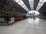
St. Pancras International Doesn’t Have Enough Space
This article on Kent & Surrey Bylines, which is entitled Why Are There Such Queues At St Pancras For Eurostar?, is typical of many you can find on the Internet.
This is the sub-heading.
Eurostar no longer stops at Ebbsfleet or Ashford International, and the queues at St Pancras are becoming intolerable
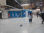
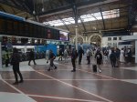
This is the first paragraph.
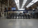
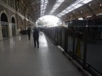
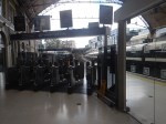
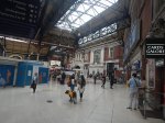
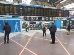
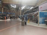
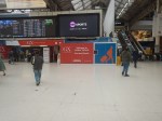
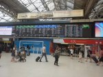
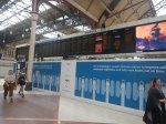
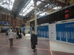
Passengers are complaining. The queues at St Pancras are now intolerable. The lines stretch back into the main hall. It is like an airport with the slow shuffle towards the security kiosks. Then, once you are through that, you go to the departure lounge. However, there is not enough seating for the waiting passengers (see picture above taken this month). Because you have to check in 90 minutes before the train starts, one can be stuck standing in this waiting room for an hour. Unless, that is, one is white-haired and venerable, in which case one is usually offered a seat by someone younger and fitter.
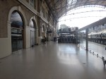
It was written on the 9th of last month. But the problems have been bad for some years, as St. Pancras station is too small.
Could Ashford International Station Be Used As A Terminal?
The station has platforms on High Speed One, but the Financial Times says the service will be run between London and Paris.
I doubt even Ryanair would stretch it to say that Ashford was in London.
Could Ebbsfleet International Station Be Used As A Terminal?
It might be possible to say that Ebbsfleet was in London, but then it is not well-connected to Central London.
Does That leave Just Stratford International?
In Platforms 1 And 4 At Stratford International Station, I came to this conclusion.
I have come to these conclusions about Platforms 1 And 4 at Stratford International station.
- The platforms are designed to take the longest Eurostar trains.
- The access to Platforms 1 And 4, doesn’t appear to be designed for continuous heavy use.
- The diamond crossover at the Eastern end of the station would allow Stratford International station to be used as an emergency terminus.
The track layout at the London end of High Speed One appears to have been designed for all eventualities.
But I suspect that Stratford International station will need a lot of money spent to provide Customs and Immigration facilities.
Could Victoria Station Be Used As A Terminal?
National Express is primarily a coach company, so could they be planning a service to connect the long distance coach networks of London and Paris?
This OpenRailwayMap shows the link between High Speed One and the Chatham Main Line.
Note.
- Ebbsfleet International and Northfleet stations are at the top of the map.
- High Speed One is the red line going through Ebbsfleet International station.
- The orange line going across the South-West corner of the map is the Chatham Main Line between Victoria station and Chatham.
- The Chatham Main Line is connected to High Speed One, by the Waterloo Connection or the Fawkham Junction Link.
This route was the original route for Eurostar to Waterloo.
But it could just as easily go into Victoria.
- Southeastern’s Victoria and Dover service takes this route.
- The distance between Victoria and Fawkham junction is 22.6 miles.
- Trains take 28 minutes with a stop at Bromley.
- I wrote some more about the Fawkham Junction Link in Kent On The Cusp Of Change – Fawkham Junction Link.
- I also wrote some more about Victoria as a High Speed terminal in Kent On The Cusp Of Change – Victoria As A Highspeed Terminal.
Note that the two Kent On The Cusp Of Change posts were based on an article in the July 2017 Edition of Modern Railways.
I am convinced that Victoria could be used as a terminal for Continental trains.
Where Would The Service Terminate In France?
Everything I said about congestion also applies to Gare Du Nord, so would it be better to use Marne-la-Vallée–Chessy station that serves Disneyland Paris and Charles de Gaulle Airport, which used to be used by Eurostar.
There are certainly possibilities to do something different.
What Trains Would Be Needed?
The FT article says that the consortium have talked to Alstom, who build the Class 373 trains.
The trains would probably need a specification like this.
- Maximum speed of at least 200 mph, like Eurostar’s Class 374 trains.
- Ability to run on tracks with a UK loading gauge.
- Ability to use both 750 VDC third rail and 25 KVAC overhead electrification.
- Less than 240 metres long, which are the platform lengths at Victoria.
Would a High Speed Two Classic-Compatible Train be suitable?
- The trains will have a maximum speed of 224 mph.
- It has been designed for a UK loading gauge.
- The two partners in these trains; Alstom and Hitachi, have both built high speed trains capable of running at slower speeds using third rail electrification.
- The standard length of the trains are 200 metres.
I suspect they would do nicely.
Conclusion
I suspect that the National Express service could use High Speed Two Classic-Compatible Trains between Victoria and Marne-la-Vallée–Chessy stations.
- The trains would be standard with the ability to use third rail electrification
- They would use a single International platform at Victoria and Marne-la-Vallée–Chessy.
- Victoria station is well-connected to the Underground.
- Marne-la-Vallée–Chessy station is connected to Charles de Gaulle airport and Disneyland Paris.
I feel that there is a feasible service that can be designed.
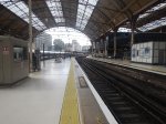
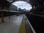
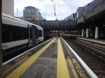
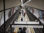
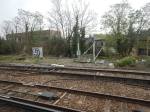
Platforms 1 And 4 At Stratford International Station
This map from OpenRailwayMap shows the tracks through Stratford International station.
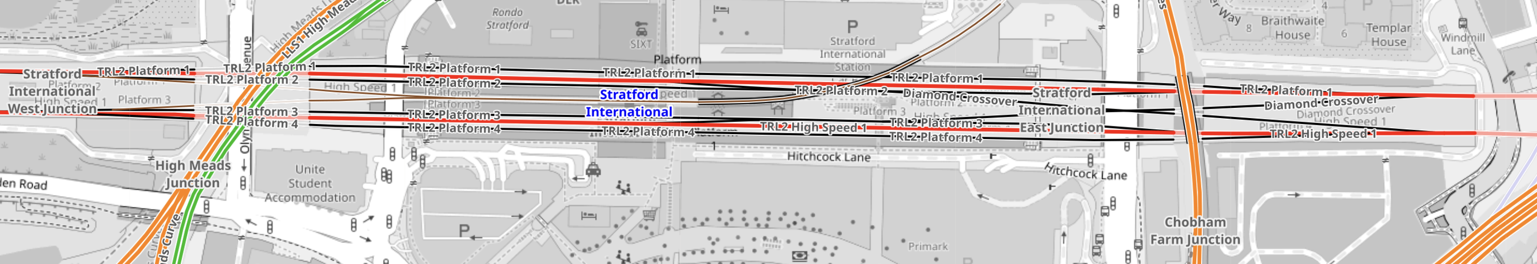
The tracks starting from the North side of the station are as follows.
- Platform 1 – Not used by normal services – Shown in black
- Fast Line for Eastbound through trains – Shown in red
- Platform 2 – Used by Eastbound stopping services – Shown in black
- Platform 3 – Used by Westbound stopping services – Shown in black
- Fast Line for Westbound through trains – Shown in red
- Platform 4 – Not used by normal services – Shown in black
Note.
- There are three Eastbound tracks, that connect together into a single track from St. Pancras and a single track to Ebbsfleet International station.
- An Eastbound train can use any of the three Northernmost tracks to pass though Stratford International station.
- There are three Westbound tracks, that connect together into a single track to St. Pancras and a single track from Ebbsfleet International station.
- A Westbound train can use any of the three Southernmost tracks to pass though Stratford International station.
- As Eurostar trains aren’t scheduled to stop at Stratford International station, they would normally take the fast lines through the station.
- Southeastern HighSpeed services usually stop in Platforms 2 or 3, as they pass through the station.
- There is a diamond crossover at the eastern end of the station.
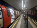
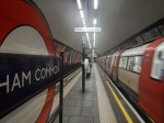
It would appear that under normal circumstances Platforms 1 and 4 are not used.
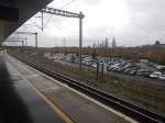
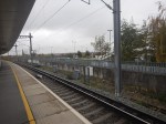
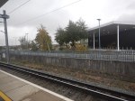
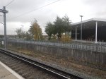
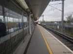
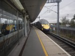
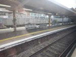
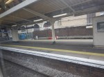
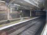
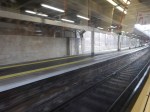
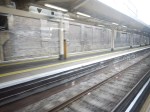
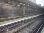
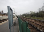
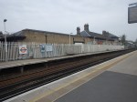
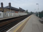
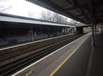
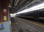
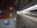
These pictures show Platforms 1 and 4 at Stratford International station.
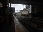

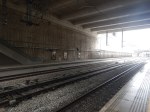
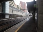
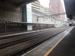


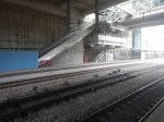

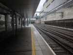
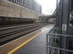
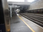
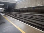
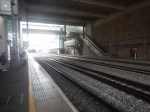
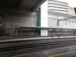
Note.
- Both Platforms 1 and 4 appear to have stairs, an escalator and a lift.
- I left from Platform 2, in a pair of Class 395 trains, which would have been 244 metres long.
- From the OpenRailwayMap, Platforms 1 and 4, appear to be longer than Platforms 2 and 3.
As Eurostar’s Class 374 trains are 390 metres long, it looks like Platforms 1 and 4 are designed to be able to handle these trains.
The Diamond Crossover At Stratford International Station
The diamond crossover at the Eastern end of the station could be used for unusual or occasional train movements.
- It could allow services to use St. Pancras station, when there was an inconvenient points failure.
- It might also allow a train to terminate before returning to the East in either Platform 1 or 4.
It could even allow Stratford International station to be used as a terminus during emergencies or engineering works.
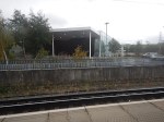
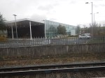
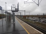
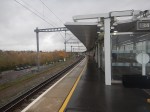
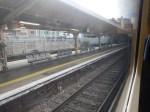
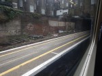
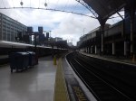
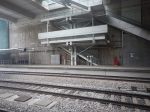
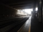
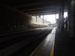
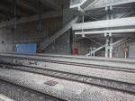
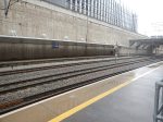
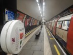
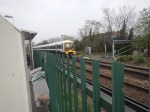
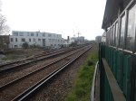
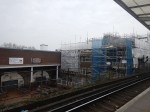
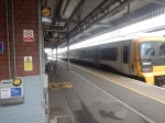
An Escalator Problem At Stratford International Station
There was an escalator problem At Stratford International station today, which meant I had to walk down to the platform.
I took these pictures.


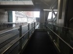

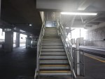
After walking down, I am fairly sure, that these stairs, which appear to be identical to those on Platforms 1 and 4, are for occasional use only.
Conclusion
I have come to these conclusions about Platforms 1 And 4 at Stratford International station.
- The platforms are designed to take the longest Eurostar trains.
- The access to Platforms 1 And 4, doesn’t appear to be designed for continuous heavy use.
- The diamond crossover at the Eastern end of the station would allow Stratford International station to be used as an emergency terminus.
The track layout at the London end of High Speed One appears to have been designed for all eventualities.
Clapham High Street Could Gain Direct Overground Routes To Victoria Station
The title of this post, is the same as that of this article on the Clapham Nub News.
These two paragraphs introduce the article.
Local councillors and the Clapham Transport Users Group have been in discussions with Network Rail about the direct route once the current ‘Networker’ trains are replaced.
Clapham High Street lost its direct services to Victoria in December 2012 when the South London Line was withdrawn in favour of the London Overground to Clapham Junction.
This forces passengers onto the Northern Line, which through Clapham has two dangerous-looking stations; Clapham Common and Clapham North.


I have a few thoughts and observations.
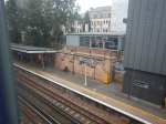
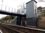
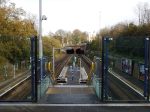
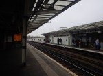
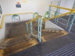
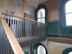
Clapham High Street Station
These pictures show Clapham High Street station.
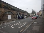


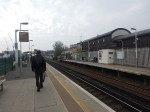
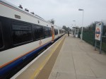
Note.
- The station is Grade II Listed.
- There are four tracks through Clapham High Street station.
- Only the lines used by the London Underground have platforms.
- I don’t think it will be difficult to add platforms to the other two tracks.
- The platforms will probably take five-car trains.
- Access to the platforms is by a subway, which could probably be extended to the other side of the tracks.
- A second entrance would be closer to Clapham North station.
- I suspect step-free access would not be too difficult to install.
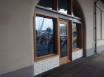
- The tracks are over railway arches, which could be developed to add to the quality businesses in the area.
This Google Map shows the station.
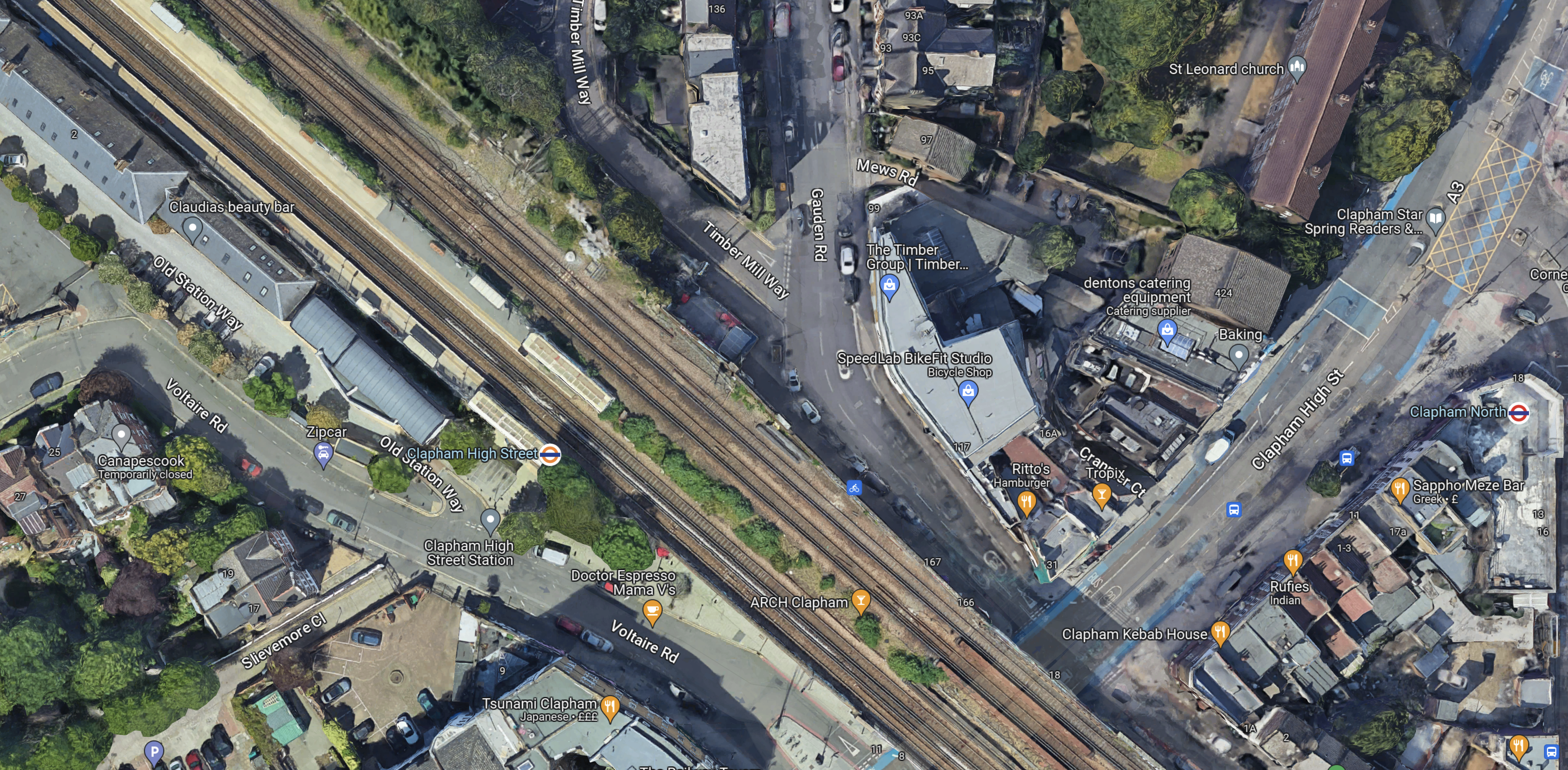
Note.
- Clapham High Street station is in the North-West corner of the map.
- Clapham North station is at the Eastern edge of the map in the middle.
- There seems plenty of space for two more platforms.
I think there is a lot of scope to improve this station.
Tracks Through Clapham High Street Station
This map from cartometro.com shows the tracks through Clapham High Street station.

Note.
- The Overground tracks are shown in orange and black.
- The fast lines, which are to the North of the Overground lines are shown in black.
- Shepherds Lane and Voltaire Road junctions allow trains on the fast lines to call in Clapham High Street station.
I suspect full digital signalling will be employed for efficiency of handling the junctions.
Services Through Clapham High Street Station
These services run through Clapham High Street station.
- London Overground – Dalston Junction and Clapham Junction – four tph – Goes via Denmark Hill and Peckham Rye
- Southeastern – London Victoria and Ashford International – one tph – Goes via Brixton, Herne Hill and West Dulwich
- Southeastern – London Victoria and Dartford – two tph – Goes via Denmark Hill, Peckham Rye, Nunhead and Lewisham
- Southeastern – London Victoria and Dover Priory – one tph – Goes via Brixton, Herne Hill and West Dulwich
- Southeastern – London Victoria and Gillingham – one tph – Goes via Denmark Hill, Peckham Rye, Nunhead and Bromley South
- Southeastern – London Victoria and Orpington – two tph – Goes via Brixton, Herne Hill and West Dulwich
- Southeastern – London Victoria and Ramsgate – one tph – Goes via Brixton, Herne Hill and West Dulwich
Note.
- tph means trains per hour.
- The London Overground services could be increased to 6 tph.
- Only the London Overground services stop in Clapham High Street station.
- The Dartford, Gillingham and Orpington trains are pathed for 90 mph trains.
- The Ashford International, Dover Priory and Ramsgate trains are pathed for 100 mph trains.
It is a comprehensive timetable.
Southeastern’s New Trains
In Battery EMUs Envisaged In Southeastern Fleet Procurement, I wrote about Southeastern’s proposed new trains.
Full details haven’t been announced yet, but I think we can be sure of the following.
- The first trains to be replaced will be the Networker trains, because they are the oldest and slowest.
- The new trains will have selected door opening (SDO), as this a feature of nearly all modern trains.
- I also suspect the trains will be capable of running at 100 mph and will be five cars long, with the ability to run in pairs.
This will enable the new trains to cross over from the fast lines to the Overground lines to stop in Clapham High Street station.
How Many Trains Would Stop At Clapham High Street Station?
Currently trains passing through the station are as follows.
- London Overground – 4 tph – Stopping
- Southeastern – 3 tph – 100 mph services to Ashford International, Dover Priory and Ramsgate – Non-stop
- Southeastern – 5 tph – 90 mph services to Dartford, Gillingham and Orpington – Non-stop
Note.
- It is likely that the London Overground service will go to 6 tph.
- Would 100 mph services always go through without stopping?
- In an ideal world would it be best if services alternated?
I suspect that a better service could be provided between Clapham High Street and Victoria with very little expenditure on infrastructure.
High Speed One Issues
An article in the July 2017 Edition of Modern Railways is entitled Kent On The Cusp Of Change.
The article suggests that Fawkham junction, could be used to allow Southeastern Highspeed services to access Victoria as a second London terminal, to increase capacity on High Speed One.
The route could be via Clapham High Street, Denmark Hill, Bromley South, St. Mary Cray, Swanley and Farningham Road.
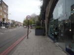
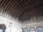
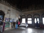
The Arches Underneath
There are several railway arches underneath the tracks at Clapham High Street station.


Some of the businesses look good and there are several other arches that are boarded up.
Railway arches are now generally owned by The Arch Co.
In Findlater’s Corner At London Bridge – 11th February 2023, I wrote about the company’s restoration of some arches at London Bridge station, which included these pictures.


I suspect that a similar restoration in up-market Clapham could be a good investment for The Arch Co.
A Four-Platform Clapham High Street Station
Consider.
- There is space for two new platforms alongside the fast lines.
- The station entrance is in an arch, that goes right under the tracks.
- Putting lifts in an arch would not be the most challenging of tasks.
- A second entrance in Gauden Road would be nearer Clapham North Underground station.
- It should also be remembered that the Government is giving out levelling up funding.
- Hackney is to receive this type of funding and I wrote about it in Hackney Central Before Levelling Up.
I can see a fully-accessible four-platform station being built at Clapham High Street station.
Denmark Hill Station
Denmark Hill station is the next station to the East of Clapham High Street station and after a rebuild is now a high quality station, with these features.
- Four tracks and platforms.
- Frequent trains to Ashford International, Clapham Junction, St. Pancras, Victoria and Whitechapel.
- Full step-free access with lifts.
- A solar roof.
- A Grade II listing.
- King’s College and Maudsley Hospitals are next door.
- A pub.
I wrote about the station in Denmark Hill Station – 4th September 2021.
These are a few pictures.


Note the solar roof. There’s more about the roof on this page of the BiPVco web site.
On the About page, there is a section called Our Story, where this is said.
BIPVco was established in April 2015 following five years of collaborative research between Tata Steel LCRI (Low Carbon Research Institute) and Swansea University with support from the Welsh government.
The research program developed ways of integrating thin-film CIGS PV cells directly onto the same substrates that make roofs and walls so that true BIPV functionality would become integral to the building envelope and could be achieved without having to resort to heavy on site mounting systems.
Our manufacturing processes were further enhanced to suit commercial production, and the products and procedures were tested and accredited before commercial launch.
Working with select partners, we designed and built many pilot PV integrated roofs between 2015 and 2017 in varying climates, including Nigeria, Canada, UAE and the UK, to demonstrate product suitability in all environments. The full commercial launch was effected in June of 2017.
They certainly seem to have taken solar panels to a new level.
I would also rate Denmark Hill station one of the finest suburban railway stations in the world!
Peckham Rye Station
The next station to the East of Denmark Hill station is Peckham Rye station.
Like many other stations and buildings in London, including the original Denmark Hill station, Peckham Rye station was designed by Charles Henry Driver.
These are some pictures, I’ve taken over the years at Peckham Rye station.


Note.
- It is a very busy station.
- I’ve read somewhere, that it is the busiest station in the UK, without any step-free access.
- It could be a magnificent station.
- One of the people driving this project is the architect; Benedict O’Looney.
This page on the Network Rail web site is entitled Peckham Rye Station Upgrade and it starts with this statement.
On 7th March 2022, we submitted Planning Permission and Listed Building Consent applications to upgrade Peckham Rye station to make it fully accessible with more capacity and better facilities for passengers.
It’s all a bit out of date, but these pictures, that I took this morning, indicate that something is progressing.


This article on IanVisits gives a few more details.
South London Crosslink
The South London Crosslink, doesn’t seem to have a website or a Wikipedia entry.
But it is mentioned in a question and answer to the London Mayor.
In response to this question.
Will you consider bringing the Victoria rail service back to Clapham High Street station and providing direct trains to Brixton, Herne Hill, and Bromley South?
The Mayor gave this answer.
The Department for Transport (DfT) is responsible for these services, as they run Southeastern railway as operator of last resort. Transport for London (TfL) is not opposed to the existing Southeastern services to and from Victoria making additional calls at Clapham High Street should the DfT, wish to take the idea forward.
There are however several practical issues that would need to be taken into consideration, and any changes to the service would be subject to cost-effective solutions being found to these.
The Clapham High Street platforms are too short for the eight-car trains used on the Victoria to Dartford and Orpington metro routes, and the existing rolling stock lacks a safety intervention called “Selective Door Opening” that enables trains to call at a station where the platform is shorter than the train. There are also technical restrictions, such as the frequent routing of these services along an adjacent pair of tracks which do not have any platforms, which would make implementation difficult using the existing railway infrastructure. Finally, there would need to be clear consideration on the wider capacity of the rail network and the robustness of the timetable. All of these concerns could affect the value for money of any proposal for these services to call at Clapham High Street station.
As I showed earlier, it looks like new trains will solve most of these problems. If they don’t, then the wrong trains have been ordered.
But there’s still not much about where the route will go after Peckham Rye, except for vague mentions of Dartford and Orpington.
I asked a friend and they said the South London Crosslink could possibly go to Bellingham.
This map from cartometro, shows the route between Denmark Hill and Crofton Park stations.
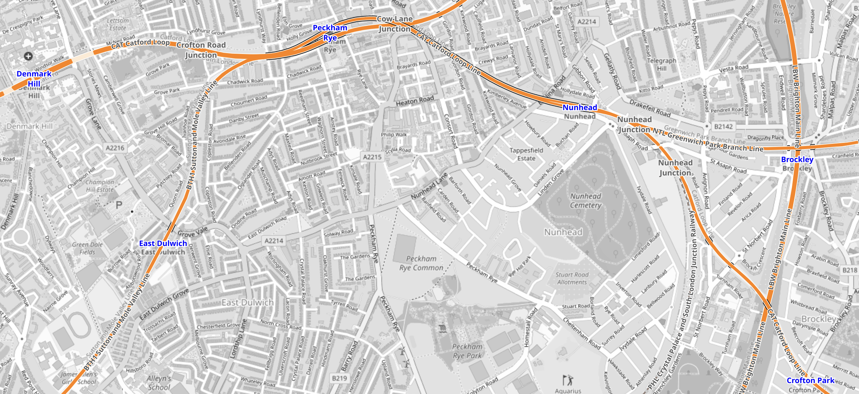
Note.
- Denmark Hill station is in the North-West corner of the map.
- Crofton Park station is in the South-East corner of the map.
- The route would be via Peckham Rye and Nunhead stations.
- It is not a very fast route with an operating speed of 50-60 mph.
- In Nunhead Junction Improvement, I wrote about improvements needed at Nunhead junction to the East of Nunhead station to improve capacity for freight trains.
This second map from cartometro, shows the route between Crofton Park and Bellingham stations.
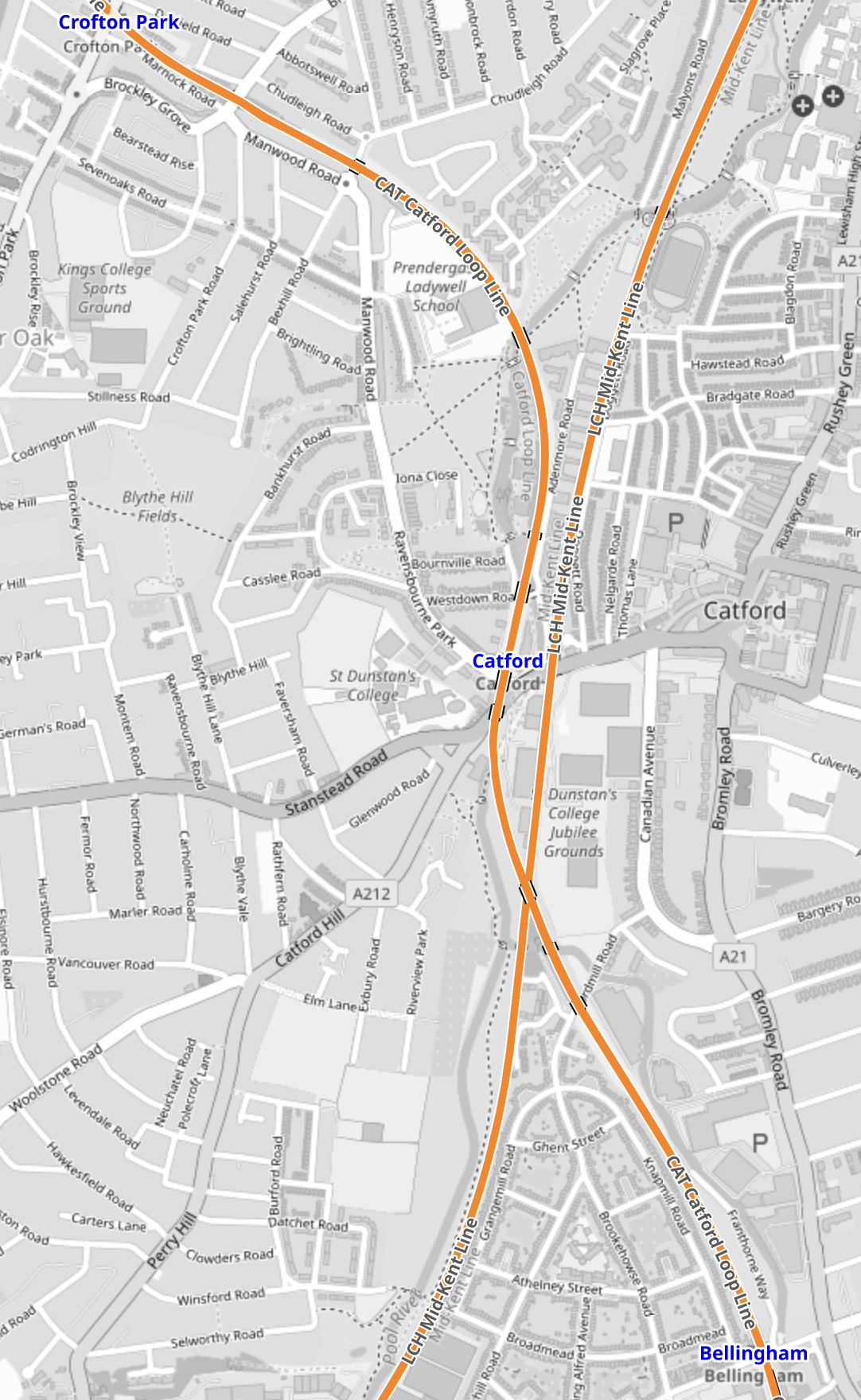
Note.
- Crofton Park station is in the North-West corner of the map.
- Bellingham station is in the South-East corner of the map.
- The line going diagonally across the map from North-East to South-West is the Hayes Line to Hayes.
- There are plans to create an interchange station at Catford.
This Google Map shows Bellingham station.
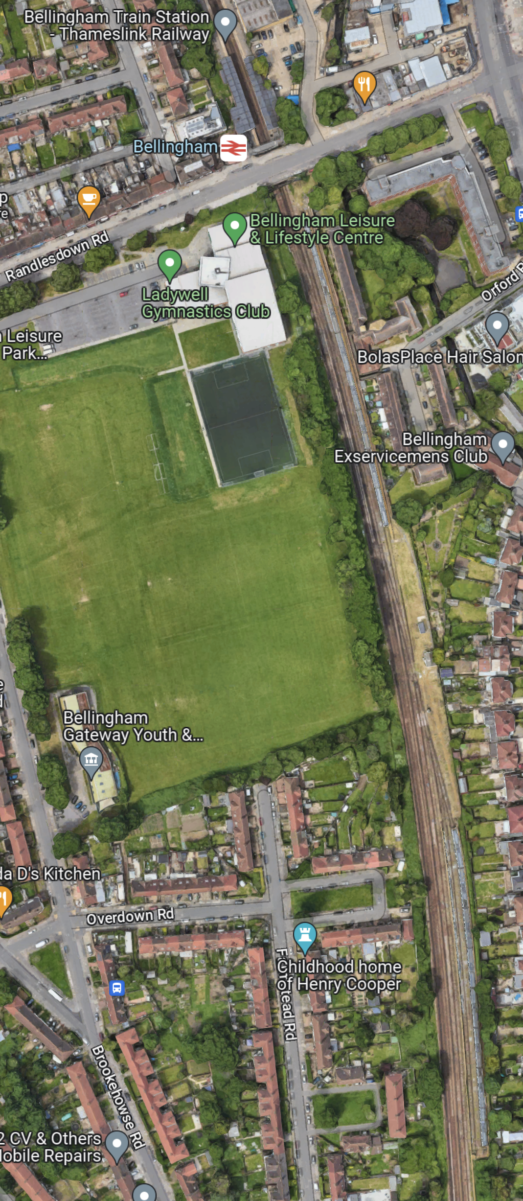
Note.
- Bellingham station is at the top of the map.
- Bellingham station is on the Catford Loop Line.
- South of Bellingham station are a series of sidings.
Is the reason, that Bellingham station was proposed as a terminus, that with a proper interchange at Catford, it creates a very efficient operational railway with some convenient sidings thrown in?
This map from cartometro, show the track layout at Bellingham station.
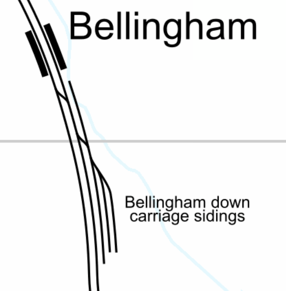
I believe that the sidings could be used as a turnback siding for trains from both directions.
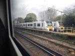
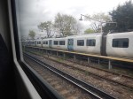
These pictures show trains in the sidings.
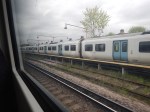
And these are of the station.

Note.
