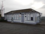
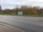
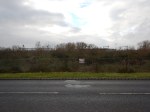
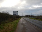
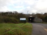
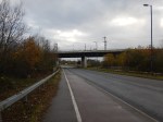
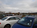
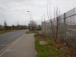
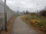
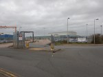
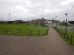
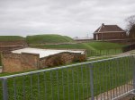
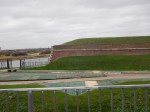
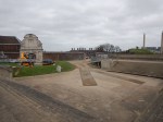
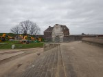
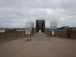
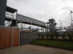
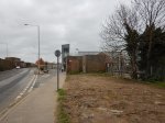
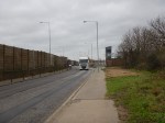
The Midland Metro Extension Is Nearly There!
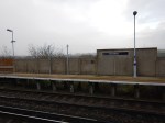
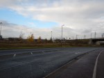
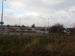
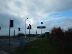
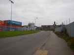
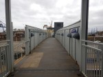
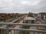
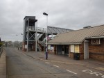
The Midland Metro is now running into Birmingham City Centre by bypassing Birmingham Snow Hill station and running initially to a stop at Bull Street. I visited Birmingham today and took these pictures.
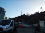
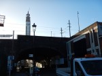
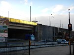


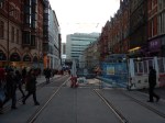


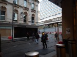

Note the following.
- There are two sets of pictures. In the first, I walked to Bull Street and in the second I took the tram there.
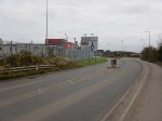
- The tram route enters Birmingham City Centre on a viaduct alongside Snow Hill station.
- It would appear that the stop at Birmingham Snow Hill station is being built on the viaduct.
- The stop at Corporation Street is still being built.
- There would appear to be no stop alongside New Street station.
I can’t see the line opening for a few months yet.
So Near And Yet So Far!
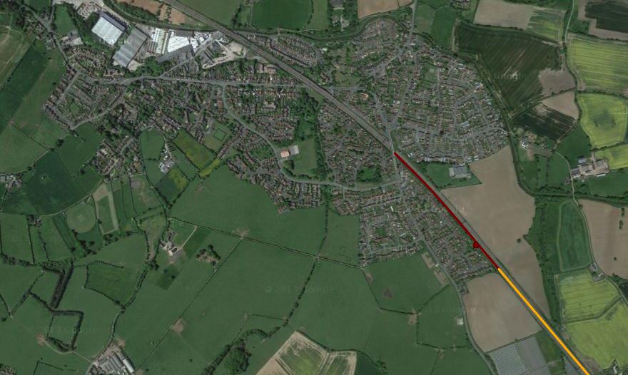
This Google Map shows the geographical relationship between Northfleet station on the North Kent Line and Ebbsfleet International station on the High Speed 1 Rail Link.
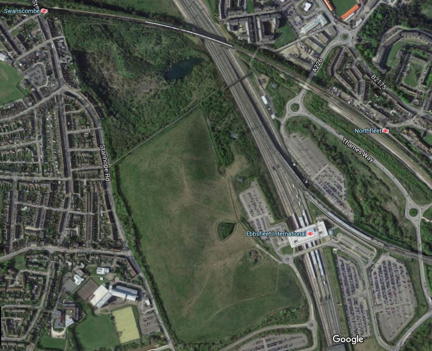
Northfleet And Ebbsfleet International Stations
Note Swancombe station at the top left, which is also on the North Kent Line.
In my view the designers of High Speed 1, lost sight of the ball here, just as they did at Stratford International station.
To many people and especially to a lot of rail commentators and builders, connectivity is very important, as it often gives passengers the ability to do difficult journeys easily with a simple cross-platform interchange.
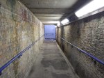
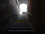
If you look at the positions of Northfleet and Ebbsfleet International stations, as the crow flies it is about four hundred metres. But to walk it along the A226, Thames Way and a loop into Ebbsfleet International station took me thirty-eight minutes.
I took these pictures as I walked.
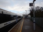
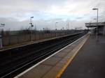


I am left with the following conclusions.
- Northfleet station appears to only stand up because the woodworm keep holding hands.
- Northfleet station is very welcoming to visitors to the town!
- The current route is a badly-signposted disgrace.
- I didn’t see any signposts pointing the other way.
- It would be a nightmare in bad weather.
- It is a step-free route.
It would not be the most difficult feat of engineering to build a walkway from Northfleet station to the Car Park C on the Northfleet side of Ebbsfleet International station.
Incidentally, the Ebbsfleet International station web site says this about getting to the station by rail.
If you can’t reach us direct then we’re just a 10 minute walk from Northfleet domestic station which is serviced by the North Kent Line.
For my age and health, I can walk reasonably fast, but it took me over three times as long. Did they hire Mo Farah to do the time test?
I think someone measured it on a map as four hundred metres and said that he or she could walk it in ten minutes.
If they did, it is downright incompetence.
I challenge Eurostar to find anybody over sixty-five, who doesn’t have form as an athlete, to walk the signposted route in ten minutes!
If they find someone, who can do it, I’ll give fifty pounds to Railway Children!
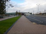
Walthamstow Village Has All Changed
These pictures show the implementation of the mini Holland in Walthamstow Village.


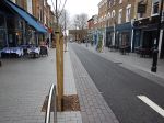


I like it! I wondr if these protestors have mellowed?
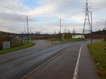
Exploring Tilbury Riverside
The idea was simple. I would walk from Tilbury Town station to the site of the former Tilbury Riverside station and have a look at the London Cruise Terminal and Tilbury Fort, before taking a ferry to Gravesend to come home.
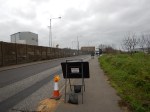
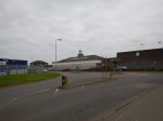


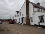

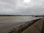


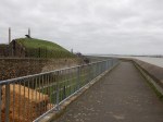
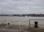
But things didn’t quite work out as planned, as although I had a good walk in the wind to river, that wind was so bad the ferries had got themselves cancelled.
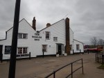
But I did find a nice place with a welcoming pub to go to in better weather!
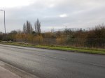
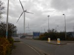
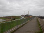
The area does need a bit of improvement.
- The London Cruise Terminal looks as welcoming as a prison from the outside.
- Connections to Tilbury Town station are simple and spasmodic.
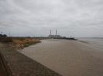
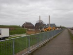
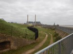
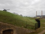
- Tilbury Fort certainly needed some more information.
- The chimneys behind the Fort are those of the Tilbury B power station, which burns biomass.
- The Ferry Terminal to Gravesend was also short of information. Especially, something like an electronic Next Ferry Indicator.
- There needs to be extension of the pedestrian routes.
- It would also help, if the trucks kept to the speed limit.
But most importantly, the area would get more visitors if Tilbury Riverside station was still being used.
Failing that a decent cycle route, with bicycle hire stations at either end.
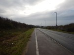
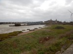
Tilbury Town Station
Tilbury Town station shows how you can take a basic station and by trying hard can make it acceptable to most visitors.
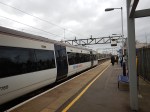
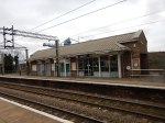
I never visited the station in say the nineteen-sixties, but I suspect it is a lot better now!
I very much liked the step-free bridge that is available to everybody who wants to cross the line easily and safely, whether they intend to travel on the trains or not.
What I didn’t like was that the A1089 road outside the station, from where you walk to Tilbury Fort or the Ferry Terminal, as it is a race-track for heavy trucks.
The Google Map shows Tilbury Town station and its position with respect to the Port, the London Cruise Terminal, the Ferry Terminal and Tilbury Fort.
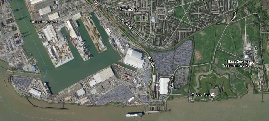
Tilbury
Tilbury Town station is at the top of the map by the A1089 road and the London Cruise Terminal is on the river. Conveniently there is a cruise ship alongside.
The railway to Tilbury Riverside station, which was next to the London Cruise Terminal was removed in 1992.
I would suspect that quite a few movers and shakers in the Tilbury area, feel that the closure of Riverside station was something that shouldn’t have been done, when they look back.
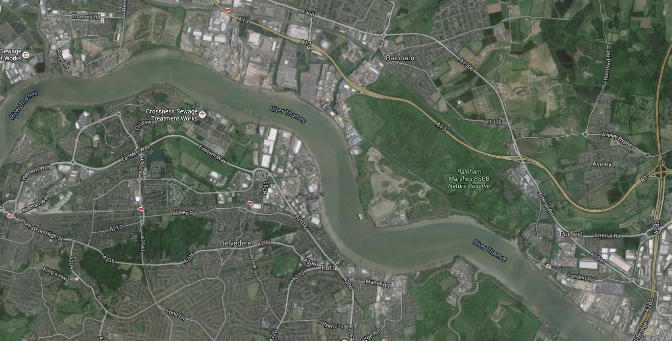
There’s A Lot Happening Around Tilbury And Gravesend
Look at this Google Map of the Thames around Tilbury and Gravesend.

Tilbury And Gravesend
The North (Tilbury) Bank
Note the following.
- The Port of Tilbury with the Container Port on the west side.
- Tilbury Town station on the Tilbury Loop, where the trains between Fenchurch Street and Southend are run by c2c.
- Grays station is the next to the west and East Tilbury station is the next to the east.
- Not far to the west of Grays is the Lakeside Shopping Centre served by Chafford Hudred Lakeside station.
- On the river, at the eastern end of the port is the London Cruise Terminal, where there appears to be a ship in dock.
- There used to be a station called Tilbury Riverside by the river, which had a service to Upminster via Grays
- To the east of the port is Tilbury Fort, which is in the care of English Heritage.
- Go a few miles further east and there is the massive port and logistics development of London Gateway.
Interspersed between the developments is the usual estuarine mix of creeks, salt-flats, a couple of nature reserves and lots of wildlife.
It may not be everybody’s idea of a place to have a good time, but there is a lot going on.
Developments On The North Bank
Several factors will drive developments in the area.
- London needs housing and is already developing large numbers of houses and flats at Barking Riverside, which is a few miles to the East.
- Will there be more housing developments along the river?
- Crossrail will arrive in the next few years and will pass a few miles away to the North, through Romford station.
- London Gateway might want their staff to come and go by train or light rail.
- There is a need for another Thames crossing and how does a possible Lower Thames Crossing, which could cross Thames by East Tilbury, fit into the mix?
Many would argue that there should be better public transport along the north bank of the river.
The Gravesend (South) Bank
Note the following.
- The Swanscombe Peninsular in the top left corner of the map.
- Swanscombe and Northfleet stations on the North Kent Line, which runs to the North of Ebbsfleet International station.
- According to Wikipedia, the walking routes between Northfleet and Ebbsfleet International stations are not the best.
- Gravesend station is in the middle of the town and the Ferry to Tilbury is within walking distance.
- Hoo Junction, which is just off the map to the East is safeguarded as the end of a possible extension to Crossrail.
In contrast to the North Bank, the South Bank seems to have much more housing and a lot less green space and industrial development.
Developments On The South Bank
Like the North Bank, there is also development on the South.
- As with the North Bank there is a lot of housing development.
- A Garden City called Ebbsfleet Valley is proposed.
- A theme park called Paramount London is being built on the Swanscombe peninsular close to Ebbsfleet International station.
- Greenhithe station, which is linked to the Bluewater Shopping Centre is just to the west of Swanscombe.
- Crossrail will arrive in 2019, a few miles to the west at Abbey Wood station.
- The possible Lower Thames Crossing, could reach Kent to the East of Gravesend.
- More Highspeed services into St. Pancras are planned to Kent and East Sussex, and the Continent.
I don’t know the Gravesend and the South Bank well, but on my walks in the last few months, it strikes me that there needs to be some public transport improvements.
Transport Improvements
Transport improvements in Tilbury, Gravesend and the surrounding area fall into three categories.
- Tilbury and the North Bank
- Gravesend and the South Bank
- Cross-River
In some ways the last is the most difficult, as other factors like a new Thames Estuary airport and a higher Thames Barrier must also be considered. The Wikipedia entry for the Lower Thames Crossing gives some options and says this about Option C.
A new road crossing connecting the M2 and M20 motorways in the south with the M25, which might be linked via a proposed new Thames flood barrier. The route from the north would pass close to South Ockendon, Orsett, Chadwell St Mary, West Tilbury, East Tilbury, across West Tilbury Marshes before it crossed the Thames just to the east of Gravesend and Thurrock. It would join the M2 in the Kent Downs Area of Outstanding Natural Beauty and in the Special Landscape Area. This proposed link is also within the Kent Downs AONB and special landscape area. According to the DfT, this long route would have “considerable environmental impacts”.
It won’t be a small fight to get that option built.
I will list the possible public transport improvements in the area.
Crossrail
Crossrail is more than just a major East-West route across London.
It is effectively a four-branch railway.
- Abbey Wood – Connecting to Kent
- Heathrow
- Reading (or Paddington) – Connecting to the West Country and Wales
- Shenfield or Liverpool Street) – Connecting to East Anglia
I believe that Crossrail should be considered as a two line railway, by including the equally capable Thameslink, which connects at Farrington and adds the following major branches.
- Bedford (or St. Pancras) – Connecting to the East Midlands and Sheffield
- Brighton and Gatwick
- Peterborough (or Kings Cross) – Connecting to Lincolnshire, Yorkshire, the North East and Scotland
The major lines not connected to either Crossrail or Thameslink are the West Coast Main Line and the lines out of Waterloo and Marylebone.
Although care is being taken to create a good passenger link between the Bakerloo Line and Crossrail at Paddington.
The connectivity of the Crossrail/Thameslink system will be further improved by some smaller schemes.
- Many stations such as Bedford, Luton Airport, Romford, Shenfield and Slough might be improved to enable interchange to fast long-distance services.
- There are plans to create an interchange at a new Old Oak Common station with HS2 and the West Coast Main Line.
- Extension of Crossrail up the West Coast Main Line.
- Feeder lines like Basingstoke to Reading, Peterborough to Lincoln and the East and West Coastway will be improved.
There are two possible feeder lines in the area I am considering in this post.
- Romford To London Gateway
- Crossrail Extension to Gravesend
Whatever happens Crossrail will become important to those in Kent, who want to get to the Southern part of Essex, as it will be a walk across platforms at Whitechapel.
At present from Abbey Wood to Shenfield takes about ninety minutes with two changes, but when Crossrail opens with a ten metre level walk at Whitechapel, it could be as short as fifty-two minutes.
Don’t underestimate how Crossrail will change the lives of everybody, who, lives, works or visits.
A Romford To London Gateway Train Service
I strongly believe that a train service from Romford to the London Gateway will eventually happen.
Consider the following.
- As London Gateway develops, it is expected to create tens of thousands of jobs, which in turn will put enormous pressures on the roads.
- A full service would improve connectivity to the large Lakeside Shopping Centre.
- This could become an important feeder route to Crossrail.
- The northern part of the route is the Romford to Upminster line, which is operated by London Overground as a shuttle using a dedicated train and platforms at the ends of the line.
- London Overground is increasing services on the Romford to Upminster Line, so they must believe there is a need.
- Track and electrification for the line is complete, although there would need to be some changes at Upminster.
- c2c and London Overground are both very ambitious train operating companies.
We have evolving needs, an ease of creating the service, and ambition, which all work in favour of implementing the service.
This route map from Wikipedia shows the stations in the area.

A full service on the route could call at these stations?
- Romford – for Crossrail and some longer distance services to Chelmsford, Colchester and Ipswich.
- Emerson Park
- Upminster
- Ockendon
- Chafford Hundred Lakeside – for Lakeside Shopping Centre
- Grays
- Tilbury Town
- East Tilbury
- London Gateway
The service could also call at Tilbury Riverside, as services used to do. This would serve the London Cruise Terminal and Tilbury Fort.
I wrote Exploring Tilbury Riverside about this area.
This is one of those ideas, that should be filed under Watch This Space.
Crossrail Extension To Gravesend
I wrote Crossrail Extension To Gravesend on this and the extension brings benefits.
- It will give vastly improved connections from Central London to East Kent and East Sussex.
- It would make Crossrail an even better option than driving across the Dartford Crossing.
- It would mean that Heathrow Airport had a direct link to Continental rail services at Ebbsfleet International.
- Ebbsfleet International is one of the few stations that could be an enormous Park-and-Ride station.
- The proposed depot at Hoo could be good for both Crossrail in terms of flexibility and East Kent, in terms of employment.
I think this extension of Crossrail will happen.
Barking To The Dartford Crossing
I’m including this map, as it shows the nature of the area.
Barking To The Dartford Crossing
Barking is in the top left and the The Dartford Crossing is in the bottom right of the map.
Note the following.
- The east-west main road just north of the river is the A13.
- Dagenham Dock station is on this road with the Barking Riverside development below it and to the south-west.
- To the south-east of the station, there is a large amount of industry.
- The Beckton Sewage Works are on the North Bank, with Crossness on the south.
- As you get towards the Dartford Crossing, the green space is Rainham Marshes RSPB Nature Reserve, with closer to the crossing Purfleet.
It is an area for those with imagination.
The Gospel Oak To Barking Line
The Gospel Oak To Barking Line is to the west and is being extended to Barking Riverside, where tens of thousands of homes are being developed.
The Transport for London Plan for 2050, says this.
An extension of the Gospel Oak to Barking Line to Barking Riverside is currently being planned to open up development of a major new quarter with 11,500 new homes.
A potential further extension could involve crossing the river to Thamesmead and Abbey Wood, where there are major regeneration needs and major opportunities for new housing developments.
My view is that if you give Barking Riverside connections to the north, west and south, perhaps a connection to the east to Dagenham Dock station on c2c is needed as well.
The Docklands Light Railway
The original plan for the area envisaged extending the Docklands Light Railway to Dagenham Dock. Wikipedia says this.
It is unlikely to go ahead as there are plans to bring the London Overground Gospel Oak to Barking Line to Barking Riverside giving better links to Barking and East London and via Barking station to Central London. This will however cause the Docklands Light Railway to not head east and have connections to c2c rail services at Dagenham Dock, so this extension could still take place and the two services would have an interchange at Barking Riverside.
I do think that some transport planners look with disdain at the Docklands Light Railway, but generally the over a hundred million rides taken on the system every year, give another view.
With the emphasis on leisure and with green issues to the fore, I could see the system reaching the Nature Reserve at Rainham.
The Docklands Light Railway is East London’s good fairy and she has ways of surprising everybody.
The Poor Connectivity Of HS1
HS1 must be one of the worst designed railways in Europe.
Currently, HS2 is being designed and great care is being taken to ensure that there is good connectivity all along the route. These are a few examples.
- Old Oak Common station will be a hub in North West London.
- Tram routes will reach Birmingham Curzon Street station long before HS2 does.
- Birmingham Interchange will be linked to Birmingham Airport
- Trams have already reached the area of the Nottingham HS2 station at Totton.
- HS2 will call at Crewe, which is a major railway hub.
On the other hand, two of HS1’s intermediate stations have very poor connectivity.
- Stratford International only has a direct link to the Docklands Light Railway.
- Ebbsfleet International has very poor direct links to classic lines.
Neither station has a direct connection to Crossrail.
HS1 seems to been designed with very limited objectives in mind, one of which was to win the Olympics for 2012.
Crossing The River
There is no doubt that there is a need for more capacity across the lower Thames and there are several plans for a Lower Thames Crossing.
Other plans have included a combined rail and road link between Medway and Canvey Island and the latest proposal has been London’s plan for a Gospel Oak to Barking Line Extension to Abbey Wood.
It is also worth noting, that the distance between Tilbury Riverside and Gravesend is probably about the same as the distance spanned by the Emirates Air-Line at Greenwich.
Also, could modern ferries provide a better and more reliable link?
The only plan being implemented that will help get people cross the Thames at the present time, is Crossrail. It will be interesting to see how Dartford Crossing traffic changes, when Crossrail opens.
I think Crossrail could be part of quite a proportion of Cross-River traffic.
- It links with the twenty-four trains per hour North-South links of Thameslink and the East London Line.
- It links with West London and Heathrow.
- If it served Ebbsfleet International, that would become a valuable Park-and-Ride station.
- It passes right through the heart of London, as opposed to HS1 and the classic lines from the South, which terminate slightly to the North and South respectively.
- I think one of the limiting factors on people switching from car to Crossrail, may well be the availability of car parking at Crossrail stations and especially those like Abbey Wood and Shenfield.
It is a pity that HS1 was so badly designed, as if Stratford International and Ebbsfleet International stations, were both better connected, then the Highspeed services on the line would be a valuable cross-River link.
I wrote about the poor connectivity of Ebbsfleet Internation to classic lines in So Near And Yet So Far!
My personal preference for another connection would be to build a bridge between Barking Riverside and Thamesmead, to take the Gospel Oak to Barking Line over rather than under the Thames, if this was possible. I would use tram-trains on the railway, that if required did a walkabout around the estates as trams on both sides of the river. The bridge would also be open to cyclists and pedestrians.
Properly designed, the bridge could be a visitor attraction in its own right!
Will Floods And Europe Solve The Problem?
If Crossrail/Thameslink is one elephant in the room, then flood protection for London and Europe are the others!
This is a Google Map of the Thames Estuary from Tilbury and Gravesend in the West to Southend in the East.

Gravesend And Tilbury To Southend
As I write this piece, the North West of England is suffering the ravages of Hurricane Desmond. Weather seems to be getting more extreme and the North Sea hasn’t had a major disaster since the North Sea Flood of 1953. This is from Wikipedia.
A combination of a high spring tide and a severe European windstorm over the North Sea caused a storm tide; the combination of wind, high tide, and low pressure led to a water level of more than 5.6 metres (18.4 ft) above mean sea level in some locations. The flood and waves overwhelmed sea defences and caused extensive flooding. The Netherlands, a country with 20% of its territory below mean sea level and 50% less than 1 metre (3.3 ft) above sea level and which relies heavily on sea defences, was worst affected, recording 1,836 deaths and widespread property damage. Most of the casualties occurred in the southern province of Zeeland. In England, 307 people were killed in the counties of Lincolnshire, Norfolk, Suffolk and Essex. Nineteen were killed in Scotland.
Desmond is very much a pussy-cat compared to what nature can and will throw at us.
In 1953, we had fewer casualties than the Dutch because our warnings were better and one would hope that because of universal television and better communications another North Sea Flood on the scale of 1953, would probably be less costly in lives lost.
The Dutch have determined that the sea shall not have them and have created impressive defences all along the coast call ed the Delta Works.
We have improved the defences along the Thames Estuary and London is now protected by the Thames Barrier.
In a section on the Future of the Thames Barrier in Wikipedia, this is said.
The barrier was originally designed to protect London against a very high flood level (with an estimated return period of one hundred years) up to the year 2030, after which the protection would decrease, whilst remaining within acceptable limits. At the time of its construction, the barrier was expected to be used 2–3 times per year. It is now being used 6–7 times per year.
It also says that the barrier would be replaced after 2070.
My cautious nature says that is a date that is too far in the future.
So why will Europe have such a large affect on the Thames Estuary?
Many predictions say that over the future, London will grow and become an even more powerful magnet for the people of Europe.
Europe itself will also become more prosperous, so we will see massive increase in both freight and road traffic across the channel.
The Channel Tunnel is unique amongst many major fixed cross-water links, in that it can be easily augmented by ferries, but I believe that people, vehicles and freight, will increasingly be on longer journeys on rail. Think about the effect of these developments.
- The destinations served by direct train from St. Pancras will increase.
- Cross-channel car traffic will increase.
- The Dutch and the Germans have built th Betuweroute, which is high-capacity freight route.
- Vehicle imports and exports are increasingly handled by special trains.
- Liverpool is building a massive new container port. A lot of the freight could go by train to Europe.
I believe that a second fixed-link across the Channel will be built, which will in itself generate more trains to and from London and vehicular traffic to and from everywhere in the UK.
Improving the rail and road networks both suffer from the same problem – London.
- Freight trains can get to and from Barking on HS1, but there is little spare capacity through London.
- Passenger trains will increasingly be constrained by lack of capacity at St. Pancras, but using Ebbsfleet International and an extended Crossrail, would be a more than acceptable alternative for many travellers.
- Road traffic will clog the Dartford Crossing and the Southern section of the M25.
The only solution is to create a new road and rail corridor to get around London.
As London will need a new flood barrier, probably we should start with an idea similar to Option C for a new Lower Thames Crossing.
A new road crossing connecting the M2 and M20 motorways in the south with the M25, which might be linked via a proposed new Thames flood barrier. The route from the north would pass close to South Ockendon, Orsett, Chadwell St Mary, West Tilbury, East Tilbury, across West Tilbury Marshes before it crossed the Thames just to the east of Gravesend and Thurrock. It would join the M2 in the Kent Downs Area of Outstanding Natural Beauty and in the Special Landscape Area. This proposed link is also within the Kent Downs AONB and special landscape area. According to the DfT, this long route would have “considerable environmental impacts”.
Given enough time to generate a full plan, we can probably come up with a better route, perhaps further to the East.
Electrification Of The East West Rail Link
East West Rail has this question about electrification in the FAQ.
Q: Will East West Rail be electrified and if so, when?
A: It is expected that the Western Section of the East West Rail link will include electrification of the line between Bedford and Oxford.
Bletchley to Oxford is expected to be completed first during the 2014-2019 railway funding period.
Bedford to Bletchley will follow, probably in the next railway funding period 2019-2024, as part of the wider work done to electrify the Midland Main Line to Corby, Nottingham and Sheffield.
The Office of Rail Regulation has confirmed funding in principle for the electrification. The exact amount of funding and scope is expected to be determined by the ORR by March 2015 following detailed development between NR, DfT and the train operators.
I will take this as a qualified yes or it would be desireable.
Bletchley to Oxford electrification is stated as being done first and if that timetable is met, it would be likely to be completed before services start on these routes.
- Oxford to Milton Keynes
- Milton Keynes to London via Aylesbury.
As both Oxford and Milton Keynes are currently or will be electrified by then, the services between the old and new cities could be performed by a 100 mph EMU, like a Class 387 train, which could then continue to Reading if required.
But there are no plans to electrify any of the London to Aylesbury Line. To complicate matters Chiltern Railways have a shortage of suitable diesel trains.
So although the line might be ready in 2019 or so, there would appear to be no chance of Chiltern Trains running between London and Milton Keynes.
Unless!
Wikipedia gives the length of the passenger section from London to Aylesbury Parkway as about thiry nine miles.
So this probably means that the line could be run by Class 387 IPEMU trains, if there was some electrification in Marylebone station to charge the trains before they travelled North.
It is an interesting possibility.
Especially, as an electrified Marylebone, would probably allow the same trains to run services to electrified stations at Bicester Village, Oxford Parkway and Oxford.
East West Rail Moves On Phase 2
East West Rail is the project to create an electrified 100 mph railway from Oxford to Ipswich and Norwich via Milton Keynes, Bedford and Cambridge.
This map from the East West Rail web site, indicates the route.

East West Rail
Phase 1 is now almost complete with the linking of Bicester to Oxford.
Services are running between Oxford Parkway and London Marylebone via Bicester Village. Hopefully, Oxford will be reached in Spring 2016.
A statement by East West Rail entitled Alliance contracts awarded for East West Rail Phase 2, has been relkeased about the award of contracts for Phase 2 of the line to connect Bicester, Milton Keynes and Bedford. This is said.
An alliance of four equal parts between Network Rail, Atkins, Laing O’Rourke and VolkerRail will build East West Rail Phase 2 (EWR2) – linking Oxford, Milton Keynes and Bedford, and Milton Keynes with London Marylebone via Aylesbury.
The contracts will enable the following services.
- Oxford – Milton Keynes (calling at Oxford Parkway, Bicester, Winslow and Bletchley)
- Oxford – Bedford (calling at Oxford Parkway, Bicester, Winslow, Bletchley, Woburn Sands and Ridgmont)
- Milton Keynes – Aylesbury – London Marylebone (an extension of the existing service between Marylebone and Aylesbury Vale Parkway, with stops anticipated at Bletchley, Winslow, Princes Risborough and High Wycombe)
- Increased capacity for freight services
The following work will be done.
- A new station at Winslow
- Two new platforms at Bletchley – Click for some details
- Construction of 18 new overbridges.
- Construction of 22 new footbridges/subways
- Changes to 97 railway crossings
It is not a small project.
I find it interesting that the work is an alliance of four companies.
This method of working has been used successfully at Stafford, in the Stafford Area Improvements Program to relieve the bottle-neck at Norton Bridge Junction on the West Coast Main Line.
Hopefully, it will avoid another Great Western Railway style of fiasco.
Forth Road Bridge In Trouble
The Forth Road Bridge has not been in the best of health for some years. Wikipedia has a section called Structural Issues and this is said.
2003 saw an inspection programme launched (at a cost of £1.2 million) to assess the condition of the bridge’s main suspension cables after excessive corrosion was discovered in a number of older bridges in the United States of a similar design and size. The study, which was completed in 2005, found that the main cables had suffered an estimated 8-10% loss of strength. Future projections highlight the likelihood of an accelerating loss of strength, with traffic restrictions to limit loading required in 2014 in the worst-case scenario, followed by full closure as early as 2020.
But now a different problem has arisen, as is reported in this article of the BBC. This said.
The Forth Road Bridge is to be closed until the new year because of structural faults, Transport Minister Derek Mackay has said.
This morning, there were long tailbacks on alternative routes.
It strikes me that this part of Scotland is in for not a very good Christmas.
At least the Forth Rail Bridge is its usual sturdy iconic self and I suspect that can cope with a few extra shuttle trains to help take the pressure of the roads.
HS2’s Interactive Map
For those who are worried, need to know or just plain curious, HS2 have put a very good quality interactive map on their web site on this page.
These are some images, I have captured.
Stations are shown by red dots
Euston, St. Pancras and Kings Cross Stations With HS2
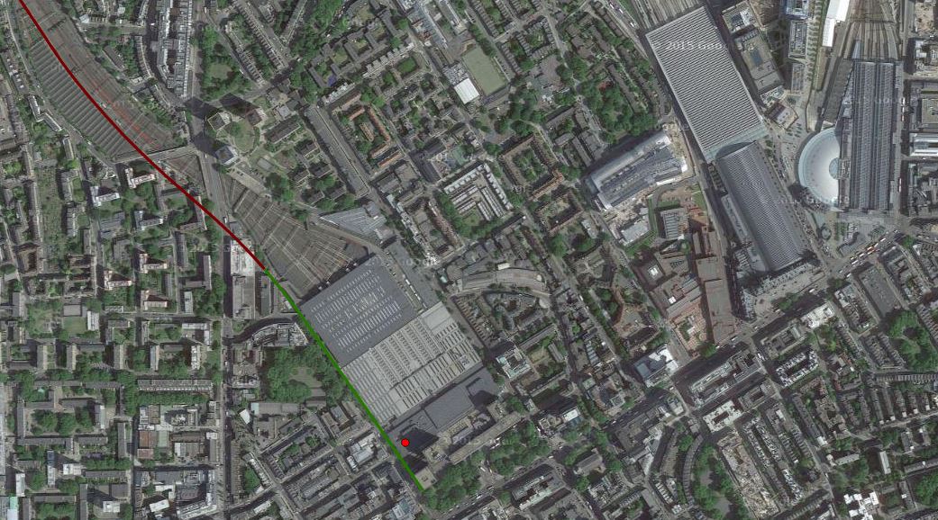
Euston, St. Pancras and Kings Cross Stations With HS2
The map clearly shows the three stations and the route of HS2 into Euston.
Note the following.
- HS2 clearly arrives at Euston on the western side of the station.
- The pedestrian route to St. Pancras could be more difficult than planners think.
- The station would appear to be extended towards Euston Road.
- Whilst the station is built, I suspect, that a good connection to the Metroipolitan/Circle can be created.
I think we’ll see some plans in the next few years, that make the connection between the three stations a lot better.
Old Oak Common Station
Old Oak Common Station
The map shows the myriad of lines in the area.
I believe that for many people using HS2 to and from London, will use this station, as its connectivity is so much more comprehensive than Euston.
Birmingham Interchange Station
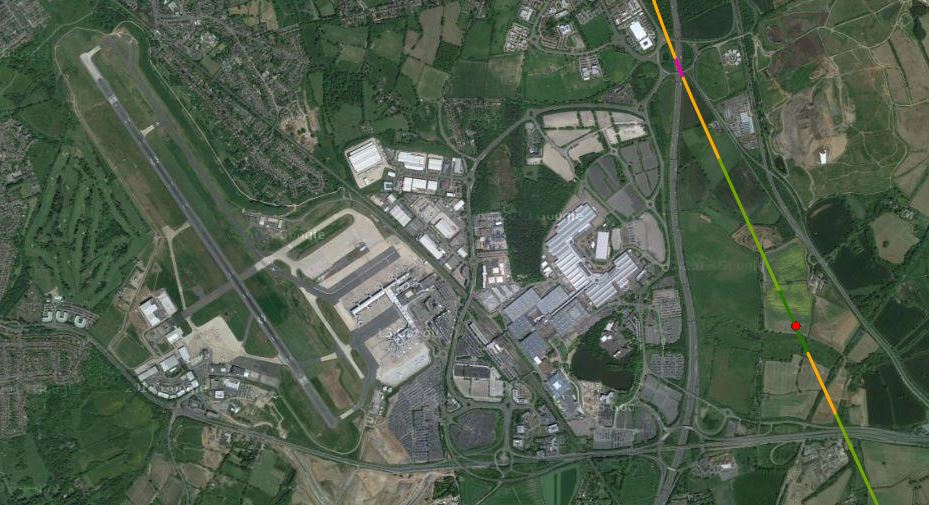
Birmingham Interchange Station
Birmingham Curzon Street Station
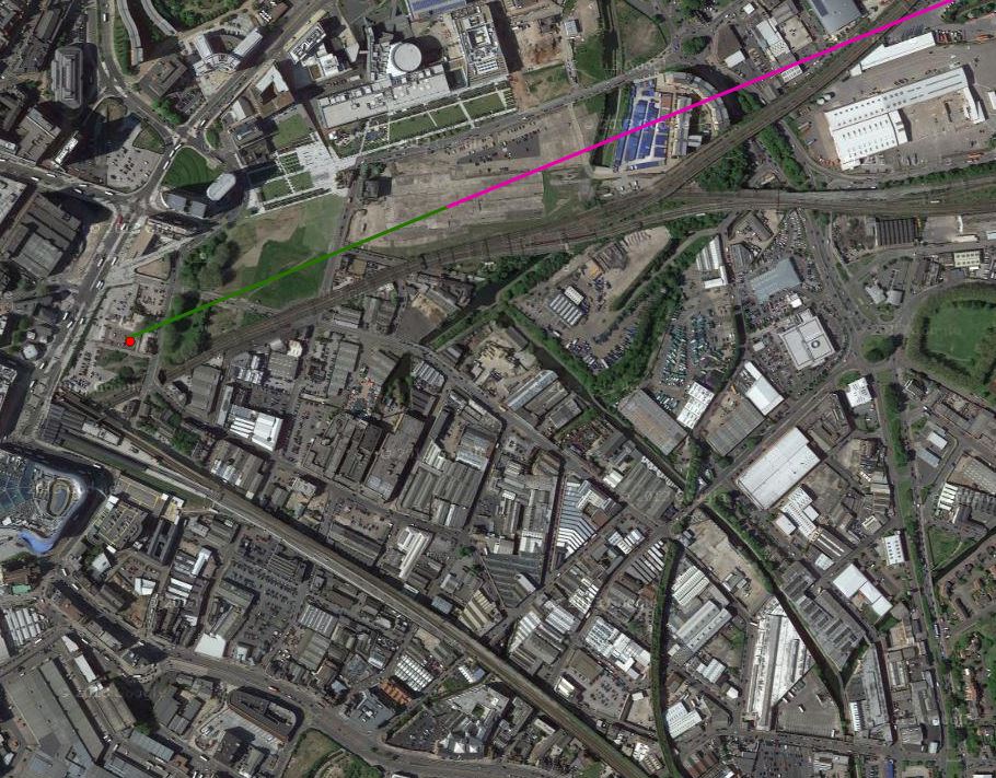
Birmingham Curzon Street Station
Birmingham Moor Street and Birmingham New Street stations are to the south of the new station.
HS2 East Of Birmingham

HS2 East Of Birmingham
This map clearly shows how trains for the North via Birmingham will go into Birmingham and then reverse direction in Birmingham Curzon Street station.
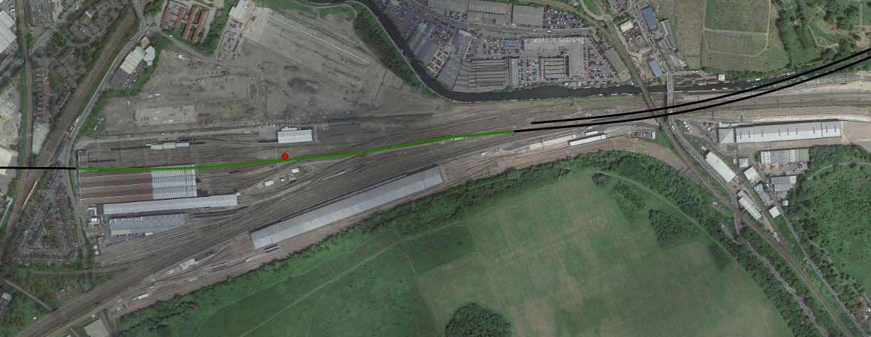
Handsacre And HS2
Handsacre And HS2
This map shows where HS2 joins the West Coast Main Line at Handsacre.
Conclusion
The interactive map is a real credit to modern computing.
Every project that could benefit should have one.
Will we be seeing one for Crossrail 2?
