Lower Thames Crossing Tunnelling ‘To Begin In 2028’
The title of this post, is the same as that of this article on the BBC.
This is the sub-heading.
The tunnelling process for the Lower Thames Crossing is due to begin in 2028.
These three paragraphs add more detail to the story.
National Highways said negotiations to buy one of the world’s largest tunnelling machines were now under way.
It would be capable of digging 60 metres below the Thames, creating a new road link between Essex and Kent, and now enables the project to secure private sector investment to deliver the remainder of the construction.
Next summer, work on the northern tunnel entrance where the tunnel machine will begin its journey will get under way.
Hopefully, it’ll all be complete by the early 2030s.
The Elephant In The Garden Of England
This section shows the proposed route of the Lower Thames Crossing.
It as an extract of a previous post called Elizabeth Line To Ebbsfleet Extension Could Cost £3.2 Billion.
It is proposed that the new Lower Thames Crossing is built to the East of Gravesend.
This map from the Department of Transport, shows the route.

Note.
- The new crossing, which is shown in red, bypasses the Dartford Crossing on the M25.
- The A226 runs between Gravesend and Higham via a junction with the new crossing at Chalk.
- Northfleet is to the West of Gravesend.
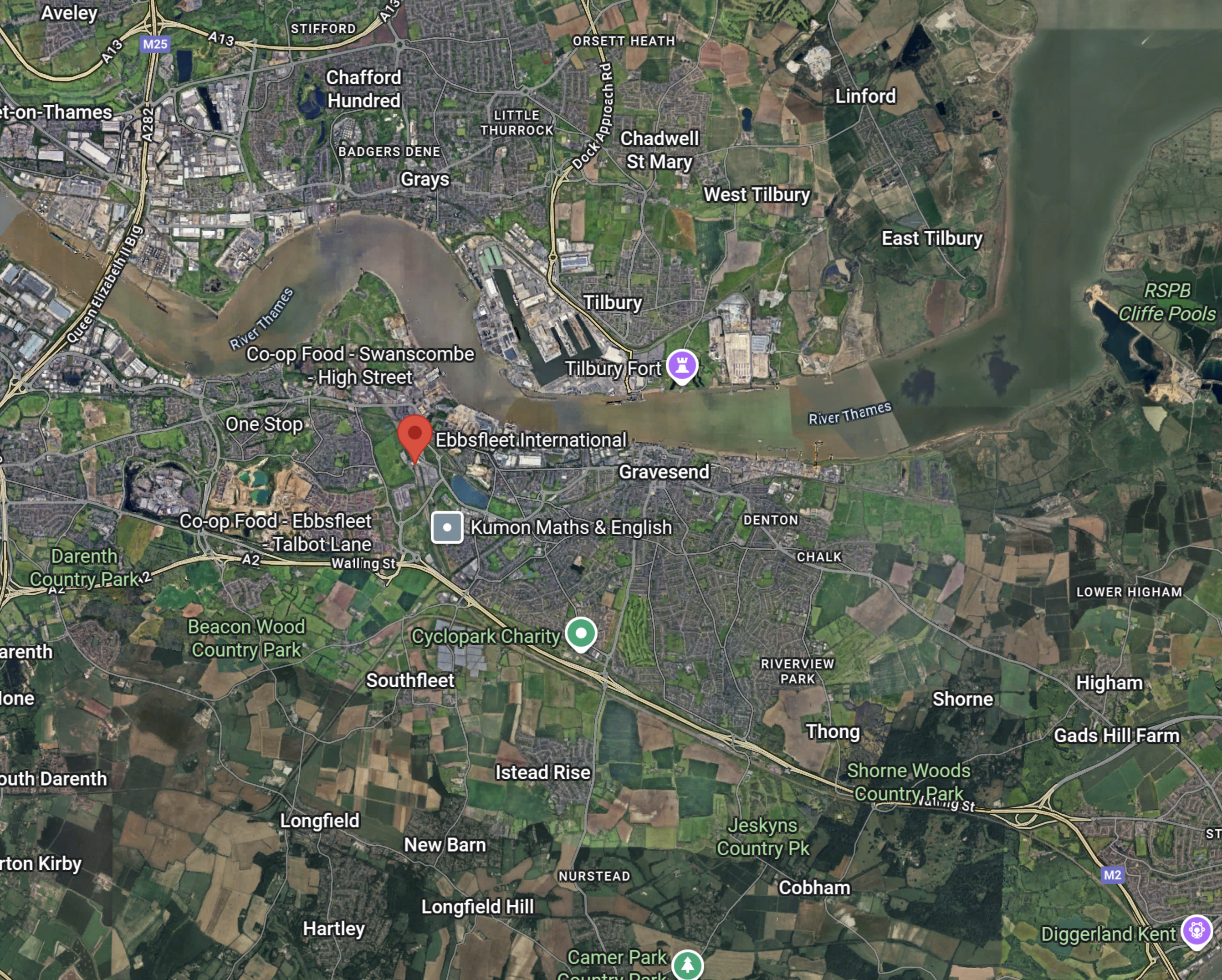
This Google Map shows the area between Chalk and Higham.
Eurostar Orders First Double-Decker Trains
The title of this post, is the same as that of this article on the BBC.
This is the sub-heading.
Eurostar has revealed plans to run double-decker trains through the Channel Tunnel for the first time.
These three paragraphs add more details.
The cross-channel rail operator has confirmed it will order up to 50 trains from manufacturer Alstom, eventually increasing the size of its fleet by nearly a third.
The expansion plans would include investing heavily in a crucial London depot, it said.
But questions remain over whether the facility has enough space for both Eurostar and potential rival operators to use it.
This my solution to the problem outlined in the last paragraph.
Note, that I wrote the software that planned the building of the Channel Tunnel and the rail links to London and was also friends with the project manager of the 1960s attempt to build a Channel Tunnel.
We need more terminal platforms and depot space in the UK to handle Eurostar’s extra trains and the other companies who want to run to London.
We should split services into two groups.
Group 1 would terminate as now in an updated St. Pancras with more passenger handling capacity, which could probably be built over the tracks at the Northern end of the station. Trains would still be stabled at Temple Mills.
Group 2 would terminate at Ebbsfleet International, which would have extra platforms, a new depot, masses of car parking and a coach terminal.
Some trains from both groups could also stop at Ashford International.
To access Ebbsfleet from Central London and also create a Heathrow link to the Channel Tunnel, the Lizzie Line would be extended to Northfleet, where there is space to handle up to eight trains per hour in new platforms built in two disused sidings.
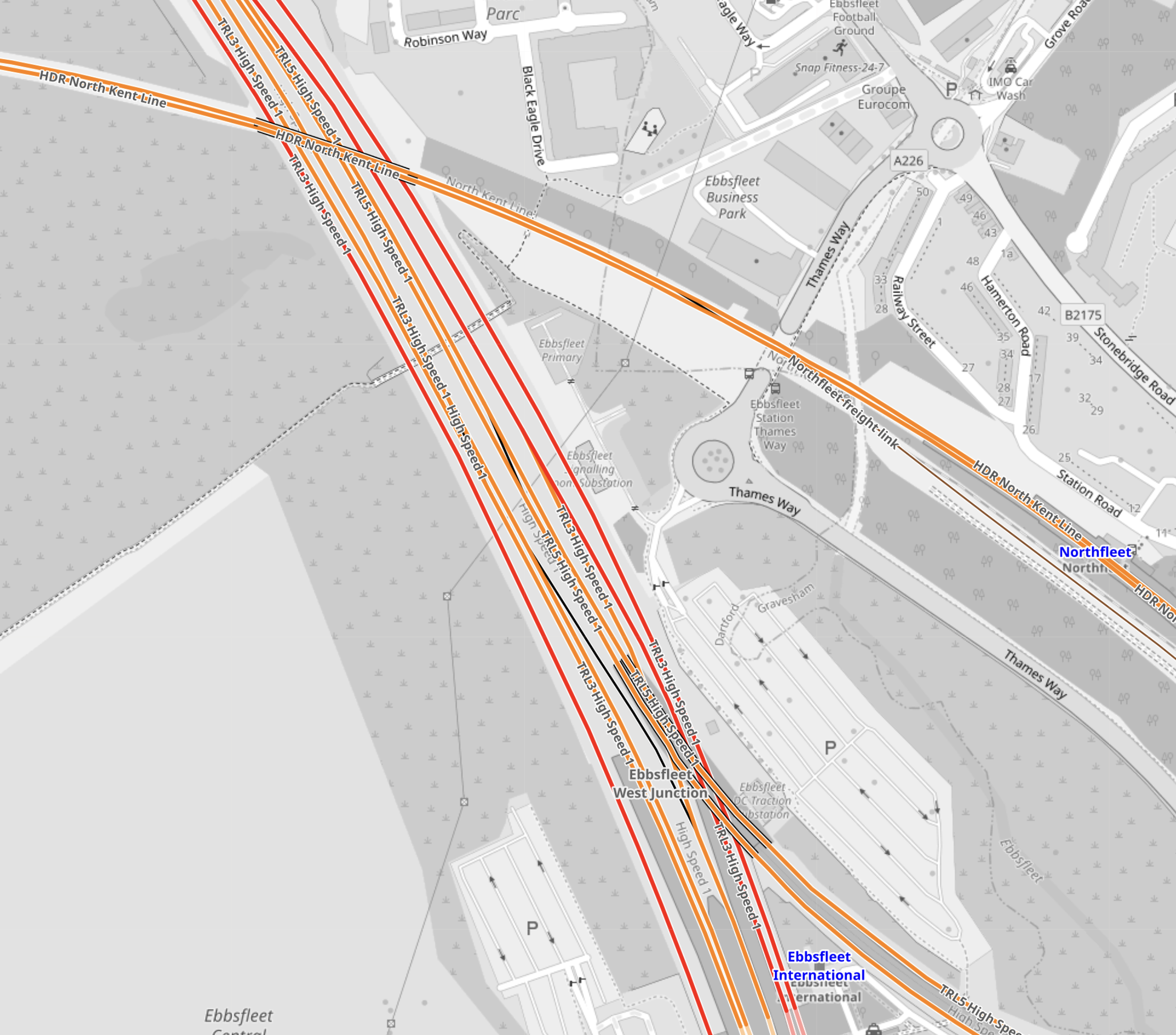
This OpenRailwayMap shows the location of Northfleet and Ebbsfleet stations.
Note.
- Ebbsfleet International station at the bottom of the map.
- The red tracks are High Speed One.
- The orange tracks are third-rail electrified lines.
- The orange tracks going across the map is the North Kent Line.
- Northfleet station is at the right edge of the map on the North Kent Line.
- Northfleet and Ebbsfleet stations are less than a kilometer apart.
- Ebbsfleet has a lot of car parking spaces.
I believe a spectacular cable-car or other link would connect Northfleet and Ebbsfleet stations.
These are some other thoughts.
Ebbsfleet International Station Has Good Motorway Access
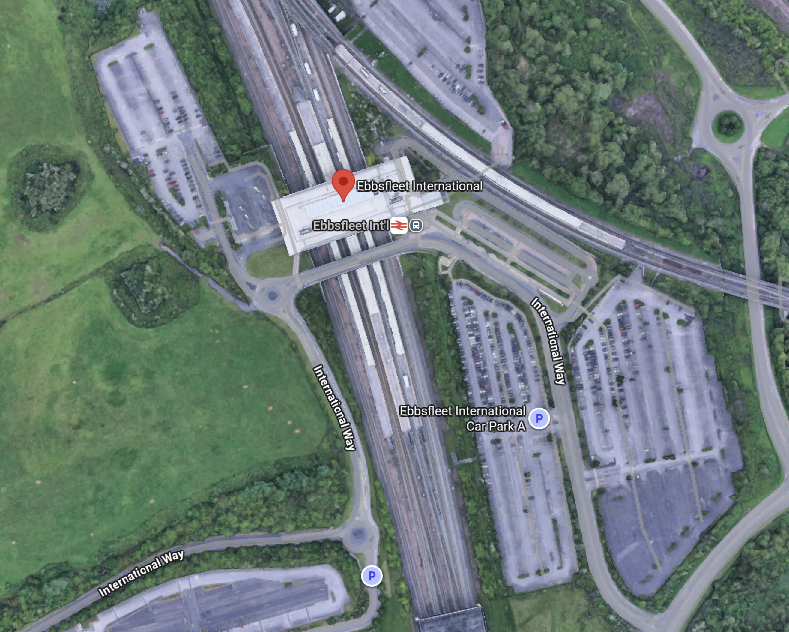
This Google Map shows the location of Ebbsfleet International station in relation to the motorways.
Note.
- The A2/M2 road runs across the bottom half of the map.
- The red arrow marks the position of Ebbsfleet International station.
- The Dartford Crossing is a few miles West of the station.
In my last few years, as an Ipswich season ticket holder, I regularly had a lift to Ebbsfleet International from a friend and the route to the station from the M25 and the A2/M2 wasn’t bad.
But it will be getting better.
This map from the Government’s consultation on the Lower Thames Crossing, shows the road layout in a few years.
Note.
- The Lower Thames Crossing is shown in red.
- Ebbsfleet International station is about a mile South of Northfleet
- The new crossing will connect to the A2, a few miles East of the link road to the station.
Travellers from much of the East of and Middle England could use the new crossing to get to Ebbsfleet International station.
These are current times from Google.
- Birmingham – 2 hours and 41 minutes
- Cambridge – 1 hour and 17 minutes
- Edinburgh – 7 hours and 44 minutes
- Fishguard – 5 hours and 29 minutes
- Glasgow – 7 hours and 6 minutes
- Holyhead – 5 hours and 29 minutes
- Hull – 4 hours and 1 minute
- Ipswich – 1 hour and 29 minutes
- Leeds – 3 hours and 55 minutes
- Liverpool – 4 hours and 40 minutes
- Manchester – 4 hours and 28 minutes
- Milton Keynes – 1 hour and 37 minutes
- Newcastle 5 hours and 25 minutes
- Norwich – 2 hours 23 minutes
- Nottingham – 2 hours and 55 minutes
- Peterborough – 1 hour and 54 minutes
- Sheffield – 3 hours and 35 minutes
- Stoke-on-Trent – 3 hours and 25 minutes
- York – 4 hours and 16 minutes
Note.
- I would suspect that the opening of the Lower Thames Crossing will knock 10-15 minutes off these times.
- Edinburgh, Glasgow, Hull, Leeds, Newcastle, Nottingham, Peterborough, Sheffield and York would probably be quicker to Europe with a change to Continental train services at St. Pancras, rather than Ebbsfleet International.
- With improvements to rail services, more of these journeys will be quicker by train.
- High Speed Two should connect Birmingham, Liverpool, Manchester and Stoke-on-Trent to London, by the mid 2030s.
But there are some, who always feel their car is safer in a car park!
Ebbsfleet International Station Has A Large Amount Of Car Parking
This map shows the car parks at Ebbsfleet International station.
Note.
- Some of the parking areas are marked with a P.
- It is easy to pick-up and drop passengers.
- The car parks could be double-decked to add more spaces if needed.
- According to the Ebbsfleet International web site, the station currently has 5225 parking spaces, 68 accessible car parking spaces.
For those that have a lot of luggage or a large family, taking the car to Ebbsfleet International may be the best option.
Ebbsfleet International Station Should Have A Coach Station
Consider.
- In the next few years, hydrogen-powered coaches with a thousand kilometre range will come to dominate the long distance coach market.
- Mercedes and Wrightbus are know to be developing long-distance hydrogen-powered coaches.
- Hydrogen-powered coaches will be able to reach all of England and Wales and a large part of Scotland from Ebbsfleet International.
- Ebbsfleet International is closely connected to the UK motorway network.
- Continental coaches using the Channel Tunnel, could use Ebbsfleet as a coach interchange with the UK.
- Ebbsfleet International could also handle customs services for Continental coach services, which would take the pressure off the Channel Tunnel and the ferries.
- Ebbsfleet International could also have a coach link to Gatwick Airport.
These and other reasons make me feel, that a coach terminal at Ebbsfleet International is essential.
A Green Connection Between The Two Halves Of The European Union For the Gretas Of This World
Consider.
- There is no zero-carbon route between the island of Ireland and Continental Europe.
- Eurostar is all-electric between London and Continental Europe, but only serves a limited number of destinations.
- Low- or zero-carbon ferries are being designed, that run on hydrogen.
- Trains between London and the Irish ferries are diesel-powered.
- The simplest solution would surely be to run hydrogen-powered coaches between Ebbsfleet International and Fishguard and/or Holyhead. Both journeys would take three and a half hours.
Hydrogen-powered coaches are under development by Wrightbus.
I also asked Google AI if anybody is planning zero-carbon ferries between the UK and ireland and received this answer.
Yes, there are plans for zero-carbon ferries between the UK and Ireland, with a specific “Green Corridor” feasibility study underway for the Holyhead to Dublin route, and a separate, separate commuter service project planned between Belfast and Bangor. The Belfast Maritime Consortium is developing the zero-carbon commuter service, and a separate “Green Corridor” feasibility study is assessing potential low-carbon pathways between Holyhead and Dublin
I believe the green connection is feasible, provided the following happens.
- Ebbsfleet International is reopened and developed as a station for Continental Europe.
- The zero-carbon ferries are developed.
- The busmasters from Ballymena deliver the ultimate hydrogen-powered coach.
- Hydrogen and other fuels are made available, where they is needed.
This could do wonders for the economy of the island of Ireland.
Out of curiosity, I did ask Google AI, what is the longest coach route in the UK and received this answer.
The longest scheduled coach journey in the UK is the Scottish Citylink route from Glasgow to Uig on the Isle of Skye (route 915 or 916), which is about 230 miles and takes around 7 hours and 50 minutes. Historically, there have been much longer international bus routes, such as the Penn Overland tour from London to Ceylon, but these were not regular, scheduled services.
So my proposal at five hours and 29 minutes is only a short hop.
I also believe that with good project management that the additional infrastructure could be built by 2030, with little or no disruption to existing services.
Centrica Really Can’t Lose At Sizewell
The title of this post, is the same as that of this article in The Times.
This is the sub-heading.
Centrica’s £1.3 billion investment in Sizewell C guarantees substantial returns, even with cost overruns.
These two-and-a-half paragraphs explain the funding.
Now we know what Ed Miliband means by his “golden age of nuclear” — golden for the companies putting their money into Sizewell C. Yes, reactor projects have a habit of blowing up private investors. But maybe not this one. It looks more like an exercise in transferring risk to consumers and the taxpayer.
Sure, nobody builds a £38 billion nuke on a Suffolk flood plain without a frisson of danger. But the energy secretary and his Treasury chums have done their bit to make things as safe as possible for the companies putting in equity alongside the government’s 44.9 per cent stake: Canada’s La Caisse with 20 per cent, British Gas-owner Centrica (15 per cent), France’s EDF (12.5 per cent) and Amber Infrastructure (7.6 per cent).
For starters, nearly all the debt for the 3.2 gigawatt plant, three-quarters funded by loans, is coming from the state-backed National Wealth Fund. It’s bunging in up to £36.6 billion, with £5 billion more guaranteed by a French export credit agency.
It looks to me that between them the British and French governments are providing £41.5 billion of loans to build the £38 billion nuke.
These are my thoughts.
Hydrogen And Sizewell C
This page on the Sizewell C web site is entitled Hydrogen And Sizewell C.
Under a heading of Hydrogen Buses, this is said.
At Sizewell C, we are exploring how we can produce and use hydrogen in several ways. We are working with Wrightbus on a pilot scheme which, if successful, could see thousands of workers transported to and from site on hydrogen double decker buses. You can read more about the pilot scheme in our press release
Firstly, it could help lower emissions during construction of the power station. Secondly, once Sizewell C is operational, we hope to use some of the heat it generates (alongside electricity) to make hydrogen more efficiently.
This would appear to be a more general statement about hydrogen and that the following is planned.
- Hydrogen-powered buses will be used to bring workers to the site. A press release on the Sizewell C web site, talks about up to 150 buses. That would probably be enough buses for all of Suffolk.
- Hydrogen-powered construction equipment will be used in the building of the power station.
- It also talks about using the excess heat from the power station to make hydrogen more efficiently. I talk about this process in Westinghouse And Bloom Energy To Team Up For Pink Hydrogen.
This is a substantial investment in hydrogen.
Centrica And Electricity From Sizewell C
The article in The Times, also says this.
Even so, there’s a fair bit of protection for the likes of Centrica, which has also agreed a 20-year offtake deal for its share of Sizewell’s electricity. The price of that is not yet known.
Nothing is said in the article about the size of Centrica’s electricity offtake.
- If they get 15 % of Sizewell C, that would by 480 MW.
- If they get 15 % of Sizewell B + C, that would by 660 MW.
If they use their share to generate hydrogen, Suffolk would have a massive hydrogen hub.
To power the buses and construction of Sizewell C, Sizewell B could be used to provide electricity to create the hydrogen.
How Would The Hydrogen Be Produced?
Centrica, along with other companies, who include Hyundai and Kia, are backers of a company in Hull called HiiROC, who use a process called Thermal Plasma Electrolysis to generate hydrogen.
On their web site, they have this sub-heading.
A Transformational New Process For Affordable Clean Hydrogen
The web site also describes the process as scalable from small modular units up to industrial scale. It also says this about the costs of the system: As cheap as SMR without needing CCUS; a fraction of the energy/cost of water electrolysis.
If HiiROC have achieved their objective of scalability, then Centrica could grow their electrolyser to meet demand.
How Would The Hydrogen Be Distributed?
Consider.
- Currently, the Sizewell site has both road and rail access.
- I can still see in my mind from the 1960s, ICI’s specialist articulated Foden trucks lined up in the yard at Runcorn, taking on their cargoes of hydrogen for delivery all over the country.
- As that factory is still producing hydrogen and I can’t remember any accidents in the last sixty years, I am fairly sure that a range of suitable hydrogen trucks could be developed to deliver hydrogen by road.
- The road network to the Siewell site is being updated to ensure smooth delivery of workers and materials.
- The rail access to the Sizewell site is also being improved, for the delivery of bulk materials.
I believe there will be no problems delivering hydrogen from the Sizewell site.
I also believe that there could be scope for a special-purpose self-propelled hydrogen tanker train, which could both distribute and supply the hydrogen to the vehicles, locomotives and equipment that will be using it.
Where Will The Hydrogen Be Used?
I have lived a large part of my life in Suffolk and know the county well.
In my childhood, there was quite a lot of heavy industry, but now that has all gone and employment is based on agriculture, the Port of Felixstowe and service industries.
I can see hydrogen being used in the following industries.
Transport
Buses and heavy trucks would be powered by hydrogen.
The ports in the East of England support a large number of heavy trucks.
Large Construction Projects
Sizewell C is not the only large construction project in the East of England, that is aiming to use low-carbon construction involving hydrogen. In Gallagher Group Host Hydrogen Fuel Trial At Hermitage Quarry, I talked about a hydrogen fuel trial for the Lower Thames Crossing, that involved JCB and Ryse Hydrogen.
Hydrogen for the Lower Thames Crossing could be delivered from Sizewell by truck, down the A12.
Rail
We may not ever see hydrogen-powered passenger trains in this country, but I do believe that we could see hydrogen-powered freight locomotives.
Consider.
- The latest electro-diesel Class 99 locomotives from Stadler have a Cummins diesel engine.
- The diesel engine is used, when there is no electrification.
- Cummins have developed the technology, that allows them to convert their latest diesel engines to hydrogen or natural gas power, by changing the cylinder head and the fuel system.
- Access to the Port of Felixstowe and London Gateway needs a locomotive with a self-powered capability for the last few miles of the route.
A Class 99 locomotive converted to hydrogen would be able to run with out emitting any carbon dioxide from Felixstowe or London Gateway to Glasgow or Edinburgh.
Ports
Ports have three main uses for hydrogen.
- To power ground-handing equipment, to create a pollution-free atmosphere for port workers.
- To fuel ships of all sizes from the humblest work-boat to the largest container ships.
- There may need to be fuel for hydrogen-powered rail locomotives in the future.
There are seven ports with excellent road and/or rail connections to the Sizewell site; Felixstowe, Great Yarmouth, Harwich, Ipswich, London Gateway, Lowestoft and Tilbury.
The proposed Freeport East is also developing their own green hydrogen hub, which is described on this page on the Freeport East web site.
Airports
Airports have two main uses for hydrogen.
- To power ground-handing equipment, to create a pollution-free atmosphere for airport workers.
- In the future, there is likely to be hydrogen-powered aircraft.
There are three airports with excellent road and/or rail connections to the Sizewell site; Norwich, Southend and Stansted.
Agriculture And The Rural Economy
Agriculture and the rural economy would be difficult to decarbonise.
Consider.
- Currently, most farms would use diesel power for tractors and agricultural equipment, which is delivered by truck.
- Many rural properties are heated by propane or fuel oil, which is delivered by truck.
- Some high-energy rural businesses like blacksmiths rely on propane, which is delivered by truck.
- Electrification could be possible for some applications, but ploughing the heavy land of Suffolk, with the added weight of a battery on the tractor, would probably be a mathematical impossibility.
- JCB are developing hydrogen-powered construction equipment and already make tractors.
- Hydrogen could be delivered by truck to farms and rural properties.
- Many boilers can be converted from propoane to run on hydrogen.
I feel, that hydrogen could be the ideal fuel to decarbonise agriculture and the rural economy.
I cover this application in detail in Developing A Rural Hydrogen Network.
Exports
Consider.
- Sizewell B and Sizewell C nuclear powerstations have a combined output of 4.4 GW.
- A rough calculation shows that there is a total of 7.2 GW of wind farms planned off the Suffolk coast.
- The East Anglian Array wind farm alone is said in Wikipedia to be planned to expand to 7.2 GW.
- The Sizewell site has a high capacity connection to the National Grid.
Nuclear plus wind should keep the lights on in the East of England.
Any excess electricity could be converted into hydrogen.
This Google Map shows the location of Sizewell B in relation to Belgium, Germany and The Netherlands.
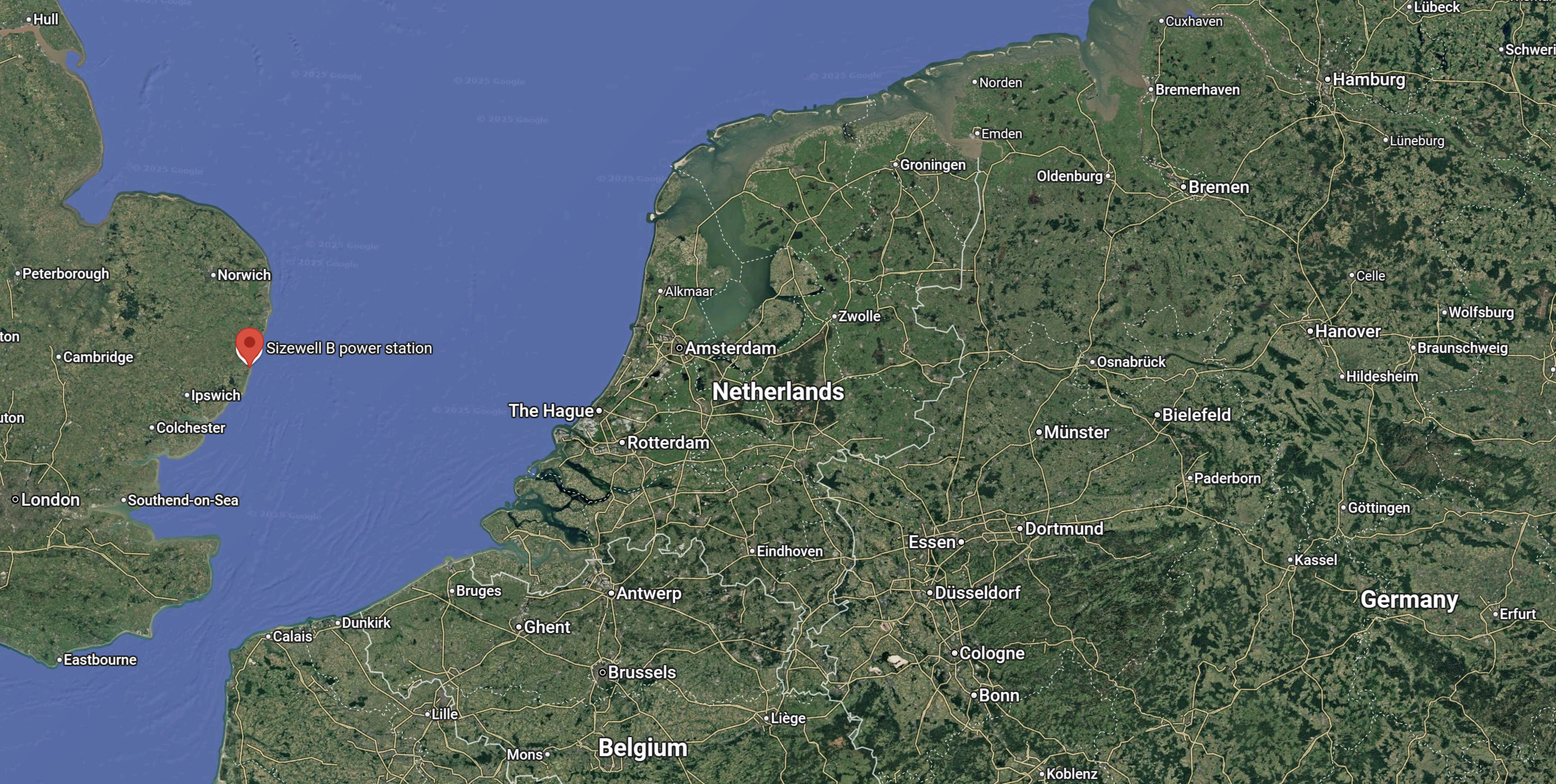
The Sizewell site is indicated by the red arrow.
The offshore oil and gas industry has used technology like single buoy moorings and coastal tankers to collect offshore natural gas for decades.
I don’t see why coastal hydrogen tankers couldn’t export excess hydrogen to places around the North Sea, who need the fuel.
It should be born in mind, that Centrica have a good reputation in doing natural gas trading. This expertise would surely be useful in hydrogen trading.
Conclusion
I believe that a hydrogen hub developed at Sizewell makes sense and I also believe that Centrica have the skills and technology to make it work.
KCC Leader Writes To The Minister For Future Of Roads About The Increase In Dartford Crossing Charges
The title of this post, is the same as that of this news item from Kent County Council.
Although it is a long letter, it would be wrong to publish only part of it in this post.
As the newly elected Leader of Kent County Council, I would welcome dialogue about the increase in the charge for the Dartford Crossing due to come into effect from September.
The increase is capped at £1, but this represents a 40% uplift on the current £2.50 charge in each direction for those without a pre-pay account. This is the only crossing option east of London until the Lower Thames Crossing is open (in 2032 at the earliest) and so Kent residents and businesses have no viable alternative when using this important route. The alternative is to drive into Greater London, potentially incurring a further charge for the Ultra Low Emission Zone (ULEZ), and the paying even more (£4 each way) to use the Blackwall or Silvertown tunnels.
Whilst most local residents in Dartford benefit from unlimited crossings for a fixed £25 annual fee, this ignores the fact that there is no reasonable alternative route for anyone in Kent making the journey to the Midlands, North and beyond. This is a constraint on the local and national economy.
The Crossing’s accounts for 2023-24 show that cash receipts were £221.6m with operating costs of £134.9m, leaving a net profit of £86.7m. Clearly the crossing is not on the cusp of losing money.
For the increase to be intended to manage demand, without an alternative route there is no way of managing routing, so it will only suppress the journeys for the very poorest in our society. This is hardly equitable. It will also increase costs to the supply chain which will be passed onto customers – furthering the cost-of-living pressures for so many hard-working people.
Our residents still remember that the toll was meant to end when the infrastructure was paid for, but changes in policy mean the charge has continued indefinitely. Effectively another tax for making journeys to work, visiting friends and family, and spending hardearned money at local resorts and attractions.
Given the impact on Kent is so great, there is a strong argument that KCC, as the Highways authority for Kent, should be passported a proportion of this money each year to aid the upkeep of the road network. When one considers the amount of foreign traffic that transverses Kent’s roads, alongside the amount of traffic from other counties within the UK, it is fair to say Kent is the Gateway County. And with that in mind we feel that lack of any financial benefit KCC receives from the Dart Charge needs to be considered as we struggle to maintain our road networks. This new funding stream would enable us to make a tangible difference to the condition of our Local Road Network or help fund major improvement schemes on the Strategic Road Network, including funding towards the new Lower Thames Crossing – unlocking growth and opportunities, and helping to offset the detrimental impact of the increased crossing charge. Kent occupies a strategic position between the UK and Europe, and its transport network is vital for UK supply chains and British businesses, therefore investment in Kent is an investment in the national economy.
I hope you carefully consider this possibility if you move forward with the toll increase.
Yours sincerely
Linden Kemkaran
Linden Kemkaran was elected to Kent County Council as a Reform UK Councillor.
This article on the HuffPost is entitled New Reform UK Council Leader Calls Ukraine War ‘A Distraction’.
This is the sub-heading.
Linden Kemkaran promised to take the Ukraine flag down in Kent’s county council chamber.
These are the first three paragraphs of the article.
A new Reform UK council leader has called the Ukraine war a “distraction”.
Linden Kemkaran, named leader of Kent County Council a week after Reform UK’s sweeping victories in the local elections, appeared to downplay the impact of the largest conflict in Europe since World War 2.
Speaking after she was named as council leader on Thursday evening, she promised to remove the Ukrainian flag from the chamber.
She may have a point about the Dartford Crossing, but her dismissal of Ukraine as a distraction, marks her out in my book as one of Putin’s friends.
Also published today, is this article on the BBC, which is entitled Three men found guilty of Wagner-linked arson attack in London.
As the arson attack took place in Bexley, just over the Kent border with London, I wonder what her view will be on the undoubtedly long sentences these terrorists working for Russia will receive. Are they just a distraction?
Lower Thames Crossing Decision Delayed To May 2025
The title of this post, is the same as that of this article on the BBC.
This is the sub-heading.
A decision on whether to build a new road crossing under the Thames will not now be made until at least 23 May 2025.
These are the first three paragraphs.
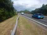
The Lower Thames Crossing would link Gravesend in Kent and Tilbury in Essex.
A statement from Transport Secretary Louise Haigh on Monday said the delay was “to allow more time for the application to be considered further, including any decisions made as part of the spending review”.
This is the third time the decision has been extended, with previous dates of 20 June and 4 October having also been missed.
This article on RouteOne, which is entitled Further Lower Thames Crossing Delay Draws Dismay From RHA, indicates the views of the road haulage industry.
On the other hand opponents say that the building of the link will damage the Green Belt.
But then the Government’s proposed housing will do that!
I laid out various options in What Are We Going To Do For The Lower Thames Crossing?, but it just seems an intractable problem.
The Wikipedia entry for the Lower Thames Crossing is a long list of failed and abandoned proposals.
Council’s Concerns Over Suggested Tunnel Charges
The title of this post, is the same as that of this article on the BBC.
This is the sub-heading.
Concerns have been raised by a county council over suggested charges at the Silvertown and Blackwall tunnels in London.
These are the first two paragraphs.
Kent County Council (KCC) said the proposed charges could impact on the county’s traffic, including at the Dartford Crossing.
The council said although it supported TfL’s ambition to improve journey reliability and reduce air pollution, it believed the proposed changes could “significantly affect” drivers from Kent.
I can’t see that the charges on the two tunnels won’t affect drivers habits.
Thirty years ago, before satellite-navigation had been invented, when my family and myself lived in East Suffolk, if I was returning from Brighton or Gatwick, I would make a choice about, whether to use the Dartford Crossing or the Blackwall Tunnel. Sometimes traffic was so bad, that I had to take the longer Western route using the M11 and the A14.
I didn’t really bother about the toll on the Dartford Tunnel, as it was then, but often the free Blackwall route was quicker.
In those days, I was relying on radio reports, but now with satellite-navigation, drivers will be taking more intelligent decisions, that take account of tolls.
The BBC article also says this.
The council says Kent drivers make up 10% of the Blackwall Tunnel’s users.
So it looks like the drivers of Kent will be paying tolls to London.
These are my thoughts.
How Can The Tolls Be Avoided?
There will still be two free crossings, to the East of Tower Bridge; the Rotherhithe Tunnel and the Woolwich Ferry, but how long will they remain free, if they drain money from the tolled tunnels?
What About The Trains?
Trains from somewhere like Ebbsfleet international station can be used.
Ebbsfleet international station has a lot of parking, but at some stations parking is distinctly limited.
I doubt though, that Transport for London have done a professional survey of the amount of parking that is needed.
They tend to believe if people live out of London, that parking for trips to London is not a Transport for London problem.
Are there any plans to increase the train frequencies, if more people use them?
Note that Off Peak Day Return tickets can be purchased with a Railcard, from Dartford to London for under a tenner, and from Ebbsfleet international to London for under fifteen pounds.
If Built, Will The Lower Thames Crossing Help?
The first paragraph of the Wikipedia entry for the Lower Thames Crossing, describes it like this.
The Lower Thames Crossing is a proposed road crossing of the Thames estuary downstream of the Dartford Crossing that links the counties of Kent and Essex, and its proposed approaches. If built it would pass through the districts of Thurrock and Gravesham, supplementing the Dartford route. The approximately 14.3-mile (23.0 km) route is being assessed by the Planning Inspectorate.
As it is likely to cost nine billion pounds and take six years to build, I can’t see the current Government building it.
But it would certainly make it easier for traffic to go between the Channel Tunnel and North of London.
Conclusion
I can see the UK muddling through, when we should be bold and create the transport infrastructure for the Twenty-First Century.
For instance, I would extend the Elizabeth Line in the North-East to Southend and in the South-East to Ebbsfleet and Gravesend. With the existing cross-platform interchange at Whitechapel, I believe, it could pick up much of the cross-river passenger traffic close to London.
I also feel that there will need to be improved connections between the fast-expanding London Gateway freight port and the Channel Tunnel.
The Channel Crossing Problem
My company provided the project management computer system; Artemis, that planned how both the tunnel and the rail link to London was built. So I heard numerous stories of inadequate infrastructure on both sides of the Channel.
I also for a time was a business partner of the man, who had been project manager on a previous attempt to build a Channel Tunnel, that was cancelled by Harold Wilson’s government in 1975, who had a lot of interesting input.
I have heard over the years of these inadequacies,
- The Dartford Crossing wouldn’t be able to handle the traffic generated at busy times.
- The Eurotunnel terminal in Folkestone wasn’t built large enough.
- The port of Dover is too small.
- The roads to the Port of Dover were inadequate.
- The rail terminal at St. Pancras doesn’t have the capacity to run services to the places that are better served by train.
The government only has one major improvement in place, which is a new Thames Crossing, but that will only make matters worse, as more traffic will be tempted to cross the Channel to get to Europe.
It is my belief, that we need more innovative services to provide more capacity.
- A German company called CargoBeamer, is developing a system, whereby unaccompanied freight trailers can be moved thousands of miles across Europe by rail. Their plans include services to Birmingham, Cardiff, Manchester and Scotland.
- I would also run a CargoBeamer service from Calais to Holyhead to create a direct freight service between Ireland and Europe.
- Ebbsfleet needs to be developed as a destination for the Elizabeth Line and an extra terminal for both daytime and sleeper trains to Europe.
- High speed freight trains, based on existing 160 mph EMUs could be used.
- Given the position of the new Thames Crossing on the Isle of Grain, perhaps a new ferry port could be built on the island to partially replace Dover.
- Could some Eurotunnel services start from Watford Gap?
We have to be bold.
Elizabeth Line To Ebbsfleet Extension Could Cost £3.2 Billion
The title of this post, is the same as that of this article on Ian Visits.
These is the first paragraph.
A report looking at transport upgrades across the southeast of England suggests that extending the Elizabeth line into Kent would cost around £3.2 billion. The report, by Transport for the South East (TfSE) also supports the proposal and looks at how it could be funded.
This image from the Abbeywood2Ebbsfleet consultation, shows the proposal.
Note, that there doesn’t appear to be too much new infrastructure, except for a proper connection between Northfleet and Ebbsfleet stations. References on the Internet, say that the similar-sized Luton DART connection at Luton Airport, cost around £225 million.
As the quoted cost is £3.2 billion, I would assume, that installation of digital signalling on the North Kent Line and the trains that use it, is one of the major costs.
I have some thoughts.
Improvement Is Needed
There are endless jokes, which have a punchline something like, “If you want to go to X, I wouldn’t start from here.”
On Monday, I intend to go to visit my friend; Ian, who lives at Longfield in Kent. Abbey Wood is the nearest Elizabeth Line station to Longfield and it is only seventeen miles away from Abbey Wood, but the quickest way you can do it by train is 64 minutes with a change at Rochester or 79 minutes going back into London and coming out from Victoria.
As before, I leave London, I will be having breakfast with another friend in Moorgate, the Elizabeth Line to Abbey Wood will be a good place to start.
If I got the trains right, I can get between Moorgate and Northfleet in 41 minutes. Northfleet is just 5.5 miles from Longfield.
If Ian, wants to go to London, he usually drives to Ebbsfleet, where there is lots of parking and gets the Highspeed trains to Stratford or St. Pancras. Trains take 12 and 19 minutes to and from the two London termini, but go nowhere near to Canary Wharf, the City of London, Liverpool Street, Oxford Street, Paddington, West London and Heathrow.
I believe that for Ian and the other nearly million residents of West Kent, that the following should be done as soon as possible.
- Extend the Elizabeth Line to Gravesend, which would give 300,000 more people a local Elizabeth Line station.
- Build a people-mover between Northfleet and Ebbsfleet stations, which would create a high-capacity rail hub for North-West Kent, with connections to London, Heathrow and the Continent, and massive parking.
Heathrow and Northfleet would take under an hour and a quarter on a direct train.
Current Services Between Abbey Wood And Gravesend
Currently, these services run at some point on the North Kent Line between Abbey Wood And Gravesend stations.
- Southeastern – London Cannon Street and London Cannon Street – 2 tph – Via Abbey Wood, Belvedere, Erith and Slade Green.
- Southeastern – London Cannon Street and Dartford – 2 tph – Via Abbey Wood, Belvedere, Erith, Slade Green and Dartford.
- Southeastern – London Charing Cross and Gravesend – 2 tph – Via Dartford, Stone Crossing, Greenhithe, Swanscombe, Northfleet and Gravesend.
- Southeastern HighSpeed – London St Pancras and Ramsgate via Faversham – 1 tph – Via Ebbsfleet International and Gravesend.
- Thameslink – Luton and Rainham – 2 tph – Via Abbey Wood, Slade Green, Dartford, Stone Crossing, Greenhithe, Swanscombe, Northfleet and Gravesend.
Note.
- tph is trains per hour.
- I have only indicated stations, where trains stop between Abbey Wood and Gravesend stations.
Aggregating these trains gives the following totals for each station.
- Abbey Wood – 6 tph
- Belvedere – 4 tph
- Erith – 4 tph
- Slade Green – 6 tph
- Dartford – 6 tph
- Stone Crossing – 4 tph
- Greenhithe – 4 tph
- Swanscombe – 4 tph
- Northfleet – 4 tph
- Gravesend – 5 tph
As stations get at least four tph, with more important ones getting 5 or 6 tph, it appears to be a well-constructed timetable.
Effect Of Changing The London Cannon Street And London Cannon Street From The Erith Loop To A Dartford Service
This should make no difference to the numbers, as the service is now clear of the Elizabeth Line after Slade Green.
Effect Of Cutting Back The London Charing Cross and Gravesend Service To Dartford
This service between London Charing Cross and Gravesend has a frequency of 2 tph and calls at Dartford, Stone Crossing, Greenhithe, Swanscombe, Northfleet and Gravesend.
Cutting it back to Dartford adjusts the totals as follows.
- Abbey Wood – 6 tph
- Belvedere – 4 tph
- Erith – 4 tph
- Slade Green – 6 tph
- Dartford – 4 tph
- Stone Crossing – 2 tph
- Greenhithe – 2 tph
- Swanscombe – 2 tph
- Northfleet – 2 tph
- Gravesend – 3 tph
Some of the frequencies have halved.
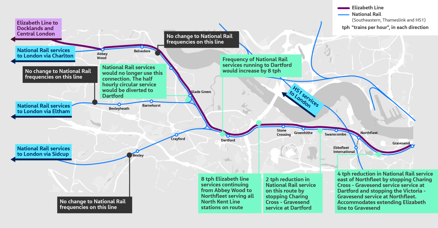
Effect Of Adding Eight tph To Northfleet And Four tph To Gravesend On The London Charing Cross and Gravesend Service
The Elizabeth Line Extension is proposed to add the following trains to the service.
- 8 tph will continue from Abbey Wood to Northfleet.
- 4 tph will continue from Abbey Wood to Gravesend.
This adjusts the totals as follows.
- Abbey Wood – 6 tph
- Belvedere – 12 tph
- Erith – 12 tph
- Slade Green – 14 tph
- Dartford – 12 tph
- Stone Crossing – 10 tph
- Greenhithe – 10 tph
- Swanscombe – 10 tph
- Northfleet – 10 tph ( 4 tph – Terminating, 6 tph – Passing through)
- Gravesend – 7 tph ( 4 tph – Terminating, 3tph – Passing through)
Note.
- These surely are frequencies, that will satisfy the most picky traveller.
- There are freight trains running on the route.
- The tightest section would appear to be between Abbey Wood and Dartford, although Dartford and Northfleet is only two tph less.
- West of Northfleet it gets easier.
- But I do think though, that full digital signalling between Abbey Wood and Gravesend would be able to handle it.
- 14 tph is a frequency that is less than that of the central sections of the East London Line, the Elizabeth Line and Thameslink.
- I have flown my virtual helicopter along the line and there may be places to add a third track, which would add more capacity.
I believe that it is possible to achieve the passenger train frequencies in the last table.
Abbey Wood East Junction
This Google Map shows the track layout to the East of Abbey Wood station.
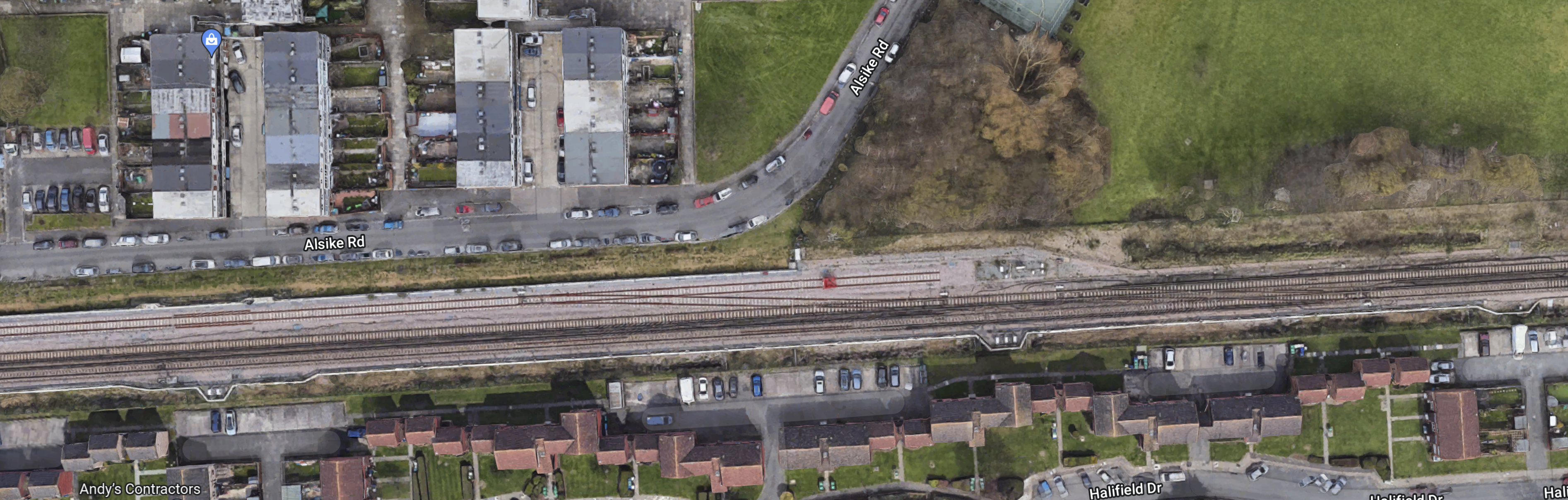
Note.
- There are crossovers so trains can run between the Elizabeth Line platforms on the North side of Abbey Wood station and the North Kent Line.
- There is space on either side of the railway.
- I have my doubts that the current track layout would be able to handle twelve Elizabeth Line, six North Kent Line and possibly a freight train in every hour, especially where flat junctions are involved.
I can see a flyover or dive-under being built in this area to handle the trains efficiently.
Abbey Wood Power Change-Over
Some thoughts.
- I will assume, that the change-over between 25 KVAC overhead and 750 VDC third-rail power will take place in or near Abbey Wood station.
- This would avoid any erection of electrification gantries to the East of Abbey Wood station.
- If the Office of Road and Rail refuse to allow any more third rail, I could see a Headbolt Lane solution being applied, where batteries are used to bridge the 1.4 mile gap between Abbey Wood station with its 25 KVAC overhead electrification and Belvedere station with its 750 VDC third-rail electrification.
- North Kent Line trains would take their existing route between Abbey Wood and Belvedere stations.
- Also, if a comprehensive and efficient track layout is used here, then there might be cost savings if the Elizabeth Line trains supplied their own power from batteries.
An efficient junction to the East of Abbey Wood station, coupled with well-thought out electrification could be key to successfully handling the nearly 20 tph at Abbey Wood station.
Belvedere, Erith And Slade Green Stations
Belvedere, Erith and Slade Green stations are on a double-track section of the line.
- The three stations are not step-free.
- There appear to be a lot of industrial sites, that could be developed for housing.
- There might be the possibility of adding an extra track in places.
- Luckily, there are no level crossings.
- There are some footbridges over the railway, that probably need updating to step-free
I suspect that developing the housing on this route will be most important.
Slade Green Depot
This Google Map shows Slade Green depot and the large triangular junction opposite the depot.
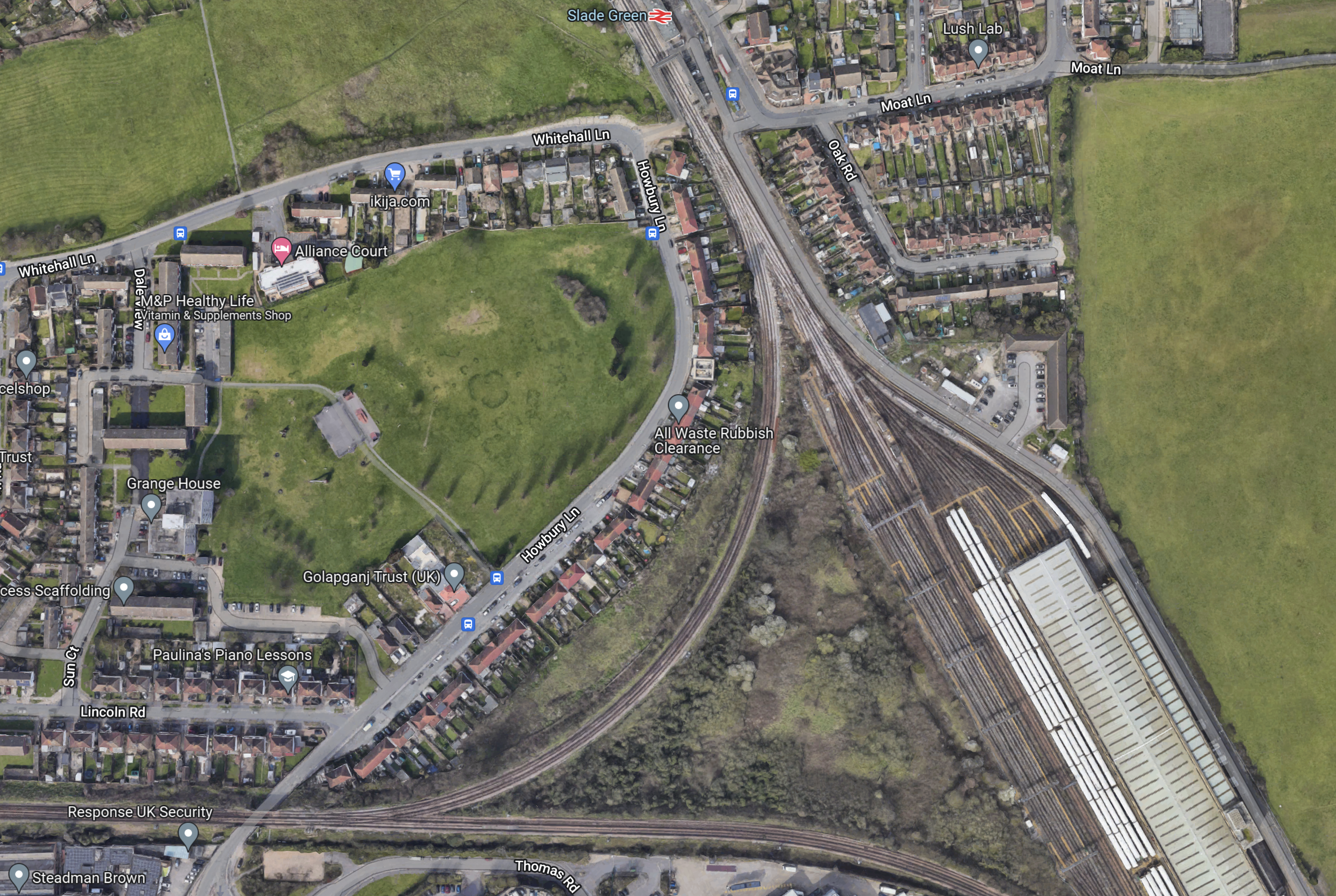
Note.
- Slade Green station is at the top of the map.
- Slade Green depot is in the South-East corner of the map.
- The West point of the junction leads to Bexleyheath.
- The West and North points of the junction are connected by the Erith Loop.
- The South point of the junction leads to Dartford.
There are rail capacity problems in this area.
- Slade Green depot is not big enough.
- One train service goes both ways on the Erith Loop between Slade Green and Bexleyheath every thirty minutes, which could be a block on increasing train frequencies between Abbey Wood and Dartford stations.
- The proposal is saying that the Slade Green and Bexleyheath service will go via Dartford station, where it will probably reverse.
I can see comprehensive redevelopment of the depot and the junction to remove the capacity problems and perhaps build a lot of housing.
- If the Erith Loop is not used could the centre of the junction be developed with a much-needed extension to the depot?
- The depot might be moved elsewhere or perhaps rebuilt with tower blocks on the top.
I think that moving the Slade Green and Bexleyheath service via Dartford could mean that the Erith Loop isn’t needed, so this might free up space to increase the size of the depot.
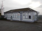
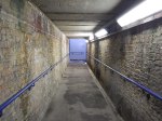
Dartford Station
This Google Map shows Dartford station and the area around the station.
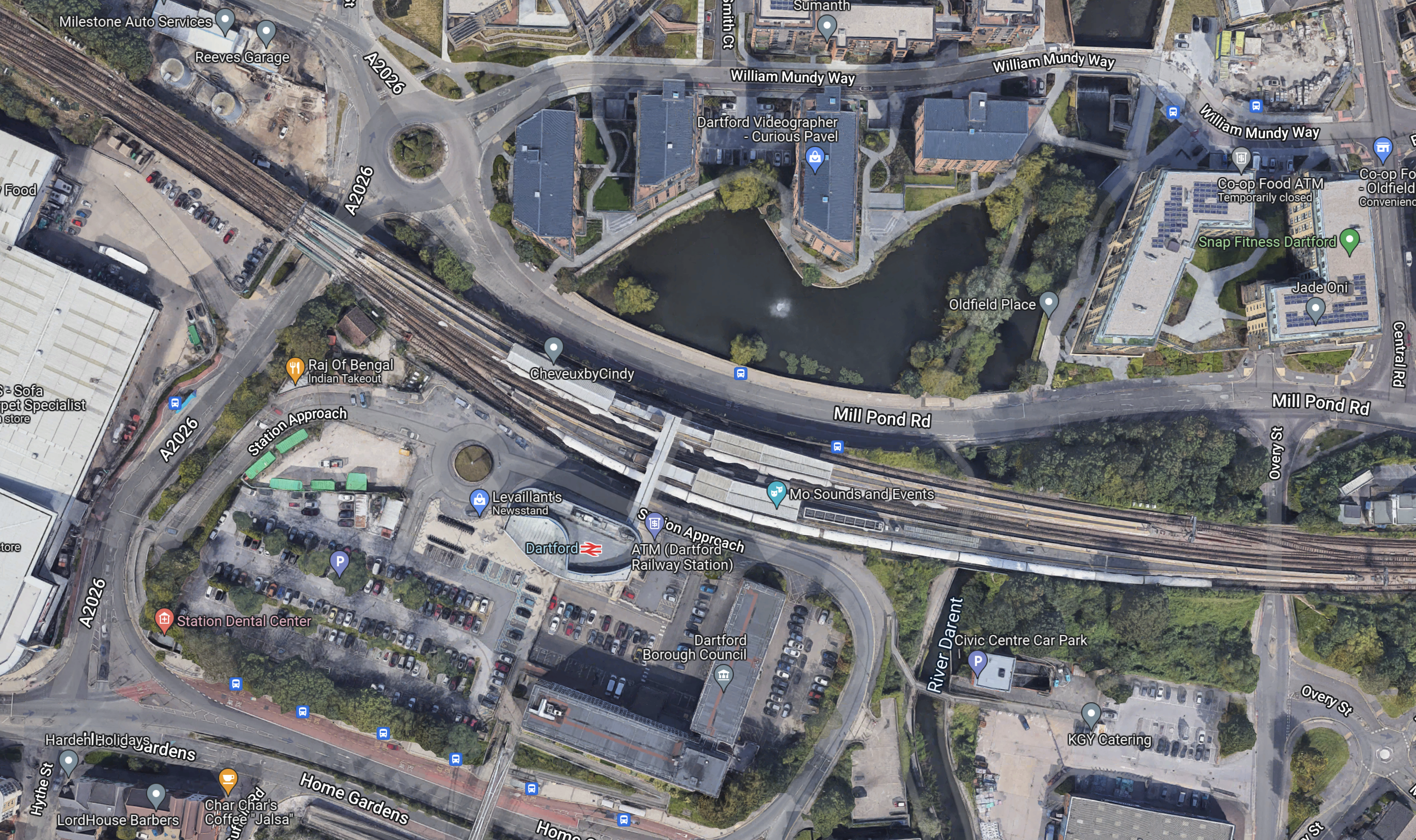
Note.
- The station has four long platforms.
- It should be able to handle the 12 tph in both directions.
- There is a lot of new developments by the station.
- The station is step-free.
- There are some pictures of Dartford station in Dartford Station – June 27th 2022.
But I do suspect that the station probably needs extra capacity and a substantial rebuild.
Stone Crossing, Greenhithe And Swanscombe Stations
Stone Crossing, Greenhithe and Swanscombe stations will be handling 10 tph.
- Greenhithe is a new station with full step-free access.
- But Stone Crossing and Swanscombe stations may need improvement to bring them up to Elizabeth Line standards.
- More details of Stone Crossing station are given in Stone Crossing Station – June 27th 2022.
- More details of Greenhithe station are given in Bluewater Shopping Centre By Train.
- More details of the current state of Swanscombe station are given in Swanscombe Station – June 27th 2022.
- The one level crossing in the area was closed in 2018.
- There may be scope to add an extra track at places in this section.
I feel that these three stations could be fairly easy to bring up to the required standards.
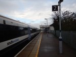
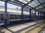
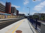
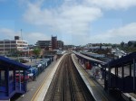
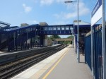
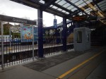
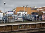
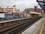
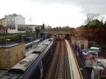
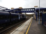
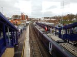
Northfleet Station
Northfleet station is a station, which in the words of estate agent; Roy Brooks, would have a lot of potential.
This Google Map shows the station.

Note.
- The two tracks through the station are the North Kent Line.
- The other two tracks are freight sidings.
- The car-parks at Ebbsfleet station are in the South-West corner of the map.
- There appears to be a large cleared site to the North-West of the station.
These pictures show the station.

The requirements for the station will be as follows.
- The ability to handle 6 tph passing through.
- The ability to be able to handle 4 tph, that terminate at the station.
- Terminating four tph, will probably need two platforms for all eventualities.
- Full step-free access.
- An interchange with Ebbsfleet International station is also needed.
- Is car parking needed?
There is certainly enough space.
The Pedestrian Link Between Northfleet And Ebbsfleet Stations
This is part of the plan and is shown on the first map in this post.
This Google Map shows Northfleet and Ebbsfleet stations.
Note.
- The large Ebbsfleet International station towards the bottom of the map.
- Northfleet station on the North Kent Line in the North East corner of the map.
- The two stations are about five hundred metres apart as the crow flies.
There has been a lot of pressure in the past to build a pedestrian link between the two stations, as reported by the Wikipedia entry for Northfleet station.
The station is very close to Ebbsfleet International station (the NNE entrance is only 334 yards (305 m) from Northfleet’s station), but passengers (using public transport) will find it far easier to access Ebbsfleet International from Gravesend or Greenhithe, as these stations are more accessible and offer easy access to Fastrack bus services. The walking route between the two stations is 0.6 miles (1 km) or 0.8 miles (1.3 km) and a suitable pedestrian link has not been built because of funding issues and objections from Land Securities.
Why when Ebbsfleet International station was built in the early 2000s for opening in 2007, was a pedestrian link not built between the two stations?
How much did omitting the link save?
Luton Airport are building the Luton DART, which is a people mover to connect Luton Airport Parkway station with the airport.
- It is 1.4 miles long.
- It is fully automated.
- It might have an extra station serving the mid-stay parking.
- It appears to be taking three years to build.
All of this very comprehensive system appears to be costing around £200 million.
I doubt that a simple pedestrian link, like a bridge with travellators, would have cost more than a few tens of million pounds.
Will Northfleet/Ebbsfleet Become A Major Railway Hub?
If Northfleet station and the connection to Ebbsfleet is well designed,, I can see this station becoming a major railway hub.
- It would have Eurostar Continental services.
- It would have HighSpeed services to London and Kent.
- It would have Elizabeth Line services to London and Heathrow.
- It would have Thameslink and Southeastern services.
- The station would have lots of parking.
I also feel in the future that more Continental services will be developed.
- Adding extra platforms for Continental services could be easier than at St. Pancras.
- It could be an ideal terminus for sleeper trains to and from the Continent.
- I might be the ideal terminus for very long distance trains to and from the Continent.
Northfleet/Ebbsfleet has something that St. Pancras lacks – space.
Gravesend Station
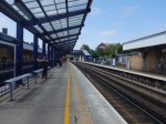
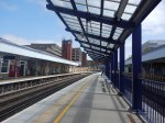
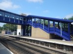
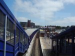
Gravesend station is a rebuilt step-free station with three platforms, as these pictures show.

But is it the right station, for the end of the Elizabeth Line?
These points are in favour.
- There is a bay platform, that could handle 4 tph.
- The station is step-free.
- The station has had a recent refurbishment.
- It has HighSpeed services to London and East Kent.
- Gravesend is a town of 74,000 people.
- Passengers can change between through trains by just staying on the same platform.
But these points are against.
- The station is on a cramped site in the town centre.
- There is no train stabling nearby.
- Adding lots of car parking may be difficult.
- Suppose adding the Elizabeth Line to the town was very successful and it was felt more services were needed. Could Gravesend station cope?
These are the times for the various services.
- HighSpeed to St. Pancras – 25 minutes
- HighSpeed to Stratford – 17 minutes
- Southeastern to Charing Cross – 65 minutes
- Thameslink to Abbey Wood- 28 minutes
- Thameslink to London Bridge – 60 minutes
I estimate that the Elizabeth Line will take just over 50 minutes to Tottenham Court Road.
This last timing in itself is a good reason for the Elizabeth Line to serve Gravesend.
But I don’t think the Elizabeth Line has to start there.
I am worried that the Elizabeth will be too successful.
- It serves Central London, Paddington and Heathrow.
- It will have a frequency of four tph from and to Gravesend.
- It will have trains with a very large capacity.
- The trains will have wi-fi and 4G connections.
I don’t think the cramped Gravesend station will be able to cope with the needs of expansion.
- An extra platform.
- Handling trains that need to be turned back to London.
- More car parking.
Northfleet/Ebbsfleet will have the parking and eight tph on the Elizabeth Line, so surely the best solution is to have the actual Elizabeth Line terminal station to the East of Gravesend.
- Travellers to the West of Gravesend will use Northfleet/Ebbsfleet.
- Travellers in Gravesend will use Gravesend station by walking, cycling or using a local bus.
- Travellers to the East of Gravesend will use the new terminal station.
The Elizabeth Line extension is supposedly costing £3.2 billion, so it should serve as many potential passengers as possible.
The Elephant In The Garden Of England
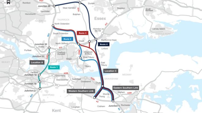
It is proposed that the new Lower Thames Crossing is built to the East of Gravesend.
This map from the Department of Transport, shows the route.
Note.
- The new crossing, which is shown in red, bypasses the Dartford Crossing on the M25.
- The A226 runs between Gravesend and Higham via a junction with the new crossing at Chalk.
- Northfleet is to the West of Gravesend.
This Google Map shows the area between Chalk and Higham.
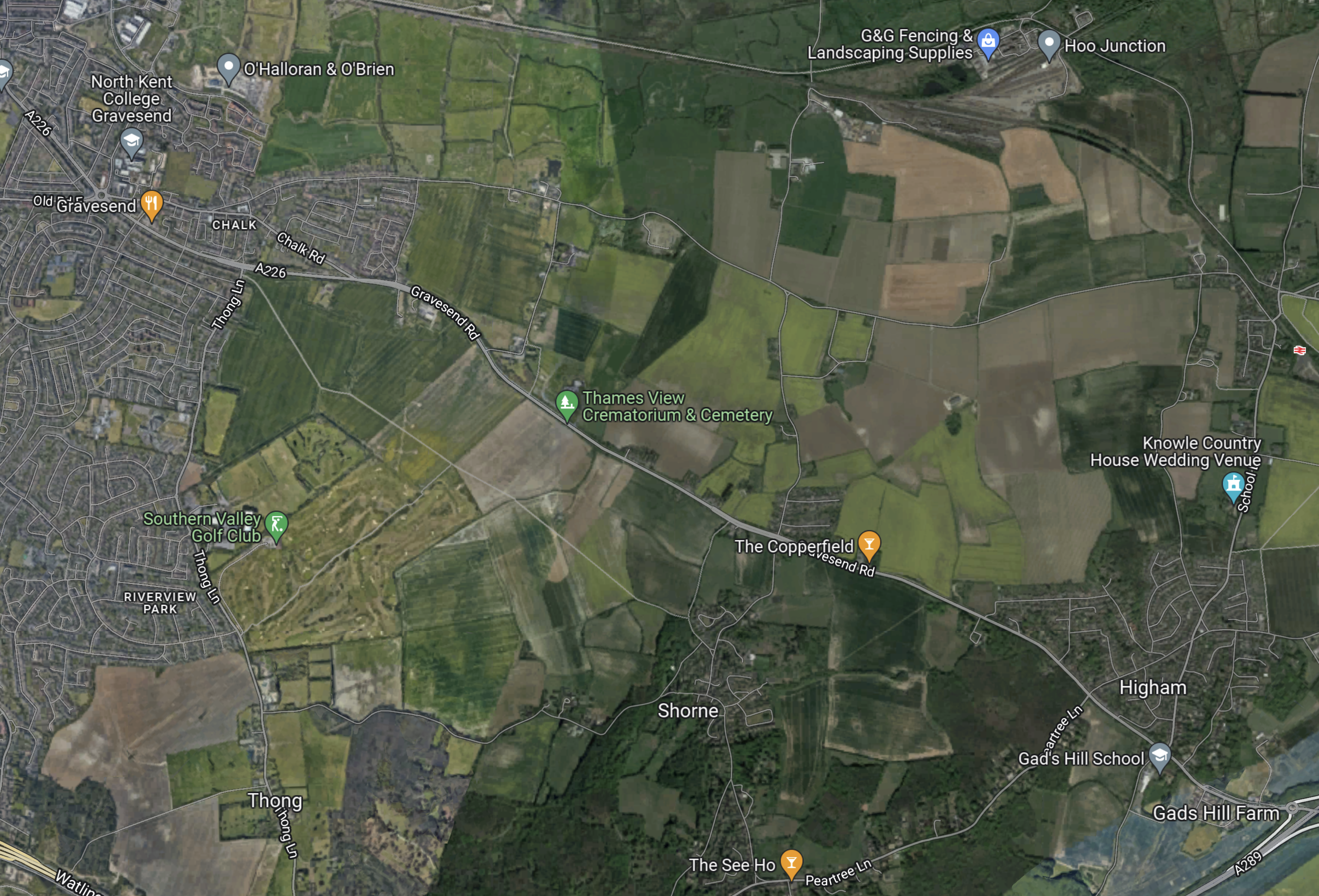
Note.
- Chalk in the North-West corner of the map.
- Higham in the South-East corner of the map.
- The A226 running between Chalk and Higham.
- Higham station on the North Kent Line about half-way up the East side of the map.
- The North Kent Line running across the top of the map between Gravesend and Higham stations via Hoo Junction.
The Lower Thames Crossing will run North-South across this map to the East of Chalk and according to the Department of Transport map to the West of Thong.
I should admit, that I don’t drive, so the Lower Thames Crossing will be of no use to me, but I have friends in Kent and most seem to be in favour of the new crossing.
Reopening The Hoo Branch To Passenger Trains
In Effort To Contain Costs For Hoo Reopening, I wrote about an article in the April 2022 Edition of Modern Railways with the same title.
This is the first paragraph of the Modern Railways article..
Medway Council is working with Network Rail and other industry players in an effort to make restoration of a passenger service to Hoo on the Isle of Grain branch feasible. The Council was awarded £170 million from the Housing Infrastructure Fund in 2020 to support schemes to facilitate building of 12,000 new houses in the area, with £63 million of the HIF money for reinstatement of services on the Hoo Branch.
The article mentions, this new infrastructure.
- A new station South of the former Sharnal Street station.
- Works to level crossings, of which there are six between Gravesend station and proposed site of the new Hoo station.
- A passing place at Hoo Junction, where the branch joins the North Kent Line.
- A passing place at Cooling Street.
It looks like we may have the smaller project of reopening the Hoo branch railway, whilst a major road and tunnel is built through the area.
This OpenRailwayMap shows the North Kent Line between Gravesend and Higham stations.
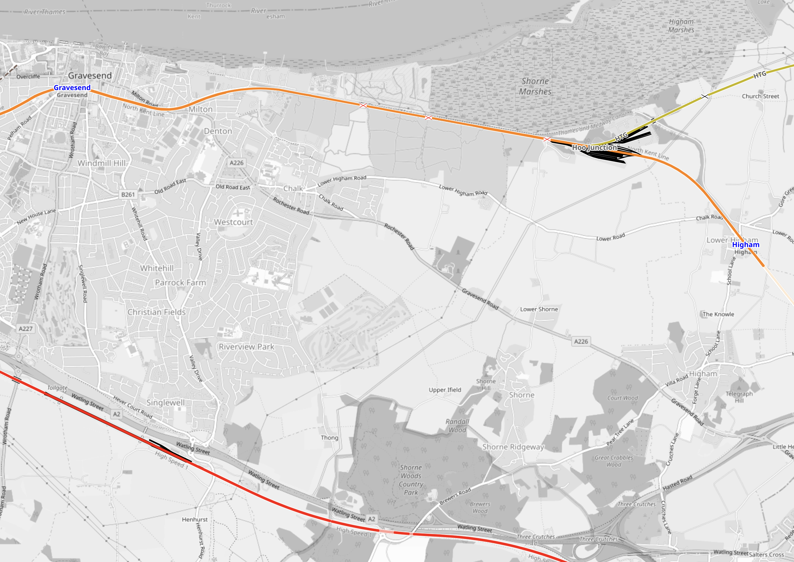
Note.
- Gravesend station is in the North-West corner of the map.
- Higham station is at the Eastern edge of the map.
- The railway shown in orange is the North Kent Line.
- The railway shown in yellow is the Hoo branch.
- The railway shown in red is the Channel Tunnel Rail Link.
It looks like the path of the new crossing could follow a similar path to the overhead power cable shown on this map.
According to Modern Railways, the main reason for reopening the Hoo Branch for passenger trains is to provide rail access for new housing on the Isle of Grain.
- Improving the Hoo branch will also help the freight services to the various docks and installations on the Isle of Grain.
- Will the builders of the new crossing, use the Isle of Grain for the supply of aggregates and the disposal of tunnel spoil?
- Remember that barges on the Thames were used to remove the tunnel spoil from London for both Crossrail and the Battersea extension to the Northern Line.
My knowledge of major projects is saying to me, that before the major works of the new crossing are started, this branch railway must be updated, otherwise it will cause problems in the future.
Could this be why, the Hoo branch reopening has been mentioned in both the April and July 2022 Editions of Modern Railways? Perhaps a sensible decision has been made, that means the Hoo branch will be improved first, to speed the construction of the new Lower Thames Crossing.
Could The Elizabeth Line Be Extended To The Proposed Hoo Station?
The proposed Hoo station is to be just South of the former Sharnal Street station.
- This is under ten kilometres from Hoo Junction, where the North Kent Line is electrified.
- A single platform could handle 4 tph, but provision for two platforms would be prudent.
- A couple of sidings could provide stabling.
- Services would join the North Kent Line at Hoo Junction.
- Services would use battery power between Hoo Junction and Hoo station.
- If charging were needed at Hoo station a short length of 25 KVAC overhead electrification would be needed.
- There is plenty of power available locally to power any electrification.
This Google Map shows the possible location of the station.
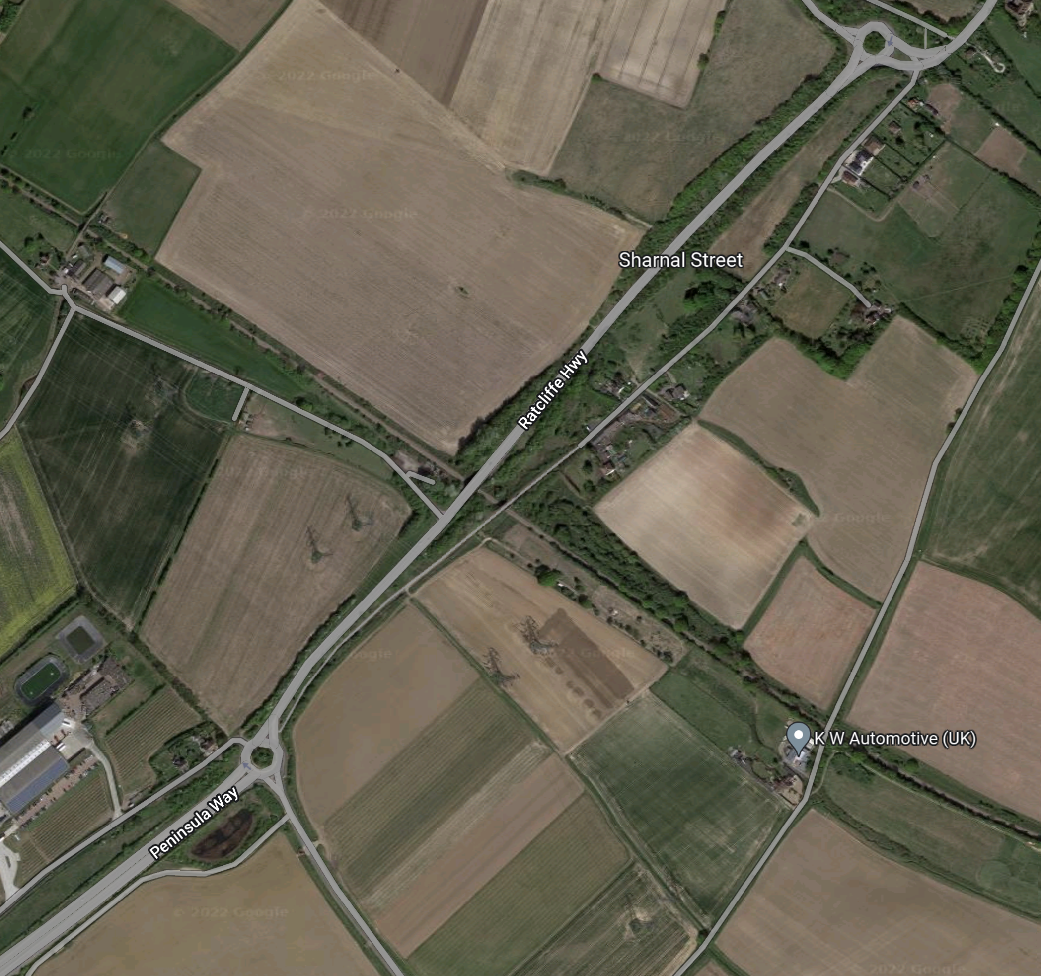
Note.
- The A 289 road running NE-SW across the map from a roundabout in the North-East corner of the map.
- The A 289 leads from the roundabout in the South-West corner of the map to the Medway Tunnel to Chatham.
- Sharnal Street is between the two roundabouts.
- The single-track railway crosses the A 289 at right-angles, about 500 metres South of Sharnal Street.
- There is even a high voltage power line going through the area to the South of the railway.
It seems to be an ideal place for a station with good road access, space and plenty of power to charge battery vehicles and trains.
I took these pictures of where the A289 crosses over the railway on June 27th 2022.
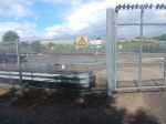
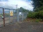
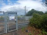


Note.
- The substation site, which is marked with Network Rail logos. It looks like power has been provided to the site.
- The high-voltage line passing to the South of the site.
- There were trucks carrying tunnel segments. Is there a factory on the Isle of Grain and will it produce segments for the Lower Thames Crossing?
- The Sharnal Street bridge over the railway.
It certainly looks like Network Rail have been planning a station there for some time.
Around The Isle Of Grain
I took these pictures of the Isle of Grain on June 27th 2022.


Note.
- There is a lot of housing planned on the island.
- Someone wants to build a theme park.
- The road past the station leads to the Medway Tunnel.
All these factors would add to the case for the station.
Battery-Electric Class 345 Trains
There would be a need to develop a third-rail battery/electric version of the Class 345 trains.
In this article in Global Rail News from 2011, which is entitled Bombardier’s AVENTRA – A new era in train performance, gives some details of the Aventra’s electrical systems. This is said.
AVENTRA can run on both 25kV AC and 750V DC power – the high-efficiency transformers being another area where a heavier component was chosen because, in the long term, it’s cheaper to run. Pairs of cars will run off a common power bus with a converter on one car powering both. The other car can be fitted with power storage devices such as super-capacitors or Lithium-ion batteries if required. The intention is that every car will be powered although trailer cars will be available.
Unlike today’s commuter trains, AVENTRA will also shut down fully at night. It will be ‘woken up’ by remote control before the driver arrives for the first shift
This was published over eleven years ago, so I suspect Bombardier have refined the concept.
A Simple Extension Of The Elizabeth Line
The branch to Hoo station could be a very simple extension of the Elizabeth Line.
- There appear to be no challenging engineering problems.
- Parking and cycling routes could be provided as required at the station.
- The centre of Gravesend would be under ten minutes from Hoo station.
- There would be a same-platform change for HighSpeed services at Gravesend station.
- The developers of the housing would be over the moon.
- Workers for the Lower Thames Crossing and the big energy projects on the Isle of Grain could reverse commute from London.
- The station would only be a few minutes more than an hour from Central London.
- The station could also double as a Park-and-Ride for Chatham and Gillingham.
- Buses could connect Hoo station to Chatham and Gillingham.
It could prove to be a very valuable station for the Isle of Grain and the Medway Towns.
The Contactless Ticketing Conundrum
This is said on the Transport for London website.
Contactless pay as you go is accepted throughout the Elizabeth line.
So it’s just a case of Have Card Will Travel!
So this will mean, that contactless ticketing will have to be accepted at all stations East of Abbey Wood.
Everybody will love that!
Are There Any Other Possible Elizabeth Line Destinations In Kent?
Train companies, since the days of British Rail have run Peak time commuter trains to bring workers into London in the morning and take them home in the evening.
There will be four tph passing through Gravesend and they don’t all have to go to and from Hoo station.
Digital signalling will give flexibility as to which stations the trains could serve.
Possibilities include.
Gillingham
Gillingham station may be a possibility.
Maidstone West
Maidstone West station may be a possibility.
Rainham
Rainham station has three platforms and is already served by two Thameslink tph to Luton through Central London, which use the bay Platform 0
Some might argue that two Elizabeth Line tph should extend from Abbey Wood to Rainham, to give a four tph service between Abbey Wood and Rainham.
This would be a North Kent Metro.
Rochester
Rochester station has three platforms and Platform 3 can turn trains back to London.
It is already used by Thameslink to turn Peak services.
Project Management
The project may be budgeted to cost £3.2 billion, but it is a small number of independent projects.
- Digital signalling
- Electrification changeover at Abbey Wood station.
- An efficient junction East of Abbey Wood.
- Rebuild Belvedere station with step-free access.
- Rebuild Erith station with step-free access.
- Rebuild Slade Green station with step-free access.
- Extend Slade Green depot.
- Upgrade Dartford station.
- Rebuild Stone Crossing station with step-free access.
- Upgrade Greenhithe station.
- Upgrade Swanscombe station.
- Rebuild Northfleet station with step-free access and two extra bay platforms.
- Install people mover between Northfleet and Ebbsfleet stations.
- Upgrade the Hoo Branch.
- Build Hoo station.
Note.
- Gravesend station would only need minimal updating.
- As I said before, I suspect the digital signalling will be the biggest cost.
- Choosing the optimal order is good project management!
- Projects that create fare revenue should be done early, especially if they don’t interfere with services on the railway.
The first projects, that I would develop would be these.
- Rebuild Northfleet station with step-free access and two extra bay platforms.
- Install people mover between Northfleet and Ebbsfleet stations.
- Upgrade the Hoo Branch.
- Build Hoo station.
As I said earlier, this project needs to be developed with the Lower Thames Crossing.
Conclusion
This seems an excellent plan.
What Are We Going To Do For The Lower Thames Crossing?
This report in the Thurrock Gazette is entitled Over a thousand residents make anger known at Lower Thames Crossing meeting tonight and it describes the anger in the area over the proposed new Lower Thames Crossing. This map from this BBC report, shows the proposed route.
The Proposed Lower Thames Crossing
I don’t drive, but I do appreciate that there is extra capacity across the Lower Thames is needed to relieve the Dartford Crossing.
So what should be done?
I think that whether or not a new Lower Thames Crossing is built, we should give people alternative routes to cross the river.
Crossrail may help in that some cross river journeys like say from Kent to Essex, may be quicker by the following route.
- Train or car to Abbey Wood station.
- Crossrail train to Whitechapel station.
- Walk across the platform at Whitechapel and take another Crossrail train to Essex, changing at Stratford or Shenfield as required.
Obviously, it won’t suit everybody, but the design of Whitechapel station has been designed to facilitate journeys like this.
I think that the Abbey Wood branch should be extended to Ebbsfleet International and Gravesend, as soon as possible. This extension is safeguarded but not planned.
It would probably help too, if the interchange between SouthEastern’s HighSpeed services and Crossrail at Stratford wasn’t a long hike round the Eastfield Shopping Centre.
Surely, the real problem is freight.
This will only be eased by putting more of it on rail between Europe and the UK.
In the end another Thames Crossing will be built and this should also solve the problem of a bigger Thames Barrier.
