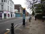
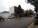
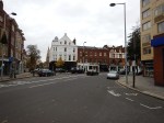
Crossrail 2 October 2015 – King’s Road Chelsea Station
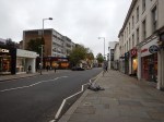
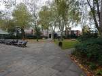
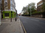
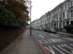
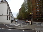
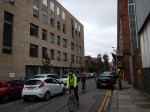
The reason for my walk this morning, between Sloane Square and Imperial Wharf stations, was to look at Crossrail 2’s plans for King’s Road Chelsea station.
If the station is built it will sit between Victoria and Clapham Junction stations.
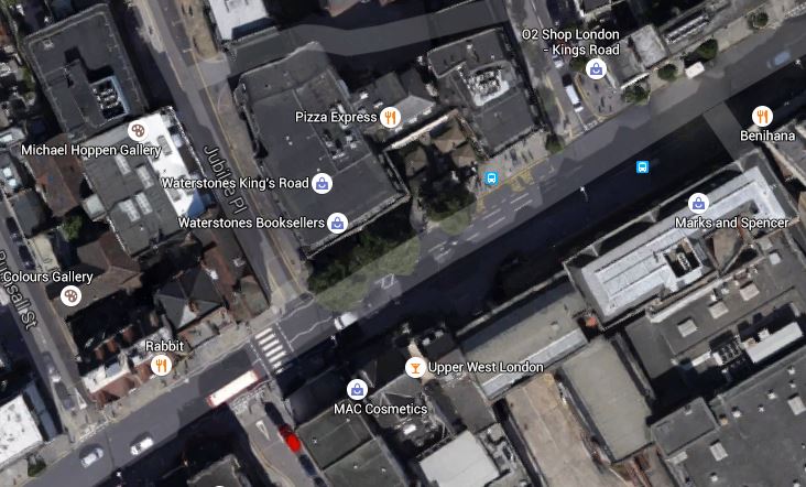
This Google Map shows the area.
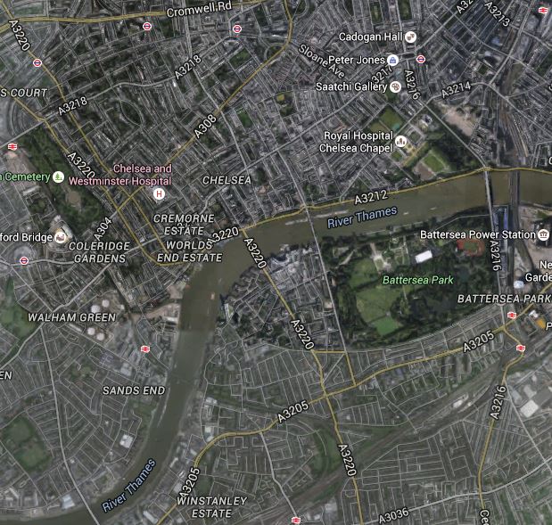
Victoria To Clapham Junction
Victoria station is in the top right corner and Clapham Junction is at the bottom of the map.
So what do Crossrail 2 say about the need for a King’s Road Chelsea station in their document about the station. They say this.
A station in the Chelsea area has always been part of the Chelsea – Hackney line safeguarding since it was first proposed in 1989. A Crossrail 2 station in Chelsea would improve community access to rail based public transport in an area where current service levels are low in comparison to similar inner London locations. It would also improve connectivity to the Royal Brompton and Royal Marsden hospitals and provide access to the existing retail and commercial developments along King’s Road. Providing a Crossrail 2 station in Chelsea would also improve journey times for those travelling to or from King’s Road.
Chelsea currently suffers weekday congestion and delays on its main roads. By 2031 congestion on London’s roads is expected to increase by 60 per cent. Providing a Crossrail 2 station would encourage more people to use public transport, which would help to reduce traffic congestion in the area and improve air quality.
That is an answer that would persuade someone like me, who doesn’t drive and knows the arguments for buses and trains, but to the average selfish driver of a high-powered car or off-road vehicle, that is almost an insult.
The Google Map does show the enormous problem in working out the route of Crossrail 2.
Victoria and Clapham Junction stations are about four kilometres apart, so for safety and ventilation reasons any tunnel between the two stations will need an access shaft.
And what lies between the two stations? The River Thames!
I’m sure that part of the reason for a new station in the Chelsea area, is to provide the necessary shaft for the tunnels, as the only other alternative is somewhere in Battersea and that is probably too close to Clapham Junction.
This creates a wonderful irony for Chelsea. Suppose that Crossrail 2 decide that because of opposition, they are going to drop building a station in Chelsea.
They might still decide to build a shaft in perhaps a block of flats, in the same way they did on Moorgate with Moor House.
So Chelsea would have an unseen emergency access and ventilation shaft, but no station.
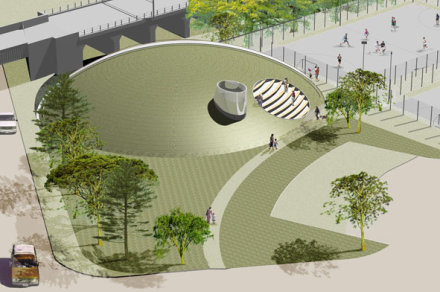
This map from the Crossrail 2 document shows the proposed station and its shafts, entrances and work-sites.
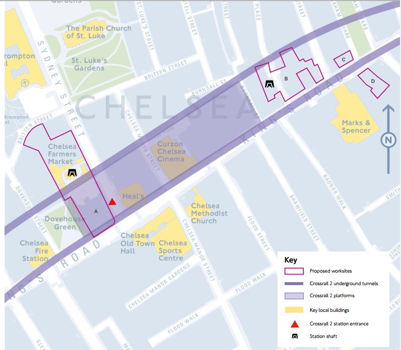
King’s Road Chelsea Station
This Google Map shows the area of Site A in an enlarged format.
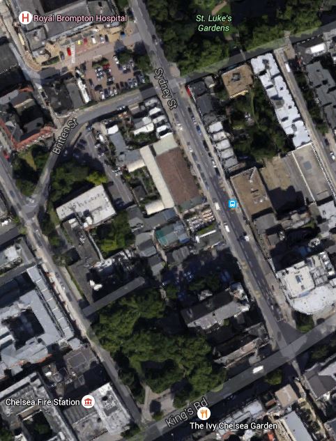
King’s Road Chelsea Station Site A
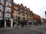
Site A is described like this by Crossrail 2.
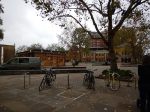
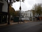
Includes the Chelsea Garden Centre and Farmers Market. This would be the main worksite for construction of the station tunnels, station entrance, ticket hall and station shaft. Although the site boundary includes 250 King’s Road and 151 Sydney Street, these buildings would be retained.
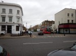
I would assume that the buildings to be retained are these on the corner.
This Google Map shows the area of Site B in an enlarged format.
King’s Road Chelsea Station Site B
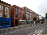
Site B is described like this by Crossrail 2.
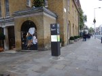
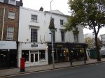
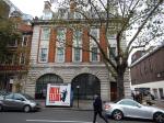
Includes retail and office buildings adjacent to The Pheasantry and extends across Jubilee Place, which would be closed temporarily. This site would be used for construction of the eastern station shaft.
The Pheasntry, where Pizza Express has their restaurant is to the right of Waterstones and Ryman
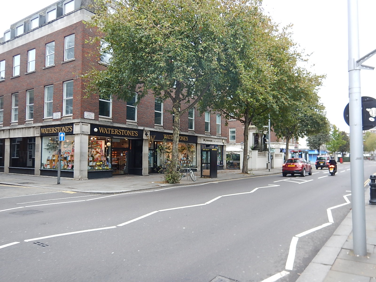
Jubilee Place is to the left of Waterstones and appears to be one-way away from the King’s Road.
This station design is not very ambitious, when you compare it to Balham or Dalston, in that it appears to be single as opposed to double-ended.
Is this because there is no interchange with other lines or because Crossrail 2 want to have to argue only one entrance with protestors?
What Will The New Buildings Be Like?
Obviously I don’t know, but I can make a few points.
- On both sites A and B, I suspect that both shafts and the station at Site A will be incorporated into buildings in keeping with the area.
- It looks from the proposed position of the station entrance, that if the building on the corner of Site A is to be retained as Crossrail 2 say, then it will double as the station.
Surely, this would be two briefs that would be welcomed by one of our world-class architects.
Conclusion
This is probably the most difficult station to build for Crossrail 2.
Not in terms of the actual engineering, but in the sensitive nature of the site and the local residents.
But as I said earlier, I have a feeling that if Crossrail 2 is built it will have to build something in the Chelsea area, due to London’s geography.
A Wall Of Flats At West Hampstead Station
I stopped off at West Hampstead station to see anything was happening on the new station.

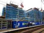
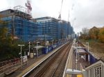

Nothing much yet!
This article on West Hampstead Life gives details of the new station.
I will reserve judgement on the flats until they’re finished. Especially, on a windy day!
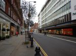
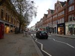
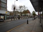
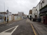
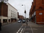
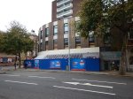
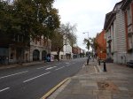
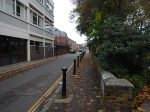
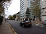
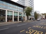
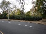
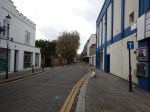
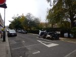
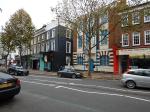
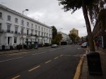
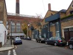
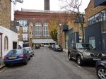
A Walk Between Sloane Square And Imperial Wharf Stations
I waled between Sloane Square and Imperial Wharf stations, to get a feel of the area and formulate my views of whether the area needs a Crossrail 2 station and if it does, what form it will take.


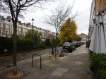


The walk and the area did raise a few interesting questions.
- Why is the Department Store in Sloane Square not called John Lewis? After all Jones Brothers, George Henry Lee and Robert Sayle have all taken the corporate name.
- Why at nine o’clock in the morning were expensive cars rushing about at well above the speed limit? This area needs a fully enforced twenty limit to make everybody safer.
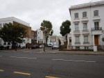
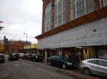
- Why all the fuss about demolishing an empty Fire Station to use the site for a Crossrail 2 station? With an imaginative architect, it would enhance the buildings in that area of the King’s Road.
- Why would anybody want to live in the very attractive but expensive side streets? You’d effectively be a prisoner of the traffic for most of the week.
- Why are so many of the shops boring members of chains? I didn’t see many that I felt, I should return visit to perhaps buy something for my house.
- Why are there no signs to Imperial Wharf station?
- Why are there so few maps?
- Why do the artisan bakeries not have anything without gluten? The only places that do gluten-free I saw were Marks and Spencer, Waitrose and Starbucks. The Angel has those and several others!
I really think that the whole point of the opposition by some, to the building of a Crossrail 2 station on the King’s Road, is that they want to keep the area congested with traffic, so that visitors stay away!
After all. posh people in Chelsea, don’t want to allow plebs like me with a degree in a very non-artistic subject like Engineering to lower the tone of the area, by visiting!
Is This Really A Pacer In A New Outfit?
I don’t like Pacers, which I often refer to as scrapyard specials, as in most cases those places should be their next destination.
Today, my heart sank as the conductor of a crowded Class 158 train at Rotherham Central station, refused entry to the train to proceed to Sheffield.
I knew what would happen and it did!
Ten minutes later and a dreaded Pacer in the form of Class 144 train hove into view. But at least it was four carriages and it would take the happy remnants of the Ipswich away supporters to Steel City!
Only after I’d been sitting in the last coach for a couple of minutes did I realise this was not an ordinary Pacer, as the seats were like Noah’s animals in a 2×2 formation and it looked like the paint and seats and their covers were all new. Above our heads was a new digital display informing the occupants of the route. This was much needed, as this particular train circumnavigated a large portion of South Yorkshire.
I took these pictures.


I had heard of the E for Evolution version of the Class 144 train before! So were we all travelling in the prototype of this train?
The pictures confirm we were.
Some other points.
- Passengers seemed to be suffering from New Train Syndrome, judging by the surprised look on their faces.
- The train sounded like a Pacer, but perhaps a bit quieter.
- Ride seemed better, than the standard Class 144 train I took to get to Rotherham. Perhaps, the maintenance engineers had tightened the nuts and tweaked the bogies or something?
- I spoke to a few passengers, who I reckoned would know nothing of the project to create the Class 144E and they seemed impressed and felt the train was a lot better than the ones they normally travel on.
- The train had the clearest information display, I’ve seen on any train. This near seventy-year-old with stroke-damaged eyesight loved it!
This Class 144 E design could convert the twenty-three Class 144 trains into something that meets the Rail Vehicle Accessibility (Interoperable Rail System) Regulations. Wikipedia says this about the train.
The demonstrator Class 144e unit (144012) features a number of upgrades such as the addition of new 2+2 style seating, a fully accessible toilet, two wheelchair spaces and spaces for bicycles and luggage. as well as Wi-Fi and media screens.
It has one problem!
The politicians have said the Pacers would be gone.
But to replace them with new electric trains and put up all that overhead wiring, would cost a fortune and more importantly take a long time.
However in the short term, an upgrade of the Class 144 trains would improve the lot of passengers some way towards the level of new trains.
So would politicians be prepared to do a U-turn and upgrade the Pacers?
Ian Walmsley in Modern Railways has said that this demonstrator is a good start and the lessons learned should be applied to upgrading other multiple units like the various Class 15X trains.
But he doubts the economics and reliability.
For myself, if I was the Transport Secretary I would take a pragmatic decision, as we desperately need more trains.
I would convert perhaps five or six of the Class 144 trains and use them on routes with severe capacity problems or train shortages. Passengers would be surveyed and a detailed analysis of all the results would be published.
I might even put a set on the Gospel Oak to Barking Line, where they would be compared to modern Class 172 trains. It would be a tough ask, but after what I experienced today, it wouldn’t be the unfair fight it would be with the standard Class 144.
Only then would a final decision be made as to whether all Class 144 trains were upgraded or scrapped!
Will Glasgow Ever Get Crossrail?
I have a Google Alert for Grossrail and occasionally it picks up an article for Glasgow Crossrail, like this comment in The Scotsman entitled Glasgow Crossrail: Will the ‘missing link’ be built?
If you look at the major cities in the UK, many have cross-city links tying the railways on both sides of the city together.
London has several.
- Thameslink
- The East, North and West London Lines
- The Gospel Oak to Barking Line
A major East-West link in Crossrail is being built and another Crossrail 2 is being planned.
Except for Manchester, where the Ordsall Chord is being built, I don’t know of a major city in England, where services are disconnected across the city.
In the last few years, I’ve walked across Glasgow a couple of times to connect between the South and East.
As a Sassenach, I can’t understand, why the Glassgow Crossrail is not given a high priority by the Scottish Government.
Perhaps the reason, is that one of the groups that would benefit most, would be English travellers arriving in Glasgow, who wanted to go North to places like Inverness, Aberdeen and Fort William.
Or could it be those old friends of the railways: the airlines, are lobbying against it, as it would allow services direct from Aberdeen and Inverness to Manchester?
Walthamstow Doesn’t Like Going Dutch!
This article from the Waltham Forest Guardian is entitled Grand opening of mini Holland scheme dominated by angry protestors.
I have posted it, as we are getting the Cycle Superhighway through where I live in the northern part of D Beauvoir Town in the near future and there are various opposing groups wanting or not wanting road closures and different parking restrictions.
As a Control Engineer, who has quite a bit of experience of dealing with complex liquid flow systems in chemical plants, I think that Councils tend to take a too definitive approach to the problem.
So my experience of chemical plants was in the late 1960s and we used an amazing PACE 231R. But that machine was the state-of-the-art computer of its day for solving differential equations. The computer was also the unrecognised star of the amazing rescue of the astronauts on Apollo 13.
The aim of the modelling in the chemical plant was to get different chemical streams flowing at the right rate into various reaction vessels, where they could be safely reacted and handled. The reaction products would then flow off in a controlled manner in other directions.
On a chemical plant the flows are controlled by various measures, but typically by valves, of which a domestic example is your mains water stop cock.
Often after modelling the flow system, it was found that the various valves were set almost to a fixed position for normal running of the plant.
If you look at traffic flows in say Walthamstow Village, as in the article, or De Beauvoir Town, you have an area bounded by main routes, which is crossed in a random manner by buses, cars, cyclists, pedestrians and trucks.
So what is different between modelling fluid and traffic flows?
Mathematically, it is the same process, but there is no variable method for regulating traffic flows.
The only regulation in De Beauvoir Town and other traffic systems is the brain of cyclists, pedestrians and regular drivers, who adapt their route according to their knowledge.
What the Mini Holland system in Walthamstow and other systems try to do is modify the thought processes of regular uses. The problem is that it may do that with the regular uses, but it doesn’t influence say your casual driver, who ventures into the area.
So in Walthamstow the local businesses and others see the drop in traffic and protest.
We need to apply more subtle ways of regulating the traffic, through areas like Walthamstow Village, that are understood by everybody.
- Speed limits should be set to twenty and they should be enforced. The Police need all the money they can get, so I would be happy to see mobile enforcement cameras on the top of Police vehicles parked at the side of the road.
- Computer-controlled traffic lights can be used as restrictors, so for instance at a notorious place where rat-runners enter an area, a pedestrian-crossing with lights could be placed. Timings could be adjusted automatically to the day of the week and time of the day.
- Speed humps aren’t as affective as they used to be. Perhaps car suspensions are better and Councils have softened them, so they don’t get sued?
- Cambridge has used rising bollards, that are automatically opened by certain vehicles, like buses, taxis, fire engines and ambulances.
- Even physical gates can even be opened and closed at various times. Suppose to calm an area, there was a need to shut off a road past a church. Why couldn’t it be opened on Sundays?
We are not being innovative enough.
Solutions like mini Hollands and just shutting routes are just too simplistic for a complex city like London.
As an aside, I’m old enough to remember London’s first experiment in traffic managment.
Green Lanes through Harringay in the 1960s was even more crowded with traffic than it is today. So traffic lights were put every fifty metres or so between Harringay Green Lanes and Turnpike Lane stations. There are quite a lot less lights today.
It cut the traffic through the area, but we all diverted through the side streets and made the lives of residents hell!
Which Constituencies Lie On Crossrail 2?
Alexandra Palace – Catherine West – Labour
Angel – Emily Thornberry – Labour
Angel Road – Kate Osamor – Labour
Balham – Sadiq Khan – Labour
Berrylands – James Berry – Conservative
Brimsdown – Joan Ryan – Labour
Broxbourne – Charles Walker – Conservative
Cheshunt – Charles Walker – Conservative
Chessington North – James Berry – Conservative
Chessington South – James Berry – Conservative
Clapham Junction – Jane Ellison – Conservative
Dalston – Meg Hillier – Labour
Enfield Lock – Joan Ryan – Labour
Epsom – Chris Grayling – Conservative
Ewell West – Chris Grayling – Conservative
Euston Kings Cross St. Pancras – Keir Starmer – Labour
Fulwell – Tania Mathias – Conservative
Hampton – Tania Mathias – Conservative
Hampton Court – Dominic Raab – Conservative
Hampton Wick – Tania Mathias – Conservative
Kempton Park – Kwasi Kwateng – Conservative
Kingston – James Berry – Conservative
Kings Road Chelsea – Greg Hands – Conservative
Malden Manor – James Berry – Conservative
Motspur Park – James Berry – Conservative
New Malden – James Berry – Conservative
New Southgate – David Burrowes – Conservative
Norbiton – James Berry – Conservative
Northumberland Park – David Lammy – Labour
Ponders End – Kate Osamor – Labour
Raynes Park – Stephen Hammond – Conservative
Seven Sisters – David Lammy – Labour
Shepperton – Kwasi Kwateng – Conservative
Sunbury – Kwasi Kwateng – Conservative
Stoneleigh – Chris Grayling – Conservative
Surbiton – James Berry – Conservative
Teddington – Tania Mathias – Conservative
Thames Ditton – Dominic Raab – Conservative
Tolworth – James Berry – Conservative
Tottenham Court Road – Keir Starmer – Labour
Tottenham Hale – David Lammy – Labour
Turnpike Lane – Catherine West – Labour
Upper Halliford – Kwasi Kwateng – Conservative
Victoria – Mark Field – Conservative
Waltham Cross – Charles Walker – Conservative
Wimbledon – Stephen Hammond – Conservative
Wood Green – Catherine West – Labour
Worcester Park – Paul Scully – Conservative
Totalling it up, there are fifteen stations in Labour consituencies and thirty-three in Conservative ones.
What has surprised me is how many MPs have more than one station in their constituency. James Berry has eleven for example.
How Will Crossrail 2 Affect De Beauvoir Town?
The recent publication of the latest plans for Crossrail 2 and the launch of a consultation about the project has led me to ask me the question that is the title of this post.
A Few Truisms About Large Projects
I was involved with large projects and writing software to help them get built on time and on budget and hopefully in a more affordable and less disruptive manner for over thirty years.
This leads me to a few truisms about large projects.
- What gets built in the end after extensive consultation, is often very different from the original plans.
- Successive similar projects get better and more affordable.
- More time spent planning a project, often results in a better and more affordable project.
- Political interference often results in a worse and more costly project.
- Good design, engineering and architecture costs less than bad.
As the design and planning process for Crossrail 2 is being started fifteen years before the stated opening in 2030, hopefully London will get this one right!
The Consultation
The consultation has a page on the Transport for London web site.
There are masses of pages to read, but if you have better things to do, then at least give the three Crossrail 2 documents in the following sections, a quick butchers.
I’ve added a few notes in the next few sections.
A Typical Crossrail 2 Station
These are my thoughts on a typical Crossrail 2 stationa typical Crossrail 2 station
This diagram shows how a typical station will be laid out underground.
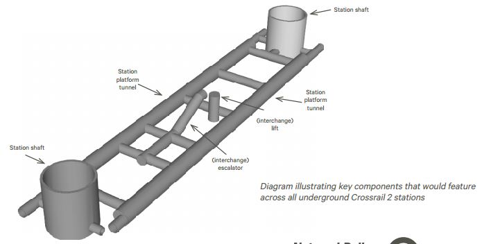
A Typical Crossrail 2 Station
Note the two shafts at each end, which provide ventilation and access. In some places, but not Dalston, they are difficult to fit amongst the buildings.
One of the reasons Balham has been chosen rather than Tooting Broadway, is that shafts at Balham fit in a Waitrose car park and where a rather poor 1960s office block sits.
Crossrail 2 Shafts
These are my thoughts on Crossrail 2 shafts
These allow access from the surface to the tunnels and trains, for stations, emergency access and ventilation.
There will be two shafts proposed for Dalston; one by Dalston Kingsland station and one by Dalston Junction station to ventilate and provide emergency access to the platform tunnels up to thirty metres down.
Don’t think that the top of shafts will be eyesores like this one in Graham Road for the Channel Tunnel Rail Link.

If you want to get a look at this awful monument to bad urban design, look to your right, as you arrive at Hackney Central station on a westbound North London Line train.
We’ve come a long way since that one was built. This is a computer visualisation of what is being built in Mile End Park for Crossrail.
I think it’s also been designed to serve as a viewing mound for the pitches nearby.
You can get a good view of the site from the top of 277 bus going to Leamouth, as the bus runs alongside Mile End Park.
Ventilation shafts can even be incorporated into buildings.
This Norman Foster- designed building is Moor House on Moorgate and it incorporates a Crossrail ventilation shaft for the massive Liverpool Street/Moorgate Crossrail station. Wikipedia says this about Moor House and its use by Crossrail.
Completed in 2004, it was the first building to be designed for the forthcoming Crossrail, with a ventilation shaft to the station underneath the building. It has the deepest foundations in London, which reach down 57 metres (187 ft) and are specifically designed to withstand further tunneling below it in the future.
I’m sure these days if you wanted to put a tunnel ventilation and access shaft by St. Paul’s Cathedral, one of our very good architects could find an acceptable solution.
Practically though, as Crossrail 2 is now being designed and probably won’t be finished until 2030, that gives us a long time to create the needed ventilation shafts in buildings that are developed on the sites where they will go.
Dalston Station
These are my thoughts on Crossrail 2’s Dalston Factsheet
This is their description of the station.
The Crossrail 2 station at Dalston would be a double-ended station, with an interchange at Dalston Junction at the southern end, and an interchange with Dalston Kingsland at the Northern end.
The Crossrail 2 station at Dalston would be underground and could include:
- 2×250 metre long platforms. Station platform tunnels around 20 metres below ground level to the top of the tunnel
- An enhanced station entrance and ticket hall onto Kingsland High Street, for interchange with Dalston Kingsland station
- An enhanced station entrance and ticket hall onto Dalston Lane, for interchange with Dalston Junction station
This map from Crossrail 2’s document shows the layout of the new station.

Note how that most of the station is underneath Kingsland High Road. I think it could be deeper than their proposed twenty metres, if it has to go under the Channel Tunnel Rail Link, which runs in a tunnel in-line with the North London Line.
The two black squarish icons are the two station shafts, as were shown in the picture of a typical station.
I estimate that the Northern shaft is opposite Dalston Kingsland station to the North of Ridley Road in a block that contains the NatWest bank and Kings Land Butchers.
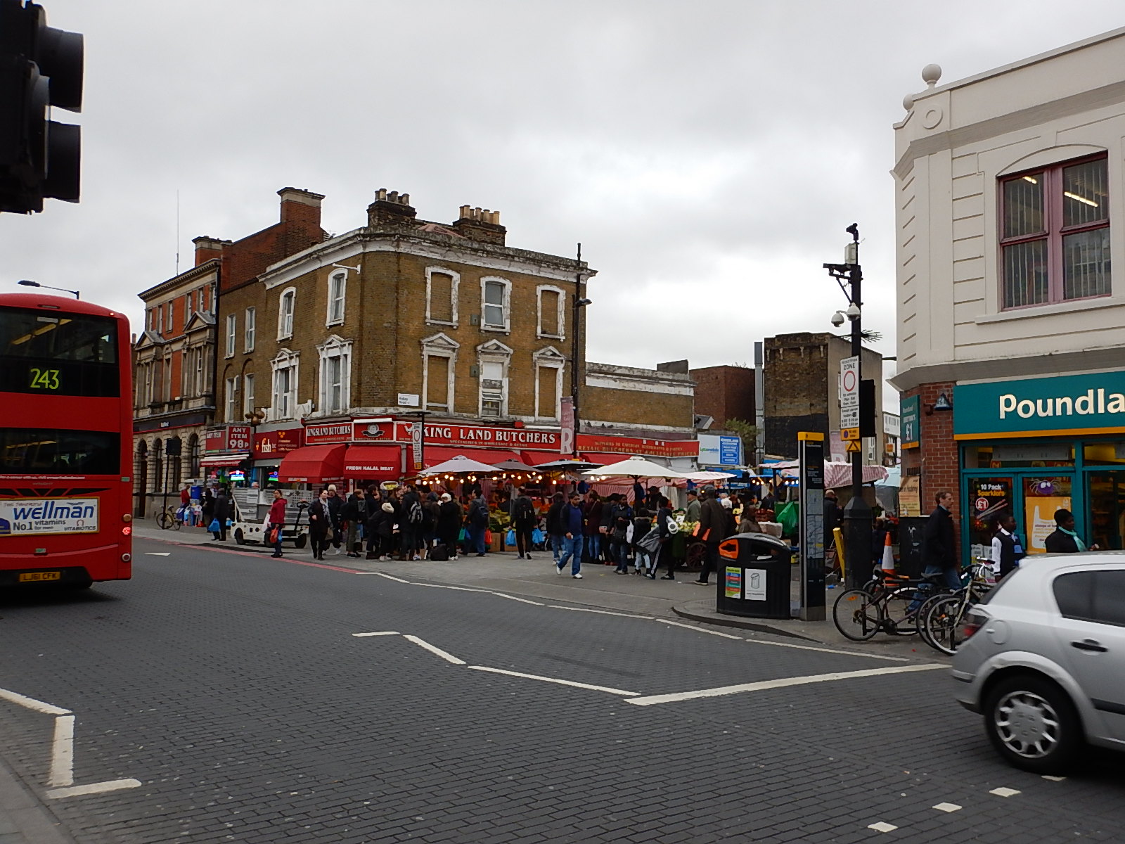
The Southern one is on the West side of Kingsland Road, just North of Tottenham Road.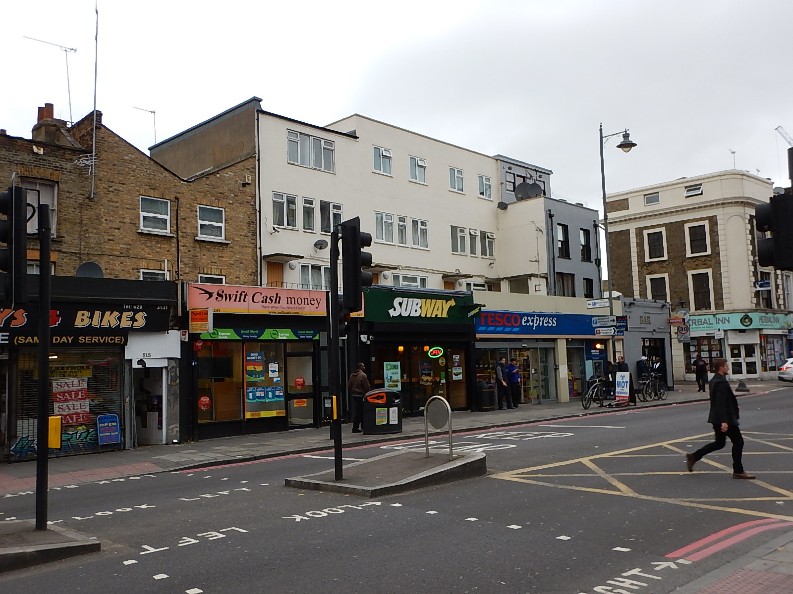
Will the buildings on these sites be missed?
Personally, I won’t miss the Subway, as I’m a coeliac and have to be gluten-free.
Railway Development In Dalston
Before looking at the effect of Crossrail 2 on Dalston and De Beauvior Town, I will look at other rail developments that could also have an effect.
- Twenty-four six-car trains per hour on the East London Line – This proposal is in some of Transport for London’s published documents and plans have already been published to increase the number of trains through Dalston Junction from sixteen to twenty trains per hour, by 2019.
- More trains on the North London Line – If the level of freight trains can be reduced, plans exist to increase the number of passenger services through Dalston Kingsland station.
- East London Line Trains to Willesden – This was talked about in the original proposals for the Overground, but was dropped, probably to cut costs.
- HS2 at Old Oak Common – Transport for London are planning a big development at Old Oak Common, which will connect a lot of lines together including the North London Line and HS2. Certainly North London Line trains will go there, but there are innovative characters in TfL and they may terminate some East London Line trains at Old Oak Common, rather than Highbury and Islington.
- Crossrail – Who knows what effects this will have all over London? As Dalston Junction is just four stops from Whitechapel, it certainly solves the difficult problem of getting from this area to Paddington and Heathrow.
- Reopening the Hall Farm Curve – Reopening this curve north of Lea Bridge, will allow direct trains from Chingford and Walthamstow to Stratford and then possibly along the North London Line.
- Reopening the Dalston Eastern Curve – This could happen to connect Stratford and South London.
- Shoreditch High Street station on the Central Line – A connection between the East London Line and the Central Line at Shoreditch High Street station has been proposed, but not until after Crossrail is opened.
- Penge And Brockley Station Improvements – There are rumours that these stations will be improved to create better links to South East London. There are design challenges, but they are in TfL’s plans and Birmingham solved a similar problem at Smethwick Galton Bridge station.
None of these will be implemented until after Crossrail is fully opened, except some of the extra services on the East and North London Lines.
What actually happens will probably be more determined by passenger traffic statistics than anything else.
But all will have the effect of moving more trains and passengers through the two Dalston stations.
Whether Crossrail 2 is built on not, Dalston will become one of the most important interchanges on London’s transport network.
This will have three main effects on the area.
- Property developers will see it as good place to do business.
- The area will grow as a business and cultural hub.
- House prices will continue to rise.
If and when Crossrail 2 is built, these effects will get bigger.
I do wonder when the area will get a Waitrose!
How Will Crossrail 2 Affect De Beauvoir Town?
In the end, after Crossrail 2 opens it will be better transport links for De Beauvoir Town and more development in property, business and cultural directions and ever increasing house prices.
Building Dalston Station And Crossrail 2 Through Dalston
But during the building of the line, it could have other effects.
The three main sites used to construct Dalston station, will have to be redeveloped.
- Site A – The Tesco Express site on the West side of Kingsland Road opposite Dalston Junction station. This site will contain the Southern station shaft.
- Site B – Dalston Kingsland station and the block to the North.
- Site C – The block containing NatWest opposite Dalston Kingsland station. This site will contain the Northern station shaft.
I believe that just as Moor House was developed some years before Crossrail, I feel that these sites should be developed separately some years before Crossrail 2, perhaps with flats or offices above and shops at street level. The building of the blocks would incorporate the shafts and any other underground works for Crossrail 2, if it was thought appropriate.
I would also expect that development of each of these three sites, will each be a similar sized project to the creation of the two blocks of flats on the Dalston Western Curve, which are being built at the present time.
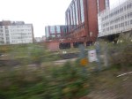
I’m pretty certain, that the digging of the southern shaft at Site A will be the only major part of the construction, that will affect De Beauvoir Town, as I suspect they’ll have to remove the spoil in a succession of trucks. I estimate there will be about 10,000 cubic metres of spoil to remove to create the hole for the shaft.
At the northern shaft at Site C . they could and should use the railway.
Question for Crossrail – Is it intended to build the two shafts at Dalston station inside other buildings and complete them early, in the manner of Moor House?
Question for Crossrail – How do you intend to remove the spoil from the shafts at Sites A and C in Dalston?
My project management knowledge suggests to me that we don’t have much to fear from the building of Crossrail 2 in Dalston and De Beauvoir, if everything goes to plan.
The reason I add the caveat, is that several rail projects have found bad ground conditions, that have made things difficult. But the railways and property developers have done so much digging in the Dalston area in recent years, I would hope they’ve found all the problems.
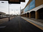
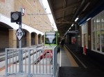
Rebuilding Dalston Kingsland Station
The rebuilding of Dalston Kingsland station is desperately needed, as it is a cramped station, that is totally inadequate for most of its users and all of those, who are in wheelchairs, pushing buggies or carrying the average suitcase.
I can’t find anything substantial on the Internet except for odd drawings and images.
There is this construction map of the Crossrail 2 work-sites at the station in Crossrail 2’s document.
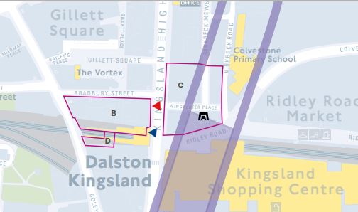
Dalston Kingsland Station Work-Sites
Note, there is a small Site D on the station side of the site currently being developed as Fifty Seven East. The Crossrail 2 document says this about Site D.
Would be used for construction of a new bridge providing access from the new ticket hall to the westbound platform at Dalston Kingsland.
So we know that at least there is going to be a new pedestrian bridge between the two platforms. As opposite Site D is Site B, about which Crossrail 2 says this.
Would be used for construction of a new Crossrail 2 station entrance and ticket hall. The site includes properties on the southern side of Bradbury Street.
Much of Site B bordering the station seems to be closed.
One sensible plan for Dalston Kingland station, would involve putting the new fully-accessible bridge in first and then building a temporary station on the site of the closed pub on the north side of the current station. This would enable passengers to still use the North London Line, whilst the current station building was rebuilt.
Note that most temporary stations that I’ve seen, are better than the current Dalston Kingsland.
I suspect that Transport for London has a complete plan, but I do feel that it will involve the fully-accessible bridge that will intrude into Fifty Seven East, being built.
Dalston Station Entrances
The station platforms lie almost under the Kingsland High Road, with entrances into Dalston Kingland at the North and Dalston Junction at the South.
As far as I can tell from the drawings. entrances into the station are as follows.
- One new and one existing entrance at Dalston Kingsland on the West side of Kingsland High Road
- One new and one existing entrance at Dalston Junction on the east side of Kingsland Road
So we have entrances in the North-West and South-East, but I can’t see any in the North-East and South-West.
The purpose of Site C in the North East is described like this by Crossrail.
Would be used for construction of the northern station shaft and escalator connection to the Crossrail 2 platforms
Given that this corner is by the iconic Ridley Road Market, surely there needs to be an entrance here, with perhaps a subway under the road to the Ticket Office.
Question for Crossrail – Is there going to be an entrance to the station close to the Ridley Road Market?
The purpose of Site A in the South West is described like this by Crossrail.
Would be used as the main site for construction of the station tunnels and southern station shaft
No mention of any entrance or escalators.
Question for Crossrail – Is there going to be an entrance to the station in the South West corner?
Question for Crossrail – Are there going to be escalators at both ends of the Crossrail 2 station?
Note that if there isn’t escalators at both ends, this means that a passenger changing from Dalston Junction to Crossrail 2 would have to virtually walk to Dalston Kingsland first.
Dalston Station and De Beauvoir Town
De Beauvoir Town is a grid of wide roads and pavements and we all have our favourite ways of crossing the area! Often we make use on our travels of the diagonal roads across the area, like Ardleigh and Stamford Roads.
As it happens Site A is just at the junction of one of these diagnonal roads; Stamford Road and the Kingsland Road. So I believe that every man, woman and fox, who lives in De Beauvoir would vote for an entrance into the station at this point. A subway would probably be welcome, as waiting for the lights on the Kingsland Road can get boring.
Incidentally, I walked this mornin from St. Peter’s to Site A and it took me ten minutes.
Question for Crossrail – What will be the pedestrian arrangements for those going between the station and De Beauvoir Town?
What Bribes Do We Want?
This is very much in jest, but Crossrail has shown itself to be a good neighbour at some of the sites it’s used.
It also ran a high-profile archaeology program that many in London, including myself, enjoyed.
One thing that disappoints me is the number of large bronze and other metal artworks, that are in store, because to display them in their intended outdoor setting, could mean they would get stolen! Surely, some could be displayed inside the new stations. It wouldn’t be easy to remove a tonne of bronze up an escalator.
Art should be accessible to everyone!
Tail-Piece
I am waiting for the 25th of November with excitement and trepidation. Will Osborne say go in his Autumn Statement?
Remember that there’s a small matter of an important election in May 2016! I have counted and there are thirty-three proposed Crossrail 2 stations in Conservative-held parliamentry consituencies and only fifteen in Labour ones!
Toronto Looks At The Overground
My Google Alert for Overground found this article from the Toronto Star entitled London’s other railway holds many lessons for Toronto, Mayor John Tory.
The Mayor had come to London to look at Crossrail and it seems that the Overground had impressed him.
But then the Overground, is only one of a family of local City networks in the UK, like those in Birmingham, Cardiff, Leeds and Liverpool, that have done the same as London and taken a run-down network, cleaned it up with bright stations, improved the trains, provided a frequent service and visible customer service, often linked with smart ticketing.
Living as I do on the Overground by Dalston Junction station, I know the concept works and it has only one serious problem – As more capacity is provided it quickly fills up. For example, I did one stop yesterday at eleven in the morning and all the seats were taken.
There is no doubt that quality sells!
The Tramlink Is Back In Wimbledon Station
The Tramlink is now back in a two platform stop in Wimbledon station.


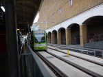


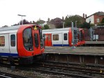

I always found that the old tram stop was like going into a mine as it was dark and not very welcoming.
This new tram stop is a lot better and there is plenty of space.
Although one passenger said it is now further to walk, as the trams stop further down the platform.
As the two platforms appear to be independent, I wonder if the proposed Extension A to Sutton could now be incorporated into Wimbledon station? This is said in the Wikipedia section.
The Sutton to Wimbledon proposal utilises the existing line between Wimbledon and Morden Road, but the cramped terminus inside Wimbledon station is barely adequate for its present function. If another service is to serve Wimbledon a new terminus will be needed.
The terminus is certainly not cramped any more and now that a second platform for the trams is available, then could Extension A be built?
In Crossrail 2 October 2015 – Wimbledon station, I said that I felt, the trams should cross over the rail lines on a viaduct and come into the other side of the station opposite to the District Line platforms, as this would give some advantages.
- Any rebuilding of the tram connection at Wimbledon station for Crossrail 2, might be avoided.
- A large concourse could be provided between tram and Tube, to give a totally flat interchange and provide the services interchanging passengers need.
- The trams would be well out of the way of Crossrail 2 and during the building of that line could keep running at most times.
- It might be possible to have three tram platforms for extra services if required.
I know because of the viaduct over the tracks and the building the platforms on the other side of the station, that my solution would be very much more expensive, but it does completely separate the trams from Crossrail 2.
The Crossrail 2 proposal achieves the same separation by putting the trams on Wimbledon Bridge in front of the station, which would probably mean that traffic would need to be restricted to buses, taxis and trams.
Other vehicular traffic would require a new bridge over the station.
I think we’ll get a better solution, when a decent architect has had a good look at the problems caused by trying to put Crossrail 2 through Wimbledon station.
