The Mayor’s Plans For East London River Crossings
This article on the BBC is entitled Mayor accused of ‘betrayal’ over Silvertown river tunnel.
I made my feeling clear about the tunnel in No To Silvertown Tunnel . I started by saying this.
My personal feelings about the Silvertown Tunnel are that it is irrelevant to me, except that it might help some trucks bring goods that I buy online or at a local shop. Although as a sixty-eight year-old-widower living alone, I don’t think my transport needs through the tunnel will be high.
I don’t drive after my stroke and I like that lifestyle, except when last night it takes me three trains, a coach and a taxi to get back from watching football at Ipswich. But that tortuous late night journey was caused because NuLabor spent my tax money on pointless wars that will haunt us for generations, rather than in extending and renewing our rail system, that will nurture and enrich our future.
I don’t think, that I’ve changed my views much.
The Mayor is actually proposing five river crossings.

Five New Thames Crossings
Here my thoughts on each
Rotherhithe – Canary Wharf Bridge
This is detailed in Wkipedia as the Rotherhithe Crossing or Brunel Bridge.
Wikipedia says this about the location.
The preferred location for the bridge identified in the feasibility study would be between the Impound Lock close to Cascades Tower on the northern (Canary Wharf) bank, and at Durand’s Wharf park on the southern (Rotherhithe) bank.[2]
There is currently a Thames Clippers ferry shuttle between these two points. The Jubilee line parallels the route of the proposed bridge, with the nearest stations at Canada Water and Canary Wharf.
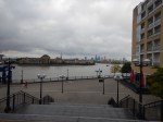
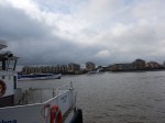
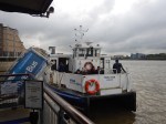
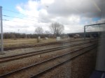
I took these pictures of the current ferry from Canary Wharf pier.

The bridge has its own web site, with a dramatic picture on the home page.
The visualisations show a bridge, that I think few would dislike. I certainly don’t!
- It’s dramatic.
- It would be open to pedestrians and cyclists.
- It would be the longest bascule opening bridge in the world.
- It would allow tall ships to pass through.
But above all I suspect that Marc and Isambard would have approved.
Canary Wharf – North Greenwich Ferry
If Canary Wharf to Rotherhithe can sustain a ferry, then surely a ferry at the other side of Canary Wharf connecting to North Greenwich with the O2, must be viable.
This Google Map shows the Thames between Canary Wharf and North Greenwich.

Canary Wharf And North Greenwich
It is not the longest ferry link, but there are questions to be answered.
- Does the ferry go right into the heart of Canary Wharf or only as far as the bank of the Thames?
- Does the ferry go all round the O2 to North Greenwich Pier or call at a new pier on the west side of the Greenwich Peninsular?
- Will the ferry be fully accessible?
- Will the ferry accommodate bicycles?
- Will the ferry be free, as is the current Woolwich Ferries?
- How many boats will be used?
I think that there could be an opportunity to design an integrated ferry and pier, that would be all things to all users.
It certainly shouldn’t be boring and if possible it should call at the heart of Canary Wharf.
Silvertown Tunnel
In my view the Silvertown Tunnel is just another route for some travellers and possibly their goods to take between the two banks of the Thames.
Categories of traffic across the river through a new Silvertown Tunnel would include.
- Individuals, groups and families, who don’t necessarily need a vehicle. But sometimes choose to take one.
- Individuals, groups and families, who absolutely need to take a vehicle.
- Vans and trucks collecting or delivering goods.
- Buses and coaches
- Taxis, mini-cabs and private hire vehicles.
One thing that has been said about the Silvertown Tunnel is that it will be funded by a toll and some reports have said that the Blackwall and Rotherhithe Tunnels will be tolled as well.
London already has a congestion charging system for areas in the centre and I suspect that this could be updated to charge for the cross-river tunnels.
We’ve never had a toll to get across the Thames in London, with even the Woolwich Ferry being free, so I suspect that a toll would reduce cross-river vehicular traffic.
Remember that, when tunnels were built under the Thames in Central London, there was few quality alternatives with the exception of the Northern and Victoria Lines and the original undeveloped Thameslink.
But over the last few years, cross-river and other public transport has been getting better. And it still is!
Consider.
- In the last year, a lot has been disclosed about Crossrail and its enormous Class 345 trains.
- We’ve also seen the opening of the new London Bridge station and can see the improvements taking place in South London.
- We’ve also seen the arrival of the Night Tube.
- Capacity is being increased on the cross-river East London Line and the Jubilee, Northern and Victoria Lines.
- We have Night Thameslink, so will we see a Night Crossrail?
Other developments will follow.
The only certainty is that we will be seeing a large increase in quality public transport, over, under and on the Thames.
I think for the first time in my life, there could be two competing ways of getting across the Thames; driving through a tunnel or using public transport.
Cost, convenience, needs and possibly an all-singing-and-dancing computer or phone app will tell you where to go.
As I said earlier, if the Silvertown Tunnel is built, it will be just another route for travellers, with perhaps a higher, but fixed cost.
If it is built, I think there should be conditions.
- The Blackwall, Rotherhithe and Silvertown Tunnels should all have tolls.
- Crossrail and Thameslink should have a great deal more Park-and-Ride capacity.
- All buses, coaches, mini-cabs, taxis and trucks in Central London should be low emission.
I also think that large areas of Central London, like the City and Oxford Street should be pedestrianised and some are on track for this to happen.
Much of the decision about the Silvertown Tunnel revolves around politics.
Sadiq Khan, has said he’s in favour of the tunnel with conditions, but he is up against a formidable movement that don’t want the tunnel built at any price.
I also find it interesting, that Ken Livingstone was in favour of the Silvertown Tunnel. But Ken brought in congestion charging.
I wouldn’t be surprised, if there’s some researchhanging aroiund in TfL, that says that a tolled road crossing will cut traffic. But it’s the sort of research no-one would believe.
So perhaps a tolled Silvertown Tunnel with conditions will be a good idea.
But only because there are now alternatives!
Gallions Reach DLR
The BBC article says this about this proposal.
A DLR crossing at Gallions Reach, helping support the development of around 17,000 new homes across Newham and the Royal Borough of Greenwich
It is different to the original proposal of a Docklands Light Railway extension to Dagenham Dock, which stayed on the North bank of the Thames.
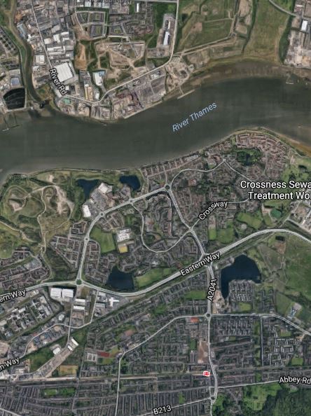
This map shows the area of London from Gallions Reach to Abbey Wood.
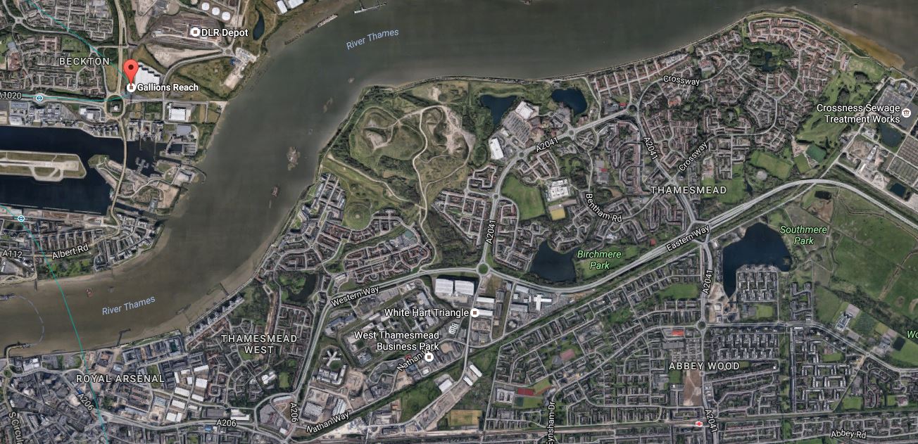
Gallions Reach To Abbey Wood
Note.
- Gallions Reach DLR station is marked with the red arrow.
- Just to the North of Gallions Reach station is the main DLR depot, which would probably be an excellent site to start a tunnel.
- The tunnel would probably emerge on the South bank of the Thames to the West of Thamesmead.
- It could then weave its way along the side of the main road.
- The North Kent Line with Abbey Wood and Belvedere stations runs along the bottom of the map.
- Crossrail could be extended to Gravesend.
- Crossrail should also be extended Ebbsfleet International for European rail services.
If the DLR extension went from Gallions Reach DLR station to Abbey Wood station it will be a loop on Crossrail serving a lot of areas ripe for quality housing and commercial development.
It certainly looks a feasible area to think about taking the DLR.
Barking Riverside Overground Extension
When I first heard about the Thamesmead Extension of the Gospel Oak to Barking Line, I thought it was a good idea.
As it is mentioned in the Mayor’s plans, I suspect that building the extension is getting nearer to reality.
Certainly provision has been made in the design of the Barking Riverside Overground Extension to extend the line under the river if required.
Joined Up Connections
If you take out the Silvertown Tunnel, which is the only one of the five crossings for which you need a vehicle, you get a route along the Thames from Canada Water To Barking.
- Walk from Canada Water to the Rotherhithe – Canary Wharf Bridge
- Cross the Rotherhithe – Canary Wharf Bridge
- Walk to the Canary Wharf – North Greenwich Ferry
- Take the Canary Wharf – North Greenwich Ferry to North Greenwich
- Take the Emirates Air-Line to Royal Victoria
- Take the DLR to Gallions Reach and on to Thamesmead
- Take the Gospel Oak to Barking Line to Barking
It’s an interesting route using various means of transport.
Slow Progress On The Gospel Oak To Barking Line
I have observed the electrification of the Gospel Oak to Barking Line since December 2015 and to say it has been painfully slow would be an understatement.
In the September 2016 edition of Modern Railways, there is a long article called Wiring The Goblin.
It talks of a lot of problems, which are resulting in a lot of lowering and rebuilding of the track bed.
Reading between the lines, I suspect that some parts of the line weren’t designed and built very well in the first place and that decades of neglect haven’t helped.
The Victorian builders of lines like these were good at some things, but they were probably driven more by getting a line open to carry goods and passengers, than by creating infrastructure, that would last a couple of hundred years.
But it does seem that the engineers are doing their best to rebuild the line in an affordable manner. This extract gives an overview of the track lowering.
Early plans for the electrification envisaged 10 track lowering sites along the route, but value engineering has seen this reduced to four main sites.
The term value engineering is used more than once in the article.
The nature of some of the work is illustrated by this description.
But the most challengin section, and the one which drives the requirement for engineering access, is a 1,750-metre stretch between Blackhorse Road station and Yunus Khan Close (a short distance south of Walthamstow Queens Road station). In just over a mile there are 17 over-line structures, with track lowering reqired by as much as 500mm. at some locations.
The Bridges of Walthamstow describes a walk I took along the route a few months ago.
To some working on the project, it must feel like digging a tunnel close to or on the surface, through the foundations of Victorian houses.
Intriguingly, my Google Alerts on the line, don’t seem to have dug up any complaints in Walthamstow, unlike they did at the Gospel Oak end of the line.
Make what you want of that!
Slab track is used selectively, but not as much as originally envisaged. I do wonder, if slab track has improved in recent years as more difficult projects like the Borders Railway and the tunnels at Glasgow Queen Street station seem to use it.
I particularly like the care that has gone into the planning of the work, which has been deliberately organised so that one track is always open for engineering trains.
The system, also used 4D modelling to avoid conflicts and get everything right. Strangely, this is the first instance of using this relatively new technique on a heavy rail project in the UK.
Little is said about the electrification, except that it is the same as used on the Northern Hub project between Liverpool and Manchester.
I have been unable to find out, if the overhead electrification can accept the return currents for the regenerative braking on the Class 710 trains.
However, in Will London Overground Fit On-board Energy Storage To Class 378 Trains?, I asked the question of the title after finding an article, where Bombardier stated that Class 378 trains could be fitted with onboard energy storage Some of the third rail lines used by these trains can probably handle regenerative braking, so I have to assume that .lines with overhead wires like the North London Line can’t.
The following must be taken into account.
- As the North London Line and the GOBlin are linked at Gospel Oak, it makes me think there is a strong possibility, that the GOBlin will not be wired to accept the return currents from regenerative braking.
- Only be the Class 710 trains that could use regenerative braking on the GOBlin, as there are few electric locomotives in the UK with regenerative braking. Only the Class 88 and Class 92 locomotives have it fitted.
- The Class 710 trains for the GOBlin are dual-voltage trains. I suspect, so that services can be extended into third-rail territory if needed.
- The AC-only Class 710 trains will run on lines like Romford to Upminster and the Chingford Branch, where it is unlikely that the wiring can work with regenerative braking.
Whether the Class 710 trains have onboard energy storage actually fitted, will be one for the accountants.
In the last section of the article, the extension to Barking Riverside is discussed. The following is said.
- The extension will be slab track throughout.
- Construction could begin in late 2017.
- Services could start in 2021.
I discussed this extension in In The Land Of The Giants.
There is a very challenging viaduct, that will thread the line through the area, and the slab track would make accurate positioning to avoid the masses of high-voltage electricity cables and the other obstacles in the area a lot simpler. The viaduct with its slab track could also be built in pieces in a factory and assembled on site, to give a better finish and quality to the work.
Perhaps too, if the 2.2 km. length of new railway, were to be built on single track viaducts, without electrification, it would reduce complexity, visual impact, noise, construction time and cost.
But this would require the Class 710 trains to be fitted with onboard energy storage.
Intriguingly, TfL’s main online document about the Barking Riverside Extension appears to have been carefully written and only mention overhead wires once, talking consistently about four car electric trains and a fully-electrified line.
As contracts for the extension must be awarded soon for a late 2017 construction start, I think we’ll see a design for the extension, that could be with or without wires.
No mention is made in the article about extending the line four kilometres under the Thames to Thamesmead and Abbey Wood.
The Google Map shows the route from Barking Riverside to Abbey Wood.
Barking Riverside To Abbey Wood
Barking Riverside station will be built in the South-West corner of the largest green space at the top of the map, above the word Thames.
Abbey Wood station is virtually due South from there towards the bottom of the map.
If this tunnel is ever built could it be in tunnels or even just a single tunnel without wires?
One problem with an extension to Abbey Wood could be somewhere suitable to put the station.
The traditional solution would be a blind tunnel or tunnels as on the Victoria Line, but could the line end in a loop extra stations at Thamesmead and the incomparable Crossness.
What better way is there to attract visitors to the area, than to put Bazalgette’s Cathedral of Sewage on the London rail map?
The GOBlin extension to Abbey Wood is certainly a rail route, where good engineering could be mixed with large doses of imagination.
Barking Riverside Development To Get A Boost
BBC London is talking about a large boost to the development of housing at Barking Riverside. This article in Building entitled L&Q buys out Bellway at Barking Riverside, gives a lot more detail. This is a visualisation of the development.

Barking Riverside Development
It looks to be a lot of much-needed housing, a proportion of which will be affordable.
According to TfL’s maps and drawings it looks like Barking Riverside station will be a couple of hundred metres or so directly inland from the T-shaped pier.
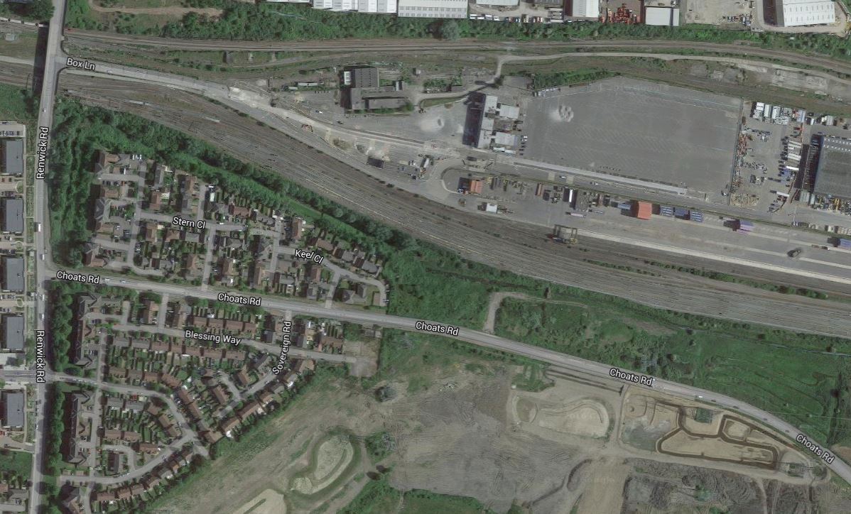
The Site Of Renwick Road Station
On the way back from Dagenham Dock station, I passed the proposed site of Renwick Road station.
This Google Map shows the area.
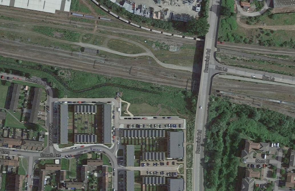
Renwick Road Area
The station will be on the western site of the bridge that takes Renwick Road over the railway.
These pictures were taken from the train.
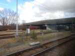
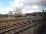
There’s plenty of space for a station, but I do think it could be exceeedingly bleak on a cold day.
Dagenham Dock Railway Station
After visiting the Land Of The Giants, my EL2 bus went through the industrial area to Dagenham Dock station.


A few points.
- The area is rather bleak.
- From the station I caught one of the two trains per hour into London.
- Dagenham Dock and the other two stations of Renwick Road and Barking Riverside will need to have a decent bus connection.
It certainly needs substantial improvement.
In The Land Of The Giants
In Defining The GOBlin Extension To Barking Riverside, I traced how the extension will get to the new station. This is a map from the TfL report, which shows the route of the extension.

Barking Riverside Extension
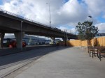
And this is an image of the viaduct that takes the extension over Choats Road.
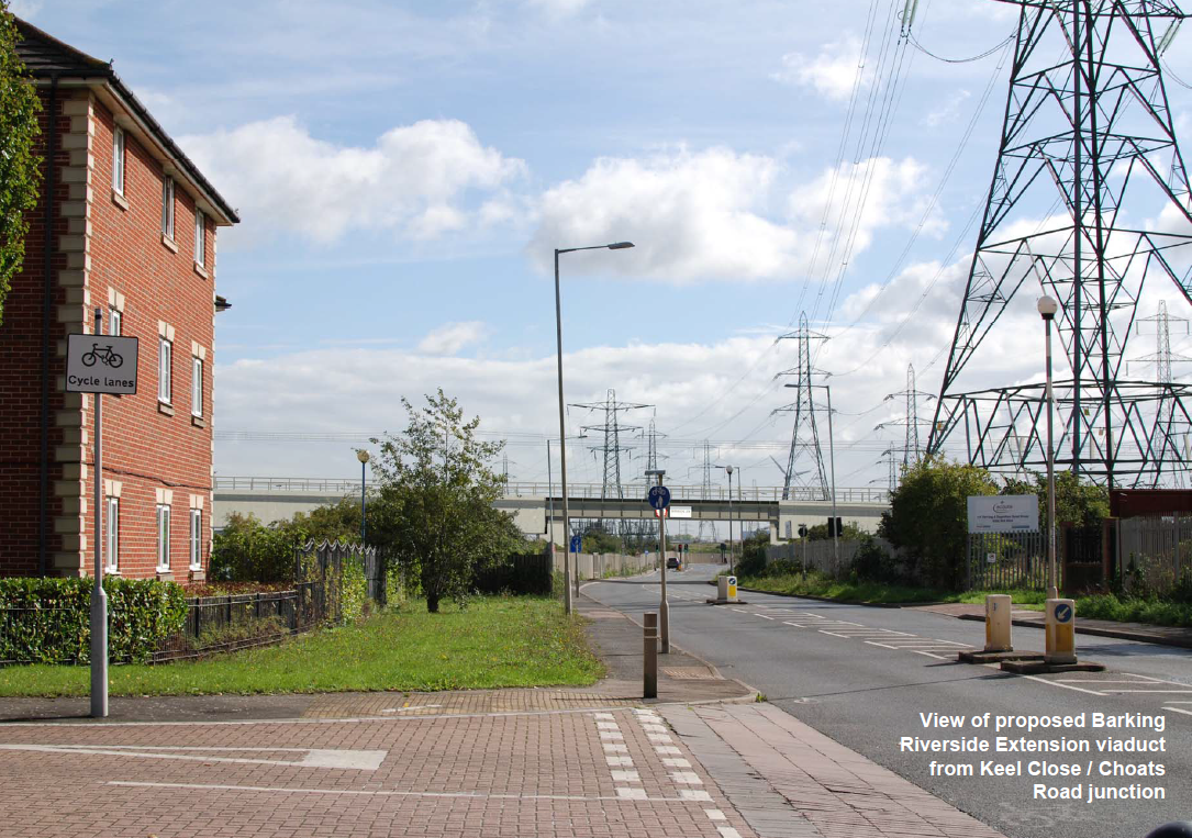
Proposed Viaduct Over Choats Road
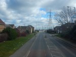
Today, I went to Barking station and took an EL2 bus to Dagenham Dock station.
I took these pictures as the bus went along Choats Road.
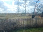


The area is certainly one with some of the largest electricity pylons.
Even so, you can understand why the TfL report says this about the viaduct.
After passing under Renwick Road, the alignment would climb on a viaduct curving south towards Barking Riverside, crossing the Freight Terminal, westbound Tilbury lines and Choats Road. The viaduct would then descend to pass under the existing high voltage power line south of Choats Road, before again rising and continuing towards a station at Barking Riverside.
This Google map certainly shows there is a lot of space.
In The Land Of The Giants
It will be interesting to see what the final layout will be.
- The viaduct that crosses Choats Road must be high enough to allow double-deck buses and other high vehicles to pass underneath.
- The TfL route map appears to show that the viaduct follows roughly the line of the pylons to the site of Barking Riverside station.
- Vertical separation of overhead wires on the viaduct and the power lines could be a problem!
- The rail line can’t go too close to the houses.
If the branch were to be built without electrification and services were to be run using the Aventras fitted with on-board energy storage, it would ease the design of the viaduct.
Defining The GOBlin Extension To Barking Riverside
Transport for London have published the results of their consultation on proposals to extend the for Gospel Oak to Barking Line (GOBlin) from Barking station to Barking Riverside.
To see the full report visit tfl.gov.uk/barking-riverside.
The main points are summarised in the next few sections.
Class 710 Trains
After the electrification of the GOBlin, services will be run using Class 710 trains, which although the line will be fully-electrified using overhead 25kVAC, will be the dual-voltage variant able to run on 750 VDC.
I would assume that this is so that the trains can go past Gospel Oak station to access parts of the North London Line and West London Line that have third-rail electrification and are shared with both London Underground and Southern Electric trains.
Bombardier have also told me, that all Aventra trains are wired so that an on-board energy storage capability can be installed.
When I rode the prototype for this IPEMU technology in public service between Manningtree and Harwich, it felt exactly like a standard Class 379 train and one of Bombardier’s engineers told me the battery range was upwards of fifty miles with a similar performance to the standard train.
In the remainder of this post, I will use Aventra IPEMU (Independently Powered Electric Multiple Unit) to indicate an Aventra Class 710 train with an on-board energy storage capability.
Because prospective routes for Aventra like the East London Line and Merseyrail run in longish tunnels, I would think it very likely that Aventras will be certified for tunnels like the Thames Tunnel or those under Liverpool.
Transport for London have certainly ordered a train, that doesn’t limit development of new routes linked to the GOBlin.
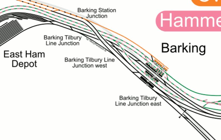
Lines At Barking Station
This map from carto.metro.free.fr shows the rail lines around Barking station.

Lines At Barking
The lines radiating from the station are as follows, taking them in a clockwise direction from the South West.
- District and Metropolitan Line services of the London Underground and c2c services to Fenchurch Street pass through East Ham station.
- GOBlin services to the West, freight trains crossing London and the occasional c2c service to Liverpool Street pass through Woodgrange Park station.
- District Line services to Upminster and the East and c2c services via Basildon take the lines through Upney station.
- c2c services via Rainham, freight trains crossing London and the proposed Barking Riverside service take the lines going vaguely to the South East.
Three platforms will be used at Barking station for GOBlin services, which come into the station from Woodgrange Park in the West and from Barking Riverside in the South East.
- Platform 1 which is the current terminus of the GOBlin will be retained and would remain available to Overground trains at Barking Station to aid service recovery during periods of disruption.
- Platform 7 which is currently used by eastbound c2c trains via Rainham, will also be used by GOBlin trains going to Barking Riverside.
- Platform 8 which is currently used by c2c trains from Rainham to Fenchurch Street, will also be used by GOBlin trains coming from Barking Riverside.
As can be seen on the map, there is a double-track flyover to connect Platforms 7 and 8, which are the two southernmost platforms to the GOBlin to the west.
The only platform and its associated connecting lines that doesn’t have any electrification is platform 1.
Changing Trains At Barking Station
The GOBlin services and c2c services via Rainham will share the island platform 7 and 8 at Barking, which could mean some easier step-free journeys for some passengers.
Plans exist for redevelopment at Barking station and I wonder if architects and planners can come up with a better layout for the station, that will become increasingly important as an interchange. Especially as the station is shared by three ambitious operators; London Overground, London Underground and c2c. All these operators have expansion and/or improvement plans for services through Barking.
Electrification of Platform 1 At Barking Station
No electrification work has happened on this platform until now and the platform could be electrified in the normal manner.
However, it may be more affordable to fit all the Class 710 trains with an IPEMU capability and run them in and out of the platform using the on-board energy storage.
The platform could also be electrified using London Underground’s system to create another bay platform for the District and Metropolitan Lines, if that was to be needed. This would not stop the platform being used by the dual-voltage Class 710 trains,
Obviously, the route planners and the accountants will decide.
Renwick Road Station
This map shows the layout of the extension.
Barking Riverside Extension
Note now the new line curves away south after passing under Renwick Road. This Google Map shows the area.
Renwick Road Area
One recommendation of the consultation is to install passive provision for a new station at Renwick Road, which eventually would make the extension a two-station branch.
The station is proposed to be a simple island platform design and TfL’s maps show it on the Western side of Renwick Road. There would appear to be plenty of space.
Barking To Renwick Road
On creating the required two lines between Barking and Renwick Road, the report doesn’t indicate, it’s anything other than a simple construction project.
Renwick Road to Barking Riverside
The line is proposed to curve off and over the rail lines and roads on a double-track viaduct, which is shown in blue on TfL’s map. The TfL report says this.
After passing under Renwick Road, the alignment would climb on a viaduct curving south towards Barking Riverside, crossing the Freight Terminal, westbound Tilbury lines and Choats Road. The viaduct would then descend to pass under the existing high voltage power line south of Choats Road, before again rising and continuing towards a station at Barking Riverside.
So it looks that the viaduct goes all the way to Barking Riverside station.
Barking Riverside Station
The proposed layout of the station is described in the TfL report.
The station would be designed to fit the look and feel expected of stations on the London Overground network, and would include the provision of step free access from street to platform and platform to train. Other features of the station would include: a ground floor ticket hall, CCTV, help points, customer information systems and secure cycle parking.
The platform level would be on the upper floor as an extension of the viaduct structure. The station ticket hall would provide direct access to Renwick Road and the separation between the railway infrastructure and ground floor ticket hall would allow additional uses to be made of the space, such as: cash machines, cafe and retail opportunities. The station design would include cladding for weather protection, including a canopy to part of the platform to allow sheltered access to trains.
So it would appear the trains are on the upper floor above the station facilities, shops and cafes.
I think this is to ensure that once the trains have passed over the Tilbury Line to Rainham and the freight tunnel, they run fairly level into Barking Riverside station. It could also mean that if the line is extended to Abbey Wood station under the Thames, the track layout to achieve this is not too complicated.
This Google Map shows the location of the station in Barking Riverside.
Barking Riverside Station And The Thames
Note.
- TfL’s map shows the station is alongside Renwick Road, where it joins River Road.
- It is perhaps a couple of hundred metres from the river.
- The housing area of Thamesmead is opposite.
- Trains could take a straight route to a possible Thames tunnel.
I think it all shows that the design of the station has been thought over long and hard.
Electrification Of The Barking Riverside Extension
The total length of the extension from Barking to Barking Riverside is 4 km., with just 1.5 km. of new line.
As with Platform 1 at Barking station, the Class 710 trains give the option of not-electrifying all or part of the extension.
Consider.
- The performance of an Aventra IPEMU running on on-board energy storage, that had been charged before Renwick Road is such, that I believe it could easily handle the extension with a full train of passengers.
- The viaduct can be built with provision for future electrification.
- As mentioned in the TfL report, the line has to be carefully profiled to avoid existing power lines. An extension without electrification, would give extra clearance.
- The Barking Riverside station design is simplified, if it is not electrified.
- The area has overhead wires everywhere and a stylish viaduct without overhead wiring could have a less negative visual impact.
- Are IPEMU trains running using on-board energy storage quieter than those using overhead wires?
But not electrifying the line from Renwick Road to Barking Riverside would reduce the complication and cost of the extension.
Intriguingly, the full TfL report only mentions overhead wires once, talking consistently about four car electric trains and a fully-electrified line.
Nothing in the TfL report precludes the use of Aventra IPEMUs to Barking Riverside and whether this route is chosen will depend on design and environmental issues, and the accountants.
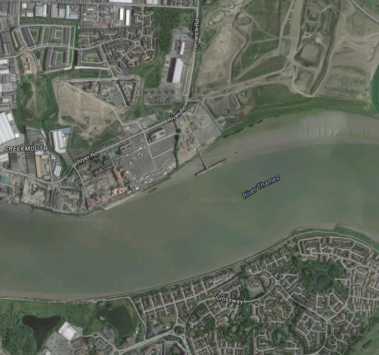
Under The Thames To Thamesmead And Abbey Wood
It is planned to incorporate passive provision, so that the line can be continued in a tunnel under the River Thames.
Barking Riverside station appears to have been designed with several features to aid this continuation.
- Trains could pass through the station on their way to or from the tunnel.
- The route from the station to the tunnel would probably not need any sharp curves.
- Barking, Barking Riverside and Renwick Road stations would probably be sufficient to handle passengers on the north side of the river.
- There appears to be nothing of any importance between the Barking Riverside station site and the Thames, so it should be easy to safeguard a route.
- Barking Riverside station is elevated, so this potential energy could help to propel a train under the river.
- A crude estimate says that from Barking Riverside station to the other side of the river is about two kilometres.
The engineers involved in the Barking Riverside extension have certainly made provision to extend the railway under the Thames.
This Google Map shows Thamesmead and the Thames.

Under The River
Note River Road and Barking Riverside on the north bank of the river, Abbey Wood station with Crossrail and the North Kent Line in the South and Crossness to the East.
I don’t know the Thamesmead area well at all, and from these maps, I can’t work out whether a surface railway could be run to Abbey Wood station from the southern tunnel entrance.
However, a tunnel all the way with intermediate stops would surely be possible.
- As London Underground have thought about extending the Jubilee Line to Thamesmead, I suspect that the area would be amenable to the right type of tunnel boring machine.
- The tunnel could be bored under the A2041 if a direct route were to be chosen.
- A trip from Barking to Abbey Wood and back is probably about twenty kilometres.
- Aventra IPEMUs could handle the route with ease.
- If Aventra IPEMUs used on-board energy storage in the tunnels, the tunnels could be built without electrification.
I believe that there is an affordable innovative solution to extending the Barking Riverside extension under the Thames.
I do question if an extension to Abbey Wood will be needed, as when Crossrail opens, it will be possible to travel from Barking to Abbey Wood with a single change at Whitechapel from the District/Metropolitan Lines to Crossrail.
Conclusion
As it should be, I think it is a well-thought plan.
As to whether the Class 710 trains will use a possible IPEMU capability, nothing is stated, but I believe the proposed design could be very IPEMU-friendly and using IPEMUs would be advantageous on cost, noise and visual grounds.
Their only downside is that they could get derided as battery trains.
I also have the feeling that if the extension does use the IPEMU capability of the trains, the extension will become a model for other extensions and branch lines all over the UK.
A Trip To Barking
In A Story And A Rumour About The Gospel Oak To Barking Line, I reported on a rumour that an LO staffer had said that the electrification will be complete by June.
I think this is impossible, as according to this document on the TfL web site, the bridge at Upper Holloway station will only be completed before the end of 2017. I don’t think I’m alone in thinking that the bridge must be completed before the electrification.
Surely,if the electrification is to be completed by June, then there will be evidence of construction all along the line.
Today, I went to Barking station and had a look around.
- The GOBlin terminates in Platform 1 at Barking station and there is no evidence of any construction there.
- There was no evidence of piling between Barking station and the short length of electrification between Barking and Woodgrange Park station.
- There was also no evidence of any work tro create supports for the catenary on the elevated section of the line between Woodgrange Park and Leyton Midland Road stations.
On a quick look too, there didn’t appear to be any construction cabins, that would be normal for such an undertaking, as electrifyimg a dozen miles of railway..
I then had a think about the objectives of all the work on the Gospel Oak to Barking Line.
- Replace the two car Class 172 diesel multiple units with four-car Class 710 electric multiple units.
- Allow freight trains to be hauled by electric locomotives.
- Extend the line to Barking Riverside.
This map from carto.metro.free.fr shows the lines at Barking station.
Lines At Barking Station
Note the following.
- The GOBlin (orange) terminates in the bay platform 1, on the North side of the station.
- Freight trains to and from London Gateway, Tilbury and the East, go through the two Barking Tilbury Line junctions and then access the GOBlin using a flyover and the Barking Station junction.
- Barking Riverside station is on a spur off the Tilbury Line to the South East.
So I asked myself, what electrification needs to be done to get electric-hauled freight trains off and on the GOBlin.
As c2c runs electric services in and out of Liverpool Street at certain times, I suspect that the wiring to get electric-hauled freight onto the GOBlin is already there.
So we’re left with the only electrification at Barking being platform 1 and the extension to Barking Riverside. The total length is probably under ten kilometres.
According to Bombardier, all Aventra trains like the Class 710 will have an energy storage capability.
So could we be seeing an extension to Barking Riverside like this?
- Between Barking Station junction and Barking Riverside station, the Class 710 trains run on their batteries.
- Eastbound and westbound services both use Platform 1, so the GOBlin has its own single-platform at Barking. Recently, Network Rail has built several single-platform stations.
- Platform 1 is not electrified.
- The line through Platform 1 is extended under the station to give a direct connection to Barking Riverside. This might need another flyover or some extra points and crossings.
- The branch line to Barking Riverside and the station are not electrified.
Effectively, using the IPEMU capability of the Class 710 trains, has simplified the project and reduced the length of electrification required by a large amount.
Whilst I was at Barking station, I took this picture.
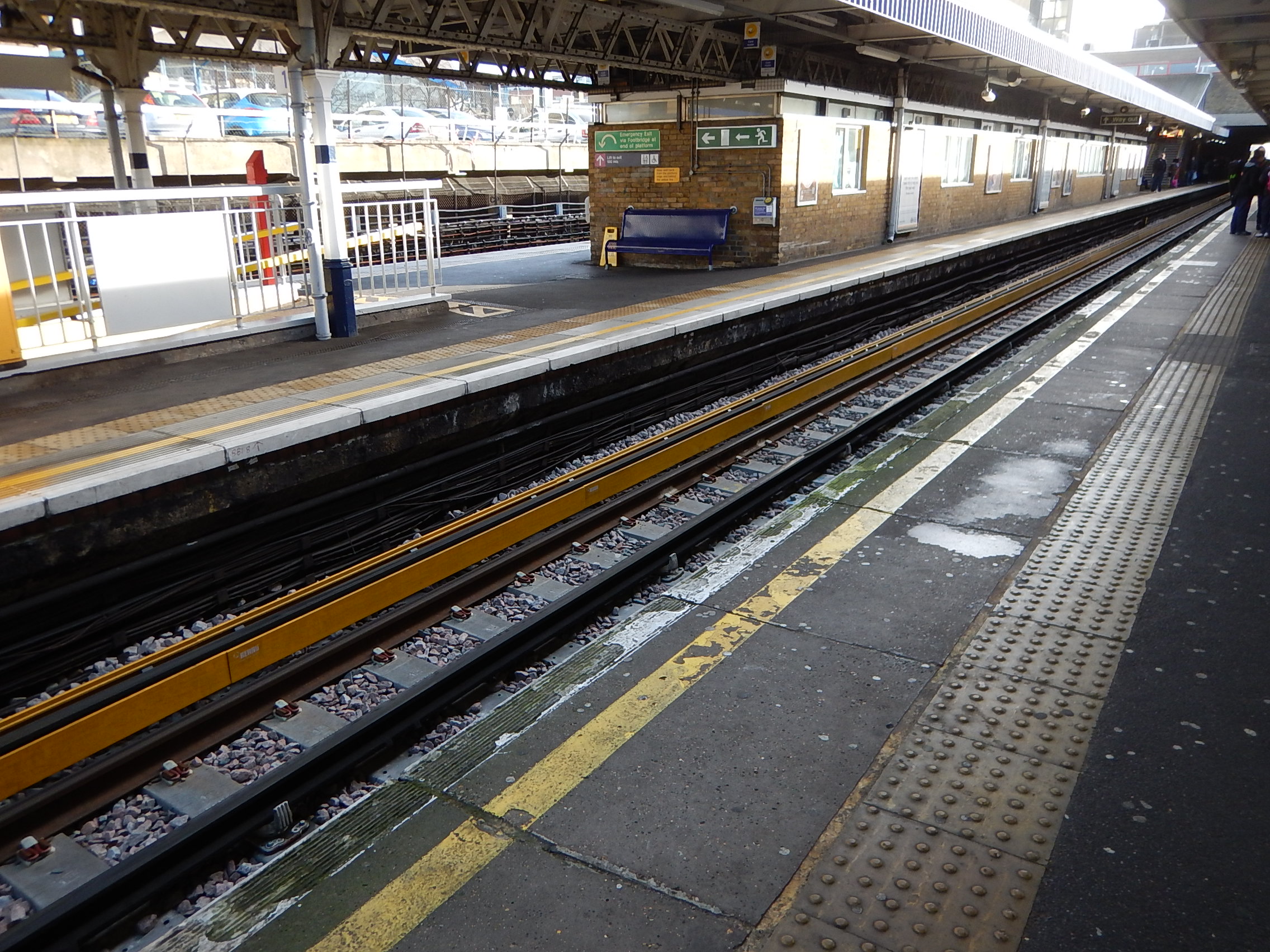
A Protected Conductor Rail At Barking Station
Note how the conductor rail is protected by a yellow wooden shield.
Why?
Is it to protect passengers or the work-force?
There’s A Lot Happening Around Tilbury And Gravesend
Look at this Google Map of the Thames around Tilbury and Gravesend.

Tilbury And Gravesend
The North (Tilbury) Bank
Note the following.
- The Port of Tilbury with the Container Port on the west side.
- Tilbury Town station on the Tilbury Loop, where the trains between Fenchurch Street and Southend are run by c2c.
- Grays station is the next to the west and East Tilbury station is the next to the east.
- Not far to the west of Grays is the Lakeside Shopping Centre served by Chafford Hudred Lakeside station.
- On the river, at the eastern end of the port is the London Cruise Terminal, where there appears to be a ship in dock.
- There used to be a station called Tilbury Riverside by the river, which had a service to Upminster via Grays
- To the east of the port is Tilbury Fort, which is in the care of English Heritage.
- Go a few miles further east and there is the massive port and logistics development of London Gateway.
Interspersed between the developments is the usual estuarine mix of creeks, salt-flats, a couple of nature reserves and lots of wildlife.
It may not be everybody’s idea of a place to have a good time, but there is a lot going on.
Developments On The North Bank
Several factors will drive developments in the area.
- London needs housing and is already developing large numbers of houses and flats at Barking Riverside, which is a few miles to the East.
- Will there be more housing developments along the river?
- Crossrail will arrive in the next few years and will pass a few miles away to the North, through Romford station.
- London Gateway might want their staff to come and go by train or light rail.
- There is a need for another Thames crossing and how does a possible Lower Thames Crossing, which could cross Thames by East Tilbury, fit into the mix?
Many would argue that there should be better public transport along the north bank of the river.
The Gravesend (South) Bank
Note the following.
- The Swanscombe Peninsular in the top left corner of the map.
- Swanscombe and Northfleet stations on the North Kent Line, which runs to the North of Ebbsfleet International station.
- According to Wikipedia, the walking routes between Northfleet and Ebbsfleet International stations are not the best.
- Gravesend station is in the middle of the town and the Ferry to Tilbury is within walking distance.
- Hoo Junction, which is just off the map to the East is safeguarded as the end of a possible extension to Crossrail.
In contrast to the North Bank, the South Bank seems to have much more housing and a lot less green space and industrial development.
Developments On The South Bank
Like the North Bank, there is also development on the South.
- As with the North Bank there is a lot of housing development.
- A Garden City called Ebbsfleet Valley is proposed.
- A theme park called Paramount London is being built on the Swanscombe peninsular close to Ebbsfleet International station.
- Greenhithe station, which is linked to the Bluewater Shopping Centre is just to the west of Swanscombe.
- Crossrail will arrive in 2019, a few miles to the west at Abbey Wood station.
- The possible Lower Thames Crossing, could reach Kent to the East of Gravesend.
- More Highspeed services into St. Pancras are planned to Kent and East Sussex, and the Continent.
I don’t know the Gravesend and the South Bank well, but on my walks in the last few months, it strikes me that there needs to be some public transport improvements.
Transport Improvements
Transport improvements in Tilbury, Gravesend and the surrounding area fall into three categories.
- Tilbury and the North Bank
- Gravesend and the South Bank
- Cross-River
In some ways the last is the most difficult, as other factors like a new Thames Estuary airport and a higher Thames Barrier must also be considered. The Wikipedia entry for the Lower Thames Crossing gives some options and says this about Option C.
A new road crossing connecting the M2 and M20 motorways in the south with the M25, which might be linked via a proposed new Thames flood barrier. The route from the north would pass close to South Ockendon, Orsett, Chadwell St Mary, West Tilbury, East Tilbury, across West Tilbury Marshes before it crossed the Thames just to the east of Gravesend and Thurrock. It would join the M2 in the Kent Downs Area of Outstanding Natural Beauty and in the Special Landscape Area. This proposed link is also within the Kent Downs AONB and special landscape area. According to the DfT, this long route would have “considerable environmental impacts”.
It won’t be a small fight to get that option built.
I will list the possible public transport improvements in the area.
Crossrail
Crossrail is more than just a major East-West route across London.
It is effectively a four-branch railway.
- Abbey Wood – Connecting to Kent
- Heathrow
- Reading (or Paddington) – Connecting to the West Country and Wales
- Shenfield or Liverpool Street) – Connecting to East Anglia
I believe that Crossrail should be considered as a two line railway, by including the equally capable Thameslink, which connects at Farrington and adds the following major branches.
- Bedford (or St. Pancras) – Connecting to the East Midlands and Sheffield
- Brighton and Gatwick
- Peterborough (or Kings Cross) – Connecting to Lincolnshire, Yorkshire, the North East and Scotland
The major lines not connected to either Crossrail or Thameslink are the West Coast Main Line and the lines out of Waterloo and Marylebone.
Although care is being taken to create a good passenger link between the Bakerloo Line and Crossrail at Paddington.
The connectivity of the Crossrail/Thameslink system will be further improved by some smaller schemes.
- Many stations such as Bedford, Luton Airport, Romford, Shenfield and Slough might be improved to enable interchange to fast long-distance services.
- There are plans to create an interchange at a new Old Oak Common station with HS2 and the West Coast Main Line.
- Extension of Crossrail up the West Coast Main Line.
- Feeder lines like Basingstoke to Reading, Peterborough to Lincoln and the East and West Coastway will be improved.
There are two possible feeder lines in the area I am considering in this post.
- Romford To London Gateway
- Crossrail Extension to Gravesend
Whatever happens Crossrail will become important to those in Kent, who want to get to the Southern part of Essex, as it will be a walk across platforms at Whitechapel.
At present from Abbey Wood to Shenfield takes about ninety minutes with two changes, but when Crossrail opens with a ten metre level walk at Whitechapel, it could be as short as fifty-two minutes.
Don’t underestimate how Crossrail will change the lives of everybody, who, lives, works or visits.
A Romford To London Gateway Train Service
I strongly believe that a train service from Romford to the London Gateway will eventually happen.
Consider the following.
- As London Gateway develops, it is expected to create tens of thousands of jobs, which in turn will put enormous pressures on the roads.
- A full service would improve connectivity to the large Lakeside Shopping Centre.
- This could become an important feeder route to Crossrail.
- The northern part of the route is the Romford to Upminster line, which is operated by London Overground as a shuttle using a dedicated train and platforms at the ends of the line.
- London Overground is increasing services on the Romford to Upminster Line, so they must believe there is a need.
- Track and electrification for the line is complete, although there would need to be some changes at Upminster.
- c2c and London Overground are both very ambitious train operating companies.
We have evolving needs, an ease of creating the service, and ambition, which all work in favour of implementing the service.
This route map from Wikipedia shows the stations in the area.

A full service on the route could call at these stations?
- Romford – for Crossrail and some longer distance services to Chelmsford, Colchester and Ipswich.
- Emerson Park
- Upminster
- Ockendon
- Chafford Hundred Lakeside – for Lakeside Shopping Centre
- Grays
- Tilbury Town
- East Tilbury
- London Gateway
The service could also call at Tilbury Riverside, as services used to do. This would serve the London Cruise Terminal and Tilbury Fort.
I wrote Exploring Tilbury Riverside about this area.
This is one of those ideas, that should be filed under Watch This Space.
Crossrail Extension To Gravesend
I wrote Crossrail Extension To Gravesend on this and the extension brings benefits.
- It will give vastly improved connections from Central London to East Kent and East Sussex.
- It would make Crossrail an even better option than driving across the Dartford Crossing.
- It would mean that Heathrow Airport had a direct link to Continental rail services at Ebbsfleet International.
- Ebbsfleet International is one of the few stations that could be an enormous Park-and-Ride station.
- The proposed depot at Hoo could be good for both Crossrail in terms of flexibility and East Kent, in terms of employment.
I think this extension of Crossrail will happen.
Barking To The Dartford Crossing
I’m including this map, as it shows the nature of the area.
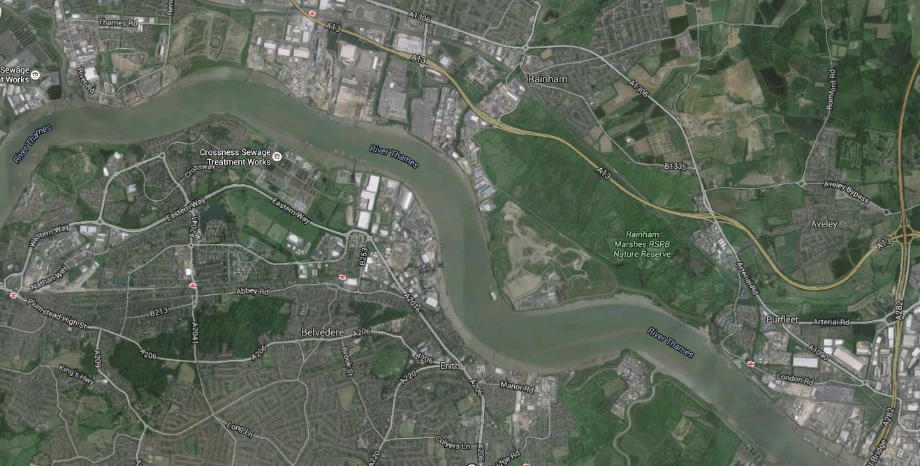
Barking To The Dartford Crossing
Barking is in the top left and the The Dartford Crossing is in the bottom right of the map.
Note the following.
- The east-west main road just north of the river is the A13.
- Dagenham Dock station is on this road with the Barking Riverside development below it and to the south-west.
- To the south-east of the station, there is a large amount of industry.
- The Beckton Sewage Works are on the North Bank, with Crossness on the south.
- As you get towards the Dartford Crossing, the green space is Rainham Marshes RSPB Nature Reserve, with closer to the crossing Purfleet.
It is an area for those with imagination.
The Gospel Oak To Barking Line
The Gospel Oak To Barking Line is to the west and is being extended to Barking Riverside, where tens of thousands of homes are being developed.
The Transport for London Plan for 2050, says this.
An extension of the Gospel Oak to Barking Line to Barking Riverside is currently being planned to open up development of a major new quarter with 11,500 new homes.
A potential further extension could involve crossing the river to Thamesmead and Abbey Wood, where there are major regeneration needs and major opportunities for new housing developments.
My view is that if you give Barking Riverside connections to the north, west and south, perhaps a connection to the east to Dagenham Dock station on c2c is needed as well.
The Docklands Light Railway
The original plan for the area envisaged extending the Docklands Light Railway to Dagenham Dock. Wikipedia says this.
It is unlikely to go ahead as there are plans to bring the London Overground Gospel Oak to Barking Line to Barking Riverside giving better links to Barking and East London and via Barking station to Central London. This will however cause the Docklands Light Railway to not head east and have connections to c2c rail services at Dagenham Dock, so this extension could still take place and the two services would have an interchange at Barking Riverside.
I do think that some transport planners look with disdain at the Docklands Light Railway, but generally the over a hundred million rides taken on the system every year, give another view.
With the emphasis on leisure and with green issues to the fore, I could see the system reaching the Nature Reserve at Rainham.
The Docklands Light Railway is East London’s good fairy and she has ways of surprising everybody.
The Poor Connectivity Of HS1
HS1 must be one of the worst designed railways in Europe.
Currently, HS2 is being designed and great care is being taken to ensure that there is good connectivity all along the route. These are a few examples.
- Old Oak Common station will be a hub in North West London.
- Tram routes will reach Birmingham Curzon Street station long before HS2 does.
- Birmingham Interchange will be linked to Birmingham Airport
- Trams have already reached the area of the Nottingham HS2 station at Totton.
- HS2 will call at Crewe, which is a major railway hub.
On the other hand, two of HS1’s intermediate stations have very poor connectivity.
- Stratford International only has a direct link to the Docklands Light Railway.
- Ebbsfleet International has very poor direct links to classic lines.
Neither station has a direct connection to Crossrail.
HS1 seems to been designed with very limited objectives in mind, one of which was to win the Olympics for 2012.
Crossing The River
There is no doubt that there is a need for more capacity across the lower Thames and there are several plans for a Lower Thames Crossing.
Other plans have included a combined rail and road link between Medway and Canvey Island and the latest proposal has been London’s plan for a Gospel Oak to Barking Line Extension to Abbey Wood.
It is also worth noting, that the distance between Tilbury Riverside and Gravesend is probably about the same as the distance spanned by the Emirates Air-Line at Greenwich.
Also, could modern ferries provide a better and more reliable link?
The only plan being implemented that will help get people cross the Thames at the present time, is Crossrail. It will be interesting to see how Dartford Crossing traffic changes, when Crossrail opens.
I think Crossrail could be part of quite a proportion of Cross-River traffic.
- It links with the twenty-four trains per hour North-South links of Thameslink and the East London Line.
- It links with West London and Heathrow.
- If it served Ebbsfleet International, that would become a valuable Park-and-Ride station.
- It passes right through the heart of London, as opposed to HS1 and the classic lines from the South, which terminate slightly to the North and South respectively.
- I think one of the limiting factors on people switching from car to Crossrail, may well be the availability of car parking at Crossrail stations and especially those like Abbey Wood and Shenfield.
It is a pity that HS1 was so badly designed, as if Stratford International and Ebbsfleet International stations, were both better connected, then the Highspeed services on the line would be a valuable cross-River link.
I wrote about the poor connectivity of Ebbsfleet Internation to classic lines in So Near And Yet So Far!
My personal preference for another connection would be to build a bridge between Barking Riverside and Thamesmead, to take the Gospel Oak to Barking Line over rather than under the Thames, if this was possible. I would use tram-trains on the railway, that if required did a walkabout around the estates as trams on both sides of the river. The bridge would also be open to cyclists and pedestrians.
Properly designed, the bridge could be a visitor attraction in its own right!
Will Floods And Europe Solve The Problem?
If Crossrail/Thameslink is one elephant in the room, then flood protection for London and Europe are the others!
This is a Google Map of the Thames Estuary from Tilbury and Gravesend in the West to Southend in the East.

Gravesend And Tilbury To Southend
As I write this piece, the North West of England is suffering the ravages of Hurricane Desmond. Weather seems to be getting more extreme and the North Sea hasn’t had a major disaster since the North Sea Flood of 1953. This is from Wikipedia.
A combination of a high spring tide and a severe European windstorm over the North Sea caused a storm tide; the combination of wind, high tide, and low pressure led to a water level of more than 5.6 metres (18.4 ft) above mean sea level in some locations. The flood and waves overwhelmed sea defences and caused extensive flooding. The Netherlands, a country with 20% of its territory below mean sea level and 50% less than 1 metre (3.3 ft) above sea level and which relies heavily on sea defences, was worst affected, recording 1,836 deaths and widespread property damage. Most of the casualties occurred in the southern province of Zeeland. In England, 307 people were killed in the counties of Lincolnshire, Norfolk, Suffolk and Essex. Nineteen were killed in Scotland.
Desmond is very much a pussy-cat compared to what nature can and will throw at us.
In 1953, we had fewer casualties than the Dutch because our warnings were better and one would hope that because of universal television and better communications another North Sea Flood on the scale of 1953, would probably be less costly in lives lost.
The Dutch have determined that the sea shall not have them and have created impressive defences all along the coast call ed the Delta Works.
We have improved the defences along the Thames Estuary and London is now protected by the Thames Barrier.
In a section on the Future of the Thames Barrier in Wikipedia, this is said.
The barrier was originally designed to protect London against a very high flood level (with an estimated return period of one hundred years) up to the year 2030, after which the protection would decrease, whilst remaining within acceptable limits. At the time of its construction, the barrier was expected to be used 2–3 times per year. It is now being used 6–7 times per year.
It also says that the barrier would be replaced after 2070.
My cautious nature says that is a date that is too far in the future.
So why will Europe have such a large affect on the Thames Estuary?
Many predictions say that over the future, London will grow and become an even more powerful magnet for the people of Europe.
Europe itself will also become more prosperous, so we will see massive increase in both freight and road traffic across the channel.
The Channel Tunnel is unique amongst many major fixed cross-water links, in that it can be easily augmented by ferries, but I believe that people, vehicles and freight, will increasingly be on longer journeys on rail. Think about the effect of these developments.
- The destinations served by direct train from St. Pancras will increase.
- Cross-channel car traffic will increase.
- The Dutch and the Germans have built th Betuweroute, which is high-capacity freight route.
- Vehicle imports and exports are increasingly handled by special trains.
- Liverpool is building a massive new container port. A lot of the freight could go by train to Europe.
I believe that a second fixed-link across the Channel will be built, which will in itself generate more trains to and from London and vehicular traffic to and from everywhere in the UK.
Improving the rail and road networks both suffer from the same problem – London.
- Freight trains can get to and from Barking on HS1, but there is little spare capacity through London.
- Passenger trains will increasingly be constrained by lack of capacity at St. Pancras, but using Ebbsfleet International and an extended Crossrail, would be a more than acceptable alternative for many travellers.
- Road traffic will clog the Dartford Crossing and the Southern section of the M25.
The only solution is to create a new road and rail corridor to get around London.
As London will need a new flood barrier, probably we should start with an idea similar to Option C for a new Lower Thames Crossing.
A new road crossing connecting the M2 and M20 motorways in the south with the M25, which might be linked via a proposed new Thames flood barrier. The route from the north would pass close to South Ockendon, Orsett, Chadwell St Mary, West Tilbury, East Tilbury, across West Tilbury Marshes before it crossed the Thames just to the east of Gravesend and Thurrock. It would join the M2 in the Kent Downs Area of Outstanding Natural Beauty and in the Special Landscape Area. This proposed link is also within the Kent Downs AONB and special landscape area. According to the DfT, this long route would have “considerable environmental impacts”.
Given enough time to generate a full plan, we can probably come up with a better route, perhaps further to the East.
