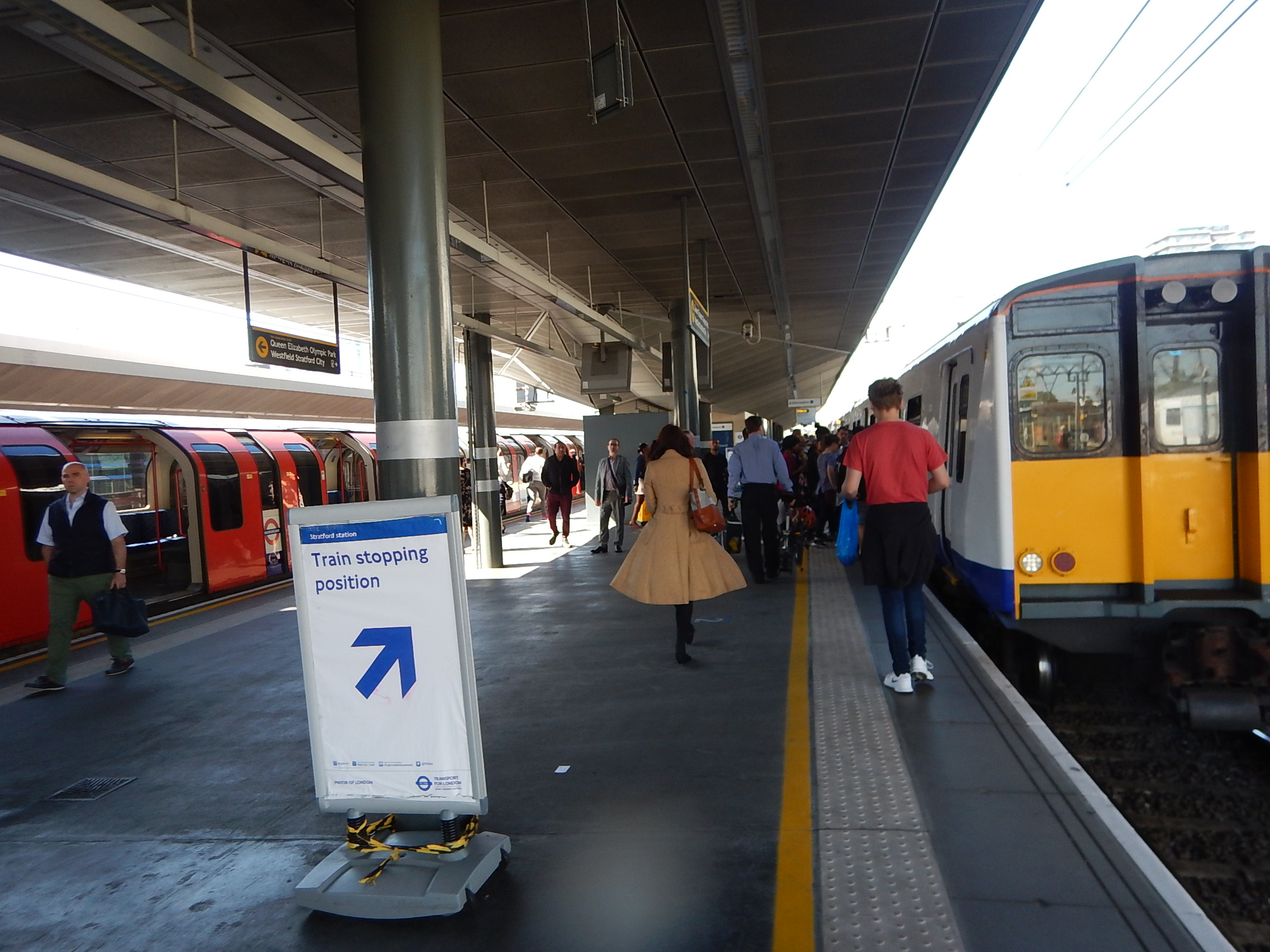
A Walk From Moorgate To Liverpool Street Station
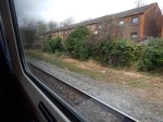
This morning, I walked from Moorgate to Liverpool Street station, when it was quiet.
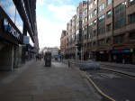


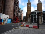

I took a route through Finsbury Circus, and was thus able to look at the various Crossrail works in the area.
These are some comments about the area, often based on this page on the Crossrail web site, which details the urban realm around Crossrail stations in the City of London.
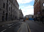
Moorgate
Moorgate station will be much changed from the current station.
Reading the Crossrail web site, gives the impression that the majority of passengers will generally walk to the station from perhaps their office, a bus or a taxi. This is said.
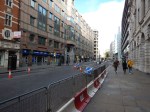
- Reducing carriageway width in Moorgate and increasing footway space.
- Introduction of a central pedestrian median in Moorgate to improve crossing at a key pedestrian crossing point and improve accessibility for all users.
- A new pedestrianised public space will be created on Moorfields between New Union Street and London Wall, with access limited to emergency and service vehicles only.
- Moorfields south of Moor Place will act as a ‘secure zone’ outside the new station entrance in which vehicles access will be controlled via station controlled retractable bollards.
- Away from the raised carriageway areas regular kerb heights are retained in close proximity to the station entrance in Moorfields, Moorgate and Fore Street which allow for comfortable boarding of taxis via wheel chair ramps. The closest regular height kerbs to the station are located approximately 30m from the station entrance on Moorfields and Moorgate.
All is part of a wider plan in the City of London, which will probably result in a more pedestrian- and cyclist-friendly city.
Buses On Moorgate
Nothing is said about buses on Moorgate, which are important to me, as they stop at the end of my road, with Northbound and Southbound stops within a hundred metres of my house.
I have two main bus routes, that will take me to and from Moorgate; the 21 and the 141.
I can remember as a child the London trolleybuses, one of which was the 641, which was replaced by the 141 bus.
This link shows where the Balls Pond Road and Mildmay Park cross about sixty years ago and the present day, perhaps seventy metres from my house.
I find it very convenient.
Moorgate is served by four main bus routes; the 21, 43, 76 and 141, all of which except the 76 go between Bank and Old Street stations.
I don’t know how the buses will be reorganised after Crossrail, but I suspect that the current stops will be used initially and only changed, when a new pattern of use emerges.
Crossrail and the Moorgate rebuild could effect the buses in several ways.
- Many new passengers will get a bus to and from Moorgate.
- I would suspect that Crossrail could cut the number of private cars in the centre of London.
- The better walking route to Liverpool Street station in the dry, might mean more bus passengers.
- The improved Great Northern Metro might increase or reduce passengers using the buses at Moorgate.
- Moorgate’s taxi-friendly design, may mean the station get choked by back-cabs and Uber.
\the rebuilding of Bank and London Bridge stations will also have an effect.
I suspect Transport for London, suspect what is going to happen, but the reality will only be found, when all the new lines, stations and walking routes are open.
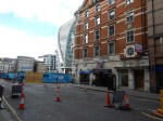
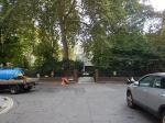
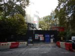
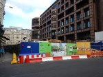
Finsbury Circus
Finsbury Circus is an oasis in the City and Crossrail will hand it back after completion, with a hopefully-tasteful ventilation shaft in the middle.
Black Redstarts
Black Redstarts are quite a rare bird in the UK, but it appears that London has a population.
A notice in Finsbury Circus Gardens gave more details.
The Central Line
The Central Line isn’t built deep under buildings in central London, but it goes under the roads. At Liverpool Street station, I get the impression that it ran between the station and the next door Broad Street station (now Broadgate), before going South under Old Broad Street and then curving to the West under Throgmorton Street to go to Bank station.
You can get an impression of the depth of the Central Line from the length of the escalators at Liverpool Street station.
This extract taken from the Wikipedia entry for the Central London Railway, which was the predecessor of the Central Line, describes the construction of the tunnels.
To minimise the risk of subsidence, the routing of the tunnels followed the roads on the surface and avoided passing under buildings. Usually the tunnels were bored side by side 60–110 feet (18–34 m) below the surface, but where a road was too narrow to allow this, the tunnels were aligned one above the other, so that a number of stations have platforms at different levels. To assist with the deceleration of trains arriving at stations and the acceleration of trains leaving, station tunnels were located at the tops of slight inclines.
So you have a stack of lines and tunnels at Liverpool Street station.
- Close to the surface is the Metropolitan and Circle Lines going across the front of the station, roughly East-West
- 18-34 metres down the Central Line runs perpendicularly to the sub-surface lines.
- Crossrail is the deepest line in an East-West direction.
Crossrail is also building a pedestrian walkway in an East-West direction, that goes under the Central Line and above the level of the Crossrail running tunnels.
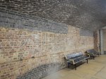
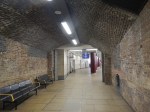
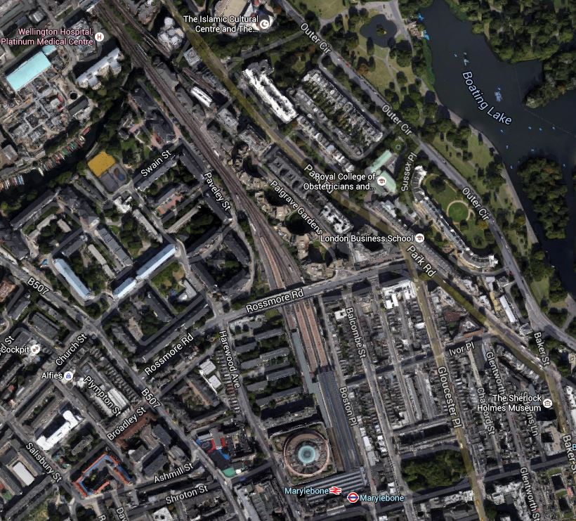
Liverpool Street Crossrail Station Disentangled
Liverpool Street station on Crossrail is a massive double-ended beast that stretches as far as Moorgate station, where it has a second entrance.
At the Liverpool Street end, it will connect to the following in addition the the Main Line services out of the station.
- Central Line
- Circle Line
- Hammersmith and City Line
- Metropolitan Line
At the Moorgate end, it will connect to the following lines.
- Circle Line
- Hammersmith and City Line
- Metropolitan Line
- Northern Line
- Northern City Line
This is a visualisation of how Moorgate station will look after it has been rebuilt for Crossrail, that I found on this web page from May 2009, so it may be out-of-date and wrong.
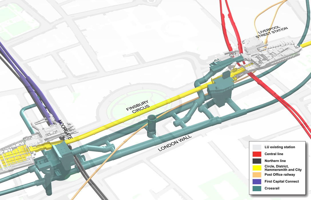
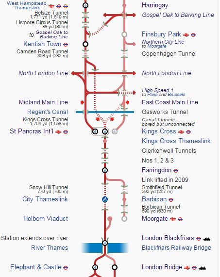
Liverpool Street-Moorgate Station Schematic
Note.
- The royal blue line is labelled at First Capital Connect, for which I use the term Northern City Line.
- Turquoise is used for new Crossrail work, with red and yellow for the Central and sub-surface lines.
- If you enlarge the image by clicking on it, you can clearly see the escalators, that currently connect the Northern City and Northern Lines to the ticket hall.
- Crossrail appears to have an escalator connection to an enlarged Moorgate ticket hall
- The deep level Northern Line, which is shown in black, passes over Crossrail, but underneath the escalators that lead down.
I have since seen a cross-section of the station from Liverpool Street to Moorgate and it would appear that a few improvements have been made.
- A pedestrian tunnel is now planned to run between the Crossrail platforms, which will effectively link the escalators at both ends, which connect into the station entrances and ticket halls upstairs.
- It could be possible that the entrance to the station has been moved towards the East.
The interchanges possible at the combined station are best described as comprehensive.
Changing Between Crossrail And The Northern Line
The Northern Line crosses the Moorgate end of the Crossrail platforms at a right angle and it would appear to have a short escalator or step connection to a cross-passage between the two Crossrail platforms.
The only problem, is that you’ll have to make sure, you’re at the Western end of the Crossrail train.
Changing Between Crossrail And The Northern City Line
It would appear that Crossrail and the Northern City Lines are at roughly the same level and are very well connected.
- Passengers would appear to be able to take an escalator or lift from one set of platforms to the ticket hall and then take another set down to the other line.
- There also appears to be another independent passage, which starts midway down the Northern City Line platforms and takes a circuitous route to the Crossrail platforms.
- There may be another convenient route, where you go via the Northern Line and reappear on the other set of platforms.
It certainly won’t be a difficult interchange for passengers, although you’ll have to remember to position yourself at the Western end of the Crossrail train.
Changing Between Crossrail And The Central Line
The Central Line crosses the Liverpool Street end of the Crossrail platforms at a right angle and it would appear to have a short escalator or step connection to a cross-passage between the two Crossrail platforms.
The connection is not as neat as the Northern Line one at the other end of the Crossrail platforms
The only problem, is that you’ll have to make sure, you’re at the Eastern end of the Crossrail train.
Changing Between Liverpool Street And Moorgate
I’ve read somewhere, that the double-ended station is designed so that passengers can walk easily between the two ends of the station.
My view of the cross-section of the station from Liverpool Street to Moorgate confirms it is a feasble route.
- Passengers at Liverpool Street will descend to an intermediate level, from where the Central Line can be accessed.
- A walk of perhaps fifty metres will take you under the Central Line tunnels and to an escalator, that will descend to a wide passage between the Crossrail platforms.
- A walk of perhaps a hundred metres will give several entrances to the Crossrail platforms and take you to an escalator, which takes you to the intermediate level at Moorgate station.
- A level walk of perhaps thirty metres or so, will take you over the Northern Line tunnels and to an escalator, that gives direct access to the booking hall at Moorgate.
So a passenger from perhaps Ipswich to Hatfield on a very wet day, will dive on arrival at Liverpool Street into the Crossrail station and use it as a dry walking route to the Northern City platforms at Moorgate.
I suspect that an Oyster card or a contactless bank card will give free access to the route.
The same route will give Moorgate passengers access to the Central Line and Liverpool Street passengers access to the Northern Line.
Related Posts
A Numerical Analysis Of Great Northern’s Class 717 Trains
Could A Reversing Siding Be Built At Alexandra Palace?
Could A Reversing Siding Be Built At Alexandra Palace?
Could Passenger Services Be Run On The Canonbury Curve?
All Change On Thameslink
Wikipedia gives a Provisional Timetable for Thameslink.
- 4 trains per hour (tph) – Sutton to St. Albans (2 tph via Wimbledon, 2tph via Mitcham)
- 2tph – Brighton to Bedford
- 2 tph – Gatwick Airport to Bedford
- 2 tph – Brighton to Cambridge
- 2 tph – Horsham to Peterborough
- 2 tph – Tattenham Corner to Cambridge
- 2 tph – Sevenoaks to Kentish Town
- 2 tph – Caterham to Finsbury Park (stopping via Sydenham or semi-fast)
- 2 tph – Maidstone East to Luton
- 2 tph – East Grinstead to West Hampstead
- 2 tph – Littlehampton to West Hampstead
Some services are extended in the Peak to and from Bedford, Luton, Three Bridges and Welwyn Garden City.
According to Modern Railways for August 2016, the new proposal is.
- 4 trains per hour (tph) – Sutton to St. Albans (2 tph via Wimbledon, 2tph via Mitcham)
- 2tph – Brighton to Bedford
- 2 tph – Three Bridges/Gatwick Airport to Bedford
- 2 tph – Brighton to Cambridge North
- 2 tph – Horsham to Peterborough
- 2 tph – Maidstone East to Cambridge
- 2 tph – Sevenoaks to Blackfriars
- 2 tph -Orpington to Kentish Town/West Hampstead
- 2 tph – Rainham to Luton (via Dartford and Greenwich)
- 2 tph – East Grinstead to Bedford
- 2 tph – Littlehampton to Bedford
No information on Peak extensions is given.
I can make the following observations.
More Off Peak Trains Through The Core
According to Modern Railways for August 2016, there will be another 2 tph in the Off Peak, through the core from St. Pancras to London Bridge.
The core section of Thameslink, which effectively goes from West Hampstead/Kentish Town and Finsbury Park in the North to London Bridge and Elephant and Castle in the South.
Thameslink Core
This section is getting to look more like a high-capacity Underground Line. The frequency is in the mid-twenty trains per hour, which is better than some Underground lines.
There is also a lot of connections.
- West Hampstead – Jubilee Line and North London Lines and possibly Chiltern and Metropolitan Lines.
- Kentish Town – Northern Line
- Finsbury Park – Great Northern, Piccadillyand Victoria Lines.
- St. Pancras – Circle, Metropolitan, Northern,Piccadilly and Victoria Lines, and Main Line services out of Kings Croiss and St. Pancras.
- Blackfriars – Circle and District Lines
- London Bridge – Northern and Jubilee Lines and Main Line services.
- Elephant and Castle – Northern and Bakerloo Lines
With this level of connections, it should surely be on the Underground Map.
Changing In The Core
Passengers will have to get more used to changing trains in the core section between St. Pancras and Blackfriars.
Passengers will get off one train at a station they like, wait for hopefully a few minutes, before getting a train to their preferred destination.
I think Thameslink could make this a lot easier, by providing kiosks and coffee shops on the platforms of the station, they would like people to change.
New Routes
Thameslink will open up new routes.
Until I was fifteen, I lived near Oakwood station and getting to and from Gatwick from there is not easy. But after Thameslink opens, the Piccadilly Line takes me to Finsbury Park for Thameslink, where I suspect I’ll be able to get a train to Gatwick.
All the fuss is about Crossrail, but the effect of a full Thameslink could be almost as great.
London Bridge Station
According to a platform layout diagram in Wikipedia of London Bridge station, Thameslink will use the following platforms.
- Platform 4 to go South.
- Platform 5 to go North.
Is the design of the island platform 4/5 in the new station, wide enough to have kiosks and/or coffee shops?
It’s certainly an island platform, that will enable passengers to change direction.
Sutton Loop Services
Sutton currently has 2 tph to St. Albans and 2 tph to Luton, so the new proposal might be seen as a cutback, as it doesn’t go all the way to Luton.
Will users of the Sutton Loop Line find this acceptable? According to the Political Developments section in the Wikipedia entry for the Thameslink Programme, this is said.
Network Rail had planned to terminate Sutton Loop Thameslink trains at Blackfriars station, rather than have them continue through central London as at present. This upset many residents in South London and their local politicians, who saw it as a reduction in services rather than an improvement. In response to pressure, government has ordered Network Rail to reverse the decision.
There are powerful interests!
Cambridge
Are some Cambridge services going to Cambridge North station, to give better connections between Thameslink and services to and from Kings Lynn, Norwich, Peterborough and the Midlands?
Cambridge North station is given in Wikipedia as a three platform station.
Is that enough? Especially, if trains arriving at Cambridge North station from the North were to be turned back.
Thameslink will also highlight a real problem at Cambridge.
After Thameslink opens, for many passengers, going to say Ipswich or Norwich via Cambridge could be a better option, than going via Liverpool Street.
At present trains from Cambridge to Ipswich, Norwich and Peterborough do not have enough capacity or frequency. At least a four-car train running every thirty minutes is needed now and, Thameslink will bring more passengers to the routes.
Hopefully, the new East Anglia Franchise will improve these important services across the region.
Midland Main Line
It would seem that services on the Midland Main Line branch of Thameslink, stop a few stations further in with perhaps fewer services going to Luton.
Given that the Midland Main Line is to be electrified and fast trains will be running from St. Pancras to Derby, Nottingham and Sheffield, the interface between the two lines needs to be well thought out.
Consider.
- The interchange between Thameslink and Midland Main Line services at St. Pancras is not the best.
- Will Bedford be upgraded to be a better interchange?
- Trains on the electrified Midland Main Line will probably be 200 kph trains, as opposed to the 160 kph of the Class 700 train‘s on Thameslink.
- The trains run on separate pairs of lines, with the slow lines to the East and the fast lines to the West.
In my view, there is a need for a cross platform interchange between Thameslink and long distance services, but on a brief look, this might be difficult, at anywhere other than Bedford station.
As Bedford will also become the Eastern terminus of the East West Rail Link, and there is space in the area of the station, could we see Bedford developed into an important and efficient interchange?
St. Pancras Station
A lot of this could have been much easier, if St. Pancras station had been designed as a working station, rather than to show off! It may have a fur coat, but it’s certainly got no knickers.
A simple illustration of the bad design of St. Pancras, is to imagine you’re coming from say Flitwick on Thameslink and want to go to anywhere on the Northern, Piccadilly and Victoria Lines.
- The Piccadilly and Victoria Lines are a long walk from Thameslink and the Midland Main Line platforms at St. Pancras.
- The Northern Line is better as sensible passengers will use Kentish Town or London Bridge to change.
At least there is a good interchange to the Circle, District and Metropolitan Lines at Farringdon and Blackfriars.
In some ways the easiest way to get from the Thameslink platforms at St. Pancras to the Victoria and Piccadilly Lines, especially if you’re going South, is to get off at Farringdon station and use the cross-platform interchange between the Southbound Thameslink and the Westbound Circle/Metropolitan, which I showed in A Space Too Good To Leave Empty, and then take one stop back to Kings Cross before walking up the stairs to take the escalators to the Northern, Piccadilly and Victoria Lines.
East Coast Main Line
Thameslink’s links to the East Coast Main Line hopefully will be much better, as there are stations, where interchange to local and long-distance services could be excellent.
- Finsbury Park (At least 6 tph) will hopefully give good interchange to Great Northern, Piccadilly and Victoria Lines and local services.
- Welwyn Garden City (At least 4 tph) will interchange with local services
- Stevenage (At least 4 tph) will interchange with local services and some long distance trains.
- Peterborough (2 tph) will interchange with local services and lots of long distance trains.
As the slow lines are on the outside of the fast lines on the East Coast Main Line, I suspect that there are several good opportunities to create cross- or same platform interchanges between local services, Thameslink and long distance services to the North and Scotland.
Northern City And Hertford Loop Lines
One set of services that will benefit from Thameslink are those on the Northern City Line out of Moorgate and the associated Hertford Loop Line.
- The service will be connected to Thameslink services at Finsbury Park, Welwyn Garden City, Stevenage and other stations.
- The lines recently went to seven-day-a-week operation.
- The lines are getting new Class 717 trains.
- The Hertford Loop Line is a double-track line with a 120 kph speed limit and stations for six-car trains.
- The current Southern terminus at Moorgate, is not the easiest to access.
In the future, don’t discount improvements to the Hertford Loop Line, to get more trains through the area.
Consider.
- The Hertford Loop Line is the only diversion past the bottleneck of the Digswell Viaduct.
- Both ends of the line are grade-separated.
- The fastest trains between Finsbury Park and Stevenage on the main line take 18 minutes with no stops and 31 minutes with five stops.
- A typical stopping train on the Hertford Loop Line takes around 41-50 minutes.
- The line can handle long trains and frequently does, when there are problems on the main line.
- Thameslink Class 700 trains could certainly run on the line, but couldn’t stop unless platforms were extended.
- After the Great Northern Class 717 trains are delivered, under normal operation only the most modern trains with the latest signalling will use the line.
- Stevenage station already has cross platform interchange between main line, Thameslink, local and Hertford Loop services.
I think we shouldn’t discount the possibility of some Thameslink services going via an uprated Hertford Loop Line to release paths on the congested part of the East Coast Main Line.
Suppose the Hertford Loop Line was updated to include.
- 160 kph speed limit.
- Perhaps longer platforms at Hertford North station.
- Cross-platform or same platform interchange at Finsbury Park and Stevenage and perhaps Alexandra Palace.
- Perhaps a new parkway station South of Stevenage which could accept 12-car Thameslink trains.
I suspect Network Rail are updating their book of cunning plans to get more capacity through and around the Digswell Viaduct.
More Routes To Kent
The headline of the article in the August 2016 article in Modern Railways is Thameslink To Medway In Revised Timetable.
So why is Thameslink increasing its presence in Kent?
I could be cynical and say it is to take traffic from their rival company; Southeastern, but I think it is all about managing resources.
Consider.
- The core section of Thameslink can handle 24 tph in both directions.
- North of the Thames, the increased capacity has been used to create a second route out of London to Welwyn Garden City, Cambridge and Peterborough.
- East Croydon is a bottleneck and can’t take any more trains.
- The Bermondsey Dive-Under and the new London Bridge station will create more capacity and better routes to South East London and Kent.
- Thameslink has always served Kent.
- Many Kent services go right across London to Victoria, whenb perhaps it would be easier if they served London Bridge or went through Thameslink.
So by switching some of the available services through London to Kent, this could be to relieve pressure at Victoria and East Croydon. So perhaps in the long term, this will allow more services from Victoria to Brighton via East Croydon and Gatwick Airport
But obviously, these changes wouldn’t be done if the passengers didn’t need to use the route.
I have to admit, that I hear regular complaints about the quality of the train service in South East London.
The 2 tph between Orpington and West Hampstead certainly looks like a measure to address South East London’s bad connectivity. I know one solicitor who’ll use it to get from home to her office.
The 2 tph between Rainham and Luton is the interesting service, as it goes via the Medway towns, Dartford and Greenwich.
- It gives the Medway towns an additional route and more capacity to London.
- It connects to Greenhithe for Bluewater.
- It connects to Crossrail at Abbey Wood.
- Could this route release capacity in Victoria?
One thing that surprises me, is that it duplicates the proposed Crossrail extension to Gravesend. Perhaps it is just a better idea.
The other Kent service which is the 2 tph between Cambridge and Maidstone East, which is extended to Ashford in the peaks, seems to be a replacement for an existing service, but it could be taking the pressure off Victoria services.
Obviously Thameslink have the detailed passenger figures and can plan accordingly.
But surely, if the East Coastway service is extended to Ashford, perhaps by the use of IPEMU-capable Class 377 trains, then does this create another high-class commuter route to the far South-East?
Connecting To East Croydon And Gatwick From East London
For those of us in East London, who live along the East London Line, this is one of the most important sections of Thameslink.
At present, we can get to and from Gatwick Airport and East Croydon stations, by changing at somewhere like New Cross Gate or Norwood Junction stations.
It had been hoped that the improved Thameslink would have laid down a simple rule for getting from the East London Line to Gatwick, but when I asked Thameslink about this, they referred me to Transport for London, who unsurprisingly referred me back to Thameslink. I wrote about it in detail in Searching For What Is Going To Happen On The East London Line After The Thameslink Programme Opens.
Obviously, when Crossrail opens, it will help, as it runs from Whitechapel to Farringdon, but it would still be ideal to be able to get to Gatwick with one change, without making several and going halfway round London.
London Bridge To Caterham And Tattenham Corner via Purley
These destinations were originally to be incorporated into Thameslink, but it now appears, that they will become a shared service from London Bridge that divides at Purley station.
The current service is 2 tph from London Bridge to both Caterham and Tattenham Corner. As each train stops at all stations between New Cross Gate and East Croydon stations, this could appear to be the service that the East London Line needs.
The current London Overground services on the East London Line through New Cross Gate are 4 tph to West Croydon and 4 tph to Crystal Palace. As I said in Increased Frequencies On The East London Line, from 2018 Crystal Palace will receive 6 tph from Dalston Junction station.
So this means that from 2018, every six minutes a London Overground train will travel in both directions between New Cross Gate and Sydenham stations,. The services would run on the slow lines well out of the way of Thameslink on the fast lines.
There would probably be paths on the fast line to run the London Bridge to Purley services, but because Thameslink is such a high-frequency service, I suspect that they would run on the slow lines.
This would of course create a local Metro service to feed passengers to London Bridge and especially East Croydon to access longer distance services.
Let’s hope that there is sufficient capacity on the slow lines between New Cross Gate and East Croydon to incorporate a London Bridge to Purley service of sufficient frequency, so that plebs like me in Dalston wanting to go to East Croydon, can just get the first train to Sydenham and wait for a few minutes for the arrival of an East Croydon train.
In a perfect world, there would be ten trains per hour from London Bridge to East Croydon to match the Overground service. This would mean that the two services would alternate.
But I doubt this will happen, as other trains use the slow lines, like the service from Victoria to Sutton via Crystal Palace and West Croydon.
However, if we have at least a 4 tph service between London Bridge and Purley via East Croydon, that would mean that a reasonable service with one same platform interchange would exist between the East London Line and East Croydon, with all its connections to the South. Thameslink would be providing at least the following services from East Croydon.
- 4 tph to Brighton
- 4 tph to Three Bridges
- 2 tph to Horsham
All 10 tph would serve Gatwick Airport.
I wonder if the London Bridge to Purley services would share the same platform or island platform at East Croydon with Thameslink services.
If they did, then going to and from Gatwick Airport and Brighton from anywhere on the East London Line, would involve a maximum of two same platform changes.
London Bridge To Uckfield
For several months, I’ve thought that London Bridge to Uckfield will be run by an IPEMU or a train with onboard energy storage. I wrote about this in The Uckfield Branch Is Almost Ready For Longer Trains.
At present this service uses the fast lines between London Bridge and East Croydon and is run by Class 171 trains. An ideal train would be a modified Class 377 train, running in anb 8-, 10- or 12-car formation.
Between London Bridge and South Croydon, it would run using the third rail electrification and could keep up to a Thameslink speed. Only South of Oxted would it use the energy from the onboard storage to power the train.
Will Thameslink really want this interloper on their train superhighway between London Bridge and East Croydon?
Probably not!
But surely, the service could share the slow lines with the London Bridge to Purley services and the London Overground.
The Extended East London Line
Summarising the services that use the East London Line and the slow lines of the Brighton Main Line North of New Cross Gate we get from 2018.
- 4 tph Dalston Junction to West Croydon (London Overground) – Uses route from New Cross Gate to Norwood Junction
- 6 tph Highbury and Islington to Crystal Palace (London Overground) – Uses route from New Cross Gate to Sydenham.
- ? tph London Bridge to Purley (Southern) – Uses route from New Cross Gate to East Croydon
- ? tph London Bridge to Uckfield (Southern) – Uses route from New Cross Gate to East Croydon
- 4 tph Crystal Palace to West Croydon (Southern) – Uses route through Norwood Junction.
If say we had 4 tph to Purley and and 2 tph to Uckfield, then that would mean.
- 16 tph between New Cross Gate and Sydenham
- 14 tph through Norwood Junction
- 8 tph through East Croydon
- 8 tph to West Croydon
I suspect, that people who know about train scheduling could squeeze up to about the same twenty trains per hour along the line, that London Overground will be running through the Thames Tunnel.
If something like this train pattern were to be implemented, it would effectively create an extended East London Line from Highbury and Islington and Dalston Junction in the North to Gatwick Airport, Brighton and Uckfield in the South via East Croydon. All passengers would probably do is change trains, but not platforms once or twice.
The Brighton Main Line 2
There are a lot of commuters and others, who press for a second main line to Brighton, It even has its own web site, which would seem to like to see.
- Another route to London created using the Uckfield Branch and a reinstated Wealden Line.
- Better access to the Canary Wharf area of London.
Having looked at what Thameslink are doing, I think I can say the following.
- The new 12-car Class 700 trains will bring extra seats.
- Brighton will get 4 tph Thameslink train service through London.
- Thameslink services will interchange with East London Line services in a more efficient manner to give better access to Canary Wharf, Shoreditch, Whitechapel and East London in general.
- If the Thameslink services do create capacity at Victoria and East Croydon, then we’ll see more services from Brighton to Victoria.
- 10- or 12-car services will run from Uckfield into London Bridge, at 2-4 tph.
Hopefully, it will put off the day, when serious money needs to be spent to build a second line from Brighton to London.
Conclusion
I obviously don’t know, if this logic is right!
But if the following is done.
- Move services from Surrey to Kent.
- Provide a new Metro route from London Bridge to Caterham and Tattenham Corner via Purley.
- Optimise service end-points.
- Look seriously at the Hertford Loop Line
- Have a good think about how to serve Cambridge.
The following will happen.
- Victoria will have some spare capacity.
- Pressure on East Croydon will be eased.
- A frequent service can be created between London Bridge and Uckfield.
- The East London Line gets connected to Gatwick and Brighton.
- South East London gets much needed connectivity.
But the biggest effect will be the ability to create more services between Victoria and Brighton via East Croydon and Gatwick Airport.
It all illustrates some of the possibilities created by the new Thameslink proposals.
And all without any new infrastructure, other than what is currently being constructed.
A Space Too Good To Leave Empty
I took these pictures in the space between the Southbound Thameslink and Westbound Metropolitan platforms at Farringdon station.

It’s just too good to leave empty!
But at least it’s a convenient almost step-free way to interchange between the two lines. Say from.
- Liverpool Street to Gatwick.
- Bedford to Paddington.
It’s just a pity that all the other connections at Farringdon, seem to be lots of steps.
Crossrail’s Loops And Branches Across London
Most people think of Crossrail, as an East-West railway under London serving the following places on its pair of branches in the East and the West.
- Shenfield and Abbey Wood in the East.
- Heathrow and Reading in the West.
But it is more than that, as the East-West Crossrail can be considered to be part of a larger system that includes a number of North-South routes.
- Thameslink from St. Pancras to East Croydon via Farringdon on Crossrail.
- East Londson Line from Highbury and Islington to Canada Water via Whitechapel on Crossrail.
- West London Line from Willesden Junction to Clapham Junction via Old Oak Common on Crossrail.
- Bank Branch of the Northern Line from Camden Town to Kennington via Tottenham Court Road on Crossrail.
- Charing Cross Branch of the Northern Line from Camden Town to Battersea via Moorgate on Crossrail.
- Bakerloo Line from Willesden Junction to Elephant and Castle via Paddington on Crossrail.
Cross-London journeys will get interesting, as there will often be a dozen ways to go between A and B, when they are in different parts of London.
Kids will race each other across the City.
Crossrail will also grab a strong hold of other cross-London routes.
Central Line
Crossrail has interchanges with the Central Line at the following stations.
- Stratford
- Liverpool Street
- Tottenham Court Road
- Bond Street
- Ealing Broadway
The Central Line will add a loop to Crossrail from Stratford to Ealing Broadway.
People who live say near Queensway will use the Central Line to access the outer reaches of Crossrail., at Ealing Broadway and Stratford.
In Step-Free Interchanges In East London, I pointed out the excellent interchange between Crossrail and the Central Line at Stratford, which sadly is Crossrail’s only top quality interchange to other lines.
The interchanges with the Central Line in Central London would sappear to be very unadventurous. Only when the line is opened, will we know how well they work and the quality of the design.
Perhaps the only way to have got better interchanges would have been for one track of Crossrail to be each side of the Central Line, through Central London.
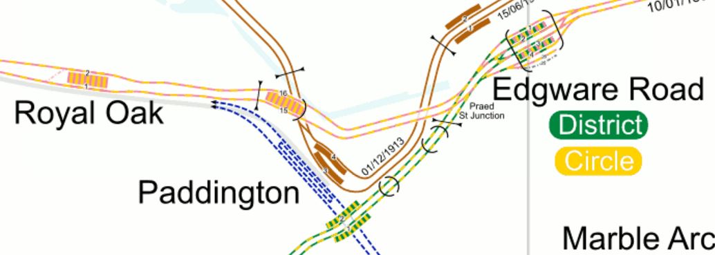
This map from carto.metro.free.fr shows the section of Crossrail from Marble Arch to Tottenham Court Road.
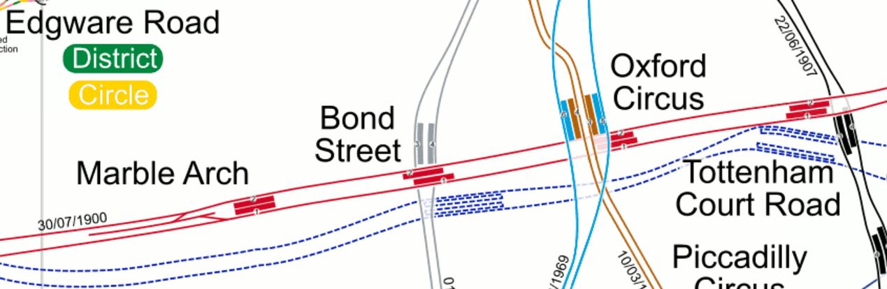
Crossrail Through Central London
From this map it looks like it could be possible, but I know from this section in Wikipedia, that it was difficult squeezing the tunnels past the Northern Line at Tottenham Court Road, so perhaps the route that was chosen, was the best one from a construction and cost point of view. It could even have been the only one possible.
Metropolitan Line
Crossrail has interchanges with the Metropolitan Line at the following stations.
- Whitechapel
- Liverpool Street
- Moorgate
- Barbican
- Farringdon
- Paddington
The Metropolitan Line will add a loop to Crossrail from Whitechapel to Paddington. Although, due to the distance between the two lines at Paddington, this probably means the Metropolitan Line will serve as a North-Western branch of Crossrail, that serves Kings Cross, St. Pancras and Euston.
This map from carto.metro.free.fr shows the section of Crossrail from Whitechapel to Farringdon.
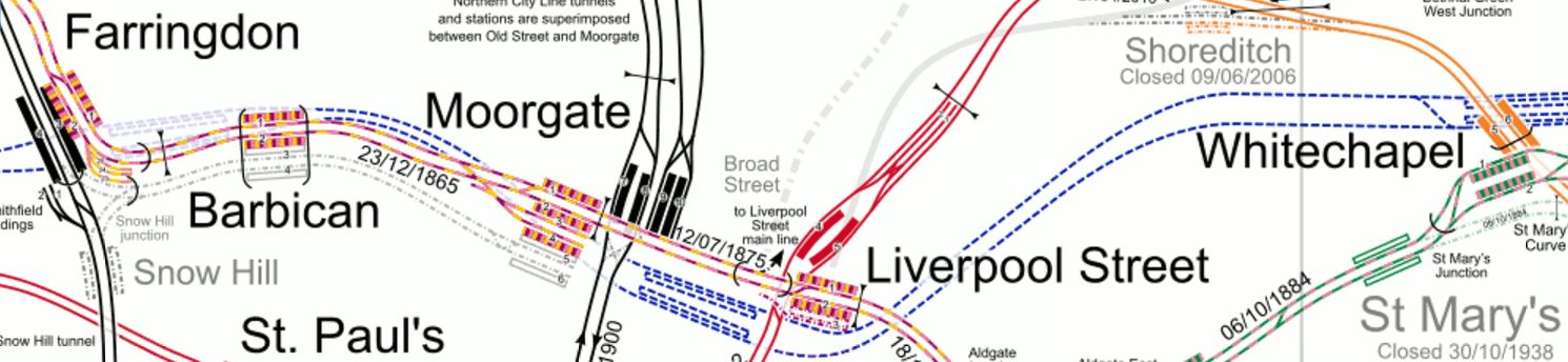
Crossrail Through The City
Note how two Crossrail stations; Liverpool Street-Moorgate and Barbican-Farringdon effectively each serve two Metropolitan stations.
Effectively, it gives a large choice of routes between North West London and East London and Essex.
Crossrail interchanges with the District Line at the following stations.
- Whitechapel
- Paddington
- Ealing Broadway
The District Line will add a loop to Crossrail from Whitechapel to Ealing Broadway, with a partial interchange at Paddington.
This map from carto.metro.free.fr shows the lines around Paddington.
Crossrail Through Paddington
Crossrail would appear to have a good right-angled connection with the District Line, between Edgware Road and Wimbledon.
So it could be argued that after Crossrail opens, the Edgware Road to Wimbledon service of the District Line is another North-South branch of Crossrail, just like with Thameslink and the East London Line.
North London Line
Crossrail interchanges with the following stations on the North London Line.
- Stratford
- Old Oak Common
The North London Line will add a loop to Crossrail from Stratford to Old Oak Common.
Jubilee Line
Crossrail interchanges with the following stations on the Jubilee Line.
- Stratford
- Bond Street
The Jubilee Line will add a loop to Crossrail from Stratford to Bond Street.
The Stations On The Loops
The effect of all these loops, mean that these stations will be on a line that connects to both ends of Crossrail.
- Acton Town
- Aldgate East
- Baker Street
- Bank
- Baron’s Court
- Bermondsey
- Bethnal Green
- Blackfriars
- Brondesbury
- Brondesbury Park
- Caledonian Road and Barnesbury
- Camden Road
- Canada Water
- Canning Town
- Cannon Street
- Canonbury
- Chancery Lane
- Chiswick Park
- Dalston Kinsland
- Ealing Common
- Earl’s Court
- East Acton
- Edgware Road
- Embankment
- Euston Square
- Finchley Road And Frognal
- Gospel Oak
- Gloucester Road
- Great Portland Street
- Hackney Central
- Hackney Wick
- Hammersmith
- Hampstead Heath
- Highbury and Islington
- Holborn
- Hommerton
- Kensal Rise
- Kentish Town West
- Kings Cross St. Pancras
- Lancaster Gate
- London Bridge
- Mansion House
- Marble Arch
- Mile End
- Monument
- North Greenwich
- Notting Hill Gate
- Oxford Circus
- Queensway
- Ravenscourt Park
- St. James’s Park
- St. Paul’s
- Shepherd’s Bush
- Sloane Square
- South Kensington
- Southwark
- Stamford Brook
- Temple
- Tower Hill
- Turnham Green
- Victoria
- Waterloo
- Westminster
- West Acton
- West Ham
- West Hampstead
- West Kensington
- White City
- Willesden Junction
The list may be impressive, even without stations on the North-South lines, but it has consequences.
- Ealing Broadway could see a lot of interchange traffic between Crossrail and the Central and |District Lines. Is it up to the task?
- Stratford and Whitechapel will see a lot of interchange traffic between Crossrail and other lines. These two stations have been designed for it.
- The Victoria Line is difficult to access. However, it is only a short walk from the Hanover Square entrance to Bond Street Crossrail station.
- The Piccadilly Line is difficult to access.
I suspect that as at Oxford Circus, there will be small schemes in several places to create connectivity.
Kings Cross St. Pancras is a big problem as it is a mass of long tunnels, but Crossrail and Thameslink will give passengers the chance to avoid it.
- If you’re on Crossrail and want to go North on the Victoria or Piccadilly Lines, I suspect that it would be easier to take Thameslink to Finsbury Park, where you can dive into the Underground.
- If you’re on Crossrail and want to go South on the Victoria Line, the quickest way might be change to the Bakerloo at Paddington and then walk across the platform to the Victoria Line at Oxford Circus.
But whatever route you take in a few years time, won’t be the obvious one today.
Extra Connectivity
There are various projects either under construction, planned or proposed, that would increase Crossrail’s reach.
- The Hall Farm Curve linking Walthamstow and Chingford to Stratford.
- The rebuilding of Bank, Camden Town, Highbury and Islington and other stations.
- The Northern Line Extension to Battersea.
- The Bakerloo Line Extension.
- The Greenford Branch is being improved.
- The re-signalling of London Underground’s sub-surface lines.
- The four-tracking of the West Anglia Main Line in preparation for Crossrail 2.
- The adding of a Central Line station at Shoreditch High Street.
- Extensions to the Docklands Light Railway.
- Old Oak Common will become more and more important with connections to the West Coast Main Line, HS2 and the Chiltern Main Line.
- Increases in frequency on the Victoria Line, Jubilee Line, Sub-Surface Lines, the Northern City Line and the Overground.
I do think though we could see a few surprises.
- There have been proposals to extend the Waterloo and City Line for years. Modern tunnelling and innovative train concepts might allow a shuttle between Waterloo and Crossrail at Liverpool Street.
- As the City of London wants to cut traffic in the Square Mile, what will they do?
- Will Oxford Street finally become traffic free?
- Will Manor House and Harringay Green Lanes be reorganised?
- Crossrail has seen some interesting concepts developed for building lift and escalator tunnels, which will be used again and again.
- Crossrail will be extended to somewhere not mentioned before.
I have a feeling that Crossrail 2 won’t be so urgent.
Step-Free Interchanges In East London
This map from carto.metro.free,fr shows the lines around where I live, which can be best described as a post code of N1.
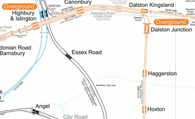
Lines Around N1
I live halfway on the diagonal line between Dalston Kingsland and Essex Road stations. Years ago, there used to be a station at Mildmay Park, between Dalston Kingsland and Csnonbury, which if it still existed would be very useful for me, as it would be about a hundred and fifty metres away.
So my journeys often start from one of the half dozen bus routes, that have stops within fifty metres or so of where I live.
- I’ll take a 38, 30, 56 or 277 to Dalston Kingsland or Dalston Junction stations for the North London Line and East London Line respectively.
- I’ll take a 141 to Manor House station for the Piccadilly Line.
- I’ll take a 38 or 56 bus to Essex Road station for the Northern City Line
- I’ll take a 38 or 56 bus to Angel station for the Northern Line.
- I’ll take a 21 or 141 bus to Moorgate for the Metropolitan and Circle Lines
- I’ll take a 21 or 141 bus to London Bridge for main line trains.
- I’ll take a 21 or 141 bus to Bank for the Central and Waterloo and City Lines
- I’ll take a 56 bus to St. Paul’s for the Central Line
- I’ll take 30 bus to Kings Cross, St. Pancras and Euston for main line trains.
Who said the three most important things when buying a house, are location, location and location?
Strangely, I rarely go directly to Highbury and Islington station, as the station is one of the worst in London for passenger convenience, with long and crowded tunnels and no step-free access to the deep tunnels.
If I need to go North on the Victoria Line, I will sometimes go to Essex Road and then take the Northern City Line for one stop to Highbury and Islington station, where there is a step-free level interchange to the Victoria Line.
There are several of these interchanges in East London, making train and tube travel easier.
Northern City And Victoria Lines At Highbury And Islington Station
This map from carto.metro.free.fr, shows the layout of lines at the station.
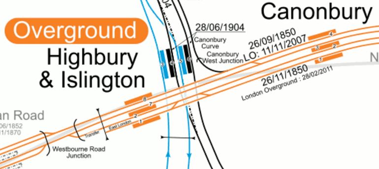
Note how the two Northbound lines and the two Southbound lines of the Victoria and Northern City Lines are paired, so that passengers can just walk through one of several short tunnels that connect the two platforms.
This connection will get more important in the future, as improvements will bring more passengers through the interchange.
- Highbuty and Islington station will be rebuilt, with access to the deep level platforms much improved.
- If traffic said it was needed, the Southbound and Northbound deep-level platforms, which are not far apart might even be connected together and to a second entrance on the other side of Holloway Road.
- The Northern City Line is getting new Class 717 trains, which will give an increase in capacity and I believe that the frequency on the Northern City Line will improve to 6, 8 or even 10 trains per hour (tph), thus making my ducking and diving easier.
- The Northern City Line will connect to Crossrail and for the first time N1 to lots of places, will be one change at Moorgate from the Northern City Line to Crossrail.
- The Victoria Line will increase in frequency to possibly 40 tph and benefit from station improvements at stations like Tottenham Hale, Blackhorse Road and Walthamstow Central.
It should also be noted how the Crossrail connection at Moorgate will help me.
When going to football at Ipswich, I may walk to Essex Road and then get a train to Moorgate, where I will take Crossrail to perhaps Shenfield for a fast train to Ipswich.
But who knows what I’ll do, as there will be several different routes, all of which will have their advantages?
East London Line To North London Line At Highbury And Islington Station
This is only from the East London Line trains arriving from West Croydon in Platform 2 at Highbury and Islington station to Westbound trains on the North London Line in Platform 7.
Although not as powerful as the double interchange at Highbury and Islington station between the Victoria and Northern City Lines, it is typical of well-thought out connections all over the Overground.
Piccadilly And Victoria Lines At Finsbury Park Station
This is a cross-platform interchange, that is heavily used as effectively it gives a simple choice of route through Central London for passengers from the Northern ends of the Piccadilly and Northern Lines. It’s a pity that the interchange between the two lines at Kings Cross St Pancras and Green Park aren’t as simple.
Metropolitan/District And Central Lines At Mile End Station
This picture gives a flavour of the interchange at Mile End station.
Cross-Platform Interchange At Mile End Station
It is a cross-platform interchange, that I use more and more, to go to the East on the Central Line. I usually arrive on a Metropolitan/District Line train from Whitechapel station, which is just a few stops down the East London Line.
Central Line And Shenfield Metro/Crossrail At Stratford Station
This interchange at Stratford station is going to be an integral part of Crossrail, as it will firmly connect the new line to the Central Line, with advantages to both.
This picture shows the interchange on the Eastbound platform.
Central Line To Shenfield Metro/Crossrail Interchange
This interchange is certainly well-used and Crossrail will only increase that use.
Why Is This Not Done More Often?
These interchanges seem to work well!
But what always puzzles me, is why this layout is not used more often. And I don’t just mean in London. In all my travels, I can’t remember getting off a train in Europe and just walking across the platform to get a metro or a tram.
I suspect it could be because to get this type of interchange, you need to build some expensive railway infrastructure.
All of the examples I have given concern where a new line is being added to an existing network.
I am surprised that Crossrail doesn’t use a similar interchange anywhere else on its route.
Look at the Crossrail stations I documented in How Are Crossrail’s Eastern Stations Progressing?
In all stations, the Crossrail and fast lines are in pairs, whereas to get Cross-platform interchange between fast and stopping services, probably needs a different layout. That is not the fault of Crossrail, but the way the Great Eastern Main Line was built decades ago.
At the London end of the East Coast Main Line, the two slow lines are on either side of the two fast lines. At Stevenage, they have put two island platforms between the slow and fast lines, so that passengers have a cross-platform interchange between trains.

Stevenage Station
The Google Map clearly shows the layout.
Reversal Stations
In Crossrail In East Docklands, I said this about Whitechapel station.
Whitechapel station will be Crossrail’s Jewel In The East and the most important interchange for the line in East London.
- It links both eastern branches of Crossrail to the Metropolitan and District Lines.
- It provides an interchange to London’s important but sometimes forgotten East London Line.
- An extended Whitechapel station would provide much better access to the East of the City of London.
But perhaps more importantly, Whitechapel is the reversal station for passengers travelling between one Eastern branch of Crossrail and the other.
A reader has asked me what I mean by a reversal station.
Look at this map from carto.metro.free.fr, which shows the lines around and through Whitechapel.
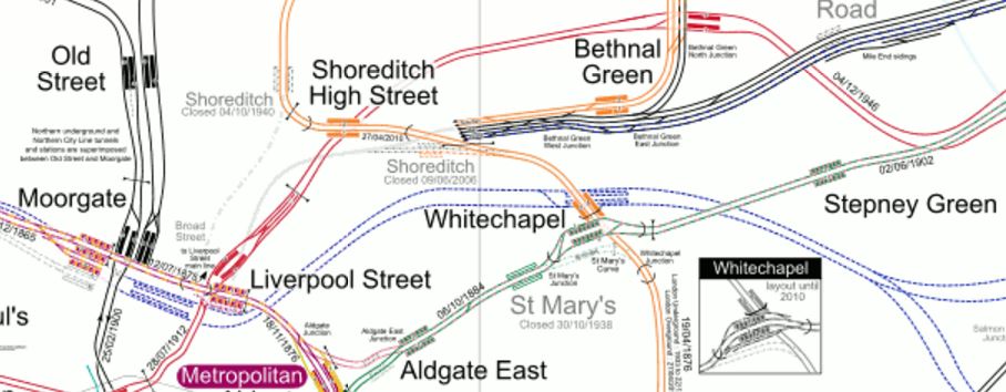
Lines Through Whitechapel
The Crossrail tracks, which are shown in blue, come from the West and go through the two platforms at both Liverpool Street/Moorgate and Whitechapel, before dividing into the two branches to Abbey Wood and Shenfield, a mile or so South of Stepney Green.
Note.
- Liverpool Street and Moorgate will share a massive doubled-ended Crossrail station with an island platform, that connects to all the lines at the two stations it connects.
- Whitechapel has a massive underground station with another island platform, where all Eastbound trains use the North side of the platform and the Westbound trains use the South.
I call Whitechapel a reversal station, as it means that any passenger arriving from the East wanting to go West on the other branch, just walks across the platform and gets an appropriate train.
As a dozen trains an hour will be using each branch, that means the maximum wait will be five minutes, but if say the trains were timed to pair up at Whitechapel, so that an Eastbound Shenfield train was always in the station with or just after a Westbound train Abbey Wood and vice-versa, the interchange time would be determined by how long it took passengers to walk across.
The interchange is totally step-free for transferring passengers and can be paired with a very wide platform to make the interchange easy for everyone.
It is a simple but absolutely brilliant concept!
The designer of the station obviously liked it so much, he did it again at Whitechapel.
Arrive at Whitechapel on an Eastbound Metropolitan or District Line train and if you need to go back West on the other line, you just walk across for the train you want. These trains don’t pair up, but then the signalling wasn’t designed to be this sophisticated in the middle of the last century.
This interchange on the Sub Surface Lines has only started recently and I wonder how often it is used by passengers.
Are there any other stations, where this passenger reversal is or could be used?
Hayes And Harlington
A similar technique could have been used at Hayes and Harlington station to link the two Western branches of Crossrail, which have the following services.
- Four trains per hour serve the Heathrow Branch.
- Two trains per hour serve both Reading and Maidenhead.
But using a similar layout to Whitechapel with a spacious island platform and scheduling the trains appropriately, might effectively give Reading four services an hour to Heathrow, which would involve nothing more than a step-free interchange at Hayes and Harlington.
It would certainly have been more affordable than tunneling into Heathrow from the West.
This map from carto.metro.free.fr shows the lines through Hayes and Harlington and the Junction for Heathrow.
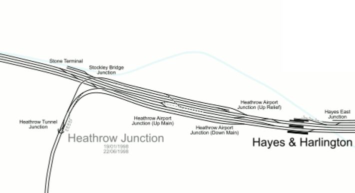
Lines Through Hayes And Harlington And Heathrow Junction
It’s probably too late now to adjust all the tracks and platforms at Hayes and Harlington station and the Stocley Viaduct, but I do believe that something could be setup at the station to improve access to Heathrow from the West until the full tunnelled link is built.
I believe that good design here, could have enabled a much more affordable Western Link for Heathrow, without any need to tunnel into the Airport.
An ideal solution would incorporate.
- Two tracks into Heathrow.
- Step-free and preferably step-across interchange at Hayes and Harlington station for passengers from Reading.
- Connection to Great Western Railway’s local trains in the Thames Valley.
- Contactless ticketing using bank cards between London, Heathrow and London.
- All Crossrail trains from London to serve all terminals.
Point five must be possible, as I’m sure the tunnels under Heathrow have a larger capacity than is being used.
But Heathrow are holding Crossrail, London and Londoners to ransom!
But then we hold all the cards, as no Mayor and few Londoners, would ever support the expansion of Heathrow!
This Google Map shows the current Hayes and Harlington station.

Hayes And Harlington Station
This description of platform use is from Wikipedia.
The station has five platforms, four being through platforms and one being a terminus bay platform. Platforms 1-2 are used only during engineering works; platforms 3 & 4 are for stopping services to and from Heathrow Airport, Reading and Oxford; platform 5 is a bay terminus platform, which is sometimes used during peak times, amended services and during engineering works. Platform 5 is capable of holding an eight-car train; platforms 2, 3 and 4 can hold seven-car trains and platform 1 can hold a five-car trains. All lines at Hayes & Harlington are electrified. On platform 5 there is an alternative entrance leading to High Point Hayes, the entrance has Oyster Pay & Go readers, platforms 3 & 4 are connected by a bridge towards the end of the platforms.
Stations are numbered from the South.
What would need to be done is create an island platform between the two relief lines that will be used by Crossrail.
This would mean that a passenger between Heathrow and Reading, would just walk across the platform and wait for their train. As at Whitechapel, the first train would arrive a few minutes before the second left. It would be easy to arrange with Crossrail’s modern signalling and train control.
Under Crossrail in the Wikipedia entry for the station, these modifications are listed.
- New station building
- 4 new lifts to provide step-free access
- Platforms 1-4 extended
- New 200m bay platform 5 constructed (replacing existing bay)
- New platform canopies to platform 4 and 5
- Track work to widen the island platform 2/3 and to provide access to the new bay platform
Does point six mean that Platform 2 is Crossrail for Reading and Heathrow and Platform 3 is Crossrail for London?
I hope so, as that would give a step-across interchange between Reading and Heathrow.
But there is no mention of the layout of the two fast lines, which are currently served by platforms 1 and 2.
In Hayes And Harlington Station – 28th March 2016, there are several pictures of the station and the lines don’t appear to have been slewed to the South to enable the Crossrail Lines to be either side of an enlarged island platform 2/3.
It was probably just too difficult.
Old Oak Common
There are proposals to add a branch of Crossrail that would go up the West Coast Main Line to perhaps Milton Keynes. The logical place for Crossrail to join the West Coast Mail Line (WCML) is near Old Oak Common station.
I believe this could be another reversal station like Whitechapel, where the Western and WCML branches split to the West of the station.
This map shows some of the proposed track and station layout at Old Oak Common.
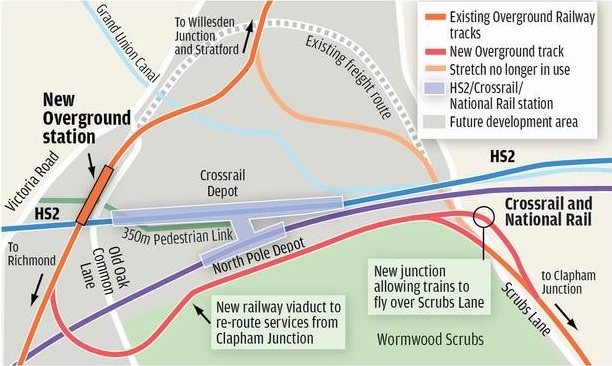
Rail Lines At Old Oak Common
The WCML is off the North of this map.
Get this connection right and there would be step-across access between the WCML to Milton Keynes and all stations to Heathrow on Crossrail.
Willesden Junction On The North And West London Lines
The North London and West London Lines divide to the west of Willesden Junction station.
Passengers between say Richmond and Imperial Wharf stations can use Willesden Junction station as a step-across to reverse direction. The timetable gives five or six minutes for the change, which is acceptable, but not as quick as I believe Whitechapel will be.
St. Pancras Thameslink
When the Thameslink Programme is completed, the Thameslink platforms at St. Pancras International will become a reversal station for passengers wanting to change between the Great Northern and Midland Main Line branches.
But it will not be a simple walk across a platform, but a hike over a footbridge, albeit one with step-free access.
The only Central London station on Thameslink, which will be an island platform will be London Bridge, where platforms 4 and 5 will serve Thameslink.
East Croydon
In an ideal world all Northbound Thameslink services at East Croydon station would call at the same island platform and all Southbound services would call at the opposite face of the island. I think that sixteen trains per hour will use the various Thameslink routes through East Croydon. On a dedicated platform, that is only one train every four minutes and the East London Line handles that with ease!
I think that the number of Thameslink trains through East Croydon is not very ambitious, in contrast to the number through the core of twenty-four trains per hour, which is ambitious, but not unduly so!
But I can’t find any information as to whether this will happen.
Where will passengers wanting to travel between Caterham and Tattenham Corner stations change trains?
It does strike me, that the care applied to the design of Crossrail, is lacking in the Thameslink Programme.
They obviously used ordinary envelopes, rather than special engineering ones!
Just compare the mess that is East Croydon station to the much larger, more complicated and impressive Reading station.
If Croydon is serious about being important, it needs a gateway station like Ealing Broadway, Huddersfield, Leeds, Liverpool, Manchester Victoria, Northampton, Nottingham, Stratford or Reading, rather than an overcrowded badly-designed stop on the Brighton Main Line, that just makes visitors say, they’ll never return.
East Croydon also needs a proper connection to the East London Line. The current terminus of West Croydon is one of the worst designed pieces of railway infrastructure in the world. It’s equivalent to putting a main station for Liverpool in Birkenhead or one for Newcastle in Sunderland.
West Croydon station should be shut as soon as possible and East London Line services transferred to East Croydon.
Manchester Piccadilly
Whilst I’m in attack-dog mode, the two worst platforms in the country are platforms 13 and 14 at Manchester Piccadilly station.
- These platforms were designed to get passengers as fit as possible, by locating them some distance from the main station facilities.
- They are too small and always crowded.
The plans to remedy the overcrowding, include building two new platforms further out at great expense.
This may solve the problem, but I’d like to see answers to these questions first.
- How many trains per hour stop at each platform? A platform like this should be able to handle sixteen trains per hour both ways, as does Canada Water on the Overground.
- How many passengers use this island platform to reverse direction?
- How many passengers get off one train here and get on another in a few minutes? I’ve done that myself on those platforms, a few times.
- How would platform utilisation change with two and three-car trains changed for larger ones?
- Could a reorganisation of services and the Ordsall Curve, increase seats on various routes, but reduce the number of trains through these platforms?
- What difference would contactless ticketing using bank cards make to passenger throughput?
- Is it necessary that every train stopping at Piccadilly always seems to stop at Oxford Road?
As an aside here, I could rightly claim that I’ve written more successful resource scheduling programs, than anybody else ever has!
I know it was designed in the 1960s, but I believe that by applying some modern data analysis and desjgn, that platforms 13 and 14, with more space, escalators and lifts everywhere, better facilities and perhaps a direct entry to the Metrolink station underneath, could go a long way to handling more traffic.
Could A Chiltern Metro Be Created?
In the Wikipedia entry for Chiltern Railways, there is a section under plans labelled Active.
Three of the entries in this section refer to the stations between London Marylebone and West Ruislip or a Chiltern Metro.
- Lengthening of platforms at South Ruislip, West Ruislip, Sudbury Hill Harrow, Sudbury and Harrow Road and Northolt Park to accommodate eight vehicles, thereby obviating the need for vehicles to be locked out of use on departure from London Marylebone.
- The restoration of the quadruple track between South Ruislip (Northolt Junction) and West Ruislip, allowing trains to call at both stations without blocking the line. Triple track currently exists at West Ruislip, with the up platform loop still in situ, and at South Ruislip, with the Down Main through line also in situ. This would involve the reconstruction of the new down platform at West Ruislip, and the reconstruction of the up platform at South Ruislip. This ‘Chiltern Metro’ service was not programmed into the last round of franchising agreements.
- New Chiltern Metro Service that would operate 4+tph for Wembley Stadium, Sudbury & Harrow Road, Sudbury Hill Harrow, Northolt Park, South Ruislip and West Ruislip. This would require a reversing facility at West Ruislip, passing loops at Sudbury Hill Harrow, and a passing loop at Wembley Stadium (part of the old down fast line is in use as a central reversing siding, for stock movements and additionally for 8-car football shuttles to convey passengers to the stadium for events)
So could a Chiltern Metro be created between Marylebone to at least as far as West Ruislip.
In A Modern Electrified Metro Network Using IPEMU Technology, I postulated what a local metro would be like.
- Services are run by modern four-car electric trains, that meet all current and envisioned access and customer requirements.
- Services are run by a standard train, so if the network expands, more trains can be easily built!
- The ability to lengthen the trains, say for an important sporting or cultural event.
- Enough trains to run four trains per hour services on important lines and perhaps one per hour on lines that get much lesser use.
- Most services run out and back from the central station.
- As little disruption as possible, whilst creating the metro.
So does Chiltern’s broad plan of a metro between Marylebone and West Ruislip fit those rules?
- Modern four- car trains like Class 710 trains could run the service.
- Bombardier’s Aventra, which is the basis of the Class 710 will be around for some time, so extras will probably be available.
- Three-train formations of twelve-cars can probably be created, but eight-car would probably be an initial maximum need.
- Not a problem on a short metro line, which would probably need four sets for a four train per hour service.
- All services go to and from Marylebone.
- I’m sure, if IPEMU technology were to be used, electrifying between Marylebone and at least West Ruislip, could be done without major blockades of the line.
It would appear that the objectives can be easily met and using standard Aventra trains with an IPEMU capability would help.
The Current Service Pattern
Wikipedia lists the current services, outside the peak from Marylebone as the following.
- 2 trains per hour (tph) to/from Birmingham (one fast, first stop Bicester North, and one semi-fast, first stop High Wycombe).
- 1tph to/from Banbury (semi-fast, first stop High Wycombe). Some extend to Stratford-upon-Avon.
- 1tph to/from Bicester North (semi-fast, first stop Gerrards Cross)
- 1tph to/from Princes Risborough (semi-fast, first stop Gerrards Cross)
- 1tph to/from High Wycombe (stopping service)
- 1tph to/from Gerrards Cross (stopping service)
- 2tph to/from Aylesbury (via Amersham). One of these services in each hour continues on to serve Aylesbury Vale Parkway
- 2tph to/from Oxford Parkway (fast)
So that is nine trains an hour through West Ruislip, two up the Aylesbury Line and eleven between Marylebone and Neasden.
What Would A Chiltern Metro Look Like?
Wikipedia is fairly precise, that the inner section between Marylebone and West Ruislip would stop at the following stations.
- Wembley Stadium
- Sudbury & Harrow Road
- Sudbury Hill Harrow
- Northolt Park
- South Ruislip.
Although other documents on the web suggest a first stop at a new station of West Hampstead Interchange.
My journey today on the line took twenty minutes.
Some questions occur to me.
- Will extra stations be added?
- Will some trains go on to places like Gerrards Cross, High Wycombe and Princes Risborough?
- With modern signalling and extra tracks in places, what is the capacity of the various sections of the line.
- How many extra services to what destinations, do Chiltern want to run?
Chiltern’s answers will be better than my speculation.
What Trains Should Work The Metro?
Ian Walmsley in the April 2015 Edition of Modern Railways writes enthusiastically about Bombardier’s new Aventra train, where under Potential he starts with this sentence.
As a platform, the design will be offered in various guises for future contracts up to 125 mph.
He then goes on to say this about a possible future order for Aventras.
But the interesting one to me is East Midlands Trains electrics. As a 125 mph unit it could cope well with Corby commuters and the and the ‘Master Cutler’ crowd – It’s all about the interior.
Could Chiltern use a similar train, that was equally at home, running at over hundred miles per hour to and from Birmingham or trundling through North West London on the Metro?
Consider.
- The advantages of an identical fleet that can work all lines and services must be immense!
- I believe a universal high-class interior is possible, as Class 387 trains are almost there. Remember, Chiltern don’t do low class!
- All trains would have an IPEMU capability to reduce electrification and running costs.
- In a few years time, all IPEMUs will have automated pantograph up and down, to use electrification where available.
- Some could be dual-voltage to work on London Underground lines through Amersham.
Chiltern passengers certainly live in interesting times.
The Chiltern Metro And the Chiltern Main Line
In the following sections, I shall now look at the various parts of the route of the proposed proposed Chiltern Metro and its shared route with the Chiltern Main Line as far as West Ruislip.
Marylebone Station To Neasden
Marylebone station has a simple track layout, that is unlike most of the other London termini.
This Google map shows the station.
Marylebone Station
Complicated it is not, as it appears just two lines lead into and out of the station, and there are no major junctions until Neasden South Junction.
This map from carto.metro.free.fr shows the lines at Neasden.
Lines Through Neasden
Note how the Chiltern Lines, which are shown in black, divide opposite Neasden Depot.
- The Chiltern Main Line goes off to the west through Wembley Stadium station.
- The London to Aylesbury Line goes off to the North West through Wembley Park station.
It certainly isn’t a complicated layout.
If you are going to use IPEMUs on Chiltern, I believe that it would be relatively easy to electrify the five miles of the lines from Marylebone to Neasden and what was felt necessary of the tracks in the platforms, to ensure that the trains reached Neasden South Junction on the way to West Ruislip with the on-board energy storage nearly full.
If this could be achieved, then some or all of the line and its stations between Neasden and West Ruislip could be left without electrification.
West Hampstead Interchange
If any station sums up the complicated nature of the UK’s railways it is the proposed West Hampstead Interchange.
This map from carto.metre.free.fr, shows the various lines go through the area.

West Hampstead Lines
From North to South the stations and lines are.
- West Hampstead Thameslink station is electrified to 25 KVAC and Midland Main Line services, Thameslink services and freight services between the Gospel Oak to Barking Line and the Dudding Hill Line go through.
- West Hampstead station is electrified to 25 KVAC and North London Line services go through.
- West Hampstead tube station is electrified to 630 VDC and Jubilee Line services go through.
- The Metropolitan Line passes to the south of the tube station. There are no platforms.
- The Chiltern Lines are the Southernmost lines and are not electrified. There are no platforms.
The layout of the Chiltern Lines from Marylebone to Neasden may be uncomplicated, but West Hampstead is a lot of railway to sort.
It might be easy to add platforms for the Metropolitan Lines and Chiltern, but given the narrow pavements and large amount of traffic in the area, creating a new West Hampstead Interchange won’t be easy.
The Wrong Kind Of Electrification?
If the Chiltern Line is to be electrified, it is very much entwined with the London Underground.
- From Marylebone to Neasden the Chiltern Lines follow London Underground’s Jubilee and Metropolitan Lines, which have London’s 630 VDC fourth-rail electrification.
- After Neasden, Chiltern trains on the Aylesbury Line actually run on electrified London Underground tracks between Harrow-on-the Hill and Amersham..
- Between South Ruislip and West Ruislip stations the Chiltern Lines run alongside the Central Line.
- According to Wikipedia, London Underground are updating their fourth-rail electrification to deliver the standard 750 VDC commonly used by third-rail electrification in the UK.
Given that a major cost of electrification is getting power to the electrification, I just wonder if any electrification of the Chiltern Lines would piggy-back off the London ~Underground in London and off the 25 KVAC systems around Birmingham and the East-West Rail Link.
The sections that would not be electrified, would be handled by IPEMUs working from their on-line energy storage.
As Digby said to Dan Dare, “It’s not very pretty! But it works!”
I can’t believe that engineers working on the development of Chiltern Railways are not looking at the possibility of using some of the infrastructure, London Underground has already installed.
Bombardier are already building some dual-voltage Class 710 trains for the London Overground, so rolling stock won’t be a problem.
Wembley Stadium Station To Sudbury Hill Harrow Station
This Google Map shows the line Chiltern Main Line between Wembley Stadium to Sudbury Hill Harrow stations.
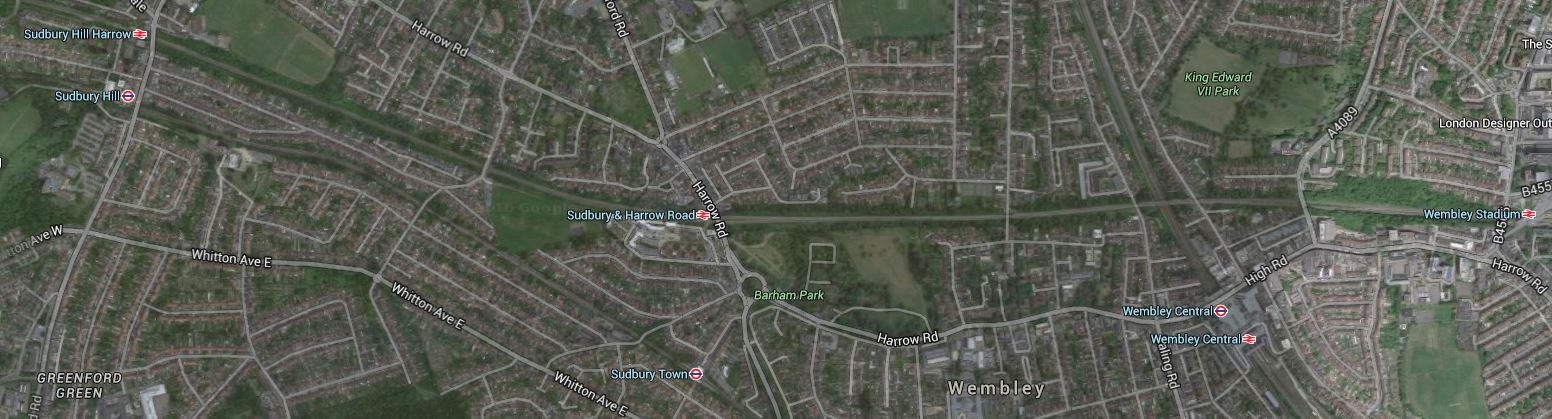
Wembley Stadium Station To Sudbury Hill Harrow Station
The only station in the middle is Sudbury & Harrow Road.
The line in this section is very reminiscent of the Gospel Oak to Barking Line and it shows as a green scar on the map.
This map from carto.metro.free.fr shows the same area.
Chiltern Main Line Through Wembley And Harrow
These are some pictures I took of the line.
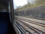
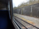
If it were to be decided to electrify this part of the line, I suspect it would no more difficult than the Gospel Oak to Barking Line.
Electrification Or Passing Loops?
Some stations like Sudbury Hill Harrow and Wembley Stadium are down to have passing loops to allow faster trains to overtake stopping ones.
But as the line is likely to be run by electric trains, does their superior braking and acceleration mean that at some stations, the need for passing loops is avoided.
Obviously, Chiltern and Network Rail have done extensive calculations and optimised the number of passing loops against the trains that will be run on the line.
Trains with an IPEMU capability, which includes regenerative braking, may also reduce the need for passing loops.
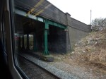
Wembley Stadium Station
Wembley Stadium station is planned to be the first station on the Chiltern Metro, although others think that the first station should be West Hampstead.
This Google Map shows the station.
Wembley Stadium Station
Note.
- There is a large space between the two platforms and lines in the station.
- There is certainly enough to create one or two passing loops, so that fast trains can pass trains calling at the station.
- The station has probably been designed for twelve-car trains.
- There would be no need to electrify through the station.
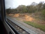
I took these pictures as my train went through today.
It certainly is a wide space in the middle.
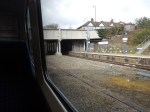
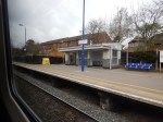
Sudbury And Harrow Road Station
Sudbury And Harrow Road Station is not a very busy station and my train didn’t stop. I also didn’t get any pictures.
This Google Map shows the rather cramped layout of the station, squeezed between the two lines.
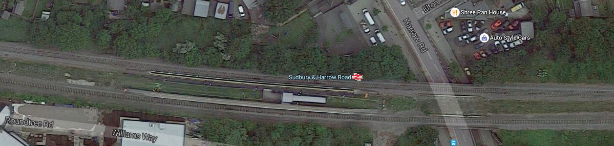
Sudbury And Harrow Road Station
Note.
- The station in an island layout.
- The platforms could be lengthened for the Metro.
- A passing loop could be squeezed through if possible.
- Electrification would probably be possible if required.
Hopefully the changes would attract more passengers to this station.
I visited this station once before and wrote about it in The Station With The Least Passengers In London.
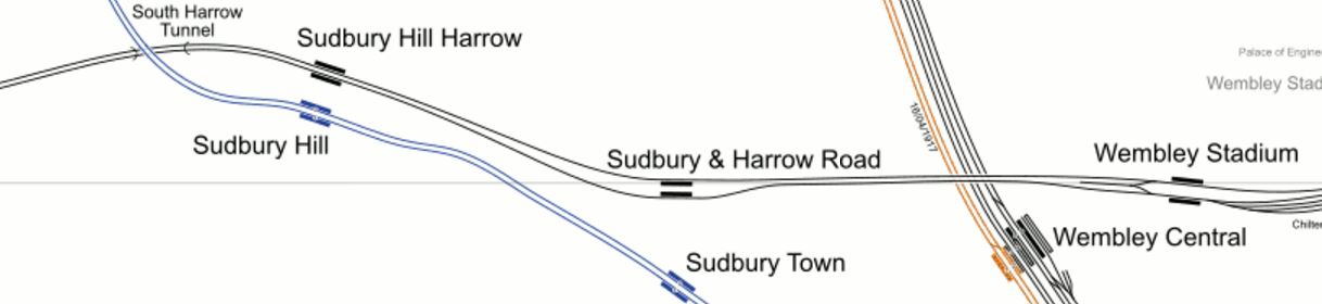
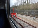
Sudbury Hill Harrow Station
Sudbury Hill Harrow Station is a basic station.
This Google Map shows the layout of the station and the area around it.
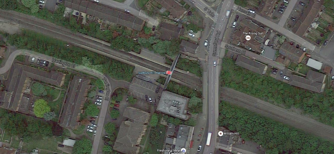
Sudbury Hill Harrow Station
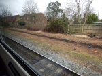
I took these pictures as I passed through today.
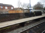
This station is down for platform lengthening and the addition of passing loops, so I suspect this will mean a complete rebuild.
This could be tricky, as the line is a main line with nine trains an hour in both directions.
But there would appear to be space to the East of the road bridge and if the station was to be rebuilt provision could be made for electrification.
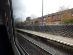
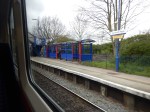
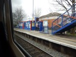
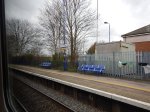
Northolt Park Station
Northolt Park Station is another basic station.
This Google Map shows the station.
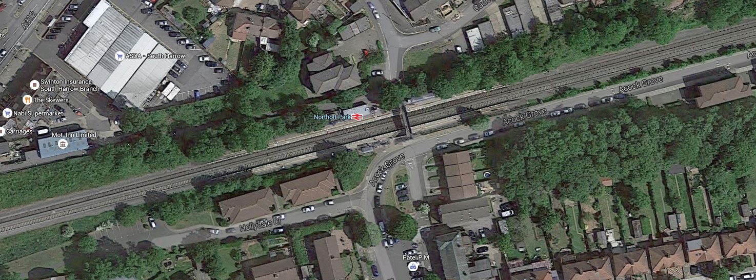
Northolt Park Station
I took these pictures today.
This station is another one, that is down for lengthened platforms. But it will be tight and there is no place for passing loops.
Northolt Junction
Northolt Junction is where the Chiltern Main Line meets the Acton-Northolt Line to form the Great Western and Great Central Joint Line, that goes on to High Wycombe and eentually Birmingham.
This Google Map shows the junction.
Northolt Junction
Note the waste recycling plant in the middle of the junction.
This map from carto.metro.free.fr shows the lines in the area.
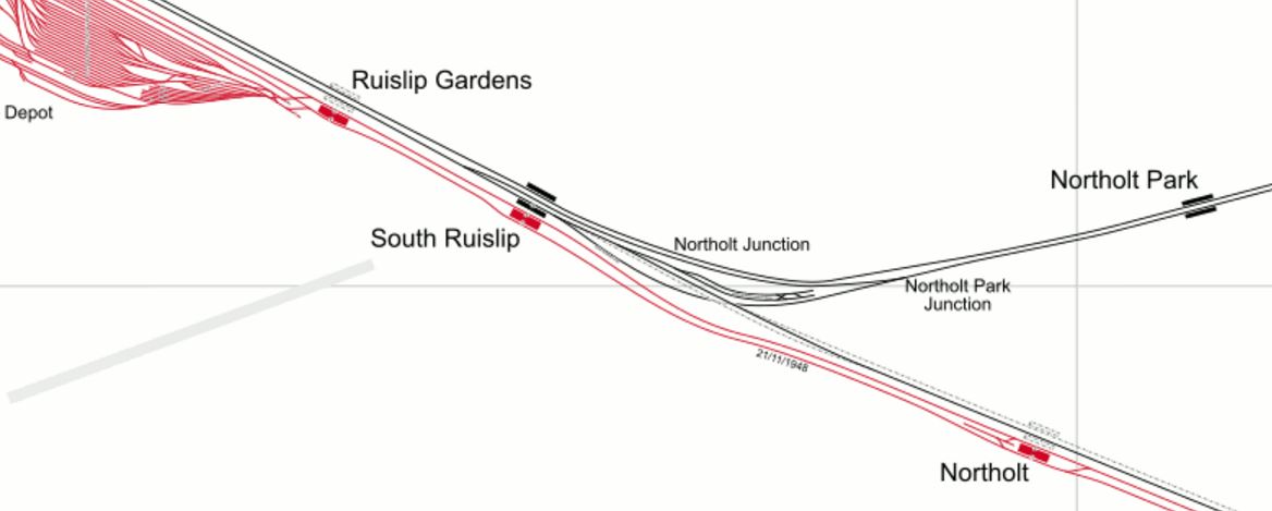
Northolt Junction
Note the large Ruislip Depot for the Central Line.
These are pictures, I took from the Chiltern train.
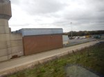
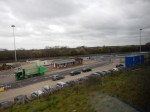
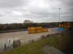
It’s certainly all rather cramped in the middle of the junction.
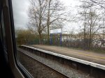
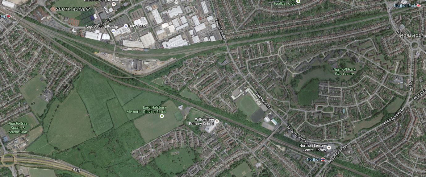
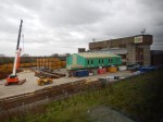
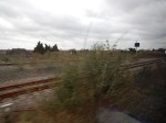
South Ruislip Station
South Ruislip Station is an interchange with the Central Line, located to the West of Northolt Junction.
I only managed one quick picture as my train rushed past.
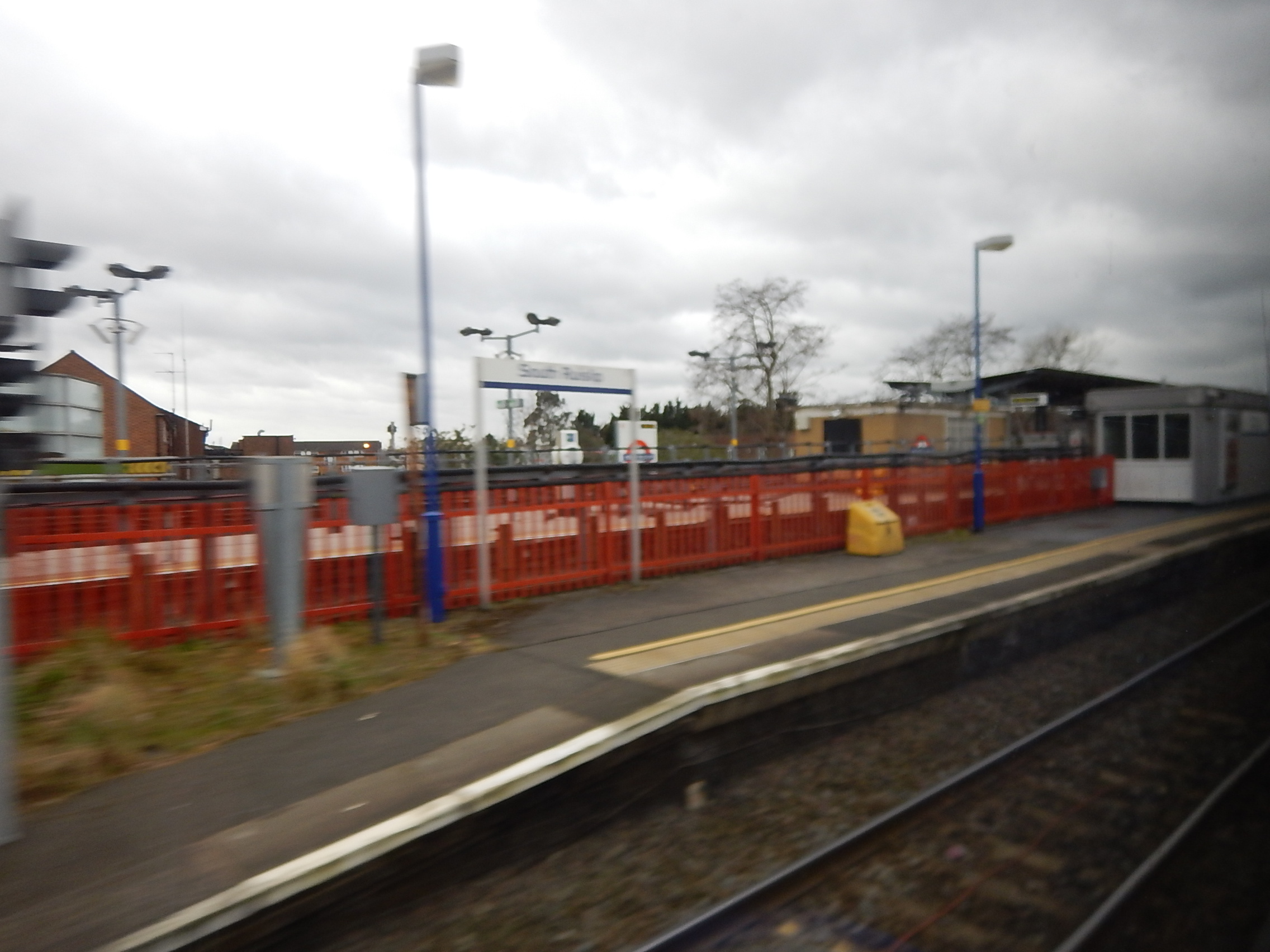
South Ruislip Station
This Google Map shows the station and the surrounding area.
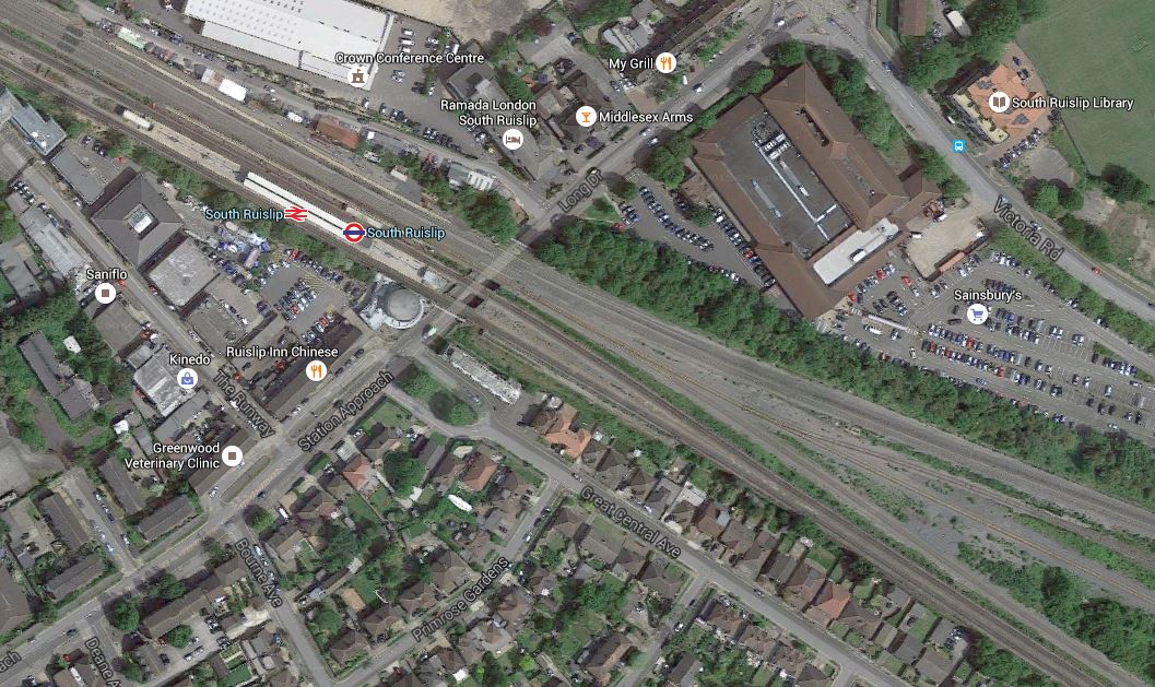
South Ruislip Station
Note.
- Going East the lines divide here, with the Northern tracks going to Marylebone and the Southern ones going to Paddington, alongside the Central Line.
- The platforms at South Ruislip station will be lengthened for the Chiltern Metro.
- The heavy rail lines through here will be four-tracked and there is certainly space for that.
Given that the Acton-Northolt Line leads from here to an electrified Paddington and Old Oak Common, there could be pressure to fully electrify through South Ruislip. If that were to be decided, I can’t see that being a difficult task compared to some in the UK.
West Ruislip Station
West Ruislip Station has been proposed as the outer terminus of the Chiltern Metro.
This Google Map shows the station and the surrounding area.
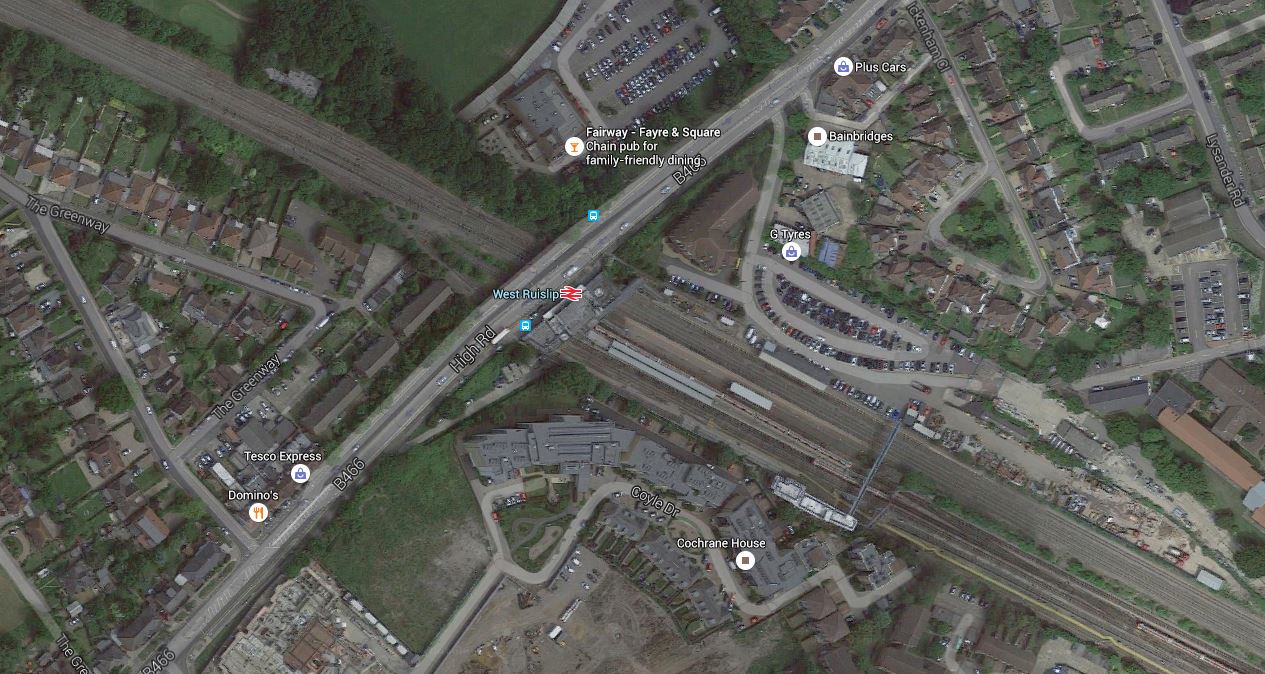
West Ruislip Station
These are pictures I took of the station.
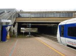
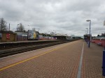
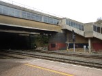
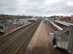
Note.
- A turnback facility is needed and this would probably be a siding on the West side of the station. It should be no problem to install.
- Platforms need to be lengthened for eight-car trains.
- There is plenty of space for two fast tracks through the centre of the station.
- Electrification if required wouldn’t be a problem.
I changed trains from the Chiltern service to a Central Line train.
Sorting Out Lines At West Ruislip
Before I went to West Ruislip station, I hadn’t realised how many lines pass through the area.
This Google Map shows a wider view of West Ruislip station.
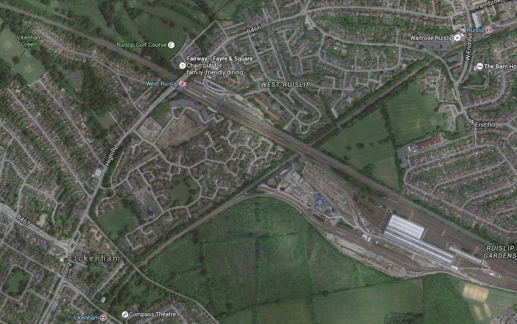
Lines Through West Ruislip
These lines are shown on the map, or connect to these lines within a few stations.
- The Chiltern Main Line opened in 1906 as the Great Western and Great Central Joint Railway.
- The Great Western and Great Central Railway used to run passenger trains to Paddington along the Acton-Northolt Line.
- The Central Line opened in 1948 to Central London.
- The Piccadilly Line crosses to the East of West Ruislip station opened in 1933.
- The Metropolitan Line shares tracks with the Piccadilly Line opened in 1910.
- The Greenford Branch of the Great Western Main Line opened in 1903, joins the Central Line, four stations from West Ruislip station.
It shows how the various private companies went their own way. I’m sure if Borken had been in charge of London all of those years ago, we’d have a better pattern of rail lines in the area.
But some dreamers have plans. I discuss them in the next three sections.
Central Line To Uxbridge
In the Wikipedia entry for West Ruislip station, this is said.
The London Borough of Hillingdon announced in June 2011 that it would be lobbying Transport for London to have the Central line extended from West Ruislip to Uxbridge tube station. Such a project would require a business case approved by TfL and the completion of signal upgrade work on the Metropolitan line.
It is probably a valid aspiration, but could similar connectivity be created by perhaps adding platforms on the Metropolitan/Piccadilly Line, where it passes under the Chiltern Main Line and Central Line to the East of West Ruislip station and connecting everything together with a moving walkway?
If this were to be combined with the desired lengthening of the Chiltern platforms, this could be a worthwhile project, if the numbers add up.
Denham To Uxbridge
In the Wikipedia entry for Chiltern Railways under Active Plans, this is said.
Re-opening the former Great Western Railway branch line to Uxbridge High Street, continuing the route to Heathrow Airport. This would give Birmingham a direct rail link with Britain’s largest airport.
Uxbridge High Street station closed completely in 1964.
I would assume, that this would use the route of the Uxbridge (Vine Street) Branch to get to the Great Western Main Line at West Drayton station, from where it could use either of these routes to get to the Airport.
- Crossrail
- An extension of the Staines and West Drayton Railway
This could be the sort of ambitious plan that appeals to Chiltern.
This is a Google Map of Uxbridge Town Centre.
Uxbridge Town Centre
Note Uxbridge Underground station, High Street and Vine Street are all close together.
In Germany, they wouldn’t mess about, but would use a tram-train on the route.
- West Ruislip to Uxbridge as a train on a rebuilt rail line.
- Through Uxbridge Town Centre as a tram.
- Uxbridge to West Drayton and Heathrow as a train on a rebuilt rail line.
Obviously, the route could be adjusted to serve property, leisure and employment hotspots.
Greenford Branch Line
The Greenford Branch Line is like an elderly aunt, who gets forgotten to be asked to family parties, but when she does come, is extremely useful and entertaining, because she can do things, that others can’t.
The Wikipedia entry under Future says this.
In 2017 Crossrail is due to begin using two of the four tracks of the Great Western Main Line and the Greenford service will terminate at West Ealing, rather than continue to Paddington, to obviate interference with Crossrail, and to create track capacity for increased services to Heathrow. In compensation the branch line service will increase from two to four trains per hour. Ealing Council desires to have the line connected to the south west to Clapham Junction via the West London Line, and to the north west to West Ruislip.
I think Ealing Council’s plan is a non-starter, if it envisages trains travelling along the Great Western Main Line.
But look at this map of the rail lines from carto.metro.free.fr.
Lines In West London
Note that it would appear that the track layout at Greenford could allow trains to go from the Greenford Branch towards West Ruislip and South Ruislip in the West or North Acton and Old Oak Common in the East.
These are pictures I took of the lines and the junction at Greenford station.
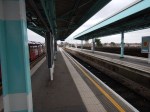

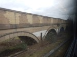
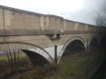
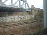
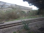
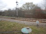
The current Greenford Branch platform would probably be augmented or replaced by platforms on the Acton-Northolt Line.
This Google Map shows the area around Greenford station.
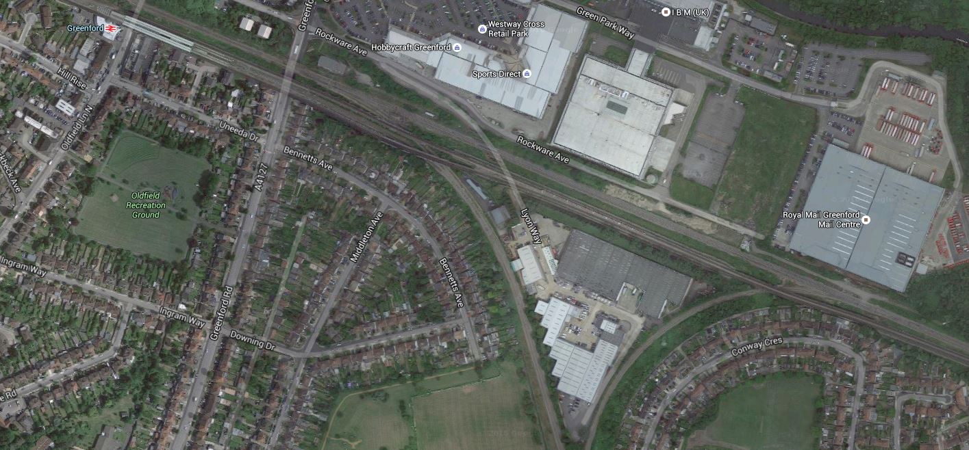
Greenford Station And The Junction To The East
It would appear that parts of the junction have been built on, but it looks like it could easily be made possible for trains to pass in all directions, between the Acton-Northolt Line and the Greenford Branch.
The Greenford Branch is under three miles long and appears to be mainly double-track, but it does have a level crossing close to the Southern end.
I also took some pictures of the bay platform at West Ealing station, that is currently under construction.

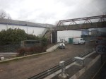
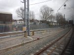
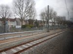


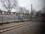
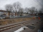
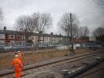
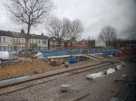
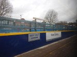
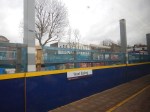
I can’t be sure yet, but it does appear that the platform will be electrified.
So what does this say about how the rumoured four trains per hour that work the branch will be powered?
I think there are two possibilities.
- Diesel power as now.
- IPEMUs charged in the bay platform.
Given that one of London Overground’s Class 710 trains with an IPEMU capability and one of Great Western Railway’s Class 165 trains, that currently work the line, could use the same infrastructure, the choice of train would be up to the operator.
One problem that would have to be addressed is the short platforms at Drayton Green, Castle Bar Park and South Greenford.
At least if the branch was not electrified, there would be no wires to get in the way.
Look at this Google Map.
Park Royal To Old Oak Common And Wormwood Scrubs
Note.
- The red arrow points at Park Royal, which at 500 hectares, is the largest business park in London.
- The green area in the East is Wormwood Scrubs, which is one of the largest areas of common land in London.
- North of Wormwood Scrubs is Old Oak Common, which is mainly old railway land, that is being regenerated.
- Old Oak Common station, with connections to HS2, the West Coast Main Line, the Great Western Main Line, North London Line, West London Line, Crossrail and other lines is being created to serve the developments in the area.
Across the South of Park Royal and connecting to Old Oak Common station, runs the Acton-Northolt Line.
If transport planners and railway designers, can’t make a feast of these tasty ingredients, I’d be very surprised.
I said that the choice of rolling stock would be down to the operator.
As Ealing Council would like to see the Greenford Branch go to Clapham Junction, the obvious route is to go via the Acton-Northolt and West London Lines, stopping at appropriate stations en route, like Old Oak Common and possible new ones; South of Park Royal.
This would be a good fit with London Overground services and their four-car Class 710 trains would be ideal for the route.
With the full development of Old Oak Common station, this would not only give access to West Coast Main Line and HS2 services, but also direct access to the North London Line from West Ealing and West Ruislip.
The latter connection would make so many of those journeys across the North of the capital, so much easier and avoid going by the centre.
I think Chiltern too, will make a bid to get into running services on the Greenford Branch and the Acton-Northolt Line, as it would give them a very useful destination in London of Old Oak Common.
These services would also be a good fit with Chiltern’s services and trains.
Conclusion
The Chiltern Metro is certainly possible from an infrastructure point of view.
I also believe that with selective and appropriate electrification, that a 100 mph version of Bombardier’s new Aventra train with an on-board energy storage or IPEMU capability could handle all their services.
My project management and engineering knowledge (Note! Not experience!), also leads me to believe that most of the upgrade to electric trains could be done without too many blockades and disturbance, as much of the line is already to a very high standard with sufficient loading gauge to accept Aventras, when running on the on-board power source.
Just because you want to swap your diesel Mercedes for an electric Tesla of vaguely the same size, it doesn’t mean you have to move house or even build a new garage, as both cars run on the same roads. You just make sure the battery gets charged, rather than fill it up with fossil fuel.
It’s the same if you replace your diesel train with an Aventra IPEMU. Except that in places, you can charge your train as you’re running on any traditionally-electrified line.
The only problem, is to make sure, your trains get enough chances to charge their on-board energy storage devices. But railways have had the organisation of trains to various places down to a fine art for well over a hundred years.
It’s called timetabling!
A Trip To Aylesbury Vale Parkway Station
Aylesbury Vale Parkway station is one of Chiltern Railway’s termini in Buckinghamshire.
It is on the London to Aylesbury Line with services to Marylebone via Amersham, with a journey time of five minutes over the hour.
Plans also exist for the station to be calling point on the proposed service between Marylebone and Milton Keynes. The plans for the station in Wikipedia say this.
East West Rail plans to extend passenger services northwards to Bletchley and Milton Keynes by 2019 using parts of the former Varsity Line. The platform has been built to accommodate a second track if ever implemented, which would create an island platform. At present trains (currently run only as specials onBank Holidays) between Aylesbury and Quainton Road cannot serve Aylesbury Vale as there is no platform on the through route.
The track between Aylesbury and the new station was upgraded to continuous welded rail with a maximum line speed for DMU passenger trains of 60 mph (97 km/h). It is proposed that when services are extended to the north, trains will run via High Wycombe and not Amersham. Trains currently serving the station will thereafter terminate at Aylesbury.
These are some pictures I took of the station.


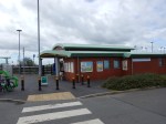
It is just a simple affair with a bus stand, car parks and the usual facilities, that appears will be soon surrounded by houses.
Chiltern Railways And Electrification
Before discussing how services will link up and down the London to Aylesbury Line, I will look at Chiltern Railways and electrification.
Under Developments and Announcements in the Wikipedia Entry for the East West Rail Link, this is said.
On 10 January 2013 Network Rail announced its intention to construct the western section between Bedford and Oxford, Aylesbury and Milton Keynes, as part of their five-year strategic business plan (2014–2019). The target date for train services to be operational on this section is December 2017. Electrification of the line between Oxford and Bedford was also included in the budget and target completion date was March 2017.
So electrification of the East West Rail Link is included in the project, even if the dates in the announcement are very much out of date now.
Given the following facts about the Chiltern Main Line, I believe it is likely that at some point, everybody will look seriously at providing electric trains from Marylebone to Birmingham Snow Hill station.
- The line has a close relationship with the East West Rail Link and other electrified or soon-to-be electrified lines.
- Chiltern finds it difficult to acquire more diesel-powered trains to fulfil their ambitions.
- Chiltern would like to run faster, larger, more efficient and greener electric multiple units.
Under Electrification in the Wikipedia entry for Chiltern Railways, this is said.
No section of the line is electrified, but in 2010 the chairman of Chiltern Railways, Adrian Shooter, indicated that electrification is being considered, though not in the immediate future. He added: “We could do some very interesting things with high-acceleration EMUs and possibly some further infrastructure work.
At some time in the next ten years, we’ll probably see electric trains between Marylebone and Birmingham Snow Hill.
But there will not necessarily be full electrification, as I believe IPEMU technology will change the way electrification is carried out.
Consider as well that the Chiltern Main Line is just one hundred and eighty kilometres long and the current maximum range of an IPEMU is being quoted as about sixty miles or just under a hundred kilometres, so with the following electrification.
- Marylebone and for perhaps twenty miles or so to handle local metro services.
- Birmingham Snow Hill, Birmingham Moor Street and the Snow Hill Lines, where there are local metro services.
- Banbury to Leamington Spa and other places, so that freight trains powered by bi-mode Class 88 locomotives, could use the line efficiently.
The Local lines from Marylebone and the Snow Hill Lines would be electrified using the techniques in A Modern Electrified Metro Network Using IPEMU Technology
IPEMUs would be able to run the full length of the line without the need for full electrification in an environmentally-sensitive area, inhabited by touchy people.
Northward To The East West Rail Link And Milton Keynes
Northward from Aylesbury Vale Parkway station, the Wikipedia entry for East West Rail Link, says that the line will be single track and allow 90 mph working. But as my pictures and a quick gander on Google Maps show, there is quite a bit of space available around the current single track. So as the East West Rail Link seems to be being designed as a double-track 100 mph railway, with full electrification, I think there are three possible options between the East West Rail Link and Aylesbury Vale Parkway and Aylesbury stations.
- Double-track 100 mph with electrification.
- Single-track 90 mph with electrification.
- Single-track 90 mph without electrification.
I think the line will be built with some form of electrification, so that electric trains can run from Aylesbury to Milton Keynes.
The line is also used by some freight trains, so double-track might be a good idea.
Aylesbury To London Via Amersham
Returning from Aylesbury today, I was surprised to see that the train ran from Amersham to Harrow-on-the-Hill on the same tracks as the Metropolitan Line. In fact for sixteen of the thirty-nine miles of the line from Marylebone to Aylesbury Vale Parkway, the line has full London Underground electrification.
Amersham to Aylesbury is about fifteen miles, with the distance between the two Aylesbury station being four miles, which means that Harrow-on-the-Hill to Marylebone is just a few miles.
So if an IPEMU could use the London Underground’s rail-based electrification, starting at Milton Keynes the train would easily arrive at Harrow-on-the-Hill with a full battery, that would take the train to Marylebone and back.
I don’t believe that the technical problems of an IPEMU starting at any station between Aylesbury and Milton Keynes and going to Marylebone and back are insurmountable.
Aylesbury To London Via High Wycombe
This uses the single-track Aylesbury to Princes Risborough Line, which is about a dozen miles long, before running to Marylebone along the Chiltern Main Line, which is another forty miles or so.
So some electrification will be needed.
According to Wikipedia, Chiltern have various plans to improve their network.
- The restoration of the quadruple track between South Ruislip (Northolt Junction) and West Ruislip, allowing trains to call at both stations without blocking the line. Triple track currently exists at West Ruislip, with the up platform loop still in situ, and at South Ruislip, with the Down Main through line also in situ. This would involve the reconstruction of the new down platform at West Ruislip, and the reconstruction of the up platform at South Ruislip. This ‘Chiltern Metro’ service was not programmed into the last round of franchising agreements.
- Restoration of fast through lines at Beaconsfield as part of a longer-term aspiration for a 90-minute journey time between London and Birmingham
- Double-track the line from Princes Risborough to Aylesbury.
- New Chiltern Metro Service that would operate 4+tph for Wembley Stadium, Sudbury & Harrow Road, Sudbury Hill Harrow, Northolt Park, South Ruislip and West Ruislip. This would require a reversing facility at West Ruislip, passing loops at Sudbury Hill Harrow, and a passing loop at Wembley Stadium (part of the old down fast line is in use as a central reversing siding, for stock movements and additionally for 8-car football shuttles to convey passengers to the stadium for events)
Some would also fit well with adding electrification, so I think that enough electrification can be added to allow an IPEMU to go from Aylesbury to Marylebone.
Oxford To London
Given that there will be electrification between Oxford and Bicester Village stations courtesy of the East West Rail Link, IPEMUs could start at Oxford and reach Princes Risborough, from where they used the same methods as Aylesbury and Birmingham services to get to London.
This article on the BBC, which is entitled Cowley line passenger train service planned for Oxford, says this.
Chiltern Railways has revealed plans for a passenger service to run on the Cowley branch in Oxfordshire.
The line, currently only used for freight, would see two new stations on the route at Oxford Science Park and Oxford Business Park.
So if this service goes to London, it would certainly be another job for an IPEMU.
Watford Junction To Amersham And Aylesbury
The Croxley Rail Link has been designed so it can have a link to Amersham. Wikipedia says this about the link.
A further proposal is to use the existing but seldom-used Metropolitan line chord which allows trains to run from Watford towards Amersham via Rickmansworth. In conjunction with the Croxley Rail Link, this route would allow direct services between Watford Junction and Amersham, thus improving local public transport in Hertfordshire and Buckinghamshire.
These are pictures I took, as the train passed the junction of the branch line to Watford.
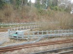
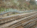
It would certainly be a new use for a substantial piece of infrastructure, but would it do much more than link Amersham to Watford Junction.
Chiltern Trains could run an IPEMU from Watford Junction to Aylesbury Vale Parkway calling at all stations, but as passengers could also get to Aylesbury from Milton Keynes, I wonder if it would be well used.
Rail Lines In The City Of London Will Be Transformed
This map from carto.metro.free.fr shows the various rail lines in the City of London.
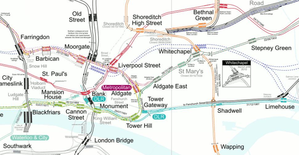
Lines In The City
Londoners and those who know the City well, will be able to pick out the lines in the map, but to help those who don’t, here’s a brief guide.
Note the North-South routes.
- Thameslink through Farringdon, City Thameslink and Blackfriars.
- Northern City Line through Old Street to terminate at Moorgate.
- Northern Line through Old Street, Moorgate, Bank and London Bridge
- East London Line through Shoreditch High Street, Whitechapel, Shadwell and Wapping.
And the East-West routes.
- Metropolitan Line through Farringdon, Barbican, Moorgate, Liverpool Street, Aldgate, Aldgate East and Whitechapel.
- Central Line through St. Paul’s, Bank, Liverpool Street and Bethnal Green.
- District Line through Blackfriars, Mansion House, Cannon Street, Monument, Tower Hill, Aldgate East and Whitechapel.
- DLR stretching east from Bank and Tower Gateway.
- Jubilee Line through Southwark and London Bridge.
There are also two lines that provide links out of the area.
- Circle Line through Farringdon, Barbican, Moorgate, Liverpool Street, Tower Hill and Blackfriars.
- Waterloo and City Line between Waterloo and Bank.
The biggest transport development London in recent years, is about to create a high-capacity link through the area.
Most people think of Crossrail, as just an east-west line across London.
Crossrail will connect Heathrow, Reading, Paddington and Bond Street in the West with Essex and Kent passing through Farringdon, Moorgate/Liverpool Street and Whitechapel.
But Crossrail will do a lot more for the City of London.
Bank
This map from carto.metro.free.fr shows the lines around Bank station.
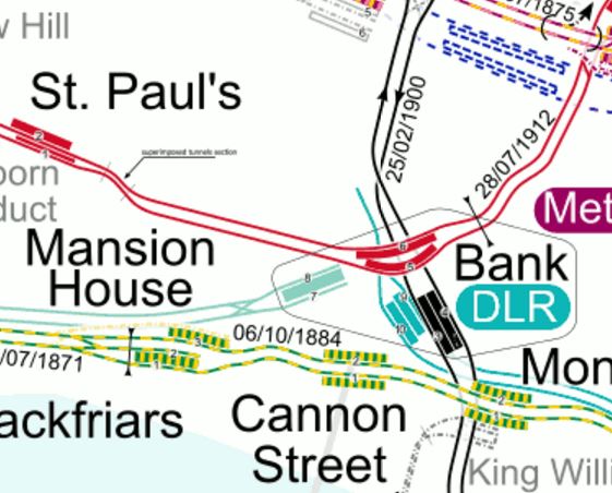
Lines Around Bank
Bank station is in desperate need of an upgrade.
In this press release on the TfL website entitled MAJOR UPGRADE OF BANK TUBE STATION GETS THE GREEN LIGHT FOR WORK TO BEGIN, this is said.
The £563m upgrade will increase the busy station’s capacity by 40 per cent, improving accessibility and reducing interchange times when it is completed in 2021. Now approved, the station becomes the latest in a series of major upgrades taking place across the Capital.
Bank is the third busiest station on the Tube network and is used by over 52 million passengers per year, with demand having risen by 50 per cent over the last 10 years. Improving the station is critical to keep London working and growing and is a key step in TfL’s future plan to increase frequency on the Northern line.
The plans for Bank station show the following.
- A new entrance to Bank station with lifts and escalators on Cannon Street at the junction of Nicholas Lane.
- This entrance will be about a hundred metres from Cannon Street station on the other side of the road.
- A new southbound running tunnel for the Northern Line, which will be to the west of the current platforms.
- Lots of cross passages and tunnels to link it all together.
The Liverpool Street/Moorgate Crossrail station, could take the pressure off Bank station during the expansion.
- As the Crossrail station, when it opens, should have good access to the Northern and Central Lines, will many walk the short distance?
- Many will use Crossrail/Thameslink to get to the Bank area, rather than a crowded Underground.
- Crossrail could be quicker to Canary Wharf from Bank than the DLR.
If the City of London took a bold step and pedestrianised much of the City, this would help make the Bank/Farringdon/Liverpool Street/Moorgate area a giant concourse for the rail lines underneath.
This Google Map shows the area from Moorgate and Liverpool Street in the North to Cannon Street and Bank in the South.

Bank To Liverpool Street
I reckon that from the Crossrail station to Bank will be about seven hundred metres of walking on the flat, as it took me less than ten minutes with plantar fasciitis.
Camberwell
Camberwell station is not in the City, but I’m including it here, as it looks like being the first positive consequence of Crossrail/Thameslink.
This press release on the Transport for London web site is entitled BAKERLOO LINE EXTENSION TO IMPROVE TRANSPORT LINKS IN SOUTH LONDON BY 2030. It says this about a new station at Camberwell.
The Mayor and TfL will be working closely with Network Rail and Southwark Council on plans for a new Thameslink station at Camberwell. This new station would reduce journey times into central London by up to 20 minutes, and by providing connections to the Underground and Crossrail, will improve access from Camberwell to locations across London.
It’s not definitely decided yet, but it looks hopeful.
I wonder if we’ll hear more before May.
This map from carto.metro.free.fr shows the lines south from Elephant and Castle.
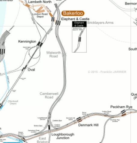
Camberwell Station
Will the new Camberwell Station be where Camberwell Road station is shown?
Cannon Street
Cannon Street station is a modern well-appointed station, but it isn’t connected directly to Crossrail or Thameslink, but all the work will benefit this station.
- The new entrance at Bank station will mean that Cannon Street will be better connected into the lines serving Bank station.
- There is also the new Walbrook Entrance To Bank Station, which opens in 2017 and will give more routes into Bank station.
- Improvements to the District and Circle Lines will mean that Cannnon Stret has better East-West connections.
- Due to the improved layout at London Bridge station, passengers will have greater flexibility in their choice of terminus.
I think that the number of passengers using Cannon Street will increase.
Farringdon
This map from carto.metro.free.fr shows the lines from Farringdon to Liverpool Street.

Farringdon To Liverpool Street
The Crossrail station at Farringdon is an immense double-ended one connecting to both Farringdon and Barbican stations.
I always think, that Crossrail and Thameslink should be treated together.
Once passengers learn how to navigate around Farringdon station, they will increasingly consider Crossrail and Thameslink as one system.
For myself, in Dalston, I suspect that my route to places South of the Thames could start at Farringdon. I could either get a 56 bus to near the station or use the East London Line and a five-minute hop on Crossrail,
Liverpool Street and Moorgate
Look closely at Liverpool Street and Moorgate on the Farringdon To Liverpool Street map and you can see the Crossrail station platforms lying between the two current stations. Several questions will be answered, when the station Crossrail station is fully revealed.
- Will connection be possible between the Northern and Central lines and easier than at the labyrinth at Bank?
- Will entrances from the Crossrail station be arranged to give direct access to the many buses?
- Will the Crossrail station create good access to Liverpool Street station from the Northern Line?
- Will access to the Northern City Line be better?
If they get the design right at the Liverpool Street/Moorgate Crossrail station, it could really take the pressure off Bank station, whilst it is extended.
London Bridge
London Bridge is a station that is being rebuilt at the moment.
It is part of this analysis, as the redesign of the station will make it easy for passengers to change easily between Thameslink and the various routes going to all over the South.
Hopefully, the new station will also make it easy to change between trains and the buses and Underground.
I sometimes think for selfish reasons, that a high-capacity surface link using a bus or tram is needed between London Bridge and Old Street, via Bank and Moorgate. I regularly use the 141 bus on this route, but it doesn’t have the required frequency or capacity.
It will be interesting to see how many passengers transfer to Thameslink, at or before London Bridge and then use Crossrail from Farringdon.
Shoreditch High Street
This map from carto.metro.free.fr shows the Central Line as it goes East from Liverpool Street to Stratford.

Central Line In East London
The Central Line is in red, with Liverpool Street station, just off the map at the left and Stratford station at the top right.
Look at the map and you’ll see that Shoreditch High Street on the East London Line is directly above one of the longer stretches of the Central Line without a station.
With all the development going on in the Shoreditch area, it could be a good idea to link the two lines here with a new Central Line station. Construction of the station would require breaking the Central Line into two halves for a couple of years, so it would be a great inconvenience.
But Crossrail connects the gap, as it serves Stratford and Liverpool Street, so it is a possibility this link will be created once Crossrail has opened.
As the London Overground stations at Bethnal Green and Cambridge Heath are very much not the best and are certainly not step-free, rebuilding them and connecting one of them to Bethnal Green tube station might be something at which to look.
This Google Map shows the rail lines between Shoreditch High Street and the two Bethnal Green stations.
Shoreditch High Street And The Two Bethnal Green Stations
As Network Rail are thinking about some more terminal platforms in the area to ease overcrowding at Liverpool Street, we could see something innovative in this area.
Whitechapel Station
Look at Whitechapel on a tube map showing Crossrail and it appears to be just a handy interchange between Crossrail and the East London Line, and the District and Metropolitan Lines.
But it is much more than that!
- Whitechapel will be the station, where passengers going west from an Eastern branch, will walk across the platform to go back down the other branch. This will create a simple route between say Ilford and Abbey Wood stations, that avoids going further into the centre of London.
- The East London Line has a capacity of 24 trains per hour, but only runs sixteen at the moment. Once Crossrail is fully established, I believe the number of destinations on the East London Line, both North and South of the Thames, will increase.
- Whitechapel may well be the station, where travellers change to the south-east branch of Crossrail for Canary Wharf. I’ll probably do that by changing from the East London Line.
- The two platforms for the District and Metropolitan Lines will be combined into a single island platform, so on journeys like Barbican to Mansion House, passengers might take to going on a first train to Whitechapel and walking across the platform to get a district Line train, instead of waiting for a Circle Line train.
But you can’t predict how passengers will use a new station! As it’s the East End, where ducking and diving is the most popular sport, getting predictions right is even more difficult!
I shall certainly use Whitechapel station a lot, as it’s just a few stops down from Dalston Junction.
Conclusion
You ain’t seen nothing yet!
