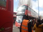
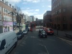
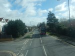
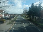
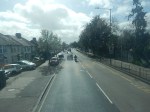
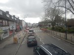
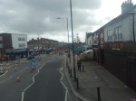
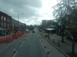
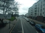
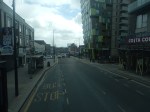
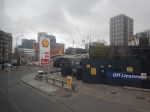
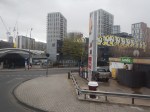
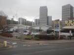
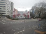
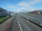
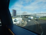
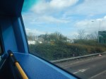
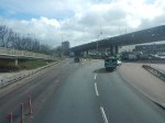
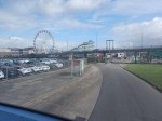
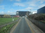
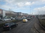
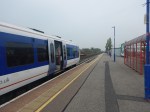
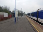
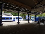
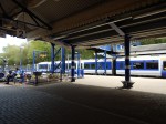
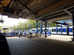
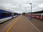
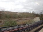
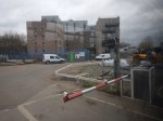
Riding The 182 Bus Between Harrow Bus Station And Brent Cross
I did this journey, which could be part of the Superloop, in good weather, and was able to take these pictures.


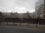
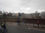
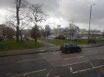
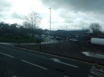


Note.
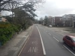
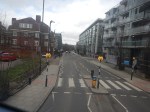
- The roads were not bad and were partly two lanes each way, with large roundabouts at junctions.
- I suspect the bus was going at between 30 and 40 mph most of the way.
- There was still quite a lot of traffic.
- It is a distance of about 7 miles.
- The timetable says that buses run every 10-13 minutes.
- Harrow-On-The-Hill station is next to Harrow Bus station.
- Harrow-On-The-Hill connects to the Metropolitan Line and Chiltern
- Northwick Park Hospital is on the route.
- Sudbury and Harrow Road station connects to Chiltern.
- South Harrow station connects to the Piccadilly Line.
- Wembley Central station connects to the Bakerloo and Watford DC Lines and National Rail.
- Wembley Stadium station connects to Chiltern.
- Wembley Park station connects to the Metropolitan and Jubilee Lines.
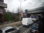
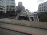
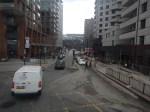
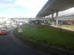
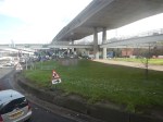
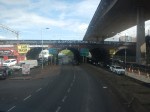
The journey took about 70 minutes, mainly because of the traffic at the road works.
I have a few thoughts.
The Route Of The Bus 182 Could Be Part Of The Superloop
I feel my journey today, proved that this would be part of a feasible Superloop leg between Harrow and North Finchley bus stations.
A Chiltern Metro
Wikipedia says this about a proposed metro service between Marylebone and West Ruislip stations.
- The Metro would have a frequency of four tph.
- It would call at Wembley Stadium, Sudbury & Harrow Road, Sudbury Hill Harrow, Northolt Park and South Ruislip.
- The service would require a reversing facility at West Ruislip.
- There would need to be passing loops at Sudbury Hill Harrow, and Wembley Stadium.
Given that the Chiltern Metro was first proposed over a decade ago, perhaps the concept could be increased in scope.
- Housing and other developments along the route may suggest that a station further out like High Wycombe might be a better terminal.
- ERTMS in-cab digital signalling is likely to be installed at some time, which would decrease headways between trains and allow more services.
- Electrification is likely in some form before 2040 and this will improve train performance.
- If Neasden station were to be rebuilt, as a comprehensive transport and residential development, I believe that this Metro service should also call at Neasden, as it would complement the West London Orbital Railway.
I believe that a review of the Chiltern Metro may mean, that an improved version is worth creating.
Would A Mutant Many-Parent Child Help To Solve London’s Transport Problems?
London needs to increase the capacity of its public transport system, as the City continues to get larger and larger.
Current Major Projects
There are only three major rail projects ongoing in London at the present time.
The Bank Station Upgrade
The Bank Station Upgrade appears to be progressing well, albeit perhaps it’s a bit late due to the pandemic.
It is a complex project and from what I have heard and observed, it has been well designed and planned.
The Barking Riverside Extension
As with the Bank Station Upgrade the Overground extension to the new Barking Riverside station, appears to be going reasonably well.
But compared to that project, it is a relatively simple project, built mainly in the open air, with no tunneling.
Crossrail
Crossrail is in trouble, after what many believe was a very good tunnelling phase of the project.
But then tunnels under London usually seem to go well. I can remember the Victoria Line tunnelling and many other under London since the 1960s and all of these tunnels seem to have been dug without trouble. As I write, there don’t seem to be any tunneling problems with the Thames Tideway Tunnel.
Crossrail now has been reduced to a series of station builds and rebuilds, some of which are as large as the Bank Station Upgrade, with other ongoing projects like the testing of trains and systems.
So why are some of these stations running late in their delivery?
If you walk along the route of Crossrail in the City of London and through Clerkenwell and the West End, it is one massive building side as developers raise massive clusters of new developments around and above the Crossrail stations.
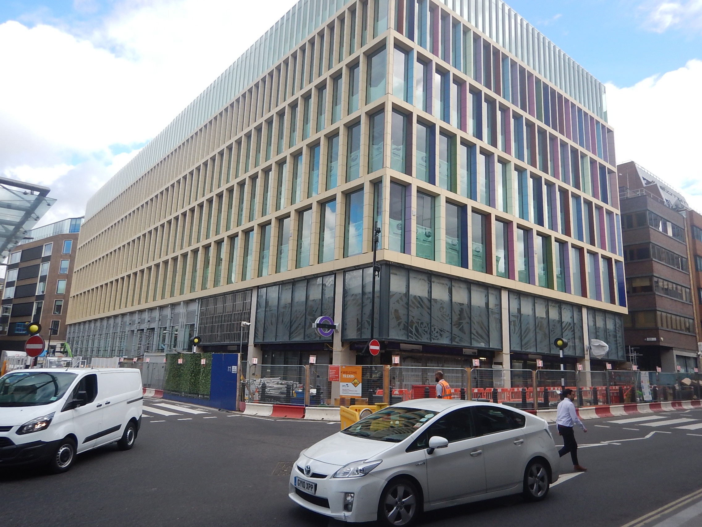
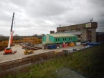
The picture shows Farrington station’s Eastern entrance, with a new development on top.
This one wasn’t a big one, but it went up in record time.
These buildings are often funded by Sovereign Wealth Funds, who want their buildings finished ASAP and as they have bottomless pockets, they are prepared to pay more to get the builders and tradesmen they need.
And where did they get the workers from? Other projects, including Crossrail.
This problem happened in Aberdeen at the height of the oil boom in the last century.
I also think that Brexit worsened the problem, as workers from mainland EU moved to large projects closer to home, like Stuttgart 21 and the new Berlin Brandenburg airport, that were both very much in trouble and could have been offering premium salaries as well!
The solution would have been to phase developments so that the limited pool of workers was not exhausted.
But that probably wouldn’t have suited the developers and politicians for all sorts of reasons.
- An uncompleted building doesn’t bring in money and jobs.
- Early completion must improve chances of letting the building.
- Delaying the building would probably have meant fewer holidays for politicians in exotic locations.
Hopefully, a comprehensive enquiry into the lateness of Crossrail will provide answers.
High Speed Two
High Speed Two is to my mind a London local project. But only in a secondary way!
- Rebuilding Euston station will improve Underground connections and interchange at Euston and Euston Square stations.
- It is claimed by High Speed Two, that the rebuilt Euston station will create 16000 jobs and 2200 homes.
- High Speed Two will enable massive development at Old Oak Common, with tens of thousands of homes and jobs.
- Old Oak Common station will be a very important rail hub in North-West London.
With seventeen trains per hour (tph) between Euston and Old Oak Common will High Speed Two attract local traffic?
- I suspect High Speed Two between Manchester Airport and Manchester Piccadilly and between Birmingham Interchange and Birmingham Curzon Street will also attract local traffic.
- I’ve used TGVs between Nice and Antibes.
- Tourists might visit, just like they did and still do at the Olympic Park.
- Many Londoners will join High Speed Two at Old Oak Common.
Some wag will suggest putting it on the Tube Map. But is it such a stupid idea?
Where Does London Need More Rail Services?
Having lived in London on and off for over seventy years, I feel the worst areas for rail links are probably.
- North West London
- South East London
- South Central London between Wimbledon and Croydon.
- South West London
Note.
- Over the years, there is no doubt that East and North London have improved considerably, with the development of the East London, North London and Gospel Oak to Barking Lines.
- Thameslink has been improved in North London and now it is being supported with improvements to the Northern City Line. Both routes now have new Siemens trains, which give a whole new dimension to using ironing-boards as seats.
- Crossrail will produce major improvements in West, East and South East London.
- Building of a new Penge Interchange station, which I wrote about in Penge Interchange could improve routes to and from South East London.
- Hopefully the work in recent years at Waterloo will improve suburban services out of Waterloo. In An Analysis Of Waterloo Suburban Services Proposed To Move To Crossrail 2, I showed that four tph could be run to Chessington South, Epsom, Hampton Court and Shepperton stations.
It looks like North West and South Central London are missing out.
How Can Services Be Improved In North West London?
There are radial routes from the centre of London to the suburbs.
Starting from the North and going to the West, there are the following lines.
- The High Barnet branch of the Northern Line
- The Mill Hill East branch of the Northern Line
- The Midland Main Line to St. Albans, Luton, Bedford and the East Midlands.
- The Edgware branch of the Northern Line
- The Jubilee Line to Stanmore
- The West Coast Main Line to Watford, Milton Keynes, the West Midlands, the North West of England and West Scotland.
- The Bakerloo Line to Harrow & Wealdstone.
- The Watford DC Line of the London Overground
- The Amersham, Chesham and Watford branches of the Metropolitan Line
- The Chiltern Route to Aylesbury.
- The Chiltern Main Line to High Wycombe, Banbury, Bicester, Birmingham and Oxford.
- The West Ruislip branch of the Central Line.
- The Uxbridge branch of the Metropolitan and Piccadilly Lines
When I used to live at Cockfosters as a child, to visit my many cousins in North West London, there was no alternative but to use a bus and take well over an hour each way.
There are now some circular rail routes in London but nothing in the North West of the capital.
The Dudding Hill Line And The West London Orbital Railway
But there is the little-used freight route called Dudding Hill Line.
- It runs between Cricklewood on the Midland Main Line and Acton Central on the North London Line.
- It is four miles of double-track railway.
This YouTube video shows a cab ride from Acton to Cricklewood.
Plans exist to turn it into the West London Orbital Railway, which will run two services.
- West Hampstead and Hounslow via Cricklewood, Neasden, Harlesden, Old Oak Common Lane, Acton Central, South Acton, Lionel Road, Brentford, Syon Lane and Isleworth
- Hendon and Kew Bridge via Brent Cross West, Neasden, Harlesden, Old Oak Common Lane, Acton Central, South Acton
Note.
- The proposed frequency of both services is four tph.
- There would be some stations to be built, but the track exists.
- There would be no new tunnels.
- The route is technically feasible.
- The route would connect West London to High Speed Two.
- There would be little disruption whilst it was built.
- The services could be run by dual-voltage battery-electric trains charged on the electrification at both ends of the route.
- The scheme represents a high value for money, with a benefit-cost ratio (BCR) of 2.2.
On the other hand, the scheme has two serious problems, as far as the current London Mayor is concerned.
- Transport for London has no money, partly because of London’s Fare Freeze.
- The project is not in South London.
This important and value-for-money project will not be built, whilst Sadiq Khan is still Mayor of London.
Harlesden Interchange
I believe that if we get the interchanges right on the West London Orbital Railway correct we can do things like.
- Increase the benefit cost ratio.
- Link the route to South London to make the Mayor a bit happier about the North London Scheme.
This Google Map shows Harlesden station.
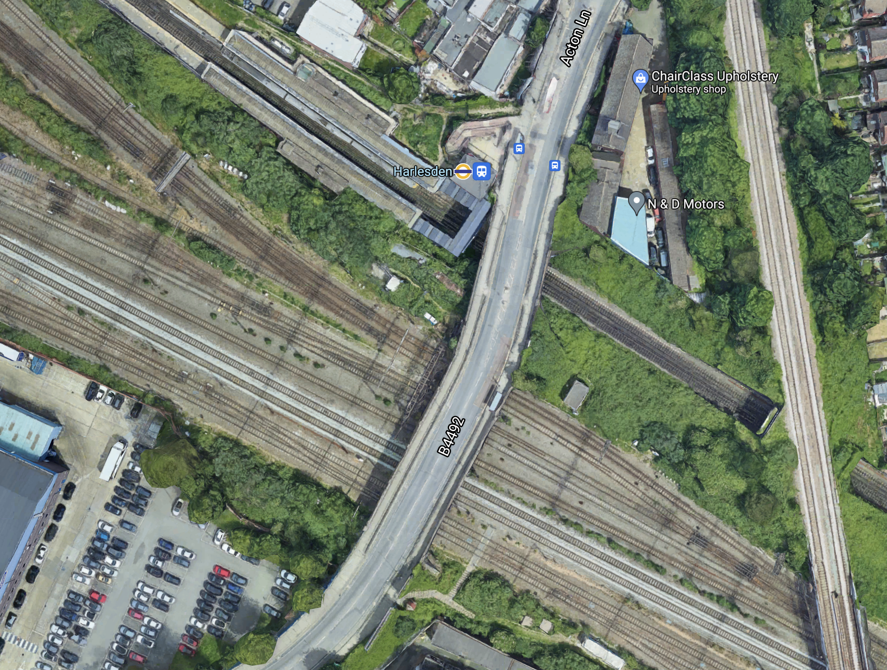
Note.
- The Bakerloo Line/Watford DC Line running North-West/South-East through Harlesden station.
- The West Coast Main Line in the Southern section of the map.
- The Dudding Hill Line running North-South across the map.
Platforms will be built on the Dudding Hill Line to connect that would probably be new or extended platforms in the current Harlesden station to enable interchange between the West London Orbital and the Watford DC Lines.
I also think there is a possibility that platforms could be added to the slow tracks of the West Coast Main Line, so that suburban services into London Euston can also connect to the West London Orbital Line.
It would also enable a connection between Southern’s Clapham Junction and Milton Keynes service and the West London Orbital Railway.
Looking at this from various angles, I think that an architect good at designing three-dimensional structures could develop a quality Harlesden Interchange station.
Neasden Interchange
Like Harlesden, Neasden is another possibility for a comprehensive interchange.
This Google Map shows Neasden station.
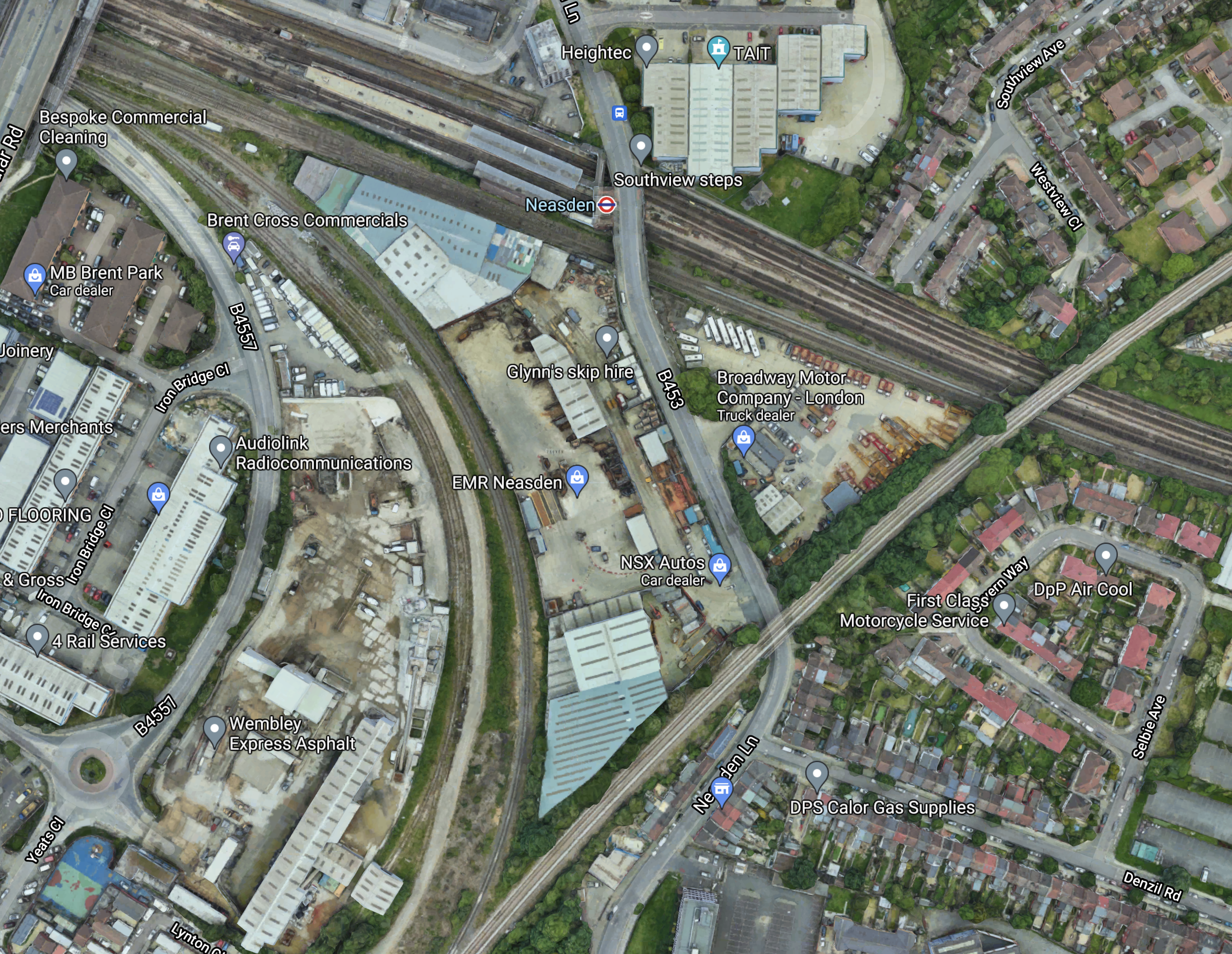
Note.
- There are a lot of lines going through Neasden station.
- The Dudding Hill Line goes across the South-East corner of the map.
- There is plenty of space in the area.
This map from cartometro.com shows the lines in the area.
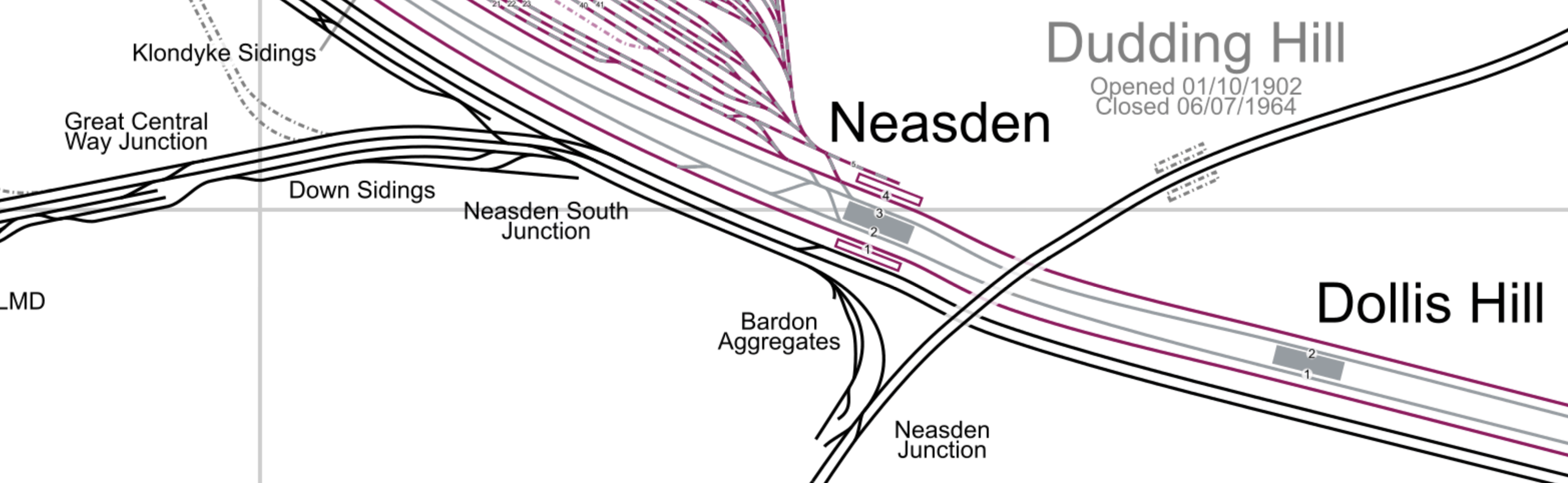
Note.
- The Dudding Hill Line is indicated by the former Dudding Hill station.
- The red tracks are Metropolitan Line tracks.
- The silver tracks are Jubilee Line tracks.
- The Southerly pair of lines through Neasden and Dollis Hill stations are Chiltern’s lines into Marylebone.
- The Chiltern tracks divide to the West of Neasden station, with the Aylesbury line following the other tracks and the Chiltern Main Line diverging to the West.
- London’s largest Underground Depot at Neasden, lies to the North-West in an area of London noted for few merits with the North Circular Road passing through.
I wonder, if the station and the depot offers a unique opportunity to offer large scale additions to London’s housing stock over the top of a rebuilt station and depot.
This Google Map shows the wider area.
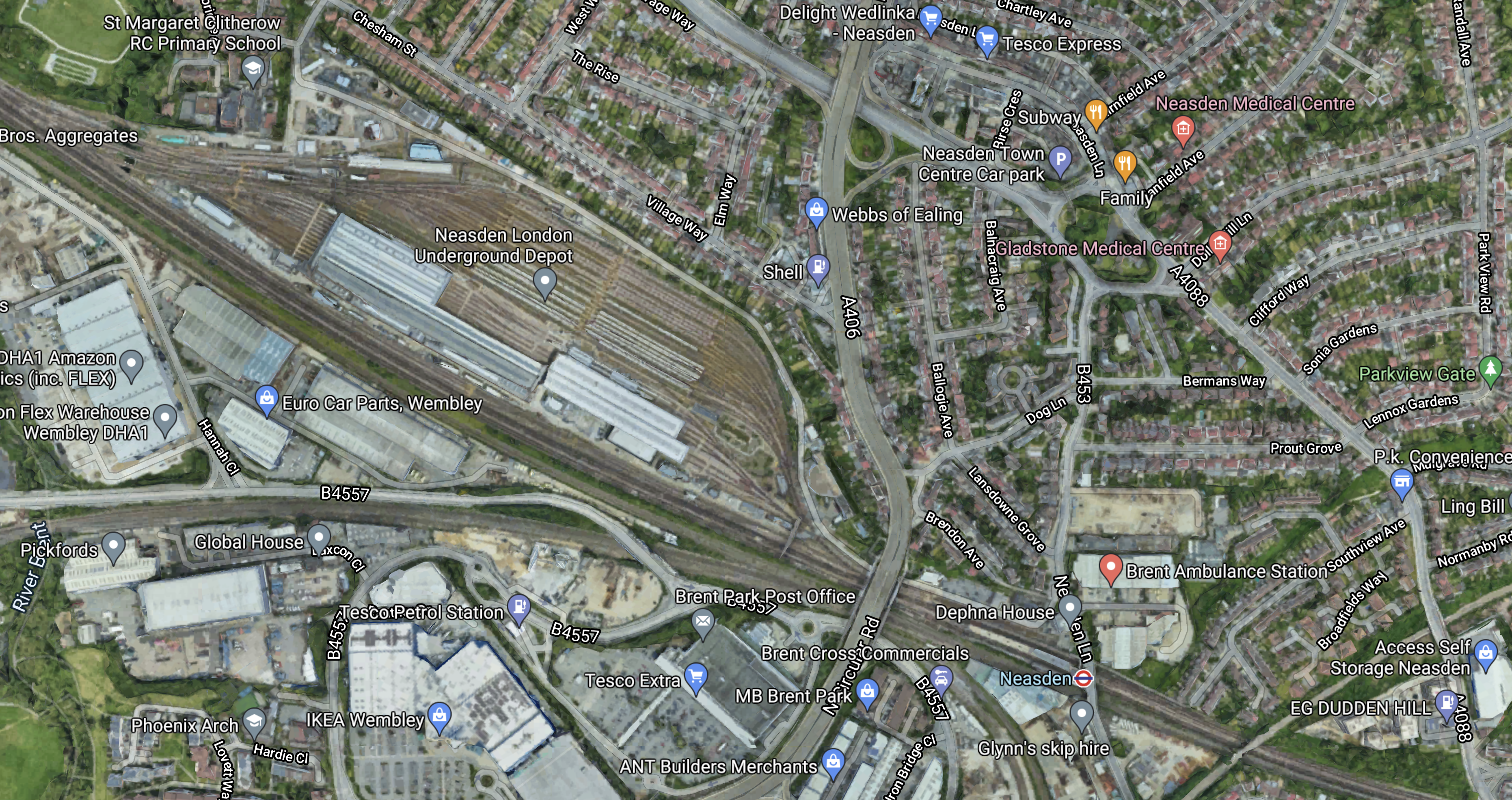
Note.
- Much of the depot appears to be open-air stabling for trains.
- The North Circular Road passes North-South between the depot and Neasden station.
- The Dudding Hill Line cuts across the South-East corner of the map.
- This corner of the map is labelled as Dudden Hill.
- According to Wikipedia, Dudding Hill is considered a more genteel spelling of Dudden Hill and could be as old as 1544.
It looks as if it would be relatively easy to develop over the top of the depot to create housing, industrial or commercial properties.
But why stop there and cover both the North Circular Road and the six tracks through Neasden station?
Neasden station could be rebuilt into a station with platforms on the following lines.
- Metropolitan Line
- Jubilee Line
- Chiltern Lines
- Dudding Hill Lines
Note.
- I estimate that Chiltern has a train about every six minutes, so some could stop.
- There might be space for a bay platform for Chiltern.
Neasden could be a major housing and transport hub.
- There could be large amounts of parking.
- Road access would be good.
- It would have good rail connections.
- It could have a bus interchange.
- London needs housing.
It might even be an alternative to Chiltern’s plan for a West Hampstead Interchange.
The Mayor of London, Transport for London and the Borough of Brent need to be bold!
Improvements To Chiltern’s Routes
Chiltern Railways have some plans that could improve services in North West London.
Using The Acton-Northolt Line
Wikipedia says this about using the Acton-Northolt Line to access new platforms at Old Oak Common station.
Upgrading the Acton–Northolt line (formerly the “New North Main Line”) to new platforms at Old Oak Common. This upgrade will also extend to London Paddington to increase capacity on the Chiltern Main Line as there is no room to expand the station at Marylebone.
This scheme has merit.
- The platforms would be connected to the Chiltern Main Line along the route of a partly-disused railway.
- The route could be double-tracked.
- There must be space for at least two new platforms.
- The new platforms could easily handle four tph.
- There may be a case for some new stations.
The scheme could add valuable extra capacity for Chiltern.
A Chiltern Metro
Wikipedia says this about a proposed metro service between Marylebone and West Ruislip stations.
- The Metro would have a frequency of four tph.
- It would call at Wembley Stadium, Sudbury & Harrow Road, Sudbury Hill Harrow, Northolt Park and South Ruislip.
- The service would require a reversing facility at West Ruislip.
- There would need to be passing loops at Sudbury Hill Harrow, and Wembley Stadium.
Given that the Chiltern Metro was first proposed over a decade ago, perhaps the concept could be increased in scope.
- Housing and other developments along the route may suggest that a station further out like High Wycombe might be a better terminal.
- ERTMS in-cab digital signalling is likely to be installed at some time, which would decrease headways between trains and allow more services.
- Electrification is likely in some form before 2040 and this will improve train performance.
- If Neasden station were to be rebuilt, as a comprehensive transport and residential development, I believe that this Metro service should also call at Neasden, as it would complement the West London Orbital Railway.
I believe that a review of the Chiltern Metro may mean, that an improved version is worth building.
Improvements To The Milton Keynes And Clapham Junction Service
I feel that this service could be key in improving services between North London and South London via the West London Line and High Speed Two’s station at Old Oak Common.
Currently, this service is as follows.
- It runs between Milton Keynes and Clapham Junction stations.
- It has a frequency of one tph.
- It calls at Bletchley, Leighton Buzzard, Tring, Berkhamsted, Hemel Hempstead, Watford Junction, Harrow & Wealdstone, Wembley Central, Shepherd’s Bush, Kensington (Olympia), West Brompton and Imperial Wharf stations.
- The service used to extend to South Croydon via Wandsworth Common, Balham, Streatham Common, Norbury, Thornton Heath, Selhurst and East Croydon.
- It uses Class 377 trains.
- It shares parts of the route with the London Overground.
I also think it has various issues and questions with respect to the future.
- The Class 377 trains are only 100 mph units, whereas the outer suburban trains on the West Coast Main Line are 110 mph Class 350 trains, which will soon be replaced by 110 mph Class 730 trains. Do the slower trains cause timetabling problems?
- Is one tph enough?
- The route doesn’t serve High Speed Two at Old Oak Common station.
- Is the service run by the right operator?
- What is the ideal Southern terminal?
These are my thoughts on the various issues.
The Service As A North-South Link
A friend, who lives in South London has told me, that if you go to an event at Wembley stadium the route is busy.
On the other hand, I’ve used it at midday on a Tuesday and found the trains empty.
But developed properly it could connect the following.
- Milton Keynes Central
- Bletchley for the East West Rail Link
- Watford for the West Coast Main Line to the North
- Wembley Central for Wembley Stadium and other entertainments
- Willesden Junction for the North London Line
- Hythe Road for High Speed Two, Crossrail and the Great Western Railway
- Shepherd’s Bush for the shopping.
- Clapham Junction for most of South London and the South of England
It would be a very useful cross-London route to complement Thameslink and the East London Line.
The Frequency
The current Milton Keynes and Clapham Junction has a frequency of one tph.
This may be enough for some parts of the route, as other services also provide services.
But many would argue, that perhaps South of Watford Junction, the service needs to be increased to connect the area to Old Oak Common and Clapham Junction.
I feel that High Speed Two, Crossrail and the Great Western Railway give so much connectivity, that between Clapham Junction and Willesden Junction needs a frequency of at least eight tph.
As the North London Line and the Watford DC Line are working at a frequency of four tph, this could indicate that a four tph direct service Watford Junction and Clapham Junction be ideal. Perhaps, it could continue North to Milton Keynes with a frequency of two tph.
The Trains
I am absolutely certain, that the full service needs to be operated by dual voltage trains, that are capable of running at 110 mph.
The Class 350/1 trains of West Midlands Trains would probably be ideal for the full service.
- They are dual voltage trains.
- They are 110 mph trains.
- They have a long distance interior.
They are being replaced with new Class 730 trains, so would be available.
If some services were running only as far North as Watford Junction, these could be either Class 378 or Class 710 trains of the London Overground.
The Connection To The West London Line And High Speed Two
This map from Wikipedia by Cnbrb shows the latest iteration of the lines at Old Oak Common station.
Note.
- The green route is taken by the Milton Keynes and Clapham Junction trains.
- The bright blue is High Speed Two.
- The purple is Crossrail.
- The orange is the Overground
- Hythe Road station is proposed for the West London Line to connect to Old Oak Common station for High Speed Two.
- Hythe Road station will have a bay platform to turn trains from the South.
- Old Oak Common Lane station is proposed for the North London Line to connect to Old Oak Common station for High Speed Two.
But where is the connection between the Milton Keynes and Clapham Junction service and Old Oak Common station for High Speed Two?
- Access from the South is not a problem as the Overground can be used to Hythe Road station.
- Extra services from the South can be run to and from the bay platform at Hythe Road station.
- Access from the East is not a problem as the Overground can be used to Hythe Road station.
- How do passengers go between say Wembley Central and Heathrow?
In addition for access from the West is the Overground can be used to Old Oak Common Lane station.
But as things stand at the moment the Milton Keynes and Clapham Junction service bypasses Hythe Road station and the only ways to go from Milton Keynes to Old Oak Common station for either High Speed Two, Crossrail or the Great Western is to do one of the following.
- Change to the Watford DC Line at Watford Junction, Harrow & Wealdstone or Wembley Central and then change to the Overground at Willesden Junction for either Old Oak Common Lane or Hythe Road station.
- Continue South to Shepherd’s Bush station, cross over to the other platform and then come back to Hythe Road station.
- Go via Euston station. OK for High Speed Two, but not for Crossrail or the Great Western.
They cannot be serious!
I hope that there is a cunning plan to enable the Milton Keynes and Clapham Junction service to connect.
Whilst on the subject of connections at Old Oak Common, where is the promised connection of Crossrail to the West Coast Main Line?
Were all these connections just kicked into the long grass and quietly forgotten, as they were deemed too difficult and/or expensive?
I think serious questions need to be asked about the design of Crossrail and High Speed Two at Old Oak Common.
Why weren’t Crossrail and High Speed Two designed to connect directly to the London Overground at Willesden Junction station perhaps by the use of a North South people mover serving the following lines?
- Bakerloo, Watford DC, West Coast Main and West London Orbital Lines at a rebuilt Harlesden station.
- London Overground at the high-level Willesden Junction station.
- High Speed Two
- Crossrail and the Great Western Railway
- The new Chiltern platforms.
- Central Line at East Acton station.
Note.
- Hythe Road and Old Oak Common stations would not be needed.
- The Milton Keynes and Clapham Junction service would call additionally at the rebuilt Harlesden station.
The current design of Old Oak Common stinks like a horse designed by a committee!
The Northern Terminal
I suggested earlier that some trains use Watford Junction and others use Milton Keynes Central.
Both stations have the capacity and the connectivity.
The Southern Terminal
In the last ten years, South Croydon, East Croydon and Clapham Junction have been used as the Southern terminal.
Thameslink seems to have chosen its various terminals to satisfaction of the travelling public, so perhaps the same method or personnel should be used.
The Operator
The Gibb Report said that this service should be transferred to the London Overground and I wrote about this proposal in Gibb Report – East Croydon – Milton Keynes Route Should Be Transferred To London Overground.
This is one suggestion, but I do wonder, if it should be transferred to West Midlands Trains and run in conjunction with their West Coast Main Line services.
- The service needs 110 mph trains.
- Timetabling and operation should be easier.
- London Overground trains don’t have a long-distance interior.
On the other hand, trains running between Watford Junction and Clapham Junction would probably be better if they were London Overground trains.
Conclusion
I believe that by using the current network and some modern trains and signalling, the passenger services to the West of the capital can be substantially improved.
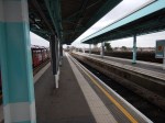
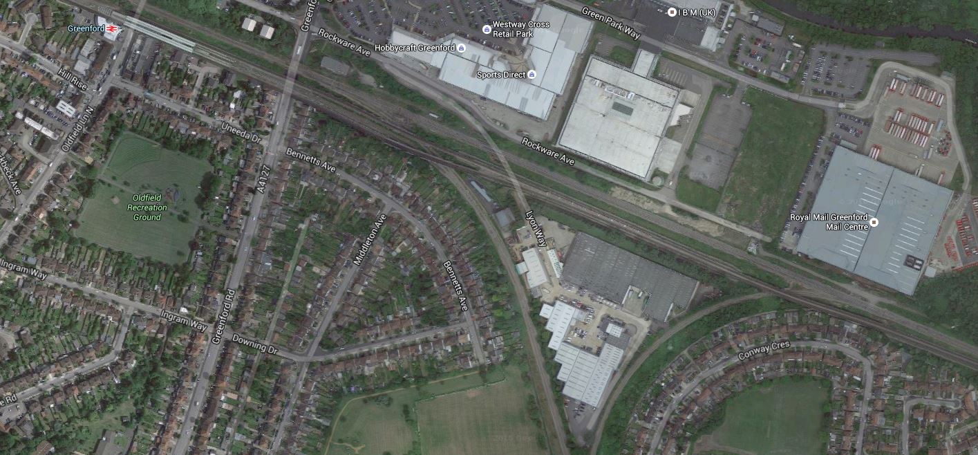
Interchange Between Chiltern Railways And The Central Line At South Ruislip Station
After my trip to Beaconsfield station, which I wrote about in Beaconsfield Station To Go Step-Free, I needed to get to West Ealing station.
So I took a direct train to South Ruislip station, where I changed to the Central Line for Greenford station and the Greenford Branch to West Ealing.
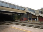
These pictures show the subway at South Ruislip station.

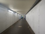
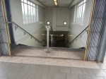

It is a subway with inadequate steep steps.
According to the Wikipedia entry for Chiltern Railways, one of their active plans is for a Chiltern Metro. This is said.
New Chiltern Metro Service that would operate 4+tph for Wembley Stadium, Sudbury & Harrow Road, Sudbury Hill Harrow, Northolt Park, South Ruislip and West Ruislip. This would require a reversing facility at West Ruislip, passing loops at Sudbury Hill Harrow, and a passing loop at Wembley Stadium (part of the old down fast line is in use as a central reversing siding, for stock movements and additionally for 8-car football shuttles to convey passengers to the stadium for events).
So there could be four trains per hour (tph) through South Ruislip station, in addition to the current hourly service to High Wycombe.
Also.
- When Chiltern Railways have a second London terminal at Old Oak Common station, there could be more stopping trains.
- There is also pressure to run services along the Greenford Branch to West Ruislip and High Wycombe.
- The Central Lione will be getting new larger trains in the next few years.
There is certainly, a lot of potential to improve services and South Ruislip station could need to go step-free.
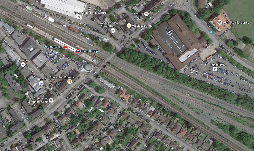
This Google Map shows the station.
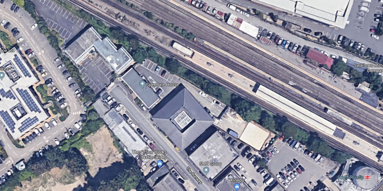
Putting lifts into the subway to access platforms has been done many times and wouldn’t be the most major of projects.
Whether it is worth doing, would be solely down to passenger numbers.
- Currently, the station handles about two million passengers per year, most of whom are using the Central Line.
- There will probably be a lot of new housing built in the next few years.
- With the disruption of building High Speed Two, through the area, this might mean new passengers start using the station.
I predict that South Ruislip station will go step-free.
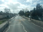
Crowded Roads In West London
Today, I tried to get to West Drayton station to have a lunchtime drink with an old mate from Cambridge, who had called me up yesterday, as he might have needed a second person to help him with one of his robotic machines.
But it all went pear-shaped at Paddington, where trains to West Drayton were very much delayed and I was advised to take the Underground to Greenford station and then use a bus.
But at Greenford, there wasn’t a bus map or anybody to ask, so in the end I took a bus to Ealing Hospital, where I thought I knew I could get a bus to West Drayton. But there wasn’t! So I thought about giving up and instead, I got a bus to Ealing Broadway station, to get back to Paddington. But I arrived at Ealing Broadway station, just before a train to West Drayton arrived. I caught that, had a drink with my friend and then caught a train back to Paddington. He didn’t need me to help, as all he needed was a pair of eyes to tell him what was happening at the sharp end of his machine and the client had turned up with his glasses.
So I achieved my objective and also had a wander round the Boroughs of Ealing and Hillingdon on buses and trains.
I trundle round North and East London most of the time and sometimes I even cross the River and go to the Deep South.
But I do find West London the most crowded, with buses slowed by all the traffic on the roads and infrequent very busy trains.
The West of London needs improvement in public transport.
I sometimes think, the traffic has got worse over the forty-six years, I had a driving licence.
Rail And Underground Lines
There are several lines going West from Central London, which include.
- The Chiltern Line from Marylebone to West Ruislip
- The Central Line to West Ruislip
- The Metroplitan Line to Uxbridge
- The Piccadilly Line to Uxbridge
- The Great Western Main Line tfrom Paddington to Reading and Heathrow
- The Piccadilly Line to Heathrow
Going further round, there are several lines from Waterloo going to the South West.
Only one line; the West London Line goes North South, although there used to be others.
The network is probably more sparse than some other directions from London.
Reliance on Cars And Buses
I think this rather thin coverage, puts a heavy radiance on cars and buses, which might explain the crowded roads.
Crossrail
Crossrail will bring improvement with the following Off Peak services in trains per hour (tph), along the slow lines of the Great Western Main Line.
- 4 tph to Heathrow Terminal 4
- 2 tph to Reading
- 2 tph to Maidenhead
Note.
- The central core tunnel probably has a limit of 24 tph.
- The service has a good balance between the various destinations.
- There will also be Great Western Railway services.
- Looking at the Crossrail schedule, there is scope to adjust the schedule on each branch.
I think that as Crossrail develops and the line and its passengers learn more about each other, the service pattern of Crossrail will change.
If I have a worry about Crossrail, it is that few of the stations towards Central London have many parking spaces, so will walking, cycling and the buses be adequate for Crossrail to tap its full potential?
The West London Tram
The West London Tram was proposed by Ken Livingstone in 2002.
These paragraphs from Wikipedia describes the tram and its route.
The West London Tram was a proposed on-street light rail line that was to run along the Uxbridge Road (A4020) corridor in West London, England. The scheme is promoted by Transport for London (TfL) but opposed by the councils of all three London Boroughs through which it would run. It was postponed indefinitely on 2 August 2007
The tram route was planned to run between Uxbridge and Shepherd’s Bush, serving Hillingdon, Southall, Hanwell, West Ealing, Ealing and Acton en route and would have completely replaced a number of equivalent London Bus routes.
If it had been built it would have had good connectivity to Crossrail and the Central Line. But the view of those against the project prevailed.
In my trip today, you could see why probably every car driver in the area, would be against a scheme like the tram. Only at places on the route, where there was a wide island of grass dividing the carriageways, would the tram not have increased congestion.
It looks like the thirty million pounds spent was wasted.
Crossrail And/Or West London Tram?
This Google Map shows the area around the three stations of Hanwell, West Ealing And Ealing Broadway.
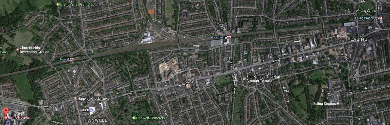
Great Western Main Line And The A4020 Through Ealing
Note.
- The Great Western Main Line across the middle.
- The A 4020 runs South of and parallel to the railway.
- Ealing Hospital is marked by the red arrow in the bottom left of the map.
I asked in the Header to this section if it should be And/Or between the projects.
Undoubtedly, it should be Or! Taxpayers can’t afford both!
In comparing the two, I believe the following points are valid.
- Trams stop about three or four more times than trains.
- The train is faster.
- The tram doesn’t serve Old Oak Common station or Heathrow.
- Trams annoy drivers in the same way that bendy buses do.
- Crossrail has a rich connection pattern compared to the tram.
- Pedestrians probably prefer trams, whilst drivers prefer trains.
The politicians decided and chose the trains.
Making More Of The Railways
If the streets are crowded can we use the existing railways to inject greater capacity into the existing railways in West London?
The key to this, as it sits in the middle of so many lines is the creation of a new station at Old Oak Common.
I will now summarise the possible rail projects that can be developed in West London
Chiltern Railways To Old Oak Common
Chiltern Railways have a capacity problem at Marylebone and one way to alleviate it would be for Chiltern to create a second terminal at Old Oak Common station, which could be accessed using an improved New North Main Line.
There is a real possibility of this project going forward and it could have many worthwhile features.
It would add another East-West route across West London, but with the comprehensive connectivity of Old Oak Common.
Chiltern Metro Creation
Wikipedia says this about a Chiltern Metro.
New Chiltern Metro Service that would operate 4+tph for Wembley Stadium, Sudbury & Harrow Road, Sudbury Hill Harrow, Northolt Park, South Ruislip and West Ruislip. This would require a reversing facility at West Ruislip, passing loops at Sudbury Hill Harrow, and a passing loop at Wembley Stadium (part of the old down fast line is in use as a central reversing siding, for stock movements and additionally for 8-car football shuttles to convey passengers to the stadium for events).[73] This ‘Chiltern Metro’ service was not programmed into the last round of franchising agreements.
When I wrote Could A Chiltern Metro Be Created? and came to the conclusion, that it might be possible, I got several positive responses.
Greenford Branch Improvements
The Greenford Branch Line connects the Great Western Main Line and the New North Line.
This map from carto.metro.free.fr shows the Northern end of the branch, where it joins the New North Line.
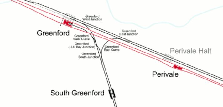
Northern End Of The Greenford Branch
Whilst this map from carto.metro.free.fr shows the Southern end of the branch, where it joins the Great Western Main Line.
Southern End Of The Greenford Branch
What service the line will get after Crossrail opens has still to be decided,
- 4 tph between West Ealing and Greenford stations is certainly possible.
- There are those, including Ealing Council, who don’t like Greenford losing its direct connection to Paddington.
- A rebuilt Greenford station could incorporate Chiltern services.
As the connections at both ends of the branch allow trains to go in either an East or West direction, could this be useful in creating services between the two main lines?
Brentford Branch Reopening
I wrote about this in Could The Golden Mile In Houslow Get A Station?
The Brentford Branch could be a useful branch, worked by a shuttle train!
Hounslow Loop Line Improvements
The Hounslow Loop Line, which has a strong presence on both sides of the river and takes passengers to and from Waterloo, is being improved to increase capacity.
Could we see the Overground opening new services along the North London Line to perhaps Brentford, Hounslow and Feltham stations?
The route is used by freight trains, and Transport have suggested using the route to create an orbital Overground route.
Conclusions
The railways will take the strain in West London, after the abandonment of the West London Tram.
Will Chiltern Railways Get A Second London Terminus At Old Oak Common?
This article on the Rail Magazine web site is entitled Chilterns Route Study to tackle capacity challenges and it describes how Chiltern Railways may gain a second terminal in London at Old Oak Common, which would link to the following lines.
And that’s only for starters as a couple of Underground and other lines pass through the general area.
The full study on Network Rail’s web site is entitled West Midlands and Chilterns Route Study. This is said about Chiltern Railways.
The Chiltern Route provides an important commuter route into London with connections to the Underground.
- London continues to grow, and evolve with economic hubs expanding beyond the traditional City
- Growing towns with major housing development planned at Aylesbury, Bicester and Princes Risborough
- Marylebone Station is approaching its maximum capacity, in terms of train numbers and passengers
- Any expansion of Marylebone is likely to be expensive, and disruptive due to its constrained location.
The report suggests using Old Oak Common as an additional terminal, connected to the Chiltern route. It gives these benefits.
- Up to 4 additional trains per hour, with more travel options in to London.
- Access to HS2, Crossrail and Great West Main Line.
- Reduced cost and disruption compared to upgrading Marylebone.
The report is recommending building a new station at Old Oak Common, rather than upgrading Marylebone.
I think that this is a very sensible use of the space and existing railways in West London.
In Could A Chiltern Metro Be Created?, I looked at the lines between Marylebone and West Ruislip, where Chiltern Railways have ambition to create a Chiltern Metro. I said this.
I think Chiltern too, will make a bid to get into running services on the Greenford Branch and the Acton-Northolt Line, as it would give them a very useful destination in London of Old Oak Common.
Whatever happens, there will be some interesting rail developments involving Chiltern Railways in West London.
Old Oak Common Station And The Acton-Northolt Line
This map from carto.metro.free.fr shows the lines around Old Oak Common.
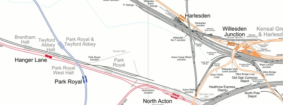
Old Oak Common Station And The Acton-Northolt Line
Note the West Coast Main Line and Great Western Main Line go to the North and South respectively of the Old Oak Common site.
The line going to the West alongside the Central Line is the Acton-Northolt Line which links in the West to the Chiltern Main Line, just to the East of South Ruislip station.
This is the best map, I can find of the proposals for Old Oak Common station.
Rail Lines At Old Oak Common
And this map from carto.metro.free.fr shows roughly the same area.
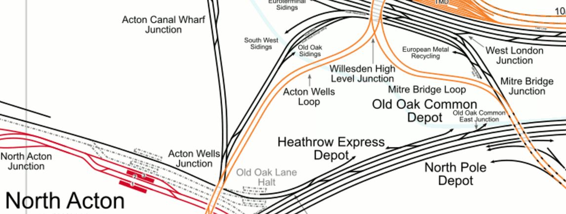
Current Lines At Old Oak Common
The Acton-Northolt Line is currently single-track and without electrification or any stations, other than South Ruislip and West Ruislip after Northolt Junction, where it joins the Chiltern Main Line.
From following the line both on a Central Line train and on Google Maps, it would appear that restoring the Acton-Northolt Line to its original double-track should be possible.
With regard to electrification, as Old Oak Common station will be electrified for Crossrail, the North London Line and other lines, it would at least have power at one end.
The Current And Proposed Service Pattern
Wikipedia lists the current services, outside the peak from Marylebone on Chiltern as the following.
- 2 trains per hour (tph) to/from Birmingham (one fast, first stop Bicester North, and one semi-fast, first stop High Wycombe).
- 1tph to/from Banbury (semi-fast, first stop High Wycombe). Some extend to Stratford-upon-Avon.
- 1tph to/from Bicester North (semi-fast, first stop Gerrards Cross)
- 1tph to/from Princes Risborough (semi-fast, first stop Gerrards Cross)
- 1tph to/from High Wycombe (stopping service)
- 1tph to/from Gerrards Cross (stopping service)
- 2tph to/from Aylesbury (via Amersham). One of these services in each hour continues on to serve Aylesbury Vale Parkway
- 2tph to/from Oxford Parkway (fast)
So that is nine trains an hour through West Ruislip, two up the Aylesbury Line and eleven between Marylebone and Neasden.
The Network Rail report, is saying that another four trains per hour would run from Old Oak Common station, which would mean thirteen trains an hour through West Ruislip.
Where these four trains will go will be up to Chiltern, but I’m sure they’ll find the passengers to fill them.
Gerrards Cross Station
I’d never been to Gerrards Cross before and when a friend suggested I go to see her for lunch, I got on a train.

The journey had been complicated because there had been a complete signal failure at Marylebone, so in the end I took the Central Line to West Ruislip station. Checking the Oracle as I came out from London, I was able to determine, that the odd train was running and I was likely to catch one a couple of minutes after my tube arrived. I did and I arrived in Gerrards Cross station an hour later than I’d planned.
This Google Map shows the station and the local area.
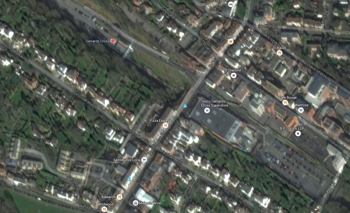
Gerrards Cross
I had a pleasant lunch in Pizza Express with my friend.
Gerrards Cross is certainly not a town, where I would chose to live, but it is one of those rare towns, where you could get together to have a pleasant lunch or conduct a business meeting close to the railway station.
Note that the pictures and the map show how the Tesco supermarket, is built over the railway.
This tunnel collapsed during building and blocked the railway for a few months. Luckily no-one was hurt, but I do think Tesco got a bit of a bruising to their ego.
My view is that we need more schemes like this to reclaim railway land, so we can build over the top. Although, housing, offices and public buildings like hospitals would be preferable to yet another unnecessary Tesco supermarket.
In Could A Chiltern Metro Be Created?, I looked at Chiltern Railways’s plan for a metro service between Marylebone and West Ruislip stations.
In the post, I asked if it would be better if the service was extended past West Ruislip.
At present, Gerrards Cross has an off-peak stopping service of one train per hour into Marylebone.
If the Metro does get created, I’m sure Gerrards Cross could benefit from more stopping services into Marylebone, but as Gerrards Cross is a station with only two tracks, I doubt it would be used as a terminus, as on my trip, trains were going through without stopping every few minutes.
West Ruislip and Beaconsfield stations, which both have two platforms and enough space for four tracks would appear to be better choices for the Western terminus of the Chiltern Metro.
In an ideal world, I would like to see island platforms between the fast and slow lines at the terminus of the Chiltern Metro, so that passengers travelling between stations on the Metro and Chiltern Main Line services.
But I doubt there is sufficient space at any current station for this layout.
Could A Chiltern Metro Be Created?
In the Wikipedia entry for Chiltern Railways, there is a section under plans labelled Active.
Three of the entries in this section refer to the stations between London Marylebone and West Ruislip or a Chiltern Metro.
- Lengthening of platforms at South Ruislip, West Ruislip, Sudbury Hill Harrow, Sudbury and Harrow Road and Northolt Park to accommodate eight vehicles, thereby obviating the need for vehicles to be locked out of use on departure from London Marylebone.
- The restoration of the quadruple track between South Ruislip (Northolt Junction) and West Ruislip, allowing trains to call at both stations without blocking the line. Triple track currently exists at West Ruislip, with the up platform loop still in situ, and at South Ruislip, with the Down Main through line also in situ. This would involve the reconstruction of the new down platform at West Ruislip, and the reconstruction of the up platform at South Ruislip. This ‘Chiltern Metro’ service was not programmed into the last round of franchising agreements.
- New Chiltern Metro Service that would operate 4+tph for Wembley Stadium, Sudbury & Harrow Road, Sudbury Hill Harrow, Northolt Park, South Ruislip and West Ruislip. This would require a reversing facility at West Ruislip, passing loops at Sudbury Hill Harrow, and a passing loop at Wembley Stadium (part of the old down fast line is in use as a central reversing siding, for stock movements and additionally for 8-car football shuttles to convey passengers to the stadium for events)
So could a Chiltern Metro be created between Marylebone to at least as far as West Ruislip.
In A Modern Electrified Metro Network Using IPEMU Technology, I postulated what a local metro would be like.
- Services are run by modern four-car electric trains, that meet all current and envisioned access and customer requirements.
- Services are run by a standard train, so if the network expands, more trains can be easily built!
- The ability to lengthen the trains, say for an important sporting or cultural event.
- Enough trains to run four trains per hour services on important lines and perhaps one per hour on lines that get much lesser use.
- Most services run out and back from the central station.
- As little disruption as possible, whilst creating the metro.
So does Chiltern’s broad plan of a metro between Marylebone and West Ruislip fit those rules?
- Modern four- car trains like Class 710 trains could run the service.
- Bombardier’s Aventra, which is the basis of the Class 710 will be around for some time, so extras will probably be available.
- Three-train formations of twelve-cars can probably be created, but eight-car would probably be an initial maximum need.
- Not a problem on a short metro line, which would probably need four sets for a four train per hour service.
- All services go to and from Marylebone.
- I’m sure, if IPEMU technology were to be used, electrifying between Marylebone and at least West Ruislip, could be done without major blockades of the line.
It would appear that the objectives can be easily met and using standard Aventra trains with an IPEMU capability would help.
The Current Service Pattern
Wikipedia lists the current services, outside the peak from Marylebone as the following.
- 2 trains per hour (tph) to/from Birmingham (one fast, first stop Bicester North, and one semi-fast, first stop High Wycombe).
- 1tph to/from Banbury (semi-fast, first stop High Wycombe). Some extend to Stratford-upon-Avon.
- 1tph to/from Bicester North (semi-fast, first stop Gerrards Cross)
- 1tph to/from Princes Risborough (semi-fast, first stop Gerrards Cross)
- 1tph to/from High Wycombe (stopping service)
- 1tph to/from Gerrards Cross (stopping service)
- 2tph to/from Aylesbury (via Amersham). One of these services in each hour continues on to serve Aylesbury Vale Parkway
- 2tph to/from Oxford Parkway (fast)
So that is nine trains an hour through West Ruislip, two up the Aylesbury Line and eleven between Marylebone and Neasden.
What Would A Chiltern Metro Look Like?
Wikipedia is fairly precise, that the inner section between Marylebone and West Ruislip would stop at the following stations.
- Wembley Stadium
- Sudbury & Harrow Road
- Sudbury Hill Harrow
- Northolt Park
- South Ruislip.
Although other documents on the web suggest a first stop at a new station of West Hampstead Interchange.
My journey today on the line took twenty minutes.
Some questions occur to me.
- Will extra stations be added?
- Will some trains go on to places like Gerrards Cross, High Wycombe and Princes Risborough?
- With modern signalling and extra tracks in places, what is the capacity of the various sections of the line.
- How many extra services to what destinations, do Chiltern want to run?
Chiltern’s answers will be better than my speculation.
What Trains Should Work The Metro?
Ian Walmsley in the April 2015 Edition of Modern Railways writes enthusiastically about Bombardier’s new Aventra train, where under Potential he starts with this sentence.
As a platform, the design will be offered in various guises for future contracts up to 125 mph.
He then goes on to say this about a possible future order for Aventras.
But the interesting one to me is East Midlands Trains electrics. As a 125 mph unit it could cope well with Corby commuters and the and the ‘Master Cutler’ crowd – It’s all about the interior.
Could Chiltern use a similar train, that was equally at home, running at over hundred miles per hour to and from Birmingham or trundling through North West London on the Metro?
Consider.
- The advantages of an identical fleet that can work all lines and services must be immense!
- I believe a universal high-class interior is possible, as Class 387 trains are almost there. Remember, Chiltern don’t do low class!
- All trains would have an IPEMU capability to reduce electrification and running costs.
- In a few years time, all IPEMUs will have automated pantograph up and down, to use electrification where available.
- Some could be dual-voltage to work on London Underground lines through Amersham.
Chiltern passengers certainly live in interesting times.
The Chiltern Metro And the Chiltern Main Line
In the following sections, I shall now look at the various parts of the route of the proposed proposed Chiltern Metro and its shared route with the Chiltern Main Line as far as West Ruislip.
Marylebone Station To Neasden
Marylebone station has a simple track layout, that is unlike most of the other London termini.
This Google map shows the station.
Marylebone Station
Complicated it is not, as it appears just two lines lead into and out of the station, and there are no major junctions until Neasden South Junction.
This map from carto.metro.free.fr shows the lines at Neasden.
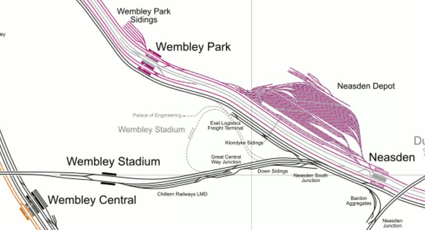
Lines Through Neasden
Note how the Chiltern Lines, which are shown in black, divide opposite Neasden Depot.
- The Chiltern Main Line goes off to the west through Wembley Stadium station.
- The London to Aylesbury Line goes off to the North West through Wembley Park station.
It certainly isn’t a complicated layout.
If you are going to use IPEMUs on Chiltern, I believe that it would be relatively easy to electrify the five miles of the lines from Marylebone to Neasden and what was felt necessary of the tracks in the platforms, to ensure that the trains reached Neasden South Junction on the way to West Ruislip with the on-board energy storage nearly full.
If this could be achieved, then some or all of the line and its stations between Neasden and West Ruislip could be left without electrification.
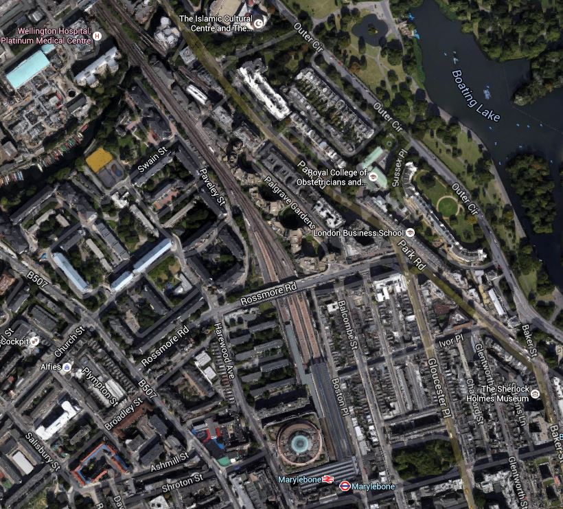
West Hampstead Interchange
If any station sums up the complicated nature of the UK’s railways it is the proposed West Hampstead Interchange.
This map from carto.metre.free.fr, shows the various lines go through the area.

West Hampstead Lines
From North to South the stations and lines are.
- West Hampstead Thameslink station is electrified to 25 KVAC and Midland Main Line services, Thameslink services and freight services between the Gospel Oak to Barking Line and the Dudding Hill Line go through.
- West Hampstead station is electrified to 25 KVAC and North London Line services go through.
- West Hampstead tube station is electrified to 630 VDC and Jubilee Line services go through.
- The Metropolitan Line passes to the south of the tube station. There are no platforms.
- The Chiltern Lines are the Southernmost lines and are not electrified. There are no platforms.
The layout of the Chiltern Lines from Marylebone to Neasden may be uncomplicated, but West Hampstead is a lot of railway to sort.
It might be easy to add platforms for the Metropolitan Lines and Chiltern, but given the narrow pavements and large amount of traffic in the area, creating a new West Hampstead Interchange won’t be easy.
The Wrong Kind Of Electrification?
If the Chiltern Line is to be electrified, it is very much entwined with the London Underground.
- From Marylebone to Neasden the Chiltern Lines follow London Underground’s Jubilee and Metropolitan Lines, which have London’s 630 VDC fourth-rail electrification.
- After Neasden, Chiltern trains on the Aylesbury Line actually run on electrified London Underground tracks between Harrow-on-the Hill and Amersham..
- Between South Ruislip and West Ruislip stations the Chiltern Lines run alongside the Central Line.
- According to Wikipedia, London Underground are updating their fourth-rail electrification to deliver the standard 750 VDC commonly used by third-rail electrification in the UK.
Given that a major cost of electrification is getting power to the electrification, I just wonder if any electrification of the Chiltern Lines would piggy-back off the London ~Underground in London and off the 25 KVAC systems around Birmingham and the East-West Rail Link.
The sections that would not be electrified, would be handled by IPEMUs working from their on-line energy storage.
As Digby said to Dan Dare, “It’s not very pretty! But it works!”
I can’t believe that engineers working on the development of Chiltern Railways are not looking at the possibility of using some of the infrastructure, London Underground has already installed.
Bombardier are already building some dual-voltage Class 710 trains for the London Overground, so rolling stock won’t be a problem.
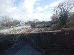
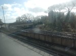
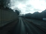
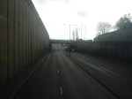
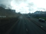
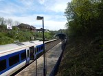
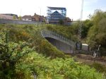
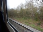
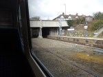
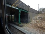
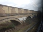
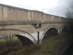
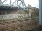
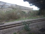
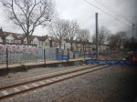
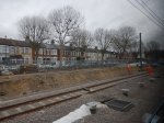
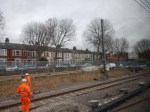
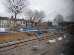
Wembley Stadium Station To Sudbury Hill Harrow Station
This Google Map shows the line Chiltern Main Line between Wembley Stadium to Sudbury Hill Harrow stations.
Wembley Stadium Station To Sudbury Hill Harrow Station
The only station in the middle is Sudbury & Harrow Road.
The line in this section is very reminiscent of the Gospel Oak to Barking Line and it shows as a green scar on the map.
This map from carto.metro.free.fr shows the same area.
Chiltern Main Line Through Wembley And Harrow
These are some pictures I took of the line.
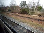
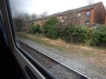
If it were to be decided to electrify this part of the line, I suspect it would no more difficult than the Gospel Oak to Barking Line.
Electrification Or Passing Loops?
Some stations like Sudbury Hill Harrow and Wembley Stadium are down to have passing loops to allow faster trains to overtake stopping ones.
But as the line is likely to be run by electric trains, does their superior braking and acceleration mean that at some stations, the need for passing loops is avoided.
Obviously, Chiltern and Network Rail have done extensive calculations and optimised the number of passing loops against the trains that will be run on the line.
Trains with an IPEMU capability, which includes regenerative braking, may also reduce the need for passing loops.
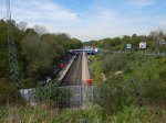
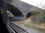
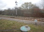
Wembley Stadium Station
Wembley Stadium station is planned to be the first station on the Chiltern Metro, although others think that the first station should be West Hampstead.
This Google Map shows the station.
Wembley Stadium Station
Note.
- There is a large space between the two platforms and lines in the station.
- There is certainly enough to create one or two passing loops, so that fast trains can pass trains calling at the station.
- The station has probably been designed for twelve-car trains.
- There would be no need to electrify through the station.
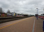
I took these pictures as my train went through today.
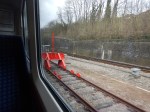
It certainly is a wide space in the middle.
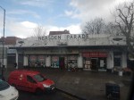
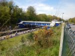
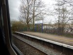
Sudbury And Harrow Road Station
Sudbury And Harrow Road Station is not a very busy station and my train didn’t stop. I also didn’t get any pictures.
This Google Map shows the rather cramped layout of the station, squeezed between the two lines.
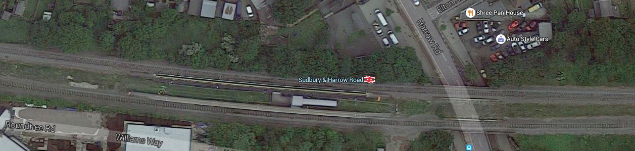
Sudbury And Harrow Road Station
Note.
- The station in an island layout.
- The platforms could be lengthened for the Metro.
- A passing loop could be squeezed through if possible.
- Electrification would probably be possible if required.
Hopefully the changes would attract more passengers to this station.
I visited this station once before and wrote about it in The Station With The Least Passengers In London.
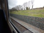
Sudbury Hill Harrow Station
Sudbury Hill Harrow Station is a basic station.
This Google Map shows the layout of the station and the area around it.
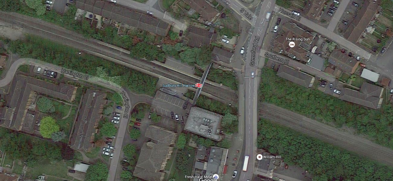
Sudbury Hill Harrow Station
I took these pictures as I passed through today.
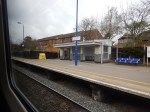
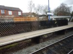
This station is down for platform lengthening and the addition of passing loops, so I suspect this will mean a complete rebuild.
This could be tricky, as the line is a main line with nine trains an hour in both directions.
But there would appear to be space to the East of the road bridge and if the station was to be rebuilt provision could be made for electrification.
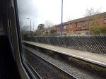
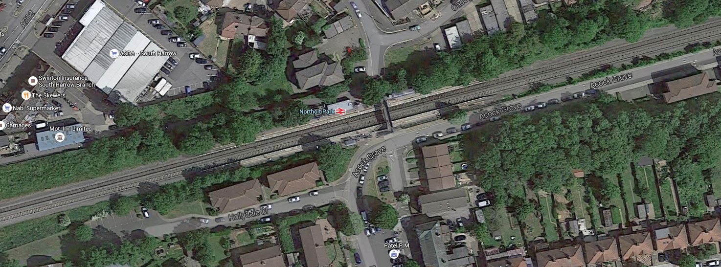
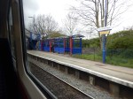
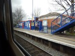
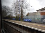
Northolt Park Station
Northolt Park Station is another basic station.
This Google Map shows the station.
Northolt Park Station
I took these pictures today.
This station is another one, that is down for lengthened platforms. But it will be tight and there is no place for passing loops.
Northolt Junction
Northolt Junction is where the Chiltern Main Line meets the Acton-Northolt Line to form the Great Western and Great Central Joint Line, that goes on to High Wycombe and eentually Birmingham.
This Google Map shows the junction.
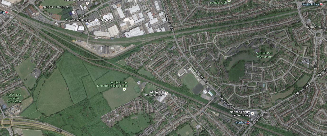
Northolt Junction
Note the waste recycling plant in the middle of the junction.
This map from carto.metro.free.fr shows the lines in the area.
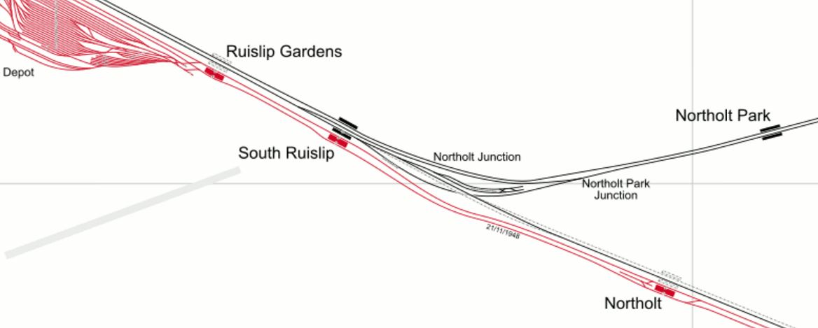
Northolt Junction
Note the large Ruislip Depot for the Central Line.
These are pictures, I took from the Chiltern train.
It’s certainly all rather cramped in the middle of the junction.
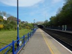
South Ruislip Station
South Ruislip Station is an interchange with the Central Line, located to the West of Northolt Junction.
I only managed one quick picture as my train rushed past.
South Ruislip Station
This Google Map shows the station and the surrounding area.
South Ruislip Station
Note.
- Going East the lines divide here, with the Northern tracks going to Marylebone and the Southern ones going to Paddington, alongside the Central Line.
- The platforms at South Ruislip station will be lengthened for the Chiltern Metro.
- The heavy rail lines through here will be four-tracked and there is certainly space for that.
Given that the Acton-Northolt Line leads from here to an electrified Paddington and Old Oak Common, there could be pressure to fully electrify through South Ruislip. If that were to be decided, I can’t see that being a difficult task compared to some in the UK.
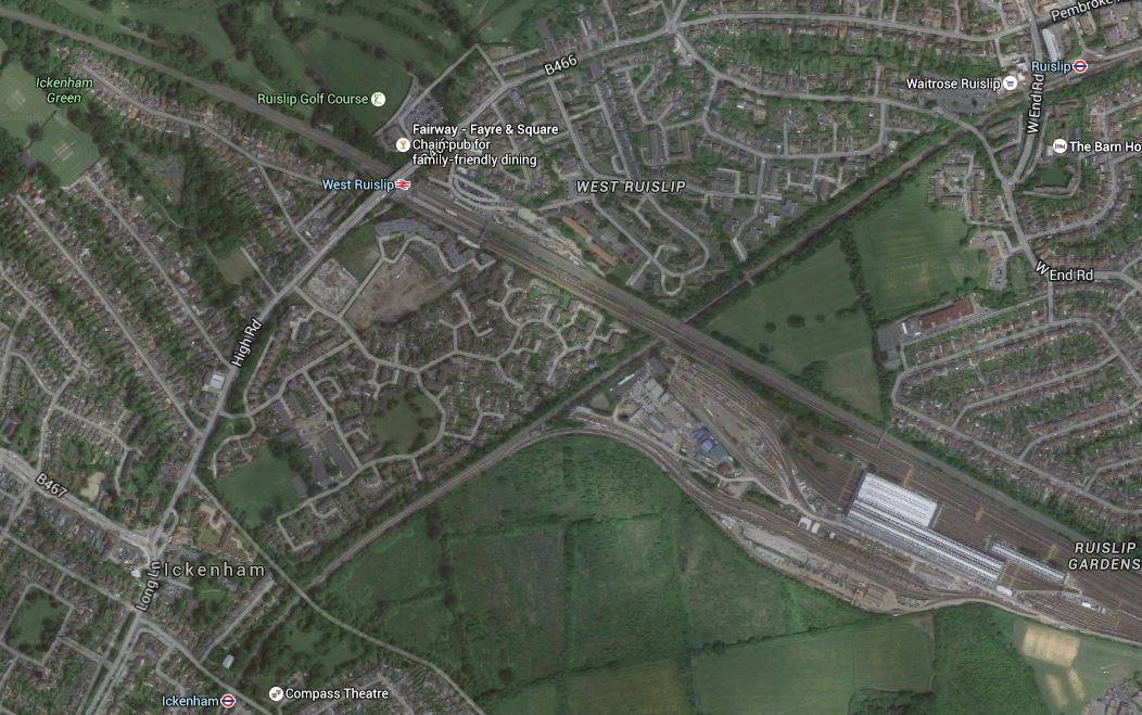
West Ruislip Station
West Ruislip Station has been proposed as the outer terminus of the Chiltern Metro.
This Google Map shows the station and the surrounding area.
West Ruislip Station
These are pictures I took of the station.
Note.
- A turnback facility is needed and this would probably be a siding on the West side of the station. It should be no problem to install.
- Platforms need to be lengthened for eight-car trains.
- There is plenty of space for two fast tracks through the centre of the station.
- Electrification if required wouldn’t be a problem.
I changed trains from the Chiltern service to a Central Line train.
Sorting Out Lines At West Ruislip
Before I went to West Ruislip station, I hadn’t realised how many lines pass through the area.
This Google Map shows a wider view of West Ruislip station.
Lines Through West Ruislip
These lines are shown on the map, or connect to these lines within a few stations.
- The Chiltern Main Line opened in 1906 as the Great Western and Great Central Joint Railway.
- The Great Western and Great Central Railway used to run passenger trains to Paddington along the Acton-Northolt Line.
- The Central Line opened in 1948 to Central London.
- The Piccadilly Line crosses to the East of West Ruislip station opened in 1933.
- The Metropolitan Line shares tracks with the Piccadilly Line opened in 1910.
- The Greenford Branch of the Great Western Main Line opened in 1903, joins the Central Line, four stations from West Ruislip station.
It shows how the various private companies went their own way. I’m sure if Borken had been in charge of London all of those years ago, we’d have a better pattern of rail lines in the area.
But some dreamers have plans. I discuss them in the next three sections.
Central Line To Uxbridge
In the Wikipedia entry for West Ruislip station, this is said.
The London Borough of Hillingdon announced in June 2011 that it would be lobbying Transport for London to have the Central line extended from West Ruislip to Uxbridge tube station. Such a project would require a business case approved by TfL and the completion of signal upgrade work on the Metropolitan line.
It is probably a valid aspiration, but could similar connectivity be created by perhaps adding platforms on the Metropolitan/Piccadilly Line, where it passes under the Chiltern Main Line and Central Line to the East of West Ruislip station and connecting everything together with a moving walkway?
If this were to be combined with the desired lengthening of the Chiltern platforms, this could be a worthwhile project, if the numbers add up.
Denham To Uxbridge
In the Wikipedia entry for Chiltern Railways under Active Plans, this is said.
Re-opening the former Great Western Railway branch line to Uxbridge High Street, continuing the route to Heathrow Airport. This would give Birmingham a direct rail link with Britain’s largest airport.
Uxbridge High Street station closed completely in 1964.
I would assume, that this would use the route of the Uxbridge (Vine Street) Branch to get to the Great Western Main Line at West Drayton station, from where it could use either of these routes to get to the Airport.
- Crossrail
- An extension of the Staines and West Drayton Railway
This could be the sort of ambitious plan that appeals to Chiltern.
This is a Google Map of Uxbridge Town Centre.
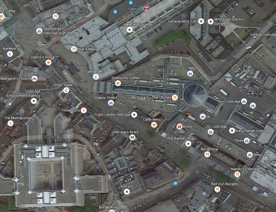
Uxbridge Town Centre
Note Uxbridge Underground station, High Street and Vine Street are all close together.
In Germany, they wouldn’t mess about, but would use a tram-train on the route.
- West Ruislip to Uxbridge as a train on a rebuilt rail line.
- Through Uxbridge Town Centre as a tram.
- Uxbridge to West Drayton and Heathrow as a train on a rebuilt rail line.
Obviously, the route could be adjusted to serve property, leisure and employment hotspots.
Greenford Branch Line
The Greenford Branch Line is like an elderly aunt, who gets forgotten to be asked to family parties, but when she does come, is extremely useful and entertaining, because she can do things, that others can’t.
The Wikipedia entry under Future says this.
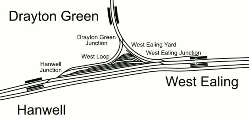
In 2017 Crossrail is due to begin using two of the four tracks of the Great Western Main Line and the Greenford service will terminate at West Ealing, rather than continue to Paddington, to obviate interference with Crossrail, and to create track capacity for increased services to Heathrow. In compensation the branch line service will increase from two to four trains per hour. Ealing Council desires to have the line connected to the south west to Clapham Junction via the West London Line, and to the north west to West Ruislip.
I think Ealing Council’s plan is a non-starter, if it envisages trains travelling along the Great Western Main Line.
But look at this map of the rail lines from carto.metro.free.fr.
Lines In West London
Note that it would appear that the track layout at Greenford could allow trains to go from the Greenford Branch towards West Ruislip and South Ruislip in the West or North Acton and Old Oak Common in the East.
These are pictures I took of the lines and the junction at Greenford station.

The current Greenford Branch platform would probably be augmented or replaced by platforms on the Acton-Northolt Line.
This Google Map shows the area around Greenford station.
Greenford Station And The Junction To The East
It would appear that parts of the junction have been built on, but it looks like it could easily be made possible for trains to pass in all directions, between the Acton-Northolt Line and the Greenford Branch.
The Greenford Branch is under three miles long and appears to be mainly double-track, but it does have a level crossing close to the Southern end.
I also took some pictures of the bay platform at West Ealing station, that is currently under construction.


I can’t be sure yet, but it does appear that the platform will be electrified.
So what does this say about how the rumoured four trains per hour that work the branch will be powered?
I think there are two possibilities.
- Diesel power as now.
- IPEMUs charged in the bay platform.
Given that one of London Overground’s Class 710 trains with an IPEMU capability and one of Great Western Railway’s Class 165 trains, that currently work the line, could use the same infrastructure, the choice of train would be up to the operator.
One problem that would have to be addressed is the short platforms at Drayton Green, Castle Bar Park and South Greenford.
At least if the branch was not electrified, there would be no wires to get in the way.
Look at this Google Map.
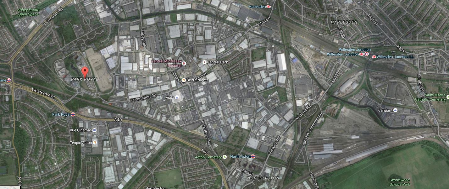
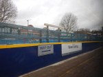
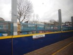
Park Royal To Old Oak Common And Wormwood Scrubs
Note.
- The red arrow points at Park Royal, which at 500 hectares, is the largest business park in London.
- The green area in the East is Wormwood Scrubs, which is one of the largest areas of common land in London.
- North of Wormwood Scrubs is Old Oak Common, which is mainly old railway land, that is being regenerated.
- Old Oak Common station, with connections to HS2, the West Coast Main Line, the Great Western Main Line, North London Line, West London Line, Crossrail and other lines is being created to serve the developments in the area.
Across the South of Park Royal and connecting to Old Oak Common station, runs the Acton-Northolt Line.
If transport planners and railway designers, can’t make a feast of these tasty ingredients, I’d be very surprised.
I said that the choice of rolling stock would be down to the operator.
As Ealing Council would like to see the Greenford Branch go to Clapham Junction, the obvious route is to go via the Acton-Northolt and West London Lines, stopping at appropriate stations en route, like Old Oak Common and possible new ones; South of Park Royal.
This would be a good fit with London Overground services and their four-car Class 710 trains would be ideal for the route.
With the full development of Old Oak Common station, this would not only give access to West Coast Main Line and HS2 services, but also direct access to the North London Line from West Ealing and West Ruislip.
The latter connection would make so many of those journeys across the North of the capital, so much easier and avoid going by the centre.
I think Chiltern too, will make a bid to get into running services on the Greenford Branch and the Acton-Northolt Line, as it would give them a very useful destination in London of Old Oak Common.
These services would also be a good fit with Chiltern’s services and trains.
Conclusion
The Chiltern Metro is certainly possible from an infrastructure point of view.
I also believe that with selective and appropriate electrification, that a 100 mph version of Bombardier’s new Aventra train with an on-board energy storage or IPEMU capability could handle all their services.
My project management and engineering knowledge (Note! Not experience!), also leads me to believe that most of the upgrade to electric trains could be done without too many blockades and disturbance, as much of the line is already to a very high standard with sufficient loading gauge to accept Aventras, when running on the on-board power source.
Just because you want to swap your diesel Mercedes for an electric Tesla of vaguely the same size, it doesn’t mean you have to move house or even build a new garage, as both cars run on the same roads. You just make sure the battery gets charged, rather than fill it up with fossil fuel.
It’s the same if you replace your diesel train with an Aventra IPEMU. Except that in places, you can charge your train as you’re running on any traditionally-electrified line.
The only problem, is to make sure, your trains get enough chances to charge their on-board energy storage devices. But railways have had the organisation of trains to various places down to a fine art for well over a hundred years.
It’s called timetabling!
