Is The Silvertown Tunnel A Silver Elephant?
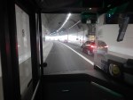
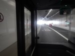
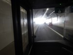
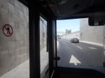
I have been through the Silvertown Tunnel several times now and every time the bus has never really slowed for lots of traffic.
I went through this morning on Easter Sunday and these pictures show all the other traffic I saw.
Note.
- I was sitting in the front passenger seat of a 129 bus, which is on the left of the bus.
- We were going from South to North through the Silvertown Tunnel.
- I could read the driver’s speedometer and it showed within a mile per hour of thirty all the way.
- We were passed by only one car in the tunnel.
- There were about a dozen passengers on the lower deck of the bus.
- I didn’t check how many were on the top deck of the bus.
Even on an Easter Sunday, I would have thought the service would have been busier.
Is The Silvertown Tunnel A Silver Elephant?
There are two answera to this question.
- Yes – A lot of money has been spent for just a few cars and bus passengers to have an easy ride through the tunnel.
- No – As traffic is flowing freely through the tunnel, it shows the tunnel is doing its job and freeing up traffic in East London.
But whatever view you take, a lot of money has been spent for a small number of vehicles and passengers to pass through the tunnel.
I also suspect very little extra revenue is being generated.
The Jubilee Line Was Busy
The complete route I took this morning was as follows.
- Home To Angel – 38 bus – Not very busy.
- Angel to London Bridge – Northern Line – Not very busy.
- London Bridge to North Greenwich – Jubilee Line – All seats taken.
- North Greenwich to West Silvertown – 129 bus – Not very busy.
- West Silvertown to Canning Town – Docklands Light Railway – Not very busy.
- Canning Town to Canada Water – Jubilee Line – All seats taken.
- Canada Water to Dalston Junction – Overground – Not very busy.
- Dalston Junction to Home – 30 bus – Not very busy.
Note.
- Only the sections on the Jubilee Line were really busy, with all seats taken.
- London Bridge, Stratford and Waterloo stations on the Jubilee Line are also busy National Rail stations.
- London Bridge, Canada Water, North Greenwich, Canning Town and Stratford all have large modern well-designed bus stations within easy walking distance of the Jubilee Line.
- Given, that there is now a charge to cross the river, have a lot of people decided to take the Jubilee Line rather than their car to go to the O2 at North Greenwich and the Olympic Park and Eastfield at Stratford?
I strongly feel, that more capacity is needed on the Jubilee Line, as no matter what time I use it, I never seem to get a seat.
Taking The Dover Road
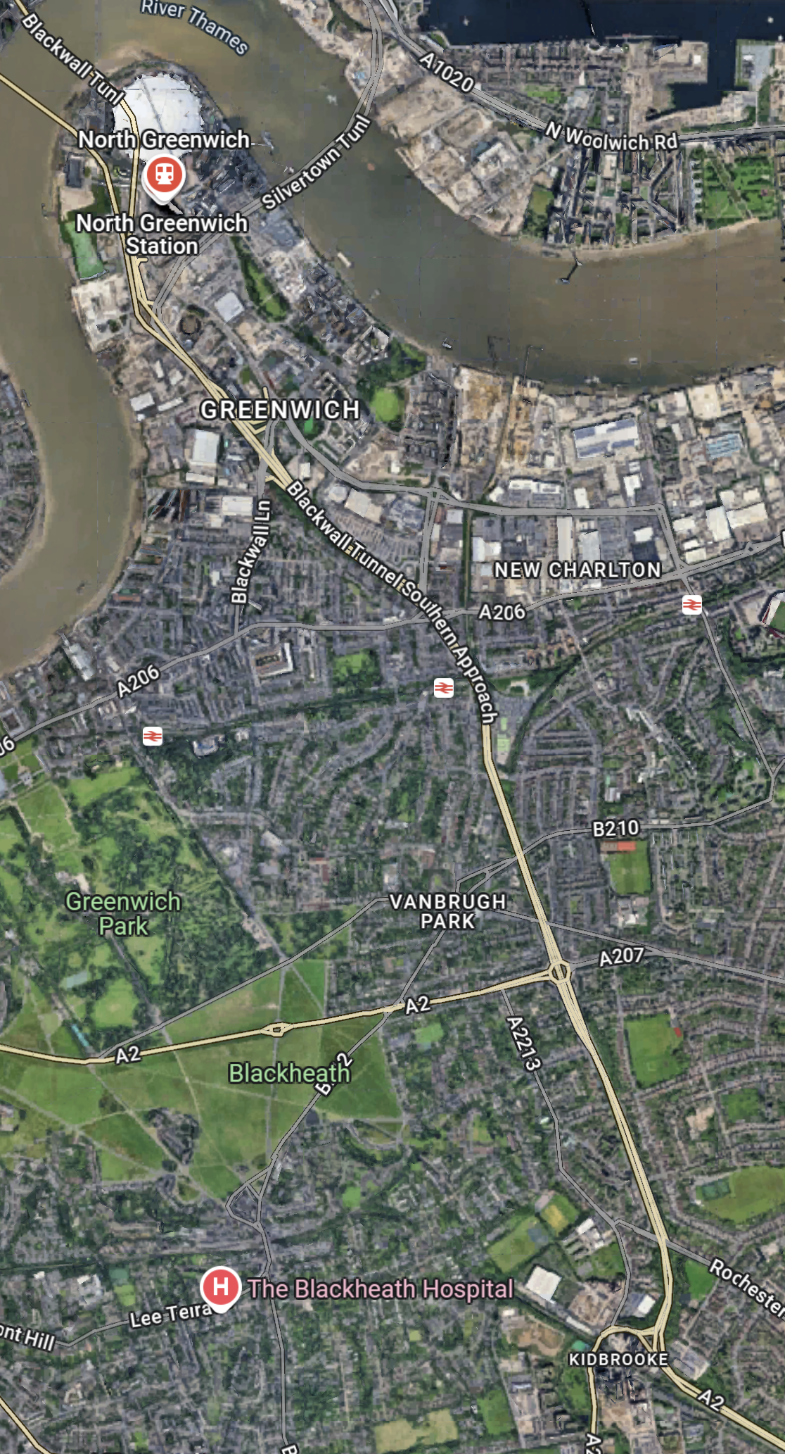
This Google Map shows how the A2 ( the Dover Road) links up with the Silvertown and Blackwall Tunnels.
Note.
- The O2 in the North-West corner of the map, with North Greenwich station in red under it.
- The Blackwall Tunnel crosses the river to the North-West of the O2.
- The Silvertown Tunnel crosses the river to the East of the O2.
- Running diagonally across the map is the Blackwall Tunnel Southern Approach, which also serves the Silvertown Tunnel.
- The station to the West of the Southern Approach is Westcombe Park station.
- Click the map to show it to a larger scale.
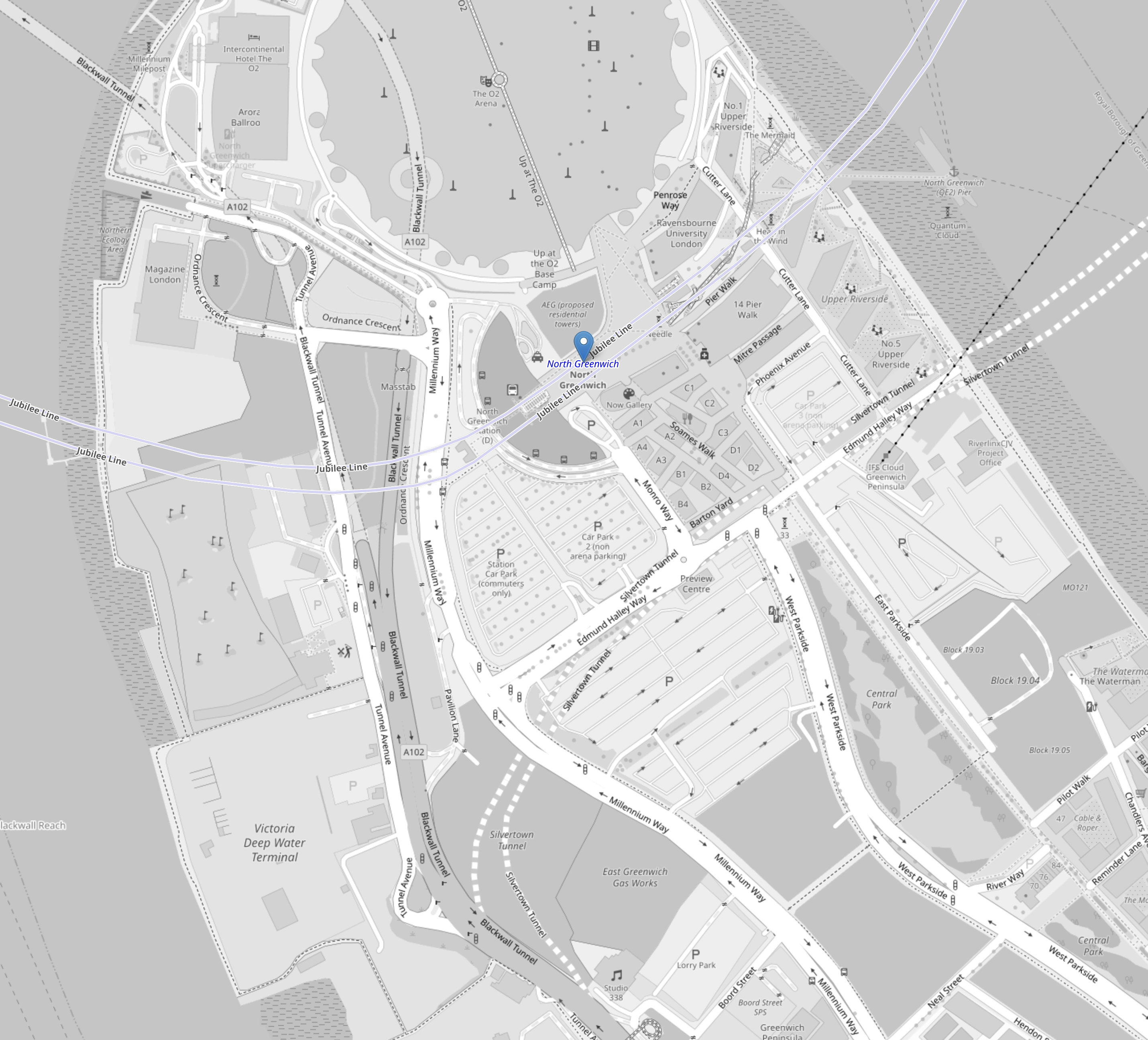
This second Google Map shows the O2, North Greenwich station and the approaches to both tunnels.
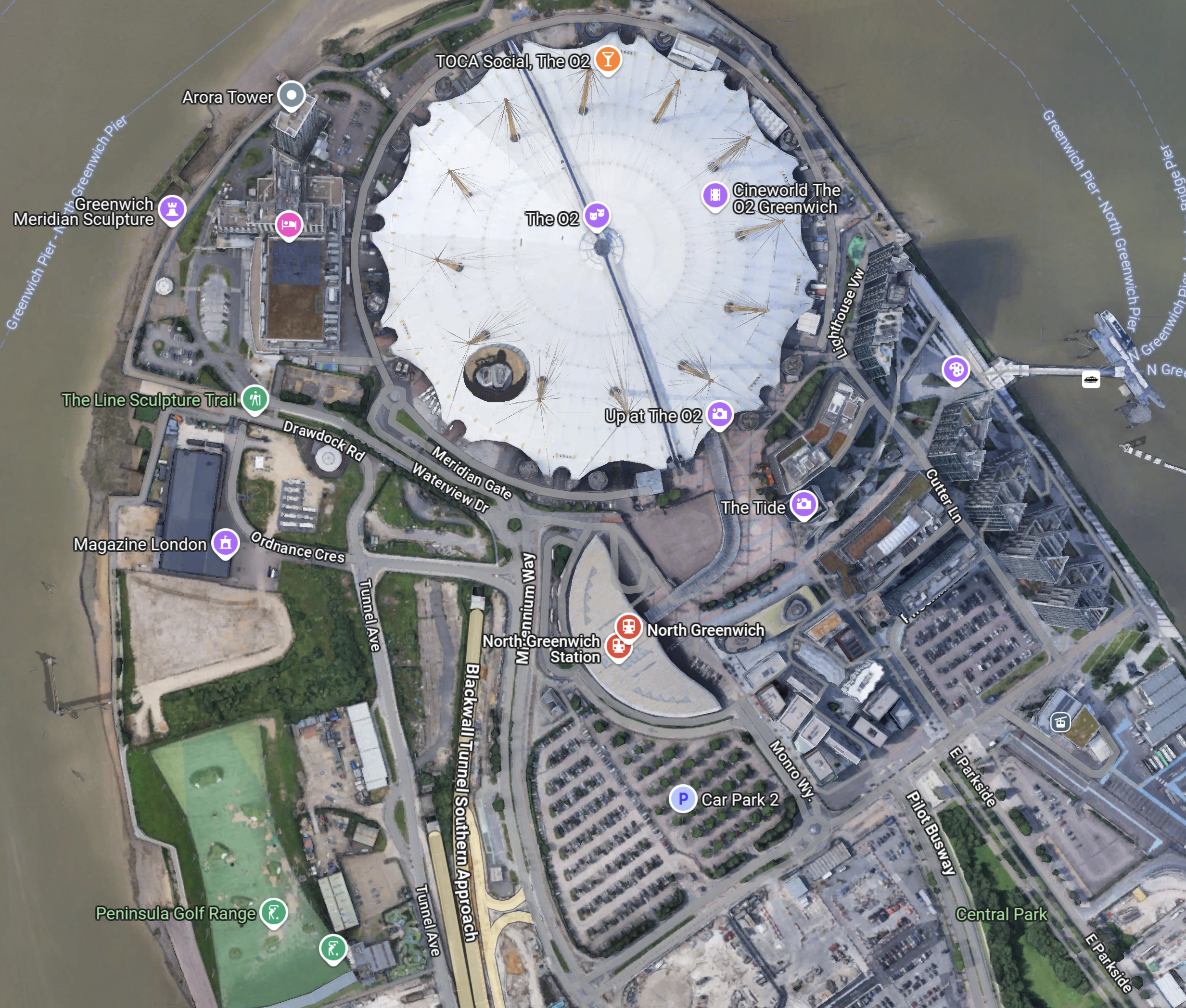
Note.
- The half-moon-shaped building is North Greenwich station.
- The tunnel approaches are rather complicated, but seem to be working well.
- There is lots of car parking.
- The Blackwall Tunnel Southern Approach leaves the tunnles in a Southerly direction.
- Click the map to show it to a larger scale.
This third Google Map shows how the A2 (Dover Road) and A20 (Folkestone Road) link up to the Blackwall Tunnel Southern Approach.
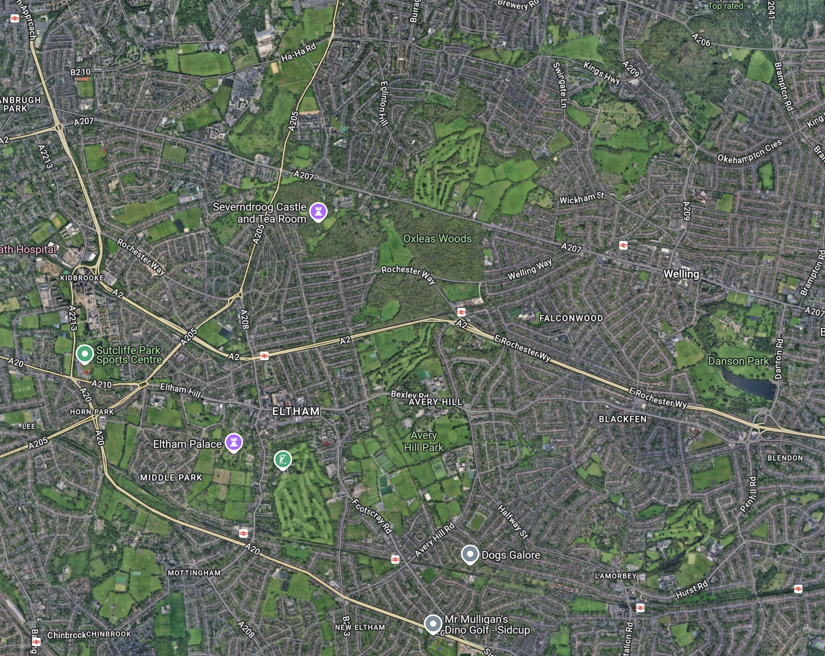
Note.
- The station in the North-West corner of the map is Westcombe Park.
- The road running diagonally South-East from the corner is the Blackwall Tunnel Southern Approach.
- The Blackwall Tunnel Southern Approach then turns East to join with the A2 (Dover Road).
- The Blackwall Tunnel Southern Approach also links up with the A20 (Folkestone Road) , which is the other road running diagonally at the bottom of the map.
In some ways, I am rather surprised at how little traffic is passing through the tunnels given this double dual-carriageway/motorway connection to East Kent, the Channel Tunnel and the Continent. It also has a double connection at both the A2 and A20 to join the M25.
Perhaps, it does mean that the charges are frightening drivers away.
The Roads To The North
This Google Map shows the main approach road to the Blackwall Tunnel.
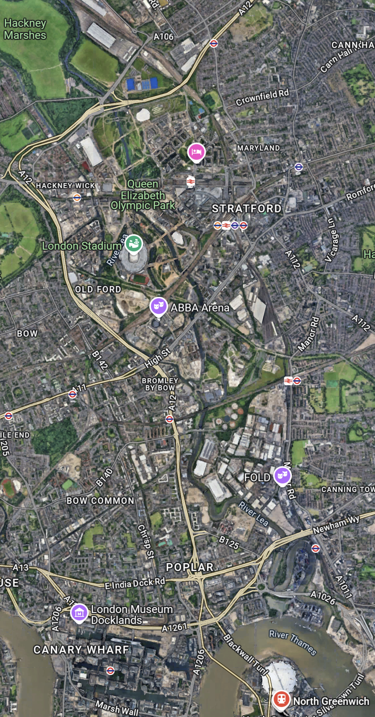
Note.
- The O2 and North Greenwich station in the South-East corner of the map.
- The Blackwall Tunnel crosses the river to the North-West of the O2.
- The A12 dual-carriageway runs North up the Lea Valley through Hackney.
- There is a dual-carriageway/motorway box formed by the M11 in the West, A12 in the East, M 25 in the North and A 406 in the South to speed traffic on its way, including to the two main routes to the North; the M1 and the A1.
I have lived for thirty years of my life in North London, and I feel, that although the roads to the North of London could be improved, I don’t suspect they are the reason drivers are not using the Silvertown and Blackwall Tunnels.
I would suspect that drivers don’t like or trust the charging system, or could it be that the public transport system in London and especially the East of London is too good?
But we do need to increase the capacity of the Jubilee Line either directly or would a high-capacity bus-route shadowing the line, be able to add the extra capacity needed?
Silvertown Tunnel Bus Network Proposals
This web page is the Silvertown Tunnel Bus Network Proposals.
These proposals are made.
- A new high frequency, limited stop service between Grove Park and Canary Wharf referred to in this consultation as route X239
- To extend route 129 (Lewisham – North Greenwich) north across the river to Great Eastern Quay via the Royal Docks development zone
- A minor change to route 108 so that it uses the new Millennium Way slip road to exit the Blackwall Tunnel southbound
- We are also seeking your views on route options for three sections of routes 129 and X239.
It looks like route 108 will continue to use the current stop.
The proposals include this map.
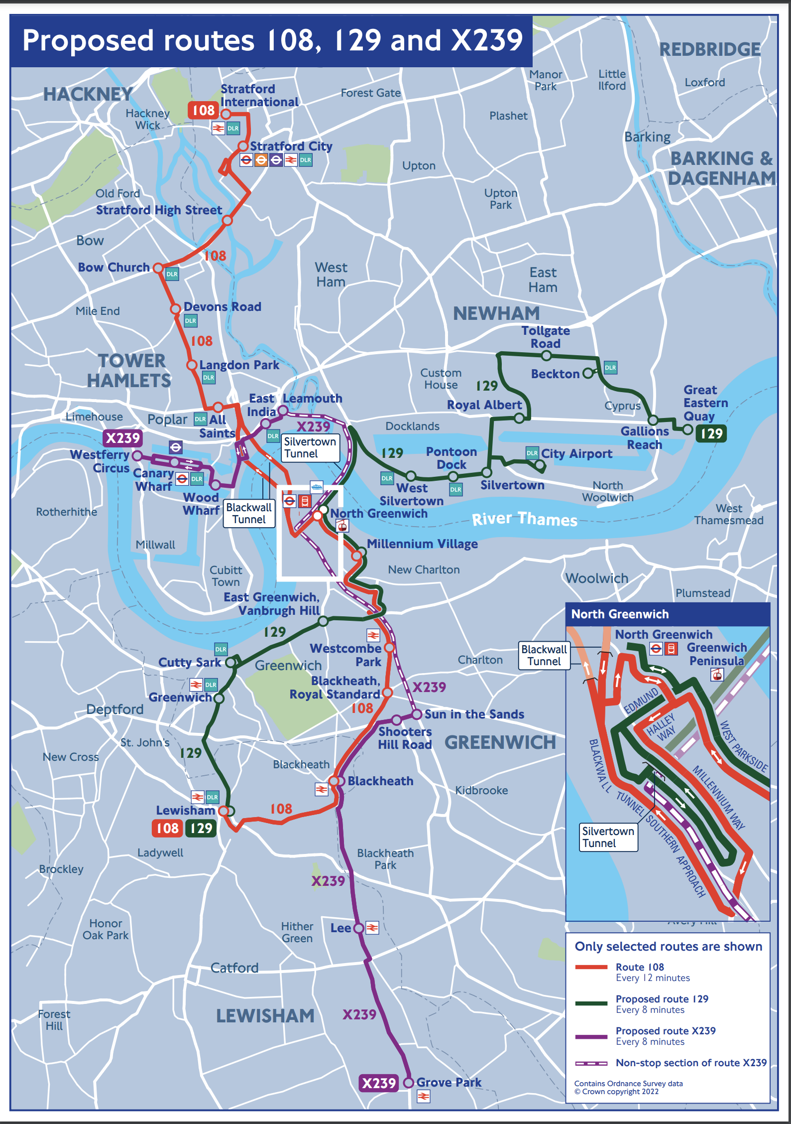
I copied this map from the TfL web site, as they don’t provide one for people who want or need to use it.
These are my observations.
The 108 Bus
The 108 seems to be more or less as now and will be continue to be run by a single-decker bus, as double-decker buses can’t use the Blackwall Tunnel.
North of the Thames, the 108 calls at these stations.
- Stratford International for DLR and National Rail.
- Stratford for DLR, Central, Elizabeth and Jubilee Lines, and National Rail.
- Bow Church for DLR
- Devons Road for DLR
- Langdon Park for the DLR
- Bazely Street (All Saints) for DLR
South of the Thames, the 108 calls at these stations.
- North Greenwich for the Jubilee Line.
- Westcombe Park for National Rail
- Blackheath for National Rail
- Lewisham for DLR and National Rail
Note.
- It is possible to go between Lewisham and Stratford on the DLR with a change at Canary Wharf.
- It is possible to go between North Greenwich and Stratford on the Jubilee Line.
- Westcombe Park station is on the Greenwich Line.
I would wonder, if many people use this bus route for long distances.
The 129 Bus
Note.
- The 129 appears to connect Lewisham and Greenwich to the City Airport and the Becton branch of the DLR.
- Many journeys on the 129 bus, might be easier using the DLR, with a change at Westferry or Poplar, which is probably what travellers do now.
- The 129 bus is shown on the map with a stop at Silvertown. Does that mean that it could connect with a Silvertown station on the Elizabeth Line?
- As the 129 bus will pass through the larger Silvertown Tunnel, it could be a double-decker route, instead of the current single-decker.
North of the Thames, the 129 calls at these stations.
- Gallions Reach for the DLR
- Beckton for the DLR
- Royal Albert for the DLR
- London City Airport for the DLR
- Silvertown
- Pontoon Dock for the DLR
- West Silvertown for the DLR
South of the Thames, the 129 calls at these stations.
- North Greenwich for the Jubilee Line.
- Cutty Sark for DLR
- Greenwich for DLR and National Rail
- Lewisham for DLR and National Rail
Would improvements and a frequency increase to the DLR and the building of Silvertown station, mean that changes to the 129 bus route, would not be so important?
The X329 Bus
Note.
- Canary Wharf must be served and starting at Westferry Circus is probably a good choice.
- But is Grove Park station, the ideal Southern terminal?
- Not stopping the X329 bus at North Greenwich is probably correct, as North Greenwich station is a large Jubilee Line and bus interchange close to the O2.
North of the Thames, the X329 calls at these stations.
- Canary Wharf for DLR and Elizabeth and Jubilee Lines
South of the Thames, the X329 calls at these stations.
- Blackheath for National Rail
- Lee for National Rail
- Grove Park for National Rail
Note.
- Blackheath station is on the Bexleyheath and North Kent Lines.
- Lee station is on the Dartford Loop Line.
- Grove Park station is on the South Eastern Man Line.
- Grove Park has a bus station, where there could be space for a battery charger for electric buses.
The X329 seems to have been partly designed on the premise, that an express bus should be run through the Silvertown Tunnel. But it does connect four of the rail lines going into London terminals to Canary Wharf.
Silvertown Station For London City Airport
Silvertown station would more than double the number of stations with easy routes to the London City Airport.
The Elizabeth Line would enable the direct connection that is needed to Canary Wharf, the City of London, Heathrow, Liverpool Street and Paddington stations and the West End.
- A single change at Abbey Wood, would give access to much of Kent.
- A single change at Farringdon, would give access to Thameslink services and Gatwick and Luton airports.
- Around 2030, a single change at Old Oak Common, would give access to High Speed Two services.
- A single change at Paddington, would give access to Wales and West services.
- A single change at Whitechapel, would give access to the great circle of the London Overground.
I believe the case for a Silvertown station with at least a good walking route to the London City Airport is strong, and the station would be a marvellous asset for Silvertown and the Airport.
The Southern End Of The Silvertown Tunnel
This map from OpenRailwayMap shows the Southern end of the Silvertown Tunnel.
Note.
- The O2 Arena at the top of the map in the middle.
- The blue arrow below it, which indicates North Greenwich station.
- The two dotted white lines show the route of the Silvertown Tunnel.
- The two silver-grey lines that loop across the top part of the map are the Jubilee Line.
- The black dotted line between the Jubilee Line and the Silvertown Tunnel is the cable car.
This second OpenRailwayMap shows the Silvertown Tunnel’s junction with the approach to the Blackwall Tunnel.
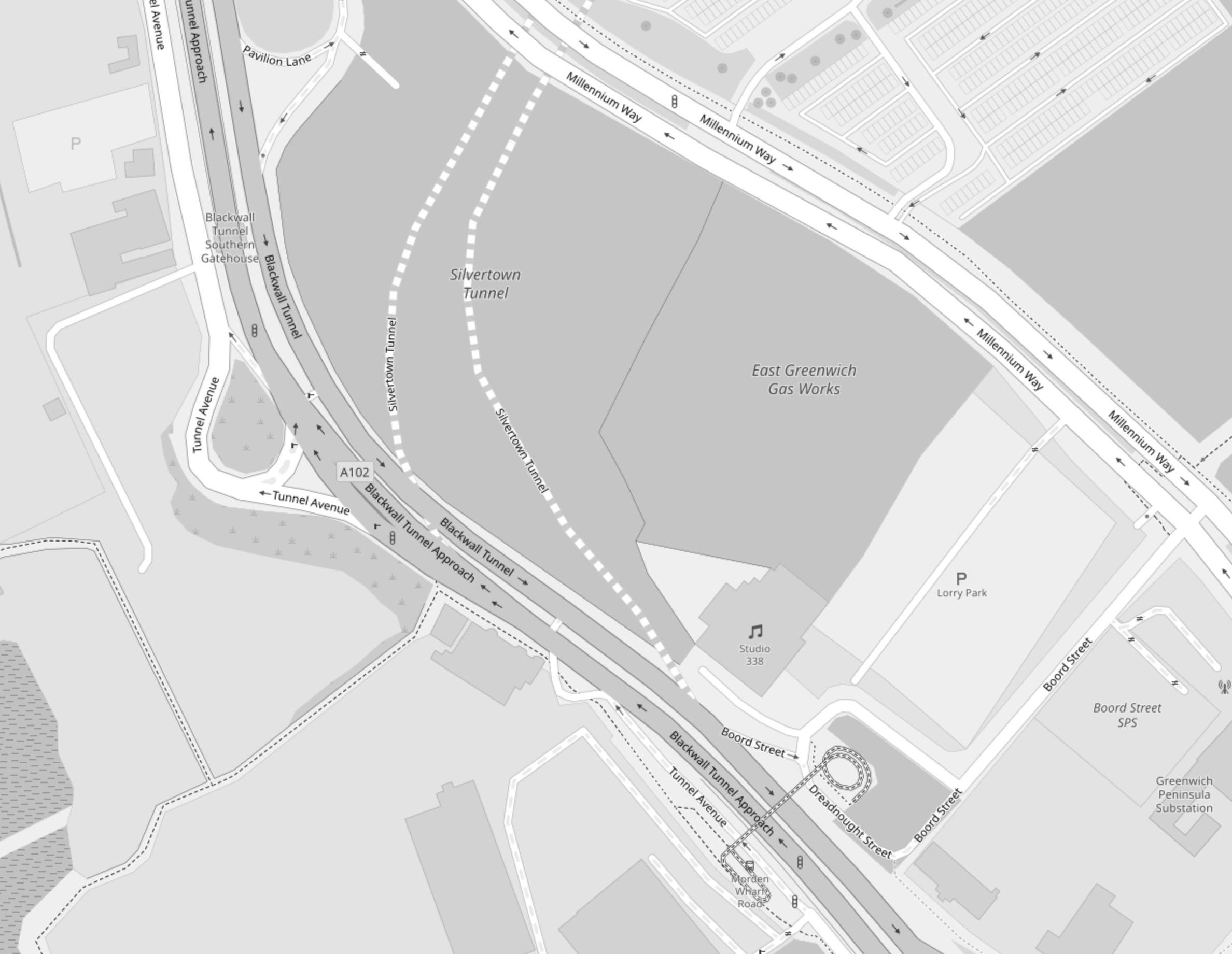
Note.
- The two dotted white lines show the route of the Silvertown Tunnel.
- Studio 338, which is a music and arts venue, is indicated by the double quaver.
- The site to the North of Studio 338 is labelled the East Greenwich Gas Works.
- The roads to the Northbound tunnel bores of both tunnels, split to the West of Studio 338.
- The roads from the Northbound tunnel bores of both tunnels, join to the West of Studio 338.
This Google Map shows the same area as the previous map.
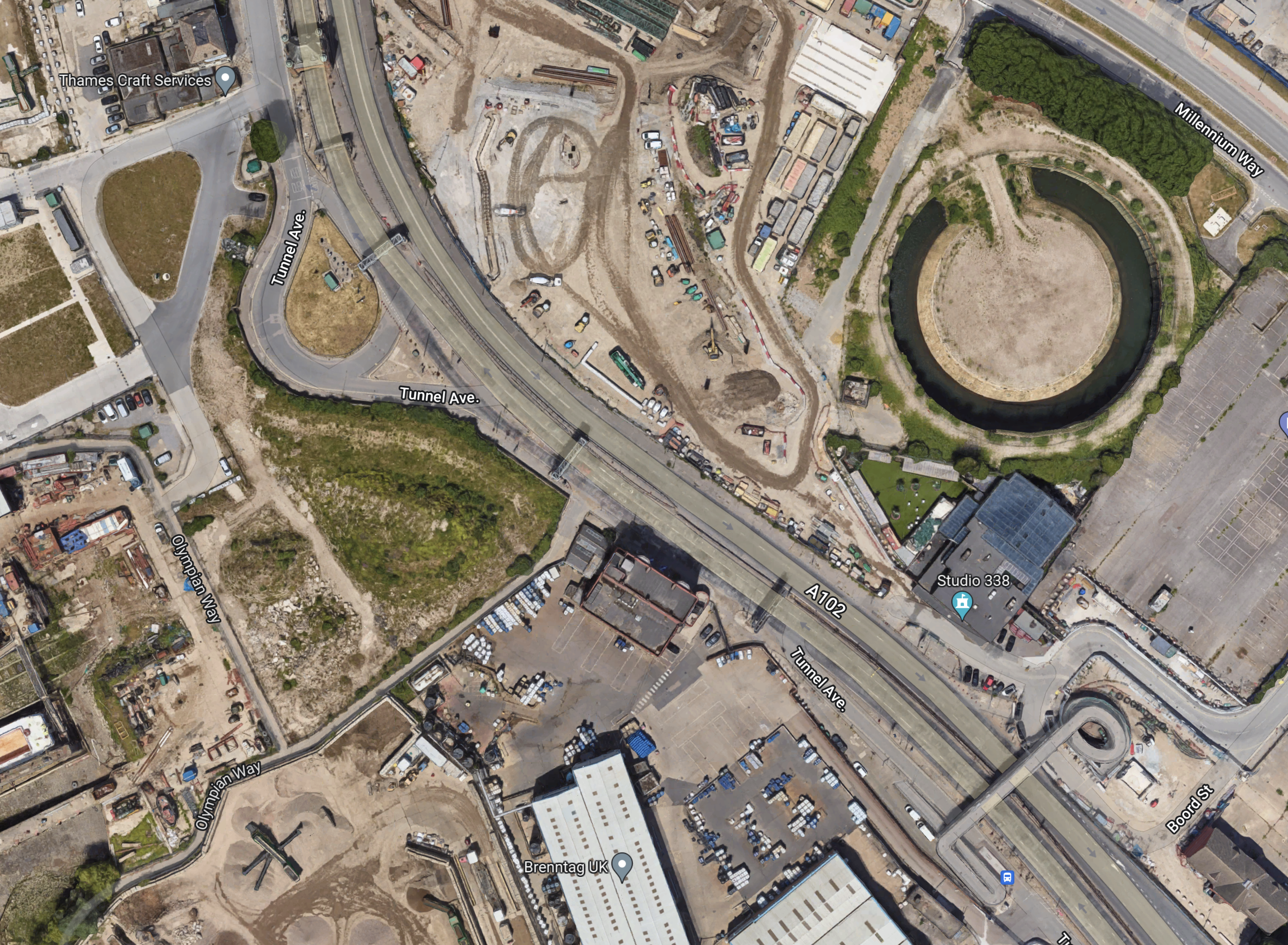
Note.
- Studio 338 is clearly marked.
- To its North is a circular structure on the site labelled as the East Greenwich Gas Works on the previous map.
- Could this be the remains of a gas holder?
Could it be that the works to the West of the circular structure are the start of tunneling?
Conclusion
It looks to me, that the designers of the Silvertown Tunnel have been able to squeeze in a junction between the approaches to the two tunnels, that should be fairly free-flowing.
