Crossrail 2 October 2015 – Dalston Station
Are us plebs in humble Dalston going to get one of the best and busiest stations on Crossrail 2?
I wrote that opening statement in jest, but think about the proposed combined Dalston station’s position in London’s rail network.
- It is the most Northerly station before the two branches to New Southgate and Broxbourne link under Stamford Hill.
- Dalston Junction (Or is it Dalston South?) gives an escalator connection between Crossrail 2 and an up to twenty-four trains an hour to South-East London on the East London Line.
- Dalston Kingsland (Or is it Dalston North?) gives an escalator connection between Crossrail 2 and all those trains on the North London Line.
So Dalston will become the important interchange for a large number of cross-London journeys. Raynes Park to New Southgate may well be direct, but so many journeys like Norwood Junction to Brimsdown will just be a single change at Dalston.
Crossrail 2 will put Dalston in one of the most important places on the map of London’s rail network.
Crossrail 2’s proposal for Dalston Station
This Crossrail document is entitled Dalston Station.
The proposal in the document starts like this.
The Crossrail 2 station at Dalston would be a double-ended station, with an interchange at Dalston Junction at the southern end, and an interchange with Dalston Kingsland at the Northern end.
So we get three stations in one, which also means that at last there will be a true dry interchange between Dalston Kingsland station on the North London Line and Dalston Junction station on the East London Line.
This map from the document shows the layout of the two existing stations and their connection by means of two two-hundred and fifty metre long underground Crossrail 2 platforms.

Crossrail 2 Dalston Station
It would appear that two shafts will be sunk to the Crossrail 2 tunnels.
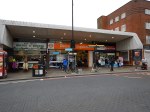
- The Southern one would be in the Tesco Express or the bar next door,
- The Northern one would be just to the north of Ridley Road in the block containing the NatWest Bank.
Note how much of the route of the Crossrail 2 tunnels, runs on the East side of Kingsland High Street, under the Shopping Centre and the new flats. The tunnels will be at least twenty metres down just to get past High Speed One, which runs under the North London Line and Dalston Kingsland station, so any older buildings will be well above any Crossrail 2 construction.
I would also suspect that High Speed One also makes designing and construction of the Kingsland end of the station challenging.
The Work Sites
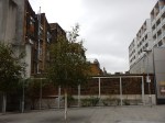
The Crossrail 2 proposal for Dalston station is nothing but ambitious and to build it there will be no less than five work sites.
- Site A – Would be used as the main site for construction of the station tunnels and southern station shaft
- Site B – Would be used for construction of a new Crossrail 2 station entrance and ticket hall. The site includes properties on the southern side of Bradbury Street.
- Site C – Would be used for construction of the northern station shaft and escalator connection to the Crossrail 2 platforms
- Site D – Would be used for construction of a new bridge providing access from the new ticket hall to the westbound platform at Dalston Kingsland
- Site E – Would be used for construction of a station entrance and ticket hall, for interchange with Dalston Junction station.
But I would be very surprised if the work wasn’t phased so that the work-load in Dalston was spread and work is performed in a logical order.
Dalston Kingsland station is a dump compared to Dalston Junction station, with all the charm, access problems and convenience of a Victorian tube station.
In a reasonable world, it would be replaced now, whether Crossrail 2 is built soon or postponed to the Twenty-Second Century.
The need for a Site D indicates that a new bridge will be built across the station to give access. As Site D is currently in the construction site for new flats called Fifty Seven East and Dalston Kingland station desperately needs step-free access, then surely this bridge should be built now!
To further assess the work-sites, I walked along Tottenham Road to Site A, then crossed to Site E, before walking up Kingsland High Street to look at Sites B, C and D.


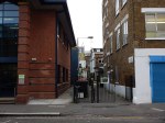


There is certainly, a lot going on and if everybody gets it right, it can become one of London’s more important High Streets.
What Is Already Happening In Kingsland High Street?
Before I come to my conclusions, I’ll say a little about what is already happening.
- Plans may have been published to rebuild Dalston Kingsland station.
- There are more projects to build flats in the area. London needs housing and as these will be designed so they don’t affect Crossrail 2, they will go ahead.
- The Dalston Kingsland Shopping Centre is supposed to be being rebuilt.
- There are also plans to improve the pedestrian flows on what is a very congested road for walkers.
- There will be other changes due to the Cycle Superhighway passing about fifty metres to the west of Kingsland High Street.
So in say four or five years time, we should have a better High Street and Kingsland station, whether Crossrail 2 is coming or not!
Conclusions
So what are my initial conclusions?
- Because of the station design, there will need to be some demolition at both current stations.
- Site A needs a full rebuild, as it has very little property of merit and I certainly wouldn’t miss the Subway, Tesco and the bar on the end. The shaft to access the new platforms, will probably be in the middle of the current Tesco.
- Site B is in a bad state with much of the property locked up. Some of the properties on Bradbury Street will need to be demolished to rebuild Dalston Kingsland station, let alone build the Crossrail 2 station. Will anybody mourn?
- Site C is where the Northern shaft will be. There will be some demolishion.
- Site D is a curious one in that it is inside a site that is being developed.
- Site E is where the new entrance to |Dalston Junction and the Crossrail 2 station is going to be built. I’d have hoped that the Crossrail 2 passages would have been laid out in the redesign of the Overground station. What’s been published gives me doubts!
- How much of the demolition will be of properties worth keeping? Those that I photographed didn’t shout save me!
There are three sites on the High Street, which will be very much affected by the rebuilding of Dalston Kingsland station and building of Crossrail 2.
- Site A, where the Southern shaft for the station is located.
- Site B, where the Northern entrance to the new station is proposed, is substantially closed at present.
- Site C, opposite Dalston Kingsland station that will contain the Northern shaft for the station and escalator connection to the Crossrail 2 platforms.
All could be developed with new residential or commercial properties on top.
I believe that the proposed plan for the new Crossrail 2 station should be treated as what it is, just a proposal.
Or at least as far as the above ground presence is concerned.
All three sites could be developed as welcoming portals to enhance the public transport system as it serves the area around Dalston.
I would apply the principle, that access to the Crossrail 2 station, should be available from both sides of Kingsland High Street at both the Northern and Southern ends.
I will now look at each site in detail.
Site A
This is a Google Map showing Dalston Junction station and Site A.
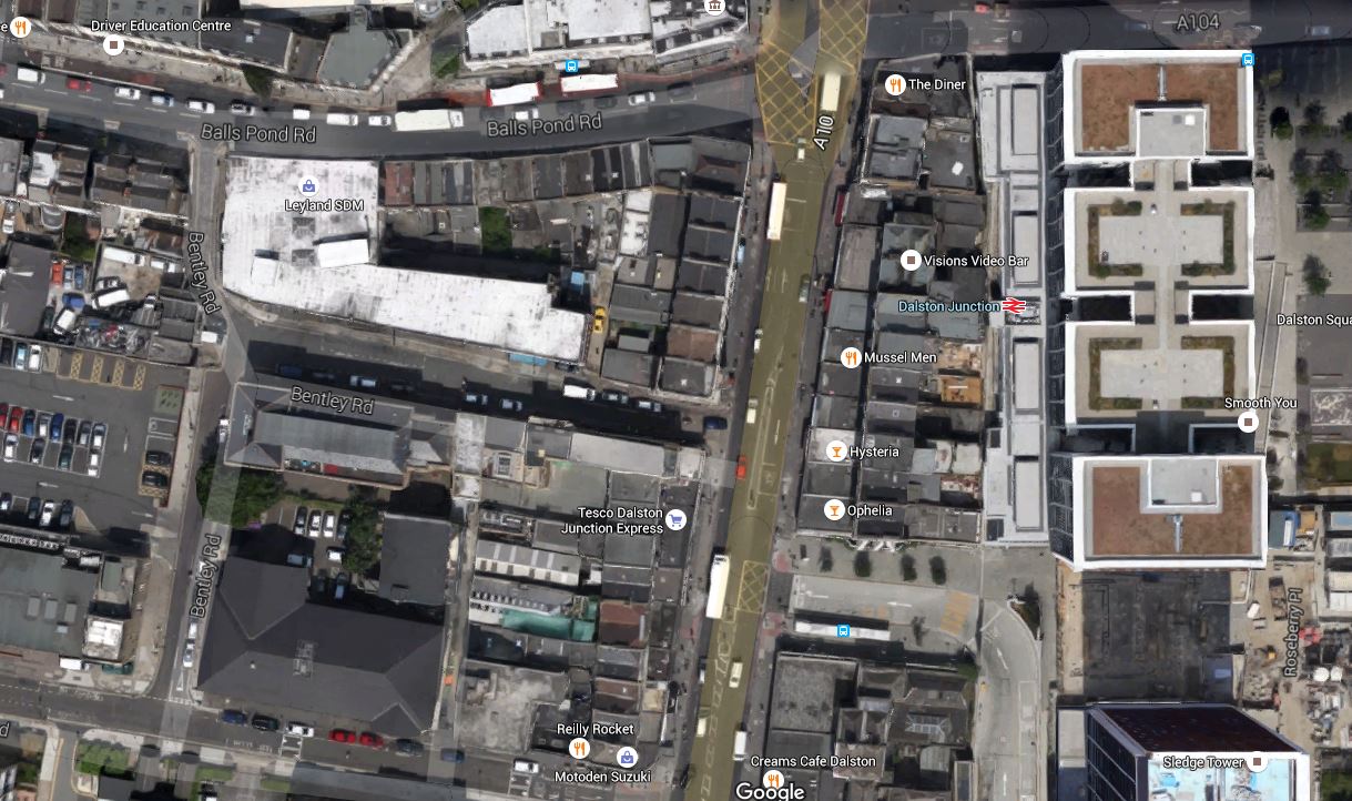
Dalston Junction Station And Site A
Note the station and its towers above in the East and Bentley Road Car Park in the West. You should be able to pick out the Tesco Express on the Kingsland Road.
I walk to Dalston Junction station most days to get the Overground. But it is not a good walking route.
- The pavements along the Balls Pond Road and Kingsland Road are very narrow and you are squashed between traffic and large numbers of walkers.
- It is easier to walk up Tottenham Road, but as with the other route crossing Kingsland Road can be difficult.
- If you live to the South West of Dalston Junction station, it is probably easier to walk to Haggerston station, as I do sometimes.
- It is particularly difficult to cross at the cross roads where the Balls Pond Road meets the Kingsland Road.
As the frontage of Site A on the Kingsland Road will have to be substantially demolished, in an ideal world, provision would be made to access the escalator and lift connection to the Crossrail 2 station from the West side of Kingsland Road.
Perhaps when the frontage of Site A on Kingsland Road is rebuilt after Crossrail 2 works have finished, it should provide a subway under the road to the station and the sort of shops and cafes, that passengers like in their stations.
It would welcome those, who live to the South West of Dalston Junction station to the area, just as Dalston Square on the other side of the station welcomes those from the South East.
Site B
This is a Google Map showing Dalston Kingsland station and Sites B and C.

Dalston Kingsland Station And Sites B And C
Site B is to the North of Dalston Kingsland station, on the West side of Kingsland High Street.
Note that this map was made before the construction of Fifty Seven East started, as Peacocks is still on the West side of Kingsland High Street.
I feel that if they rebuild Dalston Kingsland properly, then then are possibilities to not only build residential or commercial development on top of Site B, but over the railway and the station as well.
Land is expensive and the station occupies almost as much space as Fifty Seven East, so surely a similar sized development over the station would be a welcome addition to London’s housing stock.
I would also hope that the design of the station includes the following.
- A step-free subway under Kingsland High Street to Ridley Road Market. This is probably a given, as the escalators to Crossrail 2 go down from Site C.
- As the station is close to the Cycling Superhighway, I suspect that it will be heavily used by cyclists, who would need lots of secure bike parking.
- Personally, I would like easy walking access along Bradbury Street as I regularly walk to Dalston Kingsland station along that route.
There are certainly lots of possibilities to make the existing Dalston Kingsland station a welcoming North West gateway to Crossrail 2 and Kingsland High Street.
Site C
This is a Google Map showing Dalston Kingsland station and Sites B and C.
Dalston Kingsland Station And Sites B And C
Site C is to the North of Dalston Kingsland station, on the East side of Kingsland High Street. The NatWest bank, which is at the Northend of Site C is indicated.
Any development on this site must enhance the Ridley Road Market and provide that gateway for those travelling to and from the North East of the station.
It is essential that there is an entrance to the station on the East side of Kingsland High street, to give good connections to the market and the Shopping Centre.
My Ultimate Test Of The New Station
My ultimate test of the new Dalton station would be on a cold and wet day, to have the ability to arrive at Dalston Kingsland station on the North London Line, go down an escalator to Crossrail 2, where I can walk along to the Southern End, go up the escalator and exit the station on the West side through a rebuilt Site A.
And do it pushing my yet-to-be-born great-grandchild in a buggy! The spirit of my grandmother, who was born opposite Dalston Junction station would be very pleased!
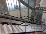
Stations For Inclined Lifts
After the superb installation at Greenford, I wonder if stations like these will get inclined lifts in their third space.
It would probably be dependent on the layout of the stations, but we’ll certainly see more.
Highbury and Islington station might be able to have a central inclined lift, but then to get to the platforms, there are further difficult stairs. If ever a station was built that would be difficult to provide step-free access, it is this one.
Could We See Some Packaged Inclined Lift Applications?
I liked the inclined lift at Greenford, that I saw yesterday.
There are many stations in the UK and across the wider world, where access to the trains is down a long staircase from a road or bridge that crosses the platforms at a right angle.
So could a simple inclined lift be fitted alongside these stairs, at Mill Hill station in Blackburn?
I think that you could build a lift in its own glass module in a factory, make an appropriate hole in the bridge parapet and lift the inclined lift into position on the platform.
There could be several advantages.
- The preparation work at the station would not be major construction.
- It would surely be more affordable for stations with low usage for passengers, who need full step-free access. Mill Hill might be an example., as the station isn’t used by more than 70,000 passengers in total in a year.
- If say the station were to be rebuilt, the lift could be saved and used elsewhere.
- The installation of the lift could be a very fast process, perhaps done over a weekend.
- The package could include a staircase, which could be covered if desired.
I think that when architects see the stairs/escalator/inclined lift combination at Greenford station, they’ll get some very imaginative ideas.
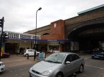
The Inclined Lift In An Improved Greenford Station
I visited Greenford station in January 2012, just after Transport for London announced that the last wooden escalator would be replaced with an inclined lift.
The lift has now been installed.

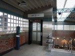
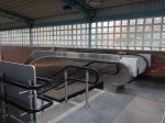
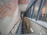


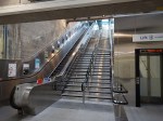

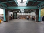
I rode down and then used the escalator up.
It is impressive and you do wonder how many other stations could have this type of lift installed.
This article on the Crossrail web site, entitled Crossrail and TfL to Install First Incline Lifts in UK Public Transport, says this.
Crossrail and Transport for London (TfL) today awarded a major contract to Kone for around 50 lifts for the new Crossrail stations as well as five lifts for Bank, Greenford and Hammersmith Tube stations.
Crossrail will pioneer the use of incline lifts to deliver step-free access at two of the major central London stations. Four innovative incline lifts will run alongside escalators at Farringdon and Liverpool Street Crossrail stations where it is not possible to install vertical lifts. London Underground will also install an incline lift at Greenford station by 2014.
My gateway to the Victoria Line; Highbury and Islington could be a possibility, but one of the station staff told me, that the space at the bottom of the current set of two escalators and a fixed staircase is very small and fitting a third escalator is impossible.
But it might be possible to squeeze in a much needed inclined lift. Note that the lift doesn’t intrude into the circulation space at the top and bottom of the stairs.
I suspect that Transport for London will be watching the Greenford installation with more than a usual interest.
They’ve certainly got several stations with both an up and down escalator and a stairway between that could be possibilities for conversion to fully step-free by the use of an inclined lift.
The station I could have used more times than any other; Southgate has the required space between the escalators, but as it is a Grade 2* Listed building, I can’t see the heritage lobby allowing even a well-designed and tasteful inclined lift into the Jewel of the Piccadilly Line.
But Bounds Green, Manor House, Turnpike Lane, Walthamstow Central and Wood Green could be ones to upgrade.
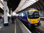
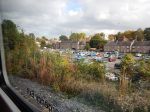
York Station
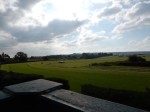
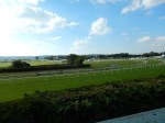
York station is a busy station as both the East Coast Main Line and Cross Country services pass through. It is also quite large with eleven platforms.

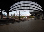

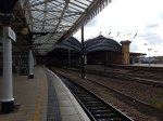
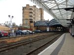
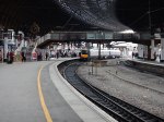

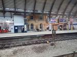

The pictures show how you can look out along the Scarborough Bridge and the bay platform 2, where trains from Scarborough can be turned back.
The last shot is the car park where the three mobile cranes were positioned to lift the bridge into place in Dancing With Cranes And A Bridge With Help From Lego.
It is worth taking a look at this Google Map of the station.
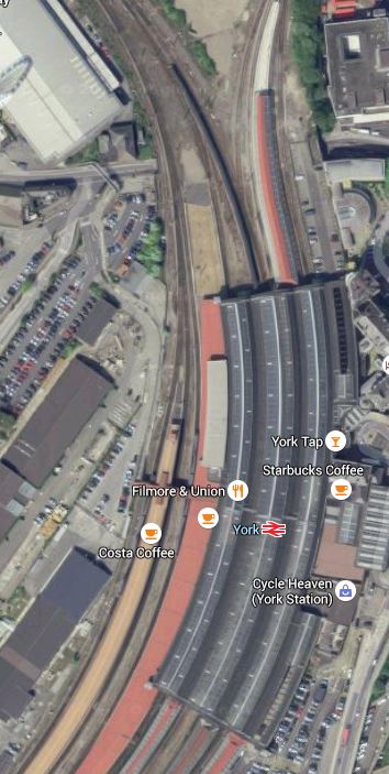
York Station
Note the island platform poking out from under the roof at the top, with Platform 4 on the left and Bay Platform 2 on the right.
There is another simple Bay Platform 1 at the southern end, which serves the line to Hull.
Both platforms 1 and 2 could be electrified, if it was decided to run IPEMU trains to Hull and Scarborough respectively. I think that East Yorkshire services could be electrified in this manner using the power at York, Doncaster and Leeds, with perhaps some form of top-up at Hull and Scarborough.
More On The Camden Town Station Upgrade
This document on TfL’s web site gives more details of the proposed capacity upgrade at Camden Town station. This schematic of the tunnels, platforms and walkways shows how the station could look in a few years time.

Camden Town Station Schematic
Note the following.
- The Northbound platforms are above the South ones.
- The triple escalators (7) and double lifts (8) at the left, leading down the the circulation space (9), which is shared with two escalators of the existing station.
- There is a new cross passage between the two Northbound platforms, which means that the interchange between the Northbound High Barnet and Edgware branches is a simple walk across, as it is now in the current station.
- The cross passage between the two Southbound platforms, is a bit more complicated, as the platforms are beneath the level of the circulation space. Judging by the large ends of the passage in the schematic, I suspect that as at Angel short escalators will give access to the platform.
- These short escalators would also help those passengers, who’ve gone the wrong way, as we all done from time to time, change direction.
- Would the current cross-platform connections with their steps down to the Southbound platforms just be refurbished or would they be changed to give a direct step free connection between the two Southbound platforms?
- The current emergency stairs are shown and I suspect that a bit of remodelling in this area, could improve cross-platform connections.
At a first look I see two problems with the design.
Obviously, the route between the two Northbound platforms and to the circulation space and the lifts is step-free, but I can’t see how this is the case for the Southbound platforms. It could be that lifts will be provided to access the platforms from the circulation space, or the main lifts will go down another level to what appears to be a a second cross passage, which appears to connect the two Southbound platforms and by-pass the stair or escalators to the circulation space.
I also can’t see how the station could be connected to Camden Road station. Unless the route from say escalators and lifts down from the London Overground station feed into a tunnel, which is an extension Northwards from the lift lobby.
An uncovered walking route between the two Camden stations, is not a solution that is acceptable, in the present and passengers in the future will demand something a lot better.
I shall be going to the exhibition in the next couple of days and all will probably be clear.
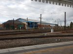
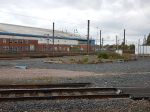
Lewes Station
Lewes station has an unusual layout, as this Google Map shows.
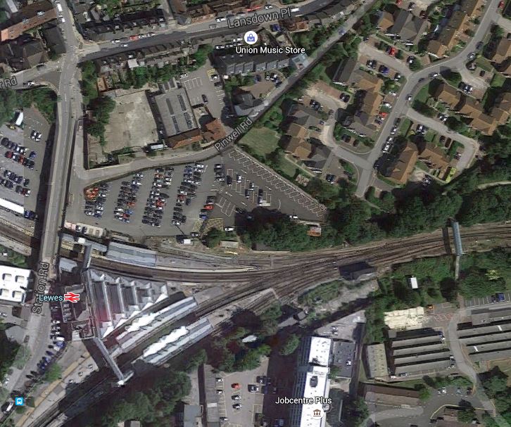
Lewes Station
The line going off to the right is the East Coastway Line to Bexhill, Hastings and eventually via the Marshlink Line toAshford.
The top line at the left goes to Plumpton and eventually to London, whilst the bottom one goes to Brighton.
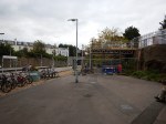
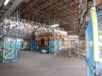
At the moment a great deal of work is going on, as these pictures of the station show.


Lewes could end up being a more important station if plans to reopen the Wealden Line to Uckfield come to fruition, to create a second route between London and Brighton. There is a BML2 web site, which is nothing but ambitious, as this map shows.

BML2 Map
I think that the Lewes to Uckfield section might be rebuilt and it would be an ideal place to use IPEMU trains, as they could be used on the whole of the Uckfield Branch of the Oxted Line to replace the current Class 171 diesel trains.
I have a feeling too, that IPEMUs would be ideal to bridge the electrification gap between Ashford and Ore and allow Hastings, Bexhill and Eastbourne to have high-speed services to St. Pamcras. Would these services if they ever start turn back at Eastbourne, Brighton or Lewes?
There is certainly scope for extra services in the area, if only there were more routes to London. In many places along the South Coast, services are hourly, which given the development and other issues in the area, probably isn’t enough.
In my view, half-hourly services are the minimum frequency on any rail-line that is connected to major centres of population, as this effectively, is a turn-up-and-go service. If the Scots feel this is needed on the Borders Railway, then the logic probably applies along the Sussex Coast.
Plumpton Station, Level Crossing And Racecourse
When a friend phoned me from Brighton asking me next time I was in the area to meet him for a coffee, I decided to combine the trip with a visit to the site of the level crossing in I Wonder If This Happens In Europe.
These are pictures I took at Plumpton station.


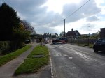


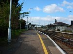


It would not be called grand, but it must be one of the few stations in the UK with an attached racecourse.
The rebuilding of the level crossing is causing problems according to Wikipedia. This is said.
Network Rail closed the level crossing in September 2015 so that the gates on the crossing could be replaced. However, Lewes District Council rejected the plans to replace the gates as it would cause “substantial harm to the significance of the signal box”. Network Rail have said that they cannot open the crossing as the work is not completed. This has effectively split the village in two, with some motorists having to take a six or seven mile detour.
I did chat with a local and her grey whippet and feel that there could be more to this than meets the eye.
If you type “Plumpton suicide” into Google, you find reports, where people have killed themselves at the crossing.
But I also feel that Network Rail haven’t been too clever in this one. My view is that stations like Plumpton need at least a half-hourly service, as this means you have a proper turn-up-and-go service.
One of the pieces of work being done in the area, is to close all the signal boxes and handle all signalling from Three Bridges Operating Centre. This work combined with an automated level crossing, could surely enable all the half-hourly services between Lewes and London to stop at the station.
But it would enrage the militant wing of the heritage lobby!
As to the signal box, they should be looking at a version of the Highams Park solution. Perhaps it would make a cafe and/or business centre.
Starting a half-hourly service might have the effect of increasing traffic at the station.
It’s a difficult one, but with the population of areas like Sussex getting older, more numerous and more and more people cutting use of their cars, who knows?
For the duration of the level crossing closure, Network Rail and Southern had a golden opportunity to experiment with stopping all services. Some of those drivers, who are doing a long detour, might have been persuaded to try the trains to Lewes, Brighton or London.
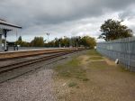
Den Haag HS Station
This is the station from where I left The Hague
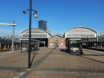
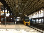
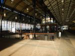
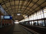

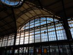

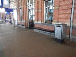
Over the years, I have used it, Den Haag HS station has been cleaned up, but in some ways it is a rather soulless place, except for some of the old details.
I had bought my ticket earlier, but at least there was a machine at the station, where I could get a ticket to Brussels.
Unlike at Brussels, where there were no machines selling tickets to The Netherlands that I could find.
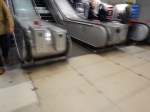
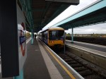
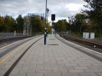
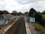
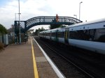
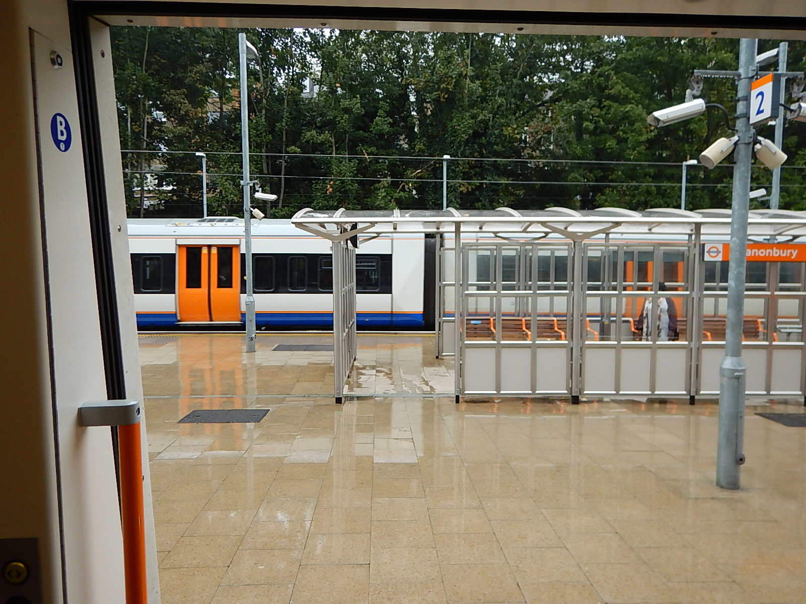
The Canonbury Interchange In The Wet
Passengers going from Stratford to stations on the East London Line, often change at Canonbury, where it is a walk across from North London Line trains going West to East London Line trains going South, which are pften timed to be in the station together. I often do the change, as after one stop to Dalston Junction station, I can get any number of buses to just around the corner from where I live and can get home without crossing any roads.
A few days ago, I did the change in the wet.
The Canonbury Interchange In The Wet
Recently, Transport for London have placed a shelter in the middle of the platform, so it was a run from the Westbound train into the shelter and after a few minutes, another run straight from the shelter into the open door of the Southbound train, from where I took the picture, just as another Westbound train was arriving.
Canonbury station is an excellent example of how good design can improve the daily lives of everybody.
So often modern designs look good, but just annoy a lot of the population, who aren’t in the designer’s age, sexual and ethnic group.
