Manchester Metrolink Will Be Going To The Trafford Centre
According to this article on Global Rail News, the Manchester Metrolink has been given permission and funding to build the Trafford Park Line.
This is a map of the line.
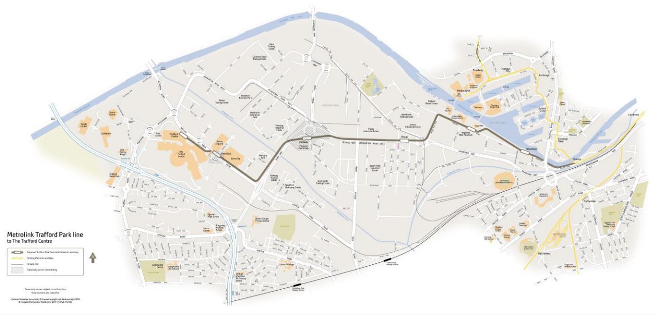
Trafford Park Line
It calls at these stops.
Pomona
This Google Map shows Pomona tram stop.
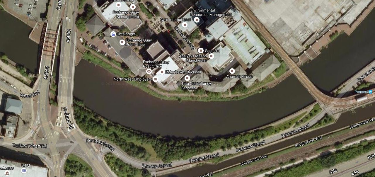
Pmona Tram Stop
The stop is at the far right and the rightmost bridge carries the tram over the water.
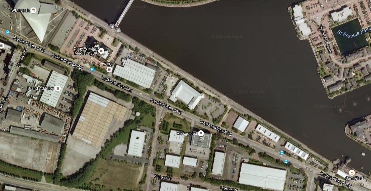
This second Google Map shows Note how the stop has been built to allow a junction with the Trafford Park Line.
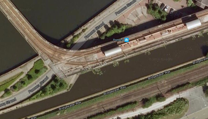
Pomona Tram Stop In Detail
The Trafford Park Line appears to continue along the edge of the water.
Wharfside
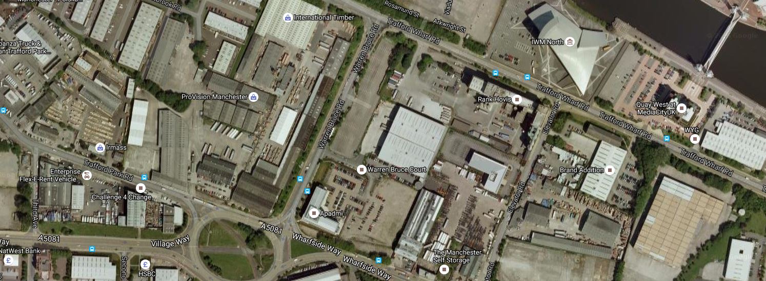
This Google Map shopws the location of the Wharfside tram stop close to Old Trafford.
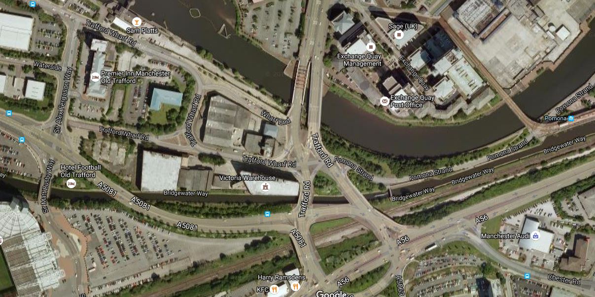
Wharfside Tram Stop
It is on Trafford Park Road, probably between the water and the Premier Inn.
Note Old Trafford in the bottom-left corner.
Imperial War Museum
ThisGoogle Map shows the route between Wharfside and the Imperial War Museum tram stop.
Imperial War Museum Tram Stop
The stop appears to be on Trafford Park Road, by the footbridge at the top of the map..
Village
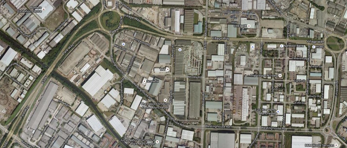
This Google Map shows the route between the Imperial War Museum and the Village tram stop.
Village Tram Stop
The Imperial War Museum is at the top of the map and the Village tram stop will be on the road leading .West from the rpundabout at the bottom.
Parkway
This Google Map shows the route between Village and the Parkway tram stop.
Parkway Tram Stop
The Parkway stop is in towards the Southern side of Parkway Circle, which is the circle at the top towards the left.
Village tram stop is to the West of the other circle and the tram line goes along Village Way to Parkway Circle before going South West.
A Park-and-Ride could be built at this stop.
EventCity
This Google Map shows the route from Parkway to the Trafford Centre.
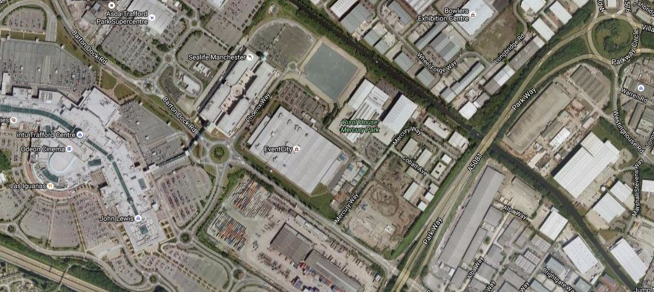
From Parkway To The Trafford Centre
The EventCity tram stop is I suspect by EventCity, which is the big building in the centre of the map.
Trafford Centre
Finally, according to current plans the tram goes on to the Trafford Centre stop.
On To Trafford Waters
This article in the Manchester Evening News is entitled Huge £1bn Trafford Waters development on banks of Manchester Ship Canal given go-ahead.
This Google Map includes Trafford Waters, which is between the Trafford Centre and Manchester Ship Canal.

Trafford Waters
According to Wikipedia there will be a Trafford quays tram stop, to serve the new development.
Finally To Salford Reds And Port Salford
These two final tram stops; Salford Reds and Port Salford are named on Wikipedia..
This Google Map shows the location of these two stops.
Salford Reds And Port Salford Tram Stops
Salford Reds is on the North Bank of the Manchester Ship Canal, to the West of the M6 Motorway.
Fort Salford is a freight terminal on the banks of the canal.
This is said on the FAQ page of Port Salford web site in answer to the question What are the plans to bring Metrolink to Port Salford?
Transport for Greater Manchester (TfGM) who manage the Metrolink infrastructure, aspire to build a new Metrolink line to the AJ Bell stadium and potentially beyond to Port Salford, via Trafford Park and Trafford Centre. Therefore, the new dual carriageway and lift-bridge have been future proofed to eventually accommodate a Metrolink tram line.
That certainly gives one way for the Trafford Park Line to cross the Manchester Ship Canal.
Western Gateway Infrastructure Scheme
The Western Gateway Infrastructure Scheme is designed to bring better connectivity between Port Salford on the North side of the Manchester Ship Canal and Trafford and Trafford Park on the other side. Wikpedia says this.
As part of the Western Gateway Infrastructure Scheme (WGIS), a new link road was constructed in connection with the Port. The existing A57 road was redirected closer to the Salford City Stadium, and a mile-long new dual carriageway link to Trafford Way and a new lift bridge over the Manchester Ship Canal was constructed to the east of the M60 bridge.
This video shows more.
But all is not going well as this report from the Manchester Evening News shows.
Conclusions
These are my thoughts on what has been published.
- There is a lot of development going on along the Manchester Ship Canal.
- There will probably have to be at least one tram crossing of the Manchester Ship Canal between Trafford Centre and Port Salford.
- The design of the tram route hasn’t be finalised yet and changes can be expected.
I am also surprised that the rail link from the North into Port Salford doesn’t include a rail station.
This would allow travellers from the West to have access to the Trafford Park Line, without going all the way to Manchester Piccadilly.
If you look around the UK and Europe, it is probably important that there is a good interface between the tram network and trains, cars and bicycles.
Manchester Metrolink has some good interchanges to rail, but it needs more.
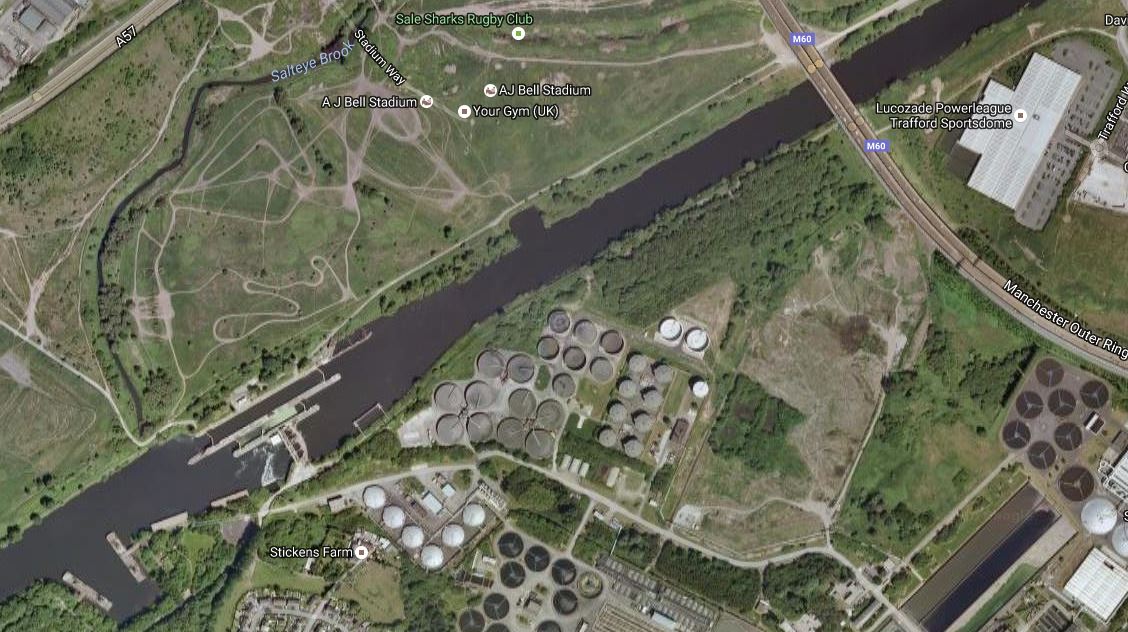
For completeness this Google Map shows Trafford Park from Port Salford in the West to Pomona in the East.

The waterway curving across the map is the Manchester Ship Canal.
Both Port Salford and Pomona are at the edges of the map.
It’ll be interesting to see how this project develops.
Developments on the Trafford Park Line can now be followed on the line’s own Wikipedia entry.
