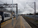
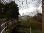
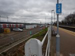
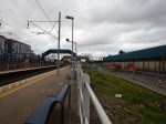
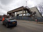
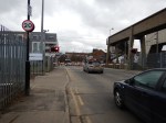
West Anglia Route Improvement – Cheshunt Station – 26th February 2017
I took these pictures at Cheshunt station.


This Google Map shows the layout of the station.
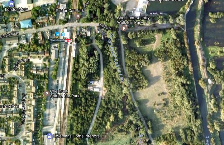
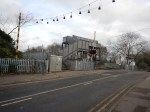
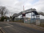
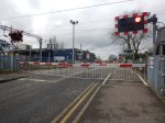
Cheshunt Station
The station is very much a gateway to the Lea Valley Country Park and it could be difficult to find a by-pass for the level crossing.
I think putting two extra tracks through the station could be difficult.
- ,The space is a bit narrow.
- The level crossing will probably have to stay.
- A lot of express trains stop, so that passengers can change to the London Overground.
Perhaps the solution is to do something like the following.
- Extend the London Overground service to Broxbourne station, where there is space for extra platforms.
- Stop fast services calling at Cheshunt station.
- Move the two slow tracks Westward a bit, to create space for the two new lines on the Eastern side.
I also think, that extending the Overground to Broxbourne would make Broxbourne station an even better interchange.
West Anglia Route Improvement – How Many Slow Services Will Go Through Tottenham Hale Station?
Currently there are the several slow trains on the West Anglia Main Line, running a rather complicated service to give most stations four tph.
The major services are.
- 1 tph between Liverpool Street and Cambridge.
- 2 tph between Liverpool Street or Stratford and Hertford East.
- 2 tph between Liverpool Street or |Stratford and Bishops Stortford.
Obviously in the Peak there is more, but four-five slow trains per hour through Tottenham Hale station to Broxbourne wouldn’t be far away from the overall frequency, if the fast trains are ignored.
Greater Anglia probably have plans to increase the frequencies.
West Anglia Route Improvement – How Many Fast Services Will Go Through Tottenham Hale Station?
Currently, there are the following fast trains.
- 1 tph between Liverpool Street and Cambridge.
- 4 tph between Liverpool Street and Stansted Airport.
There is also 1 tph stopping train from Cambridge, which I found a pain, as like most people, I just wanted to get to and from London quickly.
I wouldn’t be surprised to see this number increased to something like.
- 4 tph between Liverpool Street and Cambridge.
- 4 tph between Liverpool Street and Stansted Airport.
- 2 or 4 tph between Stratford and Stansted Airport.
This is only one train in every five or six minutes.
As Tottenham Hale to Broxbourne is about eleven miles, one of Stadler’s new trains going non-stop on a clear line would probably do the trip in around 8 minutes compared to the current fastest of about 19 minutes.
West Anglia Route Improvement
I have decided to bring all of my posts on the following subjects together under a tag of West Anglia Route Improvement.
- STAR – The local Stratford-Tottenham-Angel Road service connecting the Meridian Water development to Tttenham Hale and Stratford stations.
- Crossrail 2 along the Lea Valley.
- Four tracking of the West Anglia Main Line between Tottenham Hale and Broxbourne.
- Station Improvements between Tottenham Hale and Broxbourne.
I also suspect other subjects connected with the improvement of the West Anglia Main Line and other related rail routes will also be added.
West Anglia Route Improvement – What Is STAR?
STAR stands for Stratford-Tottenham-Angel Road and is a proposed four trains per hour (tph) service between Stratford and Angel Road stations, calling at the following stations.
The main purpose is to provide a service to the new £3.5billion housing and commercial development project at Meridian Water, the developers of which will be rebuilding Angel Road station and renaming it to Meridian Water.
Brief details of the project are given in the March 2017 Edition of Modern Railways.
- STAR will involve laying a third track between Stratford and Angel Road, alongside the West Anglia Main Line and the Temple Mills Branch to Stratford.
- STAR will be completed at the end of 2018.
- STAR will run at a frequency of four trans per hour (tph)
- STAR will help in the four-tracking of the West Anglia Main Line.
More will certainly emerge in the next few months.
But I have a few questions about STAR.
Will STAR Services Go Beyond Angel Road Station?
The only STAR service at present is the two tph service to either ?Hertford East or Bishops Stortford stations that call at Lea Bridge, then in a rather haphazard pattern up the Lea Valley.
It is not a passenger-friendly service, as you turn up for the half-hourly train and find the destination you want is served on the alternate service.
I have a feeling the service pattern is designed by history, rather than a train planner with a brain.
What Type Of Train Will Be Used?
I think the route STAR will take, has a possible headroom problem at Tottenham Hale.
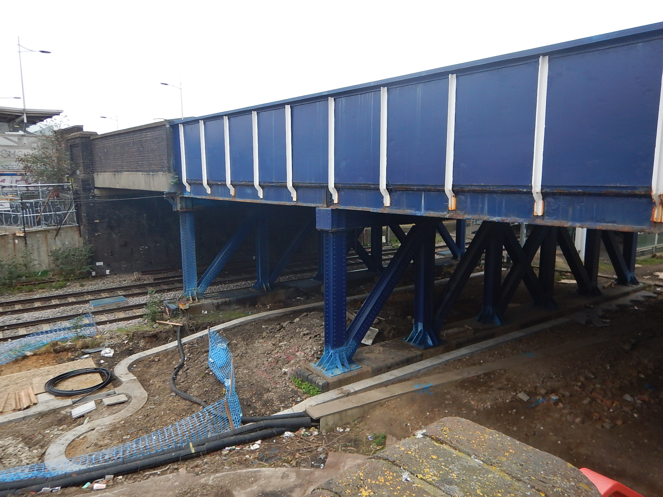
Ferry Lane Bridge At Tottenham Hale Station
When I first saw this bridge and saw the height of the overhead electrification on the existing West Anglia Main Line under the far span, I immediately questioned if they could fit the electrification under either of the blue steel bridges, where STAR might pass, in a manner that would meet all the Health and Safety regulations.
Read this article on the Rail Engineer web site, which is entitled EGIP – electrification clearance woes, to learn more about how regulations are making electrification not just an engineering problem.
So will this mean that STAR will be built without wires?
Diesel trains would work, but wouldn’t fit the profile of Meridian Water as an ecologically-sound development.
I think we could see IPEMUs or electric multiple units with onboard energy storage working the route.
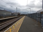
Will STAR Share Platforms With The West Anglia Up Line?
The space for putting the third track for STAR is narrow as this picture at Tottenham Hale shows.
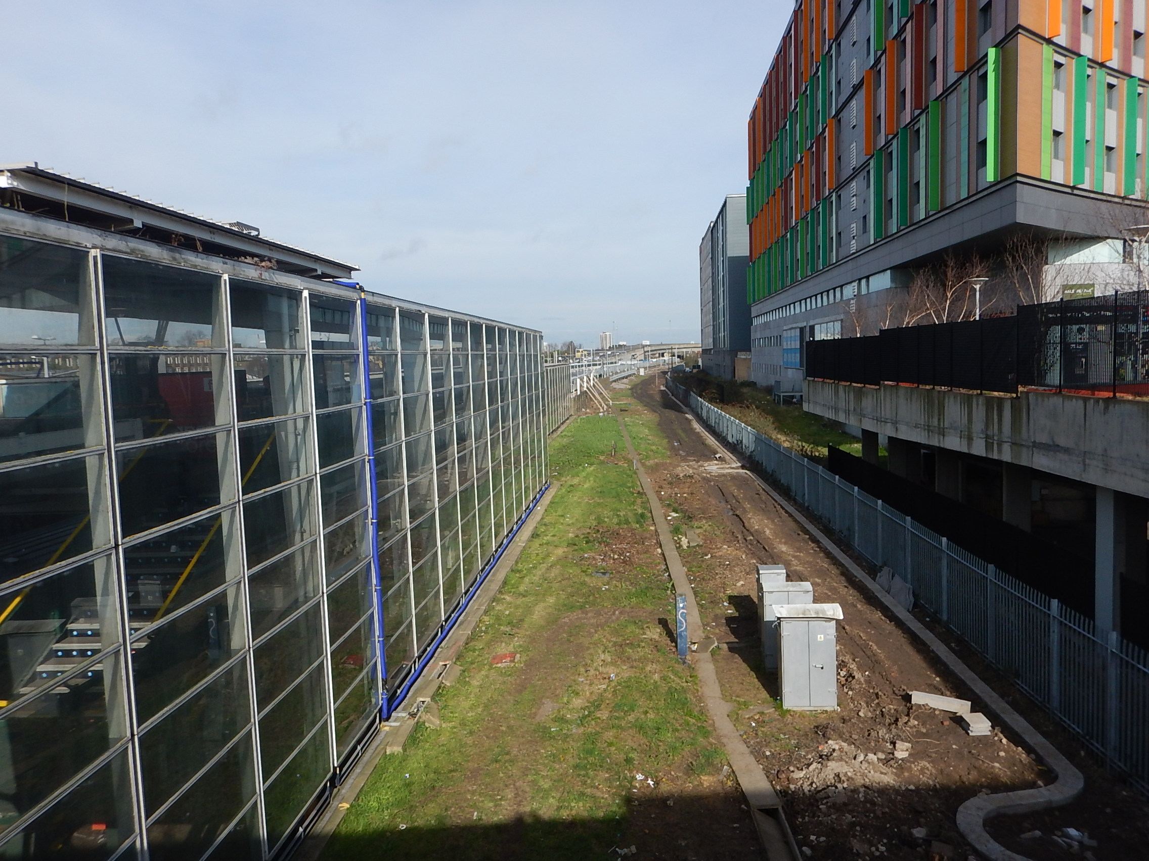
STAR Will Go Through Here At Tottenham Hale Station
If STAR goes through in the space conveniently marked by green grass, the easiest way to create a platform would be to add a second face on the existing Platform 1.
- A step-free bridge is being built linking Hale Village to a new station building with step-free access to the existing Platforms 1 and 2.
- If STAR used the other face of Platform 1, it would share the step-free access of that platform.
- STAR would have cross-platform access with services to Liverpool Street.
- There would be step-free access between STAR and the Victoria Line.
It could be a very simple and affordable way of creating a new platform and interchange with full step-free access.
The technique could also be used at Northumberland Park station.
Could STAR Call At Stratford International Station?
One of the many proposals for the Docklands Light Railway was to extend the Stratford International Branch along the Lea Valley. This seems to have been dropped.
But there is a line called the High Meads Loop, that would appear to allow trains to call at Lea Bridge station and Platform 11 at Stratford station, before looping round Eastfield and Stratford International station and returning through Lea Bridge station. In a forum, a claim is made by I assume a driver, that he’s done this.
If a platform could be built on the High Meads Loop to serve Stratford International station, then STAR services could go round the High Meads Loop and call at the platform.
But if the loop could be used to turnback trains, then it would allow a lot more trains to use Stratford as a destination.
Could A Similar Service To STAR Connect Stratford To Walthamstow And Chingford?
I have been past the work-site between Lea Bridge station and Coppermill Junction several times in the last few days and it would appear that the Hall Farm Curve that would make this service possible is being cleared of fifty-plus years of rubbish.
But, there are other problems in creating this service, like the level crossing at Highams Park station.
Could The Capacity Of STAR Be Increased?
The capacity on the East London Line, which runs a similar 4 tph service on four separate routes, was increased by the simple process of lengthening the trains.
Provided the platforms are built to accept longer trains, this would be the easy way to increase capacity.
What Will Happen To STAR When The Great Anglia Main Line Is Four-Tracked?
STAR will only affect the West Anglia Main Line between Coppermill Junction and Angel Eoad, as this is the only section, where the STAR and the new lines will co-exist.
In How Many Fast Services Will Go Through Tottenham Hale Station?, I concluded that there will be between ten and twelve fast trains per hour in both directions between Tottenham Hale and Broxbourne stations.
I also think, that these trains will go non-stop along the new lines only stopping at Broxbourne, as the timings of the new slow trains could be the same as the current fast ones. See Timings Between Tottenham Hale And Broxbourne Stations for full details.
As the four-tracking will not take place for a few years, I think it is likely that Stadler and Bombardier will be able to fit onboard storage to their trains, so could we see the two new lines squeezed into the small space between STAR and the development at Tottenham Hale without electrification?
Signalling technology would also probably allow such a line to be bi-directional, with trains running alternatively in both directions.
It would certainly save space to have a single bi-directional line without electrification handling the fast trains through Tottenham Hale!
The fast line would revert to a normal double track at Coppermill Junction and Angel Road station.
As closing a rail route is often a difficult process, even after Crossrail 2 is providing a high frquency service between Tottenham Hale and Angel Road, STAR will continue into the future.
Conclusion
STAR is putting down some interesting markers for the future.
West Anglia Route Improvement – Northumberland Park Station – 22nd February 2017
I took these pictures at Northumberland Park station.


This Google Map shows the station.
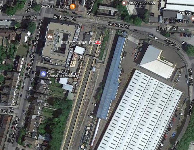
Note.
The station is alongside London Underground’s Northumberland Park Depot.
Work is well underway to clear the space for the new tracks.
The level crossing wasn’t very busy.
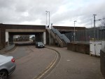
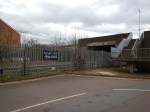
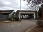
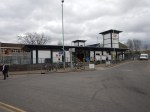
West Anglia Route Improvement – Waltham Cross Station – 22nd February 2017
I took these pictures at Waltham Cross station.

This Google Map shows Waltham Cross station.
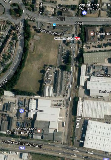
Waltham Cross Station
Note.
- The railway goes under both the M25 where provision has been msade for the extra tracks.
- There is no future proofing under the A121 to the North of the station. So the bridge needs extensive remodelling.
- Housing has been built on the North side of the A121, which may need to be demolished for the four-tracking.
- The space is a bit tight alongside the station, but the property is commercial.
- The recently built step-free footbridge at Waltham Cross station will need to be replaced or at least extensively modified.
Considering that Waltham Cross station was rebuilt for the 2012 Olympics, it is a supreme example of not paying attention to the future.
This Google Map shows the station in detail.
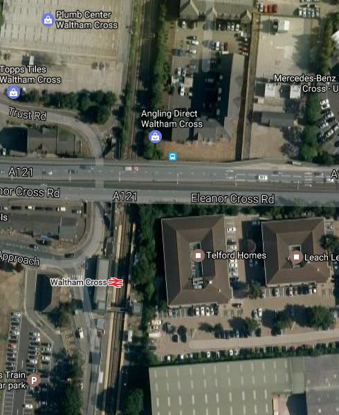
Waltham Cross Station – Enlarged
I hope Network Rail own a big shoehorn and have a big budget for both doing the work and compensation.
To be fair to Network Rail, it’s probably not totally their fault.
Surely when the A121 was improved through Waltham Cross, provision for four-tracking the railway should have been made. Earlier, this had been done, when the M25 , which opened i n 1986, was built.
On the other hand, Network Rail must have known that their bridge could be in the way of four-tracking.
If you look at the fifth picture in the gallery, there might just be space for the two tracks to fit between the offices and lifts for the footbridge.
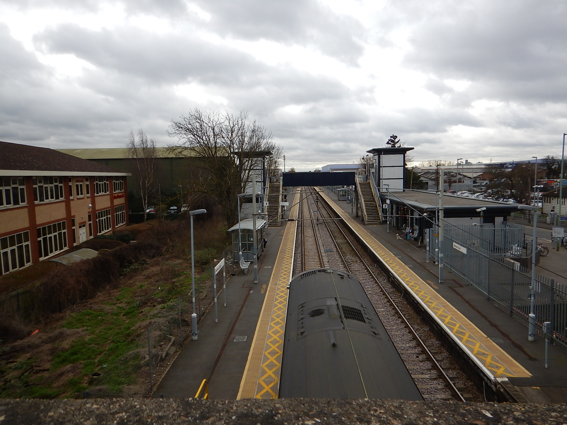
I don’t think I’d like to have one of those offices by the railway.
But even if the tracks could be installed, there would then be the need to do the following.
- Tunnel through the bridge.
- Lower the track to make enough space for the trains and catenary.
- Use slab-track to ensure train stability.
- Put in lots of acoustic barriers.
You get a lot of fun in the construction industry.
It will be interesting to see how Network Rail design themselves out of this one.
West Anglia Route Improvement – A Level Crossing Replacement Station
We have lots of level crossings in the UK and they are dangerous, hated by drivers of vehicles and trains, and cause all sorts of problems.
When I was writing Works Around Coppermill Junction And Along The West Anglia Main Line, I realised that the West Anglia Main Line has four major level crossings, all of which are at stations.
I’ve also since found that Ponders End used to have a level crossing.
As an example, I’ll consider Enfield Lock station, which needs updating for Crossrail 2.
This is a Google Map of the station.
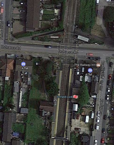
To update the station for Crossrail 2, the following must be provided.
- Two extra tracks through the station.. They will probably be to the East of the current tracks.
- Two twelve car platforms for the current tracks, with step-free access to all trains that will call at the station for wheelchairs, buggies and those past their best.
- Network Rail have said that the level crossing at the station will be closed.
- New station buildings, as the current ones will be demolished for the new tracks.
- Full step-free access.
In additions, these features would be welcome.
- Access from both sides of the tracks.
- Why not access from both sides of the road?
- Ability for pedestrians, cyclists and those in wheelchairs to easily cross the tracks.
- Kiosks accessible to both platforms.
No facilities are needed on the fast lines, except possibly acoustic fences.
Perhaps the solution is to close the level crossing and put a wide pedestrian and cycling underpass under the railway.
It would be of a similar width as the road, accessed by gentle slopes and landscaped to blend in with the surroundings.
The underpass would contain.
- The booking hall, with perhaps a counter and ticket machines.
- Secure bicycle parking.
- A warm waiting room, that would mean passengers don’t have to wait in the cold in the winter.
- Kiosks and possibly a cafe.
- Lifts and steps to both platforms.
- Is there enough space at the top of the slopes for a simple Kiss-And-Ride?
The level crossing has been replaced with a fully-accessible modern station.
I don’t think the idea is truly original, as I might have seen a station like this somewhere in Europe, possibly in the Netherlands or Germany.
Where Would Such A Station Be Built?
But, I do think the concept may have advantages in some situations, where perhaps some of these reasons apply.
- The level crossing is heavily used by pedestrian and cyclists.
- The level crossing crosses a large number of railway tracks.
- Would removing the level crossing allow a needed increase in passenger or freight services?
- The railway line is very busy and the crossing spends a lot of time closed.
- There is no space for a bridge.
- A station is needed in the area.
- Heritage issues might rule out a conventional station with a step-free footbridge.
- It’s reasonably easy to dig the underpass.
I think that a prerequisite is that there must be a reasonable diversion for vehicles.
After my observations today, Brimsdown could be a prime candidate.
- Two new lines are being added through the station.
- It is very busy with trains and in a few years time could have forty trains per hour.
- The site has little space.
- A bridge for vehicles is impossible, but there is an alternative route.
Network Rail and Enfield Council certainly need an innovative solution to remove this level crossing.
A Modular System
I also believe that a factory-built modular system could be designed, which would enable these stations to be installed quickly.
Get the design right and it might also find applications, where no level crossing exists, but good pedestrian and cycling access is needed across a railway, where a new station is also needed.
A Crossrail For Aberdeen
Cross-city lines are all the vogue.
- London has Thameslink, several Underground and Overground Lines and will shortly have Crossrail.
- Edinburgh has Crossrail.
- Liverpool has the Northern Line.
- Paris has the RER.
- Leipzig has a cross-city tunnel.
- Birmingham has the Cross-city Line.
So why shouldn’t Aberdeen propose Aberdeen Crossrail?
Aberdeen Crossrail
This Google Map shows Aberdeen.
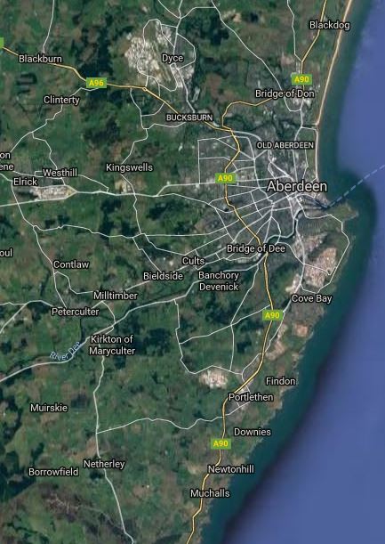
Note.
- The white blob on the map above the City, which is Dyce Airport.
- The Aberdeen to Inverness Line links Dyce Airport to Aberdeen station in the City.
- The Edinburgh to Aberdeen Line and the Glasgow to Aberdeen Line share a common route South from the City as far as Dundee.
- The shared line South runs along the coast, through a succession of towns, some of which have stations.
The Aberdeen Crossrail plan is to link the Aberdeen to Inverness Line to the shared line to the South and create a frequent service along the route.
That is a standard philosophy for a cross-city line.
This diagram from Wikipedia, shows the proposed line and the stations.
It is a simple plan and a simple route with one big difference to most of the other proposed or built Cross-city lines – There is no expensive central tunnel. It is almost solely a marketing concept, based around existing services.
Implementation
Wikipedia says this about Implementation.
Transport Scotland announced in March 2016 that the scheme will go ahead as part of a wider timetable recast in 2018. The new service will run between Inverurie & Montrose, serving all existing intermediate stations and one at Kintore from 2019. The Aberdeen to Inverurie section will then have a 30-minute interval service in operation. Infrastructure enhancements on the Aberdeen to Inverness line (including the redoubling of track from Aberdeen to Inverurie) are also scheduled to be completed by this time, as part of a £170 million route upgrade project.
All it needs is to add lots of stations.
It is a project manager’s dream to build, as once trains are running and the pattern of passenger use develops, the authorities can add trains and stations, as needs and the budget dictate.
Similarity To The London Overground
The nearest cross-city lines in concept to Aberdeen Crossrail are probably the North London and East London Lines of the London Overground, where two cross-city lines were created from some very tired track, stations and trains, by refurbishing the first two and replacing the trains.
Like the London Overground, Aberdeen Crossrail is updating the route. Aberdeen’s current trains are probably better now than the travelling urinals, that the Overground inherited from Silverlink.
One thing that I think Aberdeen Crossrail will need is a Turn-Up-And-Go frequency of four trains per hour (tph), that has been used so successfully on the Overground and Merseyrail.
Frequency Issues
The route of Inverrurie to Montrose has been deliberately chosen.
- Inverurie to Aberdeen takes around 23 minutes.
- Montrose to Aberdeen takes around 35 minutes.
So with slightly faster trains and line speed, than currently used, it should be possible for a train to go from Inverurie to Montrose and back in two hours to include a few minutes to turn the train round.
A two hour round trip means that a train leaving Inverurie at say 06:00 in the morning, will if all goes well, be back in Inverurie to form the 08:00 train.
How convenient is that?
This means that one tph will need two trains, two trph will need four trains and four tph will need eight trains.
Possible Stations
In A Look At New Station Projects, I’ve found several.
- Kintore is a planned new station.
- Aberdeen Airport is a possible new station.
- Aberdeen Exhibition And Conference Centre is a possible new station.
- Cove is a possible new station
- Kittybrewster is a possible new station in Aberdeen.
- Girdle Ness is a possible new station in Aberdeen.
- Newtonhill is a possible new station South of Portlethen.
I am sure there are others.
Girdle Ness
Girdle Ness could be a station in a spectacular location on the coast.
This Google Map shows Aberdeen.
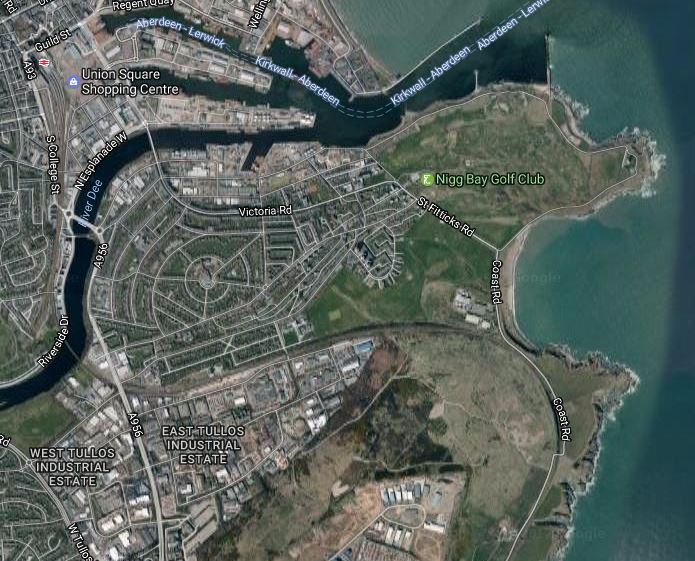
Aberdeen station in the top left corner and Girdle Ness is the lower of the two promontories on the right.
What looks like a wall curving behind the promontory is in fact the railway crossing across the city and the turning South to Montrose, Dundee and Edinburgh.
If an average architect couldn’t make good use of this location, then they’re not even average.
Conclusion
This proposal is very likely to be a success, but I feel that it needs to offer a frequency of four trph.
Will Trains Enable Chinese And Other Tourists To Invade Loch Ness?
In my list of possible stations from my friend Nick, there is the innocent station called Ness.
This could be any one of the following.
As the others, are probably not destinations that would generate a lot of traffic to pay for the station, I suspect that Ness refers to Loch Ness.
There used to be a Fort Augustus Pier station, at the Southern end of Loch Ness. I assume from the giveaway word in the station name, that this was the transit point for Victorian hunters going to shoot Nessy
The station was the Northern terminus of the Invergarry and Fort Augustus Railway. At its Southern end the railway connected to the West Highland Line at Spean Bridge station.
This Google Map shows the area.
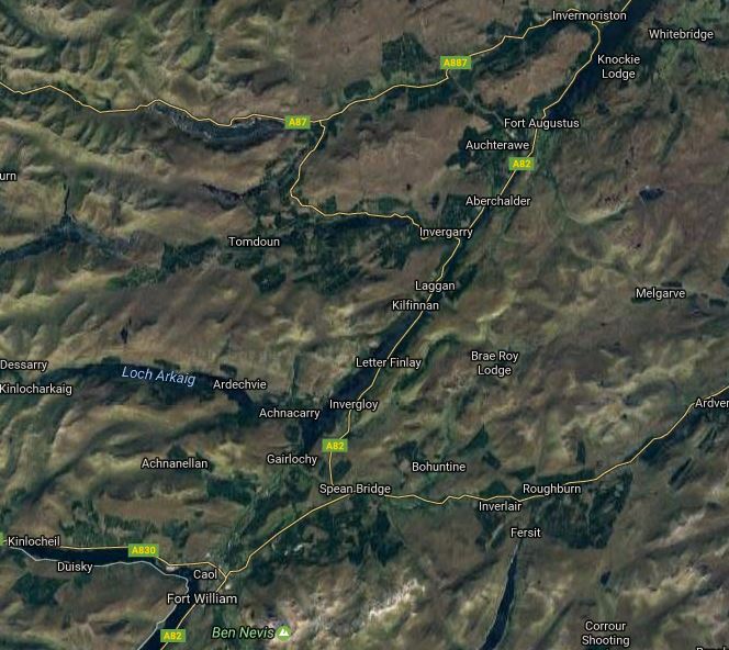
Fort Augustus To Spean Bridge
Loch Ness intrudes from the North and Spean Bridge station is close to Ben Nevis at the bottom.
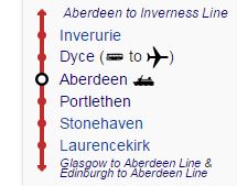
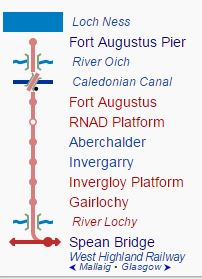
This diagram shows the various stations on the Invergarry and Fort Augustus Railway.
Surprisingly, the railway has not been completely dismantled and Wikipedia says this.
Some of the line today has been built over by roads and holiday parks, although it mostly survives in a reasonably good, if overgrown, condition. The many bridges and single tunnel are in particularly good condition. Some of the line along Loch Oich has been incorporated into the Great Glen Way, and a further section is proposed to become part of National Cycle Route 78.
A restoration project is (2016) under way at Invergarry Station, the last remaining station that is largely intact. The Invergarry Station Preservation Society plan to create a static museum, with a short length of track and several freight wagons.
It would be an interesting way to get to Inverness, if you could get a boat from Fort Augustus.
