The Ventilation Shafts For The Channel Tunnel Rail Link
This post is being developed together with a related one of the ventilation shafts for Crossrail, to show the sort of buildings we can expect to be created to provide access to new rail tunnels under London and other cities.
As I travel around the city, I will be adding more pictures and when I think the details are complete, I’ll add a summary.
The Channel Tunnel Rail Link goes from Ebbsfleet to St. Pancras in two twin tunnels, which both surface on either side of Stratford International station.
The twin tunnels have to have ventilation and emergency access shafts and there are five of them for the Channel Tunnel Rail Link. From East to West approaching London they are as follows.
1. Wayside Ventilation Shaft
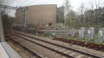
This shaft is in Barking and can be seen on this Google Earth image.
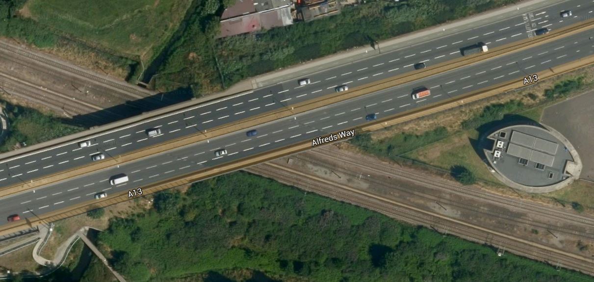
Wayside Ventilation Shaft
The shaft is nestled in the angle of where the A13 crosses the London Tilbury and Southend Line.
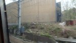
This page on the Bell Johnson web site, gives an interesting insight into the design of the shaft. There is also an image taken during construction.
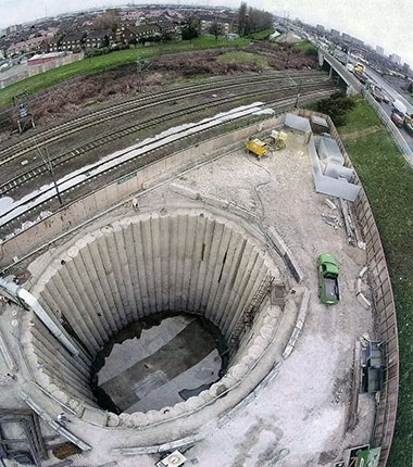
Waysite Ventilation Shaft Under Construction
The picture was taken from the east and clearly shows the road and the railway. These images were taken from a train.

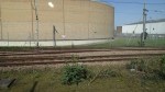

The ventilation shaft is to the west of Dagenham Dock station, which is where I turned round to come back into London. As the station is in Zone 5, it is Freedom Pass territory.
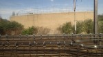
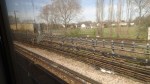
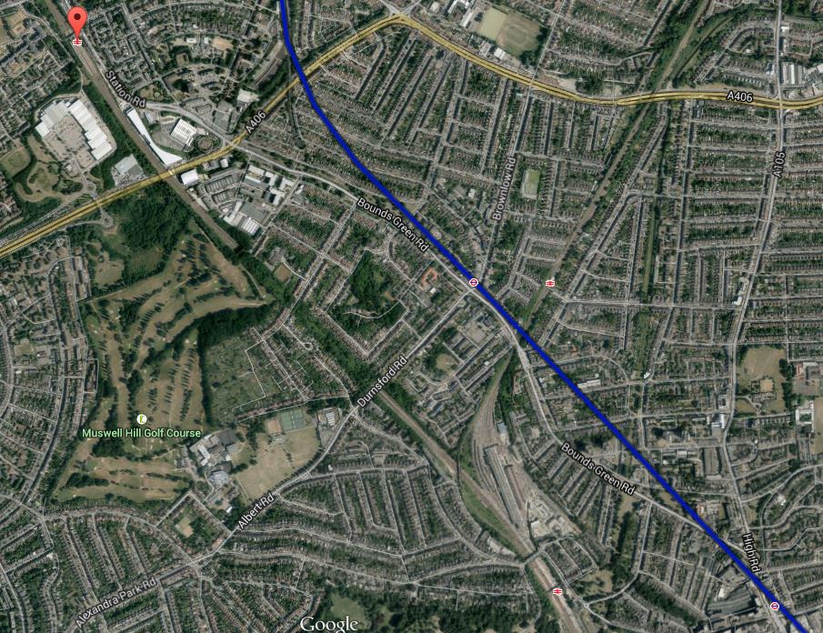
2. Barrington Road Ventilation Shaft
This shaft is to the west of Barking station and is shown in this Google Earth image.
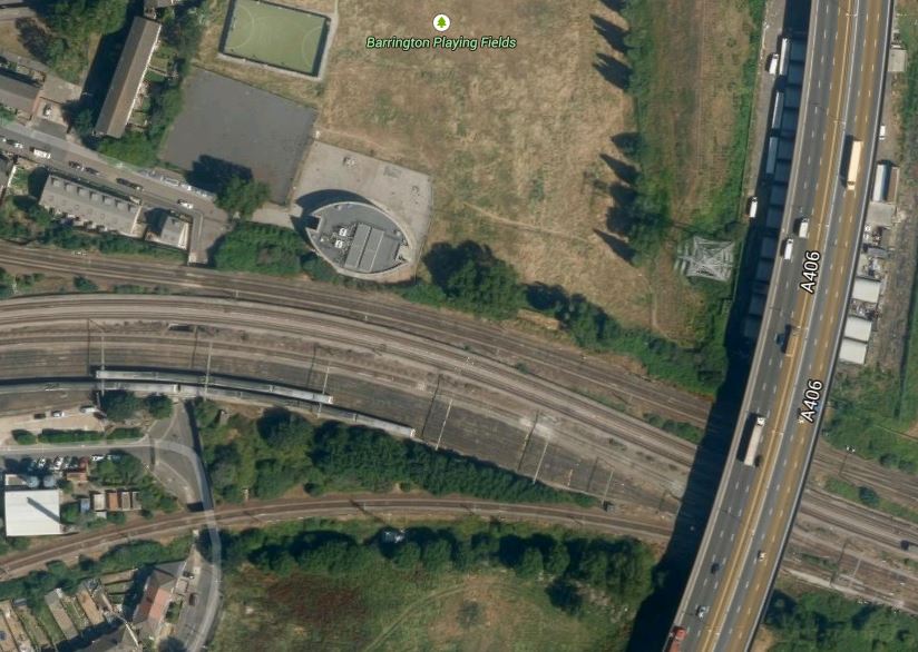
Barrington Road Ventilation Shaft
Note that the shaft is to the north of the train lines going into Barking station and to the west of the A406 road. I took these pictures from trains passing through the area.


I reckon that you possibly get the best view of the building on top of the ventilation shaft from a eastbound, District or Metropolitan Line train with clean windows. Unless of course, you walk to the Barrington Playing Field from East Ham station.
3. Woodgrange Road Ventilation Shaft
This shaft is located south of Forest Gate station and is shown on this Google Earth image.
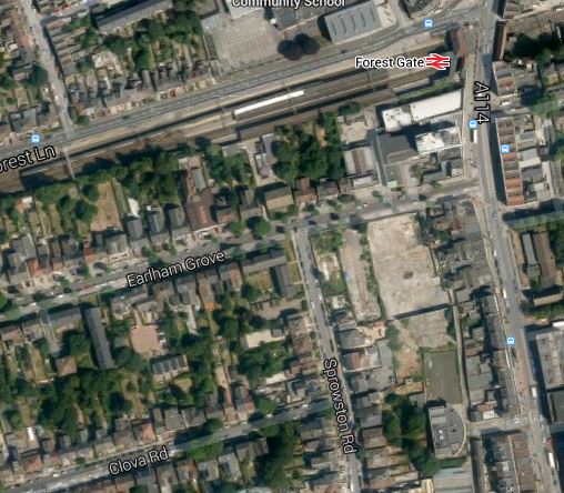
Woodgrange Road Ventilation Shaft
Forest Gate station is on the Great Eastern Main Line out of Liverpool Street and later next month, it will be taken over by Crossrail.
The shaft is directly underneath the station, but would appear to be more tucked away in buildings than the shafts at Wayside and Barrington Road.
It is also the only ventilation shaft for the tunnel, that doesn’t have a full elliptical building on top.
I tried to take a decent picture of the building, but you can only see one side between the houses.
The only point to note, is that in a previous building on the site, Jimmi Hendrix wrote Purple Haze.
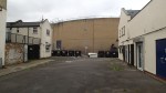
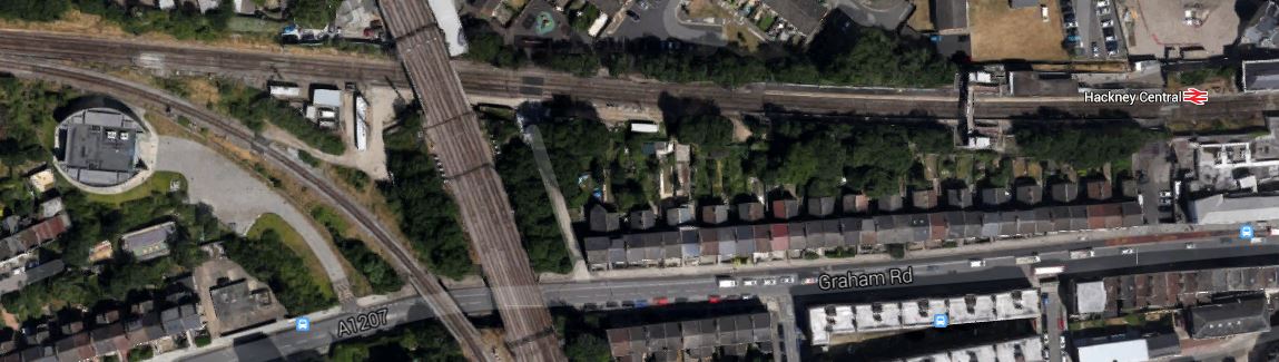
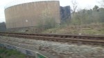
4. Graham Road Ventilation Shaft
This shaft is east of Dalston and just to the west of Hackney Central station, close to the North London Line, under which the Channel Tunnel Rail Link was bored.
It is shown on this Google Earth image.
Graham Road Ventilation Shaft
Note how it lies close to the curve that links the North London and Lea Valley Lines, just to the south-west of where the two lines cross, which in turn is to the west of Hackney Central station.
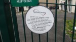
I was able to take these pictures from a train on the North London Line.
I shall attempt to take a few more.
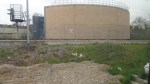
5. Corsica Street Ventilation Shaft
This shaft is just east of Highbury and Islington station and is shown on this Google Earth image.
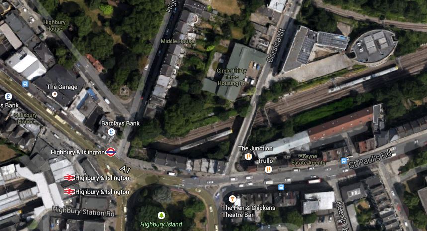
Corsica Street Ventilation Shaft
It is another shaft with an elliptical building on top, which you can see in the top-right corner of the image.
I was able to take these pictures.
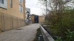
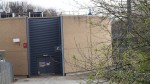
Some were taken from Corsica Street looking through the gate and the others from passing trains.
These structures have more than a touch of the Martello Tower about them! Ironic really, as these ventilation shafts are there to help encourage the French to visit, whereas the Towers were built to repel Napoleon.
The Crossrail 2 Junction Under Stamford Hill
The two northern branches of Crossrail 2, that go to New Southgate and Tottenham Hale respectively, would appear according to this safeguarding map on the Crossrail 2 web site, to join together under Stamford Hill.
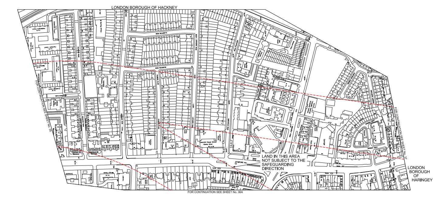
Crossrail 2 Northern Junction
This map is as it is presented on the Crossrail 2 web site, with north to the right and east to the bottom.
It looks like the junction will be in the area of Holmleigh Primary School. From the safeguarded area shown in red, it would appear that the New Southgate branch lines up north-south with the A10 road and the Tottenham Hale branch comes in from the north-east.
When the tunnels for Crossrail were built, a similar junction was needed to be built in Stepney. They obtained the access they needed by taking over part of Stepney City Farm. The work is described in a section in the Wikipedia entry.
In 2010 Crossrail took over approximately a third of the Farm’s site as part of the works to build a rail transport link connecting east and west London.[1] A map of the works as it affects the farm can be found in the annual report for Stepney City Farm Ltd from 2010_11(p. 6). This work is due to end in 2016 when the land will be returned to the farm. In January 2011 Crossrail opened up an archaeological dig at the construction site on the farm. A ventilation shaft next door to the farm leads down to the one of the largest mined caverns in Europe. In mitigation Crossrail worked closely with the farm to allow the existing animals to remain by making major improvements to the farm, especially the drainage of the fields and building a large barn for over-wintering the animals and a rural arts building to house the farm’s craftspeople
I visited in 2012 and was impressed at the good relationship between both sides.
So will a similar surface reconstruction be done with Holmleigh Primary School?
There may also be an alternative, in that the junction is just over a kilometre from the tunnel portal south of Tottenham Hale. So could a tunnel be dug from the portal and the cavern for the junction be excavated without digging down from the surface? The New Southgate branch would then go straight through the cavern on its way to Dalston, Islington and beyond.
I’m no tunnelling expert, but surely instead of digging down to create the cavern, digging in from the side is not that different.
I do think though, that the junction has been arranged deliberately under Stamford Hill, which will surely mean it is deeper underground than it otherwise would be. This must reduce any noise and vibration at the surface.
Remember too, that High Speed One was dug through this area a mile or so to the south. Wikipedia describes the digging of the tunnels like this.
The twin tunnels bored under London were driven from Stratford westwards towards St Pancras, eastwards towards Dagenham and from Dagenham westwards to connect with the tunnel from Stratford. The tunnel boring machines were 120 metres long and weighed 1,100 tonnes. The depth of the tunnels varies from 24 metres to 50 metres.
So the engineers will only probably be repeating something that was completed in 2007. But now they are more experienced and the machines are probably larger and more powerful.
It would be a major difference in the disruption caused by Crossrail 2 compared to Crossrail, if the line could be bored through Stamford Hill without any large construction shafts having to be dug from the surface.
Crossrail 2 At Tottenham Hale
As regards Tottenham Hale this has been said recently.
A new tunnel entrance south of Tottenham Hale station to take the line from above to below ground
This is Crossrail 2‘s map of the area, which I obtained from this page on the Crossrail 2 web site.
Crossrail 2 At Tottenham Hale
Tottenham Hale station is at the top of the map and the Lea Valley Line to Liverpool Street and Stratford goes down the map. The other railway going across the map is the Gospel Oak to Barking Line. Note the curve that makes a triangular junction that encloses a large amount of safeguarded land, which is shaded and bounded in red. This is a Google Earth image of the area south of Tottenham Hale station.
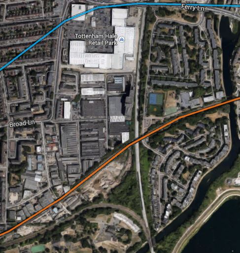
South Of Tottenham Hale
I’ve tried rather badly to match the two maps, but it does show that there would appear to be enough space to fit a tunnel portal into the area. This is a detailed look from Google Earth of the eastern end of the land enclosed by the triangle of lines.
Industrial Land At Tottenham Hale
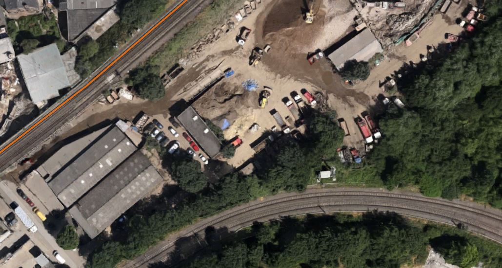
As the safeguarded route moves away to the west from here to join the New Southgate branch of the line, it is probably in this downmarket industrial area which appears to be a depot of some sort, that the Crossrail 2 tunnels will emerge. I actually put up a post entitled Could This Be Where Crossrail 2 Is Dug?, which shows this area.
As a site from where to build the tunnels, it has a lot to recommend it.
1. It is well served by railways and the River Lee and the related substantial canal, so it would be unlikely that there would be many heavy lorries associated with the construction.
2. There is little housing in the area and it would appear few or even none will be needed to be demolished for the construction. The only sensitive area would possibly be Markfield Park with the recreational developments and steam engine by the River.
3. There is plenty of space to create a surface junction with perhaps a flyover for operational reasons to connect to the Lea Valley Lines. On the other hand, the tunnels may turn north underground and just emerge alongside the Lea Valley Lines.
4. Perhaps crucially though, Tottenham Hale station, the Tottenham Hale Retail Park and the surrounding area are the subject of a big development to create almost a new town centre in South Tottenham, which I talked about in this post. I doubt this development will not be built to be totally Crossrail 2 ready.
Looking at these maps in detail, I can’t help feeling that in a few years time, there will be something special in this area, given that Thames Water and Waltham Forest Council are developing the reservoirs to the south-east of Tottenham Hale station into the Walthamstow Wetlands.
Some maps have shown Crossrail 2 surfacing north of Tottenham Hale station. This Google Earth image shows the area.
North Of Tottenham Hale Station
The strange structure underneath the lines through the station is the tunnel portal for the Victoria Line, where trains go to and from the Northumberland Park Depot.
I think the image shows why the Crossrail 2 tunnel portal can’t be north of the station.
Custom House Station – 22nd March 2015
Today’s pictures add a few of the Crossrail line as it runs along by the side of the Docklands Light Railway to the Connaught Tunnel.

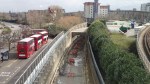
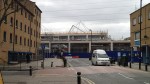

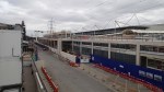
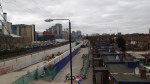
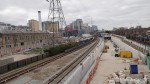

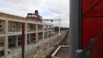
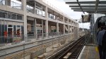
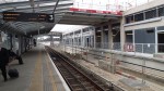
This area of the line is now starting to look like a railway. The bridge at Prince Regent station must have some of steepest and longest steps on the DLR, but once you’re up there you get good views of the rebirth of the Connaught Tunnel and Crossrail as it goes back to Custom House station and the portal to the tunnel to the west of that station. This Google Earth image shows the location of the station by the Excel Exhibition Centre.
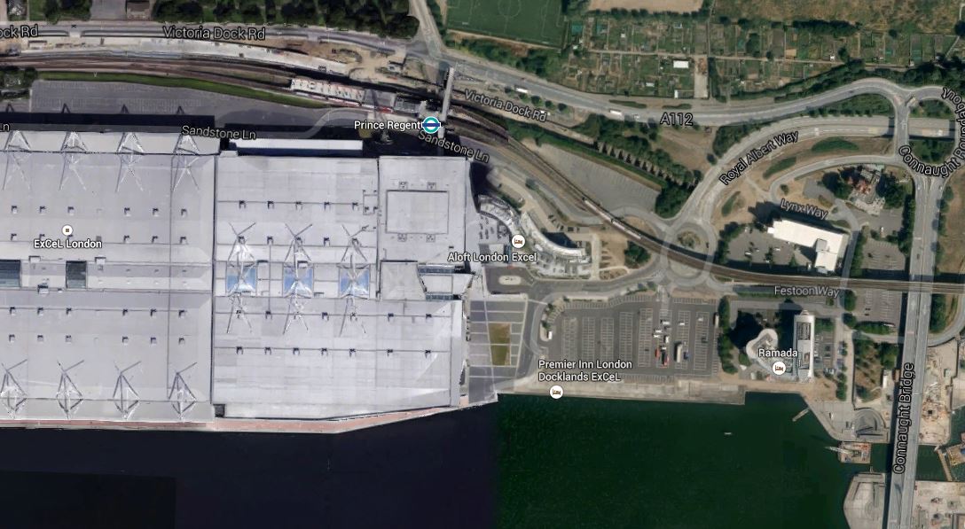
Prince Regent Station
You can clearly see the buttresses in the Connaught Tunnel, that are also visible in the gallery, to the east of Prince Regent station and above the train on the Docklands Light Railway.
The Connaught Tunnel must curve southwards to link up with Crossrail’s Thames Tunnel.
Should We Create A Northern Playground In Addition To A Northern Powerhouse?
George Osborne and other politicians, thinkers, academics and businessmen talk about creating a Northern Powerhouse.
I am very much in agreement to these aims, but from my London-based viewpoint, I tend to think that the North has a lot more to offer.
Two of the bigger successes of the North in recent years have been the reinvigoration of Liverpool as one of the best tourist destinations in the world and the Tour de France in Yorkshire in 2014.
So should any Northern Powerhouse plans, take more than a large nod to emphasising the leisure and tourism opportunities in the area?
The government’s plan for transport in the North released yesterday and discussed in this post, is fifty years too late and if it’s implemented, it will be some years, before High Speed Trains touch 140 mph on the way between Liverpool and Hull and Newcastle.
The high speed railway should remain an end objective, but in the mean time, we should do various things to make the wait bearable.
1. Electrification In The North
The Electrification in the North study recommended that virtually all lines north of a line drawn between Chester and Lincoln be electrified. A rolling program should be planned that virtually eliminates diesel-powered passenger and freight trains.
This would speed up services between all the major cities and also connect all of the wonderful rural lines that cross the Pennines and hug the coastline to major centres of population.
So this electrification program is just as much Northern Playground as Northern Powerhouse.
2. Contactless Ticketing
Plans for the North talk about an Oyster Card for the North. As so many Londoners will tell you, Oyster is old superseded technology and so last decade.
We need a universal contactless ticketing system based on bank cards that works all over the UK!
This would mean that you just turned up at any station, bus or tram stop in the UK, touched in and you’re off on your journey.
Those who doubt this is possible, should spend a week using their bank card as a ticket in Greater London. They will find a system totally devoid or hassle and cash, well-liked by both passengers and staff. It also automatically gives you the cheapest price for the collection of journeys you take over a day, week or month.
Leisure passengers by their more spasmodic and impulsive nature will benefit tremendously from simple contactless ticketing.
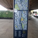
3. Maps And Information Everybody Can Understand
As London was first in the world with decent maps and also because it is so large, that no resident knows the whole city, London needs comprehensive maps and travel information displayed everywhere in a common easily-understood and learned format.
As the combined population of the North of England is upwards of eleven million as against the eight of Greater London in a wider area, I suspect those in the North find themselves in an unknown area more often than those in Greater London.
So one thing that the North needs for both Playground and Powerhouse is a universal mapping and information system, which is the same all across the various parts of the North.
I feel that the North should use London’s system, which includes.
1, A detailed local walking map on every bus stop, tram stop and station.
2. Comprehensive bus information at every station.
3, A detailed bus spider map on every bus stop, tram stop and station.
4. A five digit number on every bus stop, which if sent as an SMS message to a short SMS number, gives details of the next few buses.
,I doubt that this will ever happen, as no council in the North would ever allow something to be used in exactly the same way as it is in London. Or if it was one of the larger cities, in the same format as another.
If the system relied on passengers having and using smart phones, then it should be prohibited.
But quite frankly, at the moment the information systems in the North are truly dreadful.
4. Two Hours From London
This is a list of the major cities of the North and typical fastest journey times by train to and from London.
Barnsley – 2:34 to 2:45 – Change at Sheffield
Blackburn – 2:56 – Change at Preston
Blackpool – 2:45 – Change at Preston
Bolton – 2:45 – Change at Manchester
Bradford – 2:49 to 2:52 – Change at Leeds
Burnley – 3:41 – Change at Preston
Darlington – 2:20 – Direct
Doncaster – 1:34 to 1:38 – Direct
Halifax – 2:48 – Direct/3:08 – Change at Leeds
Harrogate – 2:43 – Change at York or Leeds
Huddersfield- 2:52 to 2~:54 – Change at Manchester or Leeds
Hull – 2:33 – Direct
Leeds – 2:11 to 2:13 – Direct
Liverpool – 2:12 to 2:14 – Direct
Manchester – 2:07 to 2:09 – Direct
Middlesbrough – 2:57 to 2:59 – Change at Darlington
Newcastle – 2:50 – Direct
Preston – 2:08 – Direct
Rotherham – 2:16 to 2:28 – Change at Doncaster or Sheffield
Sheffield – 2:01 – Direct
Stockport – 1:55 to 1:56 – Direct
Warrington – 1:44 – Direct
Wigan – 1:55 – Direct
York – 1:50 to 2:02 – Direct
This list shows several things.
1. Many of the direct journeys between London and the North could be brought consistently under two hours, once ERTMS allows 140 mph running on the East Coast Main Line and the West Coast Main Line in a few years time.
2. Electrification of the Midland Main Line to Sheffield will bring that city consistently under two hours from London, which will speed up the journey to Barnsley, Rotherham and other places.
3. Some destinations like Blackpool, Bradford, Huddersfield, Hull and Middlesbrough would get a significantly faster service to and from London, if there was no need to change.
If we get the expected speed up on the East and West Coast Main Lines, what sort of times will we get to the major cities in the North.
Adjusting for the probable speed increase from 125 to 140 mph. gives these estimates for the following journeys.
Darlington – 2:05
Doncaster -1:26
Hull – 2:17
Leeds – 1:57
Liverpool – 1:59
Manchester – 1:55
Newcastle – 2:32
Preston – 1:54
York 1:47
I think we can say that in a few years time, many more towns and cities in the North will be within two hours from London, which can only be beneficial to those places for both Powerhouse and Playground purposes.
I regularly go to the North for the day by train to see football. Some places like Middlesbrough and Blackburn are tiring journeys, but get them under two hours and leisure traffic can’t help but increase, especially, if there were more affordable good hotels and better late train services back to London..
5. Better Connectivity
More places could be brought under the important two hour ideal, if perhaps the east-west routes interfaced better with the north-south ones at places like Darlington, Doncaster, Leeds, Preston and York.
In an ideal world, a passenger from say London to Hull, should be able to step off a northbound train at Doncaster and just by walking across the platform to step on to a train for Hull. At the same time passengers from Sheffield and Rotherham going to Newcastle would just step across the platform the other way.
This may seem rather utopian, but precise timing of trains is what ERTMS is supposed to enable.
The easier it is to get between any two points in the North, the more things will be improved.
6. High Speed Lines Across The Country
When the upgrade and electrification of the Midland Main Line is completed in 2020, there will be three major 140 mph railways between London and the North.
To complement these there needs to be High Speed Lines across the country from say Liverpool to Hull and Newcastle.
Any east-west lines will connect with the north-south lines at places like Darlington, Doncaster, Leeds, Manchester, Newcastle, Preston, Sheffield and York.
As I said in the previous section, there needs to be good interfaces between the two sets of lines to speed up journeys to stations that are a change away from the north-south lines.
At some point in the future, there will be a need for purpose-built High Speed Lines across the county.
But by the time this is done, I think tunnelling techniques will have improved to such a degree that instead of building a surface railway with all the planning and other difficulties that entails, a tunnel will be bored under the Pennines to connect Hull and Doncaster with Liverpool. The tunnel would be arranged to pass under major stations like Sheffield and Manchester Piccadilly and could connect to them by lifts and escalators.
Such a tunnel could be bored to a W10 loading gauge, so that it could transfer freight containers under the Pennines to link Liverpool and the West Coast Main Line with the Electric Spine to Southampton and the East Coast Main Line to London Gateway and Felixstowe. I believe a high-capacity freight railway between east and west through the Pennines, will have the same effect as theFelixstowe-Nuneaton freight corridor has had on the A14.
This Google Earth image shows the towns and cities between Liverpool and Hull.
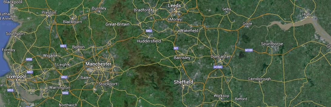
Liverpool To Hull
It may seem a long way to bore a tunnel even if it didn’t go all the distance, but we’re probably talking about 2030 and the machines then, will make today’s machines look like toys. The tunnel would probably start west of Manchester and go to east of Sheffield, which would be under fifty kilometres, connecting to Liverpool and Hull by means of surface lines.
Also if any new route could handle freight and link the Port of Liverpool to the east side of England this could have interesting possibilities.
For instance, would it be quicker for containerised freight from the United States and Canada to reach Germany and Central Europe if it went via Liverpool and a freight train through the Channel Tunnel?
Plans of this nature have existed for years, but none has ever been implemented. Some proposals for the Great Central Railway are given here.
It all goes to show that modern technology will create lots of options for putting a High Speed Line across the country.
Both Powerhouse and Playground will benefit.
Crossrail 2’s Tunnels Under London
Length And Stations Of The Tunnels In Crossrail And Crossrail 2
Crossrail has been designed with 42 km of rail tunnels under London., with seven new underground stations at Paddington, Bond Street, Tottenham Court Road, Farringdon, Liverpool Street Whitechapel and Woolwich. In addition there are new above ground stations at Canary Wharf and Custom House.
Crossrail 2 in contrast has according to this article in the Guardian has 35 km or as they say 22 miles of rail tunnels. According to this route shown on the Crossrail 2 web site, it will have underground stations at Alexandra Palace, Angel, Clapham Junction, Dalston Junction, Euston/St. Pancras, Kings Road/Chelsea, Seven Sisters, Tooting Broadway, Tottenham Court Road, Turnpike Lane and Victoria.
The Crossrail 2 Central Tunnel
I created this map from the one shown on the route page.
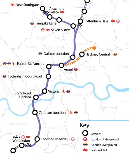
Crossrail 2 Central Tunnel
Note that there are three portals at Tottenham Hale, New Southgate and Wimbledon.
Thoughts About The Routes
Not much has been published about the finer details of the routes but some things stand out.
1. The two Northern branches to Tottenham Hale and New Southgate would appear to split around Coppermill Junction, which is close to a sizeable area of undeveloped land, that could probably serve the same purpose for Crossrail 2, as the Limmo Peninsular access shaft did for Crossrail.
2. The New Southgate branch, would appear to roughly follow underneath the route of the old Palace Gates Line. Logic says that if you tunnel along the line of an old raulway, which for much of its route, has not been built on, you can’t interfere with many buildings.
How Deep Will The Tunnel Be?
Crossrail is deep under London. This article on the Crossrail web site says that the construction shaft at the major tunnel junction at Stepney Green, has a depth of 34.5 metres. As at Tottenham Court Road station, they threaded the tunnels through within a few centimetres of the Northern Line, which is generally one of the deeper Underground lines, I suspect that there is a vast network of tunnels that have to be avoided., which in addition to the tube lines, include the Northern City line, HS1 and at least one newly-built electricity tunnel.
So would the designers of the tunnel make it deeper than all the others? The Wikipedia article on HS1 says this about the tunnels.
The depth of the tunnels varies from 24 metres to 50 metres.
As Crossrail 2 will cross HS1 in the Dalston area, it will have to go either above or below this line. I know very little about tunneling, but I do think that a deep tunnel under London at around or dseeper than 50 metres is possible.
The main problem with deep tunnels is connecting them to the stations above, so being able to do this in an affordable and acceptable manner to passengers, may limit the depth to which the tunnels go. I use Angel station with its long escalators that rise 27 metres regularly and I would prefer that an alternative solution was found, if stations on Crossrail 2 were deeper. Perhaps large modern and very fast lifts could be used, as these make the station totally step-free.
I don’t know whether this has been done on Crossrail, but when they built the Victoria Line they arranged that stations were hump-backed, so trains would slow down as they arrived in the station and accelerate away down the hill. Wikipedia says this.
Each platform constructed specifically for the Victoria line from new is 132.6 metres (435 ft) long. The line has hump-backed stations to allow trains to store gravitational potential energy as they slow down and release it when they leave a station, providing an energy saving of 5% and making the trains run 9% faster.
This sort of technique, which now is probably a lot easier using modern tunnel boring machines that can be precisely controlled, will probably be used on Crossrail 2 to in addition to the energy savings, bring the station platforms closer to the surface, which should make construction easier and more affordable.
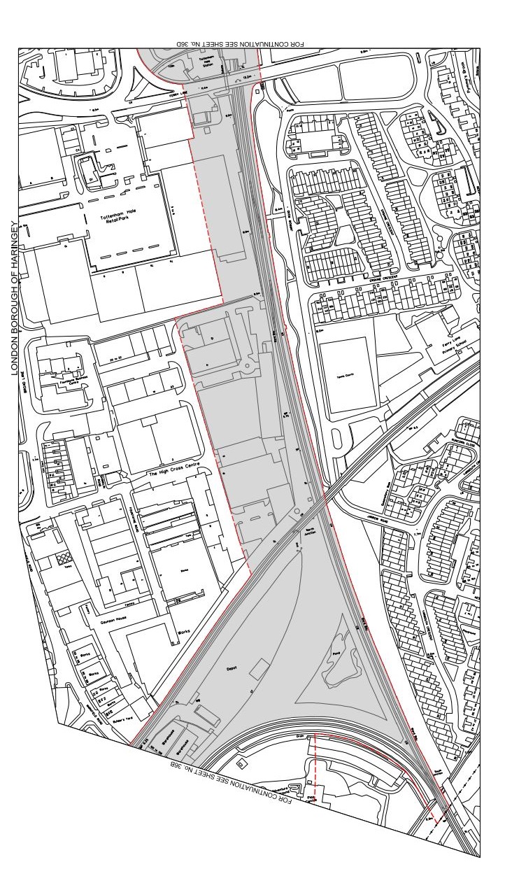
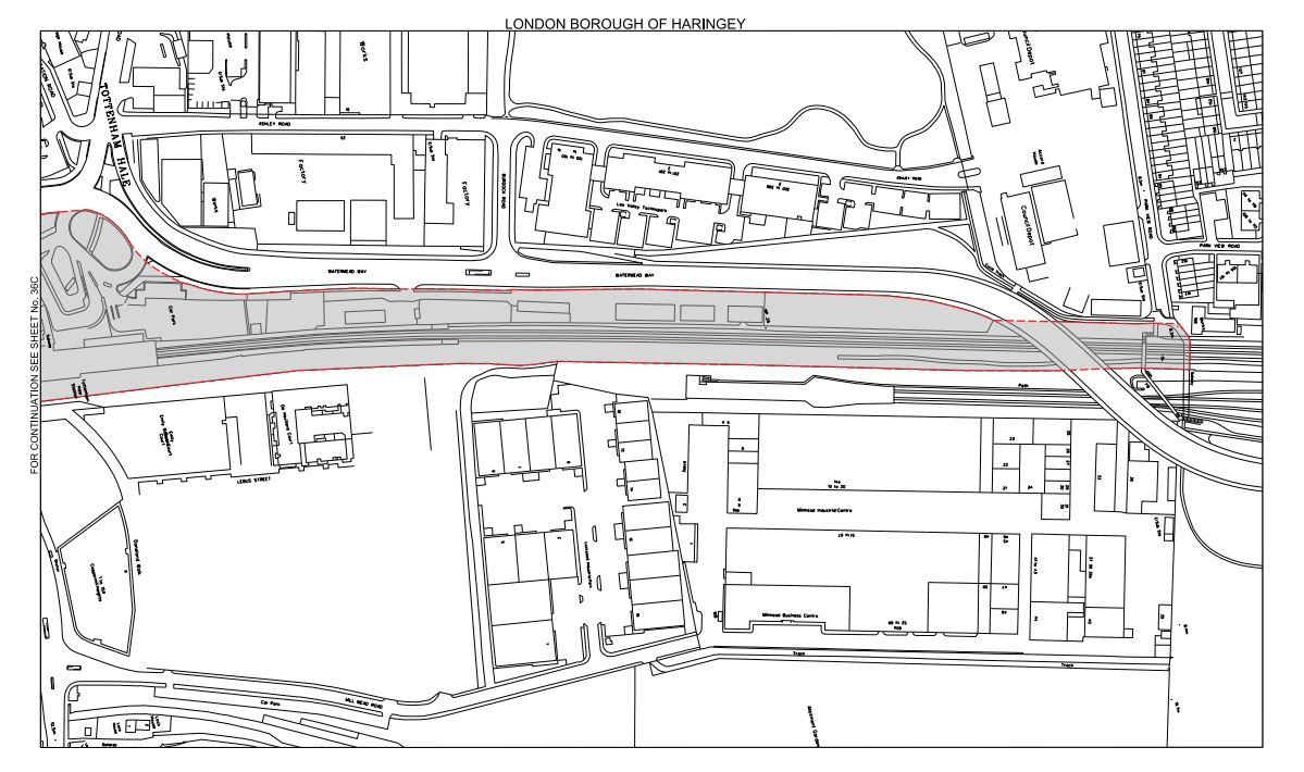
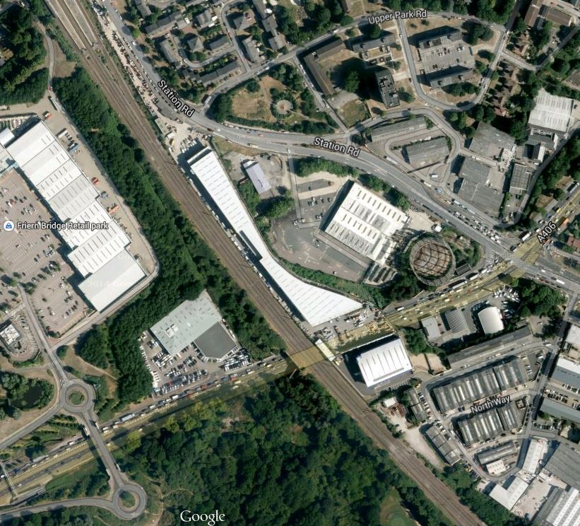
The Tottenham Hale Portal
This Google Earth map shows the area south of Tottenham Hale station.
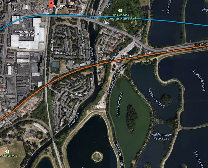
The Area South Of Tottenham Hale
Note :-
1. The West Anglia Main Line running in a north-south direction, from the red arrow that marks the station, which will be connected to Crossrail 2.
2. The blue line is the route of the Victoria Line.
3. The orange line is the Gospel Oak to Barking Line (GOBlin).
This is probably an ideal place to build a tunnel portal, as if it can’t be squeezed in alongside the West Anglia Main Line, there is a lot of open land in the area, that is only occupied by water, wildlife and illegally-dumped refuse.
There are plans to add extra tracks to the West Anglia Main Line as is detailed in Wikipedia. This is said.
It seems likely that two tracks will be built alongside the line to Cheshunt as part of Crossrail 2. Intermediate stations from Tottenham Hale will transfer to Crossrail 2 releasing capacity on the main line for additional trains.
A prudent Network Rail, would probably add these extra tracks, even if Crossrail 2 wasn’t to be built for say fifty years, as it would speed up services to Cambridge and Stansted.
The New Southgate Portal
This Google Earth map shows the area south of New Southgate station, which is the destination of the branch of Crossrail 2
The Area South Of New Southgate Station
Note :-
1. The station is indicated by the arrow at the top, with the East Coast Main Line running roughly north-west to south-east.
2. The blue line is the Piccadilly Line.
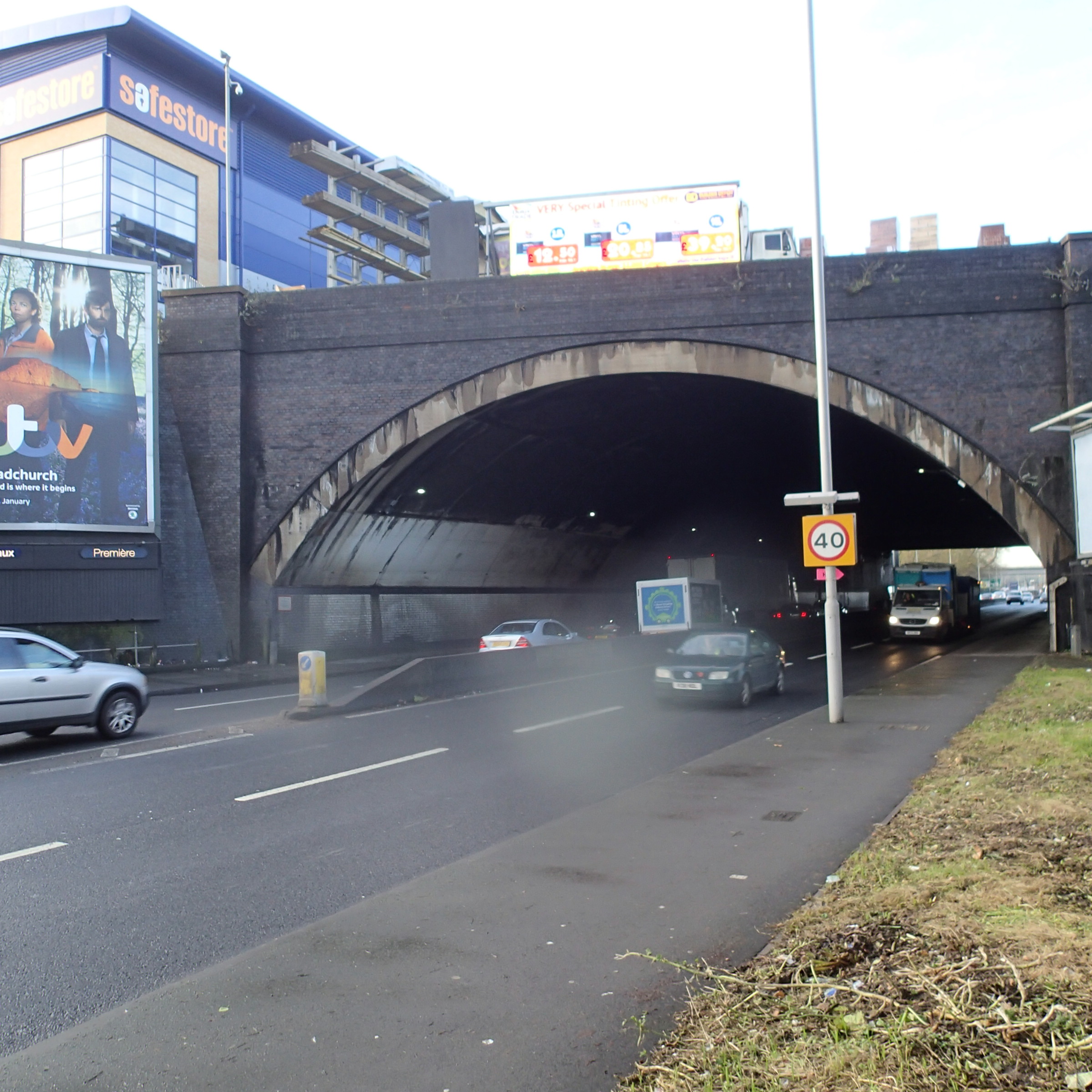
I know the area well and it is one of the worst sections of the North Circular Road, being restricted by a railway bridge with two-way traffic. This enlarged view shows the crossing of the East Coast Main Line and the North Circular Road better.
The East Coast Main Line Crossing The North Circular Road
In this view you can just see the platforms of New Southgate station at the top. The East Coast Main Line runs down the image, with the North Circular Road and the stalled traffic going across. The green area at the bottom is owned by the North London Waste Authority, who intended to build an incinerator there, But that idea seems to have been abandoned. I’m sure Transport for London can find a better use for it. This picture shows the bridge taking the Railway over the North Circular Road.
The Railway Bridge At New Southgate
I can’t imagine English Heritage rushing to save it, if Network Rail decided to replace it.
When I first heard that Crossrail 2 was being planned as going to New Southgate, I visited the station and wrote this post, in which I said this.
Looking at the map, as New Southgate station is close to the North Circular Road and is generally surrounded by industrial estates, although there is some housing, there would be scope to probably create a really good transport interchange with a large bus station and perhaps even a tram line along the North Circular Road from Brent Cross to Enfield or Southgate. If nothing else, all of the work should result in the notorious bottleneck on the road being eased.
I am still enthusiastic and very much feel that a very innovative station and transport interchange could be built here, especially if combined with putting the road in a concrete tunnel with development on top, as was done at Hatfield.
The Wimbledon Portal
This Google Earth map shows the railway line between Wimbledon station almost to Earlsfield station.
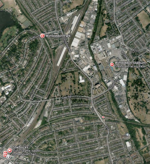
Wimbledon To Earlsfield
Note :-
1. Wimbledon station is at the bottom left and the South Western Main Line to Earlsfield runs at perhaps twenty degrees to the right of the vertical, with Earlsfield just off the image.
2. Near the top of the image level with Wimbledon Park station is Wimbledon Traincare Depot.
There would appear to be several places where the tunnels could emerge alongside the line, with somewhere around the Traincare Depot a prime candidate.
Thoughts About Stations
These are just a series of random thoughts about the stations and will be added to as time progresses.
1. Seven Sisters
As I was writing this I saw how the New Southgate branch followed the old Palace Gates Line between Alexandra Palace and Seven Sisters stations.
Look at this image showing the proximity of Seven Sisters and South Tottenham stations.
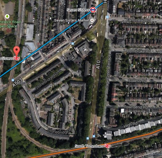
Seven Sisters And South Tottenham Stations
The blue line shows the route of the Victoria Line at Seven Sisters, which is a double-ended station of a unique and unusual design.
The orange line is the GOBlin and you can also see the curve that allows trains to pass between the GOBlin and the Lea Valley Line.
If I am correct that the junction between the two northern branches is close to Coppermill Junction, then the line of the tunnels will virtually pass under South Tottenham station in a south-east to north-west direction, probably perpendicular to the Victoria Line.
I think, if the tunnels were correctly aligned then a double-ended station could be created for Crossrail 2, where the south-eastern end could be connected by escalator and/or lifts into South Tottenham station and the north-western end could be connected into Seven Sisters station. I met an engineer who’d been in one of the new Crossrail stations and she said that to accomodate the 200 metre long Class 345 trains, the stations are massive. I can’t believe that Crossrail 2 stations will be any shorter, as they will surely use similar, if not identical trains.
One point to note, is as Crossrail 2 and the Victoria Line would cross at right-angles at Seven Sisters, the Crossrail 2 tunnels could be bored to be close underneath the bottom of the Victoria Line platforms, so that this connection, wouldn’t be a massive deep excavation, which required long escalators and lifts.
Only Transport for London would know if such a connection would be worthwhile. But I have a strong feeling that if the Gospel Oak to Barking Line was connected to Crossrail 2, the connection would be very beneficial.
2. Dalston Junction
If a double-ended station might be possible at Seven Sisters, it’s certainly possible to create one in Dalston, to connect Kingsland and Junction stations. Especially, as Dalston Kingsland station is going to be rebuilt in the next few years.
3. Euston/St. Pancras
This will be a large double-ended station and hopefully while they’re building the station, they sort out the dreadful maze of tunnels under Kings Cross and St. Pancras, which were obviously designed by an architect, who liked complicated knitting.
You have to remember that Euston to St. Pancras is not a short walk and at a rough measure it is not much short of 800 metres. So if you get in at the wrong end of the train, you’ve got a long walk.
It’s when I see messes like the Underground and Thameslink connections at Euston, St. Pancras and Kings Cross, that I feel we need to do something extremely radical.
I also feel that modern large capacity high speed lifts may be a solution to getting a simple and efficient solution, in getting up and down from a deep level railway.
4. Angel
I had a few thoughts about this station in this post.
I won’t repeat myself.
5. Tottenham Court Road
If Crossrail works out as the designers hope, we might be able to say more of the same here.
Tottenham Court Road is a bit like that trick when a magician folds a pretty young lady into a box and then puts several swords through the box without drawing blood.
Except that there are four train lines instead of swords.
6. Victoria
Victoria will be a tricky station to get right.
I also think that other developments in the next few years might make any speculation here redundant.
The lines south of the Thames are not very logical and were probably designed by the grandfather of the architect, who designed the pedestrian tunnels at Kings Cross/St. Pancras.
Hopefully Thameslink will make this better with the central stations from St.Pancras to London Bridge feeding passengers into a train every three minutes. If it does what it says on the tin, then Victoria might become a less busy station. But I doubt it!
What would help is to tie more and more services into cross-London services, where this was feasible. The East London Line could take fifty percent more trains and the West London Line is seriously underutilised.
Crossrail 2 itself might even help the situation at Victoria, as passengers will use it to get to Clapham Junction for their long distance train.
And I would also support Lord Adonis’s position of more orange trains.
7. Kings Road/Chelsea
Chelsea station or whatever it’s called is controversial. All the residents actually want is more space to park their tractors.
Seriously though, how about a station running under the Kings Road with lifts every fifty metres or so.
8. Clapham Junction
Clapham Junction will hopefully be served by the Northern Line Extension, by the time they start building Crossrail 2 and this might mean that some of the more desperate reasons for adding Clapham Junction to the tube network are partly satisfied.
As Clapham Junction is an immense station, a big underground station could be built that almost accesses all of the current platforms through individual connections.
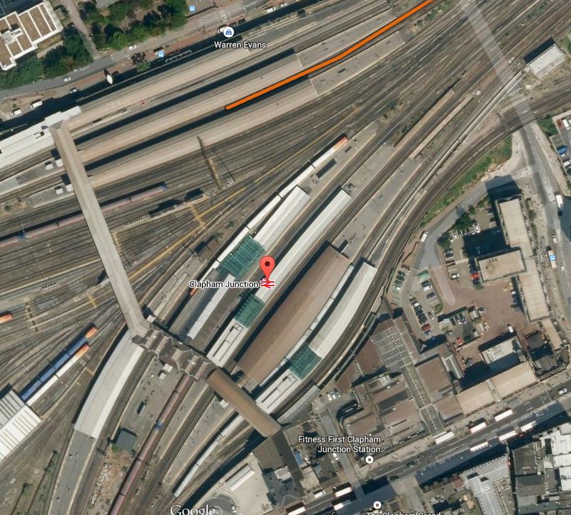
Clapham Junction Station
This would be possible, if it could be arranged that Crossrail 2 passed under Clapham Junction station at right angles to the lines through the station, in the vague direction of the overbridge towards the left of this image.
In some ways it would be like an upside down version of the new Reading station.
Will Modern Construction Techniques Create New Stations For The London Underground/Overground?
London is under tremendous pressure to provide more and more housing and in some ways it seems we’re using up the obvious sites like Stratford, Barking Riverside and Old Oak Common. So we’re going to start building on perhaps less obvious and more cramped sites.
The area round Shoreditch High Street station is being developed more and more with tower blocks. I have talked about linking the station to the Central Line and also about a new main line station in the area, so what happens here in the next few years is going to be an experience that will be worth watching.
I also feel that the area to the east of Gospel Oak station could be opened up for development, which might involve a link to the Northern Line.
Yesterday, I mused about reopening Maiden Lane station, which would involve a lot of properly development and a possible link to the Piccadilly Line.
So all three of these developments could involve a connection to a deep level underground line, something which five years ago would have been very difficult.
A few months ago, I talked about using an uphill excavator at Whitechapel station to connect the deep level Crossrail tunnels to the other lines. I have also found this article on the New Civil Engineer website, which gives more details of the amazing construction going on at Whitechapel.
My only comment is – You ain’t seen nothing yet!
If I take the three examples above, they would all mean connecting to a working twin-bore deep Underground line between two stations. I suspect that some clever construction engineers will develop a methodology to do this, with the minimum of disruption to the working line. If the first time, they do it, it is on time and on budget, the engineers will have a job for life in adding connections to deep underground lines not just in London, but all over the wider world.
To return to London, I think we’ll be surprised at some of the seemingly crazy schemes put forward for new or extended stations in the future, that have become possible with the improvement of tunneling and other construction techniques.
Coal Mining in Whitechapel
I’ve just received Crossrail’s Autumn 2014 newsletter and there’s a section about using coal mining techniques to connect the Crossrail platforms at Whitechapel to the rest of the station and the surface. They say this.
An uphill excavator is being used for the first time in the UK on the Crossrail project. The machine is being used at Whitechapel, before installing the escalators that will take passengers from the platforms (over 30 metres below ground) to and from street level.
Due to difficulties in accessing the station box to dig downwards, Crossrail’s Whitechapel contractor BBMV decided that excavating the escalator barrel upwards, starting from the platform base, was the best solution.
The uphill excavator, traditionally used in coal mines, is being used in an innovative way on the Crossrail project. Built to do two jobs in one, it works its way up by excavating the earth using a digger fixed to the front. With a spray nozzle attached to the top of the machine it also installs the tunnel lining as it goes.
I suspect this won’t be the last place that the technique is used under London. I think it could find applications in connecting stations to the surface in a reversing loop with stations, or perhaps adding step-free access to a deep Underground station.
Whatever happens, it does seem that engineers are throwing conventional thinking out of the window.
Tunnelling certainly seems to be fun!
Will The Northern Line Extension Go All The Way?
There has been masses of reports about the Northern Line Extension in the special rail media and on the BBC and in other publications, like Time Out and the Standard.
Despite the long term aim of taking the extension to Clapham Junction, mentioned in the Wikipedia entry for the project.
Provision will be made for a possible future extension to Clapham Junction railway station by notifying the London Borough of Wandsworth of a reserved course underBattersea Park and subsequent streets
There has been no discussion about the extra station.
There has also been no statements from the consortium building the line about how they will actually construct the line.
As it is not the longest of tunnels, I suspect to save money, at the expense of possibly some extra time, they will use just one tunnel boring machine (TBM). It won’t be one of the ten-million-pounds-a-time beasts used for Crossrail, as Underground tunnels are generally much smaller in diameter. Although, I wouldn’t be surprised to see the tunnels made slightly larger than normal for reasons of safety and perhaps to re-use a refurbished TBM from another project.
One thing that London Underground doesn’t like is lines that end deep in the ends of tunnels. For reasons of cost in the 1960s, the Victoria line is like this at both ends and according to Wikipedia, there have been proposals for creating a large reversing loop at Brixton to both reach Herne Hill and increase capacity.
Reversing loops also eliminate any possibility of a Moorgate disaster, which has still not been satisfacorily explained. But operationally they remove the need for trains to crawl into the end station for safety reasons, and reduce the time it takes to turn trains, thus increasing the frequency on the line.
Reversing loops with stations are not unknown in the UK. Terminal 4 at Heathrow is served by the Piccadilly Line in this way and the Merseyrail Loop Line, is a larger example, that reverses and provides several stations for the Wirral Line. It could also be argued that Bank station on the Docklands Light Railway is two platforms on a reversing loop.
So could a similar solution be used at Battersea to turn the trains? Look at this map of the area.

Around Battersea
Battersea Power Station and Battersea Park are obvious, but notice the Underground roundel marking Kennington station in the top-right corner and the British Rail symbol marking Clapham Junction station in the bottom-left.
The extension joins the current Northern line at Kennington and the Battersea station is proposed to be somewhere near the power station.
At present, Charing Cross branch trains reversing at Kennington, can go round the Kennington Loop. Wikipedia says this about the loop.
A loop tunnel south of the station enables southbound Charing Cross branch trains to be terminated at Kennington, leave the station in a southward direction and, traversing the loop, enter the northbound Charing Cross branch platform.
So instead of building two tunnels from Kennington to Battersea, with all the cost of two TBMs or the hassle of turning a single one round, I do wonder, if a cheaper and easier way of building the tunnels, would be to start in the Kennington Loop with a single TBM, tunnel via Nine Elms to Battersea and then create a wide reversing loop before returning to Battersea to dig the second tunnel back to the other side of the Kennington Loop.
One of the consequences of good project management is often that what the engineers build in the end is quite different, but better, more affordable and earlier to what the politicians said they wanted. For this reason alone, I wouldn’t be surprised if the Northern Line Extension is just a single tunnel, dug by a single refurbished TBM.
The cost savings are probably small change in a one-billion pound project, but the time spent inserting and removing a second machine, probably comes off the overall project time.
It then doesn’t take a great leap of the imagination to see that this construction/reversing loop could be extended so that it passes under Clapham Junction station.
There are other advantages too.
Operations, Safety and Reliability
I’ve mentioned the operational advantages of the reversing loop in quicker turn back of the trains and possible safety advantages, but as the extension is going to be a continuation of the Charing Cross branch of the Northern line and an extension of the Kennington Loop, there could be no complicated track work at Kennington. This will mean that the branch used through Central London, will determine the ultimate destination of the train. But this would allow London Underground to split the two lines and probably arrange dedicated platforms for the two northern branches at the operational nightmare that is Camden Town.
The reliability of two continuous lines would probably be a lot higher, than one that was constantly splitting and joining back again.
But whatever happens to the rest of the line, if the extension was a continuous reversing loop with no points or sidings, it could be built faster and would probably cost less, have a higher capacity and probably be more reliable.
The only problem would be if a train were to break down in the loop. But what happens on the Heathrow loop on the Piccadilly line?
Battersea and Nine Elms Stations
Digging the extension as a loop, also means that the two stations at Battersea and Nine Elms, become classic below ground stations of the Underground, like say Southgate and Manor House of the 1930s, and the modern Canary Wharf, where escalators and lifts descend to a wide lobby between the two lines.
Costs could even mean that they were identical below the surface, although architects would probably exercise some flare on the surface.
I also wonder if stations could be built with no escalators, but large efficient lifts, that were scheduled, so they went up and down in time with the trains.
Lift-only stations would be best as double-ended, with the lifts even coming up into car parks of the over-site development.
There is tremendous scope here for a good architect to build passenger-friendly and lower cost stations.
I’ve always believed that urban stations should have development on top, just like my local one at Dalston Junction. But how many stations anywhere make efficient use of expensive land?
Ventilation
A big problem with London Underground’s deep level lines, like the Northern, is keeping everything cool. All over London, you see structures like I photographed here. A continuous reversing loop must have advantages as all three stations would double as ventilation shafts, so there would be no need for any extra holes in the ground. If modern regulations mean that the tunnels have to be built with a walkway for evacuation, like those on the Docklands Light Railway, these larger diameter tunnels would probably help ventilation.
A secondary advantage of a well-ventilated reversing loop, is that it would be cool, so any trains on the loop could cool themselves down, just like many deep-level trains, do by basking on the surface in the suburbs.
Clapham Junction Station
In the future when the station at Clapham Junction is added, little or no tunnelling will be needed, as construction will probably involve sinking a shaft to link it to the current Clapham Junction rail station and creating a new platform or platforms alongside the reversing loop.
I would go for the single platform. In some ways then, this station would be like the Piccadilly Line station at Heathrow Terminal 4, which has a single platform on a one-way loop from Hatton Cross to Heathrow Central.
No surface buildings would be required and space would only be needed to sink the shaft during the construction phase.
Opening Clapham Junction station could give a problem in that some passengers will transfer off the trains from Basingstoke, Portsmouth, Southampton and other places to complete their journeys. Will the Northern Line cope?
On the other hand the new Clapham Junction station will link to Crossrail at Tottenham Court Road, so Clapham Junction would get a hopefully step-free link to Crossrail and on to Heathrow.
Platform Edge Doors
Regulations will probably mean that all the stations would have to be constructed with platform edge doors. A loop extension would probably have the minimum number of platform faces, thus subtracting another saving from the cost.
If I was designing the stations, all platform faces would be identical to save costs.
But if you went for lift-only stations, this could mean that a better design evolved, where the safety functions of the platform edge doors were achieved in better ways.
Train Stabling
A loop extension, if built in its simplest form, would not have any sidings for storing trains overnight or perhaps holding them when there was a problem on the Northern line.
But as the loop would of necessity be rather long between Battersea and Clapham Junction, the trains could be stabled or held in the loop. If staff needed to leave or join the trains and if the tunnel had a walkway, they’d just walk along to the nearest station.
Ease Of Construction
There has been a report in Global Rail News that the Northern Line Extension might be completed before Crossrail.
A loop extension leading off the Kennington Loop has implications for building the extension in a quick and affordable manner, so this might explain the optimism.
Consider the following.
1. No terminal station, platforms, junctions or sidings would need to be built.
2. As the main construction at Kennington only takes place on the Kennington Loop, trains on the Bank branch running to Morden will be unaffected. Trains on the Charing Cross branch would probably be suspended, unless some other way of turning them back could be found.
3. One TBM digs the whole tunnel in a continuous operation.
4. The project length is determined by the time to dig the tunnel, fit it out with track and signalling, connect it to the existing network and then give it an extensive testing, as once the TBM has passed, the construction of the platforms can be started in parallel with the rest of the project.
5. It would probably be easier to adjust the route of a loop tunnel to avoid other infrastructure and the proposed route of Crossrail 2. Victorian engineers didn’t have machines of the accuracy of today’s modern TBMs.
6. Crossrail needed a lot of shafts to insert and extract the TBMs and other equipment and materials. I’m no expert, but surely material could be brought in by service trains on the Morden branch of the Northern line, to avoid digging too many shafts.
Conclusion
I strongly believe the first phase of the Northern Line Extension will be built as a loop off the Kennington Loop and include all the tunnelling for the extension to Clapham Junction.
Clapham Junction station would not look like a terminus, as it would only be a single platform on a reversing loop.
So the second phase would solely be the fitting out of the station and connecting it to the rail station.
The Footbridge At Westbourne Park
I mentioned in this post, that I’d seen a footbridge, that spanned the lines as you approached Paddington.
This is referred to locally as the Hampden Street bridge or as the Westbourne Park footbridge. Take your pick!
So this morning, I went to have a look.
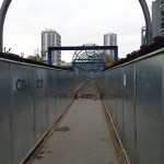
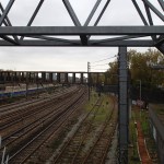
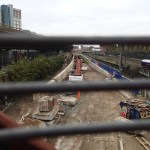
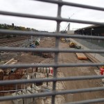
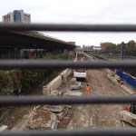
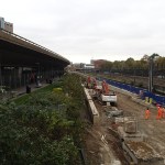
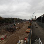
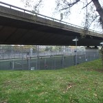
The bridge does mean you can see the workings well, but photographing them is difficult, as you have to look through a wire mesh.
It will be fascinating to go back here, to see the area, as the railway and its infrastructure progresses.
If you want to see it, just go to Royal Oak station, walk along Westbourne Park Villas and the footbridge is on the railway side of this road on the right.
After crossing the bridge, you can either complete the circle back to Royal Oak or take a bus.
