Is Silicon Roundabout Going To Become Silicon Peninsular?
Silicon Roundabout or the Old Street Roundabout is well known as the centre of a high-tech area of the UK.
But is that all going to change as part of the de-roundabouting of London by Transport for London, the roundabout will be simplified. The full plan is here. It includes this map.

Note how in TfL’s words in the full plan, it has been turned into a peninsular. Hence the title of this post.
I think car, truck and van drivers will hate it, taxi drivers will do what they always do and adapt and joke, cyclists will love it and pedestrians will probably find it better.
For myself, I would like the bus stops placed so that I could get on a 21/141 bus going northward with only a short walk from the station. Coming from Kings Cross or Euston, I might take the Northern line to Old Street station and then get the most convenient of the number of buses that serve my house. I probably wouldn’t go the other way very often, as getting a 38 to the Angel will probably be slightly quickly.
Whatever you say about the plan, it has been very well explained on a good map.
Mini-Hollands
I wonder what the Dutch think of the naming of this project by Transport for London.
How Thameslink Sorts Out London’s Trains
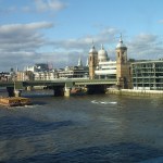
After taking the pictures of the new viaduct at London Bridge yesterday, I thought it would be good to post a map, which showed how it all fits together.

Stations Along The Thames
The picture shows most of the stations along the river that serve the South. And of course the North if they’re connected to Thameslink.
The main stations from left to right (west to east) follow.
Charing Cross is at the far left of the image, where it sits at the end of the Hungerford bridge, by which all trains enter and leave the station. The station is marked by the red British Rail double-arrow symbol, with the London Underground roundel showing the related Embankment tube station.
Waterloo is opposite Charing Cross at the other side of the Thames, although there is no direct rail connection between the stations.
Waterloo East is to the east of Waterloo and this station does have a rail connection to both Charing Cross and London Bridge.
This picture shows the position of the three stations and the rail lines to a larger scale.

Charing Cross, Waterloo and Waterloo East Stations
Note the rail lines going across Hungerford Bridge between Charing Cross and Waterloo East. I’ve never been to Waterloo East or even stopped at it on a train, but you can walk between the two Waterloo stations.
In this image the domed circular roof of the Waterloo IMAX cinema and Nelson’s Column can be clearly seen.
Blackfriars is the next station and its unique position across the river is shown in the middle of the main picture. It is the right one of the pair of bridges and the British Rail symbol indicates the main station entrance on the North Bank of the Rover. This picture shows its position in more detail.

Blackfriars and Thameslink
Note how the Thameslink lines from Blackfriars to the south go in two directions.
One line goes to the East for London Bridge, after joining with the lines from Charing Cross and Waterloo East, at the bottom right of the picture.
The other line goes directly South to Elephant and Castle.
The Temple area is at the top left of this picture, where there is a tube station. London’s new Garden Bridge will between here and the Southbank area, when it is built.
Cannon Street on the North Bank is the next station and like Charing Cross, all trains access the station by a bridge over the Thames.

Cannon Street and London Bridge
Note the triangular junction South of the Thames, that gives access to both Charing Cross and London Bridge from Cannon Street.
London Bridge station is shown in more detail in this picture.

London Bridge Detail
The detail would be a lot better, if it wasn’t for the shadow from The Shard, which is visible at the bottom right.
The pattern of the lines to and through London Bridge that will be in operation with the full Thameslink scheme is beginning to emerge.
1. The number of through platforms at London Bridge, for services on Thameslink and to/from Charing Cross and Cannon Street is being increased from six to nine.
2. The extra viaduct over Borough High Street and the Market can be seen.But it doesn’t have any tracks in this image.
3. London Bridge station itself, appears to be a big building site, with trains going through.
Incidentally, I’m not sure of the date of the Google Earth view.
The Thameslink program is vast and will add a hundred stations to the existing network. Wikipedia sums it up like this.
The Thameslink Programme, is a £6 billion project in south-east England to upgrade and expand Thameslink to provide new and longer trains between a wider range of stations to the north and to the south of London without requiring passengers to change trains in London. Work includes platform lengthening, station remodelling, new railway infrastructure, and additional rolling stock.
In this post, I have traced it south of the Thames and shown how it interfaces with the lines into Charing Cross and Cannon Street. If the architects have got the design of London Bridge station right, this alone should unlock a myriad of new routes for all those millions of Londoners and those that come into the City.
A couple of years after the new London Bridge is completed, Crossrail with its connection to Thameslink at Farringdon will open, adding even more travel possibilities.
Some months ago, I wrote a post called A Divided City.
Hopefully, the enlarged Thameslink, will help to cross the great divide of the Thames, that without which London wouldn’t even exist.
It’s Not Christmas Is It?
This picture of Southwark Cathedral was taken on Christmas Eve in 2014.

It’s Not Christmas Is It?
Not very Christmasy!
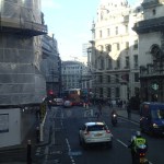
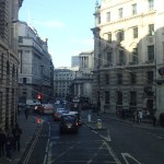
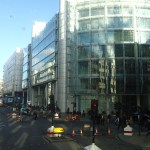
Sunlight And Shadows Through The City
I came home from London Bridge on the 141 bus and it was a gorgeous sunny day.


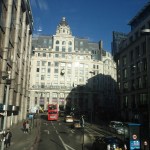
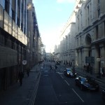
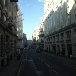


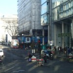
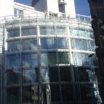

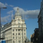

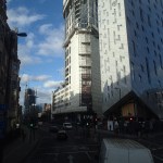
Ido like taking pictures of the sunlight and the way it creates effects and shadows.
